Menu

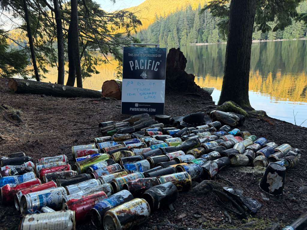
Sasamat Lake

0
0
0
0

49.317774412239, -122.88850725105

0
0
0
silt
0
0
0
0
0
No
Sunny
2
1
2
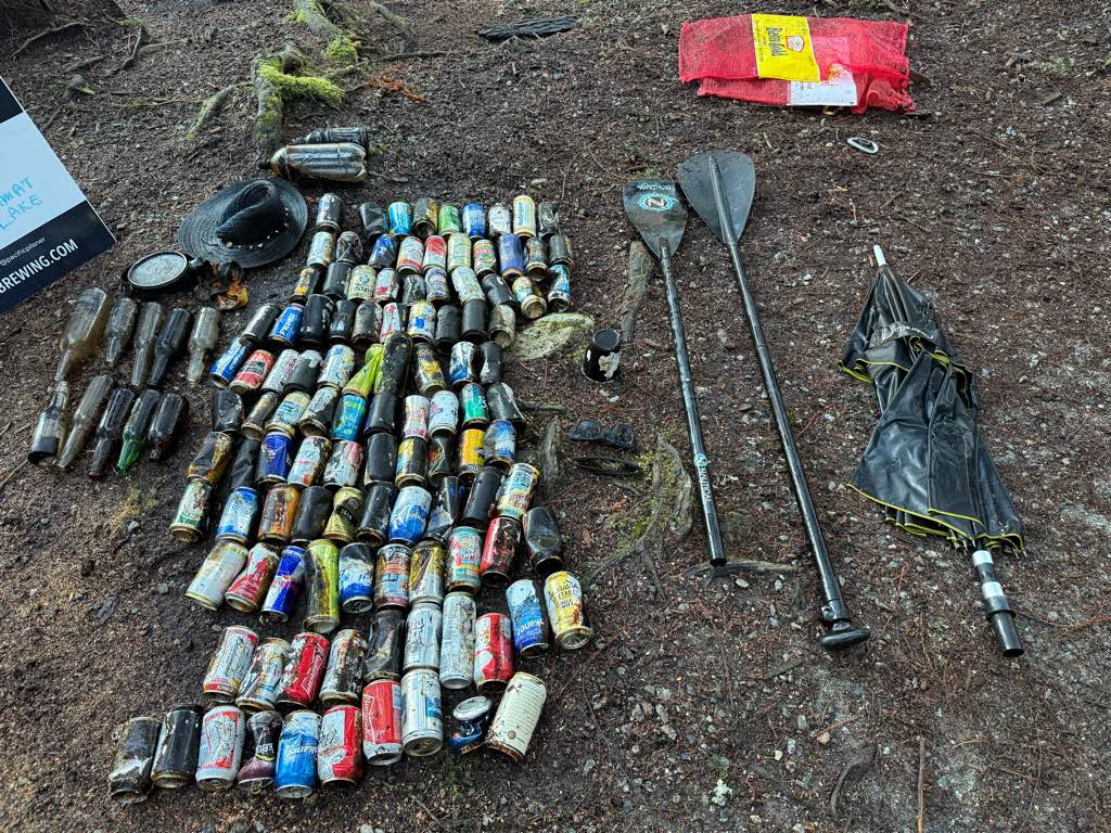
Boat paddle
Umbrella
Sunglasses
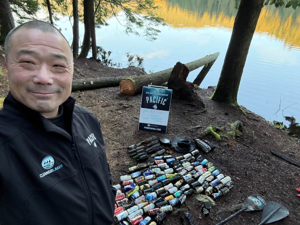
Divers for Cleaner Lakes and Oceans
Henry Wang
0
0
0
1
0
0
0
0
1
0
0
0
0
0
0
0
0
0
0
1
0
0
0
0
0
0
2
0
0
0
0
0
0
0
0
0
29.00
49
49.00
5.00
0
measured
0
0
4010.86
0
0
0
0
0
Beer cans
1
On
pounds
0
I have debris data to report
10
0
0
Calm (glassy to rippled) for waves 0 – 0.1 meter high
0
0
0
0
0
0
0
ft2
0
0
feet
other
0
0
0
0
0
0
0
0
0
1
0
0
0
0
0
0
0
110
0
0
0
0
0
0
0
0
0
0
0
Canada
State\Province
British Columbia
City
Port Moody
Map Help


Dive Location

If you know your survey site coordinates, enter them manually in decimal degrees using WGS84 Map Datum. Use the minus sign for latitudes south of the equator and longitudes west of the Prime Meridian to 180 degrees.

If you do not know your survey site coordinates, click the “Map Location” tab to use the map to zoom into your survey site and drop the pin on the map to fall within your survey dive site in the water (not on land or the beach). Ensure you zoom in as much as possible to ensure data accuracy.

Entangled Help


Use the vertical tabs below to record any entangled animals you found of each type.

Ecosystem Other
Silt lake bottom

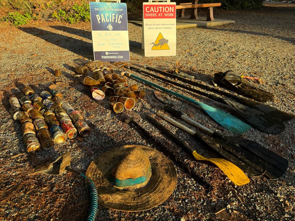
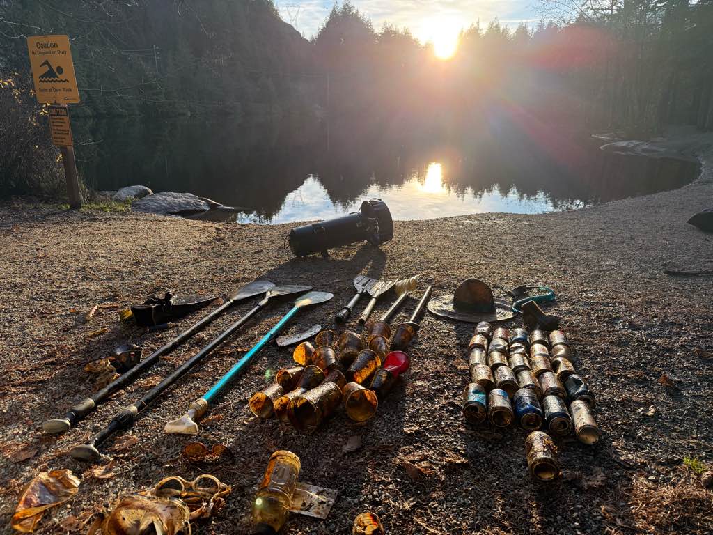
Browning Lake

0
1
0
0

49.644842, -123.205691

1
0
0
other
0
1
0
0
0
No
Mixed
7
1
1
1
Boat paddles
Sunglasses
Vape
Boat fin
Divers for Cleaner Lakes and Oceans
Henry Wang
0
0
0
21
0
0
0
0
4
0
0
0
0
0
0
0
0
0
0
2
0
0
0
0
0
0
2
0
0
0
0
0
0
0
0
0
35.00
30
31.00
5.00
0
measured
0
0
14164.80
0
0
0
0
0
Beer cans
0
On
pounds
0
I have debris data to report
0
0
0
Calm (glassy to rippled) for waves 0 – 0.1 meter high
0
0
1
0
0
0
0
ft2
0
0
feet
other
0
0
0
0
0
0
0
0
0
1
0
0
0
0
0
0
0
26
0
0
0
0
1
0
0
0
0
1
0
Canada
State\Province
British Columbia
City
Squamish
Map Help


Dive Location

If you know your survey site coordinates, enter them manually in decimal degrees using WGS84 Map Datum. Use the minus sign for latitudes south of the equator and longitudes west of the Prime Meridian to 180 degrees.

If you do not know your survey site coordinates, click the “Map Location” tab to use the map to zoom into your survey site and drop the pin on the map to fall within your survey dive site in the water (not on land or the beach). Ensure you zoom in as much as possible to ensure data accuracy.
Entangled Help


Use the vertical tabs below to record any entangled animals you found of each type.

Ecosystem Other
Silt
Dominant Substrate Other
Silt

Nemo Reef

0
0
0
0

12.0116672, 93.0064461

0
0
0
sand
0
0
0
0
0
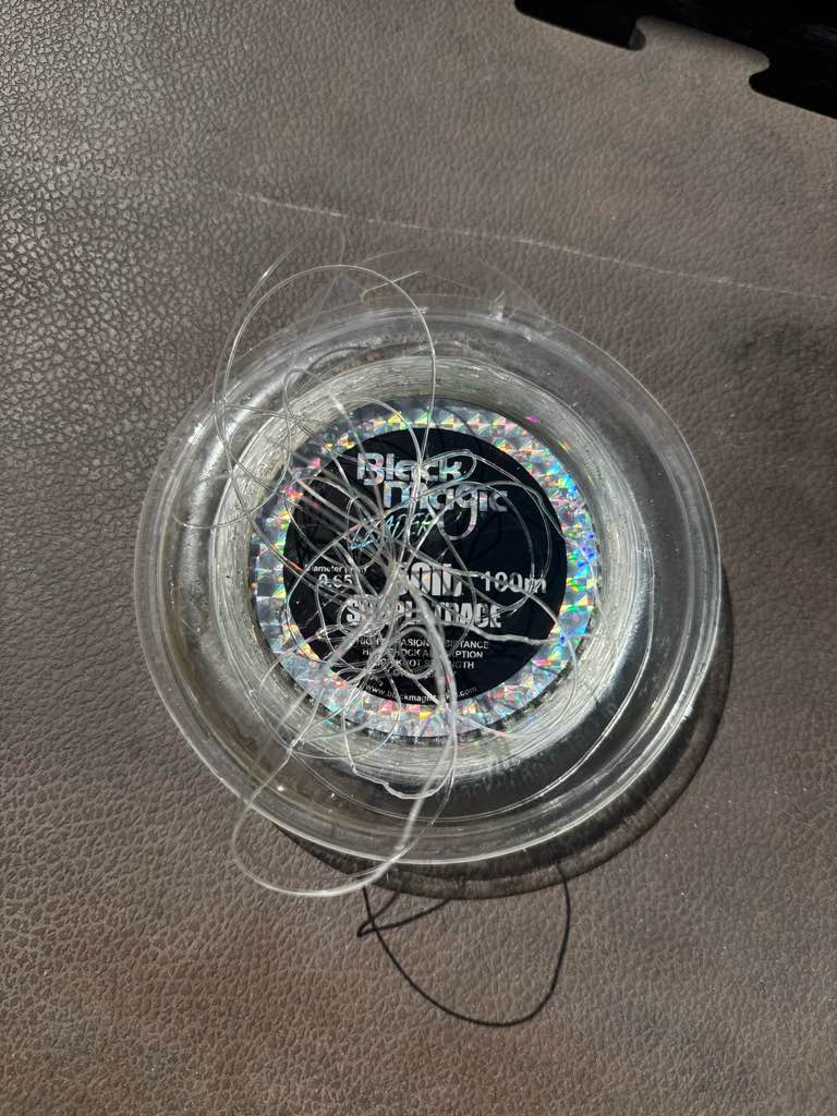
Fishing line cannot remove
Yes
Yes
Sunny
Scuba Lov
0
0
0
0
0
0
0
0
0
0
0
0
0
0
0
0
0
0
0
2
0
0
0
0
0
0
0
0
0
0
0
0
0
0
0
0
0.00
30
8.00
8.00
0
estimated
0
0
0
0
6643.85
0
0
0
0
0
Beer bottle
0
On
pounds
0
Our Survey Site was free of debris
0
0
0
Calm (glassy to rippled) for waves 0 – 0.1 meter high
0
0
0
0
0
0
0
m2
0
0
meters
coral reef
0
0
0
0
0
0
0
0
0
0
0
0
0
0
0
0
0
0
0
0
0
0
0
0
0
0
0
0
0
India
State\Province
A&N Island
City
Havelock
Map Help


Dive Location

If you know your survey site coordinates, enter them manually in decimal degrees using WGS84 Map Datum. Use the minus sign for latitudes south of the equator and longitudes west of the Prime Meridian to 180 degrees.

If you do not know your survey site coordinates, click the “Map Location” tab to use the map to zoom into your survey site and drop the pin on the map to fall within your survey dive site in the water (not on land or the beach). Ensure you zoom in as much as possible to ensure data accuracy.
Entangled Help


Use the vertical tabs below to record any entangled animals you found of each type.

Davis Deep

1
coral
10

24.920990512157, -80.506035919564

cast net, 3 anchors with chain, 3 trap pieces, a tickle stick, and approximately 100ft of rope and 100ft of monofilament line
3
1
anchor with chain
tickle stick
Key Dives
Morgan Gardner
13
91.00
42
45.00
30.00
measured
1000.00
On
pounds
I have debris data to report
Slight for waves 0.5 -1.25 meter high
3
ft2
5
feet
coral reef
United States
State\Province
FL
City
Islamorada
Map Help


Dive Location

If you know your survey site coordinates, enter them manually in decimal degrees using WGS84 Map Datum. Use the minus sign for latitudes south of the equator and longitudes west of the Prime Meridian to 180 degrees.

If you do not know your survey site coordinates, click the “Map Location” tab to use the map to zoom into your survey site and drop the pin on the map to fall within your survey dive site in the water (not on land or the beach). Ensure you zoom in as much as possible to ensure data accuracy.

Entangled Help


Use the vertical tabs below to record any entangled animals you found of each type.

Davis Humps

24.9131, -80.5017166

2
coral
10
fishing pole, electrical pole, fishing lure, fishing weight, 2 fishing hooks, bait trap, aluminum can, plastic bag scrap, 3 anchors with chains, approximately 400ft of anchor rope and 200ft monofilament line
3
anchor with chain
Key Dives
Morgan Gardner
13
1
1
126.00
40
75.00
45.00
measured
3
1000.00
On
pounds
I have debris data to report
Slight for waves 0.5 -1.25 meter high ft2
10
feet
coral reef
1
1
United States
State\Province
FL
City
Islamorada
Map Help


Dive Location

If you know your survey site coordinates, enter them manually in decimal degrees using WGS84 Map Datum. Use the minus sign for latitudes south of the equator and longitudes west of the Prime Meridian to 180 degrees.

If you do not know your survey site coordinates, click the “Map Location” tab to use the map to zoom into your survey site and drop the pin on the map to fall within your survey dive site in the water (not on land or the beach). Ensure you zoom in as much as possible to ensure data accuracy.

Entangled Help


Use the vertical tabs below to record any entangled animals you found of each type.

Muchizuni

0
0
0
0

26.247815, 127.3147352

0
0
0
coral
0
0
0
0
0
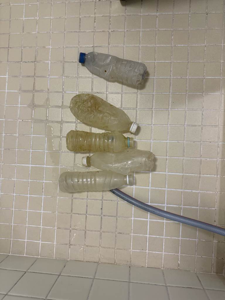
Pet bottle
Sun
Blue Vista Dive
Chingchih Kung
0
0
0
0
0
0
0
0
0
0
0
0
0
0
0
0
0
0
0
2
0
0
0
0
0
0
5
0
0
0
0
0
0
0
0
0
0.50
39
22.00
3.00
0
estimated
0
0
1086.82
0
0
0
0
0
0
On
kilograms
0
I have debris data to report
0
0
0
Calm (glassy to rippled) for waves 0 – 0.1 meter high
0
0
0
0
0
0
0
m2
0
0
meters
coral reef
0
0
0
0
0
0
0
0
0
0
0
0
0
0
0
0
0
0
0
0
0
0
0
0
0
0
0
0
0
Japan
State\Province
Okinawa
City
Tokashiki village
Map Help


Dive Location

If you know your survey site coordinates, enter them manually in decimal degrees using WGS84 Map Datum. Use the minus sign for latitudes south of the equator and longitudes west of the Prime Meridian to 180 degrees.

If you do not know your survey site coordinates, click the “Map Location” tab to use the map to zoom into your survey site and drop the pin on the map to fall within your survey dive site in the water (not on land or the beach). Ensure you zoom in as much as possible to ensure data accuracy.
Entangled Help


Use the vertical tabs below to record any entangled animals you found of each type.

EMON

0
0
0
0

8.740635, 167.732744

0
0
0
sand
0
0
0
0
0
No
New Year Fireworks
No
Windy and sunny
Kwajalein Scuba Club
Heath CHRISTIE
0
0
0
0
0
0
0
0
0
0
0
0
0
0
0
0
0
0
100
3
0
0
0
0
0
0
0
0
0
0
0
0
0
0
0
0
10.00
60
90.00
10.00
0
estimated
0
0
0
0
27794.40
0
0
0
0
0
0
On
pounds
0
I have debris data to report
0
0
0
Smooth (wavelets) for waves 0.1 - 0.5 meter high
0
0
0
0
0
0
0
ft2
0
0
feet
coral reef
0
0
0
0
0
0
0
0
0
0
0
0
0
0
0
0
1
0
0
0
0
0
0
0
0
0
0
0
0
Marshall Islands
State\Province
Kwajalein
City
Kwajalein
Map Help


Dive Location

If you know your survey site coordinates, enter them manually in decimal degrees using WGS84 Map Datum. Use the minus sign for latitudes south of the equator and longitudes west of the Prime Meridian to 180 degrees.

If you do not know your survey site coordinates, click the “Map Location” tab to use the map to zoom into your survey site and drop the pin on the map to fall within your survey dive site in the water (not on land or the beach). Ensure you zoom in as much as possible to ensure data accuracy.
Entangled Help


Use the vertical tabs below to record any entangled animals you found of each type.

Lighthouse / Bannerfish Bay

5
97
4
0

28.498747, 34.51991

0
0
0
sand
0
2
0
2
0
Christmas /New Year holidays
The mixed category needs a clothing fragment box. We find a lot of fragments of material from rag rugs. I submit them as clothing as this is the closest item to what the material is
Sunny and dry. Light winds
1
1
1
24
Plastic glove (polythene)
Lolly stick(plastic)
Shisha clip
Chewing gum
Red Sea Tribe
Rachel Shelley
0
0
0
14
204
0
0
0
0
0
1
0
0
0
0
0
0
1
73
4
0
0
0
0
0
0
3
0
0
0
0
0
0
0
0
0
1.00
43
24.50
1.00
0
estimated
0
0
2327.35
0
0
0
1
0
Cigarette butts
Plastic fragments
Paper /card fragments
1
On
kilograms
0
I have debris data to report
0
0
0
Calm (glassy to rippled) for waves 0 – 0.1 meter high
3
0
0
Clothing fragments
Small crab
Released Unharmed
1
0
0
0
0
m2
0
0
meters
coral reef
2
0
0
0
0
4
0
5
0
34
0
0
0
9
0
0
0
0
0
0
0
0
8
0
0
0
0
0
0
Egypt
State\Province
South Sinai
City
Dahab
Map Help


Dive Location

If you know your survey site coordinates, enter them manually in decimal degrees using WGS84 Map Datum. Use the minus sign for latitudes south of the equator and longitudes west of the Prime Meridian to 180 degrees.

If you do not know your survey site coordinates, click the “Map Location” tab to use the map to zoom into your survey site and drop the pin on the map to fall within your survey dive site in the water (not on land or the beach). Ensure you zoom in as much as possible to ensure data accuracy.
Entangled Help


Use the vertical tabs below to record any entangled animals you found of each type.

Wave Break Island

0
0
0
0

-28.02986751908, 153.43337912668

0
0
0
rock
0
0
0
1
0

-27.932085773733, 153.41901937769

Xmas holiday period
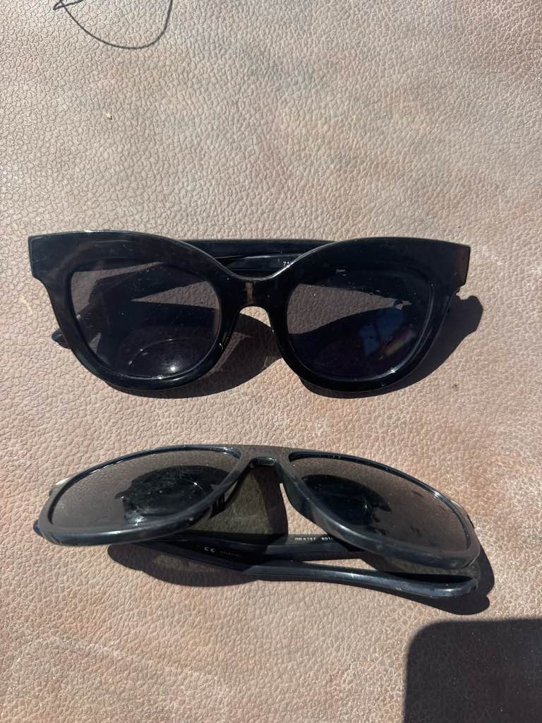
Sunglasses
Fine
1
2
1
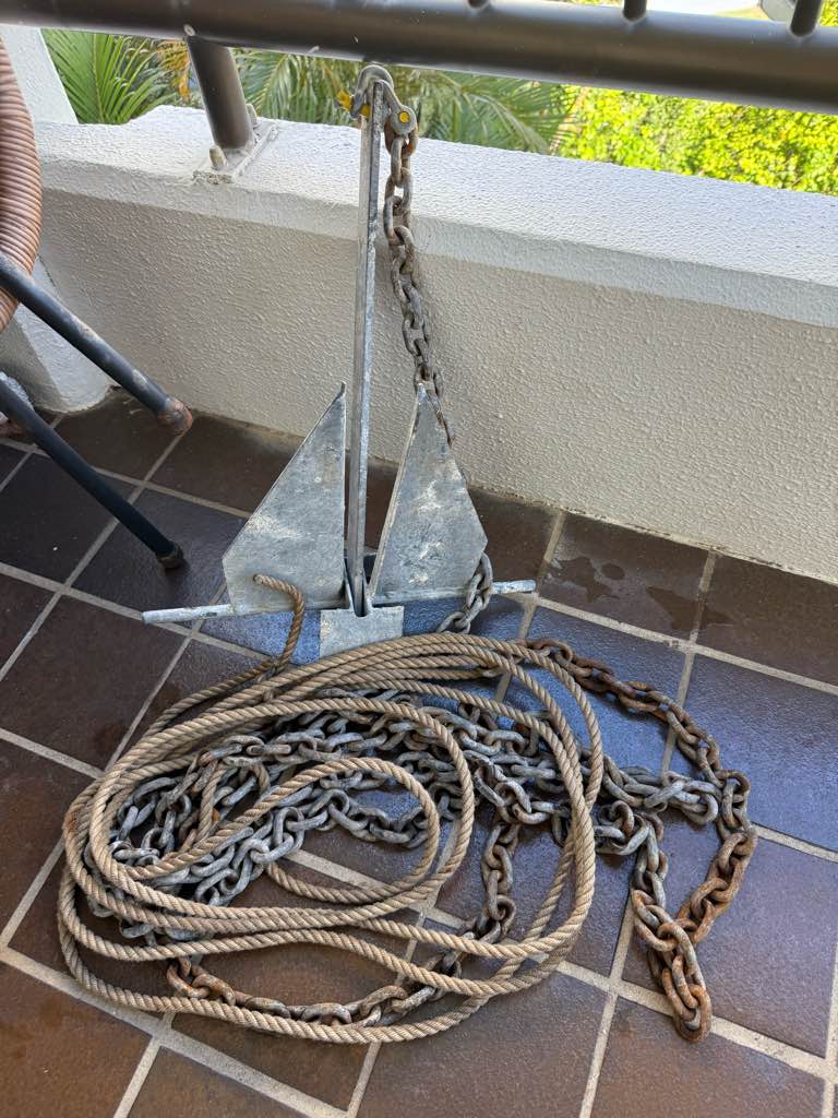
Boat anchor chain and rope
Sunglasses
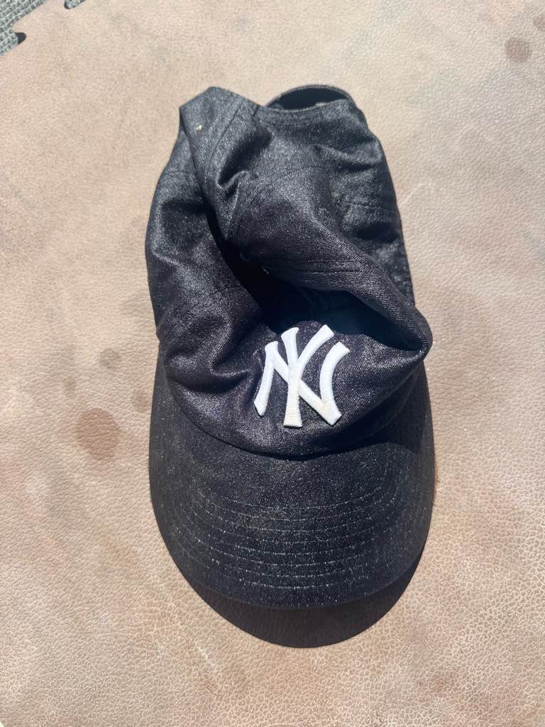
Hat
Idive
Dave Bates
0
0
0
0
0
0
0
0
0
0
0
0
0
0
0
0
0
0
0
3
0
0
0
0
0
0
0
0
0
0
0
0
0
0
0
0
15.00
68
18.00
2.00
0
estimated
0
2
5937.27
0
0
0
0
0
Boat anchor
Hat
Sunglasses
0
On
kilograms
0
I have debris data to report
0
0
0
Smooth (wavelets) for waves 0.1 - 0.5 meter high
0
0
0
0
0
0
0
m2
0
0
meters
rocky reef
0
0
0
0
0
0
0
0
0
0
0
0
0
0
0
0
0
0
0
0
0
0
0
0
0
0
0
0
0
Australia
State\Province
Queensland
City
Gold Coast
Map Help


Dive Location

If you know your survey site coordinates, enter them manually in decimal degrees using WGS84 Map Datum. Use the minus sign for latitudes south of the equator and longitudes west of the Prime Meridian to 180 degrees.

If you do not know your survey site coordinates, click the “Map Location” tab to use the map to zoom into your survey site and drop the pin on the map to fall within your survey dive site in the water (not on land or the beach). Ensure you zoom in as much as possible to ensure data accuracy.
Entangled Help


Use the vertical tabs below to record any entangled animals you found of each type.

Scuba Republic House Reef

3

-0.44350884742634, 130.75421187414

sand
1
5
Sunny and Rainy
1
electric cable
Indo Ocean Project
Lois
5
15
8
1
4
0
1.31
60
20.00
3.00
measured
1000.00
On
kilograms
I have debris data to report
Calm (glassy to rippled) for waves 0 – 0.1 meter high m2
meters
coral reef
2
Indonesia
State\Province
West Papua
City
Waisai
Map Help


Dive Location

If you know your survey site coordinates, enter them manually in decimal degrees using WGS84 Map Datum. Use the minus sign for latitudes south of the equator and longitudes west of the Prime Meridian to 180 degrees.

If you do not know your survey site coordinates, click the “Map Location” tab to use the map to zoom into your survey site and drop the pin on the map to fall within your survey dive site in the water (not on land or the beach). Ensure you zoom in as much as possible to ensure data accuracy.
Entangled Help


Use the vertical tabs below to record any entangled animals you found of each type.

Subscribe to