Menu

ADB - Sundstraumen S22397

67.209369, 14.514484

4
rock
5
Summary of 3 guided dives with guests, July to September
NORD&NE
Fredric Ihrsen
3
4.10
50
21.00
5.00
measured
10
1500.00
On
kilograms
I have debris data to report
Smooth (wavelets) for waves 0.1 - 0.5 meter high m2
meters
kelp
Norway
Map Help


Dive Location

If you know your survey site coordinates, enter them manually in decimal degrees using WGS84 Map Datum. Use the minus sign for latitudes south of the equator and longitudes west of the Prime Meridian to 180 degrees.

If you do not know your survey site coordinates, click the “Map Location” tab to use the map to zoom into your survey site and drop the pin on the map to fall within your survey dive site in the water (not on land or the beach). Ensure you zoom in as much as possible to ensure data accuracy.

Entangled Help


Use the vertical tabs below to record any entangled animals you found of each type.

ADB - Tuvveggen S22397

67.222453, 14.627599

10
rock
26
Summary of 7 guided dives with guests for July.
NORD&NE
Fredric Ihrsen
7
5.40
60
30.00
3.00
measured
22
2000.00
On
kilograms
I have debris data to report
Smooth (wavelets) for waves 0.1 - 0.5 meter high m2
meters
kelp
1
Norway
Map Help


Dive Location

If you know your survey site coordinates, enter them manually in decimal degrees using WGS84 Map Datum. Use the minus sign for latitudes south of the equator and longitudes west of the Prime Meridian to 180 degrees.

If you do not know your survey site coordinates, click the “Map Location” tab to use the map to zoom into your survey site and drop the pin on the map to fall within your survey dive site in the water (not on land or the beach). Ensure you zoom in as much as possible to ensure data accuracy.

Entangled Help


Use the vertical tabs below to record any entangled animals you found of each type.

ADB - Åbornes S22397

67.226743, 14.626451

12
rock
31
Summary of 10 guided dives with guests and or students from May to November.
NORD&NE
Fredric Ihrsen
10
1
8.70
55
28.00
1.00
measured
90
500.00
On
kilograms
I have debris data to report
Smooth (wavelets) for waves 0.1 - 0.5 meter high m2
meters
kelp
Norway
Map Help


Dive Location

If you know your survey site coordinates, enter them manually in decimal degrees using WGS84 Map Datum. Use the minus sign for latitudes south of the equator and longitudes west of the Prime Meridian to 180 degrees.

If you do not know your survey site coordinates, click the “Map Location” tab to use the map to zoom into your survey site and drop the pin on the map to fall within your survey dive site in the water (not on land or the beach). Ensure you zoom in as much as possible to ensure data accuracy.

Entangled Help


Use the vertical tabs below to record any entangled animals you found of each type.

ADB - Kaja Ripnes S22397

36

67.227279, 14.624927

3
rock
1
Summary of 3 guided dives July & August
NORD&NE
Fredric Ihrsen
3
1.30
50
28.00
3.00
measured
14
500.00
On
kilograms
I have debris data to report
Smooth (wavelets) for waves 0.1 - 0.5 meter high m2
meters
kelp
2
Norway
Map Help


Dive Location

If you know your survey site coordinates, enter them manually in decimal degrees using WGS84 Map Datum. Use the minus sign for latitudes south of the equator and longitudes west of the Prime Meridian to 180 degrees.

If you do not know your survey site coordinates, click the “Map Location” tab to use the map to zoom into your survey site and drop the pin on the map to fall within your survey dive site in the water (not on land or the beach). Ensure you zoom in as much as possible to ensure data accuracy.

Entangled Help


Use the vertical tabs below to record any entangled animals you found of each type.

ADB - ADS116 - Tunnelen S22397

1

67.234674, 14.604692

54
rock
138
11 guided dives in September and October with guests and/or students.
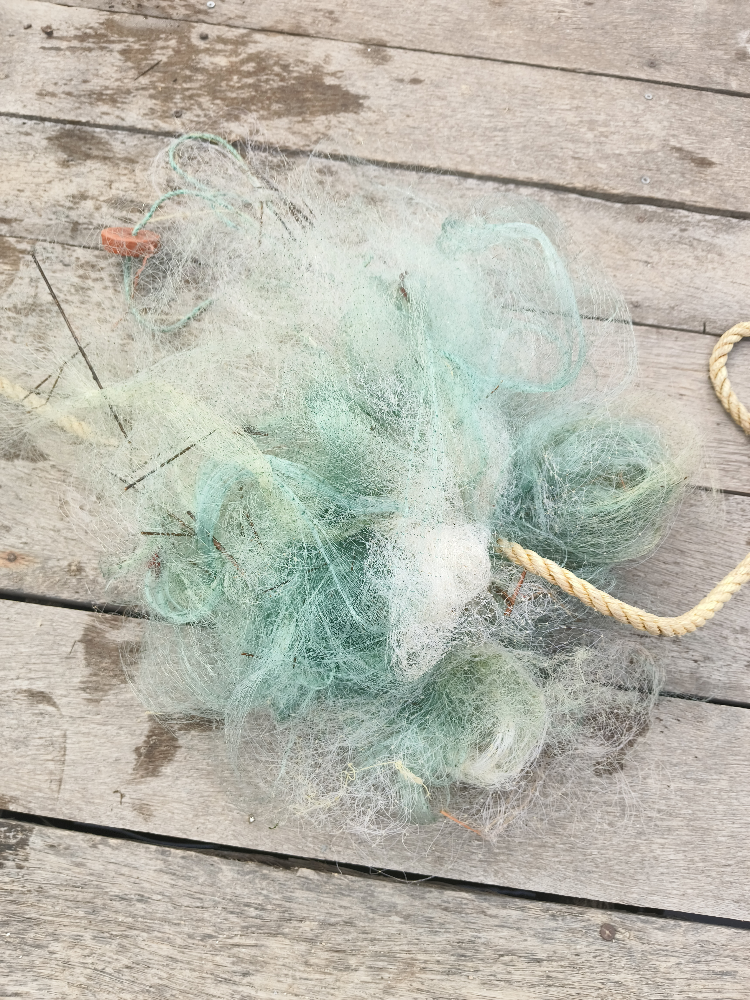
A lot of plastic fishing gear this year at this site.
One released injured, maybe survived, one was dead.
1
Dive mask
nn
Fredric Ihrsen
11
28.10
32
28.00
3.00
measured
261
1500.00
On
kilograms
I have debris data to report
Smooth (wavelets) for waves 0.1 - 0.5 meter high
Injured
Pollock, Sathe, Sei
2
Fishing line and hooks
m2
meters
kelp
Norway
Map Help


Dive Location

If you know your survey site coordinates, enter them manually in decimal degrees using WGS84 Map Datum. Use the minus sign for latitudes south of the equator and longitudes west of the Prime Meridian to 180 degrees.

If you do not know your survey site coordinates, click the “Map Location” tab to use the map to zoom into your survey site and drop the pin on the map to fall within your survey dive site in the water (not on land or the beach). Ensure you zoom in as much as possible to ensure data accuracy.

Entangled Help


Use the vertical tabs below to record any entangled animals you found of each type.

ADB - ADS10 - Ørneset S22397

67.225682, 14.616451

11
rock
15
NORD&NE
Fredric Ihrsen
1
6.00
54
21.00
1.00
measured
89
2000.00
On
kilograms
I have debris data to report
Smooth (wavelets) for waves 0.1 - 0.5 meter high m2
meters
kelp
Norway
Map Help


Dive Location

If you know your survey site coordinates, enter them manually in decimal degrees using WGS84 Map Datum. Use the minus sign for latitudes south of the equator and longitudes west of the Prime Meridian to 180 degrees.

If you do not know your survey site coordinates, click the “Map Location” tab to use the map to zoom into your survey site and drop the pin on the map to fall within your survey dive site in the water (not on land or the beach). Ensure you zoom in as much as possible to ensure data accuracy.

Entangled Help


Use the vertical tabs below to record any entangled animals you found of each type.

Yeondae Port

1
1
8
2
sand
10

33.495960905674, 126.42833054115

없음
없음
날씨 흐림. 파도 없음.시야 불량
Blue Lagoon Dive
Young Su Yeo
1
2
2
1
1
5.00
36
9.00
3.00
measured
1
242.00
낚시줄
낚시추
폐어구
On
kilograms
I have debris data to report
2
1
Calm (glassy to rippled) for waves 0 – 0.1 meter high m2
meters
rocky reef
2
South Korea
State\Province
Jeju-do
City
Jeju-si
Map Help


Dive Location

If you know your survey site coordinates, enter them manually in decimal degrees using WGS84 Map Datum. Use the minus sign for latitudes south of the equator and longitudes west of the Prime Meridian to 180 degrees.

If you do not know your survey site coordinates, click the “Map Location” tab to use the map to zoom into your survey site and drop the pin on the map to fall within your survey dive site in the water (not on land or the beach). Ensure you zoom in as much as possible to ensure data accuracy.

Entangled Help


Use the vertical tabs below to record any entangled animals you found of each type.

Sharp Island

22.357533014643, 114.29273115461

sand
1
Many fishing equipment and lure found underwater.
Moji Dive HK
Thera Leung
2
5
3
2
2.00
80
11.00
4.00
1
estimated
30.00
On
kilograms
I have debris data to report
2
Calm (glassy to rippled) for waves 0 – 0.1 meter high m2
meters
rocky reef
2
1
Hong Kong S.A.R., China
State\Province
Hong Kong
City
Hong Kong
Map Help


Dive Location

If you know your survey site coordinates, enter them manually in decimal degrees using WGS84 Map Datum. Use the minus sign for latitudes south of the equator and longitudes west of the Prime Meridian to 180 degrees.

If you do not know your survey site coordinates, click the “Map Location” tab to use the map to zoom into your survey site and drop the pin on the map to fall within your survey dive site in the water (not on land or the beach). Ensure you zoom in as much as possible to ensure data accuracy.

Entangled Help


Use the vertical tabs below to record any entangled animals you found of each type.

연대방파제

0
0
0
20

33.49601953222, 126.42706849845

3
0
0
sand
0
2
0
3
0

33.495996419556, 126.42705317307

없음
없음
없음
없음
날씨 맑음. 파도 없음. 조류 없음
0
0
0
0
0
0
0
0
0
0
0
0
0
0
0
0
0
0
0
0
0
0
0
0
0
0
0
0
0
0
0
0
0
0
0
0
0
0
0
0
Blue Lagoon Dive
Young Su Yeo
0
0
0
0
2
0
0
0
0
0
0
0
0
0
0
0
0
1
0
4
0
0
0
0
5
10
6
0
10
2
5
0
0
0
0
0
40.00
40
10.00
3.00
0
measured
0
0
0
1
4131.00
0
0
0
0
0
낚시줄
낚시추
폐어구
0
On
kilograms
0
I have debris data to report
38
0
1
Calm (glassy to rippled) for waves 0 – 0.1 meter high
0
0
0
0
2
0
0
m2
0
0
meters
rocky reef
0
0
0
0
0
0
0
0
0
0
0
0
2
0
0
0
0
3
0
0
0
0
2
0
0
0
0
0
0
South Korea
State\Province
Jeju-do
City
Jeju-si
Map Help


Dive Location

If you know your survey site coordinates, enter them manually in decimal degrees using WGS84 Map Datum. Use the minus sign for latitudes south of the equator and longitudes west of the Prime Meridian to 180 degrees.

If you do not know your survey site coordinates, click the “Map Location” tab to use the map to zoom into your survey site and drop the pin on the map to fall within your survey dive site in the water (not on land or the beach). Ensure you zoom in as much as possible to ensure data accuracy.

Entangled Help


Use the vertical tabs below to record any entangled animals you found of each type.

UNA REEF

0
0
0
50

11.914266, 79.863547

7
0
0
sand
0
6
0
50
0
Fishing
Cyclone
Urban Nomad Adventures
Visnu
0
0
0
0
0
0
0
0
0
0
0
0
0
0
0
0
0
0
0
1
0
0
0
0
2
0
0
0
15
0
0
0
0
0
0
0
20.00
55
18.00
7.00
0
estimated
0
0
0
0
61.98
0
0
0
0
0
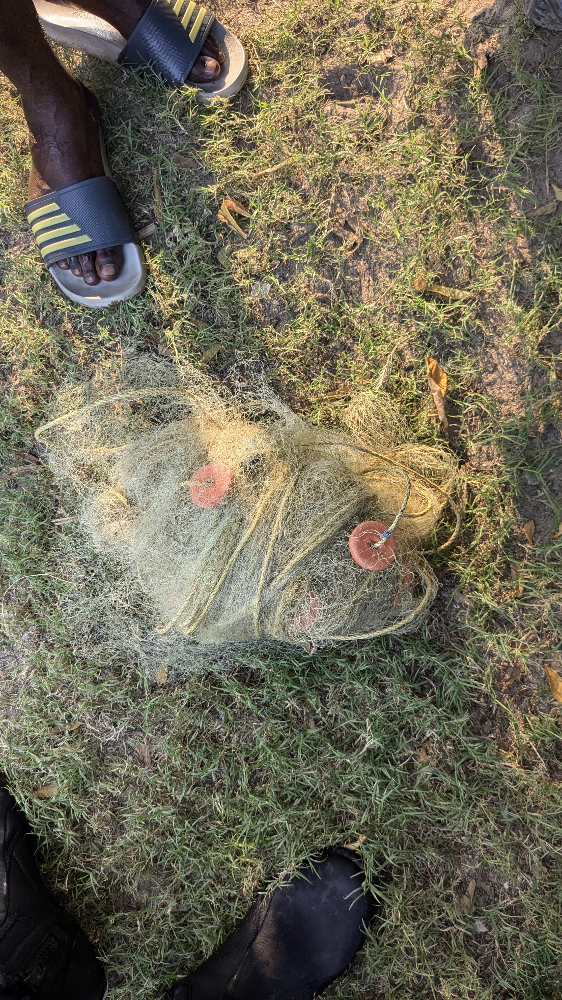
Net
Fishing line
Fishing weight
0
On
kilograms
0
I have debris data to report
0
0
0
Moderate to rough for waves greater than 1.25 meters
0
0
0
Net
1
Released Unharmed
Lion Fish
0
0
0
0
m2
0
0
meters
other
0
0
0
0
0
0
0
0
0
0
0
0
0
0
0
0
0
0
0
0
0
0
0
0
0
0
0
0
0
India
State\Province
Tamil Nadu
City
Sivakasi
Map Help


Dive Location

If you know your survey site coordinates, enter them manually in decimal degrees using WGS84 Map Datum. Use the minus sign for latitudes south of the equator and longitudes west of the Prime Meridian to 180 degrees.

If you do not know your survey site coordinates, click the “Map Location” tab to use the map to zoom into your survey site and drop the pin on the map to fall within your survey dive site in the water (not on land or the beach). Ensure you zoom in as much as possible to ensure data accuracy.
Entangled Help


Use the vertical tabs below to record any entangled animals you found of each type.

Ecosystem Other
FAD (Artificial reef)
Subscribe to