Mornington Pier
0
3
0
-38.212115003227, 145.03449556389
18
0
0
silt
0
0
0
10
0
Jewel
Overcast
1
0
0
0
0
0
0
0
0
0
0
0
0
0
0
0
0
0
0
0
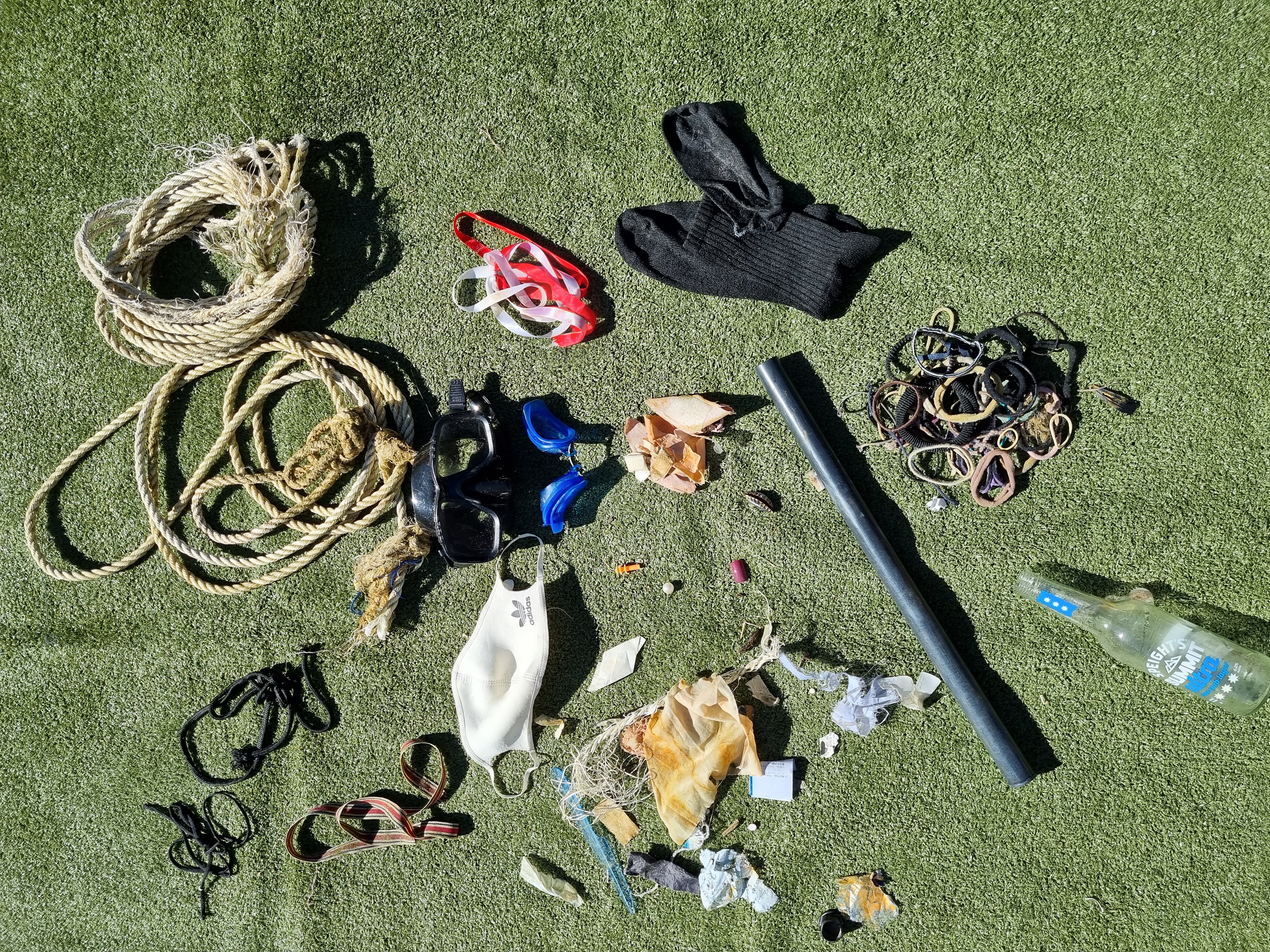
Cigarette holder
Aquatic Adventures
John Li
0
2
0
2
0
0
0
0
0
0
2
0
0
0
0
0
0
2
3
7
0
0
0
1
1
0
0
0
0
0
0
0
0
0
10.00
45
8.00
4.00
0
estimated
0
1
512.71
0
0
0
2
0
Bottles
Squid jigs
Sinkers
2
On
kilograms
0
I have debris data to report
23
0
0
Calm (glassy to rippled) for waves 0 – 0.1 meter high
0
0
0
0
1
0
0
m2


0
0
1
inside glass bottle
Octopus
Released Unharmed
meters
seagrass
1
0
0
0
4
3
0
0
0
1
0
0
2
0
0
0
8
0
0
0
0
0
0
0
0
0
0
0
State\Province
Victoria
City
Melbourne
Map Help
Dive Location
If you know your survey site coordinates, enter them manually in decimal degrees using WGS84 Map Datum. Use the minus sign for latitudes south of the equator and longitudes west of the Prime Meridian to 180 degrees.
If you do not know your survey site coordinates, click the “Map Location” tab to use the map to zoom into your survey site and drop the pin on the map to fall within your survey dive site in the water (not on land or the beach). Ensure you zoom in as much as possible to ensure data accuracy.
Entangled Help