Mae Haad North Koh Tao
180
256
20
1
sand
394
1
10.086380921914, 99.824287884076
Previous adverse weather from couple of months prior
satellite dish!
Calm
1
3
1
1
1
1
5
1
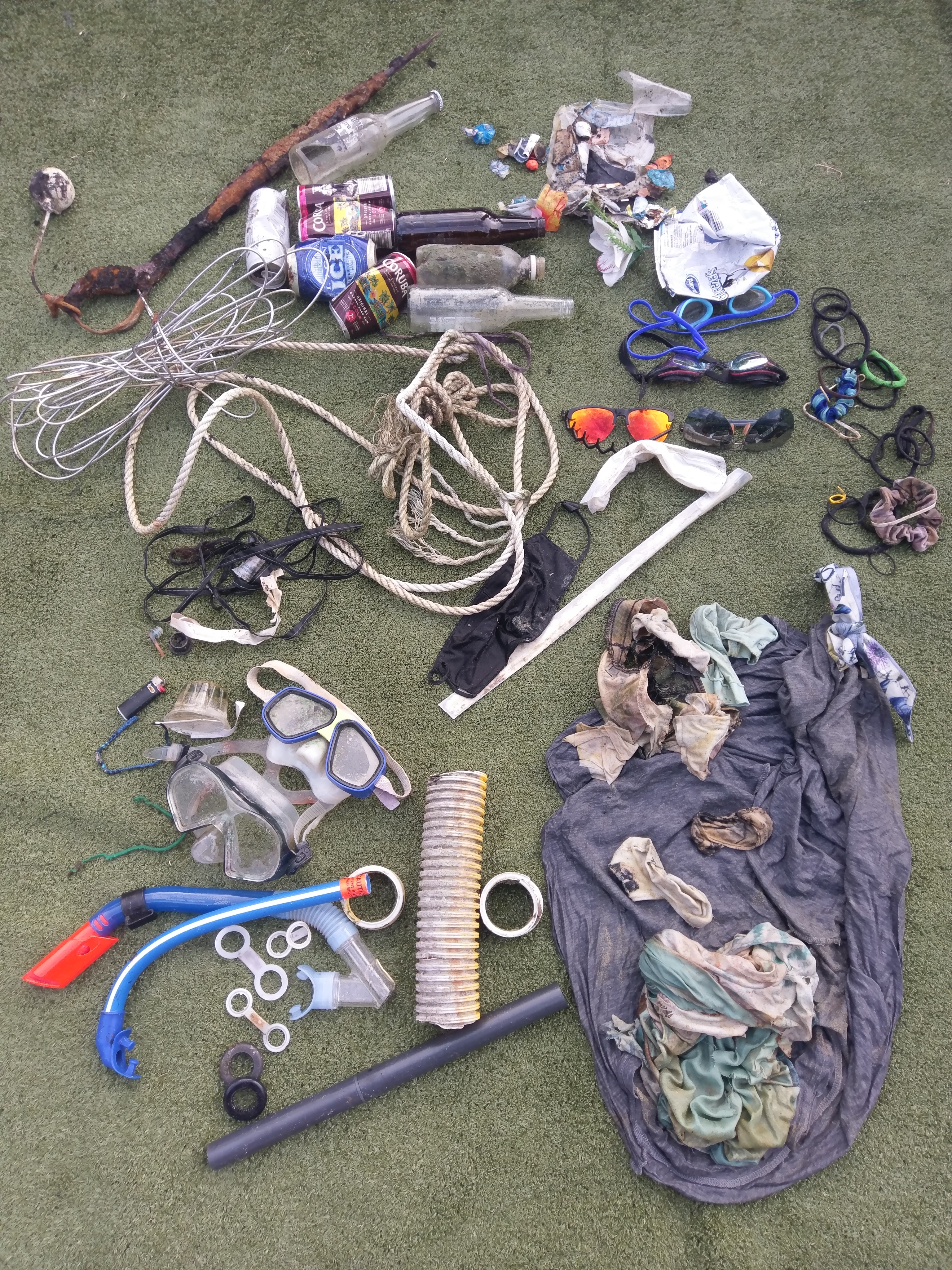
Spectacles
PPE Mask
Umbrella
Shower Hose
Kettle
Satellite Dish
CD's
Pens
Black Turtle Dive
Dan Summerfield
33
10
45
6
8
3
1
10
11
62
6
257.00
45
3.00
1.00
9
measured
300.00
Plastic Fragments
Plastic Bags
On
kilograms
I have debris data to report
83
Calm (glassy to rippled) for waves 0 – 0.1 meter high
2
7
5
14
48
m2


3
meters
coral reef
73
4
3
11
22
19
4
29
58
486
State\Province
Surat Thani
City
Koh Tao
Map Help
Dive Location
If you know your survey site coordinates, enter them manually in decimal degrees using WGS84 Map Datum. Use the minus sign for latitudes south of the equator and longitudes west of the Prime Meridian to 180 degrees.
If you do not know your survey site coordinates, click the “Map Location” tab to use the map to zoom into your survey site and drop the pin on the map to fall within your survey dive site in the water (not on land or the beach). Ensure you zoom in as much as possible to ensure data accuracy.
Entangled Help