Menu

Maikohama beach

5

34.627683011624, 135.03894025381

2
sand
2

34.627683011624, 135.03894025381

晴れ続きの1週間
Diving school NORIS kobe maiko
Sayaka Okamoto
4
1
2
7
0
2.00
60
7.00
2.00
estimated
8000.00
On
kilograms
I have debris data to report
1
7
Smooth (wavelets) for waves 0.1 - 0.5 meter high m2
1
meters
rocky reef
2
Japan
City
kobe
Map Help


Dive Location

If you know your survey site coordinates, enter them manually in decimal degrees using WGS84 Map Datum. Use the minus sign for latitudes south of the equator and longitudes west of the Prime Meridian to 180 degrees.

If you do not know your survey site coordinates, click the “Map Location” tab to use the map to zoom into your survey site and drop the pin on the map to fall within your survey dive site in the water (not on land or the beach). Ensure you zoom in as much as possible to ensure data accuracy.

Entangled Help


Use the vertical tabs below to record any entangled animals you found of each type.

ADS479 - Boca Sami

12.146246, -68.999348

9
sand
5
350
Nice, sunny, calm
Central Dive Curacao
Marcel Zinnert
3
53
1
6
18.00
60
5.00
1.00
10
estimated
123
600.00
On
kilograms
I have debris data to report
18
Calm (glassy to rippled) for waves 0 – 0.1 meter high
15
m2
1
meters
coral reef
8
5
15
3
Netherlands Antilles
City
Willemstad
Map Help


Dive Location

If you know your survey site coordinates, enter them manually in decimal degrees using WGS84 Map Datum. Use the minus sign for latitudes south of the equator and longitudes west of the Prime Meridian to 180 degrees.

If you do not know your survey site coordinates, click the “Map Location” tab to use the map to zoom into your survey site and drop the pin on the map to fall within your survey dive site in the water (not on land or the beach). Ensure you zoom in as much as possible to ensure data accuracy.

Entangled Help


Use the vertical tabs below to record any entangled animals you found of each type.

Junkyard

6
4
15
sand
17

10.085577, 99.8239614

fan belts
Scattered Rain
3
2
1
1
1
Fan belt
PPE Mask
Metal Clothes Hanger
Toothpaste tube
plastic serving tray
The Coral Tribe
Jennifer Dowling
1
2
2
2
1
1
4
3
9.00
50
15.00
5.00
6
estimated
3
50.00
fishing line
fishing net
string
1
On
kilograms
I have debris data to report
Slight for waves 0.5 -1.25 meter high
6
m2
12
meters
coral reef
1
3
1
3
1
2
1
Thailand
State\Province
Surat Thani
City
Koh Tao
Map Help


Dive Location

If you know your survey site coordinates, enter them manually in decimal degrees using WGS84 Map Datum. Use the minus sign for latitudes south of the equator and longitudes west of the Prime Meridian to 180 degrees.

If you do not know your survey site coordinates, click the “Map Location” tab to use the map to zoom into your survey site and drop the pin on the map to fall within your survey dive site in the water (not on land or the beach). Ensure you zoom in as much as possible to ensure data accuracy.

Entangled Help


Use the vertical tabs below to record any entangled animals you found of each type.

Aow Leuk

10
15
2
sand
28
1

10.071768625953, 99.841119190722

scattered rain
6
1
PPE Mask
Inhaler
The Coral Tribe
Jennifer Dowling
1
8
1
1
1
2
26
11.00
47
11.00
8.00
5
estimated
30.00
1
plastic bags
plastic bottles
Plastic frags
On
kilograms
I have debris data to report
Slight for waves 0.5 -1.25 meter high
1
1
1
3
m2
11
meters
other
0
1
3
2
Thailand
State\Province
Surat Thani
City
Koh Tao
Map Help


Dive Location

If you know your survey site coordinates, enter them manually in decimal degrees using WGS84 Map Datum. Use the minus sign for latitudes south of the equator and longitudes west of the Prime Meridian to 180 degrees.

If you do not know your survey site coordinates, click the “Map Location” tab to use the map to zoom into your survey site and drop the pin on the map to fall within your survey dive site in the water (not on land or the beach). Ensure you zoom in as much as possible to ensure data accuracy.

Entangled Help


Use the vertical tabs below to record any entangled animals you found of each type.

Ecosystem Other
sand

zamami kita

26.244099471015, 127.32670323527

sand

26.244099471015, 127.32670323527

Katsuhiro Imagama
5
2
32
7
9.50
30
9.00
5.00
measured
100.00
On
kilograms
I have debris data to report
Smooth (wavelets) for waves 0.1 - 0.5 meter high
1
m2
meters
coral reef
Japan
Map Help


Dive Location

If you know your survey site coordinates, enter them manually in decimal degrees using WGS84 Map Datum. Use the minus sign for latitudes south of the equator and longitudes west of the Prime Meridian to 180 degrees.

If you do not know your survey site coordinates, click the “Map Location” tab to use the map to zoom into your survey site and drop the pin on the map to fall within your survey dive site in the water (not on land or the beach). Ensure you zoom in as much as possible to ensure data accuracy.

Entangled Help


Use the vertical tabs below to record any entangled animals you found of each type.

Catalina Island

seagrass

33.3878856, -118.4163103

ocean one scuba center
bao sheng zhang
2
10.00
50
80.00
20.00
measured
1
1000.00
On
pounds
I have debris data to report
1
Calm (glassy to rippled) for waves 0 – 0.1 meter high ft2
feet
kelp
United States
State\Province
CA
City
catalina island
Map Help


Dive Location

If you know your survey site coordinates, enter them manually in decimal degrees using WGS84 Map Datum. Use the minus sign for latitudes south of the equator and longitudes west of the Prime Meridian to 180 degrees.

If you do not know your survey site coordinates, click the “Map Location” tab to use the map to zoom into your survey site and drop the pin on the map to fall within your survey dive site in the water (not on land or the beach). Ensure you zoom in as much as possible to ensure data accuracy.
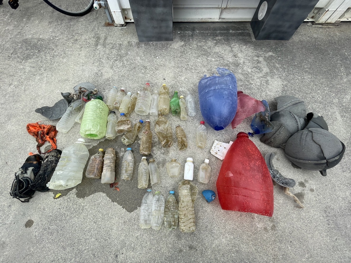
Entangled Help


Use the vertical tabs below to record any entangled animals you found of each type.

Koloa Landing

1
2
0

21.878592, -159.46835

1
0
0
coral
0
0
0
45
0
Speargun prong
Calm
1
0
0
0
0
0
0
0
0
0
0
0
0
0
0
0
0
0
0
0
Golf balls
April McCormack
0
0
0
1
0
0
0
0
0
0
0
0
0
0
0
0
0
1
0
3
0
0
0
0
0
0
0
0
0
0
0
0
0
0
10.00
60
25.00
7.00
0
estimated
0
28
1614.40
0
0
0
1
0
Fishing line
Fishing hooks
Fishing sinkers
0
On
pounds
0
I have debris data to report
0
0
0
Smooth (wavelets) for waves 0.1 - 0.5 meter high
0
0
0
0
0
0
0
ft2
0
0
feet
coral reef
0
0
0
0
0
1
0
0
0
0
0
0
0
0
0
0
0
0
0
0
0
1
0
0
0
0
0
0
United States
State\Province
Hawaii
City
Koloa
Map Help


Dive Location

If you know your survey site coordinates, enter them manually in decimal degrees using WGS84 Map Datum. Use the minus sign for latitudes south of the equator and longitudes west of the Prime Meridian to 180 degrees.

If you do not know your survey site coordinates, click the “Map Location” tab to use the map to zoom into your survey site and drop the pin on the map to fall within your survey dive site in the water (not on land or the beach). Ensure you zoom in as much as possible to ensure data accuracy.
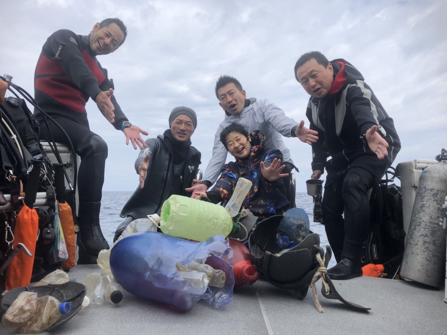
Entangled Help


Use the vertical tabs below to record any entangled animals you found of each type.

2/20/2022 Dive Against Debris Santa Monica Pier

sand
0

34.0099215, -118.4960063

ocean one scuba dive center
ocean one scuba center
10
2
1
9.30
35
45.00
10.00
estimated
1000.00
On
pounds
I have debris data to report
5
Calm (glassy to rippled) for waves 0 – 0.1 meter high
0
0
ft2
feet
other
United States
State\Province
CA
City
Santa Monica
Map Help


Dive Location

If you know your survey site coordinates, enter them manually in decimal degrees using WGS84 Map Datum. Use the minus sign for latitudes south of the equator and longitudes west of the Prime Meridian to 180 degrees.

If you do not know your survey site coordinates, click the “Map Location” tab to use the map to zoom into your survey site and drop the pin on the map to fall within your survey dive site in the water (not on land or the beach). Ensure you zoom in as much as possible to ensure data accuracy.
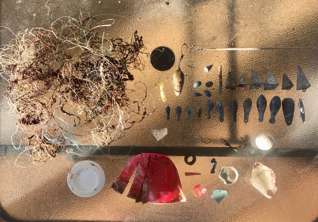
Entangled Help


Use the vertical tabs below to record any entangled animals you found of each type.

Ecosystem Other
sand bottom

Keauhou Bay

0
0
0

19.560793694844, -155.96732584038

0
0
0
coral
0
0
0
0
0
2 GoPros!
Mild
0
0
0
0
0
0
0
0
0
0
0
0
0
0
0
0
0
0
0
0
Jack’s Diving Locker
Keller
0
1
0
0
0
0
0
0
3
0
0
0
0
0
0
0
0
0
0
6
0
0
0
0
0
0
0
0
0
0
0
0
1
0
30.00
60
60.00
35.00
0
estimated
0
1
4162.75
0
0
0
0
0
Car Battery
GoPro Cameras
Snorkel Gear
0
On
pounds
0
I have debris data to report
0
0
0
Smooth (wavelets) for waves 0.1 - 0.5 meter high
0
0
0
0
0
0
0
ft2
0
0
feet
coral reef
0
0
0
0
0
0
0
0
0
0
0
0
0
0
0
0
0
0
0
0
0
0
0
0
0
0
0
0
United States
State\Province
Hawaii
City
Keauhou
Map Help


Dive Location

If you know your survey site coordinates, enter them manually in decimal degrees using WGS84 Map Datum. Use the minus sign for latitudes south of the equator and longitudes west of the Prime Meridian to 180 degrees.

If you do not know your survey site coordinates, click the “Map Location” tab to use the map to zoom into your survey site and drop the pin on the map to fall within your survey dive site in the water (not on land or the beach). Ensure you zoom in as much as possible to ensure data accuracy.
Entangled Help


Use the vertical tabs below to record any entangled animals you found of each type.

ADS644 - Point Panic

7
2
3
2
1
1
rock
2
37

21.290010842229, -157.86077768278

Trident Divers taught Dive Against Debris class
Office chair
Light rain
1
1
1
Office Chair
Folding/camp Chair
Danforth anchor
Nudi Wear
Ryan Scalf
3
2
1
1
3
16
3
6
1
1
312.00
45
26.00
4.00
4
measured
122
300.00
1
On
pounds
I have debris data to report
76
Calm (glassy to rippled) for waves 0 – 0.1 meter high
3
1
ft2
feet
rocky reef
2
3
1
2
9
36
United States
State\Province
HI
City
Honolulu
Map Help


Dive Location

If you know your survey site coordinates, enter them manually in decimal degrees using WGS84 Map Datum. Use the minus sign for latitudes south of the equator and longitudes west of the Prime Meridian to 180 degrees.

If you do not know your survey site coordinates, click the “Map Location” tab to use the map to zoom into your survey site and drop the pin on the map to fall within your survey dive site in the water (not on land or the beach). Ensure you zoom in as much as possible to ensure data accuracy.

Entangled Help


Use the vertical tabs below to record any entangled animals you found of each type.

Subscribe to