Menu

Playa Chica

11
sand
2

28.918737231191, -13.668548598873

Hay un emisario próximo que no ha funcionado correctamente. Ha hecho muchos vertidos por eso encontramos tampones.
Temporal. Fuertes vientos.
Calima. Fenómenos costeros
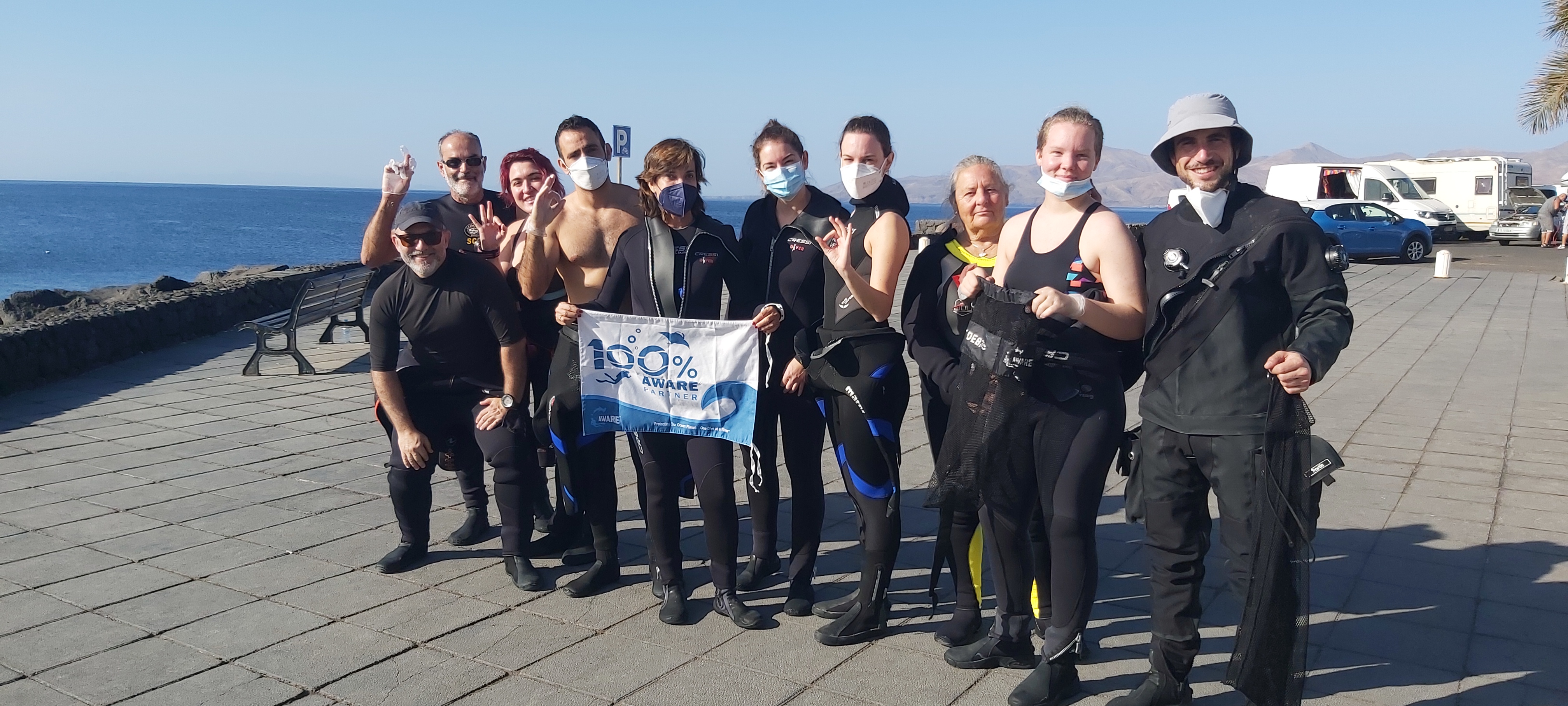
TIMANFAYA SUB #799222
Jorge Ceballos Herranz
3
9
2
3.00
45
30.00
1.00
2
estimated
6
837.83
Tampones
On
kilograms
I have debris data to report
1
Calm (glassy to rippled) for waves 0 – 0.1 meter high
6
m2
meters
rocky reef
3
Spain
State\Province
Islas canarias
City
Lanzarote
Map Help


Dive Location

If you know your survey site coordinates, enter them manually in decimal degrees using WGS84 Map Datum. Use the minus sign for latitudes south of the equator and longitudes west of the Prime Meridian to 180 degrees.

If you do not know your survey site coordinates, click the “Map Location” tab to use the map to zoom into your survey site and drop the pin on the map to fall within your survey dive site in the water (not on land or the beach). Ensure you zoom in as much as possible to ensure data accuracy.

Entangled Help


Use the vertical tabs below to record any entangled animals you found of each type.

ADS343 - Playa Lagun

5

12.31835, -69.150884

1
coral
2
Bahia Diving Curacao
Ana Kostadinova
2
7
7
5.00
55
15.00
2.00
estimated
100.00
2
On
kilograms
I have debris data to report
8
Smooth (wavelets) for waves 0.1 - 0.5 meter high
2
m2
meters
coral reef
10
9
Netherlands Antilles
State\Province
Lagun
City
Willemstad
Map Help


Dive Location

If you know your survey site coordinates, enter them manually in decimal degrees using WGS84 Map Datum. Use the minus sign for latitudes south of the equator and longitudes west of the Prime Meridian to 180 degrees.

If you do not know your survey site coordinates, click the “Map Location” tab to use the map to zoom into your survey site and drop the pin on the map to fall within your survey dive site in the water (not on land or the beach). Ensure you zoom in as much as possible to ensure data accuracy.

Entangled Help


Use the vertical tabs below to record any entangled animals you found of each type.

Playa chica

28.9190368, -13.6686448

sand

28.919415040048, -13.668622970581

Timanfaya Sub
Arianna Casals Aznar
2
3
0.02
45
20.00
5.00
estimated
4553.79
On
kilograms
I have debris data to report
Smooth (wavelets) for waves 0.1 - 0.5 meter high m2
meters
rocky reef
Spain
State\Province
Las Palmas
City
Tías
Map Help


Dive Location

If you know your survey site coordinates, enter them manually in decimal degrees using WGS84 Map Datum. Use the minus sign for latitudes south of the equator and longitudes west of the Prime Meridian to 180 degrees.

If you do not know your survey site coordinates, click the “Map Location” tab to use the map to zoom into your survey site and drop the pin on the map to fall within your survey dive site in the water (not on land or the beach). Ensure you zoom in as much as possible to ensure data accuracy.

Entangled Help


Use the vertical tabs below to record any entangled animals you found of each type.

Mae Haad

24
61
5

10.08598, 99.824338

sand
29

10.085811395921, 99.824599979514

1
2
Toilet brush
Plastic Plant Pots
The Coral Tribe
Jennifer Dowling
3
1
10
2
1
1
3
2
1
9
2
9.00
68
3.00
1.00
2
estimated
25.00
3
Plastic bags
Plastic frags
Food wrappers
On
kilograms
I have debris data to report
Smooth (wavelets) for waves 0.1 - 0.5 meter high
1
4
4
m2
3
meters
other
1
1
2
5
2
2
Thailand
State\Province
Surat Thani
City
Koh Tao
Map Help


Dive Location

If you know your survey site coordinates, enter them manually in decimal degrees using WGS84 Map Datum. Use the minus sign for latitudes south of the equator and longitudes west of the Prime Meridian to 180 degrees.

If you do not know your survey site coordinates, click the “Map Location” tab to use the map to zoom into your survey site and drop the pin on the map to fall within your survey dive site in the water (not on land or the beach). Ensure you zoom in as much as possible to ensure data accuracy.

Entangled Help


Use the vertical tabs below to record any entangled animals you found of each type.

Ecosystem Other
Sand

Joint Base Pearl Harbor-Hickam

silt

21.35287840893, -157.95859477655

Harbor bottom cleanup dive, working dive, proficiency training.
Naval activities
clear
Max
4
15.00
30
35.00
20.00
estimated
50000.00
15
On
pounds
I have debris data to report
Calm (glassy to rippled) for waves 0 – 0.1 meter high ft2
feet
seagrass
United States
Map Help


Dive Location

If you know your survey site coordinates, enter them manually in decimal degrees using WGS84 Map Datum. Use the minus sign for latitudes south of the equator and longitudes west of the Prime Meridian to 180 degrees.

If you do not know your survey site coordinates, click the “Map Location” tab to use the map to zoom into your survey site and drop the pin on the map to fall within your survey dive site in the water (not on land or the beach). Ensure you zoom in as much as possible to ensure data accuracy.

Entangled Help


Use the vertical tabs below to record any entangled animals you found of each type.

Electric Beach

4
coral
1

21.353517156548, -158.13251938555

First dive against debris in Hawaii after moving to the island, fun dive with friends to survey electric beach.
Tourism
clear
Max
3
2
9.00
30
32.00
5.00
2
estimated
900.00
On
pounds
I have debris data to report
Slight for waves 0.5 -1.25 meter high ft2
feet
coral reef
1
2
United States
Map Help


Dive Location

If you know your survey site coordinates, enter them manually in decimal degrees using WGS84 Map Datum. Use the minus sign for latitudes south of the equator and longitudes west of the Prime Meridian to 180 degrees.

If you do not know your survey site coordinates, click the “Map Location” tab to use the map to zoom into your survey site and drop the pin on the map to fall within your survey dive site in the water (not on land or the beach). Ensure you zoom in as much as possible to ensure data accuracy.

Entangled Help


Use the vertical tabs below to record any entangled animals you found of each type.

Joint Base Pearl Harbor-Hickam

silt

21.356946508532, -157.94246439915

Harbor bottom cleanup dive, pre-underway inspection of submarine, and proficiency training
Naval activities
clear
Max
6
5.00
30
35.00
20.00
estimated
50000.00
9
On
pounds
I have debris data to report
Calm (glassy to rippled) for waves 0 – 0.1 meter high ft2
feet
seagrass
United States
Map Help


Dive Location

If you know your survey site coordinates, enter them manually in decimal degrees using WGS84 Map Datum. Use the minus sign for latitudes south of the equator and longitudes west of the Prime Meridian to 180 degrees.

If you do not know your survey site coordinates, click the “Map Location” tab to use the map to zoom into your survey site and drop the pin on the map to fall within your survey dive site in the water (not on land or the beach). Ensure you zoom in as much as possible to ensure data accuracy.

Entangled Help


Use the vertical tabs below to record any entangled animals you found of each type.

Joint Base Pearl Harbor-Hickam

silt

21.356105752812, -157.94326912369

Harbor bottom cleanup dive, pre-underway inspection of submarine, and proficiency training
Naval activities
clear
Max
6
20.00
30
35.00
20.00
estimated
50000.00
20
On
pounds
I have debris data to report
Calm (glassy to rippled) for waves 0 – 0.1 meter high ft2
feet
seagrass
United States
Map Help


Dive Location

If you know your survey site coordinates, enter them manually in decimal degrees using WGS84 Map Datum. Use the minus sign for latitudes south of the equator and longitudes west of the Prime Meridian to 180 degrees.

If you do not know your survey site coordinates, click the “Map Location” tab to use the map to zoom into your survey site and drop the pin on the map to fall within your survey dive site in the water (not on land or the beach). Ensure you zoom in as much as possible to ensure data accuracy.

Entangled Help


Use the vertical tabs below to record any entangled animals you found of each type.

Joint Base Pearl Harbor-Hickam

silt

21.356551734531, -157.94525926094

Harbor bottom cleanup dive, pre-underway inspection of submarine, and proficiency training
Naval activities
clear
Max
4
5.00
30
35.00
20.00
estimated
50000.00
9
On
pounds
I have debris data to report
Calm (glassy to rippled) for waves 0 – 0.1 meter high ft2
feet
seagrass
United States
Map Help


Dive Location

If you know your survey site coordinates, enter them manually in decimal degrees using WGS84 Map Datum. Use the minus sign for latitudes south of the equator and longitudes west of the Prime Meridian to 180 degrees.

If you do not know your survey site coordinates, click the “Map Location” tab to use the map to zoom into your survey site and drop the pin on the map to fall within your survey dive site in the water (not on land or the beach). Ensure you zoom in as much as possible to ensure data accuracy.

Entangled Help


Use the vertical tabs below to record any entangled animals you found of each type.

ADS616 - Divers Leap

2
4
coral
2

12.073085528305, -68.879016672929

Rainfall-runoff,
1st Clean-Up dive after New Year's Eve,
Jet-Ski Safety Switch Cabel
Rainy, Windy
1
1
1
1
Dive Mask
Snorkel
Jet-Ski Saefty Switch Cabel
Cash Money: 10.- Naf
Fundiving Curacao
Adam Diorio
3
2
3
3
8
4
15.00
50
25.00
2.00
estimated
7000.00
3
Plastic Bottles
Glas Bottles
Firework Materials
On
kilograms
I have debris data to report
6
Smooth (wavelets) for waves 0.1 - 0.5 meter high m2
meters
coral reef
10
1
3
Netherlands Antilles
State\Province
Jan Thiel - Papagayo Beach
City
willemstad
Map Help


Dive Location

If you know your survey site coordinates, enter them manually in decimal degrees using WGS84 Map Datum. Use the minus sign for latitudes south of the equator and longitudes west of the Prime Meridian to 180 degrees.

If you do not know your survey site coordinates, click the “Map Location” tab to use the map to zoom into your survey site and drop the pin on the map to fall within your survey dive site in the water (not on land or the beach). Ensure you zoom in as much as possible to ensure data accuracy.

Entangled Help


Use the vertical tabs below to record any entangled animals you found of each type.

Subscribe to