Menu

Blue Lagoon

30.81380957098, -95.605493673032

silt
AWARE dive for AOW
SCUBA training
clear
2
medicine ball (weighted workout ball)
Max
12
5
5.00
25
30.00
5.00
estimated
700.00
On
pounds
I have debris data to report
Calm (glassy to rippled) for waves 0 – 0.1 meter high
5
ft2
3
feet
other
1
2
United States
Map Help


Dive Location

If you know your survey site coordinates, enter them manually in decimal degrees using WGS84 Map Datum. Use the minus sign for latitudes south of the equator and longitudes west of the Prime Meridian to 180 degrees.

If you do not know your survey site coordinates, click the “Map Location” tab to use the map to zoom into your survey site and drop the pin on the map to fall within your survey dive site in the water (not on land or the beach). Ensure you zoom in as much as possible to ensure data accuracy.

Entangled Help


Use the vertical tabs below to record any entangled animals you found of each type.

Ecosystem Other
quarry wall

Blue Lagoon

30.81380957098, -95.605493673032

silt
AWARE dive for AOW
SCUBA training
Clear
25
fiberglass fragments
Max
25
5.00
24
30.00
5.00
estimated
200.00
On
pounds
I have debris data to report
Calm (glassy to rippled) for waves 0 – 0.1 meter high ft2
feet
other
United States
Map Help


Dive Location

If you know your survey site coordinates, enter them manually in decimal degrees using WGS84 Map Datum. Use the minus sign for latitudes south of the equator and longitudes west of the Prime Meridian to 180 degrees.

If you do not know your survey site coordinates, click the “Map Location” tab to use the map to zoom into your survey site and drop the pin on the map to fall within your survey dive site in the water (not on land or the beach). Ensure you zoom in as much as possible to ensure data accuracy.

Entangled Help


Use the vertical tabs below to record any entangled animals you found of each type.

Ecosystem Other
quarry wall

Mammoth Lake

29.029551069421, -95.416894974623

sand
5

29.02959523104, -95.416869535023

AWARE dive for AOW
recreational SCUBA diving
31
fiberglass ladder pieces
Max
6
10
9
4
30.00
34
60.00
10.00
estimated
550.00
On
pounds
I have debris data to report
Calm (glassy to rippled) for waves 0 – 0.1 meter high
2
ft2
feet
seagrass
United States
Map Help


Dive Location

If you know your survey site coordinates, enter them manually in decimal degrees using WGS84 Map Datum. Use the minus sign for latitudes south of the equator and longitudes west of the Prime Meridian to 180 degrees.

If you do not know your survey site coordinates, click the “Map Location” tab to use the map to zoom into your survey site and drop the pin on the map to fall within your survey dive site in the water (not on land or the beach). Ensure you zoom in as much as possible to ensure data accuracy.
Entangled Help


Use the vertical tabs below to record any entangled animals you found of each type.

Blue Lagoon

silt

30.81380957098, -95.605493673032

AWARE Dive for Advanced Open Water students
SCUBA training
Clear
Texas A&M University SCUBA
Max
25
5
1
50.00
24
30.00
5.00
estimated
500.00
On
pounds
I have debris data to report
Calm (glassy to rippled) for waves 0 – 0.1 meter high
10
1
ft2
feet
other
8
12
United States
State\Province
TX
Map Help


Dive Location

If you know your survey site coordinates, enter them manually in decimal degrees using WGS84 Map Datum. Use the minus sign for latitudes south of the equator and longitudes west of the Prime Meridian to 180 degrees.

If you do not know your survey site coordinates, click the “Map Location” tab to use the map to zoom into your survey site and drop the pin on the map to fall within your survey dive site in the water (not on land or the beach). Ensure you zoom in as much as possible to ensure data accuracy.
Entangled Help


Use the vertical tabs below to record any entangled animals you found of each type.

Ecosystem Other
quarry wall

Magic Island

54
silt

21.283002199241, -157.84700981556

AWARE Dive for IDC Students
tourism
monocle lens
Clear
16
unidentified manmade material
Hawaiian Dive Company
Max
9
10
25.00
80
20.00
5.00
estimated
550.00
5
On
pounds
I have debris data to report
Smooth (wavelets) for waves 0.1 - 0.5 meter high
87
12
1
ft2
feet
seagrass
1
6
United States
State\Province
HI
City
Honolulu
Map Help


Dive Location

If you know your survey site coordinates, enter them manually in decimal degrees using WGS84 Map Datum. Use the minus sign for latitudes south of the equator and longitudes west of the Prime Meridian to 180 degrees.

If you do not know your survey site coordinates, click the “Map Location” tab to use the map to zoom into your survey site and drop the pin on the map to fall within your survey dive site in the water (not on land or the beach). Ensure you zoom in as much as possible to ensure data accuracy.
Entangled Help


Use the vertical tabs below to record any entangled animals you found of each type.

ADS307 - Portmellon

0
0
0

50.261830731679, -4.7848080043297

0
0
0
sand
0
0
0
0
0
No
Golf balls again
Over cast
0
0
0
0
0
0
0
0
0
0
0
0
0
0
0
0
0
0
0
0
Viewpoint diving 24787
David skinner
0
0
0
0
0
0
0
0
0
0
0
0
0
0
0
0
0
0
0
2
0
0
0
0
0
0
0
0
0
0
1
0
0
0
1.00
60
6.00
2.00
0
estimated
0
0
15620.80
0
0
0
0
0
0
On
kilograms
0
I have debris data to report
0
0
0
Smooth (wavelets) for waves 0.1 - 0.5 meter high
0
0
0
0
0
0
0
m2
2
0
meters
rocky reef
0
0
0
0
0
0
0
0
0
0
0
0
0
0
0
0
0
0
0
0
0
0
0
0
0
0
0
0
United Kingdom
State\Province
Cornwall
City
Portmellon
Map Help


Dive Location

If you know your survey site coordinates, enter them manually in decimal degrees using WGS84 Map Datum. Use the minus sign for latitudes south of the equator and longitudes west of the Prime Meridian to 180 degrees.

If you do not know your survey site coordinates, click the “Map Location” tab to use the map to zoom into your survey site and drop the pin on the map to fall within your survey dive site in the water (not on land or the beach). Ensure you zoom in as much as possible to ensure data accuracy.
Entangled Help


Use the vertical tabs below to record any entangled animals you found of each type.

Pickle's Reef

24.95707, -80.41477

coral
Florida Keys Dive Center
Claire
4
0.25
45
35.00
20.00
estimated
100.00
On
pounds
I have debris data to report
Slight for waves 0.5 -1.25 meter high ft2
feet
coral reef
1
United States
Map Help


Dive Location

If you know your survey site coordinates, enter them manually in decimal degrees using WGS84 Map Datum. Use the minus sign for latitudes south of the equator and longitudes west of the Prime Meridian to 180 degrees.

If you do not know your survey site coordinates, click the “Map Location” tab to use the map to zoom into your survey site and drop the pin on the map to fall within your survey dive site in the water (not on land or the beach). Ensure you zoom in as much as possible to ensure data accuracy.
Entangled Help


Use the vertical tabs below to record any entangled animals you found of each type.

ADS575 - Red Slave

11
1

12.02636, -68.251795

coral
2
AB-Dive
Dewi
7
34
17
5.80
46
27.00
13.00
2
measured
240.00
2
plastic bottles
On
kilograms
I have debris data to report
Smooth (wavelets) for waves 0.1 - 0.5 meter high
2
m2
meters
coral reef
Netherlands Antilles
State\Province
Bonaire
City
Kralendijk
Map Help


Dive Location

If you know your survey site coordinates, enter them manually in decimal degrees using WGS84 Map Datum. Use the minus sign for latitudes south of the equator and longitudes west of the Prime Meridian to 180 degrees.

If you do not know your survey site coordinates, click the “Map Location” tab to use the map to zoom into your survey site and drop the pin on the map to fall within your survey dive site in the water (not on land or the beach). Ensure you zoom in as much as possible to ensure data accuracy.

Entangled Help


Use the vertical tabs below to record any entangled animals you found of each type.

Ladders

0
0
0

21.889424750832, -159.56099996204

5
0
0
coral
0
0
0
15
0
Local fishing
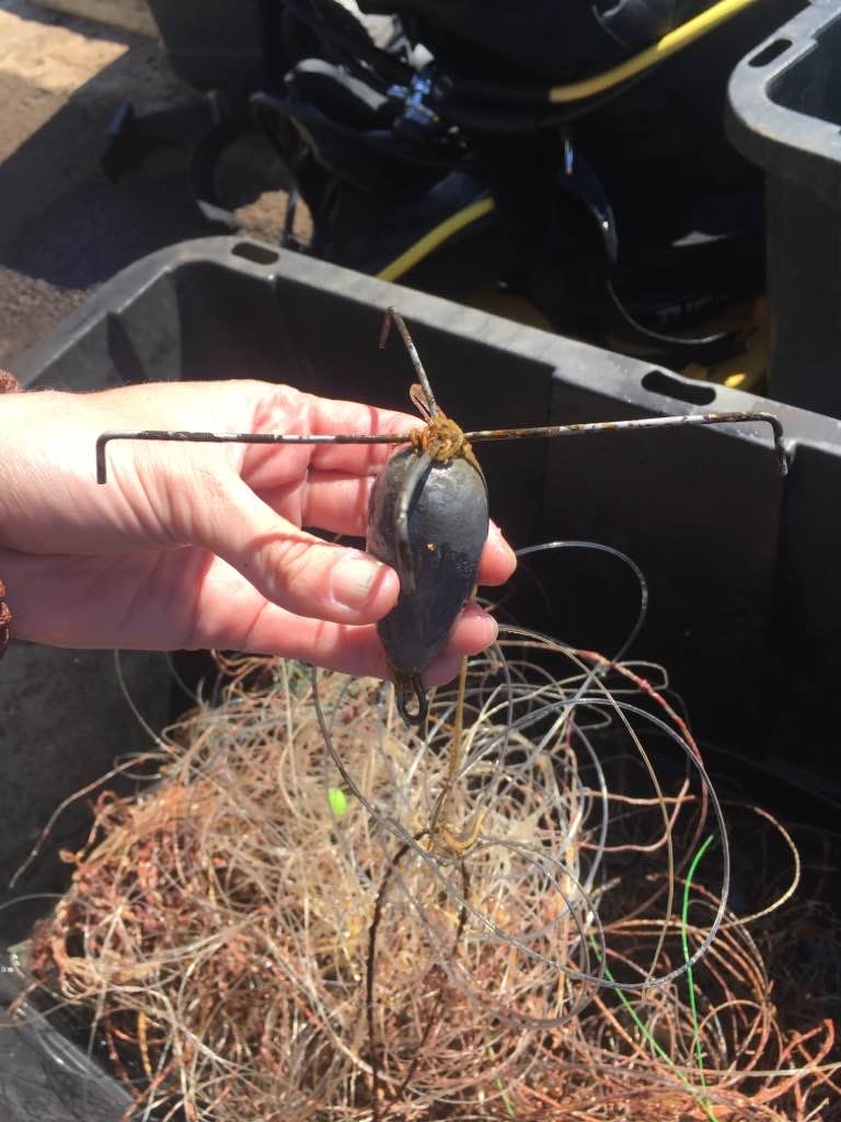
Weighted grappling hooks
NA
Calm
0
0
0
0
0
0
0
0
0
0
0
0
0
0
0
0
0
0
0
0
Protectors of Ke Kai
Tim Leichtler
0
0
0
0
0
0
0
0
0
0
0
0
0
0
0
0
0
0
0
6
0
0
0
0
0
0
0
0
0
0
0
0
0
0
20.00
45
45.00
12.00
0
measured
0
0
18758.20
0
0
0
0
0
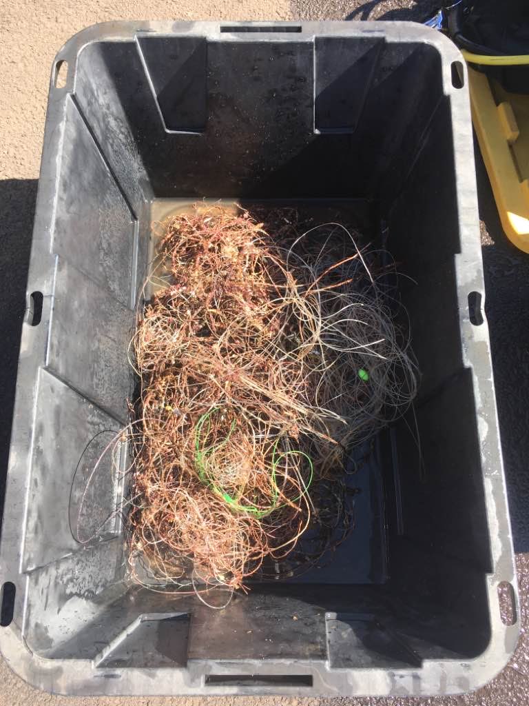
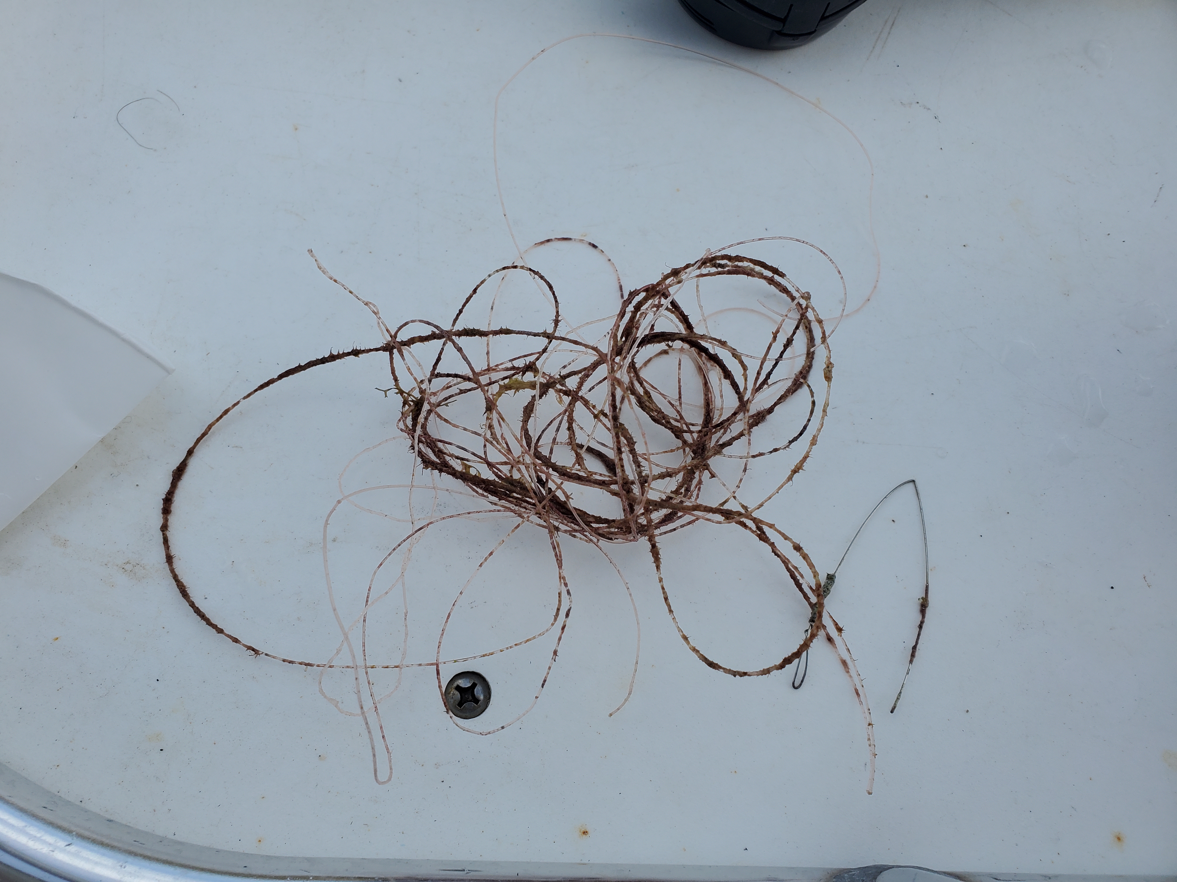
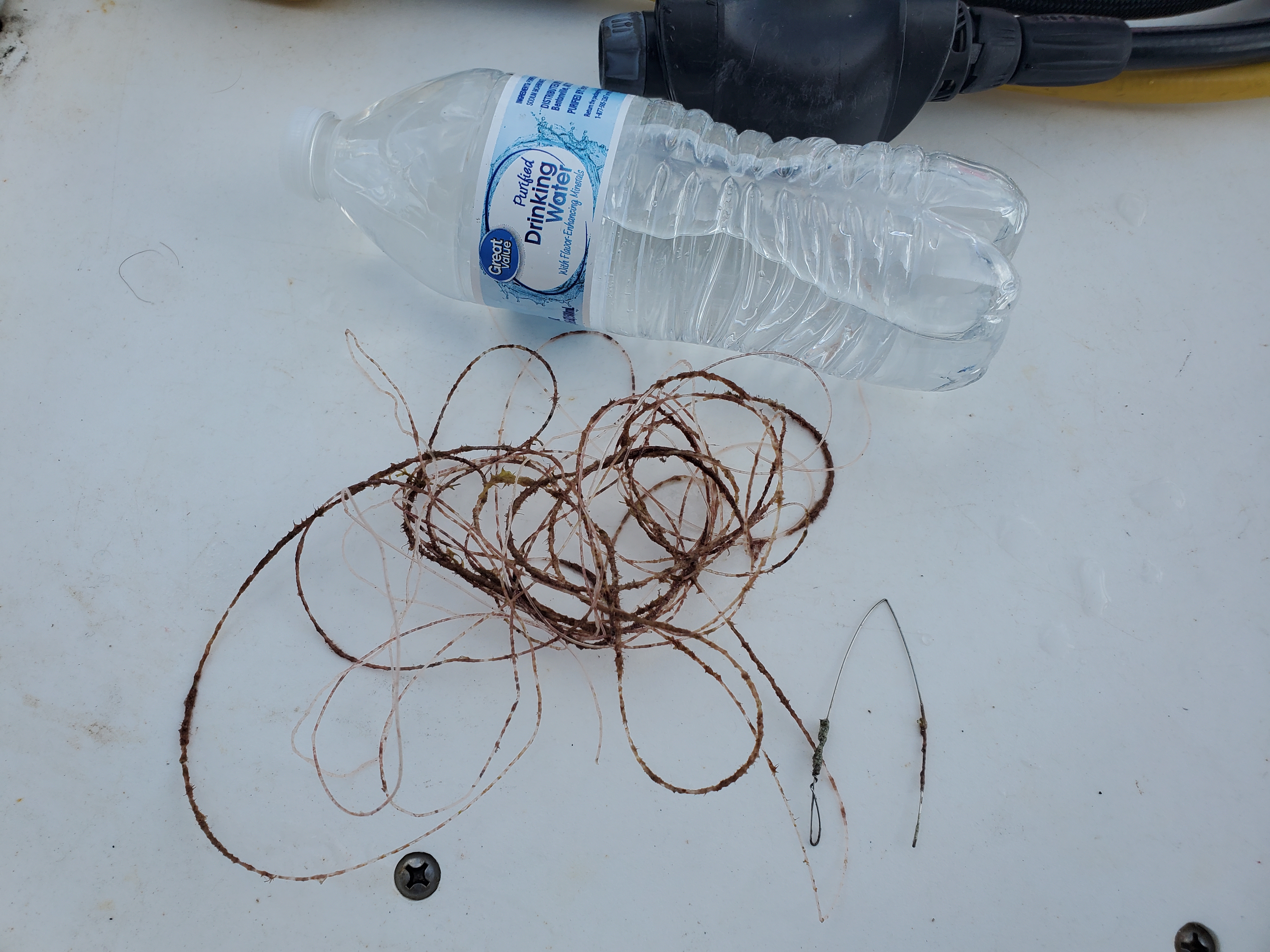
Fishing line
Fishing hooks
Grappling hooks
0
On
pounds
0
I have debris data to report
0
0
0
Slight for waves 0.5 -1.25 meter high
0
0
0
0
0
0
0
m2
0
0
1
NA
Gold
feet
coral reef
0
0
0
0
0
0
0
0
0
0
0
0
0
0
0
0
0
0
0
0
0
0
0
0
0
0
0
0
United States
State\Province
Hawaii
City
Eleele
Map Help


Dive Location

If you know your survey site coordinates, enter them manually in decimal degrees using WGS84 Map Datum. Use the minus sign for latitudes south of the equator and longitudes west of the Prime Meridian to 180 degrees.

If you do not know your survey site coordinates, click the “Map Location” tab to use the map to zoom into your survey site and drop the pin on the map to fall within your survey dive site in the water (not on land or the beach). Ensure you zoom in as much as possible to ensure data accuracy.
Entangled Help


Use the vertical tabs below to record any entangled animals you found of each type.

South Ledges

25.1398, -80.2599

sand
1

25.139847276277, -80.259938635011

Grove Scuba
Fuming Shi
4
1
0.05
47
26.00
5.00
estimated
1
2673.78
On
pounds
I have debris data to report
Calm (glassy to rippled) for waves 0 – 0.1 meter high m2
meters
coral reef
United States
State\Province
FL
City
Key Largo
Map Help


Dive Location

If you know your survey site coordinates, enter them manually in decimal degrees using WGS84 Map Datum. Use the minus sign for latitudes south of the equator and longitudes west of the Prime Meridian to 180 degrees.

If you do not know your survey site coordinates, click the “Map Location” tab to use the map to zoom into your survey site and drop the pin on the map to fall within your survey dive site in the water (not on land or the beach). Ensure you zoom in as much as possible to ensure data accuracy.
Entangled Help


Use the vertical tabs below to record any entangled animals you found of each type.

Subscribe to