Menu

Occuquian

0
0
0

38.67713928, -77.26290893

0
0
0
gravel
0
0
0
0
0
None
No
None
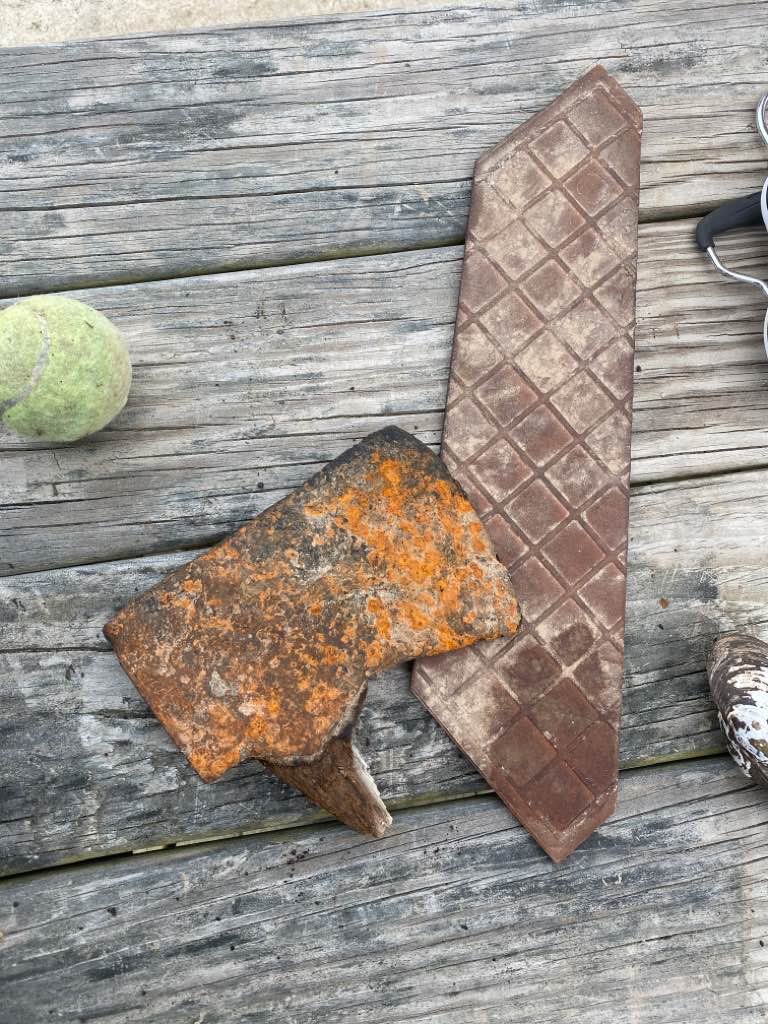
Ax head
Fair. Light no visible
1
0
0
0
0
0
0
0
0
0
0
0
0
0
0
0
0
0
0
0
Tile
Patriot scuba
Scott
0
0
0
0
0
0
0
0
0
0
0
0
0
0
0
0
0
0
0
3
0
0
0
0
0
0
0
0
0
0
0
0
0
0
5.00
20
15.00
10.00
0
measured
0
0
600.00
0
0
0
0
0
Metal Pipes
0
On
pounds
0
I have debris data to report
0
0
0
Calm (glassy to rippled) for waves 0 – 0.1 meter high
0
0
0
0
0
0
0
ft2
0
0
feet
other
0
0
1
0
0
0
0
0
0
0
0
0
0
0
0
0
0
0
0
0
0
0
0
0
0
0
0
0
United States
State\Province
Va
City
Occoquan
Map Help


Dive Location

If you know your survey site coordinates, enter them manually in decimal degrees using WGS84 Map Datum. Use the minus sign for latitudes south of the equator and longitudes west of the Prime Meridian to 180 degrees.

If you do not know your survey site coordinates, click the “Map Location” tab to use the map to zoom into your survey site and drop the pin on the map to fall within your survey dive site in the water (not on land or the beach). Ensure you zoom in as much as possible to ensure data accuracy.

Entangled Help


Use the vertical tabs below to record any entangled animals you found of each type.

Punta Playa Pescadores

1
6
rock

15.749341296742, -96.124326727236

no, I don't.
Extremely windy from the west for the past 5 days.
Huatulco Dive Center
David-Alexandre Gassin
1
1
3
1
5.00
64
14.00
5.00
4
estimated
2
528.00
fishing line and net
On
kilograms
I have debris data to report
Smooth (wavelets) for waves 0.1 - 0.5 meter high m2
1
meters
rocky reef
1
1
1
1
1
Mexico
State\Province
Oaxaca
City
Huatulco
Map Help


Dive Location

If you know your survey site coordinates, enter them manually in decimal degrees using WGS84 Map Datum. Use the minus sign for latitudes south of the equator and longitudes west of the Prime Meridian to 180 degrees.

If you do not know your survey site coordinates, click the “Map Location” tab to use the map to zoom into your survey site and drop the pin on the map to fall within your survey dive site in the water (not on land or the beach). Ensure you zoom in as much as possible to ensure data accuracy.

Entangled Help


Use the vertical tabs below to record any entangled animals you found of each type.

Dragon Bay

0
20
2

12.08316388722, -61.762740138129

0
0
0
coral
2
0
0
8
1
Crab’s arm was entangled in fishing line. We cut off the line, untangling the crab and freeing it.
1
1
1
0
0
0
0
0
0
0
0
0
0
0
0
0
0
0
0
0
Kite
Laptop Bag Carrying Case
Toothpaste
Aquanauts Grenada
Tom Geer
1
0
1
0
0
0
0
0
0
0
0
0
1
0
0
0
0
2
4
6
0
0
0
0
0
0
0
8
1
2
0
0
0
0
75.00
60
10.00
5.00
4
estimated
0
0
5.00
0
1
0
0
0
0
On
pounds
0
I have debris data to report
0
0
0
Calm (glassy to rippled) for waves 0 – 0.1 meter high
0
0
0
Fishing Line
King Crab
Injured
1
0
7
0
0
m2
3
16
meters
coral reef
0
0
0
0
0
0
0
0
0
12
0
0
0
0
0
0
0
0
0
0
0
0
0
0
0
0
0
0
Grenada
Map Help


Dive Location

If you know your survey site coordinates, enter them manually in decimal degrees using WGS84 Map Datum. Use the minus sign for latitudes south of the equator and longitudes west of the Prime Meridian to 180 degrees.

If you do not know your survey site coordinates, click the “Map Location” tab to use the map to zoom into your survey site and drop the pin on the map to fall within your survey dive site in the water (not on land or the beach). Ensure you zoom in as much as possible to ensure data accuracy.

Entangled Help


Use the vertical tabs below to record any entangled animals you found of each type.

Kai Iwi Lakes (Lake Taharoa) clean-up

2
21
1
sand
2
1

-35.8062587, 173.6494727

Partly Cloudy
1
30
8
7
fins
Hair ties
Plasters
Sun glasses
Eroad NZ
Martin Ruddy
-1
4
11
1
3
1
2
8.00
70
12.00
4.00
estimated
1
8100.00
2
Hair bands
On
kilograms
I have debris data to report
10
Calm (glassy to rippled) for waves 0 – 0.1 meter high
3
5
m2
meters
other
5
1
3
18
New Zealand
City
Auckland
Map Help


Dive Location

If you know your survey site coordinates, enter them manually in decimal degrees using WGS84 Map Datum. Use the minus sign for latitudes south of the equator and longitudes west of the Prime Meridian to 180 degrees.

If you do not know your survey site coordinates, click the “Map Location” tab to use the map to zoom into your survey site and drop the pin on the map to fall within your survey dive site in the water (not on land or the beach). Ensure you zoom in as much as possible to ensure data accuracy.

Entangled Help


Use the vertical tabs below to record any entangled animals you found of each type.

Ecosystem Other
Fresh water lake

Mushroom

24.841333, -80.62855

rock
ongoing commercial and recreational boating
mild waves
1
anchor with chain and line
Key Dives/FKNMS
Justin Benson
1
17.00
40
50.00
35.00
measured
50.00
On
pounds
I have debris data to report
Smooth (wavelets) for waves 0.1 - 0.5 meter high m2
feet
rocky reef
United States
State\Province
FL
City
Islamorada
Map Help


Dive Location

If you know your survey site coordinates, enter them manually in decimal degrees using WGS84 Map Datum. Use the minus sign for latitudes south of the equator and longitudes west of the Prime Meridian to 180 degrees.

If you do not know your survey site coordinates, click the “Map Location” tab to use the map to zoom into your survey site and drop the pin on the map to fall within your survey dive site in the water (not on land or the beach). Ensure you zoom in as much as possible to ensure data accuracy.

Entangled Help


Use the vertical tabs below to record any entangled animals you found of each type.

Mushroom

24.841333, -80.62855

rock
ongoing commercial and recreational boating
mild waves
1
anchor with chain and line
Key Dives/FKNMS
Justin Benson
1
17.00
40
50.00
35.00
measured
50.00
On
pounds
I have debris data to report
Smooth (wavelets) for waves 0.1 - 0.5 meter high m2
feet
rocky reef
United States
State\Province
FL
City
Islamorada
Map Help


Dive Location

If you know your survey site coordinates, enter them manually in decimal degrees using WGS84 Map Datum. Use the minus sign for latitudes south of the equator and longitudes west of the Prime Meridian to 180 degrees.

If you do not know your survey site coordinates, click the “Map Location” tab to use the map to zoom into your survey site and drop the pin on the map to fall within your survey dive site in the water (not on land or the beach). Ensure you zoom in as much as possible to ensure data accuracy.

Entangled Help


Use the vertical tabs below to record any entangled animals you found of each type.

Alligator Reef

24.850961, -80.616993

rock
ongoing commercial and recreational fishing
Mild waves
1
Anchor
Key Dives/FKNMS
Justin Benson
1
10.00
45
25.00
15.00
measured
3000.00
On
pounds
I have debris data to report
Smooth (wavelets) for waves 0.1 - 0.5 meter high ft2
feet
rocky reef
United States
State\Province
FL
City
Islamorada
Map Help


Dive Location

If you know your survey site coordinates, enter them manually in decimal degrees using WGS84 Map Datum. Use the minus sign for latitudes south of the equator and longitudes west of the Prime Meridian to 180 degrees.

If you do not know your survey site coordinates, click the “Map Location” tab to use the map to zoom into your survey site and drop the pin on the map to fall within your survey dive site in the water (not on land or the beach). Ensure you zoom in as much as possible to ensure data accuracy.

Entangled Help


Use the vertical tabs below to record any entangled animals you found of each type.

Victory

24.888317, -80.549267

rock
Commercial and recreational fishing, miscellaneous recreational boating activities, bad weather
Mild Waves
Key Dives/FKNMS
Justin Benson
14
30.00
35
50.00
35.00
measured
1
200.00
derelict Lobster trap
On
pounds
I have debris data to report
Smooth (wavelets) for waves 0.1 - 0.5 meter high m2
feet
rocky reef
United States
State\Province
FL
City
Islamorada
Map Help


Dive Location

If you know your survey site coordinates, enter them manually in decimal degrees using WGS84 Map Datum. Use the minus sign for latitudes south of the equator and longitudes west of the Prime Meridian to 180 degrees.

If you do not know your survey site coordinates, click the “Map Location” tab to use the map to zoom into your survey site and drop the pin on the map to fall within your survey dive site in the water (not on land or the beach). Ensure you zoom in as much as possible to ensure data accuracy.

Entangled Help


Use the vertical tabs below to record any entangled animals you found of each type.

Playa de Nueva Andalucia

1
sand
4
2

36.481239081888, -4.9646109594798

Lots of tyres filled with concrete were found. Unable to remove. Also plastic sheeting is buried in the sand.
Thanks to MiMoana for our continued collaboration
Calm flat water
Diving with Nic
Nicoli
25
9
3
4
4
5
3
2
3
35.00
61
6.00
2.00
3
measured
6
2000.00
2
3
9
On
kilograms
I have debris data to report
Smooth (wavelets) for waves 0.1 - 0.5 meter high
6
m2
meters
rocky reef
9
-1
2
Spain
State\Province
Malaga
City
La Cala de Mijas
Map Help


Dive Location

If you know your survey site coordinates, enter them manually in decimal degrees using WGS84 Map Datum. Use the minus sign for latitudes south of the equator and longitudes west of the Prime Meridian to 180 degrees.

If you do not know your survey site coordinates, click the “Map Location” tab to use the map to zoom into your survey site and drop the pin on the map to fall within your survey dive site in the water (not on land or the beach). Ensure you zoom in as much as possible to ensure data accuracy.

Entangled Help


Use the vertical tabs below to record any entangled animals you found of each type.

ADS323 - Tung Ping Chau

30
12
1
2

22.545909, 114.431823

2
3
sand
1
24
Lunchbox full of food
windy38
1
Bamboo chopstick
Tursiopsdivers
Eszter
2
1
1
4
9
1
7
3
13.34
38
4.90
1.10
measured
263.07
Plastic bags
Food wrappers
On
kilograms
I have debris data to report
Calm (glassy to rippled) for waves 0 – 0.1 meter high
2
1
m2
meters
coral reef
5
2
Hong Kong S.A.R., China
City
Tung Ping Chau
Map Help


Dive Location

If you know your survey site coordinates, enter them manually in decimal degrees using WGS84 Map Datum. Use the minus sign for latitudes south of the equator and longitudes west of the Prime Meridian to 180 degrees.

If you do not know your survey site coordinates, click the “Map Location” tab to use the map to zoom into your survey site and drop the pin on the map to fall within your survey dive site in the water (not on land or the beach). Ensure you zoom in as much as possible to ensure data accuracy.

Entangled Help


Use the vertical tabs below to record any entangled animals you found of each type.

Subscribe to