Menu

Wharf 2 Monterey

2
0
0
0

36.603755, -121.889108

2
0
0
sand
0
0
0
2
0
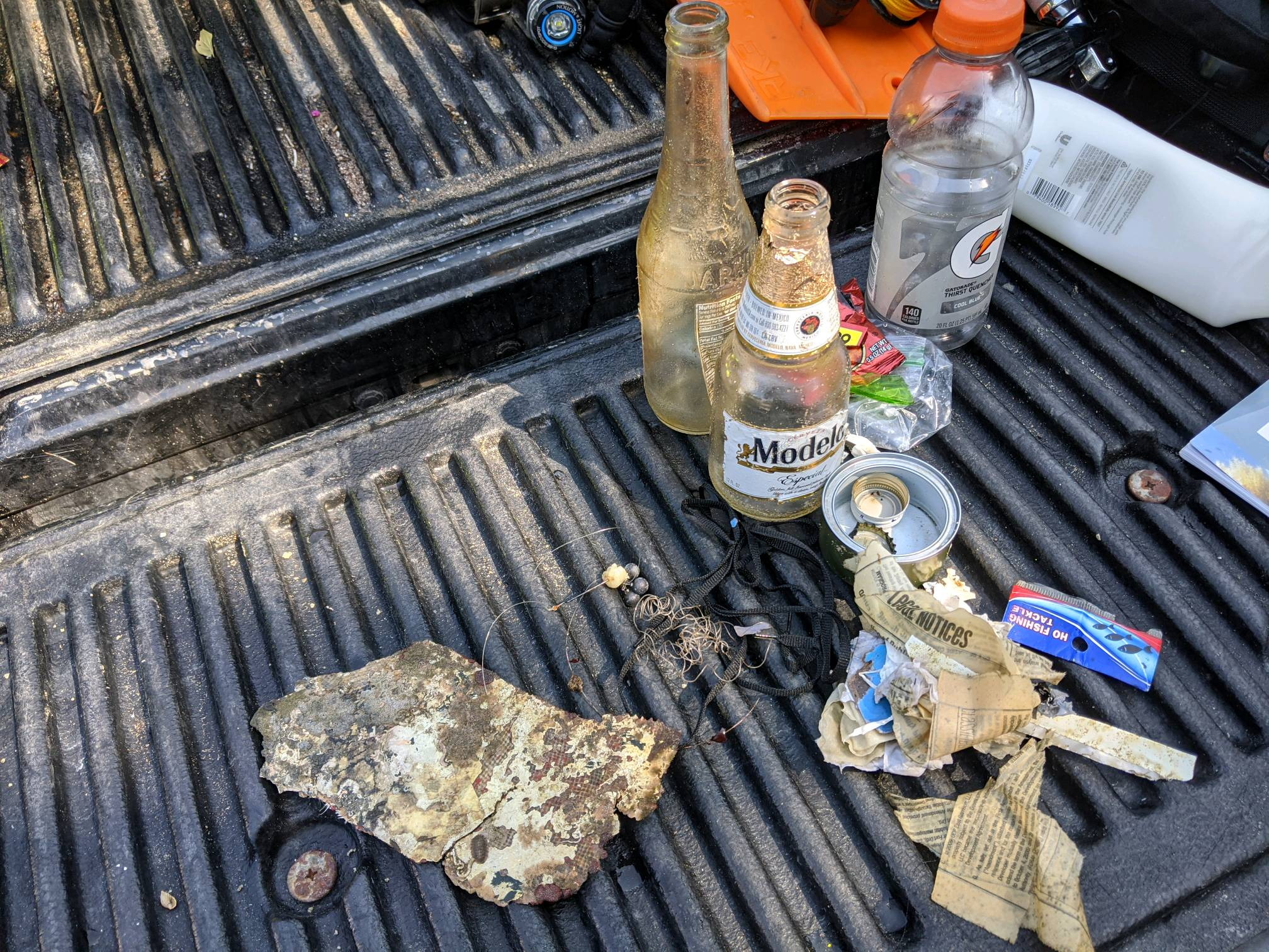
No
Fishing pole
High pressure
1
Fiber glass
Aquarius Divers
Dane Durand
0
0
0
0
0
0
0
0
0
0
0
0
0
0
0
0
0
0
6
2
0
0
0
0
0
0
1
0
0
0
0
0
0
0
0
0
2.00
40
32.00
10.00
0
estimated
0
0
0
1
2768.46
0
0
0
0
0
Paper
Glass shards
0
On
pounds
0
I have debris data to report
2
0
0
Calm (glassy to rippled) for waves 0 – 0.1 meter high
0
0
0
0
0
0
0
ft2
1
0
feet
rocky reef
0
0
0
0
0
2
0
0
0
0
0
0
0
0
0
0
0
1
0
0
0
0
3
0
0
0
0
0
0
United States
State\Province
CA
City
Monterey
Map Help


Dive Location

If you know your survey site coordinates, enter them manually in decimal degrees using WGS84 Map Datum. Use the minus sign for latitudes south of the equator and longitudes west of the Prime Meridian to 180 degrees.

If you do not know your survey site coordinates, click the “Map Location” tab to use the map to zoom into your survey site and drop the pin on the map to fall within your survey dive site in the water (not on land or the beach). Ensure you zoom in as much as possible to ensure data accuracy.

Entangled Help


Use the vertical tabs below to record any entangled animals you found of each type.

Vollen Marina

0
14
0

59.810111507831, 10.485603025247

1
0
0
silt
0
0
0
0
0
Good
1
1
1
0
0
0
0
0
0
0
0
0
0
0
0
0
0
0
0
Fiskeskrin (Fishing Box)
Malingsrulle (Paint Roller)
Sykkelhjul (Bicycle Wheel)
Oslofjorden Dykkesenter
Monica
0
3
0
0
0
0
0
0
0
0
0
0
0
0
0
0
1
0
2
3
0
0
1
0
0
0
0
0
0
0
1
0
0
0
75.00
50
9.00
3.00
3
measured
0
0
852.26
0
1
0
30
0
0
On
kilograms
0
I have debris data to report
44
0
0
Calm (glassy to rippled) for waves 0 – 0.1 meter high
0
0
0
0
1
1
1
m2
0
0
meters
other
7
0
0
0
0
0
1
0
0
3
0
4
0
0
0
1
3
0
0
7
0
14
1
2
0
0
2
0
Norway
State\Province
Viken
City
Vollen
Map Help


Dive Location

If you know your survey site coordinates, enter them manually in decimal degrees using WGS84 Map Datum. Use the minus sign for latitudes south of the equator and longitudes west of the Prime Meridian to 180 degrees.

If you do not know your survey site coordinates, click the “Map Location” tab to use the map to zoom into your survey site and drop the pin on the map to fall within your survey dive site in the water (not on land or the beach). Ensure you zoom in as much as possible to ensure data accuracy.

Entangled Help


Use the vertical tabs below to record any entangled animals you found of each type.

Playa Piskadó

2
4
0

12.369170737344, -69.154561188337

0
0
0
sand
0
1
0
105
0
Fisherwomen
Good
0
0
0
0
0
0
0
0
0
0
0
0
0
0
0
0
0
0
0
0
Goby Divers Curaçao
Ândhiela Van Hoof-Buso
0
0
0
2
0
0
0
0
0
0
0
0
0
0
0
0
0
1
0
3
0
0
0
0
0
0
0
0
0
0
0
0
0
0
1.00
90
8.00
2.00
0
estimated
0
7
31243.50
0
0
0
1
0
Fishing line and hooks
0
On
kilograms
0
I have debris data to report
0
0
0
Calm (glassy to rippled) for waves 0 – 0.1 meter high
0
0
0
0
0
0
0
m2
0
0
meters
coral reef
3
0
0
0
0
0
0
0
0
0
0
0
0
0
0
5
1
0
0
0
0
0
0
0
0
0
0
0
Netherlands Antilles
City
Willemstad
Map Help


Dive Location

If you know your survey site coordinates, enter them manually in decimal degrees using WGS84 Map Datum. Use the minus sign for latitudes south of the equator and longitudes west of the Prime Meridian to 180 degrees.

If you do not know your survey site coordinates, click the “Map Location” tab to use the map to zoom into your survey site and drop the pin on the map to fall within your survey dive site in the water (not on land or the beach). Ensure you zoom in as much as possible to ensure data accuracy.

Entangled Help


Use the vertical tabs below to record any entangled animals you found of each type.

Bonaire Harbour front

6
sand
3

12.151705177317, -68.277859326335

No
Doormat
Dry Sunny and warm
1
3
Doormat
Clothespin
Dive Friends Bonaire
Marcel van Gaalen
7
2
1
3.00
48
25.00
1.50
estimated
1800.00
plastic cups
plastic fragments
1
On
kilograms
I have debris data to report
Calm (glassy to rippled) for waves 0 – 0.1 meter high m2
4
meters
coral reef
2
1
1
Netherlands Antilles
State\Province
Bonaire
City
Kralendijk
Map Help


Dive Location

If you know your survey site coordinates, enter them manually in decimal degrees using WGS84 Map Datum. Use the minus sign for latitudes south of the equator and longitudes west of the Prime Meridian to 180 degrees.

If you do not know your survey site coordinates, click the “Map Location” tab to use the map to zoom into your survey site and drop the pin on the map to fall within your survey dive site in the water (not on land or the beach). Ensure you zoom in as much as possible to ensure data accuracy.

Entangled Help


Use the vertical tabs below to record any entangled animals you found of each type.

ADS409 - St. George's Bay

1
10
0
0

35.926326, 14.489571

0
0
0
sand
0
0
3
0
0
Good
Cresta Dive Centre
Nick
1
1
1
7
0
0
0
0
0
0
0
0
0
0
0
0
0
4
0
3
0
0
0
0
2
0
7
0
0
4
0
0
0
0
0
0
5.00
30
5.00
1.00
0
estimated
0
0
0
0
1404.99
0
0
0
0
0
0
On
kilograms
0
I have debris data to report
0
0
0
Calm (glassy to rippled) for waves 0 – 0.1 meter high
0
0
0
Bottles
Little Crabs
Released Unharmed
6
0
0
0
1
m2
1
0
meters
seagrass
0
0
0
0
0
0
0
0
0
0
0
0
0
1
0
0
0
10
0
0
0
0
0
0
0
0
0
0
0
Malta
City
St. Julian's
Map Help


Dive Location

If you know your survey site coordinates, enter them manually in decimal degrees using WGS84 Map Datum. Use the minus sign for latitudes south of the equator and longitudes west of the Prime Meridian to 180 degrees.

If you do not know your survey site coordinates, click the “Map Location” tab to use the map to zoom into your survey site and drop the pin on the map to fall within your survey dive site in the water (not on land or the beach). Ensure you zoom in as much as possible to ensure data accuracy.

Entangled Help


Use the vertical tabs below to record any entangled animals you found of each type.

Plage Des Ondes

0
15
0
0

43.55322, 7.120278

0
0
0
sand
0
2
0
0
0
Beach site
1
1
Swimming pool cap
Scissor
Diamond Plongée
Mickaël Hernandez
0
0
0
2
1
0
0
0
2
0
0
1
0
0
0
0
0
0
2
3
0
0
0
0
0
0
2
0
0
0
0
0
0
0
0
0
1.50
32
5.00
4.00
0
estimated
0
0
0
0
1667.92
0
0
0
0
0
Diving mask
0
On
kilograms
0
I have debris data to report
0
0
0
Calm (glassy to rippled) for waves 0 – 0.1 meter high
0
1
0
0
3
0
0
m2
0
0
meters
seagrass
0
0
0
0
1
0
0
0
0
0
0
0
0
0
0
0
0
0
0
0
1
0
0
0
0
0
0
0
0
France
State\Province
Alpes Maritimes
City
Golf Juan
Map Help


Dive Location

If you know your survey site coordinates, enter them manually in decimal degrees using WGS84 Map Datum. Use the minus sign for latitudes south of the equator and longitudes west of the Prime Meridian to 180 degrees.

If you do not know your survey site coordinates, click the “Map Location” tab to use the map to zoom into your survey site and drop the pin on the map to fall within your survey dive site in the water (not on land or the beach). Ensure you zoom in as much as possible to ensure data accuracy.

Entangled Help


Use the vertical tabs below to record any entangled animals you found of each type.

ADS656 - Edithburgh Jetty

0
0
0

-35.084931703435, 137.7488066297

1
0
0
sand
0
0
0
0
0
No
Crab pot
0
0
0
0
0
0
0
0
0
0
0
0
0
0
0
0
0
0
0
0
Underwater Sports Diving Centre
Wayne Rosenboom
0
0
0
0
0
0
0
0
0
0
0
0
0
0
0
0
0
0
0
2
0
0
0
0
0
0
0
0
0
0
0
0
0
0
3.00
60
7.00
2.00
0
estimated
0
0
400.00
0
0
0
0
0
Glass
0
On
kilograms
0
I have debris data to report
0
0
0
Slight for waves 0.5 -1.25 meter high
0
0
0
0
0
0
0
m2
0
0
meters
seagrass
0
0
0
0
0
0
0
0
0
0
0
0
0
0
0
0
0
0
0
0
0
0
0
0
0
0
0
0
Australia
State\Province
South Australia
City
Edithburgh
Map Help


Dive Location

If you know your survey site coordinates, enter them manually in decimal degrees using WGS84 Map Datum. Use the minus sign for latitudes south of the equator and longitudes west of the Prime Meridian to 180 degrees.

If you do not know your survey site coordinates, click the “Map Location” tab to use the map to zoom into your survey site and drop the pin on the map to fall within your survey dive site in the water (not on land or the beach). Ensure you zoom in as much as possible to ensure data accuracy.

Entangled Help


Use the vertical tabs below to record any entangled animals you found of each type.

Dutch Springs

gravel

40.686136427969, -75.354008567635

Big Blue SCUBA
9
0.50
30
8.00
3.00
estimated
200.00
On
pounds
I have debris data to report
Calm (glassy to rippled) for waves 0 – 0.1 meter high m2
meters
other
United States
Map Help


Dive Location

If you know your survey site coordinates, enter them manually in decimal degrees using WGS84 Map Datum. Use the minus sign for latitudes south of the equator and longitudes west of the Prime Meridian to 180 degrees.

If you do not know your survey site coordinates, click the “Map Location” tab to use the map to zoom into your survey site and drop the pin on the map to fall within your survey dive site in the water (not on land or the beach). Ensure you zoom in as much as possible to ensure data accuracy.

Entangled Help


Use the vertical tabs below to record any entangled animals you found of each type.

Vollen Marina

3
6
0

59.809896591834, 10.485855562813

6
0
0
silt
0
0
0
0
0
Calm
1
1
1
2
1
1
1
0
0
0
0
0
0
0
0
0
0
0
0
0
Toilet
Strømtrommel
Solstol
Lanterne
Oljefelter
Vindusmal
Iskjøler
Oslofjorden dykkesenter
Monica
0
5
0
2
0
0
0
0
0
0
0
0
0
2
0
0
2
2
0
2
0
0
4
0
0
0
0
0
0
0
0
0
0
0
72.00
48
6.00
2.00
6
measured
0
0
10.00
1
0
0
2
0
0
On
kilograms
0
I have debris data to report
1
0
0
Calm (glassy to rippled) for waves 0 – 0.1 meter high
0
0
1
0
0
0
0
m2
4
0
meters
other
8
0
7
0
9
0
0
0
0
6
0
2
0
0
0
8
0
0
0
11
0
2
0
0
0
1
2
0
Norway
State\Province
Viken
City
Vollen
Map Help


Dive Location

If you know your survey site coordinates, enter them manually in decimal degrees using WGS84 Map Datum. Use the minus sign for latitudes south of the equator and longitudes west of the Prime Meridian to 180 degrees.

If you do not know your survey site coordinates, click the “Map Location” tab to use the map to zoom into your survey site and drop the pin on the map to fall within your survey dive site in the water (not on land or the beach). Ensure you zoom in as much as possible to ensure data accuracy.

Entangled Help


Use the vertical tabs below to record any entangled animals you found of each type.

Sainte Marguerite cave

rock

43.10436121456, 5.9931126892173

A large part of the cave is on the surface. It shelters shrimps and lobsters.
Found Plastic Bottle into the cave (3,8 meter)
Found paper bracelet on rock (6 meter)
1
paper bracelet
Toulon Plongée
Mickael Hernandez
1
1
0.04
46
15.90
3.80
estimated
1101.55
plastic bottle
On
kilograms
I have debris data to report
Calm (glassy to rippled) for waves 0 – 0.1 meter high m2
meters
rocky reef
France
State\Province
var
City
Toulon
Map Help


Dive Location

If you know your survey site coordinates, enter them manually in decimal degrees using WGS84 Map Datum. Use the minus sign for latitudes south of the equator and longitudes west of the Prime Meridian to 180 degrees.

If you do not know your survey site coordinates, click the “Map Location” tab to use the map to zoom into your survey site and drop the pin on the map to fall within your survey dive site in the water (not on land or the beach). Ensure you zoom in as much as possible to ensure data accuracy.

Entangled Help


Use the vertical tabs below to record any entangled animals you found of each type.

Subscribe to