Menu

Lighthouse Bay ADS01

10.1203795, 99.8442107

coral
3
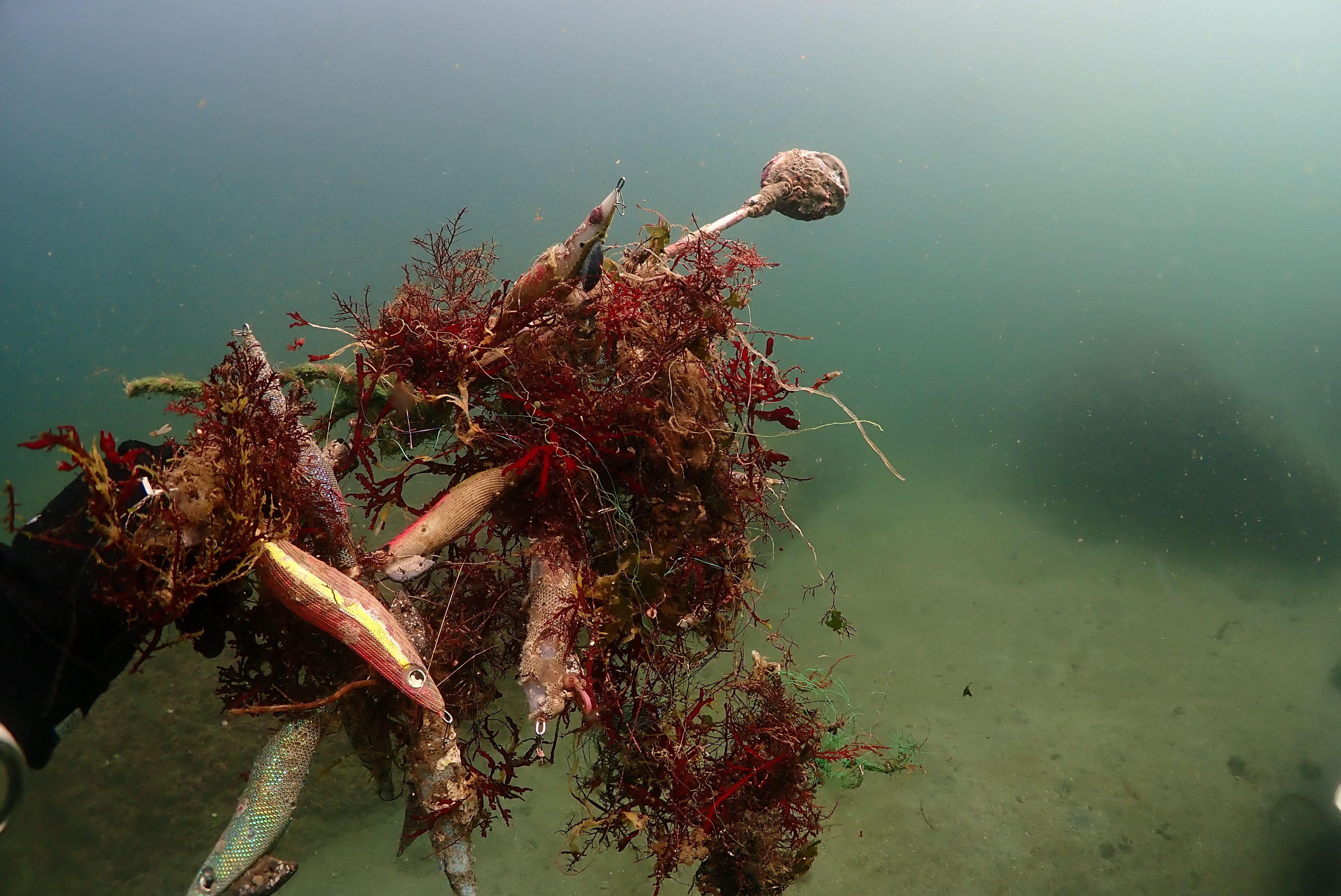
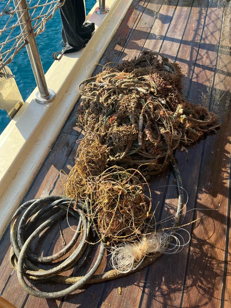
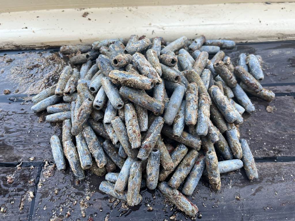
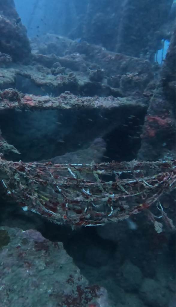
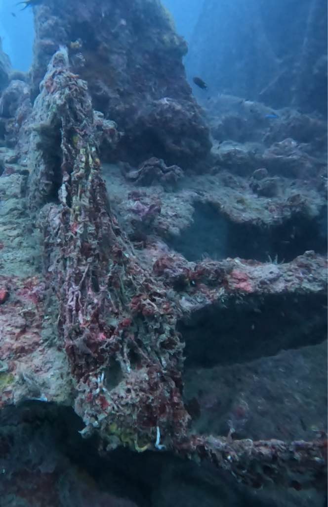
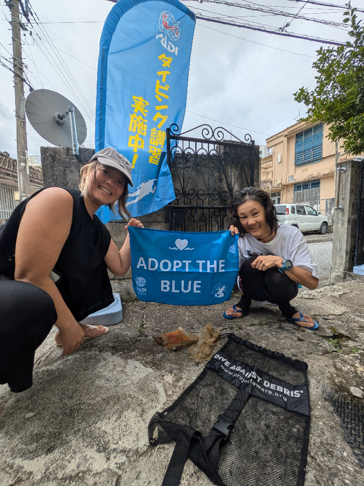
Dive Against Debri dive conducted during open water training dives.
Cloudy
Assava Dive Resort
Sabrina Fox
3
0.10
35
12.00
5.00
estimated
100.00
On
kilograms
I have debris data to report
Smooth (wavelets) for waves 0.1 - 0.5 meter high m2
meters
coral reef
Thailand
State\Province
Surat Thani
City
Koh Tao
Map Help


Dive Location

If you know your survey site coordinates, enter them manually in decimal degrees using WGS84 Map Datum. Use the minus sign for latitudes south of the equator and longitudes west of the Prime Meridian to 180 degrees.

If you do not know your survey site coordinates, click the “Map Location” tab to use the map to zoom into your survey site and drop the pin on the map to fall within your survey dive site in the water (not on land or the beach). Ensure you zoom in as much as possible to ensure data accuracy.

Entangled Help


Use the vertical tabs below to record any entangled animals you found of each type.

Mango Bay, Koh Tao, Thailand

1

10.120926476561, 99.835012573312

coral

10.120926476561, 99.835012573312

Assava Dive Resort
Sabrina Fox
-2
3
0.02
35
12.00
4.00
1
estimated
100.00
1
On
kilograms
I have debris data to report
Smooth (wavelets) for waves 0.1 - 0.5 meter high m2
1
meters
coral reef
Thailand
State\Province
Surat Thani
City
Koh Tao
Map Help


Dive Location

If you know your survey site coordinates, enter them manually in decimal degrees using WGS84 Map Datum. Use the minus sign for latitudes south of the equator and longitudes west of the Prime Meridian to 180 degrees.

If you do not know your survey site coordinates, click the “Map Location” tab to use the map to zoom into your survey site and drop the pin on the map to fall within your survey dive site in the water (not on land or the beach). Ensure you zoom in as much as possible to ensure data accuracy.

Entangled Help


Use the vertical tabs below to record any entangled animals you found of each type.

Kajinohama beach Jogashima

-1
30
sand
2

35.137006130434, 139.61294353008

Jogashima Diving Center
Kana Itakura
5
1
2
1
3
1
12
3.10
50
15.30
2.00
estimated
2
-2
2000.00
On
kilograms
I have debris data to report
0
Smooth (wavelets) for waves 0.1 - 0.5 meter high
0
m2
meters
rocky reef
9
Japan
State\Province
Kanagawa
City
658 Jogashima misakimachi miura City
Map Help


Dive Location

If you know your survey site coordinates, enter them manually in decimal degrees using WGS84 Map Datum. Use the minus sign for latitudes south of the equator and longitudes west of the Prime Meridian to 180 degrees.

If you do not know your survey site coordinates, click the “Map Location” tab to use the map to zoom into your survey site and drop the pin on the map to fall within your survey dive site in the water (not on land or the beach). Ensure you zoom in as much as possible to ensure data accuracy.

Entangled Help


Use the vertical tabs below to record any entangled animals you found of each type.

La Jolla Shores

sand

32.857907362042, -117.25860399906

Scuba Center Temecula
Sam Sanchez
3
0.00
20
20.00
5.00
measured
200.00
On
pounds
Our Survey Site was free of debris
Slight for waves 0.5 -1.25 meter high ft2
feet
other
United States
State\Province
California
City
Temecula
Map Help


Dive Location

If you know your survey site coordinates, enter them manually in decimal degrees using WGS84 Map Datum. Use the minus sign for latitudes south of the equator and longitudes west of the Prime Meridian to 180 degrees.

If you do not know your survey site coordinates, click the “Map Location” tab to use the map to zoom into your survey site and drop the pin on the map to fall within your survey dive site in the water (not on land or the beach). Ensure you zoom in as much as possible to ensure data accuracy.

Entangled Help


Use the vertical tabs below to record any entangled animals you found of each type.

Ecosystem Other
Sand

Grenada Cruise Ship Terminal

17
129
15
0

12.05167, -61.756112

5
0
0
sand
0
0
1
70
8
Cruise ship and fishing
Umbrella
Rainy
Eco Dive
Eco Dive
0
4
0
50
11
0
0
0
0
0
1
0
0
0
0
0
0
0
0
17
0
0
0
0
0
0
31
0
0
0
0
0
0
0
0
0
91.14
85
12.00
3.00
0
estimated
0
0
4485.20
0
0
2
4
0
Fishing line
Tin cans
Plastic bottles
1
On
pounds
0
I have debris data to report
2
0
0
Slight for waves 0.5 -1.25 meter high
0
0
0
0
9
0
3
m2
0
12
meters
other
0
0
4
0
0
0
0
0
0
3
0
0
0
1
9
0
36
0
0
0
0
0
0
0
0
0
0
5
0
Grenada
City
Grand Anse
Map Help


Dive Location

If you know your survey site coordinates, enter them manually in decimal degrees using WGS84 Map Datum. Use the minus sign for latitudes south of the equator and longitudes west of the Prime Meridian to 180 degrees.

If you do not know your survey site coordinates, click the “Map Location” tab to use the map to zoom into your survey site and drop the pin on the map to fall within your survey dive site in the water (not on land or the beach). Ensure you zoom in as much as possible to ensure data accuracy.

Entangled Help


Use the vertical tabs below to record any entangled animals you found of each type.

Ecosystem Other
Pier

Kızılada Lighthouse

0
0
0
2

36.652340386147, 29.043150181283

0
0
0
rock
0
0
0
7
0
Lost by fishermen
2 afternoons of winds
Seahorse Dive Centre
Mark Taylor
0
0
0
0
0
0
0
0
0
0
0
0
0
0
0
0
0
0
0
7
0
0
0
0
0
0
0
0
0
0
0
0
0
0
0
0
21.90
50
25.00
10.00
2
measured
0
214
241.30
0
0
0
0
0
Fishing lines
0
On
kilograms
0
I have debris data to report
0
0
0
Smooth (wavelets) for waves 0.1 - 0.5 meter high
0
0
0
0
0
0
0
m2
0
0
meters
rocky reef
0
0
0
0
0
0
0
0
0
0
0
0
0
0
0
1
0
0
0
0
0
0
0
0
0
0
0
0
0
Turkey
State\Province
Muğla
City
Fethiye
Map Help


Dive Location

If you know your survey site coordinates, enter them manually in decimal degrees using WGS84 Map Datum. Use the minus sign for latitudes south of the equator and longitudes west of the Prime Meridian to 180 degrees.

If you do not know your survey site coordinates, click the “Map Location” tab to use the map to zoom into your survey site and drop the pin on the map to fall within your survey dive site in the water (not on land or the beach). Ensure you zoom in as much as possible to ensure data accuracy.

Entangled Help


Use the vertical tabs below to record any entangled animals you found of each type.

SS Inch Keith Wreck

0
0
0
2

12.006739206533, 92.780627936962

0
0
0
sand
0
0
0
0
0
No
Harmful to cut because its old
Fishing Net
Windy
Barefoot Dive Center
Akshay
0
0
0
0
0
0
0
0
0
0
0
0
0
0
0
0
0
0
0
2
0
0
0
0
0
0
0
0
0
0
0
0
0
0
0
0
0.10
60
18.00
12.00
0
estimated
0
0
104.56
0
0
0
0
0
Fishing Net
0
On
kilograms
0
I have debris data to report
0
0
0
Slight for waves 0.5 -1.25 meter high
0
0
0
0
0
0
0
m2
0
0
meters
other
0
0
0
0
0
0
0
0
0
0
0
0
0
0
0
0
0
0
0
0
0
0
0
0
0
0
0
0
0
India
City
Havelock
Map Help


Dive Location

If you know your survey site coordinates, enter them manually in decimal degrees using WGS84 Map Datum. Use the minus sign for latitudes south of the equator and longitudes west of the Prime Meridian to 180 degrees.

If you do not know your survey site coordinates, click the “Map Location” tab to use the map to zoom into your survey site and drop the pin on the map to fall within your survey dive site in the water (not on land or the beach). Ensure you zoom in as much as possible to ensure data accuracy.

Entangled Help


Use the vertical tabs below to record any entangled animals you found of each type.

Ecosystem Other
Wreck

Turtle Bay

0
0
0
0

1.787165, 110.163644

1
0
0
sand
0
0
0
0
0
Yes
Snorkel
Stormy
Premier Marine And Scuba Centre
Steve Tan
0
0
0
0
0
0
0
0
1
0
0
0
0
0
0
0
0
0
0
3
0
0
0
0
0
0
2
0
0
0
0
0
0
0
0
0
1.00
50
7.00
5.00
0
estimated
0
0
0
1
2250.76
0
0
0
0
0
Fishing gear
Fishing net
0
On
kilograms
0
I have debris data to report
0
0
0
Calm (glassy to rippled) for waves 0 – 0.1 meter high
0
0
0
0
0
0
0
m2
0
0
meters
coral reef
0
0
0
0
0
0
0
0
0
0
0
0
0
0
0
0
0
0
0
0
0
0
0
0
0
0
0
0
0
Malaysia
State\Province
Sarawak
City
Kuching
Map Help


Dive Location

If you know your survey site coordinates, enter them manually in decimal degrees using WGS84 Map Datum. Use the minus sign for latitudes south of the equator and longitudes west of the Prime Meridian to 180 degrees.

If you do not know your survey site coordinates, click the “Map Location” tab to use the map to zoom into your survey site and drop the pin on the map to fall within your survey dive site in the water (not on land or the beach). Ensure you zoom in as much as possible to ensure data accuracy.

Entangled Help


Use the vertical tabs below to record any entangled animals you found of each type.

那覇シーサイドパーク

1
0
1
0

26.220751, 127.665079

0
0
0
coral
0
0
0
0
0
週末にお祭りがありました。
特になし
強風
クラフトダイブ
橋本浩
0
0
0
0
0
0
0
0
0
0
0
0
0
0
0
0
0
0
0
3
0
0
0
0
0
0
0
0
0
0
0
0
0
0
0
0
0.10
51
4.30
2.00
0
estimated
0
0
0
0
2145.11
0
0
0
0
0
お弁当箱
ビニール袋
ペットボトル
0
On
kilograms
0
I have debris data to report
0
0
0
Calm (glassy to rippled) for waves 0 – 0.1 meter high
0
0
0
0
0
0
0
m2
0
0
meters
other
0
0
0
0
0
0
0
0
0
0
0
0
0
0
0
0
0
0
0
0
0
0
0
0
0
0
0
0
0
Japan
State\Province
沖縄県
City
那覇市辻
Map Help


Dive Location

If you know your survey site coordinates, enter them manually in decimal degrees using WGS84 Map Datum. Use the minus sign for latitudes south of the equator and longitudes west of the Prime Meridian to 180 degrees.

If you do not know your survey site coordinates, click the “Map Location” tab to use the map to zoom into your survey site and drop the pin on the map to fall within your survey dive site in the water (not on land or the beach). Ensure you zoom in as much as possible to ensure data accuracy.

Entangled Help


Use the vertical tabs below to record any entangled animals you found of each type.

Ecosystem Other
パッチリーフ

Chishi

0
0
0
0

26.251263900858, 127.31581889505

0
0
0
rock
0
0
0
0
0
Good
Blue Vista Dive
ching chih kung
0
0
0
0
0
0
0
0
0
0
0
0
0
0
0
0
0
0
0
3
0
0
0
0
0
0
0
0
0
0
0
0
0
0
0
0
0.50
30
15.50
4.00
0
estimated
0
0
270.00
0
0
0
0
0
0
On
kilograms
0
I have debris data to report
0
0
0
Calm (glassy to rippled) for waves 0 – 0.1 meter high
0
0
0
0
1
0
0
m2
0
0
meters
coral reef
0
0
0
0
0
0
0
0
0
0
0
0
0
0
0
0
0
0
0
0
0
0
0
0
0
0
0
0
0
Japan
State\Province
Okinawa
City
Naha city
Map Help


Dive Location

If you know your survey site coordinates, enter them manually in decimal degrees using WGS84 Map Datum. Use the minus sign for latitudes south of the equator and longitudes west of the Prime Meridian to 180 degrees.

If you do not know your survey site coordinates, click the “Map Location” tab to use the map to zoom into your survey site and drop the pin on the map to fall within your survey dive site in the water (not on land or the beach). Ensure you zoom in as much as possible to ensure data accuracy.

Entangled Help


Use the vertical tabs below to record any entangled animals you found of each type.

Subscribe to