Menu

Huntington Beach Pier

1
76
1
0
0
0
0
sand
0
0
0
0
34

33.6552063, -118.0040619

n/a
COVID-19
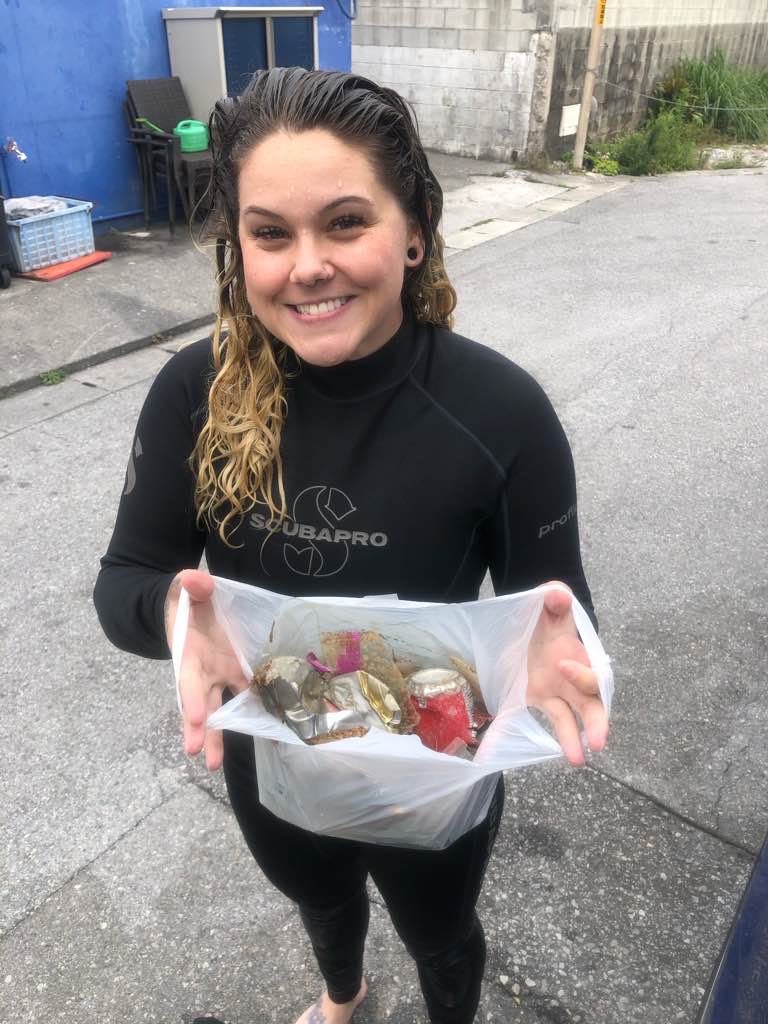
Lots of fishing net with kelp, but not recovered due to no permit
Caught tangled in net with kelp
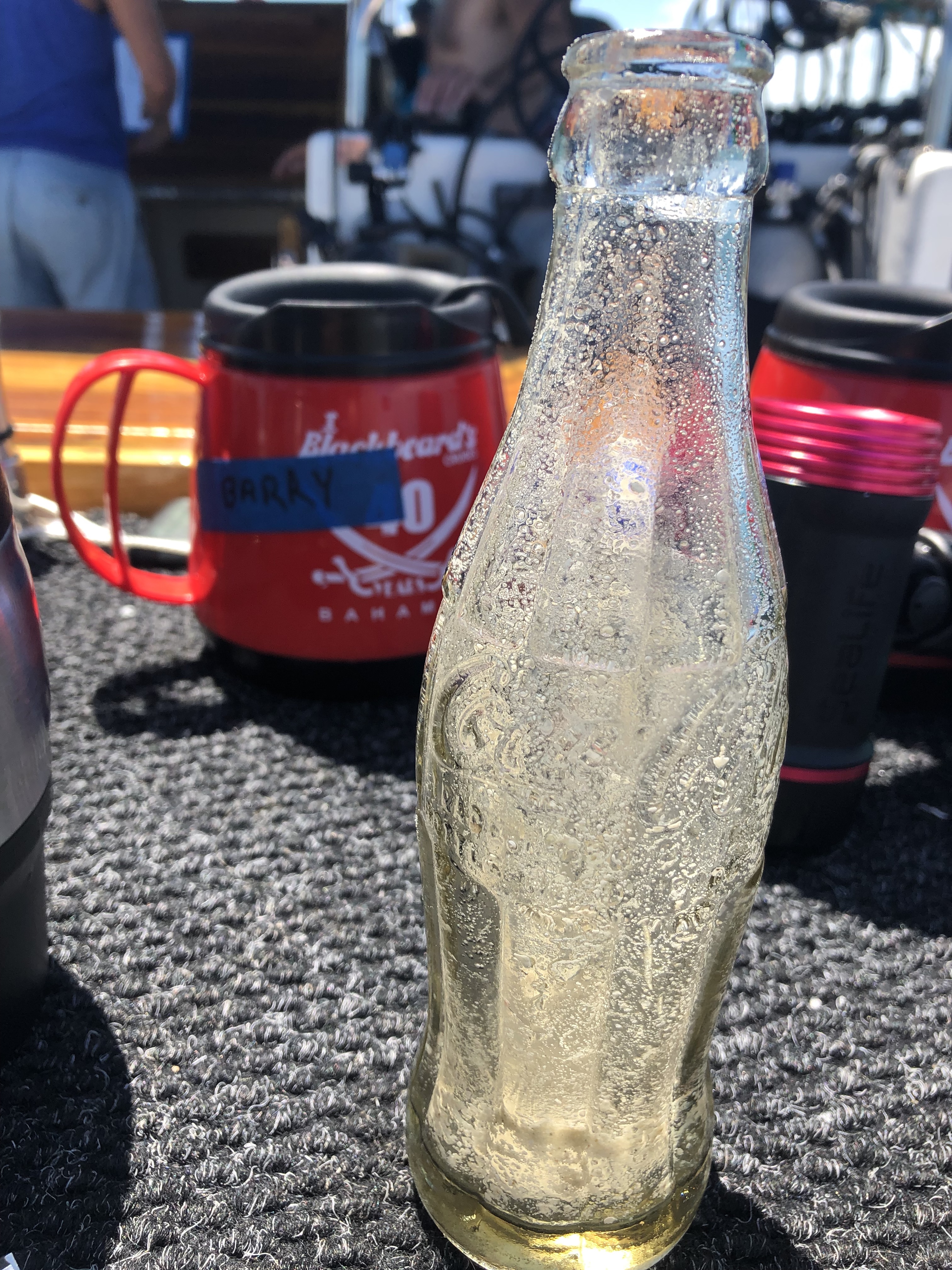
The Gardens Casino plastic bottle with label (/1\)
Cloudy, Rainy
0
Self-Initiated
Nehemiah Cook
1
0
0
1
5
1
0
0
0
0
3
0
0
0
0
0
0
4
1
1
0
0
1
0
0
1
2
0
1
0
0
0
3
0
0
0
1.25
30
4.00
1.00
0
estimated
0
0
0
0
4490.30
0
0
0
2
1
Styrofoam packaging
Styrofoam Cups
Colored plastic
1
On
pounds
0
I have debris data to report
0
0
0
Smooth (wavelets) for waves 0.1 - 0.5 meter high
1
0
0
Claw
Crab
Dead
1
0
0
0
0
m2
0
0
meters
kelp
0
0
0
0
0
0
0
0
0
0
0
0
3
0
0
0
0
0
0
0
0
0
0
0
0
0
0
0
0
United States
State\Province
CA
City
Mayport Beach
Map Help


Dive Location

If you know your survey site coordinates, enter them manually in decimal degrees using WGS84 Map Datum. Use the minus sign for latitudes south of the equator and longitudes west of the Prime Meridian to 180 degrees.

If you do not know your survey site coordinates, click the “Map Location” tab to use the map to zoom into your survey site and drop the pin on the map to fall within your survey dive site in the water (not on land or the beach). Ensure you zoom in as much as possible to ensure data accuracy.

Entangled Help


Use the vertical tabs below to record any entangled animals you found of each type.

South Steps

3
9
3

26.321207858842, 127.74815706306

1
0
0
coral
0
0
1
0
0
No
Plastic Housing for unknown item
Good
1
0
0
0
0
0
0
0
0
0
0
0
0
0
0
0
0
0
0
0
Plastic housing for Unknown object
Kadena Marina
Maurice Brown
0
0
0
0
1
0
0
0
0
0
0
0
0
2
0
0
0
0
0
2
0
0
0
0
0
0
0
0
0
0
0
0
0
0
1.00
30
45.00
10.00
0
estimated
0
0
620.28
0
0
0
0
0
Plastic fragments
Fishing items
0
On
pounds
0
I have debris data to report
0
0
0
Calm (glassy to rippled) for waves 0 – 0.1 meter high
0
0
0
0
3
0
0
m2
0
0
meters
coral reef
0
0
0
0
0
0
0
0
0
0
0
0
0
0
0
0
2
0
0
0
0
0
0
0
0
0
0
0
Japan
State\Province
Okinawa
City
Chatan
Map Help


Dive Location

If you know your survey site coordinates, enter them manually in decimal degrees using WGS84 Map Datum. Use the minus sign for latitudes south of the equator and longitudes west of the Prime Meridian to 180 degrees.

If you do not know your survey site coordinates, click the “Map Location” tab to use the map to zoom into your survey site and drop the pin on the map to fall within your survey dive site in the water (not on land or the beach). Ensure you zoom in as much as possible to ensure data accuracy.

Entangled Help


Use the vertical tabs below to record any entangled animals you found of each type.

The Pemuteran Jetty

150
0
2

-8.1434, 114.6608

1
0
0
sand
0
130
9
8
0
Rain, Local Fishing Community
Rainy Season
0
0
0
0
0
0
0
0
0
0
0
0
0
0
0
0
0
0
0
0
Abyss Ocean World
Daniel Stilwell
1
1
0
75
0
0
0
0
0
13
12
0
6
0
11
0
1
8
0
4
0
0
0
0
0
0
2
1
0
0
0
2
0
0
25.00
60
12.00
2.00
7
estimated
0
14
738.08
1
0
1
0
0
Plastic Mesh Rice Bags - breaking down into thin fragments
3
On
kilograms
0
I have debris data to report
8
0
0
Calm (glassy to rippled) for waves 0 – 0.1 meter high
0
0
2
3
0
4
1
m2
3
0
meters
seagrass
0
0
0
0
0
0
0
0
0
12
0
0
0
0
0
3
1
0
0
0
0
0
0
0
0
0
3
0
Indonesia
State\Province
Bali
City
Pemuteran
Map Help


Dive Location

If you know your survey site coordinates, enter them manually in decimal degrees using WGS84 Map Datum. Use the minus sign for latitudes south of the equator and longitudes west of the Prime Meridian to 180 degrees.

If you do not know your survey site coordinates, click the “Map Location” tab to use the map to zoom into your survey site and drop the pin on the map to fall within your survey dive site in the water (not on land or the beach). Ensure you zoom in as much as possible to ensure data accuracy.

Entangled Help


Use the vertical tabs below to record any entangled animals you found of each type.

Blue Hole

25.027117, -77.143261

sand

23.107776341079, -75.004753681195

Found a coke bottle on the side of the blue hole.
I tried to send this a while ago after my trip but the site at the time was not allowing me to do it.
The weather was clear and sunny
Blackbeards
Barry MacEwen
1
1.00
45
100.00
10.00
estimated
400.00
On
pounds
I have debris data to report
1
Calm (glassy to rippled) for waves 0 – 0.1 meter high ft2
feet
seagrass
Bahamas
City
Nassau
Map Help


Dive Location

If you know your survey site coordinates, enter them manually in decimal degrees using WGS84 Map Datum. Use the minus sign for latitudes south of the equator and longitudes west of the Prime Meridian to 180 degrees.

If you do not know your survey site coordinates, click the “Map Location” tab to use the map to zoom into your survey site and drop the pin on the map to fall within your survey dive site in the water (not on land or the beach). Ensure you zoom in as much as possible to ensure data accuracy.

Entangled Help


Use the vertical tabs below to record any entangled animals you found of each type.

Tanery Park Waterfront Park

0
0
0

43.438803509646, -79.668419322991

0
0
0
sand
0
0
3
0
0
No
Condom
Overcast
0
0
0
0
0
0
0
0
0
0
0
0
0
0
0
0
0
0
0
0
EastCape Divers
Steve Camacho
0
0
0
0
5
0
0
0
0
0
0
0
0
0
0
0
0
0
0
2
1
0
0
2
0
0
0
2
0
0
0
0
0
0
2.00
40
12.00
3.00
0
estimated
0
0
3351.60
0
0
0
0
1
Plastic bottles beer cans
Coffee cups
Candy wrappers
0
On
pounds
0
I have debris data to report
0
0
0
Calm (glassy to rippled) for waves 0 – 0.1 meter high
0
0
0
1
0
2
0
m2
0
0
feet
rocky reef
0
0
0
0
0
0
0
0
0
0
0
0
0
0
0
3
0
0
0
0
0
0
0
0
0
0
0
0
Canada
State\Province
Ontario
City
Oakville
Map Help


Dive Location

If you know your survey site coordinates, enter them manually in decimal degrees using WGS84 Map Datum. Use the minus sign for latitudes south of the equator and longitudes west of the Prime Meridian to 180 degrees.

If you do not know your survey site coordinates, click the “Map Location” tab to use the map to zoom into your survey site and drop the pin on the map to fall within your survey dive site in the water (not on land or the beach). Ensure you zoom in as much as possible to ensure data accuracy.

Entangled Help


Use the vertical tabs below to record any entangled animals you found of each type.

ADS384 - Fushifaru Housereef

0
4
0
0

5.492182, 73.512166

0
0
2
sand
2
3
4
6
3
Best Dives Fushifaru
Sophia
0
0
0
0
6
0
0
0
2
2
0
0
2
6
1
0
0
7
0
4
0
0
0
0
2
0
6
0
1
0
0
0
0
0
0
0
8.00
60
23.00
2.00
4
estimated
0
0
0
0
500.00
0
1
0
0
0
0
On
kilograms
0
I have debris data to report
11
0
0
Calm (glassy to rippled) for waves 0 – 0.1 meter high
0
0
1
0
0
3
1
m2
0
0
meters
coral reef
0
0
0
0
0
2
0
2
1
0
0
0
0
0
0
0
4
4
0
0
0
0
4
0
2
0
1
3
0
Maldives
State\Province
Lhaviyani
City
Fushifaru
Map Help


Dive Location

If you know your survey site coordinates, enter them manually in decimal degrees using WGS84 Map Datum. Use the minus sign for latitudes south of the equator and longitudes west of the Prime Meridian to 180 degrees.

If you do not know your survey site coordinates, click the “Map Location” tab to use the map to zoom into your survey site and drop the pin on the map to fall within your survey dive site in the water (not on land or the beach). Ensure you zoom in as much as possible to ensure data accuracy.

Entangled Help


Use the vertical tabs below to record any entangled animals you found of each type.

ADS571 - Saonek Monde

14
9
0

-0.449288, 130.800922

0
0
0
sand
1
2
0
10
0
Peak low tide, after supermoon, fish life in abundance. Least amount of plastic found yet, could be because of beach lockdown due to Covid19.
No
Tampon
Sunny, Cloudy
0
0
0
0
0
0
0
0
0
0
0
0
0
0
0
0
0
0
0
0
Meridian Adventure Dive Resort
Joane Esterhuizen
0
0
0
2
0
0
0
0
0
0
1
1
0
0
4
0
0
3
6
10
1
0
0
0
0
0
0
0
0
0
0
0
0
1
8.00
40
12.00
3.00
4
estimated
0
2
17566.80
0
0
0
0
0
Plastic Water bottles
Fishing line
0
On
kilograms
0
I have debris data to report
4
0
0
Smooth (wavelets) for waves 0.1 - 0.5 meter high
0
0
1
0
0
1
0
m2
0
0
meters
coral reef
0
0
0
0
0
0
0
0
0
1
0
0
0
0
0
1
0
0
0
0
0
1
0
0
0
0
0
0
Indonesia
State\Province
Raja Ampat, West Papua
City
Waisai
Map Help


Dive Location

If you know your survey site coordinates, enter them manually in decimal degrees using WGS84 Map Datum. Use the minus sign for latitudes south of the equator and longitudes west of the Prime Meridian to 180 degrees.

If you do not know your survey site coordinates, click the “Map Location” tab to use the map to zoom into your survey site and drop the pin on the map to fall within your survey dive site in the water (not on land or the beach). Ensure you zoom in as much as possible to ensure data accuracy.

Entangled Help


Use the vertical tabs below to record any entangled animals you found of each type.

ADS352 - Meno Slope

5
2
0
0

-8.35026, 116.0511

0
0
0
coral
0
0
0
0
0
Sunny/Calm
1
Shampoo wrapper
Gili Shark Conservation
Katon
0
1
0
0
0
0
0
0
1
0
0
0
1
0
0
0
0
0
0
5
0
0
0
0
0
0
0
0
0
1
0
0
0
0
0
0
2.50
46
27.00
15.00
0
estimated
0
0
0
0
8562.00
0
0
0
0
0
0
On
kilograms
0
I have debris data to report
0
0
0
Calm (glassy to rippled) for waves 0 – 0.1 meter high
7
0
0
0
0
0
0
m2
0
0
meters
coral reef
0
0
1
0
0
0
0
0
0
0
0
0
0
0
0
0
0
0
0
0
0
0
0
4
0
0
0
0
0
Indonesia
State\Province
Lombok
City
Gili Meno
Map Help


Dive Location

If you know your survey site coordinates, enter them manually in decimal degrees using WGS84 Map Datum. Use the minus sign for latitudes south of the equator and longitudes west of the Prime Meridian to 180 degrees.

If you do not know your survey site coordinates, click the “Map Location” tab to use the map to zoom into your survey site and drop the pin on the map to fall within your survey dive site in the water (not on land or the beach). Ensure you zoom in as much as possible to ensure data accuracy.

Entangled Help


Use the vertical tabs below to record any entangled animals you found of each type.

ADS219 - Pickles Reef

0
0
0
0

24.986848, -80.414711

0
0
0
sand
0
0
0
3
0
Fishing
Rainbow Reef Dive Center/FKNMS
Bella S
0
0
0
0
0
0
0
0
0
0
0
0
0
0
0
0
0
0
0
1
0
0
0
0
0
0
0
0
0
0
0
0
0
0
0
0
1.00
45
35.00
10.00
0
estimated
0
0
0
2
3615.49
0
0
0
0
0
0
On
pounds
0
I have debris data to report
2
0
0
Calm (glassy to rippled) for waves 0 – 0.1 meter high
0
0
0
0
0
0
0
m2
0
0
feet
coral reef
0
0
0
0
0
0
0
0
0
0
0
0
0
0
0
1
0
0
0
0
0
0
0
0
0
0
0
0
0
United States
State\Province
Florida
City
Key Largo
Map Help


Dive Location

If you know your survey site coordinates, enter them manually in decimal degrees using WGS84 Map Datum. Use the minus sign for latitudes south of the equator and longitudes west of the Prime Meridian to 180 degrees.

If you do not know your survey site coordinates, click the “Map Location” tab to use the map to zoom into your survey site and drop the pin on the map to fall within your survey dive site in the water (not on land or the beach). Ensure you zoom in as much as possible to ensure data accuracy.

Entangled Help


Use the vertical tabs below to record any entangled animals you found of each type.

ADS219 - Pickles Reef

0
0
0
0

24.986848, -80.414711

0
0
0
sand
0
0
0
3
0
Fishing
Rainbow Reef Dive Center/FKNMS
Alison M
0
0
0
0
0
0
0
0
0
0
0
0
0
0
0
0
0
0
0
1
0
0
0
0
0
0
0
0
0
0
0
0
0
0
0
0
0.00
45
35.00
10.00
0
estimated
0
0
0
2
25607.50
0
0
0
0
0
0
On
pounds
0
I have debris data to report
0
0
0
Calm (glassy to rippled) for waves 0 – 0.1 meter high
0
0
0
0
0
0
0
m2
0
0
feet
coral reef
0
0
0
0
0
0
0
0
0
0
0
0
0
0
0
0
0
0
0
0
0
0
0
0
0
0
0
0
0
United States
State\Province
Florida
City
Key Largo
Map Help


Dive Location

If you know your survey site coordinates, enter them manually in decimal degrees using WGS84 Map Datum. Use the minus sign for latitudes south of the equator and longitudes west of the Prime Meridian to 180 degrees.

If you do not know your survey site coordinates, click the “Map Location” tab to use the map to zoom into your survey site and drop the pin on the map to fall within your survey dive site in the water (not on land or the beach). Ensure you zoom in as much as possible to ensure data accuracy.

Entangled Help


Use the vertical tabs below to record any entangled animals you found of each type.

Subscribe to