Menu

ADS272 - Skår Gullmarn

2

58.297812, 11.531132

silt
3

58.297832911067, 11.531516965913

Oxygene Diving
Christian Ström
2
0
0.10
95
25.00
4.00
estimated
175.00
On
kilograms
I have debris data to report
Calm (glassy to rippled) for waves 0 – 0.1 meter high m2
meters
seagrass
Sweden
City
Göteborg
Map Help


Dive Location

If you know your survey site coordinates, enter them manually in decimal degrees using WGS84 Map Datum. Use the minus sign for latitudes south of the equator and longitudes west of the Prime Meridian to 180 degrees.

If you do not know your survey site coordinates, click the “Map Location” tab to use the map to zoom into your survey site and drop the pin on the map to fall within your survey dive site in the water (not on land or the beach). Ensure you zoom in as much as possible to ensure data accuracy.

Entangled Help


Use the vertical tabs below to record any entangled animals you found of each type.

Edithburgh Jetty

0
1
0

-35.084931703435, 137.7488066297

1
0
0
sand
0
0
0
3
0
No
Fishing reel handle
0
0
0
0
0
0
0
0
0
0
0
0
0
0
0
0
0
0
0
0
Underwater Sports Diving Centre
Wayne Rosenboom
0
0
0
0
0
0
0
0
0
0
0
0
0
1
0
0
0
0
0
2
0
0
0
0
0
0
0
0
0
0
0
0
0
0
20.00
75
5.00
2.00
0
measured
0
0
200.00
0
0
0
0
0
Glass
Fishing line
0
On
kilograms
0
I have debris data to report
0
0
0
Smooth (wavelets) for waves 0.1 - 0.5 meter high
0
0
0
0
0
0
0
m2
0
0
meters
seagrass
1
0
0
0
0
0
0
0
0
0
0
0
0
0
0
0
0
0
0
0
0
242
0
0
0
0
0
0
Australia
State\Province
South Australia
City
Edithburgh
Map Help


Dive Location

If you know your survey site coordinates, enter them manually in decimal degrees using WGS84 Map Datum. Use the minus sign for latitudes south of the equator and longitudes west of the Prime Meridian to 180 degrees.

If you do not know your survey site coordinates, click the “Map Location” tab to use the map to zoom into your survey site and drop the pin on the map to fall within your survey dive site in the water (not on land or the beach). Ensure you zoom in as much as possible to ensure data accuracy.
Entangled Help


Use the vertical tabs below to record any entangled animals you found of each type.

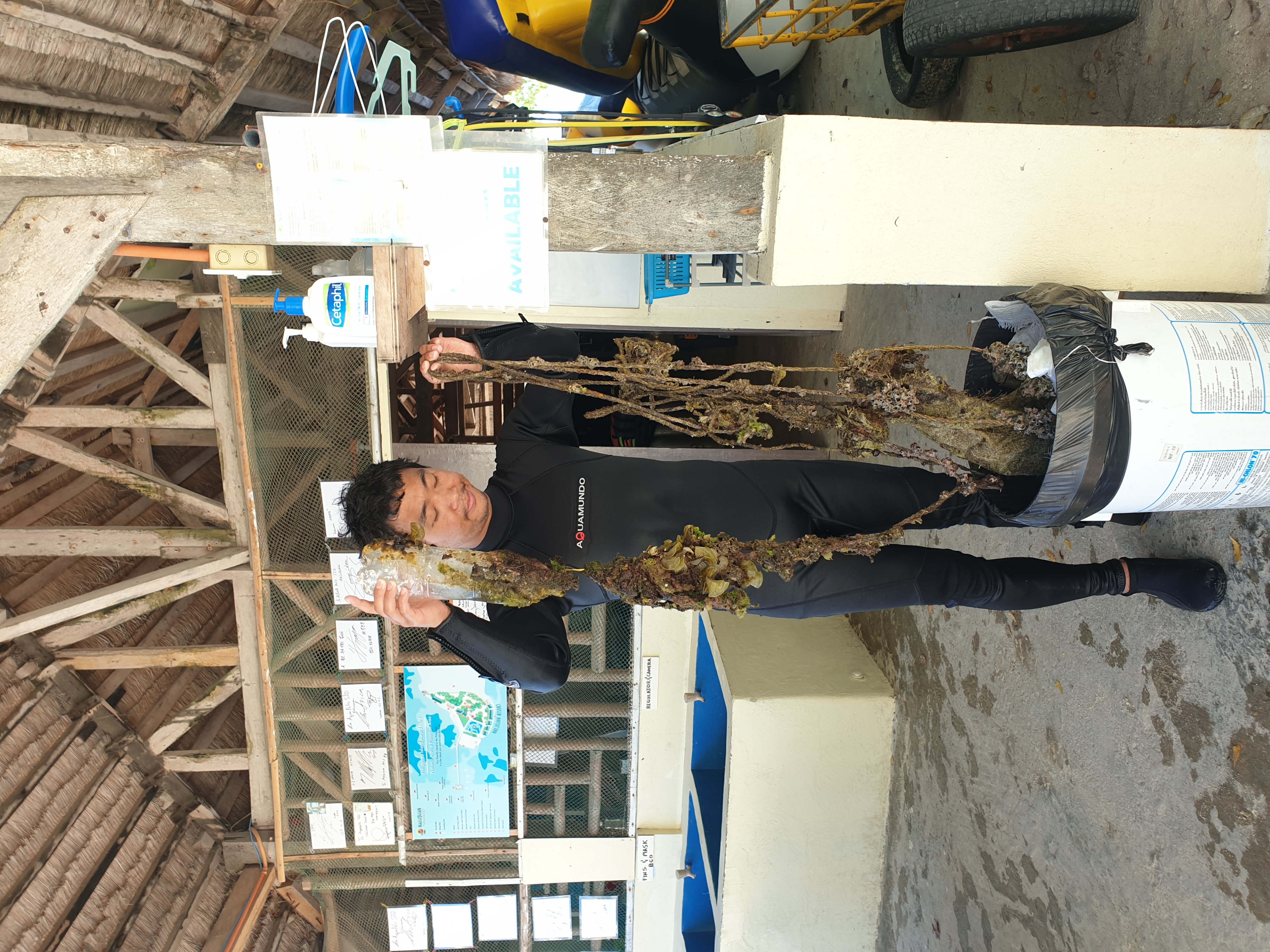
Nalusuan Island & Marine Sanctuary

10.187841, 124.001524

0
coral

10.189972249717, 123.99994477184

Temperature 31ºc, Water temperature 29ºc, clear & dry
Aquapolis SID Dive Resort
YooBong JEON
3
5
3
7.00
40
20.00
3.00
1
estimated
2500.00
rope
pet bottles
On
kilograms
I have debris data to report
2
Slight for waves 0.5 -1.25 meter high m2
meters
coral reef
1
2
Philippines
City
Cebu
Map Help


Dive Location

If you know your survey site coordinates, enter them manually in decimal degrees using WGS84 Map Datum. Use the minus sign for latitudes south of the equator and longitudes west of the Prime Meridian to 180 degrees.

If you do not know your survey site coordinates, click the “Map Location” tab to use the map to zoom into your survey site and drop the pin on the map to fall within your survey dive site in the water (not on land or the beach). Ensure you zoom in as much as possible to ensure data accuracy.

Entangled Help


Use the vertical tabs below to record any entangled animals you found of each type.

Turtle Point

0
0
0
2

9.757122, 123.342452

0
0
0
coral
0
0
0
16
0
Again suffocated tangled in the nets
Yes
Just one month after find the dead hawksbill we find a dead green
Tangled in nets
Green turtle
Good
Alegria Dive Resort
Lee Ricketts
0
0
0
0
0
0
0
0
0
0
0
0
0
0
0
0
0
0
0
3
0
0
0
0
0
0
0
0
0
0
0
0
0
0
0
0
2.00
50
30.00
5.00
4
estimated
0
0
0
0
58.11
0
0
0
0
0
Angelleys reef
0
On
kilograms
0
I have debris data to report
0
0
0
Calm (glassy to rippled) for waves 0 – 0.1 meter high
0
0
0
0
0
0
0
m2
0
0
meters
coral reef
1
0
0
0
0
0
0
0
0
0
0
0
0
0
0
0
0
0
0
0
0
0
Ghost nets
Dead
Green Turtle
0
0
0
0
0
0
0
0
Philippines
State\Province
Cebu
City
Alegria
Map Help


Dive Location

If you know your survey site coordinates, enter them manually in decimal degrees using WGS84 Map Datum. Use the minus sign for latitudes south of the equator and longitudes west of the Prime Meridian to 180 degrees.

If you do not know your survey site coordinates, click the “Map Location” tab to use the map to zoom into your survey site and drop the pin on the map to fall within your survey dive site in the water (not on land or the beach). Ensure you zoom in as much as possible to ensure data accuracy.

Entangled Help


Use the vertical tabs below to record any entangled animals you found of each type.

Home Reef

0
0
0
2

9.758125, 123.342748

0
0
0
coral
0
3
0
4
0
Yes
Good
Alegria Dive Resort
Lee Ricketts
0
0
0
0
0
0
0
0
0
0
0
0
0
0
0
0
0
0
0
2
0
0
0
0
0
0
0
0
0
0
0
0
0
0
0
0
0.50
45
15.00
5.00
0
estimated
0
0
0
0
70.96
0
0
0
0
0
Fishing nets
Fishing line
0
On
kilograms
0
I have debris data to report
0
0
0
Calm (glassy to rippled) for waves 0 – 0.1 meter high
0
0
0
0
0
0
0
m2
0
0
meters
coral reef
0
0
0
0
0
0
0
0
0
0
0
0
0
0
0
0
0
0
0
0
0
0
0
0
0
0
0
0
0
Philippines
State\Province
Cebu
City
Alegria
Map Help


Dive Location

If you know your survey site coordinates, enter them manually in decimal degrees using WGS84 Map Datum. Use the minus sign for latitudes south of the equator and longitudes west of the Prime Meridian to 180 degrees.

If you do not know your survey site coordinates, click the “Map Location” tab to use the map to zoom into your survey site and drop the pin on the map to fall within your survey dive site in the water (not on land or the beach). Ensure you zoom in as much as possible to ensure data accuracy.

Entangled Help


Use the vertical tabs below to record any entangled animals you found of each type.

Five Graves, Marty’s, Makena Landing

0
0
0

20.656515785471, -156.44287184848

0
0
0
sand
0
0
0
10
0
Incompetent inconsiderate fishermen
40 meters of brand new fishing line attaching to reef
Typical unremarkable
0
0
0
0
0
0
0
0
0
0
0
0
0
0
0
0
0
0
0
0
Maui Dreams Dive Co
Weitzenhoffer
0
0
0
1
0
0
0
0
0
0
0
0
0
0
0
0
0
0
0
3
0
0
0
0
0
0
0
0
0
0
0
0
0
0
2.00
75
21.00
3.00
0
estimated
0
4
42707.40
0
0
0
0
0
Monofilament
0
On
kilograms
0
I have debris data to report
0
0
0
Smooth (wavelets) for waves 0.1 - 0.5 meter high
0
0
0
0
0
0
0
ft2
0
0
meters
coral reef
0
0
0
0
0
0
0
0
0
0
0
0
0
0
0
0
0
0
0
0
0
0
0
0
0
0
0
0
United States
State\Province
HI
City
Makena
Map Help


Dive Location

If you know your survey site coordinates, enter them manually in decimal degrees using WGS84 Map Datum. Use the minus sign for latitudes south of the equator and longitudes west of the Prime Meridian to 180 degrees.

If you do not know your survey site coordinates, click the “Map Location” tab to use the map to zoom into your survey site and drop the pin on the map to fall within your survey dive site in the water (not on land or the beach). Ensure you zoom in as much as possible to ensure data accuracy.

Entangled Help


Use the vertical tabs below to record any entangled animals you found of each type.

Nalusuan Lady Statue

10.187786, 124.001677

coral
Temperature 31ºc, Water temperature 29ºc, clear & dry
Aquapolis SID Dive Center
YooBong JEON
3
2
10.00
55
40.00
3.00
estimated
2500.00
1
tire
cloth
On
kilograms
I have debris data to report
2
Smooth (wavelets) for waves 0.1 - 0.5 meter high
0
m2
meters
coral reef
20
4
Philippines
City
Cebu
Map Help


Dive Location

If you know your survey site coordinates, enter them manually in decimal degrees using WGS84 Map Datum. Use the minus sign for latitudes south of the equator and longitudes west of the Prime Meridian to 180 degrees.

If you do not know your survey site coordinates, click the “Map Location” tab to use the map to zoom into your survey site and drop the pin on the map to fall within your survey dive site in the water (not on land or the beach). Ensure you zoom in as much as possible to ensure data accuracy.

Entangled Help


Use the vertical tabs below to record any entangled animals you found of each type.

House Reef Tdc

6
7
0
0

-8.347739, 116.043112

3
0
0
sand
0
0
0
20
0
Awareness
Good weather
Trawangan Dive Centre
Laura
0
0
0
1
0
0
0
0
1
0
1
1
0
0
0
0
0
0
0
7
0
0
0
0
0
0
0
0
0
0
0
0
0
0
0
2
1.50
55
25.00
5.00
0
estimated
0
0
0
0
784.47
0
0
0
0
0
0
On
kilograms
0
I have debris data to report
0
0
0
Calm (glassy to rippled) for waves 0 – 0.1 meter high
0
0
0
0
0
0
0
m2
0
0
meters
coral reef
1
0
0
0
0
0
0
0
0
0
0
0
0
0
0
1
0
0
0
0
0
0
0
0
0
0
0
0
0
Indonesia
State\Province
Lombok NTB
City
Gili Trawangan
Map Help


Dive Location

If you know your survey site coordinates, enter them manually in decimal degrees using WGS84 Map Datum. Use the minus sign for latitudes south of the equator and longitudes west of the Prime Meridian to 180 degrees.

If you do not know your survey site coordinates, click the “Map Location” tab to use the map to zoom into your survey site and drop the pin on the map to fall within your survey dive site in the water (not on land or the beach). Ensure you zoom in as much as possible to ensure data accuracy.

Entangled Help


Use the vertical tabs below to record any entangled animals you found of each type.

ADS352 - Meno Slope

1
0
0
0

-8.35026, 116.0511

0
0
0
coral
0
0
0
0
0
Sunny
1
Deodorant wrapper
Gili Shark Conservation
Steve
0
0
0
0
0
0
0
0
0
0
0
0
2
1
0
0
0
0
0
8
1
0
0
0
2
0
0
0
0
0
0
0
0
0
0
0
1.50
52
18.00
10.00
0
estimated
0
0
0
0
8562.00
0
0
0
0
0
0
On
kilograms
0
I have debris data to report
0
0
0
Smooth (wavelets) for waves 0.1 - 0.5 meter high
9
0
0
0
0
0
0
m2
0
0
meters
coral reef
0
0
0
0
0
0
0
0
0
2
0
0
0
0
0
0
0
0
0
0
0
0
0
0
0
0
0
0
0
Indonesia
State\Province
Lombok
City
Gili Meno
Map Help


Dive Location

If you know your survey site coordinates, enter them manually in decimal degrees using WGS84 Map Datum. Use the minus sign for latitudes south of the equator and longitudes west of the Prime Meridian to 180 degrees.

If you do not know your survey site coordinates, click the “Map Location” tab to use the map to zoom into your survey site and drop the pin on the map to fall within your survey dive site in the water (not on land or the beach). Ensure you zoom in as much as possible to ensure data accuracy.

Entangled Help


Use the vertical tabs below to record any entangled animals you found of each type.

Jules Undersea Lodge

0
1
0

25.133291582756, -80.399007975244

0
0
0
silt
0
0
0
0
0
Sunny
0
0
0
0
0
0
0
0
0
0
0
0
0
0
0
0
0
0
0
0
Rainbow Reef Dive Center
Indy Sorensen
0
0
0
0
0
0
0
0
0
0
0
0
0
0
0
0
0
0
0
4
0
0
0
0
0
0
0
0
0
0
0
0
0
0
0.50
42
24.00
5.00
0
estimated
0
0
587.77
0
0
0
0
0
0
On
pounds
0
I have debris data to report
0
0
0
Calm (glassy to rippled) for waves 0 – 0.1 meter high
0
0
0
0
0
0
0
m2
0
0
feet
mangroves
0
0
0
0
0
0
0
0
0
0
0
0
0
0
0
0
0
0
0
0
0
0
0
0
0
0
0
0
United States
State\Province
Florida
City
Key Largo
Map Help


Dive Location

If you know your survey site coordinates, enter them manually in decimal degrees using WGS84 Map Datum. Use the minus sign for latitudes south of the equator and longitudes west of the Prime Meridian to 180 degrees.

If you do not know your survey site coordinates, click the “Map Location” tab to use the map to zoom into your survey site and drop the pin on the map to fall within your survey dive site in the water (not on land or the beach). Ensure you zoom in as much as possible to ensure data accuracy.

Entangled Help


Use the vertical tabs below to record any entangled animals you found of each type.

Subscribe to