Menu

Veteran's Park

150
1735
42
7
1
sand
61
3
4

33.837137719381, -118.39211330581

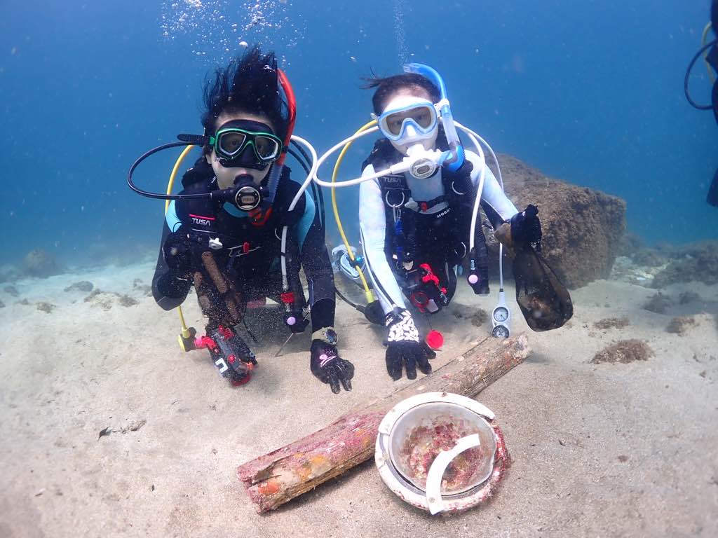
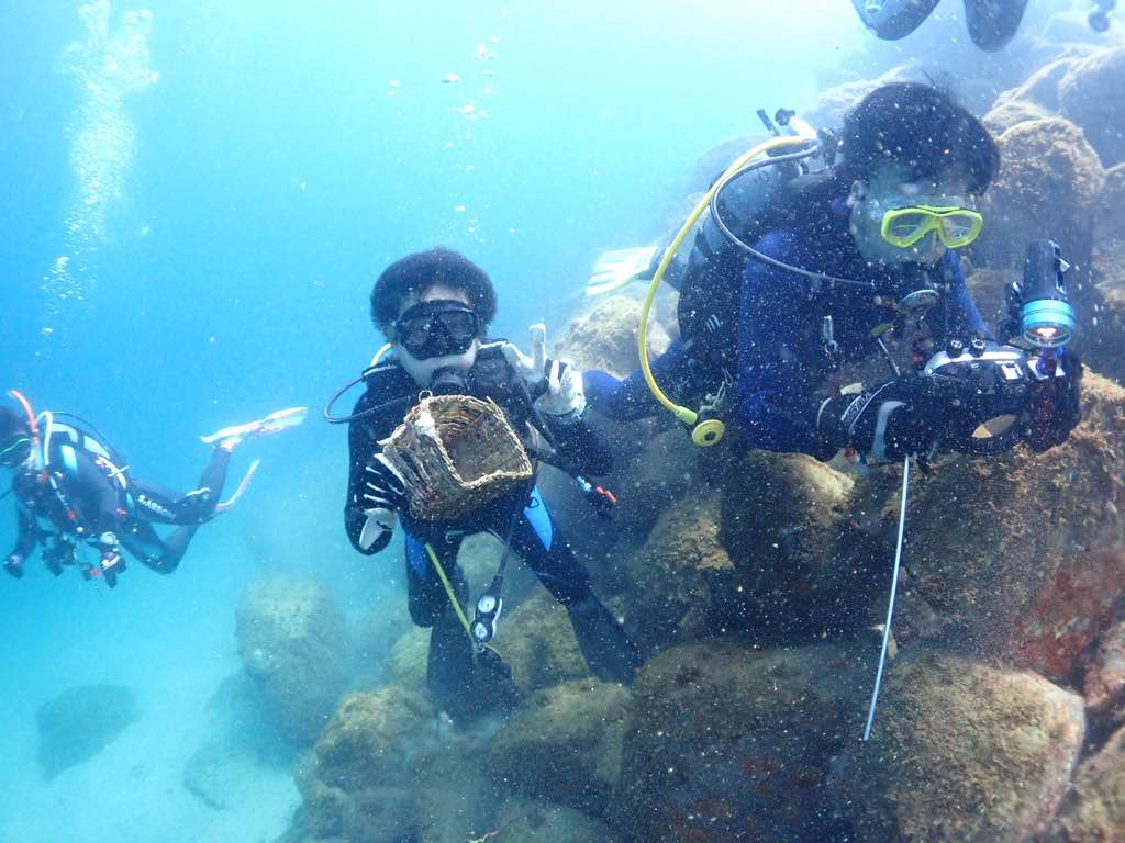
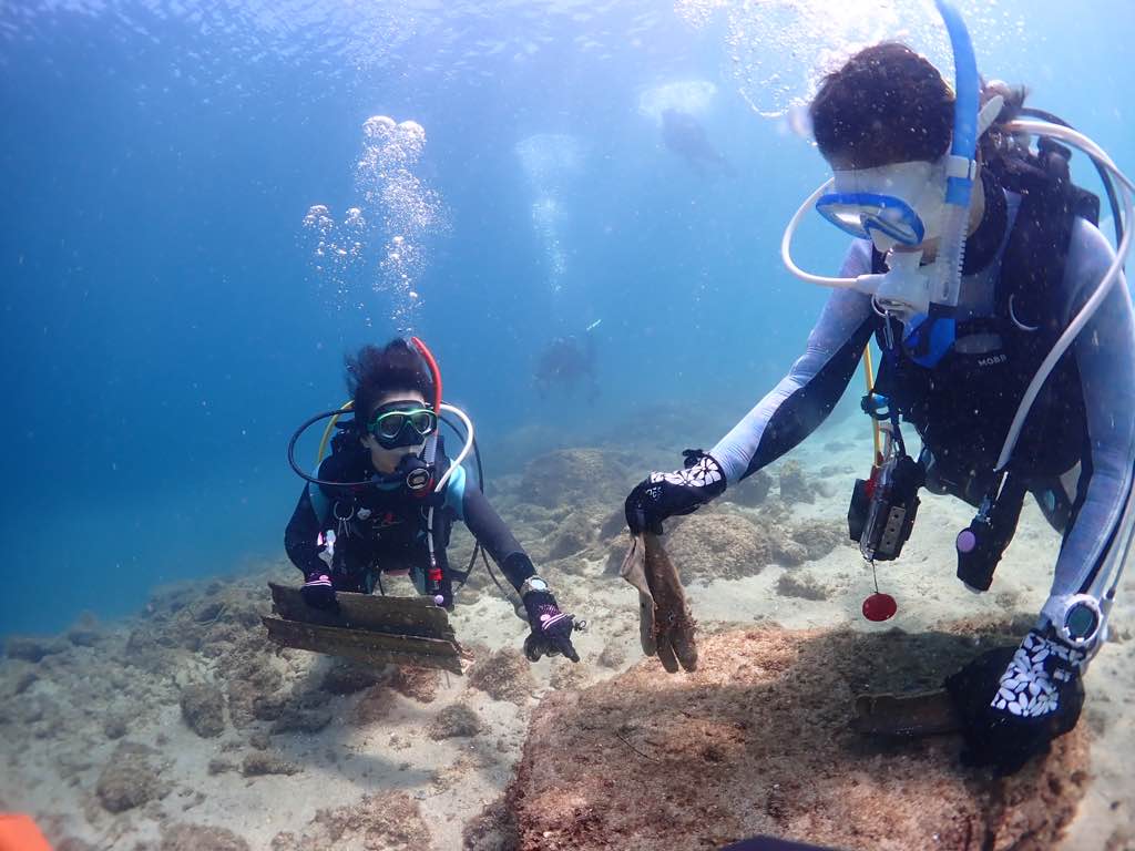
Come Together Cleanup with Zen Dive Co.
Crabs (9), Shrimps (2)
Nice pair of freediving fins
Species include: Bivalves (2), Snails (4), Octopus (10), Sea Stars (1), Urchins (5), Brittle Stars (43), Anemones (3), and Polychaete Worms (1)
4
2
1
Vapes
Sunglasses
Fishing Tackle Box
Bleu World & Zen Dive Co.
Kayla Feairheller
142
1
12
8
1
11
61
1
70
3
5
112
3
1
1
1
1
197.00
45
60.00
16.00
1
measured
1
5
2
1400.00
1
6
Plastic silverware
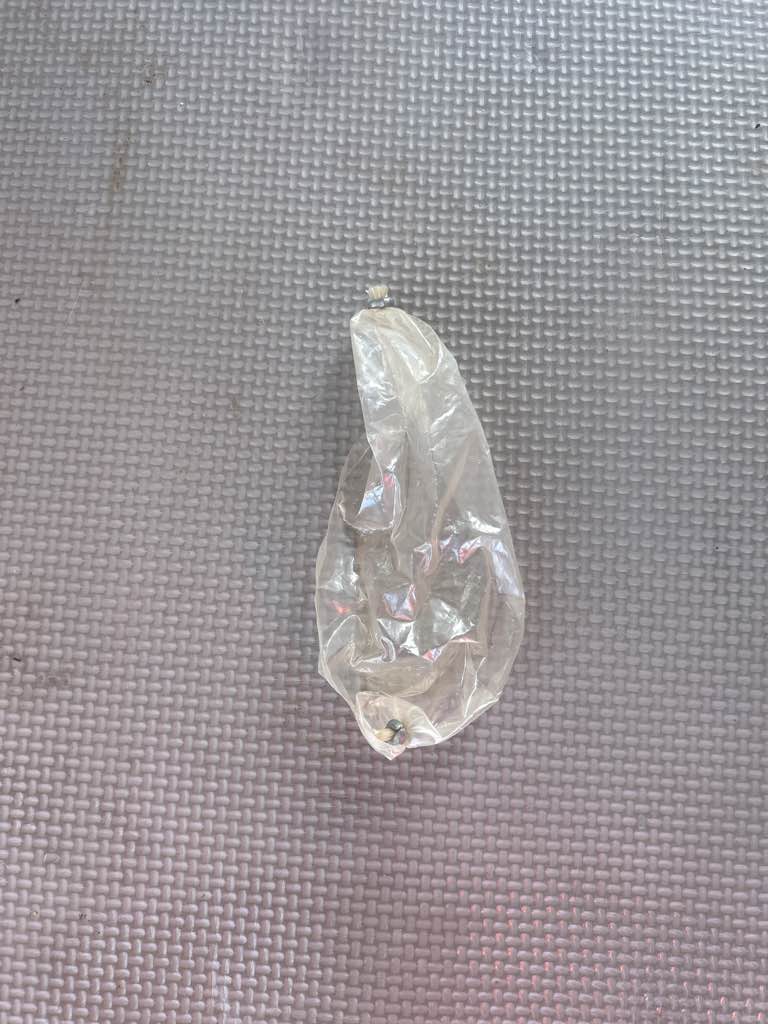
Plastic bags and food wrappers
Plastic fragments
37
On
pounds
I have debris data to report
36
Slight for waves 0.5 -1.25 meter high
8
3
Bags
Crabs, Shrimps
Released Unharmed
11
1
39
ft2
5
3
69
Bottles
Molluscs, Echinoderms, Cnidarians, and Worms
Released Unharmed
feet
kelp
5
1
1
1
1
1
3
8
1
2
11
United States
State\Province
CA
City
Redondo Beach
Map Help


Dive Location

If you know your survey site coordinates, enter them manually in decimal degrees using WGS84 Map Datum. Use the minus sign for latitudes south of the equator and longitudes west of the Prime Meridian to 180 degrees.

If you do not know your survey site coordinates, click the “Map Location” tab to use the map to zoom into your survey site and drop the pin on the map to fall within your survey dive site in the water (not on land or the beach). Ensure you zoom in as much as possible to ensure data accuracy.

Entangled Help


Use the vertical tabs below to record any entangled animals you found of each type.

The Steps

1
rock

-34.003292829486, 151.22629165649

Very clean area.. Only found one Squid jig in the kelp.. quite surprising as there were rock fisherman there when we went diving.

Will go back again and investigate further
No swell , light afternoon breezes
Dan Byrnes
2
0.25
50
12.00
1.00
estimated
386.00
On
kilograms
Our Survey Site was free of debris
Calm (glassy to rippled) for waves 0 – 0.1 meter high m2
meters
kelp
Australia
Map Help


Dive Location

If you know your survey site coordinates, enter them manually in decimal degrees using WGS84 Map Datum. Use the minus sign for latitudes south of the equator and longitudes west of the Prime Meridian to 180 degrees.

If you do not know your survey site coordinates, click the “Map Location” tab to use the map to zoom into your survey site and drop the pin on the map to fall within your survey dive site in the water (not on land or the beach). Ensure you zoom in as much as possible to ensure data accuracy.

Entangled Help


Use the vertical tabs below to record any entangled animals you found of each type.

Manly Cove

60
103
10
1

-33.7989, 151.282

4
0
9
sand
0
0
4
2
0
No
Traffic cone
Good conditions, minimal wind
4
3
2
2
6
1
Vapes
Scissors
Beach toys
Kitchen knives
Plastic Lids
Traffic cone
Dive Centre Manly
Michael Gavaghan
0
4
0
7
2
0
0
0
0
0
6
0
4
2
0
0
0
7
50
39
0
0
3
20
0
25
3
0
3
2
0
3
1
0
0
0
90.00
60
6.60
3.90
3
estimated
0
4
754.92
1
0
1
15
1
Mentor wrappers
Bait bags
Beer bottles
11
On
pounds
0
I have debris data to report
40
1
0
Smooth (wavelets) for waves 0.1 - 0.5 meter high
0
0
4
0
12
0
0
m2
0
0
1
Shoe
Blue ringed octopus
Released Unharmed
meters
seagrass
20
0
1
0
2
2
0
0
0
11
2
0
1
6
1
0
2
3
0
0
2
3
30
0
0
0
0
4
0
Australia
State\Province
NSW
City
Manly
Map Help


Dive Location

If you know your survey site coordinates, enter them manually in decimal degrees using WGS84 Map Datum. Use the minus sign for latitudes south of the equator and longitudes west of the Prime Meridian to 180 degrees.

If you do not know your survey site coordinates, click the “Map Location” tab to use the map to zoom into your survey site and drop the pin on the map to fall within your survey dive site in the water (not on land or the beach). Ensure you zoom in as much as possible to ensure data accuracy.

Entangled Help


Use the vertical tabs below to record any entangled animals you found of each type.

Aow Mao - HTMS Hanhak Sattru

sand

10.093494396702, 99.853920936584

DJL Diving (Davy Jones Locker Diving)
Julia Alberione
1
2
1
0.50
45
32.00
30.00
estimated
90.00
On
kilograms
I have debris data to report
Calm (glassy to rippled) for waves 0 – 0.1 meter high m2
meters
other
1
Thailand
State\Province
Surat Thani
City
Koh Tao
Map Help


Dive Location

If you know your survey site coordinates, enter them manually in decimal degrees using WGS84 Map Datum. Use the minus sign for latitudes south of the equator and longitudes west of the Prime Meridian to 180 degrees.

If you do not know your survey site coordinates, click the “Map Location” tab to use the map to zoom into your survey site and drop the pin on the map to fall within your survey dive site in the water (not on land or the beach). Ensure you zoom in as much as possible to ensure data accuracy.

Entangled Help


Use the vertical tabs below to record any entangled animals you found of each type.

Ecosystem Other
Wreck, sand area

Susu Dara Besar

0
0
0
34

5.9587777713254, 102.66117214599

2
0
0
coral
0
0
0
2
0
Windy
Sea Voice Divers
Sebastian
0
0
0
0
0
0
0
0
0
0
0
0
0
0
0
0
0
0
0
4
0
0
0
0
0
0
0
0
0
0
0
0
0
0
0
0
6.70
80
6.00
3.00
5
estimated
0
0
2968.13
0
0
0
0
0
Nets
Fishing line and hook
0
On
kilograms
0
I have debris data to report
0
0
0
Slight for waves 0.5 -1.25 meter high
0
0
0
0
1
0
0
m2
0
0
meters
coral reef
0
0
0
0
0
0
0
0
0
0
0
0
0
0
0
1
0
0
0
0
0
0
0
0
0
0
0
0
0
Malaysia
State\Province
Terengganu
City
Perhentian Island
Map Help


Dive Location

If you know your survey site coordinates, enter them manually in decimal degrees using WGS84 Map Datum. Use the minus sign for latitudes south of the equator and longitudes west of the Prime Meridian to 180 degrees.

If you do not know your survey site coordinates, click the “Map Location” tab to use the map to zoom into your survey site and drop the pin on the map to fall within your survey dive site in the water (not on land or the beach). Ensure you zoom in as much as possible to ensure data accuracy.

Entangled Help


Use the vertical tabs below to record any entangled animals you found of each type.

kajika

0
0
2
0

33.967489, 136.219494

4
1
0
rock
0
0
0
2
0
io takatsuki
masahiko ueda
0
0
0
0
0
0
0
0
0
0
0
0
0
0
0
0
0
0
0
5
0
0
0
0
0
0
0
0
0
0
0
0
0
0
0
1
3.00
30
17.00
3.00
0
measured
0
0
3747.53
0
0
0
0
0
0
On
kilograms
0
I have debris data to report
2
0
0
Calm (glassy to rippled) for waves 0 – 0.1 meter high
8
0
0
0
0
2
0
m2
0
0
meters
rocky reef
1
0
0
0
0
0
0
0
0
0
0
0
0
0
0
0
0
3
0
0
0
0
0
0
0
0
0
0
0
Japan
State\Province
owase
City
kajika
Map Help


Dive Location

If you know your survey site coordinates, enter them manually in decimal degrees using WGS84 Map Datum. Use the minus sign for latitudes south of the equator and longitudes west of the Prime Meridian to 180 degrees.

If you do not know your survey site coordinates, click the “Map Location” tab to use the map to zoom into your survey site and drop the pin on the map to fall within your survey dive site in the water (not on land or the beach). Ensure you zoom in as much as possible to ensure data accuracy.

Entangled Help


Use the vertical tabs below to record any entangled animals you found of each type.

Pier Uno House Reef

0
0
0
0

13.755416, 120.909575

0
0
0
coral
0
0
0
0
0
No
Rain
Pier Uno
Jen
0
0
0
1
0
0
0
0
0
0
0
0
0
0
0
0
0
0
0
7
0
0
0
0
1
0
0
0
0
0
0
0
0
0
0
0
1.00
50
60.00
20.00
0
estimated
0
0
0
0
4933.69
0
0
0
0
0
Plastcs
0
On
pounds
0
I have debris data to report
0
0
0
Smooth (wavelets) for waves 0.1 - 0.5 meter high
0
0
0
0
0
0
0
m2
0
0
feet
coral reef
0
0
0
0
0
0
0
0
0
0
0
0
0
0
0
0
0
0
0
0
0
0
0
0
0
0
0
0
0
Philippines
State\Province
Mabini
City
Anilao
Map Help


Dive Location

If you know your survey site coordinates, enter them manually in decimal degrees using WGS84 Map Datum. Use the minus sign for latitudes south of the equator and longitudes west of the Prime Meridian to 180 degrees.

If you do not know your survey site coordinates, click the “Map Location” tab to use the map to zoom into your survey site and drop the pin on the map to fall within your survey dive site in the water (not on land or the beach). Ensure you zoom in as much as possible to ensure data accuracy.

Entangled Help


Use the vertical tabs below to record any entangled animals you found of each type.

Perhentian North

0
15
0
0

5.9375074027336, 102.72806522821

0
0
0
coral
0
0
0
7
0
Thermocline
Yagi Typhoon
Marine park clean up more often
Syringe
Windy
Sea Voice Divers
Adam
0
0
0
0
0
0
0
0
0
2
0
0
0
0
2
0
0
0
0
21
0
0
0
0
24
0
299
0
40
0
0
0
0
0
0
0
29.00
50
15.00
7.00
5
measured
0
0
3153.19
0
0
0
0
0
Plastic bottle
0
On
kilograms
0
I have debris data to report
0
0
0
Slight for waves 0.5 -1.25 meter high
0
0
15
0
11
0
0
m2
0
0
meters
coral reef
0
0
0
0
0
0
0
0
0
0
0
0
0
0
0
0
67
0
0
0
0
0
3
0
0
0
0
0
0
Malaysia
State\Province
Terengganu
City
Perhentian Island
Map Help


Dive Location

If you know your survey site coordinates, enter them manually in decimal degrees using WGS84 Map Datum. Use the minus sign for latitudes south of the equator and longitudes west of the Prime Meridian to 180 degrees.

If you do not know your survey site coordinates, click the “Map Location” tab to use the map to zoom into your survey site and drop the pin on the map to fall within your survey dive site in the water (not on land or the beach). Ensure you zoom in as much as possible to ensure data accuracy.

Entangled Help


Use the vertical tabs below to record any entangled animals you found of each type.

Maeda

0
0
0
0

26.443886326156, 127.77269546589

0
0
0
sand
0
0
0
0
0
Clear
Tsunami Scuba
0
0
0
0
0
0
0
0
0
0
0
0
0
0
0
0
0
0
0
3
0
0
0
0
0
0
0
0
0
0
0
0
0
0
0
0
0.00
47
60.00
15.00
0
measured
0
0
2367.59
0
0
0
0
0
0
On
kilograms
0
Our Survey Site was free of debris
0
0
0
Smooth (wavelets) for waves 0.1 - 0.5 meter high
0
0
0
0
0
0
0
ft2
0
0
feet
coral reef
0
0
0
0
0
0
0
0
0
0
0
0
0
0
0
0
0
0
0
0
0
0
0
0
0
0
0
0
0
Japan
Map Help


Dive Location

If you know your survey site coordinates, enter them manually in decimal degrees using WGS84 Map Datum. Use the minus sign for latitudes south of the equator and longitudes west of the Prime Meridian to 180 degrees.

If you do not know your survey site coordinates, click the “Map Location” tab to use the map to zoom into your survey site and drop the pin on the map to fall within your survey dive site in the water (not on land or the beach). Ensure you zoom in as much as possible to ensure data accuracy.

Entangled Help


Use the vertical tabs below to record any entangled animals you found of each type.

Cape Maeda

1
0
0
0

26.4437007, 127.7725816

0
0
0
coral
0
0
0
0
0
Very popular dive site, coral bleaching and destruction is prevalent
The week prior tropical storm passed the island
Only one piece of debris found, coral was clean
Rainy/Stormy
Jacob
0
0
0
0
0
0
0
0
0
0
0
0
0
0
0
0
0
0
0
3
0
0
0
0
0
0
0
0
0
0
0
0
0
0
0
0
0.05
47
50.00
15.00
0
estimated
0
0
552.73
0
0
0
0
0
Plastic
0
On
pounds
0
I have debris data to report
0
0
0
Calm (glassy to rippled) for waves 0 – 0.1 meter high
0
0
0
0
0
0
0
m2
0
0
feet
coral reef
0
0
0
0
0
0
0
0
0
0
0
0
0
0
0
0
0
0
0
0
0
0
0
0
0
0
0
0
0
Japan
State\Province
Okinawa
City
Onna
Map Help


Dive Location

If you know your survey site coordinates, enter them manually in decimal degrees using WGS84 Map Datum. Use the minus sign for latitudes south of the equator and longitudes west of the Prime Meridian to 180 degrees.

If you do not know your survey site coordinates, click the “Map Location” tab to use the map to zoom into your survey site and drop the pin on the map to fall within your survey dive site in the water (not on land or the beach). Ensure you zoom in as much as possible to ensure data accuracy.

Entangled Help


Use the vertical tabs below to record any entangled animals you found of each type.

Subscribe to