Menu

Beacon Rock

0
0
0
0

27.758819086082, 34.158091575822

0
0
0
coral
0
2
0
0
0
King Snefro Fleet
Samuel Samir
0
0
0
0
0
0
0
0
0
0
0
0
0
0
0
0
0
0
0
11
1
0
0
0
1
0
0
0
0
0
0
1
0
0
1
0
15.00
50
20.00
10.00
0
estimated
1
0
708.36
0
0
0
0
0
0
On
kilograms
0
I have debris data to report
5
0
1
Calm (glassy to rippled) for waves 0 – 0.1 meter high
0
0
1
0
0
0
0
m2
0
0
meters
coral reef
0
0
0
0
0
0
0
0
0
1
0
0
1
0
0
0
0
1
0
0
1
1
0
0
0
0
0
0
0
Egypt
City
Sharm El Sheikh
Map Help


Dive Location

If you know your survey site coordinates, enter them manually in decimal degrees using WGS84 Map Datum. Use the minus sign for latitudes south of the equator and longitudes west of the Prime Meridian to 180 degrees.

If you do not know your survey site coordinates, click the “Map Location” tab to use the map to zoom into your survey site and drop the pin on the map to fall within your survey dive site in the water (not on land or the beach). Ensure you zoom in as much as possible to ensure data accuracy.

Entangled Help


Use the vertical tabs below to record any entangled animals you found of each type.

Baie Ternay Marine Park

0
0
0
0

-4.638273, 55.375856

0
0
0
coral
0
0
0
0
0
Mixed
GVI SEYCHELLES
Sam Cookson
0
0
0
0
0
0
0
0
1
0
0
0
0
0
0
0
0
0
0
3
0
0
0
0
0
0
1
0
0
0
0
0
0
0
0
0
0.20
41
16.80
8.20
0
estimated
0
0
0
0
50.00
0
0
0
0
0
0
On
kilograms
0
I have debris data to report
0
0
0
Calm (glassy to rippled) for waves 0 – 0.1 meter high
0
0
0
0
0
0
0
m2
0
0
meters
coral reef
0
0
0
0
0
0
0
0
0
0
0
0
0
0
0
0
0
0
0
0
0
0
0
0
0
0
0
0
0
Seychelles
State\Province
Mahe
City
Mahe
Map Help


Dive Location

If you know your survey site coordinates, enter them manually in decimal degrees using WGS84 Map Datum. Use the minus sign for latitudes south of the equator and longitudes west of the Prime Meridian to 180 degrees.

If you do not know your survey site coordinates, click the “Map Location” tab to use the map to zoom into your survey site and drop the pin on the map to fall within your survey dive site in the water (not on land or the beach). Ensure you zoom in as much as possible to ensure data accuracy.
Entangled Help


Use the vertical tabs below to record any entangled animals you found of each type.

Skalakia

0
0
0
0

37.056515, 21.579002

0
1
1
rock
0
0
1
0
0
Bad weather
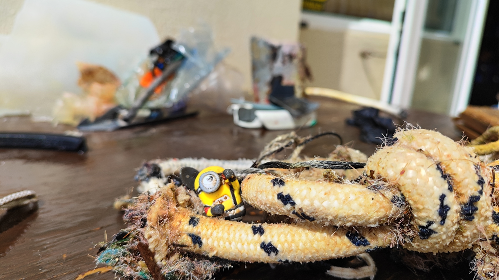
Minion toy
Rain and wind
Scuba Turtles
Andreas Vasilopoulos
0
3
0
0
0
0
0
0
0
0
0
0
2
0
0
0
0
0
0
1
0
0
2
0
0
0
3
0
0
0
0
0
0
0
0
0
1.50
45
5.00
2.00
1
estimated
0
0
0
1
5794.00
0
0
0
3
0
Construction material
Plastic bottles
Metal cans
0
On
kilograms
0
I have debris data to report
0
0
0
Smooth (wavelets) for waves 0.1 - 0.5 meter high
3
0
1
0
4
0
0
m2
2
0
meters
rocky reef
0
0
0
0
0
0
0
0
0
0
0
0
1
0
0
0
0
3
0
0
0
0
0
1
1
0
0
0
0
Greece
State\Province
Messinia
City
Marathopoli
Map Help


Dive Location

If you know your survey site coordinates, enter them manually in decimal degrees using WGS84 Map Datum. Use the minus sign for latitudes south of the equator and longitudes west of the Prime Meridian to 180 degrees.

If you do not know your survey site coordinates, click the “Map Location” tab to use the map to zoom into your survey site and drop the pin on the map to fall within your survey dive site in the water (not on land or the beach). Ensure you zoom in as much as possible to ensure data accuracy.
Entangled Help


Use the vertical tabs below to record any entangled animals you found of each type.

Kızılada Harbour

1
6
1
0

36.6540386054, 29.045233154217

1
0
0
sand
0
0
2
5
0
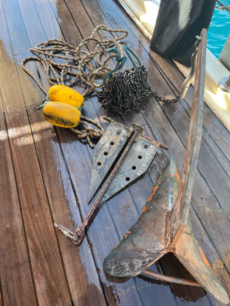
Dropped or lost from daily tourist boats
Ring
windy and choppy
1
2
1
Ring
Anchor
Anchor chain
Seahorse Dive Centre
Mark Taylor
0
0
0
0
2
0
0
0
0
0
0
0
0
1
0
0
0
0
0
2
0
1
0
0
6
0
0
0
2
2
0
0
0
0
0
0
46.00
58
14.70
4.00
4
measured
0
1
11436.50
0
0
0
0
0
Plastic
Glass
1
On
kilograms
0
I have debris data to report
1
0
0
Smooth (wavelets) for waves 0.1 - 0.5 meter high
0
0
0
Clothing
Crab
Released Unharmed
1
0
0
0
0
m2
2
0
meters
rocky reef
3
0
0
0
0
1
0
0
0
1
0
0
0
2
0
3
0
1
0
0
3
0
14
0
0
0
0
1
0
Turkey
State\Province
Muğla
City
Fethiye
Map Help


Dive Location

If you know your survey site coordinates, enter them manually in decimal degrees using WGS84 Map Datum. Use the minus sign for latitudes south of the equator and longitudes west of the Prime Meridian to 180 degrees.

If you do not know your survey site coordinates, click the “Map Location” tab to use the map to zoom into your survey site and drop the pin on the map to fall within your survey dive site in the water (not on land or the beach). Ensure you zoom in as much as possible to ensure data accuracy.
Entangled Help


Use the vertical tabs below to record any entangled animals you found of each type.

Punta Bunga

1

11.986267, 121.906472

16
sand
Rain washing garbage down from the hills
Stormy
2
2
11
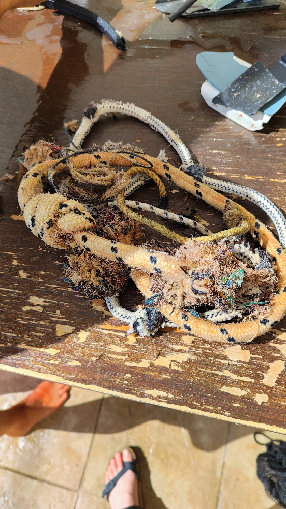
Rice Sacks
Detergent packets
Random plastic wrappers
Scotty's Action Sports Network, Inc.
Bev Harness
3
1.00
39
5.50
1.75
estimated
39.00
Fishing Line
Fishing nets
Rice sacks
On
kilograms
I have debris data to report
Smooth (wavelets) for waves 0.1 - 0.5 meter high m2
meters
coral reef
Philippines
State\Province
Aklan
City
Boracay
Map Help


Dive Location

If you know your survey site coordinates, enter them manually in decimal degrees using WGS84 Map Datum. Use the minus sign for latitudes south of the equator and longitudes west of the Prime Meridian to 180 degrees.

If you do not know your survey site coordinates, click the “Map Location” tab to use the map to zoom into your survey site and drop the pin on the map to fall within your survey dive site in the water (not on land or the beach). Ensure you zoom in as much as possible to ensure data accuracy.
Entangled Help


Use the vertical tabs below to record any entangled animals you found of each type.

Sharp Island

0
7
0
1

22.358506665486, 114.29262046995

0
0
0
sand
0
0
0
3
2
Diving Express
Lau Tsz Sum
0
2
0
0
0
0
0
0
0
0
0
0
3
1
0
0
0
0
0
20
0
0
0
0
1
0
0
0
0
0
0
0
0
0
0
0
2.60
50
12.00
3.00
2
measured
0
0
2053.61
0
0
0
0
0
2
On
kilograms
0
I have debris data to report
0
0
0
Calm (glassy to rippled) for waves 0 – 0.1 meter high
2
0
0
0
0
0
0
m2
3
2
meters
other
1
0
0
0
0
0
0
0
0
0
0
0
0
1
0
0
0
0
0
0
0
0
0
0
0
0
0
0
0
Hong Kong S.A.R., China
Map Help


Dive Location

If you know your survey site coordinates, enter them manually in decimal degrees using WGS84 Map Datum. Use the minus sign for latitudes south of the equator and longitudes west of the Prime Meridian to 180 degrees.

If you do not know your survey site coordinates, click the “Map Location” tab to use the map to zoom into your survey site and drop the pin on the map to fall within your survey dive site in the water (not on land or the beach). Ensure you zoom in as much as possible to ensure data accuracy.
Entangled Help


Use the vertical tabs below to record any entangled animals you found of each type.

Ecosystem Other
Other

Downstairs

9
6
0
2

4.596453, 118.861063

0
0
0
other
0
1
0
20
0
Storm
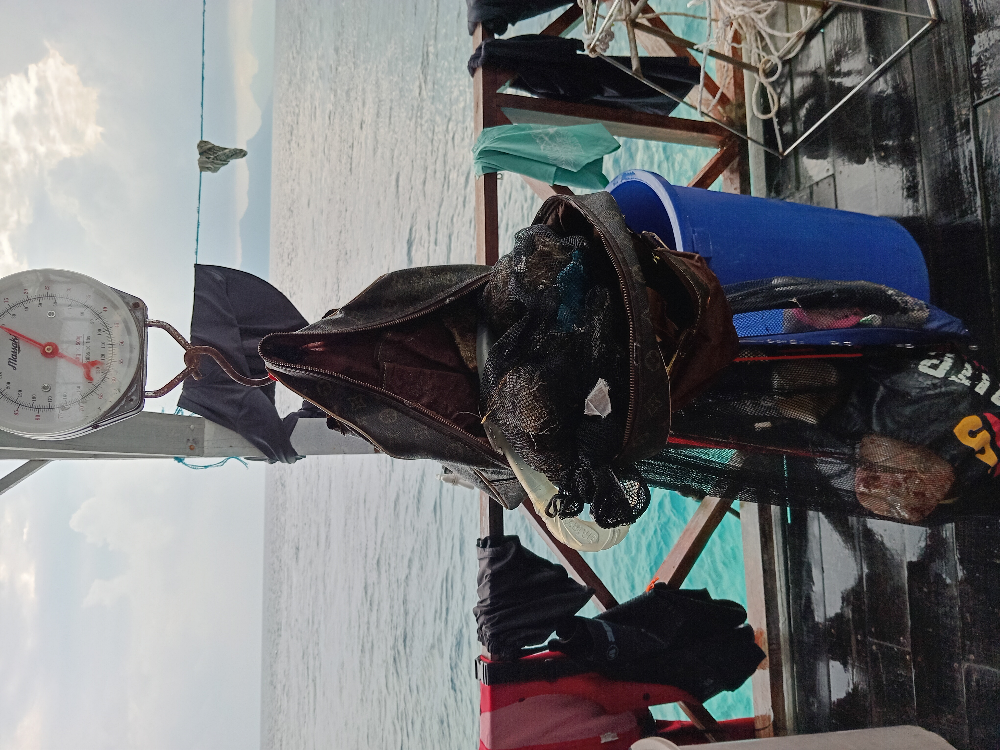
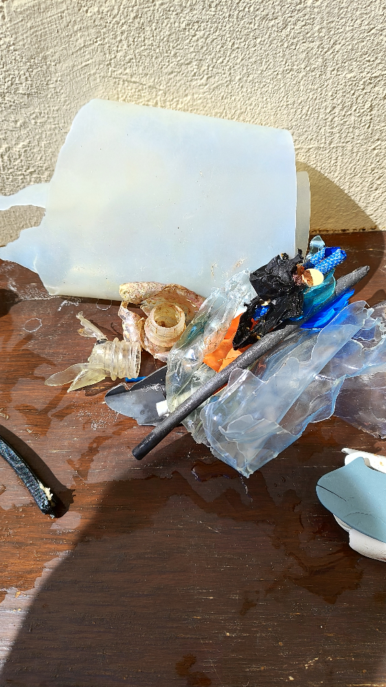
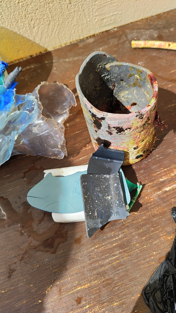
Louis Vitton bag
Very Stormy
TRACC
Shainea And Sam
0
0
0
0
0
0
0
0
2
1
1
0
1
2
6
0
0
0
0
6
0
0
3
0
0
0
0
0
0
0
0
0
0
0
0
0
8.50
47
20.00
2.00
0
measured
0
0
0
7
692.03
0
0
0
0
0
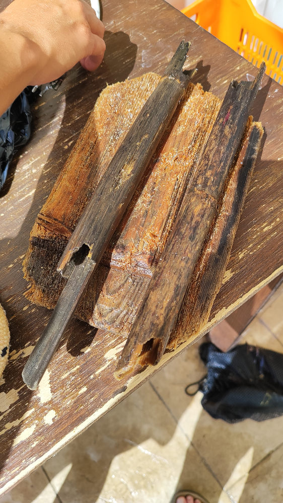
Fishing line
Plastic fragments
Diapers
0
On
kilograms
0
I have debris data to report
1
0
0
Slight for waves 0.5 -1.25 meter high
0
0
3
0
3
0
1
m2
0
2
meters
coral reef
0
0
0
0
0
0
0
0
0
0
0
0
0
0
0
0
0
1
0
0
0
0
0
0
0
0
0
0
0
Malaysia
State\Province
Sabah
City
Semporna
Map Help


Dive Location

If you know your survey site coordinates, enter them manually in decimal degrees using WGS84 Map Datum. Use the minus sign for latitudes south of the equator and longitudes west of the Prime Meridian to 180 degrees.

If you do not know your survey site coordinates, click the “Map Location” tab to use the map to zoom into your survey site and drop the pin on the map to fall within your survey dive site in the water (not on land or the beach). Ensure you zoom in as much as possible to ensure data accuracy.
Entangled Help


Use the vertical tabs below to record any entangled animals you found of each type.

Dominant Substrate Other
Rubble

Ras Katy

3
sand
1

27.847439845209, 34.305085837841

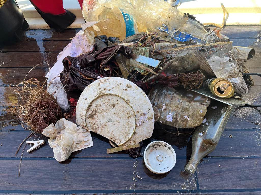
Frequent use of glass bottom and snorklling boats in the area where signle use plastic blows off boats. Also wind from the land blows rubbish into this dive spot
Calm
Emperor Divers Sharm
Elise Watling
3
1
8
5
2
3.00
60
18.00
6.00
estimated
102.00
On
kilograms
I have debris data to report
2
Smooth (wavelets) for waves 0.1 - 0.5 meter high
2
m2
meters
coral reef
1
1
1
1
2
Egypt
State\Province
South Sinai
City
Sharm El Sheikh
Map Help


Dive Location

If you know your survey site coordinates, enter them manually in decimal degrees using WGS84 Map Datum. Use the minus sign for latitudes south of the equator and longitudes west of the Prime Meridian to 180 degrees.

If you do not know your survey site coordinates, click the “Map Location” tab to use the map to zoom into your survey site and drop the pin on the map to fall within your survey dive site in the water (not on land or the beach). Ensure you zoom in as much as possible to ensure data accuracy.
Entangled Help


Use the vertical tabs below to record any entangled animals you found of each type.

Tanote Bay - Koh Tao, Thailand

1

10.084602869098, 99.848677206931

coral
Windy, Rainy
1
Pill Plastic Packet
Assava Dive Resort
Russ Dyrli
3
0.01
35
6.00
6.00
estimated
81.00
On
kilograms
I have debris data to report
Smooth (wavelets) for waves 0.1 - 0.5 meter high m2
meters
coral reef
Thailand
State\Province
Surat Thani
City
Koh Tao
Map Help


Dive Location

If you know your survey site coordinates, enter them manually in decimal degrees using WGS84 Map Datum. Use the minus sign for latitudes south of the equator and longitudes west of the Prime Meridian to 180 degrees.

If you do not know your survey site coordinates, click the “Map Location” tab to use the map to zoom into your survey site and drop the pin on the map to fall within your survey dive site in the water (not on land or the beach). Ensure you zoom in as much as possible to ensure data accuracy.
Entangled Help


Use the vertical tabs below to record any entangled animals you found of each type.

Hin Gnam - Koh Tao, Thailand

10.071877, 99.840207

coral
Windy, Rainy
Assava Dive Resort
Russ Dyrli
3
2
0.02
40
10.00
5.00
estimated
100.00
Plastic Bottles
On
kilograms
I have debris data to report
Slight for waves 0.5 -1.25 meter high m2
meters
coral reef
Thailand
State\Province
Surat Thani
City
Koh Tao
Map Help


Dive Location

If you know your survey site coordinates, enter them manually in decimal degrees using WGS84 Map Datum. Use the minus sign for latitudes south of the equator and longitudes west of the Prime Meridian to 180 degrees.

If you do not know your survey site coordinates, click the “Map Location” tab to use the map to zoom into your survey site and drop the pin on the map to fall within your survey dive site in the water (not on land or the beach). Ensure you zoom in as much as possible to ensure data accuracy.
Entangled Help


Use the vertical tabs below to record any entangled animals you found of each type.

Subscribe to