Menu

Dive Against Debris - Sazeh Dive Site In kish Island 2019

125
sand

26.507339415736, 54.072940087533

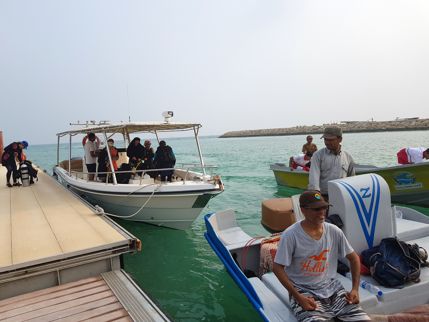
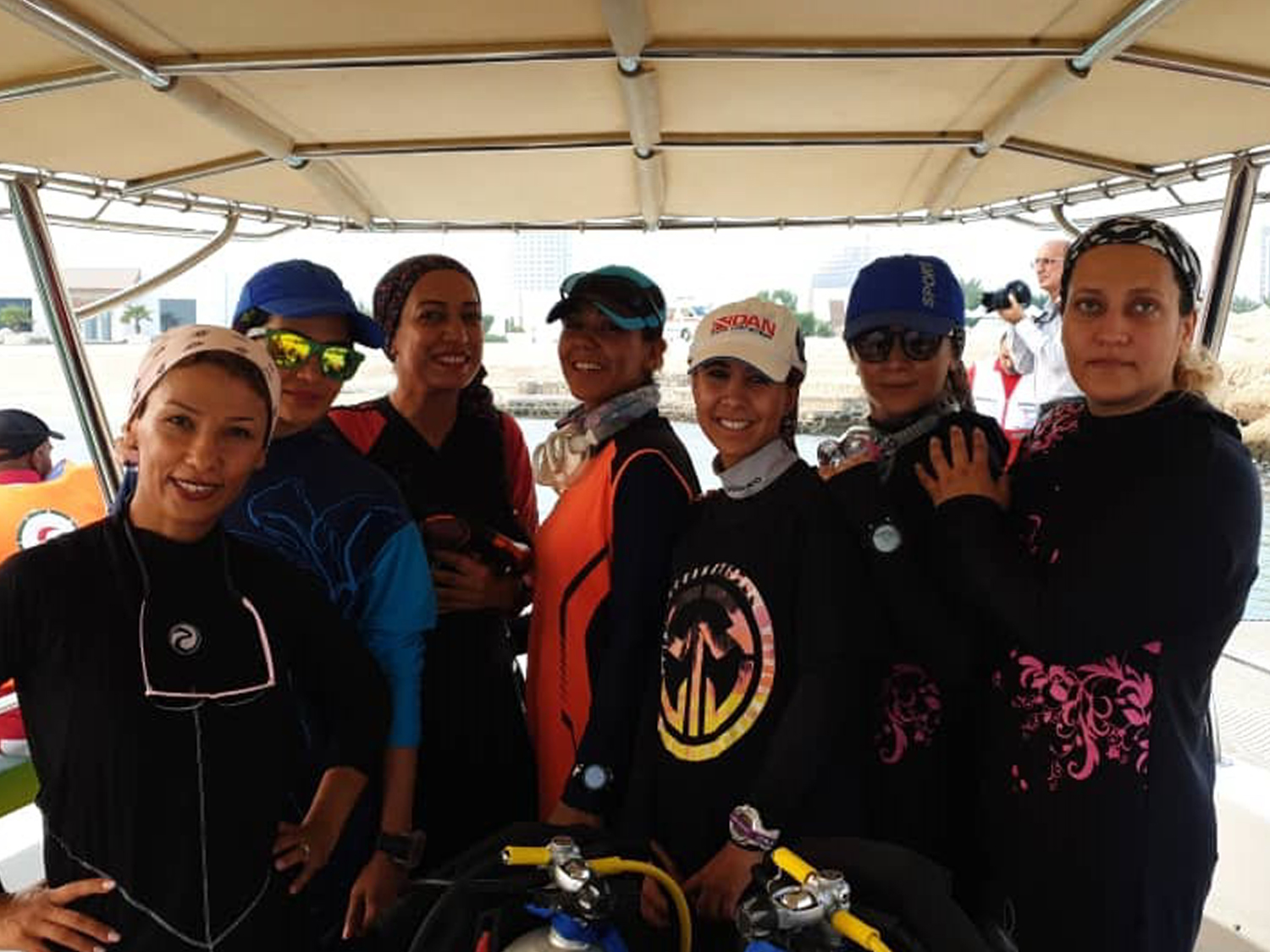
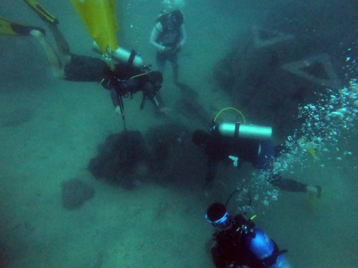
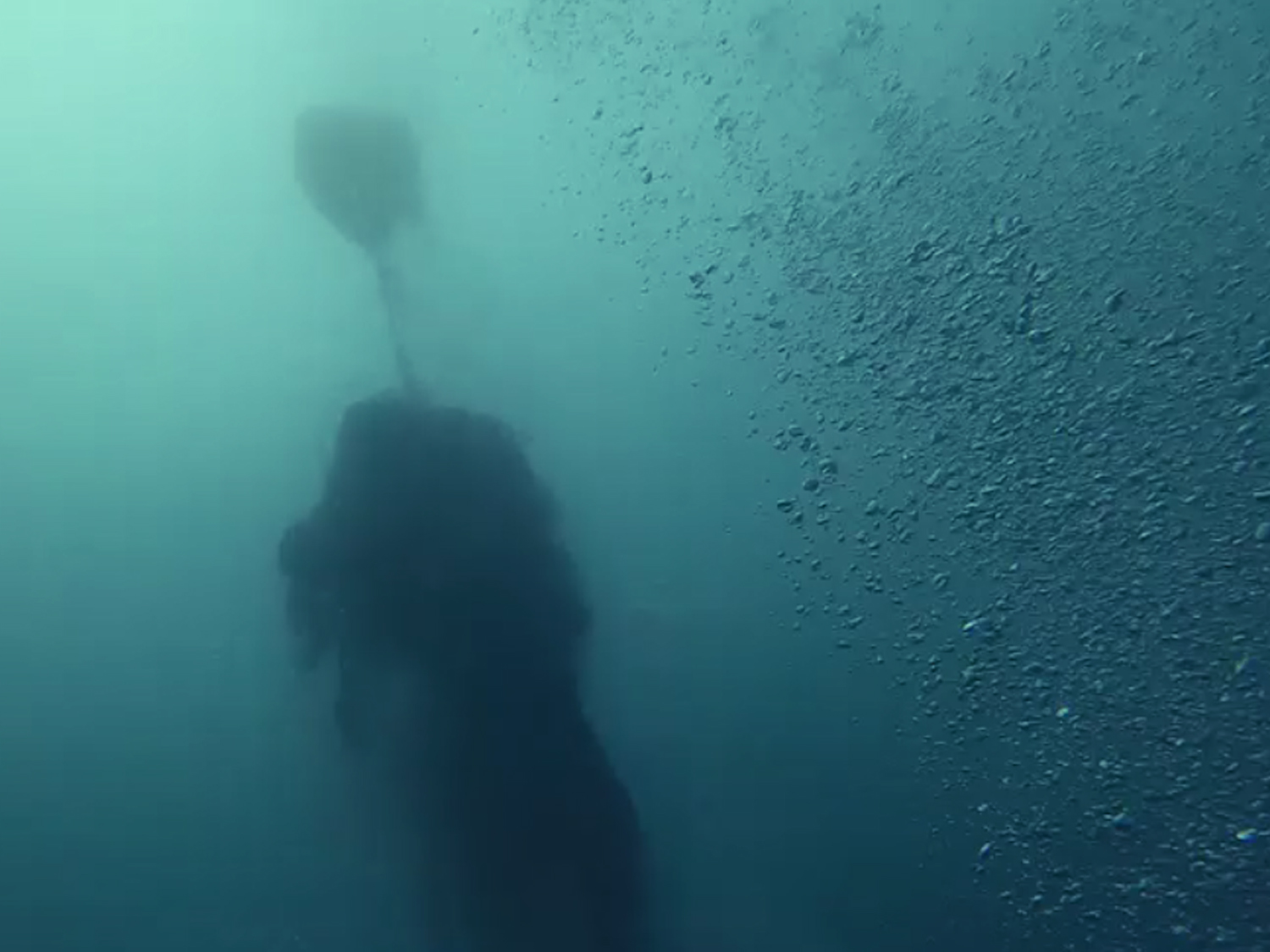
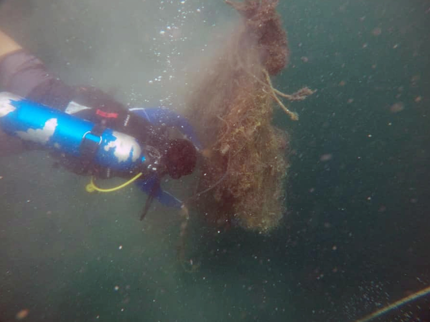
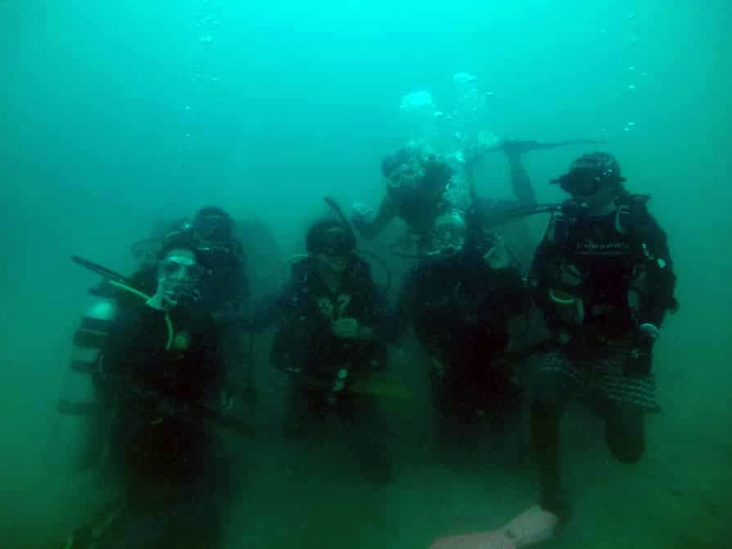
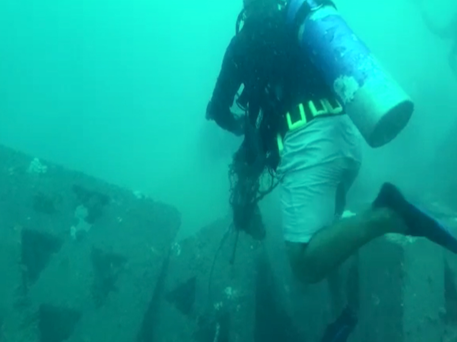
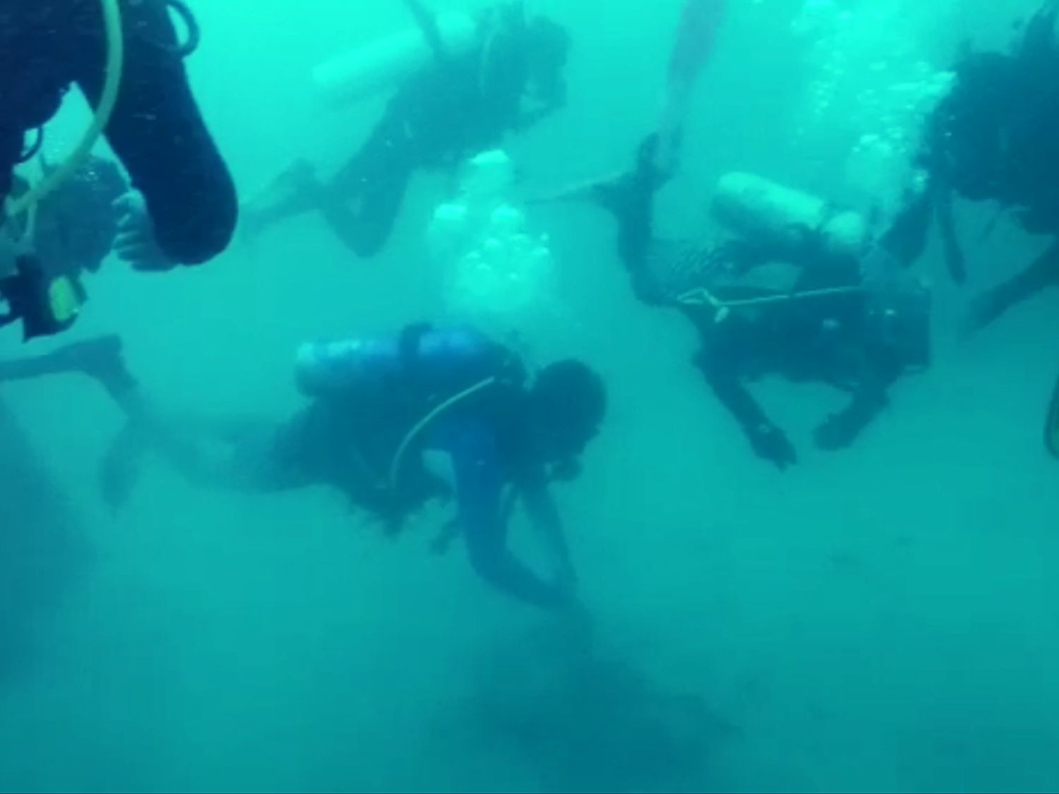
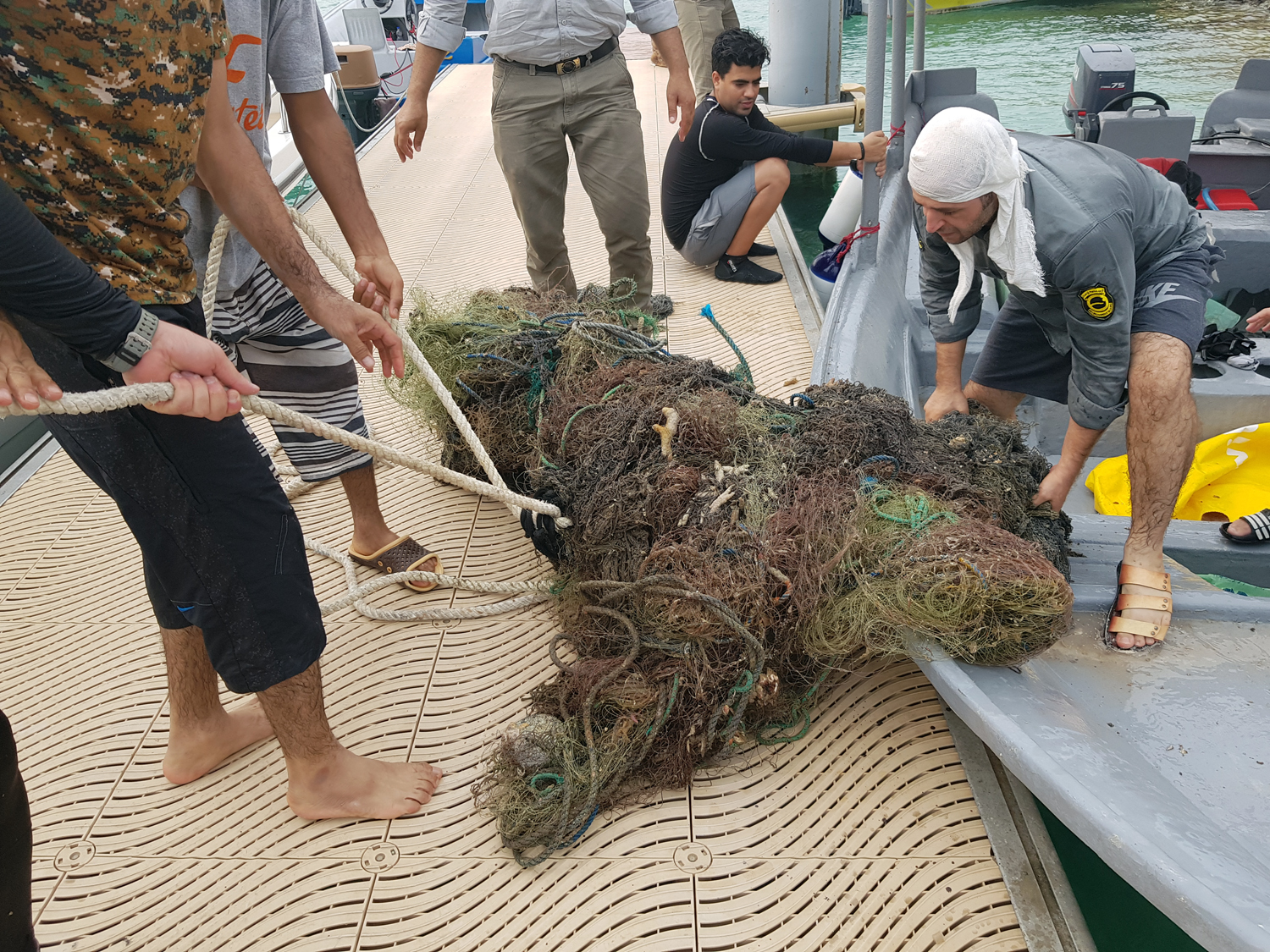
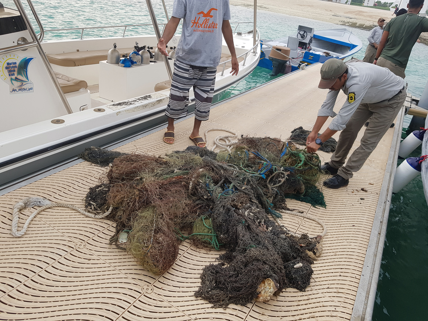
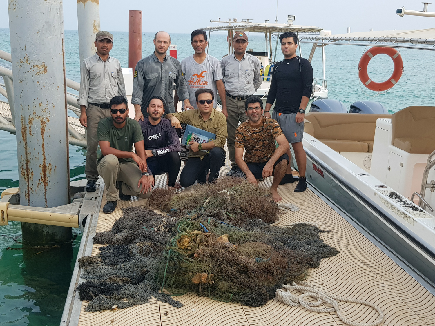
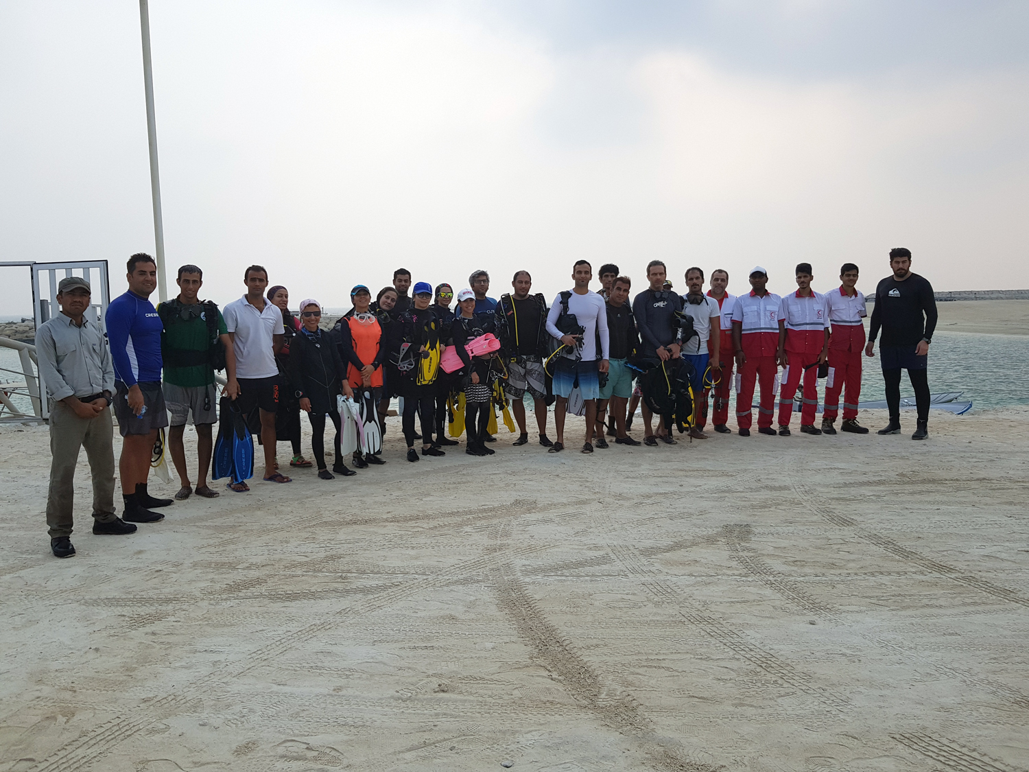
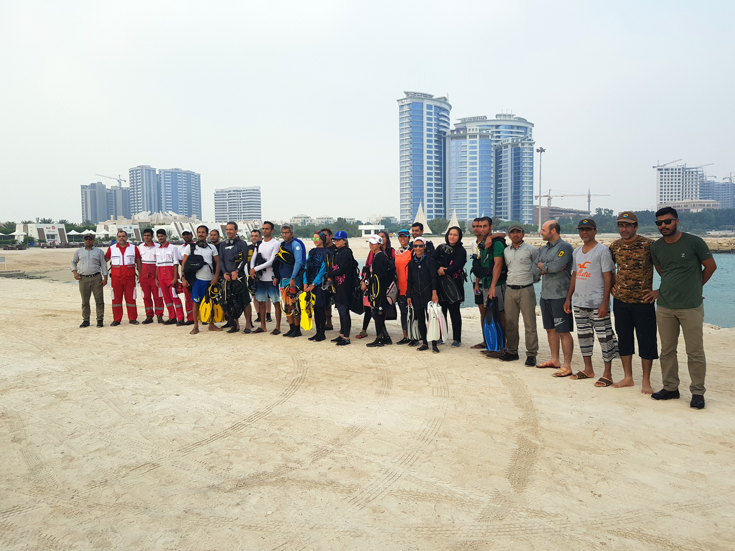
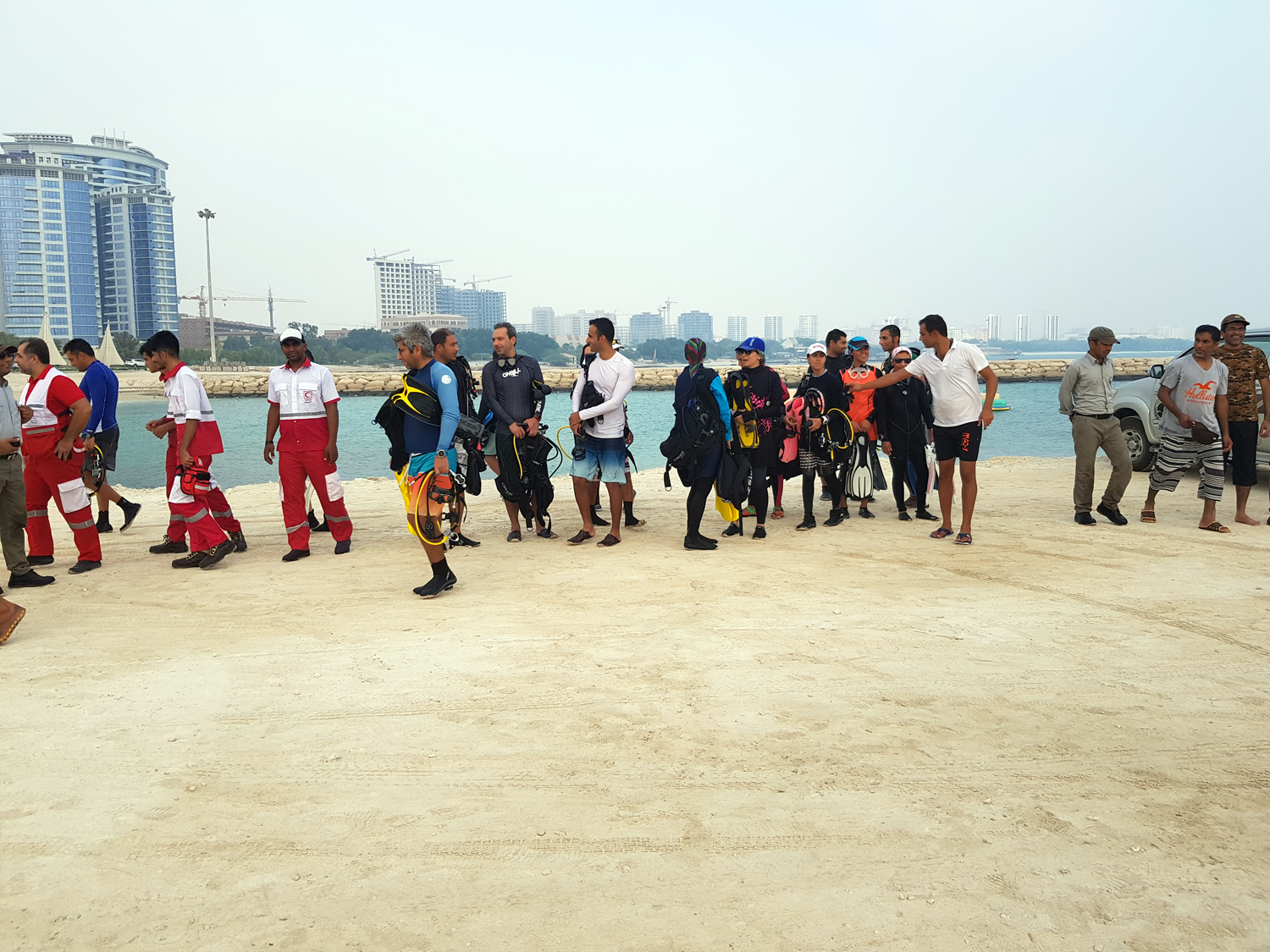
Scuba divers have cleaned debris from underwater environments for decades. But despite our best efforts, the trash from our daily lives keeps piling up ,, we hope to have better environment under the sea and save our planet ,, abandoned Fishing net in the ocean is one of the most important factor injures marine life and damages critical habitats ,, Divers volunteers cleaned up the sazeh dive site on the beautiful kish island ,, On 3 october 2019 program in partnership with various groups to clean up the sea began at the beginning of marina kish club to meet the goals and methods principles of the program held then 18 divers in 4 team with five boats to the sazeh dive site and within 40 minutes scuba diving site to clean marine debris ,, Participants in this plan are include of: 1- Department of Environment kish island 2- Kish Rescue Organization 3-Marina kish club 4 - kish seashell club ,, Divers participants: Saeid parvin - Ali Mousavi - Amir arkan Far - Mohammad Reza Saleh Hosseini - Hamid shomali - Vahid Rajabi -Nima Noshirvani - Shahab Abbasi - Davod Saeedi - Hamed Tahmtani -Mehran Absalan - Mona Panahi - Hananeh Ghaffari -Marjan Saeedi - Bahar shahr Abadi - Elnaz Rafat Talebi - Raha Kermani - Samin Gheys ,, Support team: Mehrdad Pezhhan- Mehdi Ahmadi - Seyed Ali Jebeli - Hamed Mehrabi - Soheil Sardari - Hekmat kargosha - Mohammad Heydarpour - Arjang Pouyan - Ayub Nekoui - Mohammad Hondurabi Zadeh -Mohsen Esmaili- Armin Mohammad Pour - Hamed Mohammadi ,, Special thanks to collaboration: Maryam Mohamadi - Alireza Romandeh - Meysam Rezai

Marina Kish
Saeid Parvin - Ali Mousavi
18
135.00
40
19.00
17.00
10
measured
1200.00
On
kilograms
I have debris data to report
Calm (glassy to rippled) for waves 0 – 0.1 meter high m2
meters
other
Iran
City
Kish Island
Map Help


Dive Location

If you know your survey site coordinates, enter them manually in decimal degrees using WGS84 Map Datum. Use the minus sign for latitudes south of the equator and longitudes west of the Prime Meridian to 180 degrees.

If you do not know your survey site coordinates, click the “Map Location” tab to use the map to zoom into your survey site and drop the pin on the map to fall within your survey dive site in the water (not on land or the beach). Ensure you zoom in as much as possible to ensure data accuracy.

Entangled Help


Use the vertical tabs below to record any entangled animals you found of each type.

Ecosystem Other
Artificial reefs

Twins

6

10.120891, 99.81063

1
sand
4

15.870032, 100.992541

Backpack
Sunny
Roctopus Dive
Piers Baillie
3
1
1
6.00
53
13.20
9.10
estimated
1250.00
On
kilograms
I have debris data to report
Smooth (wavelets) for waves 0.1 - 0.5 meter high
Released Unharmed
Cardinal Fish
3
Plastic Bag
1
m2
1
Backpack
Flatworm
Released Unharmed
meters
rocky reef
1
1
Thailand
State\Province
Surrat Thani
City
Koh Tao
Map Help


Dive Location

If you know your survey site coordinates, enter them manually in decimal degrees using WGS84 Map Datum. Use the minus sign for latitudes south of the equator and longitudes west of the Prime Meridian to 180 degrees.

If you do not know your survey site coordinates, click the “Map Location” tab to use the map to zoom into your survey site and drop the pin on the map to fall within your survey dive site in the water (not on land or the beach). Ensure you zoom in as much as possible to ensure data accuracy.

Entangled Help


Use the vertical tabs below to record any entangled animals you found of each type.

ADS529 - Manafaru House Reef

6.9990277777778, 72.943777777778

2
sand
5

6.9959714, 72.9408891

Best Dives Maldives
Imke
3
5
3
3
1
1
32.00
46
7.00
2.00
6
measured
1
50.00
1
1
On
kilograms
I have debris data to report
3
Calm (glassy to rippled) for waves 0 – 0.1 meter high
2
3
10
7
m2
15
2
meters
coral reef
12
2
2
2
4
7
Maldives
State\Province
Haa Alif Atoll
City
Manafaru
Map Help


Dive Location

If you know your survey site coordinates, enter them manually in decimal degrees using WGS84 Map Datum. Use the minus sign for latitudes south of the equator and longitudes west of the Prime Meridian to 180 degrees.

If you do not know your survey site coordinates, click the “Map Location” tab to use the map to zoom into your survey site and drop the pin on the map to fall within your survey dive site in the water (not on land or the beach). Ensure you zoom in as much as possible to ensure data accuracy.

Entangled Help


Use the vertical tabs below to record any entangled animals you found of each type.

POLIMDO HOUSE REEF

14
4
sand
9

1.4519104334082, 124.7498058235

Fine weather, little rain, calm surface
POLITEKNIK NEGERI MANADO
FRANS RATTU
1
15
17
151
19
25.00
45
12.00
2.00
estimated
1000.00
Plastic wraps
On
kilograms
I have debris data to report
2
Calm (glassy to rippled) for waves 0 – 0.1 meter high
12
m2
meters
coral reef
2
Indonesia
State\Province
SULAWESI UTARA
City
MINAHASA
Map Help


Dive Location

If you know your survey site coordinates, enter them manually in decimal degrees using WGS84 Map Datum. Use the minus sign for latitudes south of the equator and longitudes west of the Prime Meridian to 180 degrees.

If you do not know your survey site coordinates, click the “Map Location” tab to use the map to zoom into your survey site and drop the pin on the map to fall within your survey dive site in the water (not on land or the beach). Ensure you zoom in as much as possible to ensure data accuracy.

Entangled Help


Use the vertical tabs below to record any entangled animals you found of each type.

ADS329 - Kokkari

4
sand
3

37.778868771909, 26.886765191784

5
deck chairs
Kokkari Volunteer Fire - Dive Team
Alexandros Malagaris
6
1
5
1
3
3
408.00
68
7.00
2.00
1
measured
1
1000.00
12
2
two tiers were track size
the deck chairs all were broken with sharp jagged pieces of metal sticking out
On
kilograms
I have debris data to report
12
Smooth (wavelets) for waves 0.1 - 0.5 meter high
2
m2
meters
seagrass
2
Greece
State\Province
Samos
City
Kokkari
Map Help


Dive Location

If you know your survey site coordinates, enter them manually in decimal degrees using WGS84 Map Datum. Use the minus sign for latitudes south of the equator and longitudes west of the Prime Meridian to 180 degrees.

If you do not know your survey site coordinates, click the “Map Location” tab to use the map to zoom into your survey site and drop the pin on the map to fall within your survey dive site in the water (not on land or the beach). Ensure you zoom in as much as possible to ensure data accuracy.

Entangled Help


Use the vertical tabs below to record any entangled animals you found of each type.

Amazin Thila

0
0
0

5.400514, 72.983636

0
0
0
sand
0
0
0
0
0
Calm
0
0
0
0
0
0
0
0
0
0
0
0
0
0
0
0
0
0
0
0
SCUBASPA Yang + SPOKO divers
Ahmed Javid
0
0
0
0
0
0
0
0
0
0
0
0
0
0
0
0
0
0
0
7
0
0
0
0
0
0
0
0
0
0
0
0
0
0
0.00
45
30.00
12.00
0
measured
0
0
105.10
0
0
0
0
0
0
On
kilograms
0
Our Survey Site was free of debris
0
0
0
Calm (glassy to rippled) for waves 0 – 0.1 meter high
0
0
0
0
0
0
0
m2
0
0
meters
coral reef
0
0
0
0
0
0
0
0
0
0
0
0
0
0
0
0
0
0
0
0
0
0
0
0
0
0
0
0
Maldives
State\Province
Raa Atoll
City
Huruvalhi
Map Help


Dive Location

If you know your survey site coordinates, enter them manually in decimal degrees using WGS84 Map Datum. Use the minus sign for latitudes south of the equator and longitudes west of the Prime Meridian to 180 degrees.

If you do not know your survey site coordinates, click the “Map Location” tab to use the map to zoom into your survey site and drop the pin on the map to fall within your survey dive site in the water (not on land or the beach). Ensure you zoom in as much as possible to ensure data accuracy.

Entangled Help


Use the vertical tabs below to record any entangled animals you found of each type.

Lhohi Kandu

0
0
0

5.317191, 73.471817

0
0
0
sand
0
0
0
77
0
-
-
Calm
0
0
0
0
0
0
0
0
0
0
0
0
0
0
0
0
0
0
0
0
SCUBASPA Yang + SPOKO divers
Aleksandra Jamaica Mielenczuk
0
0
0
0
0
0
0
0
0
0
0
0
0
1
0
0
0
0
0
12
0
0
0
0
0
0
0
0
0
0
0
0
0
0
1.00
47
27.00
6.00
0
measured
0
3
147.73
0
0
0
0
0
Fishing line
0
On
kilograms
0
I have debris data to report
0
0
0
Smooth (wavelets) for waves 0.1 - 0.5 meter high
0
0
0
0
0
0
0
m2
0
0
meters
coral reef
0
0
0
0
0
0
0
0
0
0
0
0
0
0
0
0
0
0
0
0
0
0
0
0
0
0
0
0
Maldives
State\Province
Lhaviyani Atoll
City
Lhohi
Map Help


Dive Location

If you know your survey site coordinates, enter them manually in decimal degrees using WGS84 Map Datum. Use the minus sign for latitudes south of the equator and longitudes west of the Prime Meridian to 180 degrees.

If you do not know your survey site coordinates, click the “Map Location” tab to use the map to zoom into your survey site and drop the pin on the map to fall within your survey dive site in the water (not on land or the beach). Ensure you zoom in as much as possible to ensure data accuracy.

Entangled Help


Use the vertical tabs below to record any entangled animals you found of each type.

Veyvah Kandu

0
0
0

5.426443, 73.35303

0
0
0
coral
0
0
0
0
0
We did see some very old fishing line, but it was already part of the reef system so we decided to leave it in place
-
-
Calm
0
0
0
0
0
0
0
0
0
0
0
0
0
0
0
0
0
0
0
0
SCUBASPA Yang + SPOKO divers
Aleksandra Jamaica Mielenczuk
0
0
0
0
0
0
0
0
0
0
0
0
0
0
0
0
0
0
0
4
0
0
0
0
0
0
0
0
0
0
0
0
0
0
0.00
38
22.00
8.00
0
measured
0
0
104.53
0
0
0
0
0
0
On
kilograms
0
Our Survey Site was free of debris
0
0
0
Smooth (wavelets) for waves 0.1 - 0.5 meter high
0
0
0
0
0
0
0
m2
0
0
meters
coral reef
0
0
0
0
0
0
0
0
0
0
0
0
0
0
0
0
0
0
0
0
0
0
0
0
0
0
0
0
Maldives
State\Province
Lhaviyani
City
Naifaru
Map Help


Dive Location

If you know your survey site coordinates, enter them manually in decimal degrees using WGS84 Map Datum. Use the minus sign for latitudes south of the equator and longitudes west of the Prime Meridian to 180 degrees.

If you do not know your survey site coordinates, click the “Map Location” tab to use the map to zoom into your survey site and drop the pin on the map to fall within your survey dive site in the water (not on land or the beach). Ensure you zoom in as much as possible to ensure data accuracy.

Entangled Help


Use the vertical tabs below to record any entangled animals you found of each type.

Lake Perris

0
0
0
0

33.861458, -117.188903

0
0
0
silt
0
1
0
0
0
Campers and vistors
Diaper
98f
Get Wet Scuba
Cindy Sieman
0
0
0
4
0
0
0
0
0
0
2
0
0
0
1
0
0
8
0
4
2
0
0
0
0
4
6
0
0
0
0
1
0
0
0
0
10.00
30
35.00
10.00
0
estimated
0
0
0
0
2068.00
0
0
0
0
0
Plastic
Bottles
Cans
1
On
pounds
0
I have debris data to report
3
0
0
Calm (glassy to rippled) for waves 0 – 0.1 meter high
0
0
0
0
2
0
0
m2
0
0
feet
other
0
0
0
0
0
6
0
0
0
0
0
0
0
0
0
0
0
4
0
0
0
0
0
0
0
0
0
0
0
United States
State\Province
California
City
Perris
Map Help


Dive Location

If you know your survey site coordinates, enter them manually in decimal degrees using WGS84 Map Datum. Use the minus sign for latitudes south of the equator and longitudes west of the Prime Meridian to 180 degrees.

If you do not know your survey site coordinates, click the “Map Location” tab to use the map to zoom into your survey site and drop the pin on the map to fall within your survey dive site in the water (not on land or the beach). Ensure you zoom in as much as possible to ensure data accuracy.

Entangled Help


Use the vertical tabs below to record any entangled animals you found of each type.

ADS88 - Dive Bus House Reef

1
10
0
1

12.088975, -68.905175

0
0
0
sand
0
1
0
2
0
Baby turtle in illegal gill net
Ok
The Dive Bus
Adam
0
0
0
1
0
0
0
0
0
0
0
0
0
0
0
0
0
0
0
2
0
0
0
0
1
0
1
0
0
0
0
1
0
0
0
0
9.00
89
22.00
10.00
1
measured
0
0
0
0
100.00
0
0
0
0
0
Gill net
0
On
pounds
0
I have debris data to report
0
0
0
Smooth (wavelets) for waves 0.1 - 0.5 meter high
0
0
0
Gill net
Injured
Blue Tang Porquline Fish Bitterly Fish
Slipper Lobster Crab
Released Unharmed
2
2
Ghost net
0
0
0
0
m2
0
0
feet
coral reef
1
0
0
0
0
0
0
0
0
0
0
0
0
0
1
0
0
0
0
0
0
0
Fishing net
Dead
Green Sea Turtle
0
0
0
0
0
0
0
0
Netherlands Antilles
State\Province
Curacao
City
Willemstad
Map Help


Dive Location

If you know your survey site coordinates, enter them manually in decimal degrees using WGS84 Map Datum. Use the minus sign for latitudes south of the equator and longitudes west of the Prime Meridian to 180 degrees.

If you do not know your survey site coordinates, click the “Map Location” tab to use the map to zoom into your survey site and drop the pin on the map to fall within your survey dive site in the water (not on land or the beach). Ensure you zoom in as much as possible to ensure data accuracy.

Entangled Help


Use the vertical tabs below to record any entangled animals you found of each type.

Subscribe to