Menu

Karacaören Amphora Wall

0
1
0
0

36.5446383669, 29.056018376199

0
0
0
rock
0
0
0
0
0
Dropped by daily boats
Choppy overnight otherwise fair
Seahorse diving centre
Mark Taylor
0
0
0
0
0
0
0
0
0
0
0
0
0
0
0
0
0
0
0
6
0
0
0
0
0
0
1
0
0
0
0
0
0
0
0
0
5.00
43
24.00
10.00
0
measured
0
0
5252.53
0
0
0
0
0
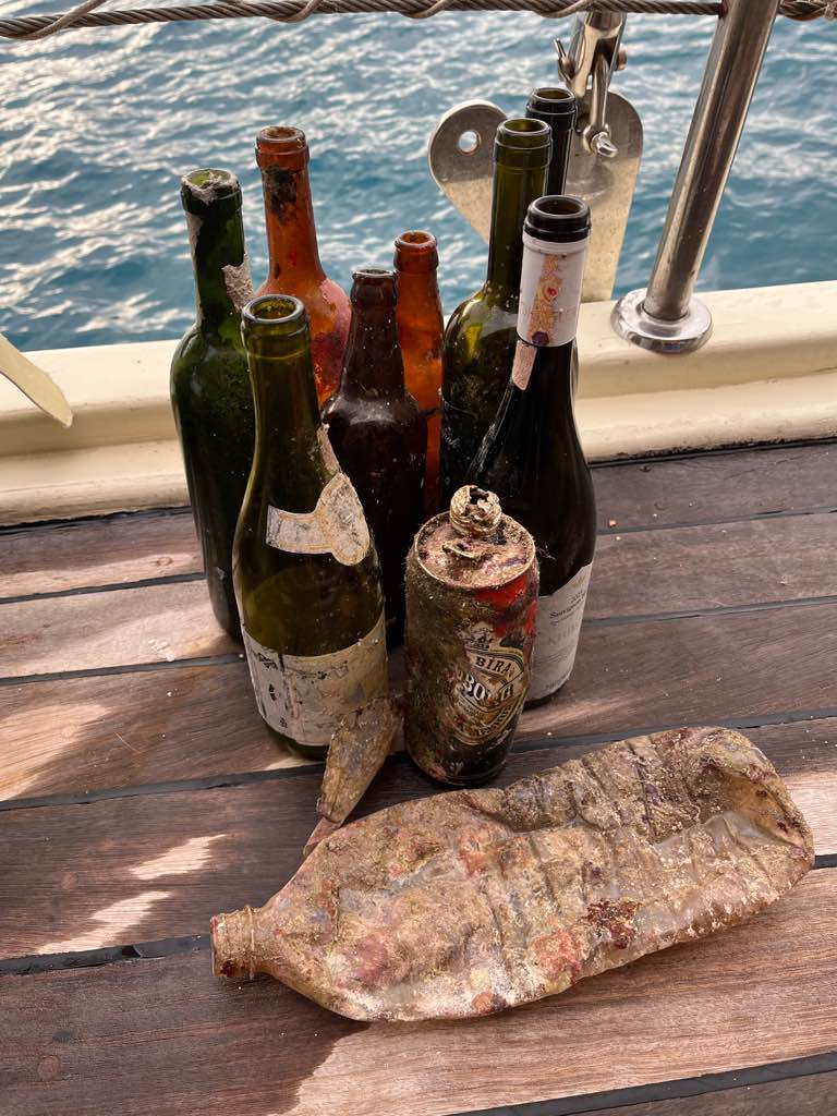
Glass
Fishing line
0
On
kilograms
0
I have debris data to report
8
0
0
Smooth (wavelets) for waves 0.1 - 0.5 meter high
0
0
0
0
0
0
0
m2
0
0
meters
rocky reef
0
0
0
0
0
1
0
0
0
0
0
0
0
0
0
0
0
1
0
0
0
0
0
0
0
0
0
0
0
Turkey
State\Province
Muğla
City
Ölüdeniz
Map Help


Dive Location

If you know your survey site coordinates, enter them manually in decimal degrees using WGS84 Map Datum. Use the minus sign for latitudes south of the equator and longitudes west of the Prime Meridian to 180 degrees.

If you do not know your survey site coordinates, click the “Map Location” tab to use the map to zoom into your survey site and drop the pin on the map to fall within your survey dive site in the water (not on land or the beach). Ensure you zoom in as much as possible to ensure data accuracy.

Entangled Help


Use the vertical tabs below to record any entangled animals you found of each type.

Karacaoren Bay

1
13
0
0

36.543168333317, 29.054066789523

1
0
0
sand
0
0
0
1
0
Dropped from yachts
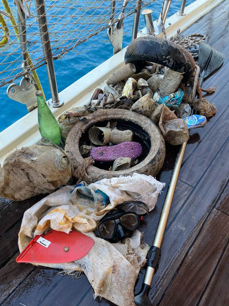
Paddleboard oar
Fair
1
Paddleboard oar
Seahorse dive centre
Matthias Konermann
0
0
0
0
0
0
0
0
2
0
0
0
2
0
0
0
0
1
0
2
0
0
0
0
0
0
11
0
0
2
0
0
0
0
0
0
9.00
45
20.00
5.00
3
measured
0
0
9575.77
0
2
0
0
0
Glass
1
On
kilograms
0
I have debris data to report
3
0
0
Smooth (wavelets) for waves 0.1 - 0.5 meter high
0
0
0
0
0
0
0
m2
0
1
meters
rocky reef
0
0
0
0
0
0
0
0
0
0
0
0
0
0
0
0
0
8
0
0
0
0
3
0
0
0
0
1
0
Turkey
State\Province
Muğla
City
Ölüdeniz
Map Help


Dive Location

If you know your survey site coordinates, enter them manually in decimal degrees using WGS84 Map Datum. Use the minus sign for latitudes south of the equator and longitudes west of the Prime Meridian to 180 degrees.

If you do not know your survey site coordinates, click the “Map Location” tab to use the map to zoom into your survey site and drop the pin on the map to fall within your survey dive site in the water (not on land or the beach). Ensure you zoom in as much as possible to ensure data accuracy.
Entangled Help


Use the vertical tabs below to record any entangled animals you found of each type.

Karacaoren Bay

1
7
0
0

36.545349922184, 29.054540690228

0
0
0
sand
0
0
0
2
0
Dropped from daily boats and yachts
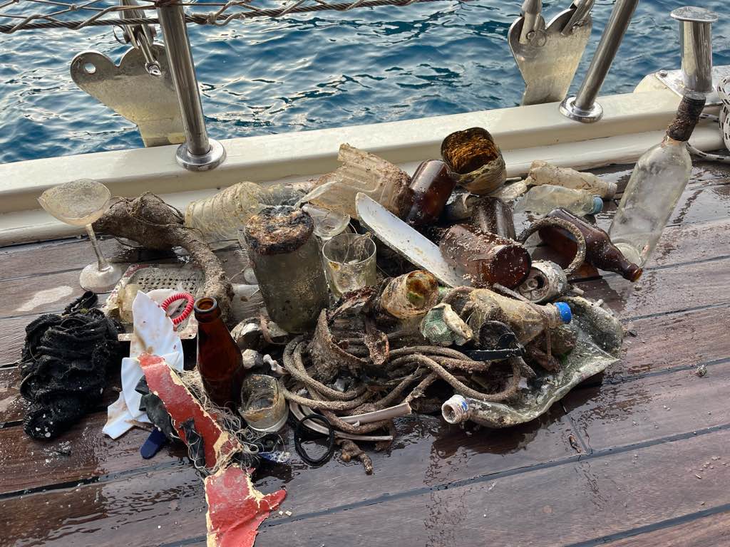
Anchor arm and fluke
Fair
1
1
Anchor arm and fluke
Sunglasses
Seahorse dive centre
Mark Taylor
0
0
0
0
2
0
0
0
0
0
0
0
0
0
0
0
0
2
0
5
0
0
0
0
0
0
9
0
0
0
0
0
0
0
0
0
13.10
47
20.00
5.00
0
measured
0
0
4209.31
0
0
0
0
0
Glass
1
On
kilograms
0
I have debris data to report
8
0
0
Smooth (wavelets) for waves 0.1 - 0.5 meter high
0
0
0
0
0
0
0
m2
2
0
meters
rocky reef
4
0
0
0
0
0
0
0
0
0
0
0
0
0
0
1
0
1
0
0
6
0
8
0
0
1
0
1
0
Turkey
State\Province
Muğla
City
Ölüdeniz
Map Help


Dive Location

If you know your survey site coordinates, enter them manually in decimal degrees using WGS84 Map Datum. Use the minus sign for latitudes south of the equator and longitudes west of the Prime Meridian to 180 degrees.

If you do not know your survey site coordinates, click the “Map Location” tab to use the map to zoom into your survey site and drop the pin on the map to fall within your survey dive site in the water (not on land or the beach). Ensure you zoom in as much as possible to ensure data accuracy.
Entangled Help


Use the vertical tabs below to record any entangled animals you found of each type.

Karacaören Island Southern slope

0
0
0
2

36.539494786912, 29.059981491121

0
0
0
rock
0
0
0
45
0
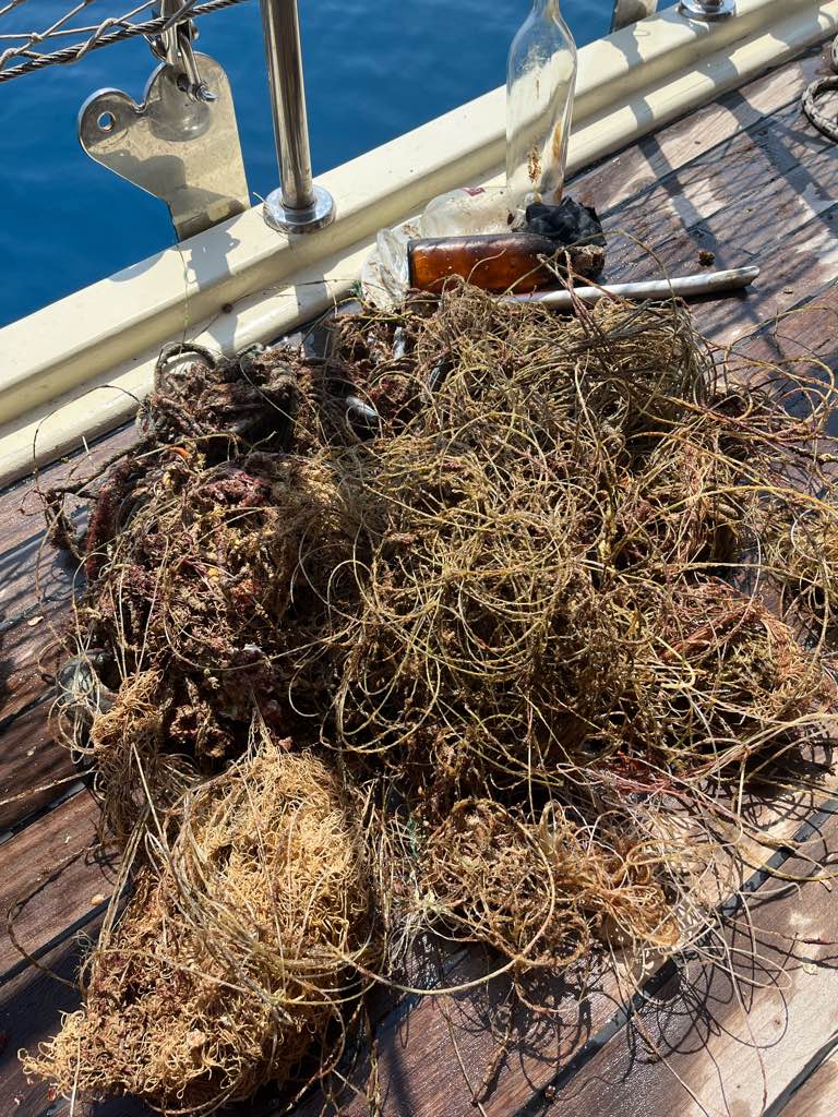
Lost by fishermen
Fair
Seahorse Dive Centre
Mehmet Avcu
0
0
0
0
0
0
0
0
0
0
0
0
0
0
0
0
0
0
0
5
0
0
0
0
0
0
0
0
3
0
0
0
0
0
0
0
10.20
60
28.00
5.00
7
measured
0
65
3426.96
0
0
0
0
0
Fishing lines
0
On
kilograms
0
I have debris data to report
2
0
0
Smooth (wavelets) for waves 0.1 - 0.5 meter high
0
0
0
0
0
0
0
m2
0
1
meters
rocky reef
0
0
1
0
0
0
0
0
0
0
0
0
0
0
0
0
0
0
0
0
2
0
0
0
0
0
0
0
0
Turkey
State\Province
Muğla
City
Ölüdeniz
Map Help


Dive Location

If you know your survey site coordinates, enter them manually in decimal degrees using WGS84 Map Datum. Use the minus sign for latitudes south of the equator and longitudes west of the Prime Meridian to 180 degrees.

If you do not know your survey site coordinates, click the “Map Location” tab to use the map to zoom into your survey site and drop the pin on the map to fall within your survey dive site in the water (not on land or the beach). Ensure you zoom in as much as possible to ensure data accuracy.
Entangled Help


Use the vertical tabs below to record any entangled animals you found of each type.

Turunc Pinari Wall

0
0
0
0

36.618289466984, 29.047587743495

0
0
0
rock
0
0
0
0
0
Lost by yachts
Fair
3
2
Anchor
Anchor chain
Seahorse Dive Centre
Mehmet Avcu
0
0
0
0
0
0
0
0
0
0
0
0
0
0
0
0
0
0
0
3
0
0
0
0
0
0
0
0
0
0
0
0
0
0
0
0
200.00
40
35.00
5.00
0
estimated
0
0
9215.48
0
0
0
0
0
Fishing line
Glass
0
On
kilograms
0
I have debris data to report
0
0
0
Smooth (wavelets) for waves 0.1 - 0.5 meter high
0
0
0
0
0
0
0
m2
0
0
meters
rocky reef
0
0
0
0
0
0
0
0
0
0
0
0
0
0
0
0
0
0
0
0
0
0
0
0
0
0
0
0
0
Turkey
State\Province
Muğla
City
Fethiye
Map Help


Dive Location

If you know your survey site coordinates, enter them manually in decimal degrees using WGS84 Map Datum. Use the minus sign for latitudes south of the equator and longitudes west of the Prime Meridian to 180 degrees.

If you do not know your survey site coordinates, click the “Map Location” tab to use the map to zoom into your survey site and drop the pin on the map to fall within your survey dive site in the water (not on land or the beach). Ensure you zoom in as much as possible to ensure data accuracy.
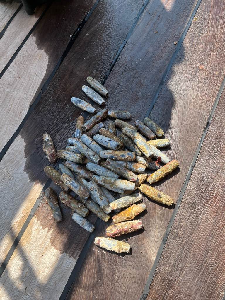
Entangled Help


Use the vertical tabs below to record any entangled animals you found of each type.

Turunc Pinari Wall

3
1
rock

36.619450918871, 29.046671968075

Dropped from daily boats and lost by fishermen.
Fair weather
Seahorse Dive Centre
Mark Taylor
1
1
3
1
37
21.60
42
18.60
5.00
3
measured
3
1400.00
Fishing line
Glass
On
kilograms
I have debris data to report
6
Calm (glassy to rippled) for waves 0 – 0.1 meter high
2
m2
1
3
meters
rocky reef
2
11
1
6
Turkey
State\Province
Muğla
City
Fethiye
Map Help


Dive Location

If you know your survey site coordinates, enter them manually in decimal degrees using WGS84 Map Datum. Use the minus sign for latitudes south of the equator and longitudes west of the Prime Meridian to 180 degrees.

If you do not know your survey site coordinates, click the “Map Location” tab to use the map to zoom into your survey site and drop the pin on the map to fall within your survey dive site in the water (not on land or the beach). Ensure you zoom in as much as possible to ensure data accuracy.
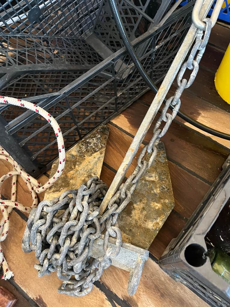
Entangled Help


Use the vertical tabs below to record any entangled animals you found of each type.

Shallow Wonder

1

-6.2982, 39.5475

coral
9
windy , wavy
Ocean Wonder Dive Center
Nadine Ostermann
1
3
6.00
42
8.00
4.00
10
estimated
500.00
Fishernet with very small tiny holes , it covers a big coral complety , was stuck, 4m x 4m
a big sack covert another coral , was stuck
On
kilograms
I have debris data to report
Calm (glassy to rippled) for waves 0 – 0.1 meter high m2
meters
coral reef
Tanzania
State\Province
Zanzibar
City
Unguja , Jambiani
Map Help


Dive Location

If you know your survey site coordinates, enter them manually in decimal degrees using WGS84 Map Datum. Use the minus sign for latitudes south of the equator and longitudes west of the Prime Meridian to 180 degrees.

If you do not know your survey site coordinates, click the “Map Location” tab to use the map to zoom into your survey site and drop the pin on the map to fall within your survey dive site in the water (not on land or the beach). Ensure you zoom in as much as possible to ensure data accuracy.
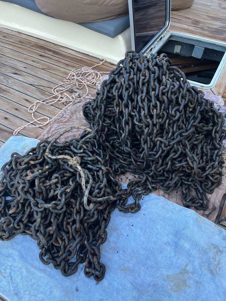
Entangled Help


Use the vertical tabs below to record any entangled animals you found of each type.

Jambiani Lagoon

3

-6.315, 39.56

coral
20

-6.3071514626924, 39.557708040345

windy , wavs medium to big
Ocean Wonder Dive Center
Nadine Ostermann
1
1
4
1
8.00
72
15.00
5.00
80
estimated
2
2500.00
On
kilograms
I have debris data to report
1
Calm (glassy to rippled) for waves 0 – 0.1 meter high
1
m2
1
1
2
Fishernet
Starfish
Released Unharmed
meters
coral reef
1
Tanzania
State\Province
Zanzibar
City
Unguja , Jambiani
Map Help


Dive Location

If you know your survey site coordinates, enter them manually in decimal degrees using WGS84 Map Datum. Use the minus sign for latitudes south of the equator and longitudes west of the Prime Meridian to 180 degrees.

If you do not know your survey site coordinates, click the “Map Location” tab to use the map to zoom into your survey site and drop the pin on the map to fall within your survey dive site in the water (not on land or the beach). Ensure you zoom in as much as possible to ensure data accuracy.
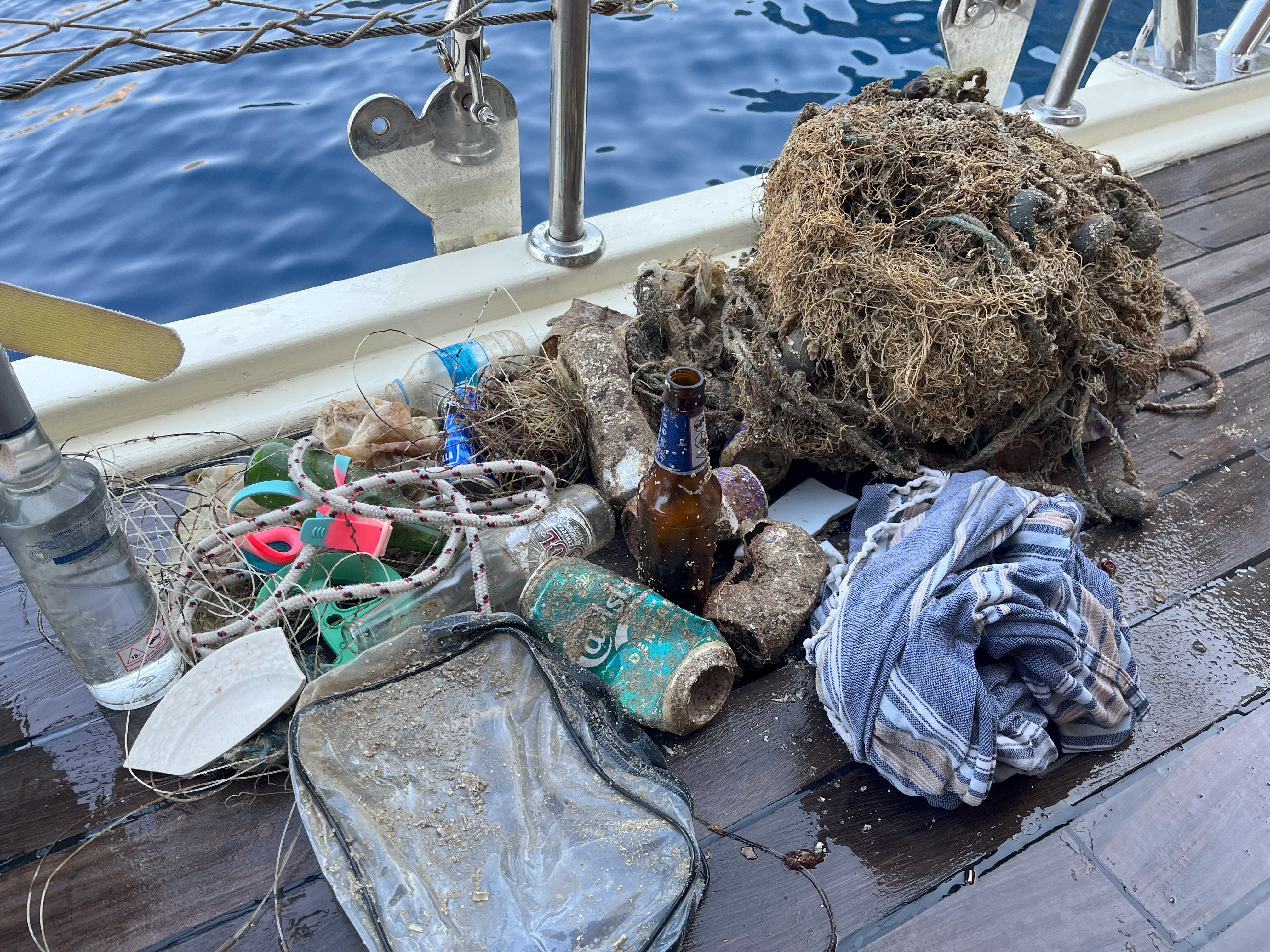
Entangled Help


Use the vertical tabs below to record any entangled animals you found of each type.

Ka Osting

8
sand

11.347267608876, 124.11764099961

Calm
1
1
Chipped Paint
Plastic toy car
TSD Malapascua
Linda
3
1
1
2
2.00
40
14.00
11.00
1
estimated
300.00
On
kilograms
I have debris data to report
Slight for waves 0.5 -1.25 meter high m2
meters
seagrass
Philippines
State\Province
Daanbantayan
City
Malapascua
Map Help


Dive Location

If you know your survey site coordinates, enter them manually in decimal degrees using WGS84 Map Datum. Use the minus sign for latitudes south of the equator and longitudes west of the Prime Meridian to 180 degrees.

If you do not know your survey site coordinates, click the “Map Location” tab to use the map to zoom into your survey site and drop the pin on the map to fall within your survey dive site in the water (not on land or the beach). Ensure you zoom in as much as possible to ensure data accuracy.

Entangled Help


Use the vertical tabs below to record any entangled animals you found of each type.

Deep quarry Kunnam

12.083191990251, 79.684143174487

silt
METAL WIRES
CALM
TEMPLE aDVENTURES
Shaveer Patel
2
6
1.00
21
9.00
6.00
estimated
30.00
On
kilograms
I have debris data to report
Calm (glassy to rippled) for waves 0 – 0.1 meter high
20
m2
meters
rocky reef
4
India
State\Province
PONDICHERRY
City
PONDICHERRY
Map Help


Dive Location

If you know your survey site coordinates, enter them manually in decimal degrees using WGS84 Map Datum. Use the minus sign for latitudes south of the equator and longitudes west of the Prime Meridian to 180 degrees.

If you do not know your survey site coordinates, click the “Map Location” tab to use the map to zoom into your survey site and drop the pin on the map to fall within your survey dive site in the water (not on land or the beach). Ensure you zoom in as much as possible to ensure data accuracy.

Entangled Help


Use the vertical tabs below to record any entangled animals you found of each type.

Subscribe to