Menu

Island Bay

2
rock
1

-41.344740999031, 174.77576578036

Windy and Raining
New Zealand Sea Adventures
Peter
1
3
0.10
33
10.00
3.00
estimated
1500.00
On
kilograms
I have debris data to report
Calm (glassy to rippled) for waves 0 – 0.1 meter high m2
meters
rocky reef
New Zealand
City
Wellington
Map Help


Dive Location

If you know your survey site coordinates, enter them manually in decimal degrees using WGS84 Map Datum. Use the minus sign for latitudes south of the equator and longitudes west of the Prime Meridian to 180 degrees.

If you do not know your survey site coordinates, click the “Map Location” tab to use the map to zoom into your survey site and drop the pin on the map to fall within your survey dive site in the water (not on land or the beach). Ensure you zoom in as much as possible to ensure data accuracy.

Entangled Help


Use the vertical tabs below to record any entangled animals you found of each type.

Laplight

175
1
coral
1

11.345172977959, 124.10864803711

Local storm that led to big waves and a lot of wind
Pair of underwear
Windy, rough waves
Thresher Shark Divers
Linda Weinländer
1
1
5
6
8.00
50
10.00
4.00
8
measured
400.00
1
1
1
Ropes
Thin plastic bags
On
kilograms
I have debris data to report
3
Calm (glassy to rippled) for waves 0 – 0.1 meter high
Food wrapper
Shrimp
Dead
1
7
m2
meters
rocky reef
2
1
Philippines
State\Province
Daanbantayan
City
Malapascua
Map Help


Dive Location

If you know your survey site coordinates, enter them manually in decimal degrees using WGS84 Map Datum. Use the minus sign for latitudes south of the equator and longitudes west of the Prime Meridian to 180 degrees.

If you do not know your survey site coordinates, click the “Map Location” tab to use the map to zoom into your survey site and drop the pin on the map to fall within your survey dive site in the water (not on land or the beach). Ensure you zoom in as much as possible to ensure data accuracy.

Entangled Help


Use the vertical tabs below to record any entangled animals you found of each type.

370761 Point Panic

2
3
2
4
rock
47
2

21.290811887197, -157.86031941841

Still waiting for Fancy Jack to come visit......
Windy and rainy
2
1
1
2
1
1
1
1
Bouys
Floor matting
Plastic Pitcher
Surf Leash
Scrub Brush
Coax Cable
Surfboard Fin
Butane Refill
Nudi Wear
Christy Johnson
2
1
2
2
18
1
5
1
1
1
192.00
50
24.00
4.00
1
measured
98
400.00
1
1
On
pounds
I have debris data to report
83
Smooth (wavelets) for waves 0.1 - 0.5 meter high
2
1
ft2
7
1
feet
rocky reef
3
1
1
1
1
1
1
2
7
United States
State\Province
HI
City
Honolulu
Map Help


Dive Location

If you know your survey site coordinates, enter them manually in decimal degrees using WGS84 Map Datum. Use the minus sign for latitudes south of the equator and longitudes west of the Prime Meridian to 180 degrees.

If you do not know your survey site coordinates, click the “Map Location” tab to use the map to zoom into your survey site and drop the pin on the map to fall within your survey dive site in the water (not on land or the beach). Ensure you zoom in as much as possible to ensure data accuracy.

Entangled Help


Use the vertical tabs below to record any entangled animals you found of each type.

Marmora Scuba Park

44.484719842548, -77.686723820389

rock

44.484719842548, -77.686723820389

Rain
Shotgun shell
Dive Kawartha
Kris Reynolds
1
4
0.10
71
36.00
15.00
estimated
1000.00
On
pounds
I have debris data to report
Slight for waves 0.5 -1.25 meter high ft2
feet
other
Canada
State\Province
Ontario
City
Lindsay
Map Help


Dive Location

If you know your survey site coordinates, enter them manually in decimal degrees using WGS84 Map Datum. Use the minus sign for latitudes south of the equator and longitudes west of the Prime Meridian to 180 degrees.

If you do not know your survey site coordinates, click the “Map Location” tab to use the map to zoom into your survey site and drop the pin on the map to fall within your survey dive site in the water (not on land or the beach). Ensure you zoom in as much as possible to ensure data accuracy.

Entangled Help


Use the vertical tabs below to record any entangled animals you found of each type.

Ecosystem Other
River bedrock

La Perouse

1
6
2
silt
2
4

-33.990590871763, 151.2316185236

overall a pretty clean site although the vis was not great and a lot of silt so there is probably a lot more debris to be found
Ceramic Ginger Beer bottle from 1914
Fine and sunny
1
Anchor
Dan Byrnes
2
1
2
1
2
2.00
50
10.00
4.00
1
measured
6
3163.00
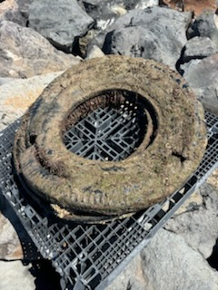
rubber tyres
On
kilograms
I have debris data to report
1
Calm (glassy to rippled) for waves 0 – 0.1 meter high m2
meters
rocky reef
1
Australia
Map Help


Dive Location

If you know your survey site coordinates, enter them manually in decimal degrees using WGS84 Map Datum. Use the minus sign for latitudes south of the equator and longitudes west of the Prime Meridian to 180 degrees.

If you do not know your survey site coordinates, click the “Map Location” tab to use the map to zoom into your survey site and drop the pin on the map to fall within your survey dive site in the water (not on land or the beach). Ensure you zoom in as much as possible to ensure data accuracy.

Entangled Help


Use the vertical tabs below to record any entangled animals you found of each type.

El Saltito

1

24.2544653, -110.1512335

rock

24.2544653, -110.1512335

No
Entangled under net, decomposing.
Entangled under net. It was decomposing for a while, the face was gone, the jaw bone was visible. Baby sergeant majors and other fish were using it as protection.
Chrissy Cappellano
6
60.00
54
9.10
0.00
estimated
5.00
Fishing net
On
pounds
I have debris data to report
Calm (glassy to rippled) for waves 0 – 0.1 meter high
Fishing net
1
Dead
California sea lion
m2
meters
rocky reef
1
Entangled in fishing net
Dead
Unknown
Mexico
State\Province
BCS
City
La Paz
Map Help


Dive Location

If you know your survey site coordinates, enter them manually in decimal degrees using WGS84 Map Datum. Use the minus sign for latitudes south of the equator and longitudes west of the Prime Meridian to 180 degrees.

If you do not know your survey site coordinates, click the “Map Location” tab to use the map to zoom into your survey site and drop the pin on the map to fall within your survey dive site in the water (not on land or the beach). Ensure you zoom in as much as possible to ensure data accuracy.

Entangled Help


Use the vertical tabs below to record any entangled animals you found of each type.

Bergse Diepsluis

0
0
0
0

51.516435, 4.172453

0
0
0
sand
0
0
0
0
0
It was really nice
No
None
A piece of paper
Good
Divexpress
0
0
0
0
0
0
0
0
0
0
0
0
0
0
0
0
0
0
0
12
0
0
0
0
0
0
0
0
0
0
0
0
0
0
0
0
0.00
50
10.00
3.00
0
estimated
0
0
0
0
680.00
0
0
0
0
0
None
0
On
pounds
0
Our Survey Site was free of debris
0
0
0
Calm (glassy to rippled) for waves 0 – 0.1 meter high
0
0
0
0
0
0
0
m2
0
0
meters
rocky reef
0
0
0
0
0
0
0
0
0
0
0
0
0
0
0
0
0
0
0
0
0
0
0
0
0
0
0
0
0
Netherlands
City
Tholen
Map Help


Dive Location

If you know your survey site coordinates, enter them manually in decimal degrees using WGS84 Map Datum. Use the minus sign for latitudes south of the equator and longitudes west of the Prime Meridian to 180 degrees.

If you do not know your survey site coordinates, click the “Map Location” tab to use the map to zoom into your survey site and drop the pin on the map to fall within your survey dive site in the water (not on land or the beach). Ensure you zoom in as much as possible to ensure data accuracy.

Entangled Help


Use the vertical tabs below to record any entangled animals you found of each type.

Kawaihae Surf Park

0
9
0
0

20.030327, -155.83027

0
0
0
other
0
0
0
150
0
Hurricane Hone
Vape
Hurricane Hone
1
Vape
Kohala Divers
Kay Cooper
0
0
0
0
0
0
0
0
0
0
0
0
0
0
0
0
0
1
0
3
0
0
0
0
0
0
0
0
1
0
0
0
4
0
0
0
10.00
63
15.00
5.00
0
estimated
0
0
0
3
89826.70
0
0
0
0
0
Fishing line
Aluminum cans
Plastic fragments
1
On
pounds
0
I have debris data to report
2
0
0
Calm (glassy to rippled) for waves 0 – 0.1 meter high
1
0
0
0
0
0
0
ft2
0
0
feet
coral reef
1
0
0
0
0
2
0
1
0
0
0
0
0
0
0
0
0
4
0
0
0
0
0
0
0
0
0
0
0
United States
State\Province
Hawaii
City
Kawaihae
Map Help


Dive Location

If you know your survey site coordinates, enter them manually in decimal degrees using WGS84 Map Datum. Use the minus sign for latitudes south of the equator and longitudes west of the Prime Meridian to 180 degrees.

If you do not know your survey site coordinates, click the “Map Location” tab to use the map to zoom into your survey site and drop the pin on the map to fall within your survey dive site in the water (not on land or the beach). Ensure you zoom in as much as possible to ensure data accuracy.

Entangled Help


Use the vertical tabs below to record any entangled animals you found of each type.

Dominant Substrate Other
Rubble

Parson's Landing

rock

33.474053938668, -118.54997489471

Bleu World
Kayla Feairheller
5
0.50
52
27.00
10.00
estimated
18362.00
On
pounds
I have debris data to report
Calm (glassy to rippled) for waves 0 – 0.1 meter high ft2
feet
kelp
1
United States
State\Province
California
City
Avalon
Map Help


Dive Location

If you know your survey site coordinates, enter them manually in decimal degrees using WGS84 Map Datum. Use the minus sign for latitudes south of the equator and longitudes west of the Prime Meridian to 180 degrees.

If you do not know your survey site coordinates, click the “Map Location” tab to use the map to zoom into your survey site and drop the pin on the map to fall within your survey dive site in the water (not on land or the beach). Ensure you zoom in as much as possible to ensure data accuracy.

Entangled Help


Use the vertical tabs below to record any entangled animals you found of each type.

West Quarry

33.4425, -118.471

rock
Bleu World
Kayla Feairheller
5
0.00
50
40.00
10.00
measured
1565.00
On
kilograms
Our Survey Site was free of debris
Calm (glassy to rippled) for waves 0 – 0.1 meter high ft2
feet
kelp
United States
State\Province
California
City
Avalon
Map Help


Dive Location

If you know your survey site coordinates, enter them manually in decimal degrees using WGS84 Map Datum. Use the minus sign for latitudes south of the equator and longitudes west of the Prime Meridian to 180 degrees.

If you do not know your survey site coordinates, click the “Map Location” tab to use the map to zoom into your survey site and drop the pin on the map to fall within your survey dive site in the water (not on land or the beach). Ensure you zoom in as much as possible to ensure data accuracy.

Entangled Help


Use the vertical tabs below to record any entangled animals you found of each type.

Subscribe to