Menu

ADS541 - Middle Reef

30
3
1

-8.1420095827232, 114.65578438045

sand
15
3
1

-8.1420095827232, 114.65578438045

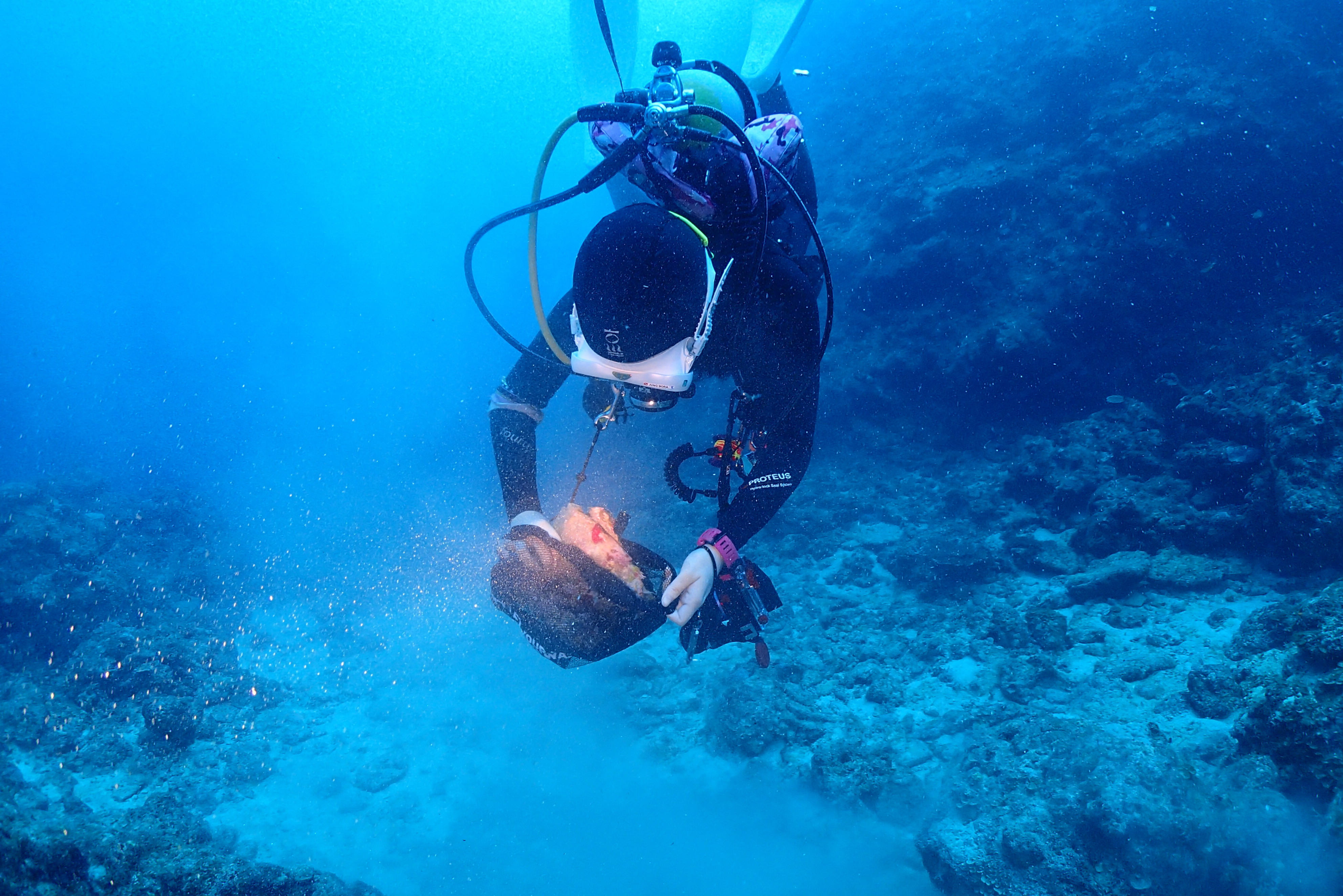
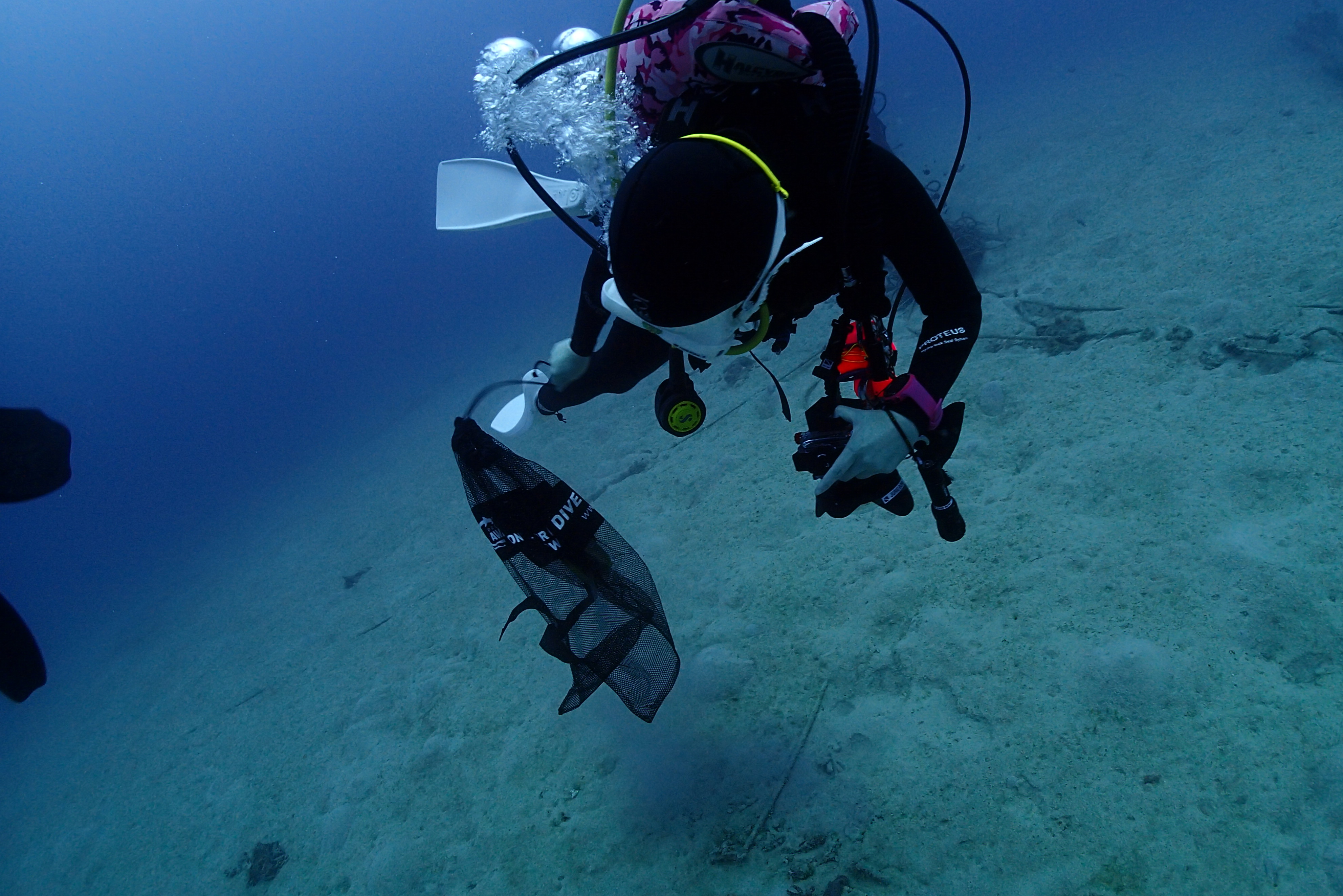
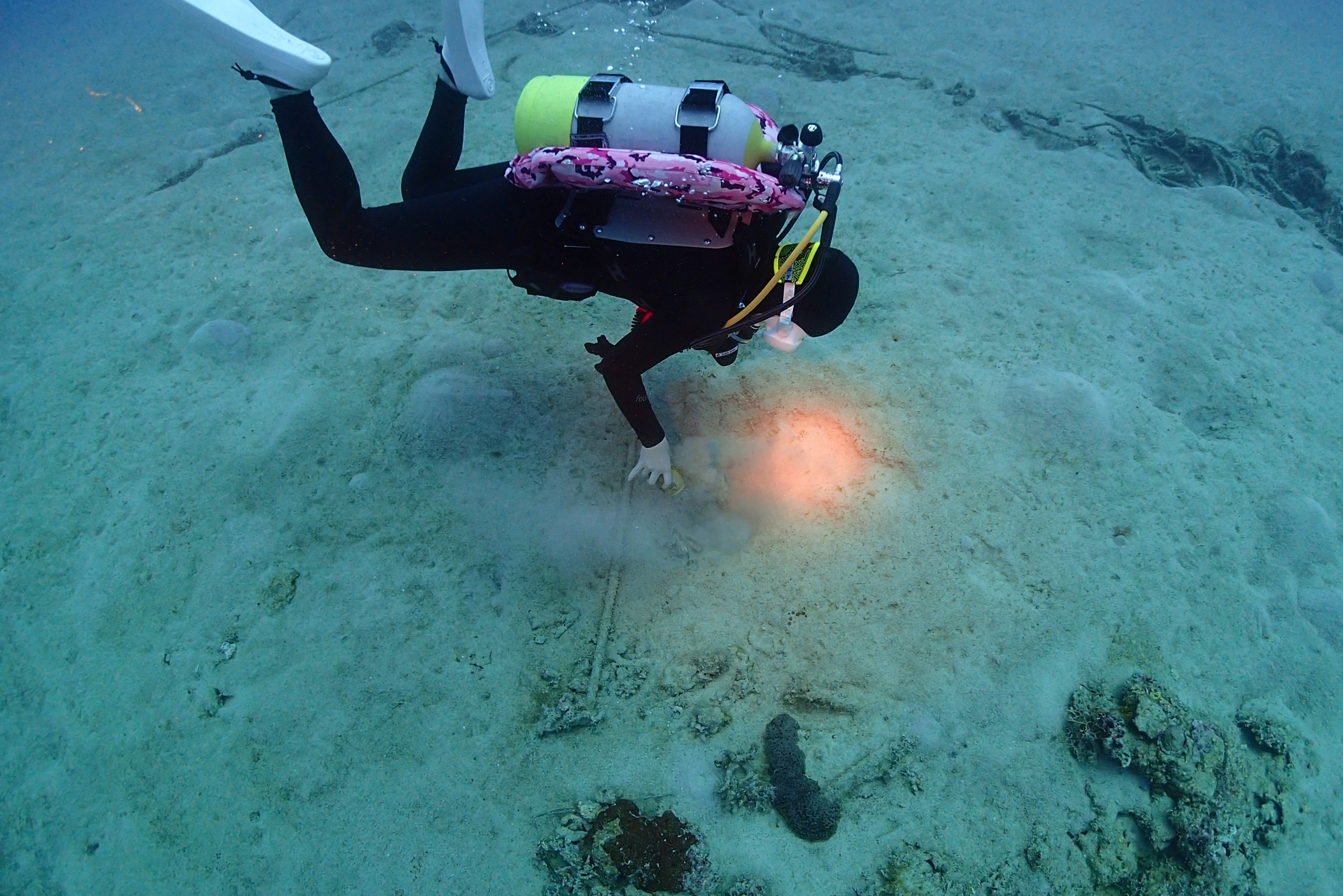
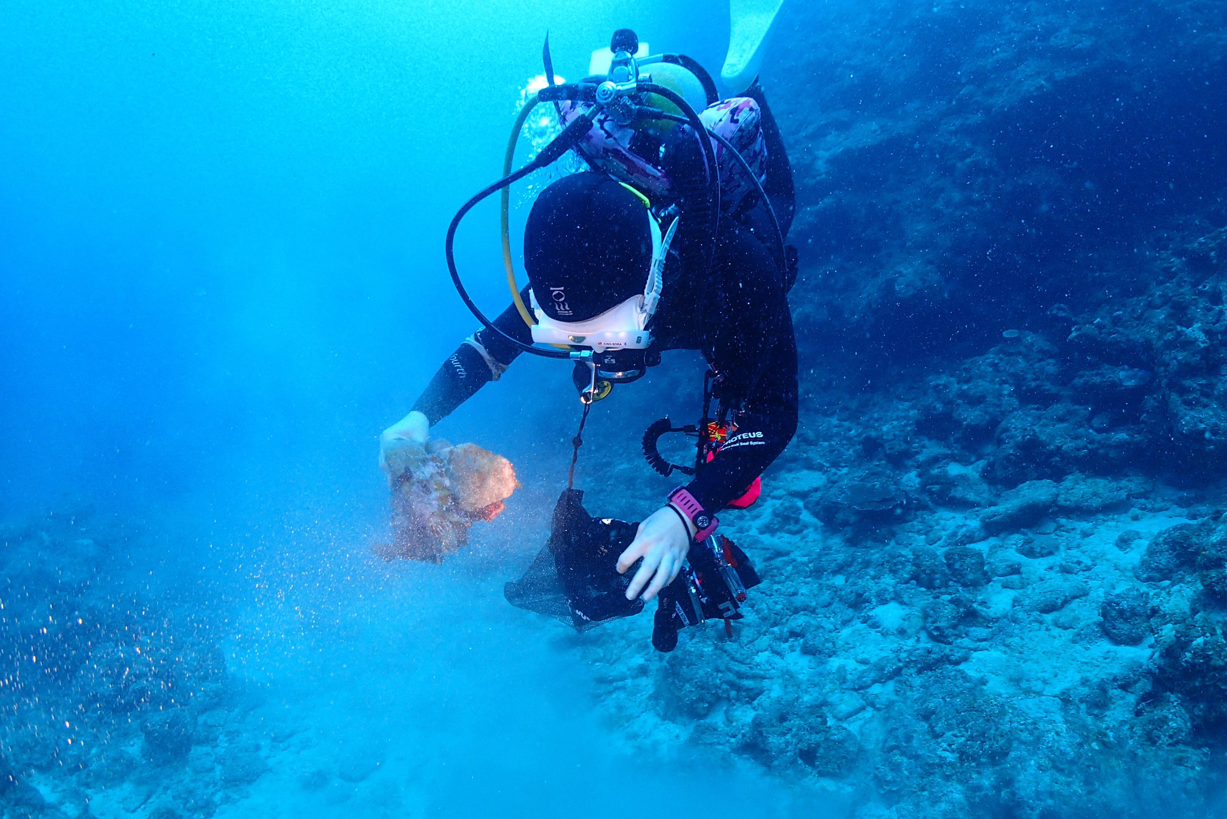
We expect to do another cleaning action of the dive site in the upcoming week, since today's waves undoubtedly carried more debris into the bay.
Higher waves during the night, getting bigger during the day; wind.
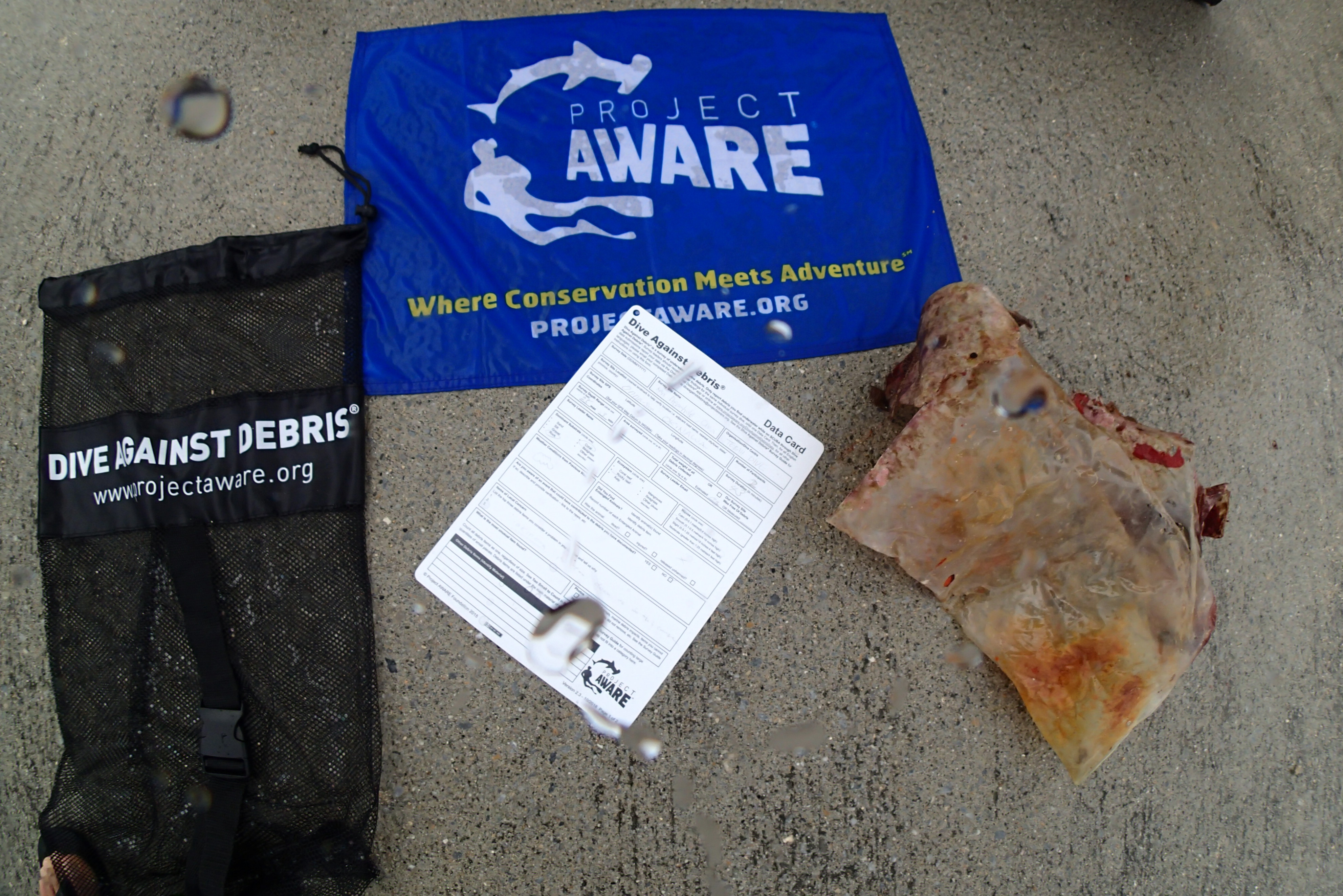
This is a dive site our team cleans regularly. Here, fishing is allowed (unlike at the neighbouring reef Biorock/Artificial Reef).
large piece of insulating foam
Mostly clear, a little windy, one night of rain
Easy Divers Bali
Ana Mestek
1
1
8
2
9
7.20
70
19.00
2.00
2
measured
1
1
1280.00
plastic food/product packaging
plastic bags
diapers
On
kilograms
I have debris data to report
2
Smooth (wavelets) for waves 0.1 - 0.5 meter high
2
m2
meters
other
1
1
Indonesia
State\Province
Gerokgak - Singaraja, Bali
City
Pemuteran
Map Help


Dive Location

If you know your survey site coordinates, enter them manually in decimal degrees using WGS84 Map Datum. Use the minus sign for latitudes south of the equator and longitudes west of the Prime Meridian to 180 degrees.

If you do not know your survey site coordinates, click the “Map Location” tab to use the map to zoom into your survey site and drop the pin on the map to fall within your survey dive site in the water (not on land or the beach). Ensure you zoom in as much as possible to ensure data accuracy.

Entangled Help


Use the vertical tabs below to record any entangled animals you found of each type.

Ecosystem Other
sand, sea grass, coral reef

Colorado Lagoon

0
0
0

33.770900442742, -118.13483925437

0
0
0
silt
0
0
0
0
0
Additional debris is at the dive site but there was not enough time to collect everything.
Human pushed it off the dock
Shopping cart
Misting, cloudy
1
0
0
0
0
0
0
0
0
0
0
0
0
0
0
0
0
0
0
0
Shopping cart
Jade Scuba Adventures
Ashley Arnold
0
0
0
0
0
0
0
0
0
0
0
0
0
0
0
0
0
0
0
2
0
0
0
0
0
0
0
0
0
0
0
0
0
0
25.00
6
11.00
5.00
0
estimated
0
0
136.81
0
0
0
0
0
0
On
pounds
0
I have debris data to report
0
0
0
Calm (glassy to rippled) for waves 0 – 0.1 meter high
0
0
0
0
0
0
0
ft2
0
0
feet
other
0
0
0
0
0
0
0
0
0
0
0
0
0
0
0
0
0
0
0
0
0
0
0
0
0
0
0
0
United States
State\Province
CA
City
Long Beach
Map Help


Dive Location

If you know your survey site coordinates, enter them manually in decimal degrees using WGS84 Map Datum. Use the minus sign for latitudes south of the equator and longitudes west of the Prime Meridian to 180 degrees.

If you do not know your survey site coordinates, click the “Map Location” tab to use the map to zoom into your survey site and drop the pin on the map to fall within your survey dive site in the water (not on land or the beach). Ensure you zoom in as much as possible to ensure data accuracy.

Entangled Help


Use the vertical tabs below to record any entangled animals you found of each type.

Paradise 2

4.2496400205694, 118.63088752065

sand
1
Calm, no wave.
BORNEO DIVERS AND SEA SPORTS SABAH SDN BHD
Tonny Ho
5
6
5
3
4.00
40
16.00
13.00
measured
1726.49
2
On
kilograms
I have debris data to report
Calm (glassy to rippled) for waves 0 – 0.1 meter high
3
m2
meters
coral reef
2
Malaysia
State\Province
SABAH
City
KOTA KINABALU
Map Help


Dive Location

If you know your survey site coordinates, enter them manually in decimal degrees using WGS84 Map Datum. Use the minus sign for latitudes south of the equator and longitudes west of the Prime Meridian to 180 degrees.

If you do not know your survey site coordinates, click the “Map Location” tab to use the map to zoom into your survey site and drop the pin on the map to fall within your survey dive site in the water (not on land or the beach). Ensure you zoom in as much as possible to ensure data accuracy.

Entangled Help


Use the vertical tabs below to record any entangled animals you found of each type.

Wave Break Island

1
1
0

-27.932208144119, 153.41925994548

0
0
0
sand
0
1
0
0
0
Gold Coast Triathlon
Showers/Windy
0
0
0
0
0
0
0
0
0
0
0
0
0
0
0
0
0
0
0
0
Dive2Go
Trevor Smith
0
0
0
0
0
0
0
0
0
0
0
0
0
0
0
0
0
0
0
3
0
0
0
0
0
0
0
0
0
0
0
0
0
0
1.00
49
12.00
5.00
0
estimated
0
0
500.00
0
0
0
0
0
0
On
kilograms
0
I have debris data to report
0
0
0
Slight for waves 0.5 -1.25 meter high
0
0
0
0
0
0
0
m2
0
0
meters
other
0
0
0
0
0
0
0
0
0
0
0
0
0
0
0
0
0
0
0
0
0
0
0
0
0
0
0
0
Australia
State\Province
QLD
City
Gold Coast
Map Help


Dive Location

If you know your survey site coordinates, enter them manually in decimal degrees using WGS84 Map Datum. Use the minus sign for latitudes south of the equator and longitudes west of the Prime Meridian to 180 degrees.

If you do not know your survey site coordinates, click the “Map Location” tab to use the map to zoom into your survey site and drop the pin on the map to fall within your survey dive site in the water (not on land or the beach). Ensure you zoom in as much as possible to ensure data accuracy.

Entangled Help


Use the vertical tabs below to record any entangled animals you found of each type.

ADS474 - Yellow Submarine

0
4
0
0

12.160231, -68.282452

0
0
0
coral
0
0
0
1
0
Calm
Dive Friends Bonaire
Vincent
0
0
0
1
0
0
0
0
0
0
0
0
0
0
0
0
0
0
0
2
0
1
0
0
0
0
0
0
0
0
0
0
0
0
0
0
0.10
40
72.00
8.00
0
estimated
0
0
0
0
10000.00
0
0
0
0
0
Long new fishingline
Plastic
Can
0
On
pounds
0
I have debris data to report
0
0
0
Calm (glassy to rippled) for waves 0 – 0.1 meter high
0
0
0
0
0
0
0
m2
0
0
feet
coral reef
0
0
0
0
0
0
0
0
0
0
0
0
0
0
0
0
0
1
0
0
3
0
0
0
0
0
0
0
0
Netherlands Antilles
State\Province
Bonaire
City
Kralendijk
Map Help


Dive Location

If you know your survey site coordinates, enter them manually in decimal degrees using WGS84 Map Datum. Use the minus sign for latitudes south of the equator and longitudes west of the Prime Meridian to 180 degrees.

If you do not know your survey site coordinates, click the “Map Location” tab to use the map to zoom into your survey site and drop the pin on the map to fall within your survey dive site in the water (not on land or the beach). Ensure you zoom in as much as possible to ensure data accuracy.

Entangled Help


Use the vertical tabs below to record any entangled animals you found of each type.

ADS501 - The Maze

0
0
0
0

24.889917, -80.566383

0
0
0
coral
0
0
0
0
0
Recreational activity and commercial trapping
Calm
Key Dives
Cortney Benson
0
0
0
0
0
0
0
0
0
0
0
0
0
0
0
0
0
0
1
3
0
0
0
0
0
0
0
0
0
0
0
0
0
0
0
0
7.00
45
30.00
24.00
0
measured
0
1
0
0
25.00
0
0
0
0
0
Metal fishing wire
Lobster trap pieces
Aluminum can
0
On
pounds
0
I have debris data to report
0
0
0
Smooth (wavelets) for waves 0.1 - 0.5 meter high
0
0
0
0
0
0
0
m2
0
0
feet
coral reef
0
0
0
0
0
0
0
0
0
0
0
0
0
0
0
2
0
1
0
0
0
0
0
0
0
0
0
0
0
United States
State\Province
FL
City
Islamorada
Map Help


Dive Location

If you know your survey site coordinates, enter them manually in decimal degrees using WGS84 Map Datum. Use the minus sign for latitudes south of the equator and longitudes west of the Prime Meridian to 180 degrees.

If you do not know your survey site coordinates, click the “Map Location” tab to use the map to zoom into your survey site and drop the pin on the map to fall within your survey dive site in the water (not on land or the beach). Ensure you zoom in as much as possible to ensure data accuracy.

Entangled Help


Use the vertical tabs below to record any entangled animals you found of each type.

ADS540 - Ses Penyes Rotges

39.49167132288, 2.4715738215668

rock
2

39.49167132288, 2.4715738215668

Slight wind
Norway Dive
Andre Foleide
2
1
2.00
46
13.00
4.00
estimated
3
16.00
plastic
fishing equipment
glass
On
kilograms
I have debris data to report
1
Slight for waves 0.5 -1.25 meter high m2
meters
seagrass
Spain
State\Province
Mallorca
City
Magaluf
Map Help


Dive Location

If you know your survey site coordinates, enter them manually in decimal degrees using WGS84 Map Datum. Use the minus sign for latitudes south of the equator and longitudes west of the Prime Meridian to 180 degrees.

If you do not know your survey site coordinates, click the “Map Location” tab to use the map to zoom into your survey site and drop the pin on the map to fall within your survey dive site in the water (not on land or the beach). Ensure you zoom in as much as possible to ensure data accuracy.

Entangled Help


Use the vertical tabs below to record any entangled animals you found of each type.

X127

0
1
0

35.902021004869, 14.501352599303

0
0
0
silt
0
0
0
0
0
Angle grinder plate
0
0
0
0
0
0
0
0
0
0
0
0
0
0
0
0
0
0
0
0
Buddies
Rachel
0
0
0
0
0
0
0
0
0
0
0
0
0
30
0
0
0
0
3
3
0
0
0
0
2
0
0
0
0
0
0
0
0
0
12.00
23
8.20
1.00
0
estimated
0
0
207.00
0
0
0
0
0
Glass bottles
Cable ties
0
On
kilograms
0
I have debris data to report
10
0
0
Smooth (wavelets) for waves 0.1 - 0.5 meter high
0
0
0
0
0
0
0
m2
0
0
meters
rocky reef
0
0
2
0
0
0
0
0
0
1
0
0
0
0
0
0
0
0
0
1
0
6
1
0
0
0
0
0
Malta
Map Help


Dive Location

If you know your survey site coordinates, enter them manually in decimal degrees using WGS84 Map Datum. Use the minus sign for latitudes south of the equator and longitudes west of the Prime Meridian to 180 degrees.

If you do not know your survey site coordinates, click the “Map Location” tab to use the map to zoom into your survey site and drop the pin on the map to fall within your survey dive site in the water (not on land or the beach). Ensure you zoom in as much as possible to ensure data accuracy.

Entangled Help


Use the vertical tabs below to record any entangled animals you found of each type.

Santa Rita Bay

2
sand
15
50

1.6955400680579, 7.4026486165224

Tire
Stormy
Bom Bom Dive Center
Flávio Quina
2
20
6
45.00
45
5.00
2.00
estimated
30.00
1
Plastic Bags
On
kilograms
I have debris data to report
Slight for waves 0.5 -1.25 meter high m2
meters
rocky reef
Sao Tome and Principe
State\Province
Principe Island
City
Santo António do Principe
Map Help


Dive Location

If you know your survey site coordinates, enter them manually in decimal degrees using WGS84 Map Datum. Use the minus sign for latitudes south of the equator and longitudes west of the Prime Meridian to 180 degrees.

If you do not know your survey site coordinates, click the “Map Location” tab to use the map to zoom into your survey site and drop the pin on the map to fall within your survey dive site in the water (not on land or the beach). Ensure you zoom in as much as possible to ensure data accuracy.

Entangled Help


Use the vertical tabs below to record any entangled animals you found of each type.

Mini Dreamhole

rock

26.510405998553, 127.86277328291

There's only few debris that we've dive in this area now. We will try to keep surveying this area, frequently.
Cloudy, sometimes Sunny days
TEBAH DIVE
SEUNGHOON KWAK
2
1
0.50
42
26.00
3.00
estimated
30.00
On
kilograms
I have debris data to report
Smooth (wavelets) for waves 0.1 - 0.5 meter high m2
meters
rocky reef
1
Japan
State\Province
Okinawa
City
Serakaki, Onna-son
Map Help


Dive Location

If you know your survey site coordinates, enter them manually in decimal degrees using WGS84 Map Datum. Use the minus sign for latitudes south of the equator and longitudes west of the Prime Meridian to 180 degrees.

If you do not know your survey site coordinates, click the “Map Location” tab to use the map to zoom into your survey site and drop the pin on the map to fall within your survey dive site in the water (not on land or the beach). Ensure you zoom in as much as possible to ensure data accuracy.

Entangled Help


Use the vertical tabs below to record any entangled animals you found of each type.

Subscribe to