Menu

Bio rock shallow turbo

3
6
0

-8.347945413785, 116.04470145021

0
0
0
coral
0
0
0
20
0
Bio rock.
Rain and currents
Stanley knife
Rain
1
1
1
0
0
0
0
0
0
0
0
0
0
0
0
0
0
0
0
0
Stanley knife
Scissors
Band aid
Gilli Eco trust
SIAN
0
0
0
3
0
0
0
0
2
0
0
0
0
1
0
0
0
0
0
6
0
0
0
0
0
0
0
0
0
0
0
0
0
0
1.50
59
18.00
2.00
0
estimated
0
0
2345.44
0
0
0
2
0
Plastic cups
Ciggie butts
Sachet plastic
0
On
kilograms
0
I have debris data to report
2
0
0
Calm (glassy to rippled) for waves 0 – 0.1 meter high
1
0
0
0
1
0
0
m2
0
0
meters
coral reef
1
0
0
0
0
0
0
0
0
0
0
0
0
0
0
0
0
0
2
0
0
0
0
0
0
0
0
0
Indonesia
State\Province
Lombok
City
Gilli T
Map Help


Dive Location

If you know your survey site coordinates, enter them manually in decimal degrees using WGS84 Map Datum. Use the minus sign for latitudes south of the equator and longitudes west of the Prime Meridian to 180 degrees.

If you do not know your survey site coordinates, click the “Map Location” tab to use the map to zoom into your survey site and drop the pin on the map to fall within your survey dive site in the water (not on land or the beach). Ensure you zoom in as much as possible to ensure data accuracy.

Entangled Help


Use the vertical tabs below to record any entangled animals you found of each type.

Lembeh Resort House Reef

73
1
2

1.456911, 125.241935

coral
12
2
Raining
Critters at Lembeh Resort
Agustian Peloa
18
2
4
3
6
1
5
10.40
60
18.00
5.00
2
measured
100.00
On
kilograms
I have debris data to report
12
Calm (glassy to rippled) for waves 0 – 0.1 meter high m2
meters
coral reef
1
2
Indonesia
State\Province
North Sulawesi
City
Bitung
Map Help


Dive Location

If you know your survey site coordinates, enter them manually in decimal degrees using WGS84 Map Datum. Use the minus sign for latitudes south of the equator and longitudes west of the Prime Meridian to 180 degrees.

If you do not know your survey site coordinates, click the “Map Location” tab to use the map to zoom into your survey site and drop the pin on the map to fall within your survey dive site in the water (not on land or the beach). Ensure you zoom in as much as possible to ensure data accuracy.

Entangled Help


Use the vertical tabs below to record any entangled animals you found of each type.

Mainit

0
1
0
0

9.212132, 123.286107

0
0
0
sand
0
2
0
32
0
Prevailing current. Also it is a marine sanctuary
Beverage bottle
Sunny and little wind
Instructor Development Philippines
Rod
0
0
0
0
0
0
0
0
0
0
0
0
0
1
0
0
0
0
1
2
0
0
0
0
0
0
0
0
0
0
0
0
0
0
0
0
2.00
35
19.00
4.00
0
estimated
0
0
0
16
2819.00
0
0
0
0
0
Fishing line
Fishing hooks
Plastic bags
0
On
kilograms
0
I have debris data to report
1
0
0
Slight for waves 0.5 -1.25 meter high
0
0
0
0
0
0
0
m2
0
0
meters
coral reef
0
0
0
0
0
0
0
0
0
0
0
0
0
0
0
0
0
0
0
0
0
0
0
0
0
0
0
0
0
Philippines
State\Province
Negros Oriental
City
Dauin
Map Help


Dive Location

If you know your survey site coordinates, enter them manually in decimal degrees using WGS84 Map Datum. Use the minus sign for latitudes south of the equator and longitudes west of the Prime Meridian to 180 degrees.

If you do not know your survey site coordinates, click the “Map Location” tab to use the map to zoom into your survey site and drop the pin on the map to fall within your survey dive site in the water (not on land or the beach). Ensure you zoom in as much as possible to ensure data accuracy.

Entangled Help


Use the vertical tabs below to record any entangled animals you found of each type.

ADS462 - Directors Bay

1

12.06591, -68.859964

coral
1
26
Jan Thiel Diving
Bob van Beurden
3
1
2
3.00
52
13.30
1.00
estimated
200.00
On
kilograms
I have debris data to report
Calm (glassy to rippled) for waves 0 – 0.1 meter high m2
meters
coral reef
3
Netherlands Antilles
Map Help


Dive Location

If you know your survey site coordinates, enter them manually in decimal degrees using WGS84 Map Datum. Use the minus sign for latitudes south of the equator and longitudes west of the Prime Meridian to 180 degrees.

If you do not know your survey site coordinates, click the “Map Location” tab to use the map to zoom into your survey site and drop the pin on the map to fall within your survey dive site in the water (not on land or the beach). Ensure you zoom in as much as possible to ensure data accuracy.

Entangled Help


Use the vertical tabs below to record any entangled animals you found of each type.

ADS497 - Zevenhuizerplas

0
0
0
0

51.981468, 4.556003

0
0
0
sand
0
0
0
0
0
Sunny
Maidiving
Vincent Maissan
0
0
0
0
5
0
0
0
0
0
0
0
0
0
0
0
0
0
0
2
0
0
0
0
0
0
2
0
0
0
0
0
0
0
0
0
0.30
45
9.00
3.00
0
measured
0
0
0
0
39.00
0
0
0
0
0
0
On
kilograms
0
I have debris data to report
0
0
0
Calm (glassy to rippled) for waves 0 – 0.1 meter high
0
0
0
0
0
0
0
m2
0
0
meters
other
0
0
0
0
0
0
0
0
0
0
0
0
0
0
0
0
0
0
0
0
0
0
0
0
0
0
0
0
0
Netherlands
State\Province
Zuid Holland
City
Rotterdam
Map Help


Dive Location

If you know your survey site coordinates, enter them manually in decimal degrees using WGS84 Map Datum. Use the minus sign for latitudes south of the equator and longitudes west of the Prime Meridian to 180 degrees.

If you do not know your survey site coordinates, click the “Map Location” tab to use the map to zoom into your survey site and drop the pin on the map to fall within your survey dive site in the water (not on land or the beach). Ensure you zoom in as much as possible to ensure data accuracy.

Entangled Help


Use the vertical tabs below to record any entangled animals you found of each type.

ADS531 - Billy's Grotto

coral

17.089162752109, -61.931308186361

NO
NO
No
Windy gust up to 21 knots with 1.5- to 2 meters wave heights.
Sandals Grande Antigua (store number 7109)
Maurice Watson
8
1
70.00
42
55.00
45.00
1
estimated
200.00
Big Mouring Rope
On
pounds
I have debris data to report
Moderate to rough for waves greater than 1.25 meters ft2
feet
coral reef
3
Antigua and Barbuda
City
St Johns
Map Help


Dive Location

If you know your survey site coordinates, enter them manually in decimal degrees using WGS84 Map Datum. Use the minus sign for latitudes south of the equator and longitudes west of the Prime Meridian to 180 degrees.

If you do not know your survey site coordinates, click the “Map Location” tab to use the map to zoom into your survey site and drop the pin on the map to fall within your survey dive site in the water (not on land or the beach). Ensure you zoom in as much as possible to ensure data accuracy.

Entangled Help


Use the vertical tabs below to record any entangled animals you found of each type.

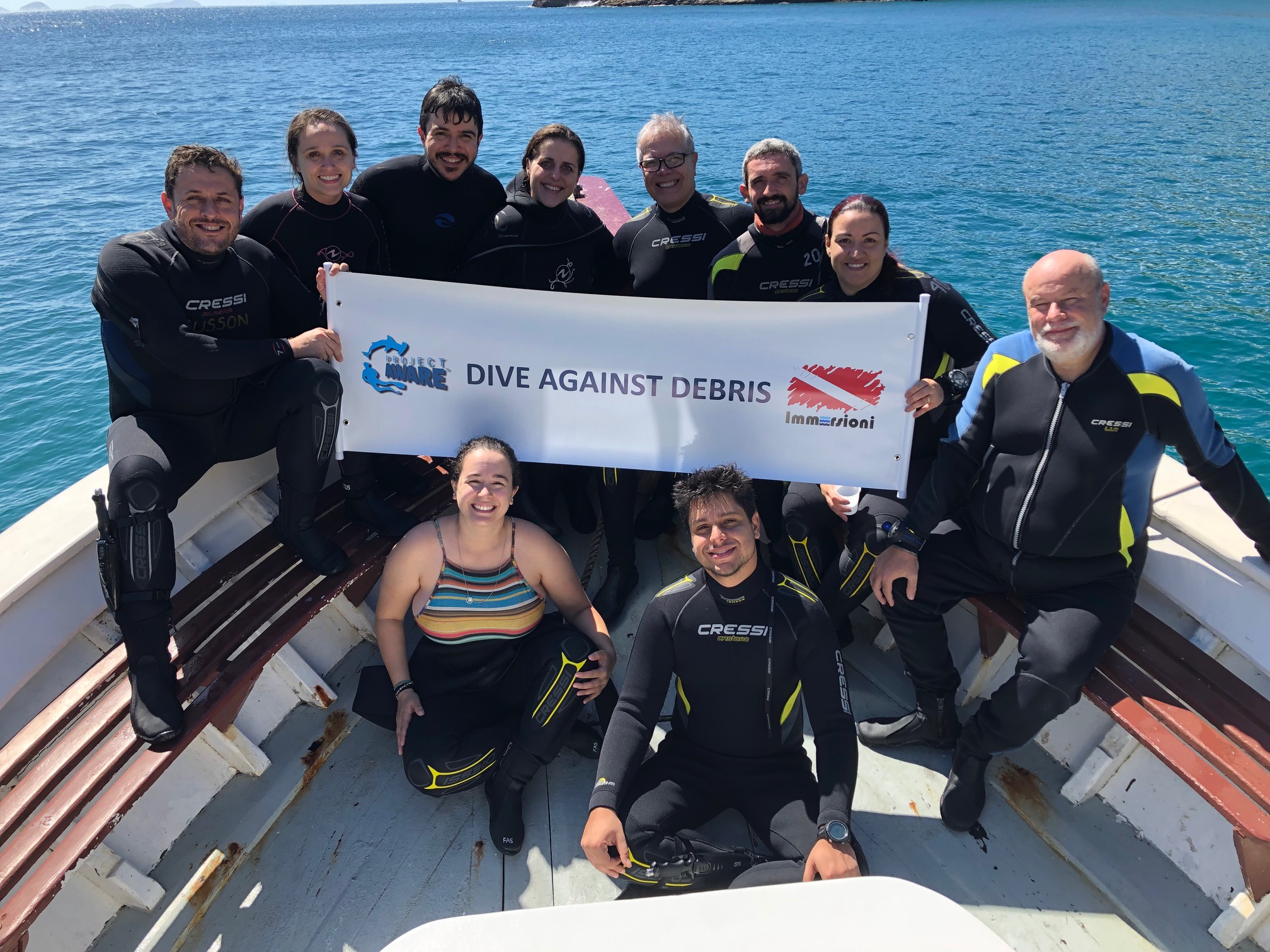
Enseada do Cardeiro - Arraial do Cabo - Brazil

-22.965545515723, -42.001762390137

rock
We were impressed by the low amount of debris !!!
That's good!!!
Excellent
Immersioni
André Gusson
10
1
1
0.20
48
12.00
6.00
estimated
62.00
On
kilograms
Our Survey Site was free of debris
Calm (glassy to rippled) for waves 0 – 0.1 meter high m2
meters
coral reef
Brazil
State\Province
São Paulo
City
São Paulo
Map Help


Dive Location

If you know your survey site coordinates, enter them manually in decimal degrees using WGS84 Map Datum. Use the minus sign for latitudes south of the equator and longitudes west of the Prime Meridian to 180 degrees.

If you do not know your survey site coordinates, click the “Map Location” tab to use the map to zoom into your survey site and drop the pin on the map to fall within your survey dive site in the water (not on land or the beach). Ensure you zoom in as much as possible to ensure data accuracy.
Entangled Help


Use the vertical tabs below to record any entangled animals you found of each type.

ADS529 - Manafaru House Reef

7

6.9990277777778, 72.943777777778

coral
37
ONLY THE LAST FEW DAYS BEFORE THE CLEAN UP ROUGH SEA AND WINDY
bestdivesmaldives_manafaru
SANDRA ORTIZ LAZARO
1
1
7
4
7
3
106.15
30
10.00
2.00
2
measured
2
100.00
7
WOOD FRAGMENTS
FISHING LINE
METAL FRAGMENTS
1
On
kilograms
I have debris data to report
1
Slight for waves 0.5 -1.25 meter high
217
2
m2
8
meters
coral reef
11
6
1
4
3
2
2
1
4
14
9
Maldives
Map Help


Dive Location

If you know your survey site coordinates, enter them manually in decimal degrees using WGS84 Map Datum. Use the minus sign for latitudes south of the equator and longitudes west of the Prime Meridian to 180 degrees.

If you do not know your survey site coordinates, click the “Map Location” tab to use the map to zoom into your survey site and drop the pin on the map to fall within your survey dive site in the water (not on land or the beach). Ensure you zoom in as much as possible to ensure data accuracy.

Entangled Help


Use the vertical tabs below to record any entangled animals you found of each type.

Giovinazzo Porticciolo

0
0
0
0

41.189709, 16.676066

0
0
0
rock
0
0
0
0
0
Someone throw it in the water several years ago
Nucleo Sub Molfetta
0
0
0
0
0
0
0
0
0
0
0
0
0
0
0
0
0
0
0
5
0
0
0
0
0
0
0
0
0
0
0
0
0
0
0
0
6.00
40
11.00
1.00
0
estimated
0
0
0
0
2960.65
0
2
0
0
0
0
On
kilograms
0
I have debris data to report
0
0
0
Smooth (wavelets) for waves 0.1 - 0.5 meter high
0
0
0
0
0
0
0
m2
0
0
meters
rocky reef
0
0
0
0
0
0
0
0
0
0
0
0
0
0
0
0
0
0
0
0
0
0
0
0
0
0
0
0
0
Italy
State\Province
Bari
City
Giovinazzo
Map Help


Dive Location

If you know your survey site coordinates, enter them manually in decimal degrees using WGS84 Map Datum. Use the minus sign for latitudes south of the equator and longitudes west of the Prime Meridian to 180 degrees.

If you do not know your survey site coordinates, click the “Map Location” tab to use the map to zoom into your survey site and drop the pin on the map to fall within your survey dive site in the water (not on land or the beach). Ensure you zoom in as much as possible to ensure data accuracy.

Entangled Help


Use the vertical tabs below to record any entangled animals you found of each type.

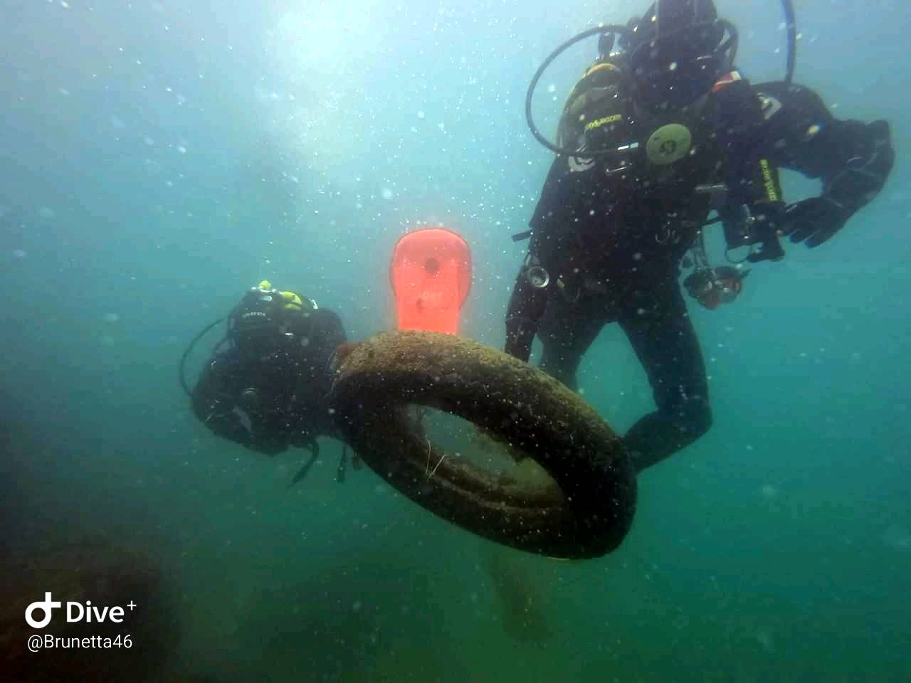
ADS482 - Long Beach

0
12
1
0

7.617043, 99.028423

0
0
0
sand
0
0
0
0
0
Toothbrush
Very hot and dry, slight breeze.
Go Pro In Paradise & Lanta Diver
Richard Reardon
0
0
0
1
1
0
0
0
0
0
0
0
0
0
0
0
0
0
0
5
0
0
0
0
4
0
1
0
0
0
0
0
0
1
0
0
1.00
20
5.00
3.00
0
estimated
0
0
0
0
30.00
0
0
0
0
0
Plastic fragments
0
On
kilograms
0
I have debris data to report
3
0
0
Smooth (wavelets) for waves 0.1 - 0.5 meter high
0
0
0
0
0
0
1
m2
0
1
meters
coral reef
0
0
0
0
0
0
0
0
0
0
0
0
0
0
0
0
1
0
0
0
0
0
0
0
0
0
0
0
0
Thailand
State\Province
Koh Lanta
City
Phra Ae
Map Help


Dive Location

If you know your survey site coordinates, enter them manually in decimal degrees using WGS84 Map Datum. Use the minus sign for latitudes south of the equator and longitudes west of the Prime Meridian to 180 degrees.

If you do not know your survey site coordinates, click the “Map Location” tab to use the map to zoom into your survey site and drop the pin on the map to fall within your survey dive site in the water (not on land or the beach). Ensure you zoom in as much as possible to ensure data accuracy.
Entangled Help


Use the vertical tabs below to record any entangled animals you found of each type.

Subscribe to