Menu

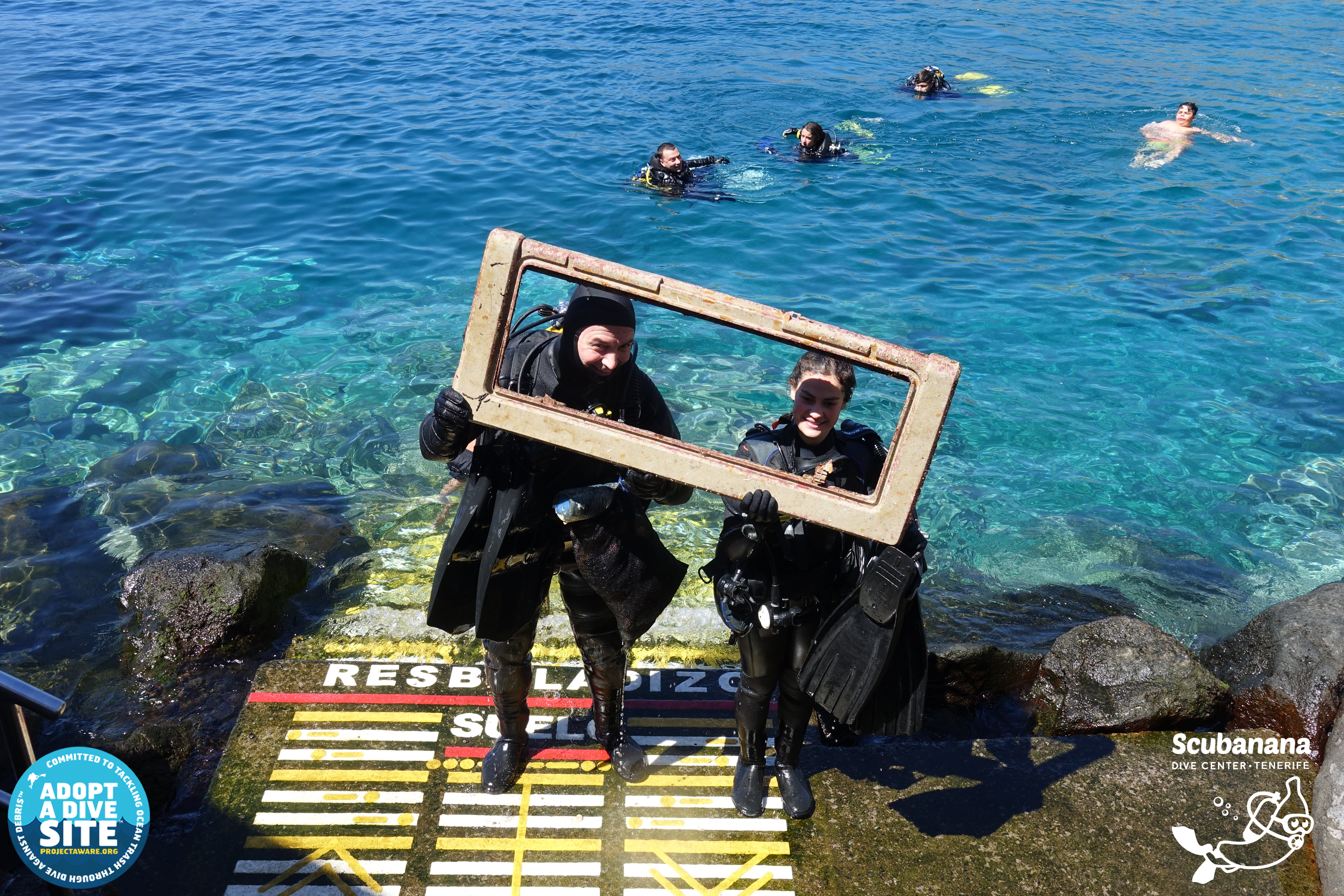
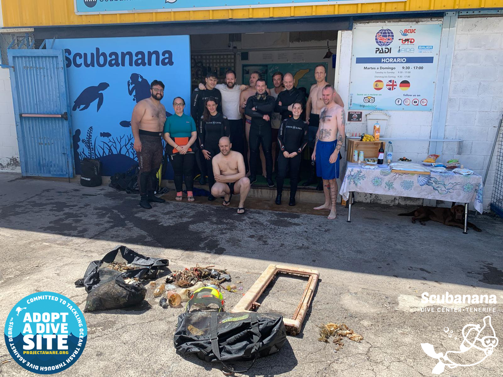
ADS475 - Cha Cha Cha Beach

3
10

12.145864893633, -68.276343687482

sand
7
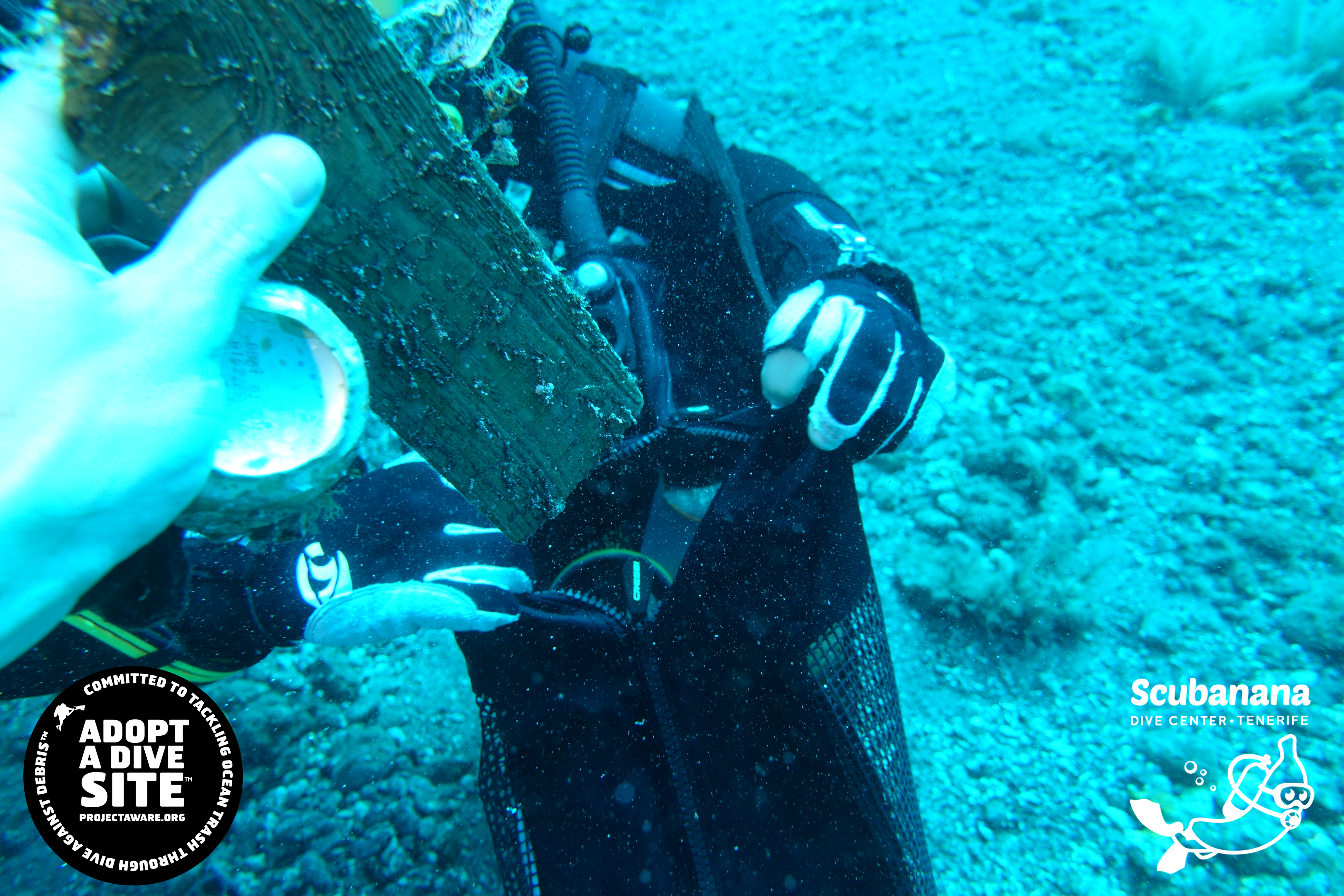
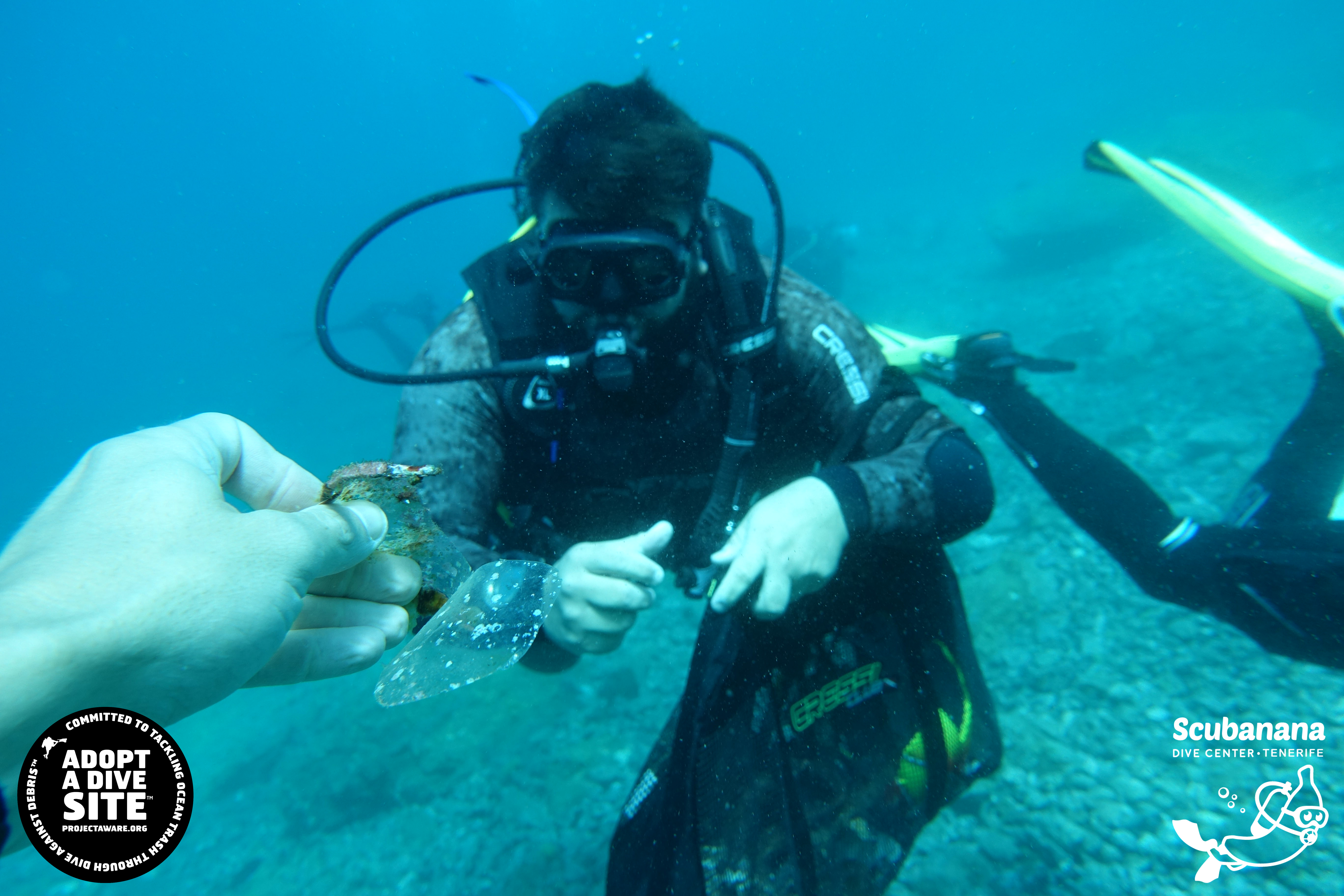
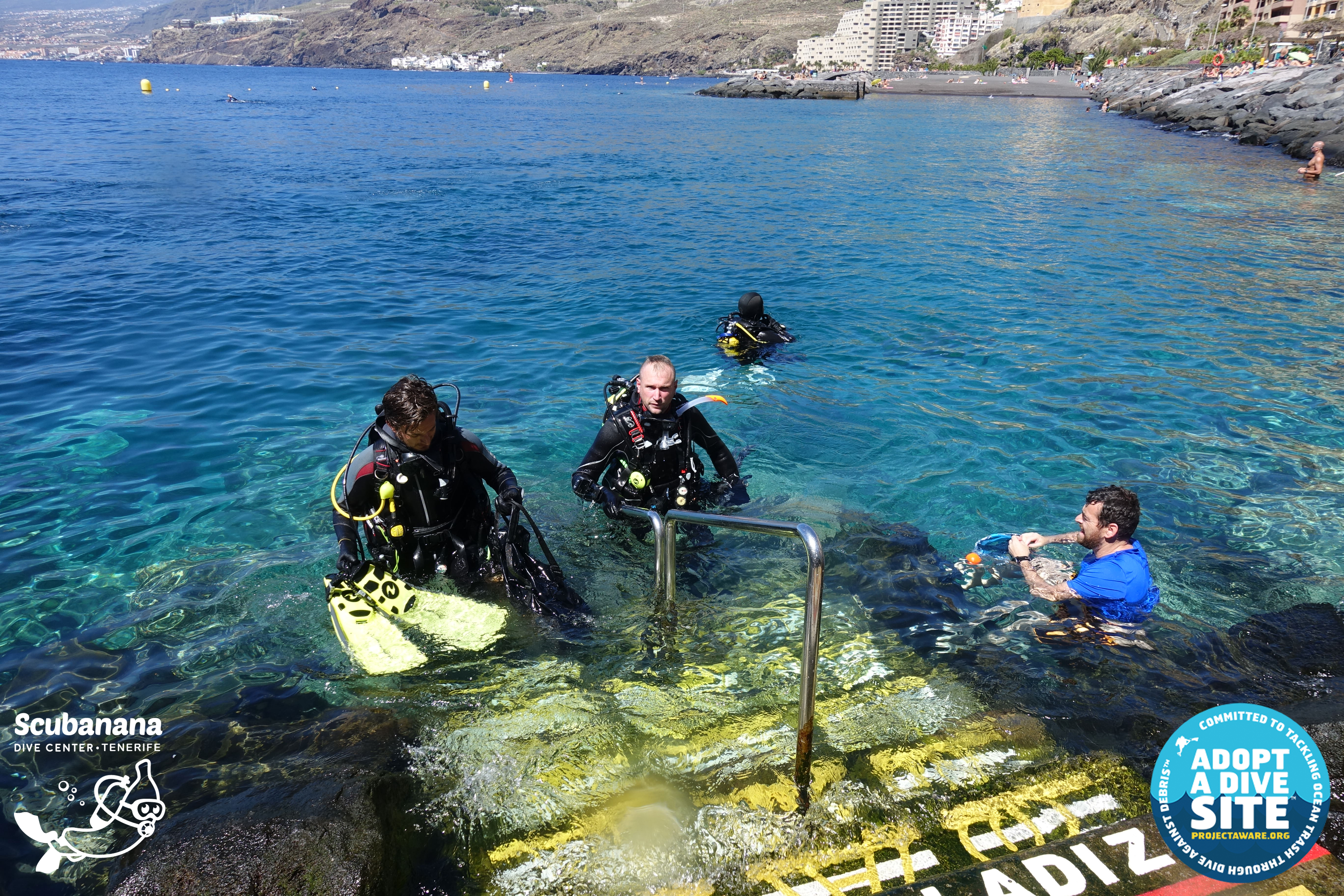
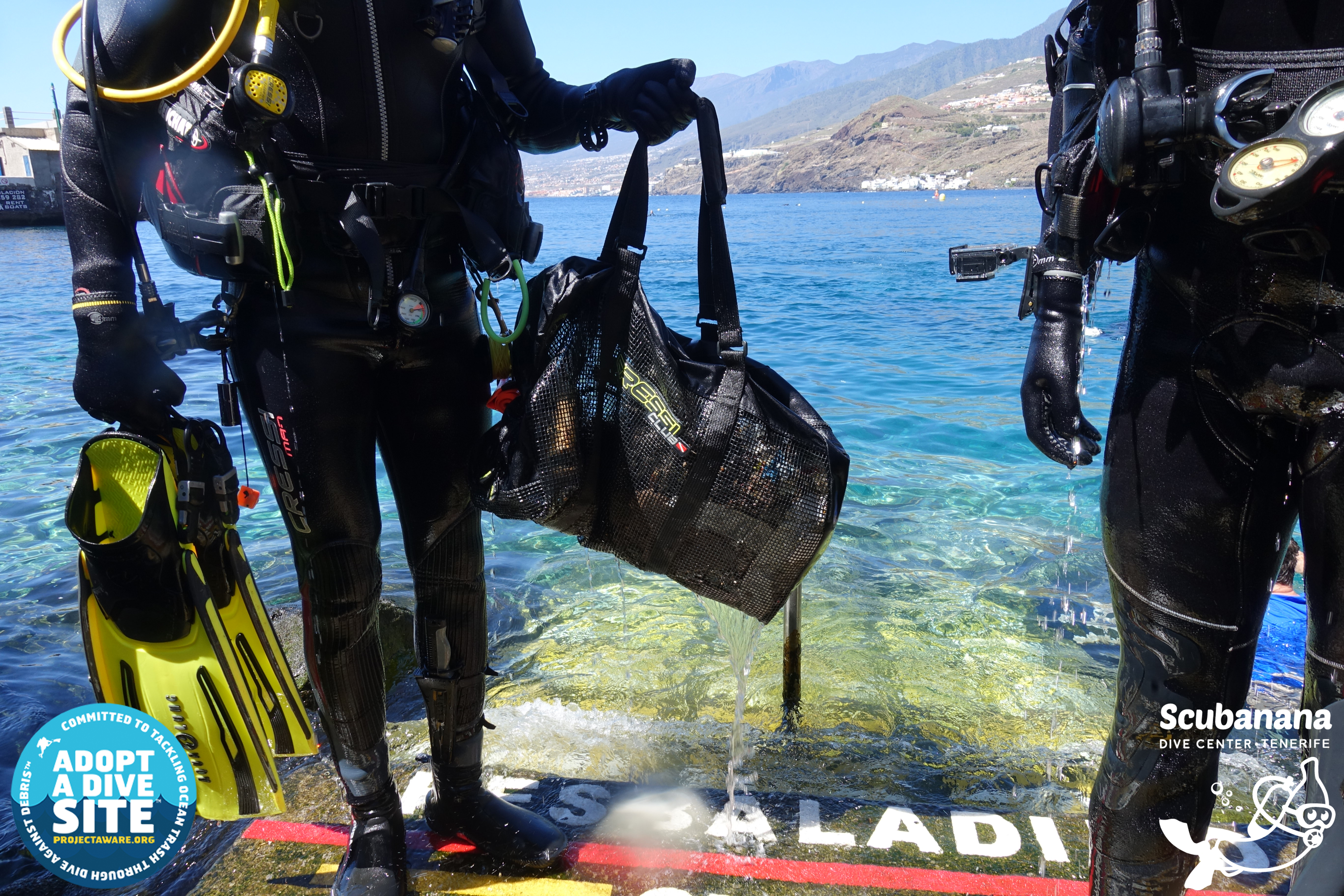
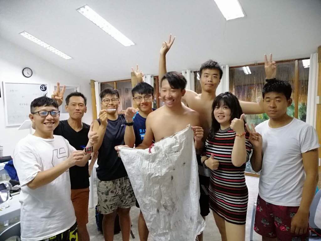
This was part of a AWARE Dive Against Debris Specialty Course!
This is near an area that is heavily trafficked by cruise lines.
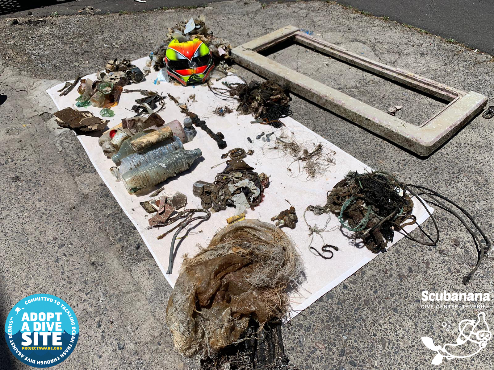
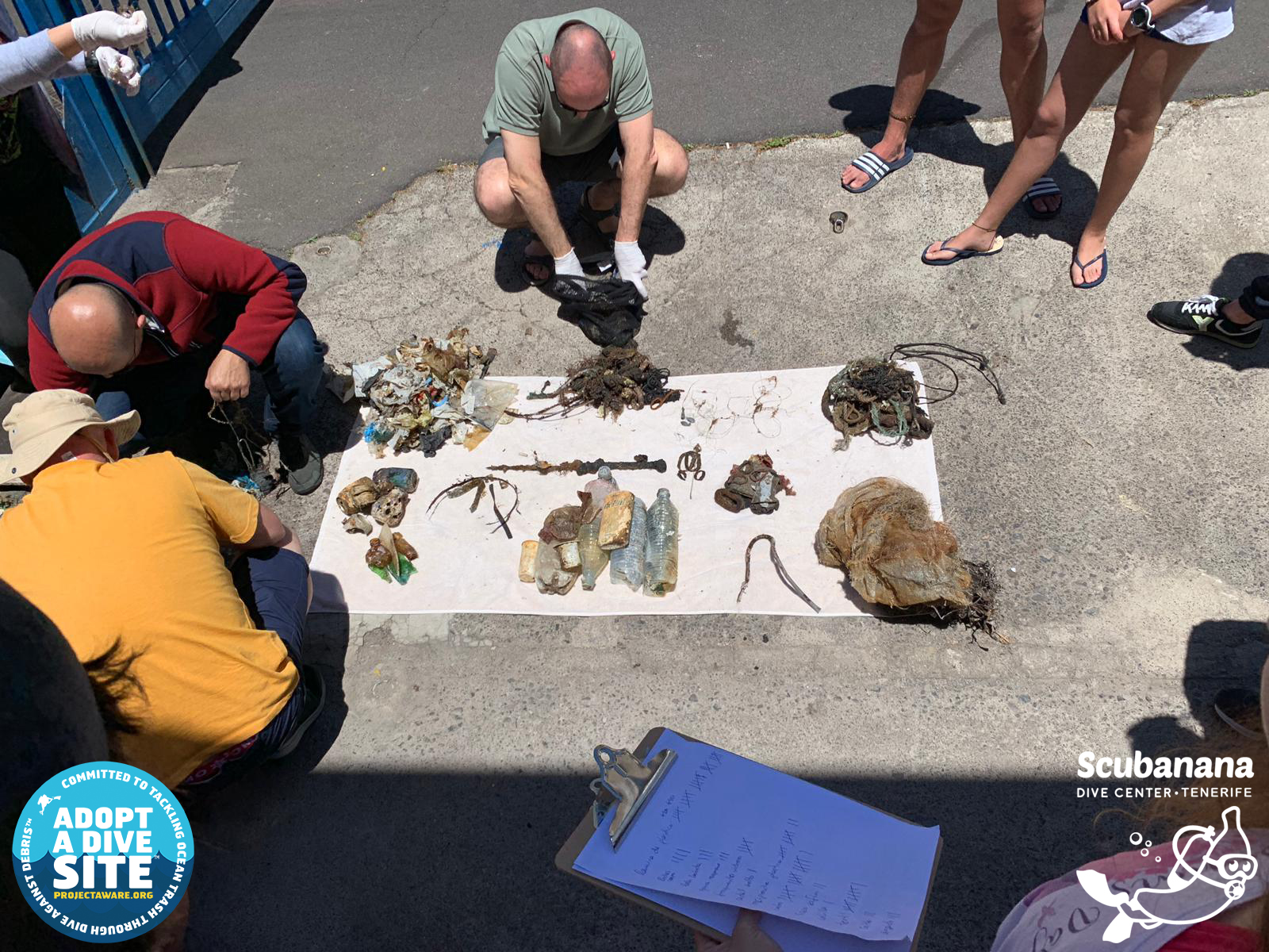
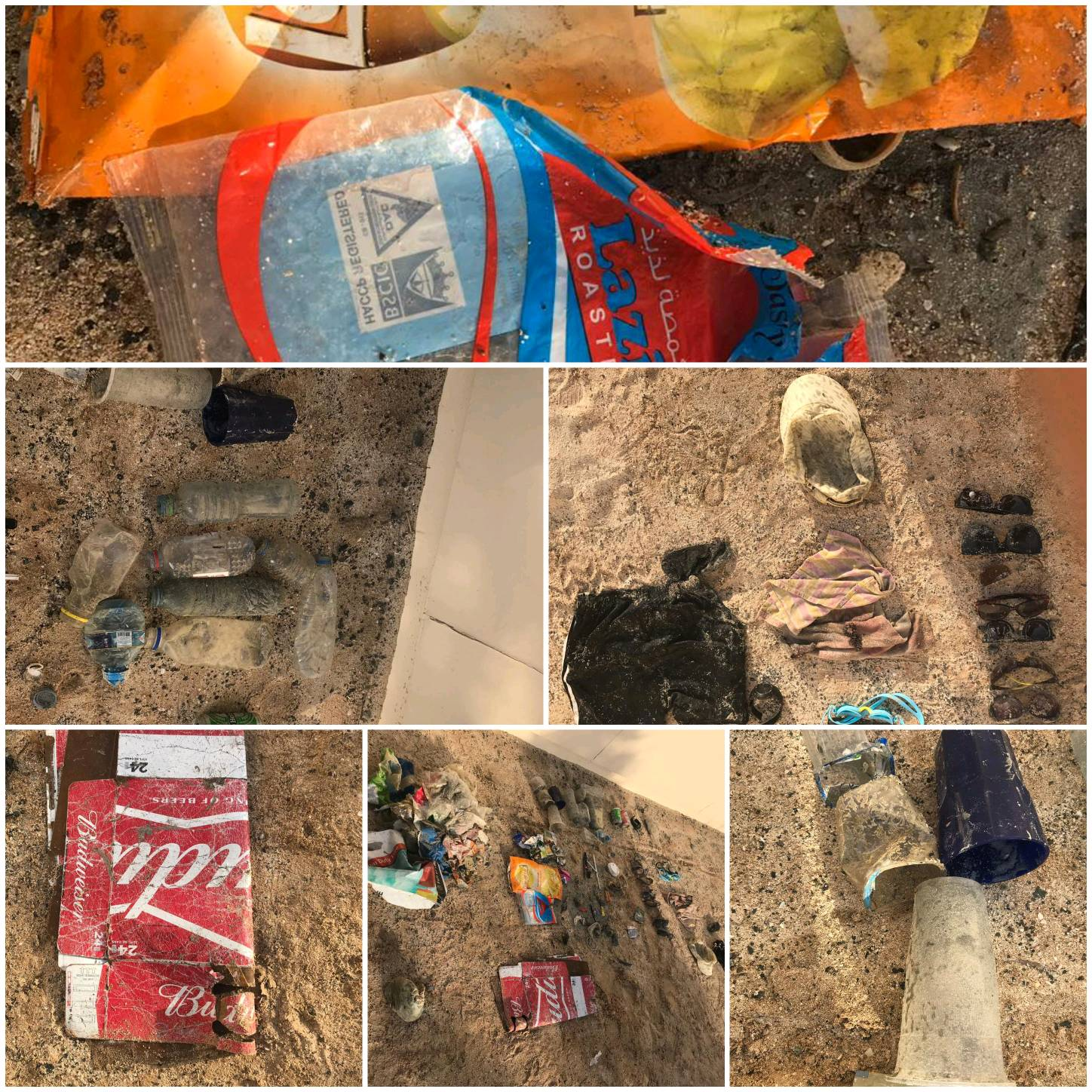
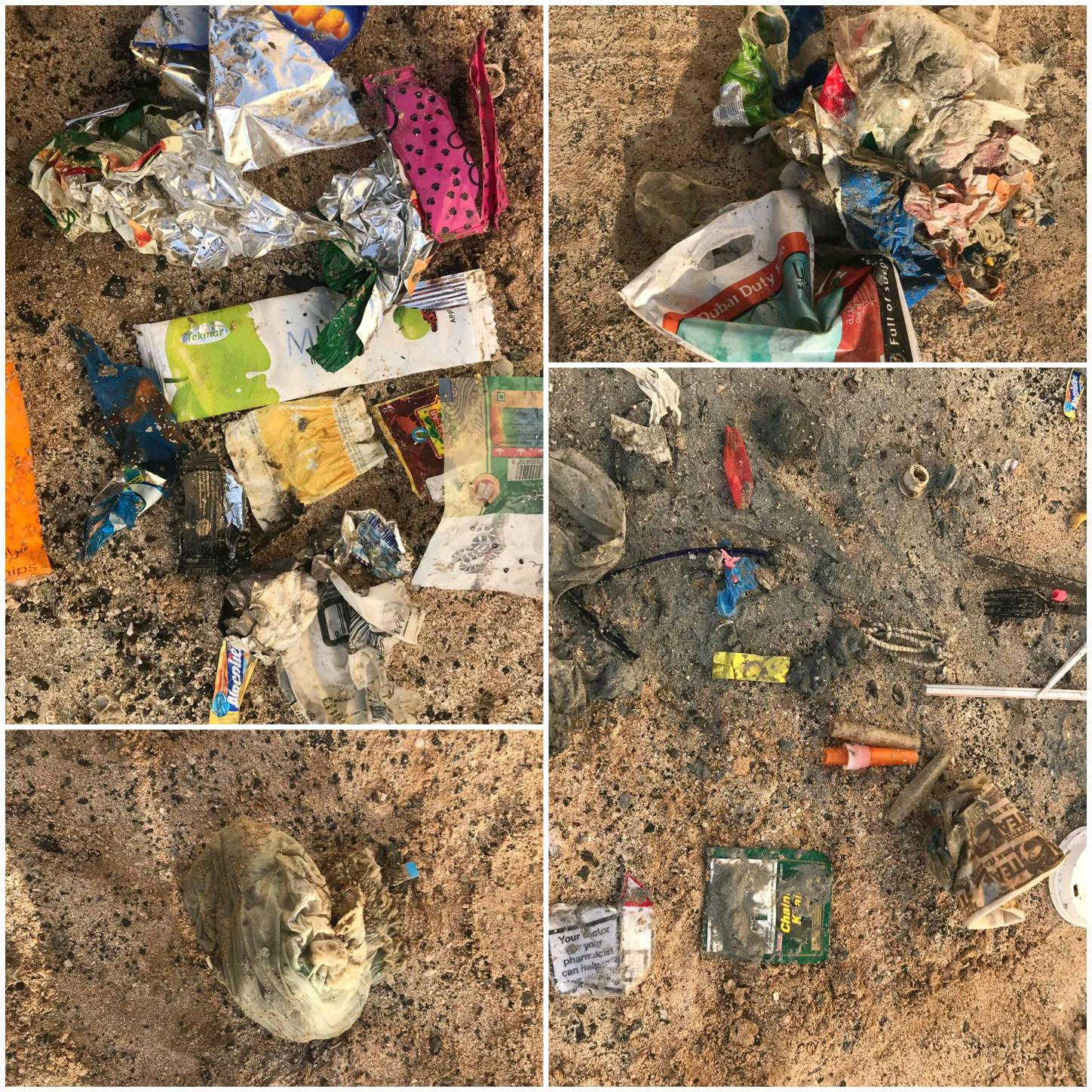
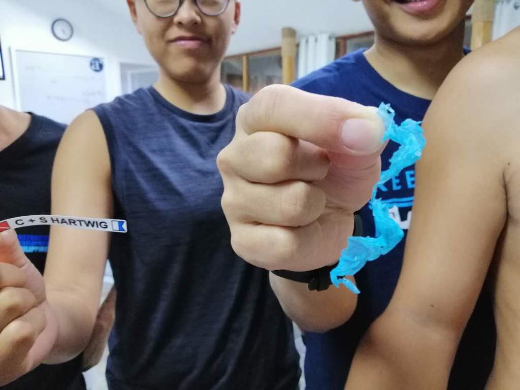
Hair ties
30 degrees C, windy, mostly sunny.
3
3
Fiber glass
Hair ties (cloth, rubber)
Dive Friends Bonaire
Kathryn Hehre
2
3
1
5
1.00
53
18.00
1.00
estimated
3500.00
3
Plastic
Metal
On
kilograms
I have debris data to report
1
Calm (glassy to rippled) for waves 0 – 0.1 meter high
2
2
m2
meters
coral reef
4
2
1
1
1
Netherlands Antilles
State\Province
Bonaire
City
Kralendijk
Map Help


Dive Location

If you know your survey site coordinates, enter them manually in decimal degrees using WGS84 Map Datum. Use the minus sign for latitudes south of the equator and longitudes west of the Prime Meridian to 180 degrees.

If you do not know your survey site coordinates, click the “Map Location” tab to use the map to zoom into your survey site and drop the pin on the map to fall within your survey dive site in the water (not on land or the beach). Ensure you zoom in as much as possible to ensure data accuracy.

Entangled Help


Use the vertical tabs below to record any entangled animals you found of each type.

Porth Ysgaden

0
0
0

52.904539, -4.649658

0
0
0
sand
0
0
0
0
0
0
0
0
0
0
0
0
0
0
0
0
0
0
0
0
0
0
0
0
0
Robert Hassall
0
0
0
0
0
0
0
0
0
0
0
0
0
0
0
0
0
0
0
2
0
0
0
0
0
0
0
0
0
0
0
0
0
0
0.00
40
5.50
1.00
0
estimated
0
0
3161.87
0
0
0
0
0
0
On
kilograms
0
Our Survey Site was free of debris
0
0
0
Smooth (wavelets) for waves 0.1 - 0.5 meter high
0
0
0
0
0
0
0
m2
0
0
meters
rocky reef
0
0
0
0
0
0
0
0
0
0
0
0
0
0
0
0
0
0
0
0
0
0
0
0
0
0
0
0
United Kingdom
Map Help


Dive Location

If you know your survey site coordinates, enter them manually in decimal degrees using WGS84 Map Datum. Use the minus sign for latitudes south of the equator and longitudes west of the Prime Meridian to 180 degrees.

If you do not know your survey site coordinates, click the “Map Location” tab to use the map to zoom into your survey site and drop the pin on the map to fall within your survey dive site in the water (not on land or the beach). Ensure you zoom in as much as possible to ensure data accuracy.

Entangled Help


Use the vertical tabs below to record any entangled animals you found of each type.

ADS528 - Radazul

292
5
sand
2
4
7
1

28.401225187871, -16.323759965791

THIS DIVE SPOT IS CLOSE TO A TURISTIC HARBOR THAT COULD BE AN ADDITIONAL CAUSE OF POLLUTION.
THE BEACH IS ATTENDED BY A LARGE NUMBER OF LOCAL PEOPLE AND TURIST, UNFORTUNATELY THE TRASH BINS USED IN THE AREA ARE NOT THE PROPER ONES CAUSE ARE NO TOP COVERED MODELS, MOREOVER THE LACK OF NUMBERS AND THE REDUCED CAPACITY INCREASE THE CHANCE TO GET THE TRASH IN THE SEA .
BIG PLASTIC FRAME
SUNNY, NO WIND, NO CURRENTS
9
Electric Cable
SCUBANANA
ANDREA PILONE
5
1
7
8
24
15.00
45
13.00
3.00
6
estimated
7
7814.76
15
SMALL PLASTIC PIECES
PLASTIC SHOP BAG
PLASTIC FOOD BAG (CHIPS)
On
kilograms
I have debris data to report
Calm (glassy to rippled) for waves 0 – 0.1 meter high
5
7
m2
14
meters
rocky reef
6
2
6
3
3
24
Spain
State\Province
Santa Cruz de Tenerife
City
Radazul
Map Help


Dive Location

If you know your survey site coordinates, enter them manually in decimal degrees using WGS84 Map Datum. Use the minus sign for latitudes south of the equator and longitudes west of the Prime Meridian to 180 degrees.

If you do not know your survey site coordinates, click the “Map Location” tab to use the map to zoom into your survey site and drop the pin on the map to fall within your survey dive site in the water (not on land or the beach). Ensure you zoom in as much as possible to ensure data accuracy.

Entangled Help


Use the vertical tabs below to record any entangled animals you found of each type.

NW wall Two Harbors harbor

0
0
0

33.444636149553, -118.49828418407

0
0
0
rock
0
0
0
1
0
Normal use of a marina
Plenty of glass beverage bottles, aluminum cans, and a plastic crate left behind- unable to take everything back in on one dive.
Old hoop net
Cloudy and sunny, some wind
0
0
0
0
0
0
0
0
0
0
0
0
0
0
0
0
0
0
0
0
Jade Scuba Adventures
Ashley Arnold
0
0
0
0
0
0
0
0
1
0
0
0
0
0
0
0
0
0
0
2
0
0
0
0
0
0
0
0
0
0
0
0
0
1
3.00
32
40.00
20.00
0
estimated
0
2
626.67
0
0
0
0
0
Glass bottles
0
On
pounds
0
I have debris data to report
3
0
0
Calm (glassy to rippled) for waves 0 – 0.1 meter high
0
0
0
0
0
0
0
ft2
0
0
feet
rocky reef
0
0
0
0
0
0
0
0
0
0
0
0
0
0
0
0
3
0
0
0
0
0
0
0
0
0
0
0
United States
State\Province
CA
City
Two Harbors
Map Help


Dive Location

If you know your survey site coordinates, enter them manually in decimal degrees using WGS84 Map Datum. Use the minus sign for latitudes south of the equator and longitudes west of the Prime Meridian to 180 degrees.

If you do not know your survey site coordinates, click the “Map Location” tab to use the map to zoom into your survey site and drop the pin on the map to fall within your survey dive site in the water (not on land or the beach). Ensure you zoom in as much as possible to ensure data accuracy.

Entangled Help


Use the vertical tabs below to record any entangled animals you found of each type.

Pelong West

0
0
0
3

5.07955, 115.051383

0
0
0
sand
0
0
0
0
0
No
N/A
Ponidivers
Thomas Kusch
0
0
0
1
0
0
0
0
0
0
0
0
0
0
0
0
0
0
0
6
0
0
0
0
1
0
3
0
0
0
0
0
0
0
0
0
1.50
63
5.00
2.00
5
measured
0
0
0
7
390.00
0
0
0
0
0
Fishing lines
Fishing hooks
0
On
kilograms
0
I have debris data to report
0
0
0
Smooth (wavelets) for waves 0.1 - 0.5 meter high
0
0
0
0
0
0
0
m2
28
0
meters
coral reef
0
0
0
0
0
0
0
0
0
0
0
0
0
0
0
0
0
0
0
0
0
0
0
0
0
0
0
0
0
Brunei
Map Help


Dive Location

If you know your survey site coordinates, enter them manually in decimal degrees using WGS84 Map Datum. Use the minus sign for latitudes south of the equator and longitudes west of the Prime Meridian to 180 degrees.

If you do not know your survey site coordinates, click the “Map Location” tab to use the map to zoom into your survey site and drop the pin on the map to fall within your survey dive site in the water (not on land or the beach). Ensure you zoom in as much as possible to ensure data accuracy.

Entangled Help


Use the vertical tabs below to record any entangled animals you found of each type.

Habtoor Grand Beach

15
0
2
0

25.086406, 55.136122

0
0
0
sand
0
63
0
0
0
Our dive site is located along the coastal waters of Jumeirah beach Residence where most of the resorts and hotels are located
High Wind
8
1
2
Sun glasses
Watch
Swimmng Gogles
Scuba Shade
Christopher Cruz
0
0
0
4
0
4
0
0
2
1
3
0
3
2
1
0
0
2
0
3
1
0
2
0
0
2
8
0
0
0
0
3
0
0
0
0
3.00
40
8.00
4.00
0
estimated
0
0
2
0
32004.70
0
0
0
2
0
Plastic Fragments
0
On
kilograms
0
I have debris data to report
1
0
0
Smooth (wavelets) for waves 0.1 - 0.5 meter high
0
0
0
0
0
0
0
m2
0
2
meters
other
0
0
0
0
0
2
0
0
0
1
0
0
0
0
0
0
0
2
0
0
0
0
0
0
0
0
0
0
0
United Arab Emirates
City
Dubai
Map Help


Dive Location

If you know your survey site coordinates, enter them manually in decimal degrees using WGS84 Map Datum. Use the minus sign for latitudes south of the equator and longitudes west of the Prime Meridian to 180 degrees.

If you do not know your survey site coordinates, click the “Map Location” tab to use the map to zoom into your survey site and drop the pin on the map to fall within your survey dive site in the water (not on land or the beach). Ensure you zoom in as much as possible to ensure data accuracy.

Entangled Help


Use the vertical tabs below to record any entangled animals you found of each type.

ADS305 - House Reef

5
121
2

28.14203, -16.438416

1
rock
1
5

28.141902905451, -16.438268610199

-
-
-
Shoe soles 2x
Calm
Tenerife Diving Academy
Kim Timmers
1
2
18
2
2
1
9
10
5
1
1
3.14
60
19.00
1.00
5
measured
2
400.00
1
Thick rope
Plastic fragments
Fishing line in a Marine Protected Area
1
On
kilograms
I have debris data to report
2
Smooth (wavelets) for waves 0.1 - 0.5 meter high
1
2
m2
6
9
meters
rocky reef
3
1
1
9
Spain
State\Province
Arico, Tenerife
City
Abades
Map Help


Dive Location

If you know your survey site coordinates, enter them manually in decimal degrees using WGS84 Map Datum. Use the minus sign for latitudes south of the equator and longitudes west of the Prime Meridian to 180 degrees.

If you do not know your survey site coordinates, click the “Map Location” tab to use the map to zoom into your survey site and drop the pin on the map to fall within your survey dive site in the water (not on land or the beach). Ensure you zoom in as much as possible to ensure data accuracy.

Entangled Help


Use the vertical tabs below to record any entangled animals you found of each type.

Atmosphere House Reef

0
0
0

9.160192, 123.246278

0
0
0
sand
0
2
0
0
0
Yes
Good
0
0
0
0
0
0
0
0
0
0
0
0
0
0
0
0
0
0
0
0
Atmosphere Resort & Spa
Sin Yu Yau
0
0
0
0
0
1
0
0
0
0
0
0
0
0
0
0
0
0
0
8
1
0
0
0
0
0
0
0
0
0
0
0
0
0
0.20
33
21.50
5.00
0
estimated
0
0
81.94
0
0
0
0
0
Plastic
0
On
kilograms
0
I have debris data to report
0
0
0
Smooth (wavelets) for waves 0.1 - 0.5 meter high
0
0
0
0
0
0
0
m2
0
0
meters
coral reef
0
0
0
0
0
0
0
0
0
0
0
0
0
0
0
0
0
0
0
0
0
0
0
0
0
0
0
0
Philippines
State\Province
Philippines
City
Dumaguete
Map Help


Dive Location

If you know your survey site coordinates, enter them manually in decimal degrees using WGS84 Map Datum. Use the minus sign for latitudes south of the equator and longitudes west of the Prime Meridian to 180 degrees.

If you do not know your survey site coordinates, click the “Map Location” tab to use the map to zoom into your survey site and drop the pin on the map to fall within your survey dive site in the water (not on land or the beach). Ensure you zoom in as much as possible to ensure data accuracy.

Entangled Help


Use the vertical tabs below to record any entangled animals you found of each type.

Near Velassaru

1
coral

4.1242807593066, 73.439213606417

Best Dives Maldives
Ismail Samooh
5
15.00
43
20.00
6.00
estimated
100.00
On
kilograms
I have debris data to report
Calm (glassy to rippled) for waves 0 – 0.1 meter high m2
meters
coral reef
Maldives
Map Help


Dive Location

If you know your survey site coordinates, enter them manually in decimal degrees using WGS84 Map Datum. Use the minus sign for latitudes south of the equator and longitudes west of the Prime Meridian to 180 degrees.

If you do not know your survey site coordinates, click the “Map Location” tab to use the map to zoom into your survey site and drop the pin on the map to fall within your survey dive site in the water (not on land or the beach). Ensure you zoom in as much as possible to ensure data accuracy.

Entangled Help


Use the vertical tabs below to record any entangled animals you found of each type.

Octopus Rock

1

12.171103439769, 109.31296048494

rock
Very sunny, hot and low winds
Sailing Club DIvers
Svenja Schiller
2
5.00
40
20.00
12.00
estimated
700.00
On
kilograms
I have debris data to report
Calm (glassy to rippled) for waves 0 – 0.1 meter high m2
meters
coral reef
1
Vietnam
State\Province
Khanh Hoa
City
Nha Trang
Map Help


Dive Location

If you know your survey site coordinates, enter them manually in decimal degrees using WGS84 Map Datum. Use the minus sign for latitudes south of the equator and longitudes west of the Prime Meridian to 180 degrees.

If you do not know your survey site coordinates, click the “Map Location” tab to use the map to zoom into your survey site and drop the pin on the map to fall within your survey dive site in the water (not on land or the beach). Ensure you zoom in as much as possible to ensure data accuracy.

Entangled Help


Use the vertical tabs below to record any entangled animals you found of each type.

Subscribe to