Menu

ADS354 - Site X

1

-4.61765, 55.396383

1
coral
4
Rainy
1
Foam fragment
GVI Cap Ternay
Andy Ezeta
11
2.00
35
10.00
8.00
measured
7
3750.00
On
kilograms
I have debris data to report
Calm (glassy to rippled) for waves 0 – 0.1 meter high m2
2
meters
coral reef
4
Seychelles
State\Province
Mahe
City
Victoria
Map Help


Dive Location

If you know your survey site coordinates, enter them manually in decimal degrees using WGS84 Map Datum. Use the minus sign for latitudes south of the equator and longitudes west of the Prime Meridian to 180 degrees.

If you do not know your survey site coordinates, click the “Map Location” tab to use the map to zoom into your survey site and drop the pin on the map to fall within your survey dive site in the water (not on land or the beach). Ensure you zoom in as much as possible to ensure data accuracy.

Entangled Help


Use the vertical tabs below to record any entangled animals you found of each type.

ADS333 - Corsaire

-4.616933, 55.40745

coral
Rainy
GVI Cap Ternay
Andy Ezeta
10
2.00
35
8.00
1.00
measured
3750.00
Glass bottles
On
kilograms
I have debris data to report
1
Calm (glassy to rippled) for waves 0 – 0.1 meter high m2
1
meters
coral reef
1
Seychelles
State\Province
Mahe
City
Victoria
Map Help


Dive Location

If you know your survey site coordinates, enter them manually in decimal degrees using WGS84 Map Datum. Use the minus sign for latitudes south of the equator and longitudes west of the Prime Meridian to 180 degrees.

If you do not know your survey site coordinates, click the “Map Location” tab to use the map to zoom into your survey site and drop the pin on the map to fall within your survey dive site in the water (not on land or the beach). Ensure you zoom in as much as possible to ensure data accuracy.

Entangled Help


Use the vertical tabs below to record any entangled animals you found of each type.

Casa Escondida House Reef

13.728121, 120.883993

rock
25

13.727585681021, 120.88437571767

N/a
Usual dumping of plastics by surrounding community
Focus on plastics only. All plastic garbage found on sea floor only.
Concentrated on plastics only
Hot and Sunny
Casa Escondida Anilao Resort and Dive Center
Armando Vergara
1
1
1
2
35
1
13.00
47
18.00
5.00
measured
100.00
Fishing line
On
kilograms
I have debris data to report
Smooth (wavelets) for waves 0.1 - 0.5 meter high m2
meters
rocky reef
Philippines
State\Province
Batangas
City
Mabini
Map Help


Dive Location

If you know your survey site coordinates, enter them manually in decimal degrees using WGS84 Map Datum. Use the minus sign for latitudes south of the equator and longitudes west of the Prime Meridian to 180 degrees.

If you do not know your survey site coordinates, click the “Map Location” tab to use the map to zoom into your survey site and drop the pin on the map to fall within your survey dive site in the water (not on land or the beach). Ensure you zoom in as much as possible to ensure data accuracy.

Entangled Help


Use the vertical tabs below to record any entangled animals you found of each type.

Magnuson Park Boat Ramp

6
2
silt
1

47.676770290284, -122.2494119271

All debris associated with the boat launch
outboard motor
Temp in the 50's
Couple days of rain up to 0.25"
1
1
1
1
1
umbrella
outboard motor
marine antenna
headphones
sunglasses
Emerald Sea Dive Club
Bill Berger
1
1
1
5
2
2
115.00
60
20.00
5.00
2
measured
8300.00
1
On
pounds
I have debris data to report
32
Calm (glassy to rippled) for waves 0 – 0.1 meter high
0
ft2
2
3
feet
other
3
1
2
11
1
United States
State\Province
WA
City
Seattle
Map Help


Dive Location

If you know your survey site coordinates, enter them manually in decimal degrees using WGS84 Map Datum. Use the minus sign for latitudes south of the equator and longitudes west of the Prime Meridian to 180 degrees.

If you do not know your survey site coordinates, click the “Map Location” tab to use the map to zoom into your survey site and drop the pin on the map to fall within your survey dive site in the water (not on land or the beach). Ensure you zoom in as much as possible to ensure data accuracy.

Entangled Help


Use the vertical tabs below to record any entangled animals you found of each type.

Ecosystem Other
lake

Strayhorn Landing

0
8
1
0

35.617366, -95.059125

3
0
0
rock
0
0
0
100
0
No
None
Storms
35
Golf balls
Gene's Aqua Pro
Philipp Neuhoefer
0
0
1
1
0
0
0
0
1
0
0
0
0
0
0
0
0
0
0
7
0
0
0
0
0
0
0
0
1
0
0
0
0
0
0
0
14.00
40
45.00
5.00
2
measured
0
0
0
3
200.00
0
0
0
0
0
Fishing line
Drink cans
Drink bottles
0
On
pounds
0
I have debris data to report
6
0
0
Calm (glassy to rippled) for waves 0 – 0.1 meter high
0
0
0
0
0
0
0
m2
0
0
feet
other
0
0
0
0
0
0
0
0
0
0
0
0
0
0
0
0
0
30
0
0
0
0
0
0
0
0
0
1
0
United States
State\Province
Oklahoma
City
Gore
Map Help


Dive Location

If you know your survey site coordinates, enter them manually in decimal degrees using WGS84 Map Datum. Use the minus sign for latitudes south of the equator and longitudes west of the Prime Meridian to 180 degrees.

If you do not know your survey site coordinates, click the “Map Location” tab to use the map to zoom into your survey site and drop the pin on the map to fall within your survey dive site in the water (not on land or the beach). Ensure you zoom in as much as possible to ensure data accuracy.

Entangled Help


Use the vertical tabs below to record any entangled animals you found of each type.

ADS519 - Cabrits Jetty

0
5
1
0

15.582133, -61.471546

0
1
0
sand
0
0
0
22
0
30
1
Tar puck
Paint roller
Salt /our Salty Passports
Kayla
0
14
0
0
0
0
0
0
3
0
0
0
0
15
0
0
2
0
0
9
0
0
0
0
0
0
1
0
0
0
0
0
0
0
0
0
125.00
45
58.00
10.00
0
estimated
0
0
0
0
2446.01
0
0
0
1
0
0
On
pounds
0
I have debris data to report
2
42
0
Slight for waves 0.5 -1.25 meter high
0
0
0
Dead
Fish
1
Food/paint tray
0
0
0
0
m2
3
1
feet
coral reef
16
0
35
0
0
0
0
0
0
1
0
0
0
0
0
22
0
3
0
0
0
0
0
3
0
0
0
0
0
Dominica
State\Province
St John
City
Portsmouth
Map Help


Dive Location

If you know your survey site coordinates, enter them manually in decimal degrees using WGS84 Map Datum. Use the minus sign for latitudes south of the equator and longitudes west of the Prime Meridian to 180 degrees.

If you do not know your survey site coordinates, click the “Map Location” tab to use the map to zoom into your survey site and drop the pin on the map to fall within your survey dive site in the water (not on land or the beach). Ensure you zoom in as much as possible to ensure data accuracy.
Entangled Help


Use the vertical tabs below to record any entangled animals you found of each type.

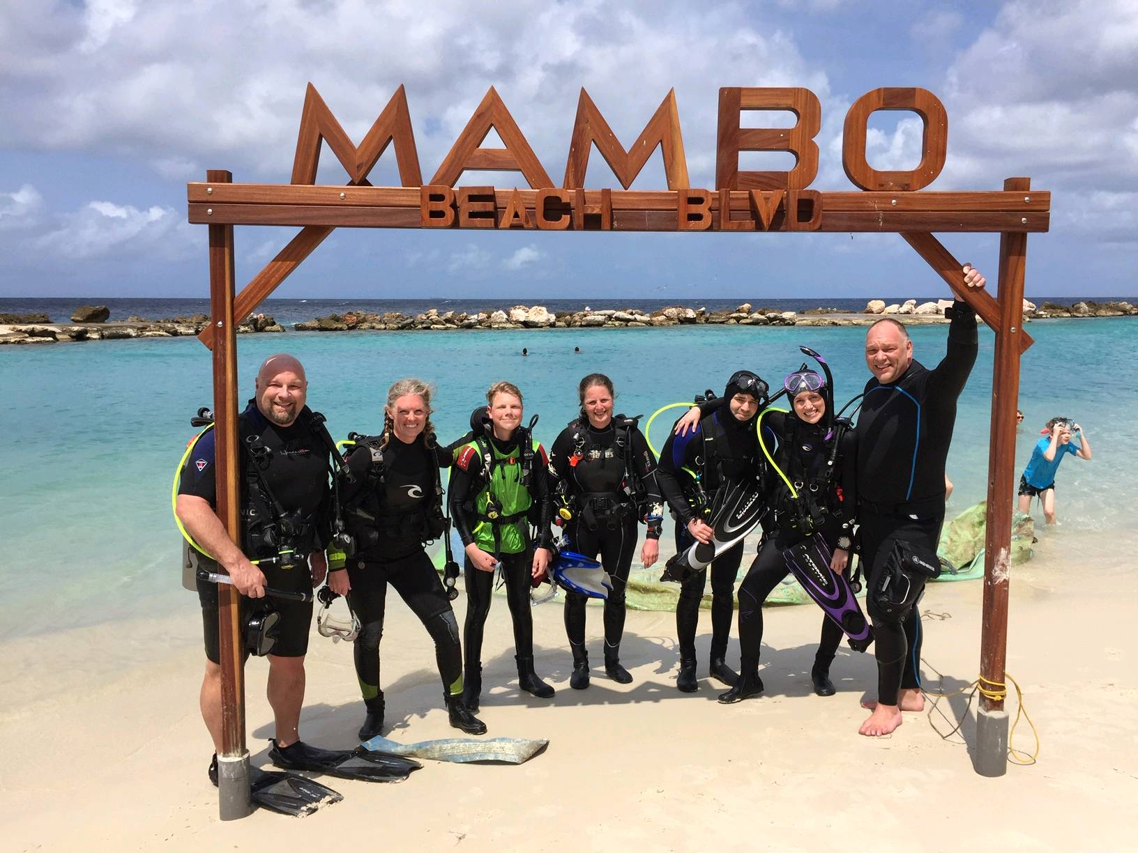
ADS324 - Stella Maris Mambo Beach

0
13
0
0

12.086322, -68.899381

0
0
0
sand
0
11
0
3
0
Beach parties
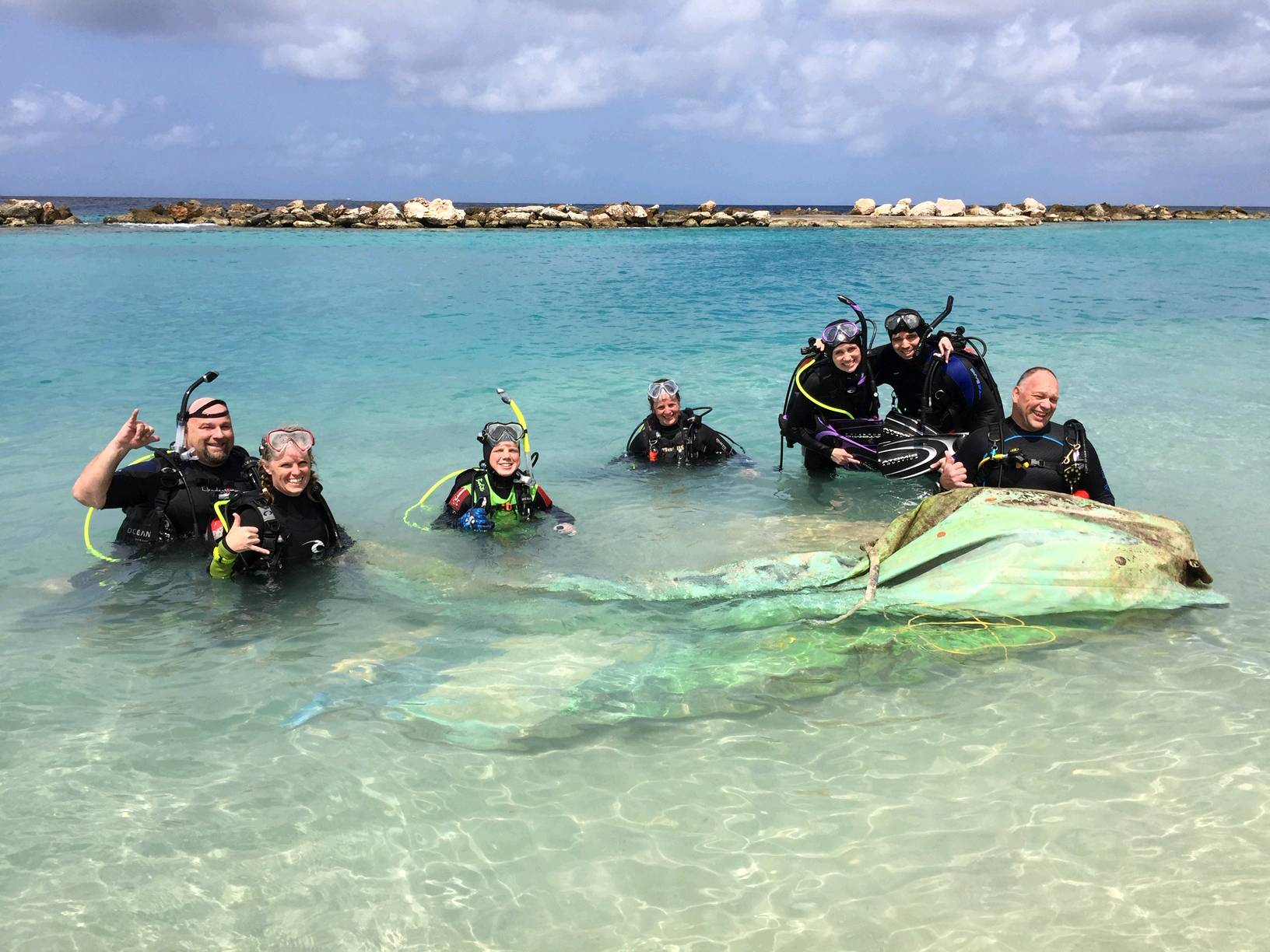
Big ass raft
Clear and sunny
1
Inflatable raft
Tri-City Scuba Centre
Drew Nageleisen
0
1
0
172
0
0
0
0
0
0
0
0
0
4
0
0
0
6
6
8
0
0
0
0
2
0
10
0
0
0
0
0
0
0
0
0
750.00
35
9.00
3.00
3
estimated
0
0
0
0
27511.90
0
0
0
0
0
Raft
0
On
pounds
0
I have debris data to report
10
0
0
Calm (glassy to rippled) for waves 0 – 0.1 meter high
0
0
0
0
8
0
0
m2
5
0
feet
coral reef
0
0
2
0
0
0
0
0
0
0
0
0
0
0
0
0
2
7
0
0
0
0
4
0
0
0
0
0
0
Netherlands Antilles
State\Province
Curaçao
City
Willamsted
Map Help


Dive Location

If you know your survey site coordinates, enter them manually in decimal degrees using WGS84 Map Datum. Use the minus sign for latitudes south of the equator and longitudes west of the Prime Meridian to 180 degrees.

If you do not know your survey site coordinates, click the “Map Location” tab to use the map to zoom into your survey site and drop the pin on the map to fall within your survey dive site in the water (not on land or the beach). Ensure you zoom in as much as possible to ensure data accuracy.
Entangled Help


Use the vertical tabs below to record any entangled animals you found of each type.

Carbarge Wreck

0
0
0

24.680828816237, 54.429338124474

0
0
0
sand
0
0
0
0
0
Wreck dive filled with ghost nets and fishing lines
No
Fishing lure
Good
17
3
0
0
0
0
0
0
0
0
0
0
0
0
0
0
0
0
0
0
Fishing nets
Cans
Al Mahara Dive Center
Daimon
0
0
0
0
0
0
0
0
0
0
0
0
0
0
0
0
0
0
0
10
0
0
0
0
0
0
0
0
0
0
0
0
0
0
11.00
45
14.00
6.00
0
measured
0
0
40.00
0
0
0
0
0
Nets entangled on wreck
0
On
kilograms
0
I have debris data to report
0
0
0
Calm (glassy to rippled) for waves 0 – 0.1 meter high
0
0
0
0
0
0
0
m2
6
0
meters
coral reef
0
0
0
0
0
0
0
0
0
0
0
0
0
0
0
0
0
0
0
0
0
0
0
0
0
0
0
0
United Arab Emirates
City
Abu Dhabi
Map Help


Dive Location

If you know your survey site coordinates, enter them manually in decimal degrees using WGS84 Map Datum. Use the minus sign for latitudes south of the equator and longitudes west of the Prime Meridian to 180 degrees.

If you do not know your survey site coordinates, click the “Map Location” tab to use the map to zoom into your survey site and drop the pin on the map to fall within your survey dive site in the water (not on land or the beach). Ensure you zoom in as much as possible to ensure data accuracy.
Entangled Help


Use the vertical tabs below to record any entangled animals you found of each type.

ADS314 - Shark Island

0
0
0

25.353533, 56.376133

0
0
0
coral
0
2
0
0
0
0
0
0
0
0
0
0
0
0
0
0
0
0
0
0
0
0
0
0
0
N/A
Hassan NK Khayal
0
0
0
0
1
0
0
0
0
0
0
0
0
0
0
0
0
0
0
2
0
1
0
0
0
0
0
0
0
0
0
0
0
0
0.10
60
8.00
3.00
1
estimated
0
0
50.00
0
0
0
0
0
0
On
kilograms
0
I have debris data to report
0
0
0
Slight for waves 0.5 -1.25 meter high
0
0
0
0
0
0
0
m2
0
0
meters
coral reef
0
0
0
0
0
0
0
0
0
0
0
0
0
0
0
0
0
0
0
0
0
0
0
0
0
0
0
0
United Arab Emirates
Map Help


Dive Location

If you know your survey site coordinates, enter them manually in decimal degrees using WGS84 Map Datum. Use the minus sign for latitudes south of the equator and longitudes west of the Prime Meridian to 180 degrees.

If you do not know your survey site coordinates, click the “Map Location” tab to use the map to zoom into your survey site and drop the pin on the map to fall within your survey dive site in the water (not on land or the beach). Ensure you zoom in as much as possible to ensure data accuracy.

Entangled Help


Use the vertical tabs below to record any entangled animals you found of each type.

ADS268 - Dibba Rock

0
0
0

25.6025977, 56.351134

0
0
0
coral
0
0
0
0
0
0
0
0
0
0
0
0
0
0
0
0
0
0
0
0
0
0
0
0
0
N/A
Hassan NK Khayal
0
0
0
0
0
0
0
0
0
0
0
0
0
0
0
0
0
0
0
2
0
0
0
0
0
0
0
0
0
0
0
0
0
0
0.00
60
14.00
4.00
0
estimated
0
0
50.00
0
0
0
0
0
0
On
kilograms
0
Our Survey Site was free of debris
0
0
0
Moderate to rough for waves greater than 1.25 meters
0
0
0
0
0
0
0
m2
0
0
meters
coral reef
0
0
0
0
0
0
0
0
0
0
0
0
0
0
0
0
0
0
0
0
0
0
0
0
0
0
0
0
United Arab Emirates
Map Help


Dive Location

If you know your survey site coordinates, enter them manually in decimal degrees using WGS84 Map Datum. Use the minus sign for latitudes south of the equator and longitudes west of the Prime Meridian to 180 degrees.

If you do not know your survey site coordinates, click the “Map Location” tab to use the map to zoom into your survey site and drop the pin on the map to fall within your survey dive site in the water (not on land or the beach). Ensure you zoom in as much as possible to ensure data accuracy.

Entangled Help


Use the vertical tabs below to record any entangled animals you found of each type.

Subscribe to