Menu

Frenchman's Bay

6
37
1
16
rock
15
25

-33.987723449321, 151.22975595559

Calm
Sydney Dive Safari
Eve Claydon
1
15
8
1
3
2
10
5
1
1
7
5
23.00
30
5.00
1.00
measured
12
300.00
2
On
kilograms
I have debris data to report
16
Calm (glassy to rippled) for waves 0 – 0.1 meter high
2
m2
meters
seagrass
8
3
6
9
80
Australia
State\Province
NSW
City
Sydney
Map Help


Dive Location

If you know your survey site coordinates, enter them manually in decimal degrees using WGS84 Map Datum. Use the minus sign for latitudes south of the equator and longitudes west of the Prime Meridian to 180 degrees.

If you do not know your survey site coordinates, click the “Map Location” tab to use the map to zoom into your survey site and drop the pin on the map to fall within your survey dive site in the water (not on land or the beach). Ensure you zoom in as much as possible to ensure data accuracy.

Entangled Help


Use the vertical tabs below to record any entangled animals you found of each type.

Bare Island

6
35
2
17
rock
10
25

-33.990104568283, 151.23109469934

Golf balls, car water seal, pop-up cooler
Calm
Sydney Dive Safari
Eve Claydon
1
1
15
8
1
1
3
2
10
5
2
1
6
1
1
5
21.00
23
10.00
2.00
measured
12
300.00
1
2
On
kilograms
I have debris data to report
15
1
Calm (glassy to rippled) for waves 0 – 0.1 meter high
2
m2
meters
rocky reef
8
4
6
8
17
Australia
State\Province
NSW
City
Sydney
Map Help


Dive Location

If you know your survey site coordinates, enter them manually in decimal degrees using WGS84 Map Datum. Use the minus sign for latitudes south of the equator and longitudes west of the Prime Meridian to 180 degrees.

If you do not know your survey site coordinates, click the “Map Location” tab to use the map to zoom into your survey site and drop the pin on the map to fall within your survey dive site in the water (not on land or the beach). Ensure you zoom in as much as possible to ensure data accuracy.

Entangled Help


Use the vertical tabs below to record any entangled animals you found of each type.

Playground Toberua

0
0
0
0

-18.011812, 178.734644

0
0
0
sand
0
0
0
0
0
No
Scuba tank boot
Rain
Toberua Divers
Everette Ingram
0
0
0
0
0
0
0
0
1
0
0
0
0
0
0
0
0
0
0
5
0
0
0
0
0
0
0
0
0
0
0
0
0
0
0
0
0.70
40
14.00
6.00
0
measured
0
0
0
0
1178.68
0
0
0
0
0
0
On
kilograms
0
I have debris data to report
0
0
0
Calm (glassy to rippled) for waves 0 – 0.1 meter high
0
0
0
0
0
0
0
m2
0
0
meters
coral reef
0
0
0
0
0
0
0
0
0
0
0
0
0
0
0
0
0
0
0
0
0
0
0
0
0
0
0
0
0
Fiji
City
Nausori
Map Help


Dive Location

If you know your survey site coordinates, enter them manually in decimal degrees using WGS84 Map Datum. Use the minus sign for latitudes south of the equator and longitudes west of the Prime Meridian to 180 degrees.

If you do not know your survey site coordinates, click the “Map Location” tab to use the map to zoom into your survey site and drop the pin on the map to fall within your survey dive site in the water (not on land or the beach). Ensure you zoom in as much as possible to ensure data accuracy.

Entangled Help


Use the vertical tabs below to record any entangled animals you found of each type.

Twin Sisters Toberua

0
0
0
0

-18.026327, 178.744054

0
0
0
coral
0
0
0
0
0
Car part used as anchor
Rain
Toberua Divers
Everette Ingram
0
1
0
0
0
0
0
0
0
0
0
0
0
0
0
0
0
0
0
2
0
0
0
0
0
0
0
0
0
0
0
0
0
0
0
0
16.86
53
20.00
10.00
1
measured
0
0
0
0
829.05
0
0
0
0
0
Rope
0
On
kilograms
0
I have debris data to report
0
0
0
Smooth (wavelets) for waves 0.1 - 0.5 meter high
0
0
0
0
0
0
0
m2
1
0
meters
coral reef
0
0
0
0
0
0
1
0
0
0
0
0
0
0
0
0
0
0
0
0
0
0
0
0
0
0
0
0
0
Fiji
City
Toberua Island
Map Help


Dive Location

If you know your survey site coordinates, enter them manually in decimal degrees using WGS84 Map Datum. Use the minus sign for latitudes south of the equator and longitudes west of the Prime Meridian to 180 degrees.

If you do not know your survey site coordinates, click the “Map Location” tab to use the map to zoom into your survey site and drop the pin on the map to fall within your survey dive site in the water (not on land or the beach). Ensure you zoom in as much as possible to ensure data accuracy.

Entangled Help


Use the vertical tabs below to record any entangled animals you found of each type.

Intercontinental

0
0
0

24.456188352323, 54.327691284355

0
0
0
silt
0
2
0
0
0
None
No
None
None
Clear 95 degrees
0
0
0
0
0
0
0
0
0
0
0
0
0
0
0
0
0
0
0
0
Ocean Diver Centre
Steven
0
0
0
0
0
0
0
0
0
0
0
0
0
0
0
0
0
0
0
2
0
0
0
0
0
0
0
0
0
0
0
0
0
0
2.00
30
7.00
3.00
0
estimated
0
0
3996.93
0
0
0
0
0
Ropes
0
On
kilograms
0
I have debris data to report
2
0
0
Smooth (wavelets) for waves 0.1 - 0.5 meter high
0
0
0
0
0
0
0
m2
0
0
meters
other
0
0
2
0
0
0
0
0
0
0
0
0
0
0
0
0
5
0
0
0
0
0
0
0
0
0
0
0
United Arab Emirates
City
Abu Dhabi
Map Help


Dive Location

If you know your survey site coordinates, enter them manually in decimal degrees using WGS84 Map Datum. Use the minus sign for latitudes south of the equator and longitudes west of the Prime Meridian to 180 degrees.

If you do not know your survey site coordinates, click the “Map Location” tab to use the map to zoom into your survey site and drop the pin on the map to fall within your survey dive site in the water (not on land or the beach). Ensure you zoom in as much as possible to ensure data accuracy.
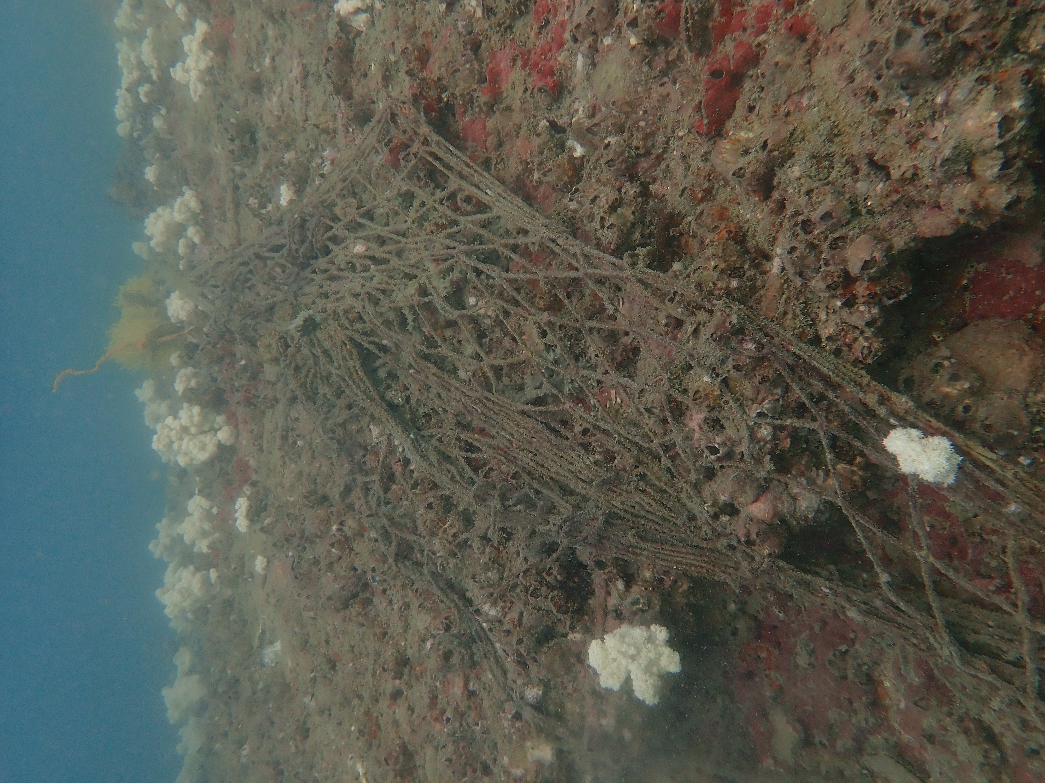
Entangled Help


Use the vertical tabs below to record any entangled animals you found of each type.

Cepu Island

2
coral

6.1717068461148, 99.789297599654

Langkawi Scuba
Magda
3
15.00
60
12.00
3.00
estimated
60.00
On
kilograms
I have debris data to report
Smooth (wavelets) for waves 0.1 - 0.5 meter high m2
1
Fishing net
Tiger Tail Seahorse
Released Unharmed
meters
coral reef
Malaysia
City
Langkawi
Map Help


Dive Location

If you know your survey site coordinates, enter them manually in decimal degrees using WGS84 Map Datum. Use the minus sign for latitudes south of the equator and longitudes west of the Prime Meridian to 180 degrees.

If you do not know your survey site coordinates, click the “Map Location” tab to use the map to zoom into your survey site and drop the pin on the map to fall within your survey dive site in the water (not on land or the beach). Ensure you zoom in as much as possible to ensure data accuracy.

Entangled Help


Use the vertical tabs below to record any entangled animals you found of each type.

Laem Farang

0
0
0
0

12.551483, 100.953014

0
0
0
sand
0
0
0
0
0
No
Hessian sack
Good
Mermaids Dive Center
Gordon
0
0
0
0
0
0
0
0
0
0
0
0
0
0
0
0
0
0
0
4
0
0
0
0
0
0
0
0
0
0
0
0
0
0
0
0
1.20
47
23.00
5.00
0
estimated
0
0
0
0
944.59
0
0
0
0
0
Hessian sack
Rope
Fish net
0
On
kilograms
0
I have debris data to report
0
0
0
Calm (glassy to rippled) for waves 0 – 0.1 meter high
0
0
0
0
2
0
1
m2
1
0
meters
coral reef
0
0
0
0
0
0
0
0
0
0
0
0
0
0
0
0
0
0
0
0
0
0
0
0
0
0
0
0
0
Thailand
State\Province
Chonburi
City
Sattahip
Map Help


Dive Location

If you know your survey site coordinates, enter them manually in decimal degrees using WGS84 Map Datum. Use the minus sign for latitudes south of the equator and longitudes west of the Prime Meridian to 180 degrees.

If you do not know your survey site coordinates, click the “Map Location” tab to use the map to zoom into your survey site and drop the pin on the map to fall within your survey dive site in the water (not on land or the beach). Ensure you zoom in as much as possible to ensure data accuracy.

Entangled Help


Use the vertical tabs below to record any entangled animals you found of each type.

Aow Leuk

16
sand
20
8

10.070850632253, 99.84112380869

New Way Diving
James Young
5
7
27
15
3
29.70
60
8.50
1.50
measured
19315.50
On
kilograms
I have debris data to report
5
Smooth (wavelets) for waves 0.1 - 0.5 meter high m2
meters
coral reef
2
2
3
4
4
3
Thailand
City
Koh Tao
Map Help


Dive Location

If you know your survey site coordinates, enter them manually in decimal degrees using WGS84 Map Datum. Use the minus sign for latitudes south of the equator and longitudes west of the Prime Meridian to 180 degrees.

If you do not know your survey site coordinates, click the “Map Location” tab to use the map to zoom into your survey site and drop the pin on the map to fall within your survey dive site in the water (not on land or the beach). Ensure you zoom in as much as possible to ensure data accuracy.

Entangled Help


Use the vertical tabs below to record any entangled animals you found of each type.

Shark Bay

5
coral
7

10.06159409609, 99.832047511074

cement Block
New Way Diving
James Young
3
2
27
26.60
60
15.00
2.00
measured
24211.90
4
On
kilograms
I have debris data to report
3
Smooth (wavelets) for waves 0.1 - 0.5 meter high m2
5
meters
coral reef
4
8
2
3
1
6
Thailand
City
Koh Tao
Map Help


Dive Location

If you know your survey site coordinates, enter them manually in decimal degrees using WGS84 Map Datum. Use the minus sign for latitudes south of the equator and longitudes west of the Prime Meridian to 180 degrees.

If you do not know your survey site coordinates, click the “Map Location” tab to use the map to zoom into your survey site and drop the pin on the map to fall within your survey dive site in the water (not on land or the beach). Ensure you zoom in as much as possible to ensure data accuracy.

Entangled Help


Use the vertical tabs below to record any entangled animals you found of each type.

Moonlight Cove

0
0
0

32.417710994028, -117.25896056114

0
0
0
seagrass
0
0
0
0
0
Sunny
0
0
0
0
0
0
0
0
0
0
0
0
0
0
0
0
0
0
0
0
Waterhorse Charters
Danna
0
0
0
0
0
0
0
0
0
0
0
0
0
0
0
0
0
0
0
20
0
0
0
0
0
0
0
0
0
0
0
0
0
0
0.25
50
45.00
7.00
0
estimated
0
0
68550.30
0
0
0
0
0
0
On
pounds
0
I have debris data to report
1
0
0
Smooth (wavelets) for waves 0.1 - 0.5 meter high
0
0
0
0
0
0
0
ft2
0
0
feet
seagrass
0
0
0
0
0
0
0
0
0
0
0
0
0
0
0
0
0
0
0
0
0
0
0
0
0
0
0
0
Mexico
State\Province
Mexico
City
Coronado Islands
Map Help


Dive Location

If you know your survey site coordinates, enter them manually in decimal degrees using WGS84 Map Datum. Use the minus sign for latitudes south of the equator and longitudes west of the Prime Meridian to 180 degrees.

If you do not know your survey site coordinates, click the “Map Location” tab to use the map to zoom into your survey site and drop the pin on the map to fall within your survey dive site in the water (not on land or the beach). Ensure you zoom in as much as possible to ensure data accuracy.

Entangled Help


Use the vertical tabs below to record any entangled animals you found of each type.

Subscribe to