Menu

ADS354 - Site X

-4.61765, 55.396383

9
coral
10
Stormy
GVI
Andy Ezeta
5
8.00
35
11.00
7.00
measured
1
3750.00
On
kilograms
I have debris data to report
4
Moderate to rough for waves greater than 1.25 meters m2
1
2
meters
coral reef
34
11
4
11
Seychelles
State\Province
Seychelles
City
Seychelles
Map Help


Dive Location

If you know your survey site coordinates, enter them manually in decimal degrees using WGS84 Map Datum. Use the minus sign for latitudes south of the equator and longitudes west of the Prime Meridian to 180 degrees.

If you do not know your survey site coordinates, click the “Map Location” tab to use the map to zoom into your survey site and drop the pin on the map to fall within your survey dive site in the water (not on land or the beach). Ensure you zoom in as much as possible to ensure data accuracy.

Entangled Help


Use the vertical tabs below to record any entangled animals you found of each type.

Sacred Reef

0
0
0
0

-18.009433, 178.733008

0
0
0
sand
0
0
0
0
0
No
Nothing unusual
Rain
Toberua Divers
Everette Ingram
0
0
0
0
0
0
0
0
0
0
0
0
0
0
0
0
0
0
0
3
0
0
0
0
0
0
0
0
0
0
0
0
0
0
0
0
8.14
27
15.00
5.00
0
measured
0
0
0
0
3733.00
0
0
0
0
0
Glass bottles
0
On
kilograms
0
I have debris data to report
5
0
0
Smooth (wavelets) for waves 0.1 - 0.5 meter high
0
0
0
0
0
0
0
m2
0
0
meters
coral reef
0
0
0
0
0
0
0
0
0
0
0
0
0
0
0
0
0
0
0
0
0
0
0
0
0
0
0
0
0
Fiji
City
Nausori
Map Help


Dive Location

If you know your survey site coordinates, enter them manually in decimal degrees using WGS84 Map Datum. Use the minus sign for latitudes south of the equator and longitudes west of the Prime Meridian to 180 degrees.

If you do not know your survey site coordinates, click the “Map Location” tab to use the map to zoom into your survey site and drop the pin on the map to fall within your survey dive site in the water (not on land or the beach). Ensure you zoom in as much as possible to ensure data accuracy.
Entangled Help


Use the vertical tabs below to record any entangled animals you found of each type.

ADS320 - Tugboat

rock
1300

12.069364293503, -68.8620854055

CURious 2 DIVE
Hans Pleij
7
3.50
60
18.00
1.00
measured
56
2000.00
On
kilograms
I have debris data to report
Calm (glassy to rippled) for waves 0 – 0.1 meter high m2
meters
rocky reef
Netherlands Antilles
State\Province
Curacao
City
Willemstad
Map Help


Dive Location

If you know your survey site coordinates, enter them manually in decimal degrees using WGS84 Map Datum. Use the minus sign for latitudes south of the equator and longitudes west of the Prime Meridian to 180 degrees.

If you do not know your survey site coordinates, click the “Map Location” tab to use the map to zoom into your survey site and drop the pin on the map to fall within your survey dive site in the water (not on land or the beach). Ensure you zoom in as much as possible to ensure data accuracy.

Entangled Help


Use the vertical tabs below to record any entangled animals you found of each type.

Caracasbaai Baja Beach

sand
9
250

12.070239813622, -68.861589713204

good
CURious 2 DIVE
Hans Pleij
14
4
5
56
9
18
64.00
60
20.00
2.00
measured
61
2500.00
On
kilograms
I have debris data to report
68
Calm (glassy to rippled) for waves 0 – 0.1 meter high m2
33
meters
rocky reef
54
7
Netherlands Antilles
State\Province
Curacao
City
Willemstad
Map Help


Dive Location

If you know your survey site coordinates, enter them manually in decimal degrees using WGS84 Map Datum. Use the minus sign for latitudes south of the equator and longitudes west of the Prime Meridian to 180 degrees.

If you do not know your survey site coordinates, click the “Map Location” tab to use the map to zoom into your survey site and drop the pin on the map to fall within your survey dive site in the water (not on land or the beach). Ensure you zoom in as much as possible to ensure data accuracy.

Entangled Help


Use the vertical tabs below to record any entangled animals you found of each type.

ADS320 - Tugboat

rock

12.069449981484, -68.862132787819

CURious 2 DIVE
Hans Pleij
9
3
2
1
13.00
60
18.00
1.00
20
measured
2500.00
On
kilograms
I have debris data to report
1
Calm (glassy to rippled) for waves 0 – 0.1 meter high m2
meters
rocky reef
Netherlands Antilles
State\Province
Curacao
City
Willemstad
Map Help


Dive Location

If you know your survey site coordinates, enter them manually in decimal degrees using WGS84 Map Datum. Use the minus sign for latitudes south of the equator and longitudes west of the Prime Meridian to 180 degrees.

If you do not know your survey site coordinates, click the “Map Location” tab to use the map to zoom into your survey site and drop the pin on the map to fall within your survey dive site in the water (not on land or the beach). Ensure you zoom in as much as possible to ensure data accuracy.

Entangled Help


Use the vertical tabs below to record any entangled animals you found of each type.

ADS47 - West Hawk Lake Cats Ass

silt

49.745288586303, -95.208520653625

While we had missed doing a survey December 2018 before the lake froze over, the site was still debris free under the ice.
Diver City SCUBA
Jacqui
10
0.00
20
40.00
10.00
measured
200.00
On
pounds
Our Survey Site was free of debris
Calm (glassy to rippled) for waves 0 – 0.1 meter high ft2
feet
other
Canada
State\Province
MB
City
Winnipeg
Map Help


Dive Location

If you know your survey site coordinates, enter them manually in decimal degrees using WGS84 Map Datum. Use the minus sign for latitudes south of the equator and longitudes west of the Prime Meridian to 180 degrees.

If you do not know your survey site coordinates, click the “Map Location” tab to use the map to zoom into your survey site and drop the pin on the map to fall within your survey dive site in the water (not on land or the beach). Ensure you zoom in as much as possible to ensure data accuracy.

Entangled Help


Use the vertical tabs below to record any entangled animals you found of each type.

Ecosystem Other
Freshwater lake

Cirkewwa - Left reef

0
19
0
0

35.988626, 14.327918

0
0
1
rock
0
1
0
0
0
Strong wind of previous days
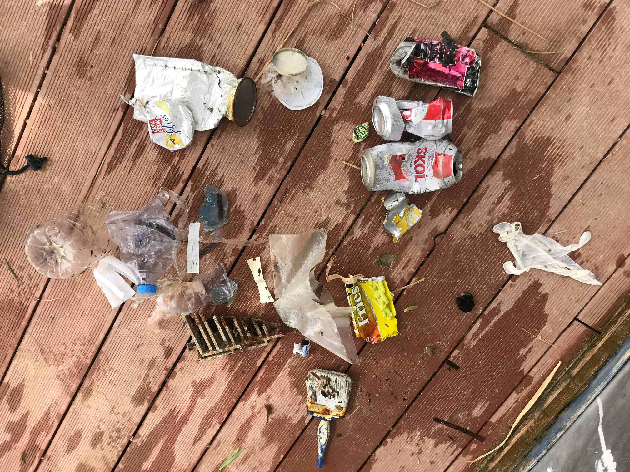
Paint brush
4 bft N/W
1
Paint brush
Orange Shark Diving Centre
Alessio Tenenti
0
0
0
1
0
0
0
0
0
0
0
0
0
0
0
0
0
0
0
4
0
0
0
0
0
0
2
0
0
0
0
0
0
0
0
0
4.00
50
20.00
2.00
0
estimated
0
0
0
0
9179.89
0
0
0
0
0
Plastic
0
On
kilograms
0
I have debris data to report
0
0
0
Slight for waves 0.5 -1.25 meter high
0
0
0
0
0
0
0
m2
0
0
meters
seagrass
0
0
0
0
0
1
0
0
0
0
0
0
0
0
0
0
1
4
0
0
0
0
1
0
0
0
0
0
0
Malta
Map Help


Dive Location

If you know your survey site coordinates, enter them manually in decimal degrees using WGS84 Map Datum. Use the minus sign for latitudes south of the equator and longitudes west of the Prime Meridian to 180 degrees.

If you do not know your survey site coordinates, click the “Map Location” tab to use the map to zoom into your survey site and drop the pin on the map to fall within your survey dive site in the water (not on land or the beach). Ensure you zoom in as much as possible to ensure data accuracy.

Entangled Help


Use the vertical tabs below to record any entangled animals you found of each type.

Fuikbaai

sand

12.056641846252, -68.8367563678

This was all left behind by the participants of Fuikdag 2019
CURious 2 DIVE for the DTF
Hans Pleij
79
1150.00
60
9.00
1.00
measured
6000.00
On
kilograms
I have debris data to report
Calm (glassy to rippled) for waves 0 – 0.1 meter high m2
meters
seagrass
Netherlands Antilles
State\Province
Curacao
City
Willemstad
Map Help


Dive Location

If you know your survey site coordinates, enter them manually in decimal degrees using WGS84 Map Datum. Use the minus sign for latitudes south of the equator and longitudes west of the Prime Meridian to 180 degrees.

If you do not know your survey site coordinates, click the “Map Location” tab to use the map to zoom into your survey site and drop the pin on the map to fall within your survey dive site in the water (not on land or the beach). Ensure you zoom in as much as possible to ensure data accuracy.

Entangled Help


Use the vertical tabs below to record any entangled animals you found of each type.

ADS320 - Tugboat

sand

12.069589258386, -68.862075731716

good
CURious 2 DIVE
Tessa Pleij
11
250.00
60
23.00
1.00
measured
2500.00
7
On
kilograms
I have debris data to report
4
Calm (glassy to rippled) for waves 0 – 0.1 meter high m2
meters
rocky reef
Netherlands Antilles
State\Province
Curacao
City
Willemstad
Map Help


Dive Location

If you know your survey site coordinates, enter them manually in decimal degrees using WGS84 Map Datum. Use the minus sign for latitudes south of the equator and longitudes west of the Prime Meridian to 180 degrees.

If you do not know your survey site coordinates, click the “Map Location” tab to use the map to zoom into your survey site and drop the pin on the map to fall within your survey dive site in the water (not on land or the beach). Ensure you zoom in as much as possible to ensure data accuracy.

Entangled Help


Use the vertical tabs below to record any entangled animals you found of each type.

ADS320 - Tugboat

rock
2
250

12.069350386687, -68.862088794628

good
CURious 2 DIVE
Hans Pleij
6
4
1
11.00
60
15.00
1.00
measured
12
1500.00
On
kilograms
I have debris data to report
13
2
Calm (glassy to rippled) for waves 0 – 0.1 meter high m2
meters
coral reef
9
2
Netherlands Antilles
State\Province
Curacao
City
Willemstad
Map Help


Dive Location

If you know your survey site coordinates, enter them manually in decimal degrees using WGS84 Map Datum. Use the minus sign for latitudes south of the equator and longitudes west of the Prime Meridian to 180 degrees.

If you do not know your survey site coordinates, click the “Map Location” tab to use the map to zoom into your survey site and drop the pin on the map to fall within your survey dive site in the water (not on land or the beach). Ensure you zoom in as much as possible to ensure data accuracy.

Entangled Help


Use the vertical tabs below to record any entangled animals you found of each type.

Subscribe to