Menu

חוף רימונים

0
0
0
0

29.549626, 34.956219

0
0
0
sand
0
0
0
0
0
חמים
שומרי המפרץ
יהב
0
0
0
0
0
0
0
0
0
0
0
0
0
0
0
0
0
0
0
14
0
0
0
0
0
0
0
0
0
0
0
0
0
0
0
0
2.00
44
8.00
0.00
0
estimated
0
0
0
0
1280.38
0
0
0
0
0
0
On
kilograms
0
I have debris data to report
0
0
0
Smooth (wavelets) for waves 0.1 - 0.5 meter high
0
0
0
0
0
0
0
m2
0
0
meters
coral reef
0
0
0
0
0
0
0
0
0
0
0
0
0
0
0
0
0
0
0
0
0
0
0
0
0
0
0
0
0
Israel
State\Province
Israel
City
Eilat
Map Help


Dive Location

If you know your survey site coordinates, enter them manually in decimal degrees using WGS84 Map Datum. Use the minus sign for latitudes south of the equator and longitudes west of the Prime Meridian to 180 degrees.

If you do not know your survey site coordinates, click the “Map Location” tab to use the map to zoom into your survey site and drop the pin on the map to fall within your survey dive site in the water (not on land or the beach). Ensure you zoom in as much as possible to ensure data accuracy.

Entangled Help


Use the vertical tabs below to record any entangled animals you found of each type.

Aow Leuk, Koh Tao

0
23
3
1

10.07163, 99.844094

1
0
0
sand
1
2
1
5
0
Bad weather
Sun hat
Sunny
Eco Koh Tao - Crystal Dive
Jennifer Dowling
0
0
0
0
0
0
0
0
0
0
2
0
0
1
0
0
0
1
0
7
0
0
0
0
0
1
3
0
0
0
0
0
0
0
0
0
6.50
58
8.00
3.00
4
estimated
0
0
0
0
75.00
0
0
0
0
0
Plastic
Plastic frags
0
On
kilograms
0
I have debris data to report
0
0
0
Smooth (wavelets) for waves 0.1 - 0.5 meter high
1
0
1
0
2
1
0
m2
0
0
meters
coral reef
0
0
0
0
0
0
0
0
0
1
0
0
0
0
0
0
0
0
0
0
0
0
2
0
0
0
0
0
0
Thailand
State\Province
Surat Thani
City
Koh Tao
Map Help


Dive Location

If you know your survey site coordinates, enter them manually in decimal degrees using WGS84 Map Datum. Use the minus sign for latitudes south of the equator and longitudes west of the Prime Meridian to 180 degrees.

If you do not know your survey site coordinates, click the “Map Location” tab to use the map to zoom into your survey site and drop the pin on the map to fall within your survey dive site in the water (not on land or the beach). Ensure you zoom in as much as possible to ensure data accuracy.
Entangled Help


Use the vertical tabs below to record any entangled animals you found of each type.

ADS517 - Playa Dorada

4

28.862463, -13.829597

sand
2

28.861635522583, -13.824017127813

quiet and sunny
Lanzarote Non Stop Divers
Emilia Fulgido
2
1
4
4
1
2.00
40
7.00
2.00
estimated
1
5000.00
On
kilograms
I have debris data to report
Calm (glassy to rippled) for waves 0 – 0.1 meter high m2
meters
rocky reef
1
2
6
Spain
State\Province
Lanzarote
City
Playa Blanca
Map Help


Dive Location

If you know your survey site coordinates, enter them manually in decimal degrees using WGS84 Map Datum. Use the minus sign for latitudes south of the equator and longitudes west of the Prime Meridian to 180 degrees.

If you do not know your survey site coordinates, click the “Map Location” tab to use the map to zoom into your survey site and drop the pin on the map to fall within your survey dive site in the water (not on land or the beach). Ensure you zoom in as much as possible to ensure data accuracy.

Entangled Help


Use the vertical tabs below to record any entangled animals you found of each type.

Leam Farang

rock

12.551438561701, 100.95317195403

Mermaids Dive Center
Daniel Burns
1
3
0.10
40
30.00
7.00
estimated
3462.00
On
kilograms
I have debris data to report
Slight for waves 0.5 -1.25 meter high m2
meters
rocky reef
Thailand
State\Province
Chonburi
City
Pattaya
Map Help


Dive Location

If you know your survey site coordinates, enter them manually in decimal degrees using WGS84 Map Datum. Use the minus sign for latitudes south of the equator and longitudes west of the Prime Meridian to 180 degrees.

If you do not know your survey site coordinates, click the “Map Location” tab to use the map to zoom into your survey site and drop the pin on the map to fall within your survey dive site in the water (not on land or the beach). Ensure you zoom in as much as possible to ensure data accuracy.

Entangled Help


Use the vertical tabs below to record any entangled animals you found of each type.

BAHADIR

0
1
0
0

21.758407, 39.055194

4
0
0
sand
0
1
0
3
0

21.757377546137, 39.053274070541

Currently
4
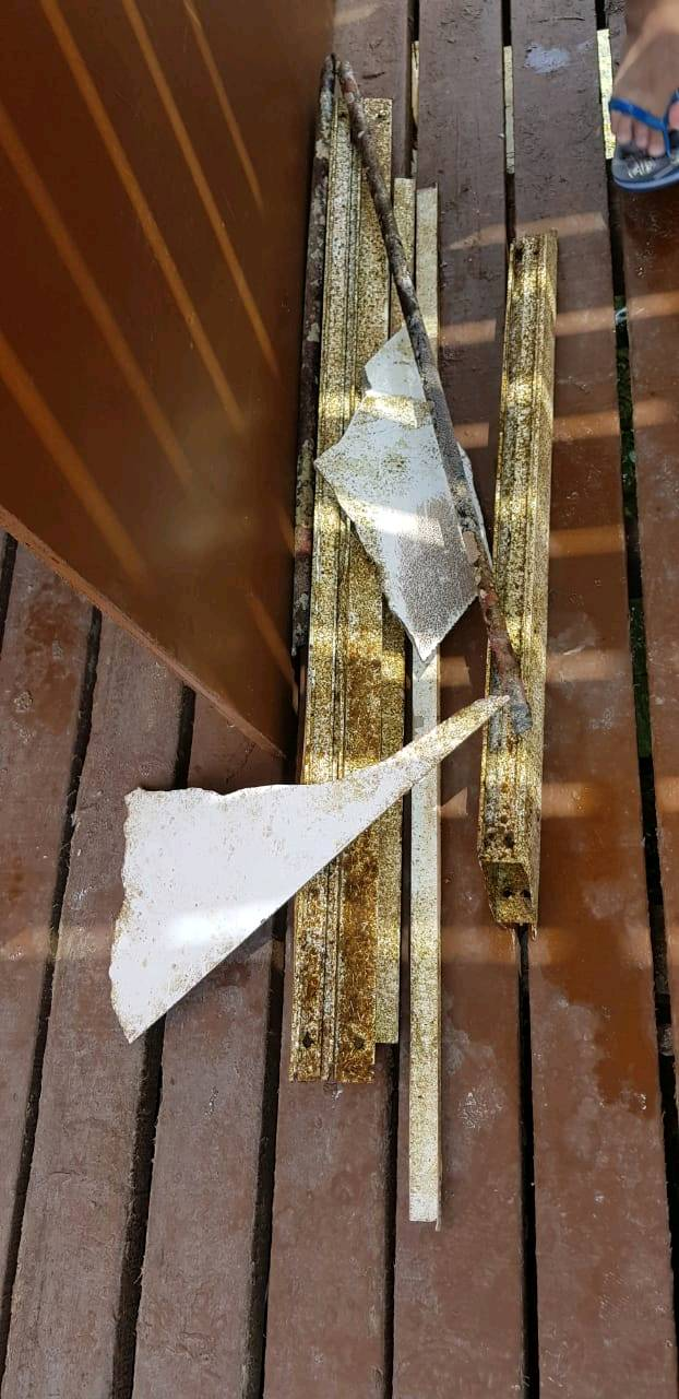
Aluminum frame
Blue Reef
Safar Turkoglu
0
1
0
2
3
0
0
0
0
0
0
0
0
0
0
0
0
0
0
4
0
0
0
0
0
2
6
0
0
0
0
0
0
0
0
0
4.30
43
13.00
8.00
0
measured
0
0
0
4
350.00
0
0
0
0
0
0
On
kilograms
0
I have debris data to report
7
0
0
Smooth (wavelets) for waves 0.1 - 0.5 meter high
2
0
0
0
0
0
0
m2
0
0
meters
coral reef
0
0
0
1
0
0
0
0
0
0
0
0
0
0
0
0
0
4
0
0
0
0
0
0
0
0
0
0
0
Saudi Arabia
State\Province
Obhur
City
Jeddah
Map Help


Dive Location

If you know your survey site coordinates, enter them manually in decimal degrees using WGS84 Map Datum. Use the minus sign for latitudes south of the equator and longitudes west of the Prime Meridian to 180 degrees.

If you do not know your survey site coordinates, click the “Map Location” tab to use the map to zoom into your survey site and drop the pin on the map to fall within your survey dive site in the water (not on land or the beach). Ensure you zoom in as much as possible to ensure data accuracy.
Entangled Help


Use the vertical tabs below to record any entangled animals you found of each type.

Htms Chang

0
0
0

11.946773538764, 102.26447850063

0
0
0
other
0
0
0
0
0
None
Good
4
0
0
0
0
0
0
0
0
0
0
0
0
0
0
0
0
0
0
0
Fishingnets
Kohmakdivers
Martijn schaink
0
0
0
0
0
0
0
0
0
0
0
0
0
0
0
0
0
0
0
2
0
0
0
0
0
0
0
0
0
0
0
0
0
0
15.00
30
30.00
5.00
0
estimated
0
0
100.00
0
0
0
0
0
0
On
kilograms
0
I have debris data to report
0
0
0
Smooth (wavelets) for waves 0.1 - 0.5 meter high
0
0
0
Released Unharmed
Boxfish
1
Silt
0
0
0
0
m2
0
0
meters
other
0
0
0
0
0
0
0
0
0
0
0
0
0
0
0
0
0
0
0
0
0
0
0
0
0
0
0
0
Thailand
State\Province
Trat
City
Kohmak
Map Help


Dive Location

If you know your survey site coordinates, enter them manually in decimal degrees using WGS84 Map Datum. Use the minus sign for latitudes south of the equator and longitudes west of the Prime Meridian to 180 degrees.

If you do not know your survey site coordinates, click the “Map Location” tab to use the map to zoom into your survey site and drop the pin on the map to fall within your survey dive site in the water (not on land or the beach). Ensure you zoom in as much as possible to ensure data accuracy.
Entangled Help


Use the vertical tabs below to record any entangled animals you found of each type.

Laem Falang

0
0
0
0

12.550726, 100.953016

0
0
0
sand
0
0
0
0
0
Good
1
Fishing net & rope
Mermaids Dive Center
Gordon
0
0
0
0
0
0
0
0
0
0
0
0
0
0
0
0
0
0
0
3
0
0
0
0
0
0
0
0
0
0
0
0
0
0
0
0
6.00
50
24.00
8.00
0
estimated
0
0
0
0
821.37
0
0
0
0
0
0
On
kilograms
0
I have debris data to report
0
0
0
Slight for waves 0.5 -1.25 meter high
0
0
0
0
0
0
0
m2
0
0
meters
coral reef
0
0
0
0
0
0
0
0
0
0
0
0
0
0
0
0
0
0
0
0
0
0
0
0
0
0
0
0
0
Thailand
State\Province
Chonburi
City
Sattahip
Map Help


Dive Location

If you know your survey site coordinates, enter them manually in decimal degrees using WGS84 Map Datum. Use the minus sign for latitudes south of the equator and longitudes west of the Prime Meridian to 180 degrees.

If you do not know your survey site coordinates, click the “Map Location” tab to use the map to zoom into your survey site and drop the pin on the map to fall within your survey dive site in the water (not on land or the beach). Ensure you zoom in as much as possible to ensure data accuracy.

Entangled Help


Use the vertical tabs below to record any entangled animals you found of each type.

BAHADIR

4
1
sand
1
2

21.746988519114, 39.044732501574

BLUE REEF
SAFAR TURKOGLU
6
7
2
6
1
8.40
45
14.00
6.00
1
measured
1
400.00
1
On
kilograms
Our Survey Site was free of debris
5
Smooth (wavelets) for waves 0.1 - 0.5 meter high m2
meters
coral reef
2
2
3
1
Saudi Arabia
State\Province
OBHUR
City
JEDDAH
Map Help


Dive Location

If you know your survey site coordinates, enter them manually in decimal degrees using WGS84 Map Datum. Use the minus sign for latitudes south of the equator and longitudes west of the Prime Meridian to 180 degrees.

If you do not know your survey site coordinates, click the “Map Location” tab to use the map to zoom into your survey site and drop the pin on the map to fall within your survey dive site in the water (not on land or the beach). Ensure you zoom in as much as possible to ensure data accuracy.
Entangled Help


Use the vertical tabs below to record any entangled animals you found of each type.

ADS518 - Batu Bolong

0
3
0
0

-8.536846, 119.614061

0
0
0
coral
0
1
0
0
0

-8.5368403107847, 119.61397287065

Wind and heavy rain
Azul Unlimited
Aitor Diaz
0
0
0
0
0
0
0
0
0
0
0
0
0
0
0
0
0
0
4
2
0
0
0
0
0
0
0
0
0
1.00
50
20.00
8.00
0
measured
0
0
70.00
Single use gel or shampoo
plastic cups
plastic forks , spoons
On
kilograms
I have debris data to report
Smooth (wavelets) for waves 0.1 - 0.5 meter high m2
meters
rocky reef
Indonesia
State\Province
NTT
City
Labuan Bajo
Map Help


Dive Location

If you know your survey site coordinates, enter them manually in decimal degrees using WGS84 Map Datum. Use the minus sign for latitudes south of the equator and longitudes west of the Prime Meridian to 180 degrees.

If you do not know your survey site coordinates, click the “Map Location” tab to use the map to zoom into your survey site and drop the pin on the map to fall within your survey dive site in the water (not on land or the beach). Ensure you zoom in as much as possible to ensure data accuracy.
Entangled Help


Use the vertical tabs below to record any entangled animals you found of each type.

ADS536 - Rye Pier

-38.36852, 144.8224

sand
1
Hooked on loose line on sea floor 20m from pier
Ocean Divers
Liz Harper
1
0.10
45
7.00
2.00
estimated
2
50.00
On
kilograms
I have debris data to report
Calm (glassy to rippled) for waves 0 – 0.1 meter high
Released Unharmed
Fiddler Ray
1
m2
meters
other
Fishing Hook and line
Australia
State\Province
Victoria
City
Bentleigh East
Map Help


Dive Location

If you know your survey site coordinates, enter them manually in decimal degrees using WGS84 Map Datum. Use the minus sign for latitudes south of the equator and longitudes west of the Prime Meridian to 180 degrees.

If you do not know your survey site coordinates, click the “Map Location” tab to use the map to zoom into your survey site and drop the pin on the map to fall within your survey dive site in the water (not on land or the beach). Ensure you zoom in as much as possible to ensure data accuracy.
Entangled Help


Use the vertical tabs below to record any entangled animals you found of each type.

Subscribe to