Menu

Dive Friends Bonaire Bari's Reef (Sand Dollar Resort)

3
coral

12.167979312192, -68.287500609727

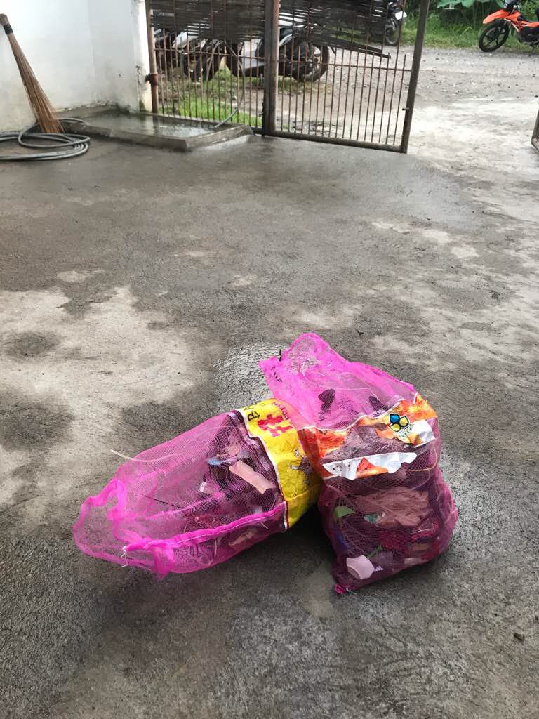
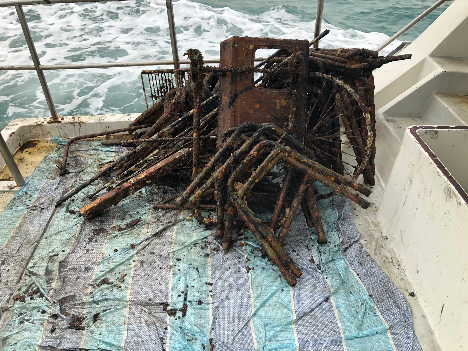
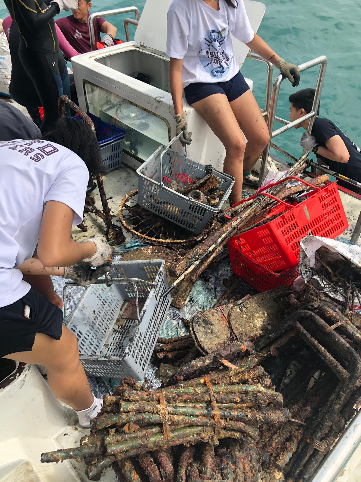
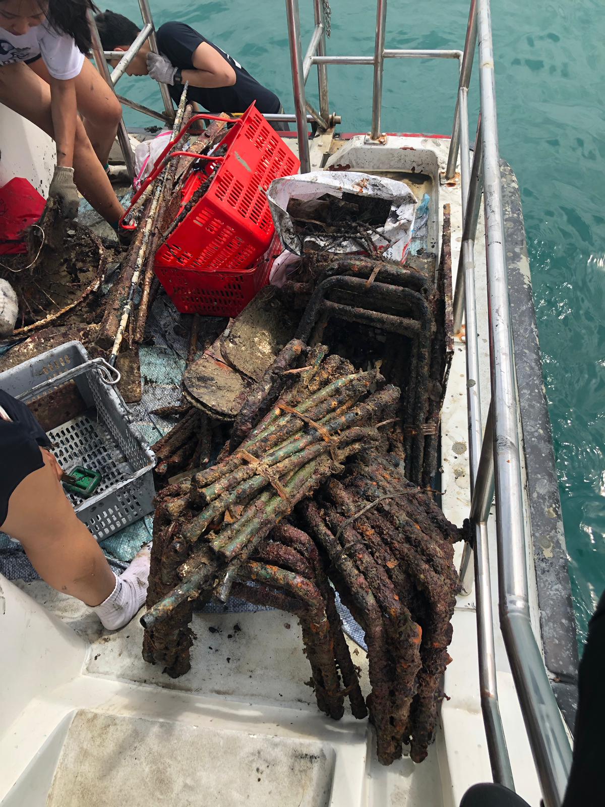
There are a lot of oil drums, machine parts, and glass bottles that are already over grown with corals that were not removed.
Dive site is near a popular beach bar on Bonaire.
32 degrees C, partly sunny, scattered rain and small storm cells passing through
1
Sunglasses (mostly plastic, metal screws)
Dive Friends Bonaire
Kathryn Hehre
2
4
14.00
51
12.70
5.00
estimated
1200.00
1
8
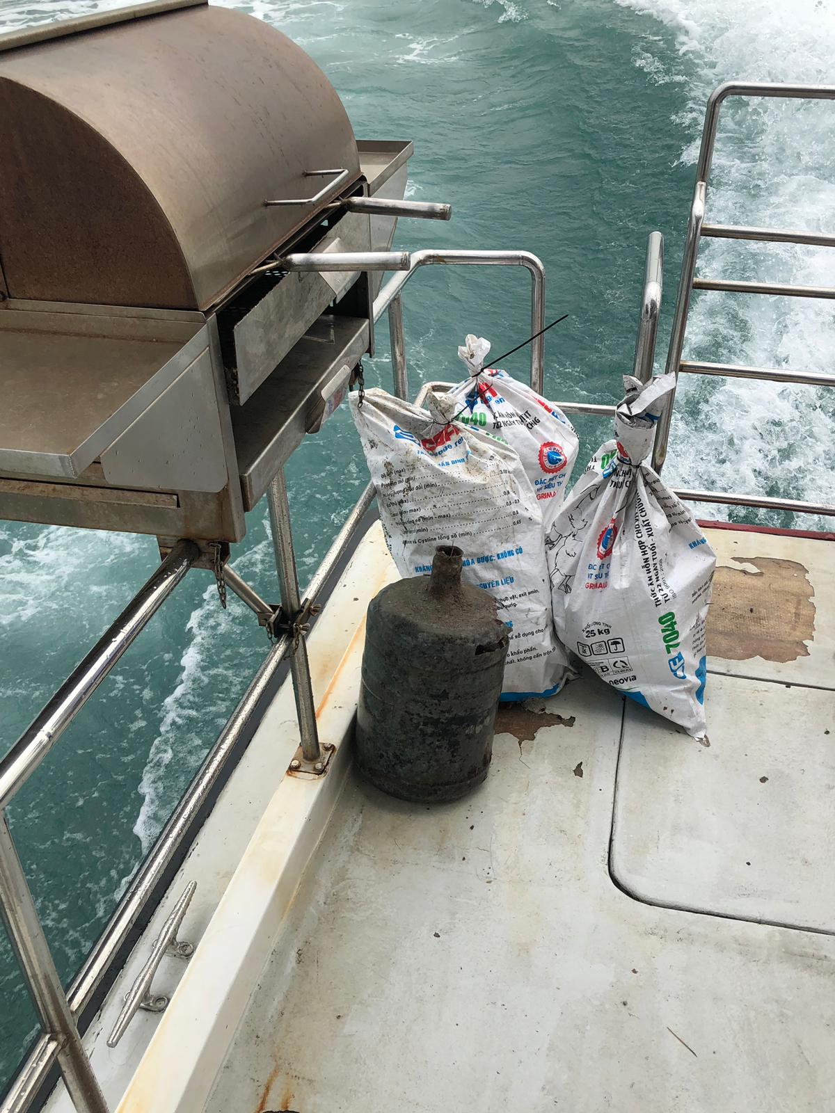
Glass Bottles (beer)
Glass fragments
On
kilograms
I have debris data to report
23
Calm (glassy to rippled) for waves 0 – 0.1 meter high m2
meters
coral reef
1
6
1
Netherlands Antilles
City
Kralendijk
Map Help


Dive Location

If you know your survey site coordinates, enter them manually in decimal degrees using WGS84 Map Datum. Use the minus sign for latitudes south of the equator and longitudes west of the Prime Meridian to 180 degrees.

If you do not know your survey site coordinates, click the “Map Location” tab to use the map to zoom into your survey site and drop the pin on the map to fall within your survey dive site in the water (not on land or the beach). Ensure you zoom in as much as possible to ensure data accuracy.

Entangled Help


Use the vertical tabs below to record any entangled animals you found of each type.

Dive Friends Bonaire Yellow Submarine

1
22
coral
1
26

12.159984024578, -68.282151685599

Sailing Regatta Bonaire 2018 was this past week - increased volume of tourists and sailboats to the island.
French Angelfish are protected around Bonaire. This one has a hook caught in its mouth, with 1m of fishing line trailing. Was not able to catch and remove hook from the fish.
32 degrees C, windy, mostly sunny
1
1
1
1
8
duct tape
onion skin
fishing line spool (plastic)
button (plastic)
wetwipes (plastic/cloth)
Dive Friends Bonaire
Kathryn Hehre
3
2
4
1
3.00
52
11.60
1.00
2
estimated
1000.00
3
5
Fishing line
Plastics
On
kilograms
I have debris data to report
3
Calm (glassy to rippled) for waves 0 – 0.1 meter high
1
Injured
French Angelfish
1
fishing hook and fishing line
2
m2
meters
coral reef
2
1
6
Netherlands Antilles
City
Kralendijk
Map Help


Dive Location

If you know your survey site coordinates, enter them manually in decimal degrees using WGS84 Map Datum. Use the minus sign for latitudes south of the equator and longitudes west of the Prime Meridian to 180 degrees.

If you do not know your survey site coordinates, click the “Map Location” tab to use the map to zoom into your survey site and drop the pin on the map to fall within your survey dive site in the water (not on land or the beach). Ensure you zoom in as much as possible to ensure data accuracy.

Entangled Help


Use the vertical tabs below to record any entangled animals you found of each type.

ADS148 - Twin Peaks

3
13
14

10.117279, 99.812562

sand
1
Rainy
Eco Koh Tao - Crystal Dive
Jennifer Dowling
1
2
1
1
10
1
6
2.50
58
15.00
2.00
estimated
2
75.00
1
3
Fishing nets
plastic fragments
On
kilograms
I have debris data to report
Calm (glassy to rippled) for waves 0 – 0.1 meter high
2
2
m2
meters
coral reef
1
1
Thailand
State\Province
Surat Thani
City
Koh Tao
Map Help


Dive Location

If you know your survey site coordinates, enter them manually in decimal degrees using WGS84 Map Datum. Use the minus sign for latitudes south of the equator and longitudes west of the Prime Meridian to 180 degrees.

If you do not know your survey site coordinates, click the “Map Location” tab to use the map to zoom into your survey site and drop the pin on the map to fall within your survey dive site in the water (not on land or the beach). Ensure you zoom in as much as possible to ensure data accuracy.

Entangled Help


Use the vertical tabs below to record any entangled animals you found of each type.

Cars

0
0
0

9.1876580319534, 123.2655270016

0
0
0
sand
0
5
0
10
0

9.1862868044124, 123.26623580691

No
Diper
Good
0
0
0
0
0
0
0
0
0
0
0
0
0
0
0
0
0
0
0
0
Bongobongo divers
David
0
0
0
4
2
0
0
0
0
0
2
0
0
2
3
0
2
2
0
2
0
5
0
0
0
0
0
0
0
2
0
0
0
0
3.00
25
5.00
1.00
0
estimated
0
0
100.00
0
0
0
0
0
Fishing line
Rubber and
Plastic bottle
2
On
kilograms
0
I have debris data to report
0
0
0
Calm (glassy to rippled) for waves 0 – 0.1 meter high
3
0
0
0
6
0
0
m2
0
0
meters
coral reef
0
0
0
0
1
5
0
0
0
0
0
0
0
0
0
0
0
0
0
0
0
5
0
0
0
1
0
0
Philippines
State\Province
Negros Oriental
City
Dauin
Map Help


Dive Location

If you know your survey site coordinates, enter them manually in decimal degrees using WGS84 Map Datum. Use the minus sign for latitudes south of the equator and longitudes west of the Prime Meridian to 180 degrees.

If you do not know your survey site coordinates, click the “Map Location” tab to use the map to zoom into your survey site and drop the pin on the map to fall within your survey dive site in the water (not on land or the beach). Ensure you zoom in as much as possible to ensure data accuracy.

Entangled Help


Use the vertical tabs below to record any entangled animals you found of each type.

ADS354 - Site X

-4.61765, 55.396383

3
coral
2
Sunny
GVI Cap Ternay
Andy Ezeta
9
0.20
34
7.00
4.00
measured
3748.00
On
kilograms
I have debris data to report
Calm (glassy to rippled) for waves 0 – 0.1 meter high m2
2
meters
rocky reef
Seychelles
State\Province
Mahe
City
Victoria
Map Help


Dive Location

If you know your survey site coordinates, enter them manually in decimal degrees using WGS84 Map Datum. Use the minus sign for latitudes south of the equator and longitudes west of the Prime Meridian to 180 degrees.

If you do not know your survey site coordinates, click the “Map Location” tab to use the map to zoom into your survey site and drop the pin on the map to fall within your survey dive site in the water (not on land or the beach). Ensure you zoom in as much as possible to ensure data accuracy.

Entangled Help


Use the vertical tabs below to record any entangled animals you found of each type.

ADS333 - Corsaire

2

-4.616933, 55.40745

coral
Sunny
GVI Cap Terenay
Andy Ezeta
12
0.10
32
11.00
7.00
measured
3750.00
On
kilograms
I have debris data to report
Calm (glassy to rippled) for waves 0 – 0.1 meter high m2
meters
coral reef
2
Seychelles
State\Province
Mahe
City
Victoria
Map Help


Dive Location

If you know your survey site coordinates, enter them manually in decimal degrees using WGS84 Map Datum. Use the minus sign for latitudes south of the equator and longitudes west of the Prime Meridian to 180 degrees.

If you do not know your survey site coordinates, click the “Map Location” tab to use the map to zoom into your survey site and drop the pin on the map to fall within your survey dive site in the water (not on land or the beach). Ensure you zoom in as much as possible to ensure data accuracy.

Entangled Help


Use the vertical tabs below to record any entangled animals you found of each type.

Shark Reef - Toberua

-18.001394, 178.735348

coral
Fisherman from the village discarding items from their boat
Batteries
Rain
Toberua Divers
Everette Ingram
2
0.40
55
19.00
10.00
measured
2250.00
Tuna fish cans
On
kilograms
I have debris data to report
Moderate to rough for waves greater than 1.25 meters m2
meters
coral reef
4
2
Fiji
State\Province
Central Province
City
Nausori
Map Help


Dive Location

If you know your survey site coordinates, enter them manually in decimal degrees using WGS84 Map Datum. Use the minus sign for latitudes south of the equator and longitudes west of the Prime Meridian to 180 degrees.

If you do not know your survey site coordinates, click the “Map Location” tab to use the map to zoom into your survey site and drop the pin on the map to fall within your survey dive site in the water (not on land or the beach). Ensure you zoom in as much as possible to ensure data accuracy.

Entangled Help


Use the vertical tabs below to record any entangled animals you found of each type.

South Channel Drive Park, NC

4
0
0
0

34.208561, -77.800236

0
0
0
sand
0
11
0
1
35
Hurricane Florence
Toolbox
65
Patriot Scuba And Patriot Dive Center
Dessie Larson
0
0
0
0
0
0
0
0
0
1
0
0
0
0
0
0
0
2
0
8
0
0
0
1
0
0
7
0
0
0
1
0
0
0
0
0
15.00
60
20.00
5.00
1
estimated
0
0
0
0
4006.93
0
0
0
0
0
Rope
Fishing line
Foam
0
On
pounds
0
I have debris data to report
1
0
0
Smooth (wavelets) for waves 0.1 - 0.5 meter high
0
0
0
0
0
0
0
m2
2
0
feet
seagrass
0
0
0
0
0
0
0
1
0
1
0
0
1
1
0
0
0
2
0
0
0
0
0
0
0
0
0
0
0
United States
State\Province
North Carolina
City
Wrightsville Beach
Map Help


Dive Location

If you know your survey site coordinates, enter them manually in decimal degrees using WGS84 Map Datum. Use the minus sign for latitudes south of the equator and longitudes west of the Prime Meridian to 180 degrees.

If you do not know your survey site coordinates, click the “Map Location” tab to use the map to zoom into your survey site and drop the pin on the map to fall within your survey dive site in the water (not on land or the beach). Ensure you zoom in as much as possible to ensure data accuracy.

Entangled Help


Use the vertical tabs below to record any entangled animals you found of each type.

Kubar Island

0
0
0

29.069639, 48.4870819

0
0
0
sand
0
0
0
0
0
Viz was about 15 feet
Unable to dislodge the metal net
Very rainy
0
0
0
0
0
0
0
0
0
0
0
0
0
0
0
0
0
0
0
0
The Palms
John Connolly
0
0
0
0
0
0
0
0
0
0
0
0
0
0
0
0
0
0
0
1
0
0
0
0
0
0
0
0
0
0
0
0
0
0
0.25
10
25.00
1.00
0
estimated
0
1
49.22
0
0
0
0
0
0
On
kilograms
0
I have debris data to report
0
0
0
Slight for waves 0.5 -1.25 meter high
0
0
0
0
0
0
0
0
ft2
0
0
feet
coral reef
0
0
0
0
0
0
0
0
0
0
0
0
0
0
0
0
0
0
0
0
0
0
0
0
0
0
0
0
Kuwait
Map Help


Dive Location

If you know your survey site coordinates, enter them manually in decimal degrees using WGS84 Map Datum. Use the minus sign for latitudes south of the equator and longitudes west of the Prime Meridian to 180 degrees.

If you do not know your survey site coordinates, click the “Map Location” tab to use the map to zoom into your survey site and drop the pin on the map to fall within your survey dive site in the water (not on land or the beach). Ensure you zoom in as much as possible to ensure data accuracy.

Entangled Help


Use the vertical tabs below to record any entangled animals you found of each type.

Lazarus North 2

45
1

1.2302954417308, 103.85096438758

9
coral
1
17

1.2302954417308, 103.85096438758

Not much debris were found on the eastern walls. The metal chair frames were mostly concentrated at the South-Western corner of the dive site. There are still more frames that have yet to be recovered due to time constrain.
None.
Metal chairs frames tied up in batches of 4 to 5, then dumped together at the same spot.
Wavy
1
4
2
1
1
1
79
Bicycle wheel frame
Ceramic
gunny sack
fishing reel
tent poles
cable wire
chair frame
The Submersibles
Jason wu
8
25
41
1
1
172.40
55
5.50
1.00
3
estimated
17
1865.72
1
1
plastic bottles <2 litres
metal beverage cans
On
kilograms
I have debris data to report
3
Smooth (wavelets) for waves 0.1 - 0.5 meter high
1
m2
2
meters
coral reef
2
14
2
1
6
21
Singapore
City
Singapore
Map Help


Dive Location

If you know your survey site coordinates, enter them manually in decimal degrees using WGS84 Map Datum. Use the minus sign for latitudes south of the equator and longitudes west of the Prime Meridian to 180 degrees.

If you do not know your survey site coordinates, click the “Map Location” tab to use the map to zoom into your survey site and drop the pin on the map to fall within your survey dive site in the water (not on land or the beach). Ensure you zoom in as much as possible to ensure data accuracy.

Entangled Help


Use the vertical tabs below to record any entangled animals you found of each type.

Subscribe to