Menu

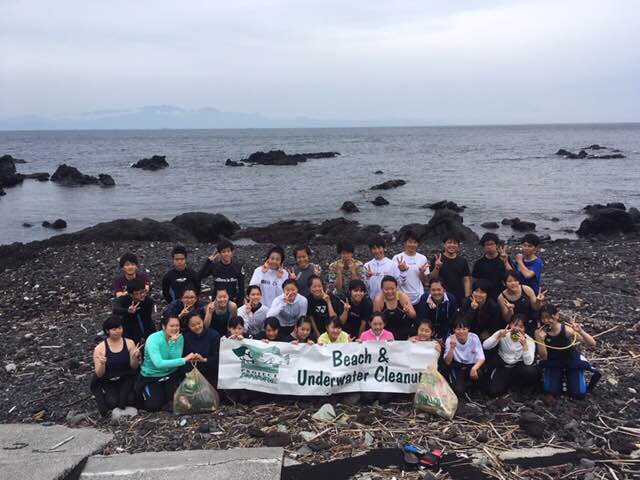
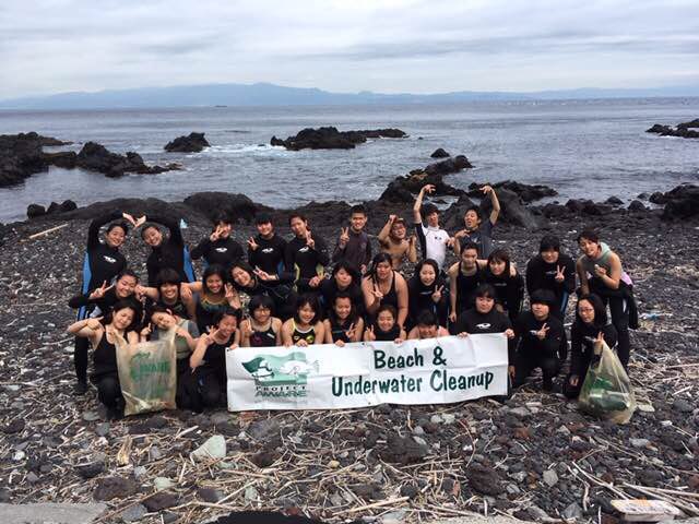
伊豆大島

0
0
0

34.78226405277, 139.35278286684

0
0
0
sand
0
0
0
0
0
曇り
0
0
0
0
0
0
0
0
0
0
0
0
0
0
0
0
0
0
0
0
ココナッツ
Norio
0
0
0
0
0
0
0
0
0
0
0
0
0
0
0
0
0
0
0
30
0
0
0
0
0
0
0
0
0
0
0
0
0
0
0.00
40
15.00
5.00
0
estimated
0
0
15.00
0
0
0
0
0
ペットボトル
ビニール袋
ガラス
0
On
kilograms
0
Our Survey Site was free of debris
0
0
0
Calm (glassy to rippled) for waves 0 – 0.1 meter high
0
0
0
0
0
0
0
m2
0
0
meters
other
0
0
0
0
0
0
0
0
0
0
0
0
0
0
0
0
0
0
0
0
0
0
0
0
0
0
0
0
Japan
State\Province
東京
City
大島
Map Help


Dive Location

If you know your survey site coordinates, enter them manually in decimal degrees using WGS84 Map Datum. Use the minus sign for latitudes south of the equator and longitudes west of the Prime Meridian to 180 degrees.

If you do not know your survey site coordinates, click the “Map Location” tab to use the map to zoom into your survey site and drop the pin on the map to fall within your survey dive site in the water (not on land or the beach). Ensure you zoom in as much as possible to ensure data accuracy.

Entangled Help


Use the vertical tabs below to record any entangled animals you found of each type.

MOMO Beach

4
coral
2
1

9.5954812862057, 123.74925106501

Lijun Tang
1
1
5
1
2
4
1
1
2.00
40
12.00
5.00
estimated
1.00
On
kilograms
I have debris data to report
Calm (glassy to rippled) for waves 0 – 0.1 meter high m2
meters
coral reef
1
Philippines
City
bohol
Map Help


Dive Location

If you know your survey site coordinates, enter them manually in decimal degrees using WGS84 Map Datum. Use the minus sign for latitudes south of the equator and longitudes west of the Prime Meridian to 180 degrees.

If you do not know your survey site coordinates, click the “Map Location” tab to use the map to zoom into your survey site and drop the pin on the map to fall within your survey dive site in the water (not on land or the beach). Ensure you zoom in as much as possible to ensure data accuracy.

Entangled Help


Use the vertical tabs below to record any entangled animals you found of each type.

Lilli Pilli

5
5
1
0

-34.069676, 151.11088

1
0
0
silt
0
0
0
5
0
No
Shoe
Was stuck to rock by hook and line. Hook was deep in mouth so couldn't get it out. Cut line and released fish
Heavy rain
Abyss Scuba Diving
Sam
0
1
2
0
0
0
0
0
0
0
1
0
0
0
0
0
0
0
0
3
0
0
1
0
3
0
2
0
0
0
0
0
0
0
0
0
17.00
58
12.00
1.00
5
estimated
0
0
0
6
254.04
0
0
0
0
0
Glass bottles
Fishing line
Cans
0
On
kilograms
0
I have debris data to report
18
0
0
Calm (glassy to rippled) for waves 0 – 0.1 meter high
0
0
1
Injured
Silver Perch
1
Fishing line and hllk
0
0
0
0
m2
0
0
meters
rocky reef
0
0
1
0
0
0
0
0
0
0
0
0
0
0
0
0
0
7
0
0
0
0
20
0
0
0
0
0
0
Australia
State\Province
NSW
City
Lilli Pilli
Map Help


Dive Location

If you know your survey site coordinates, enter them manually in decimal degrees using WGS84 Map Datum. Use the minus sign for latitudes south of the equator and longitudes west of the Prime Meridian to 180 degrees.

If you do not know your survey site coordinates, click the “Map Location” tab to use the map to zoom into your survey site and drop the pin on the map to fall within your survey dive site in the water (not on land or the beach). Ensure you zoom in as much as possible to ensure data accuracy.
Entangled Help


Use the vertical tabs below to record any entangled animals you found of each type.

ADS480 - Pompano Beach 1st Reef

20

26.2227, -80.0866

sand
30
No, as far as I know there was no event. It was just spontaneous.
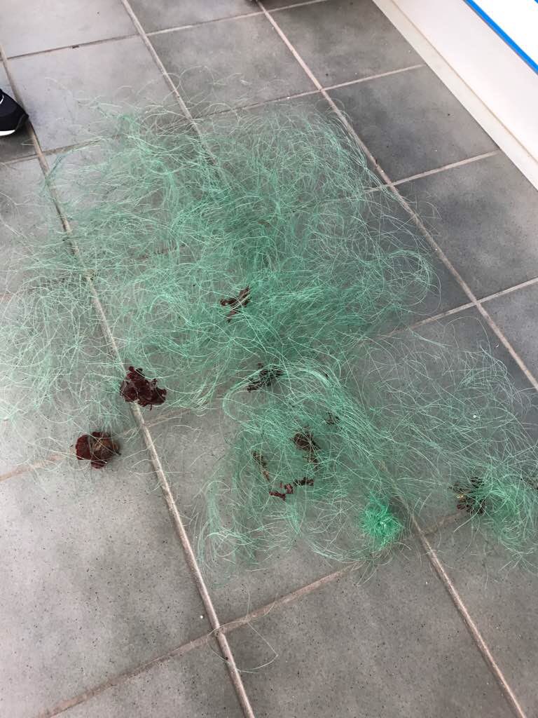
Big wad of 1/4" mesh rope.
East wind blowing from 10 to 20.
Don Burde
2
5
1
1
20.00
30
20.00
1.00
1
estimated
10000.00
1 gallon wine bottle, very heavy.
On
pounds
I have debris data to report
1
Slight for waves 0.5 -1.25 meter high ft2
feet
rocky reef
1
United States
State\Province
FL
City
Tamarac
Map Help


Dive Location

If you know your survey site coordinates, enter them manually in decimal degrees using WGS84 Map Datum. Use the minus sign for latitudes south of the equator and longitudes west of the Prime Meridian to 180 degrees.

If you do not know your survey site coordinates, click the “Map Location” tab to use the map to zoom into your survey site and drop the pin on the map to fall within your survey dive site in the water (not on land or the beach). Ensure you zoom in as much as possible to ensure data accuracy.
Entangled Help


Use the vertical tabs below to record any entangled animals you found of each type.

Bonaire Harbourfront: Karel's Beach- Fisherman's Pier

38
209
3
2
7
4
coral
5
2
382

12.154952261779, -68.279038562434

Number of glass bottles due to proximity to beach bar
Dive Friends Bonaire
Caitlin Hale
19
35
3
6
33
101
3
9
7
510.00
68
30.00
1.00
9
estimated
3
19
60.00
28
glass bottle
fishing line
plastic fragments
6
On
kilograms
I have debris data to report
403
Calm (glassy to rippled) for waves 0 – 0.1 meter high
13
3
29
1
m2
32
meters
coral reef
41
8
1
35
38
74
12
86
42
Netherlands Antilles
City
Kralendijk
Map Help


Dive Location

If you know your survey site coordinates, enter them manually in decimal degrees using WGS84 Map Datum. Use the minus sign for latitudes south of the equator and longitudes west of the Prime Meridian to 180 degrees.

If you do not know your survey site coordinates, click the “Map Location” tab to use the map to zoom into your survey site and drop the pin on the map to fall within your survey dive site in the water (not on land or the beach). Ensure you zoom in as much as possible to ensure data accuracy.
Entangled Help


Use the vertical tabs below to record any entangled animals you found of each type.

ADS452 - Negre del Falaguer

50
1
rock
3

42.067174548597, 3.2111593075138

Bad weather. Rain. Sea storm. Rough sea.
1
watering plastic can
El Rei del Mar
El Rei del Mar
1
2
15
2
1
1
3
3.00
42
20.00
1.00
estimated
300.00
On
kilograms
I have debris data to report
Slight for waves 0.5 -1.25 meter high m2
meters
rocky reef
Spain
State\Province
Girona
City
L'Estartit
Map Help


Dive Location

If you know your survey site coordinates, enter them manually in decimal degrees using WGS84 Map Datum. Use the minus sign for latitudes south of the equator and longitudes west of the Prime Meridian to 180 degrees.

If you do not know your survey site coordinates, click the “Map Location” tab to use the map to zoom into your survey site and drop the pin on the map to fall within your survey dive site in the water (not on land or the beach). Ensure you zoom in as much as possible to ensure data accuracy.

Entangled Help


Use the vertical tabs below to record any entangled animals you found of each type.

Selce

0
0
0
0

45.0909, 14.431

0
0
0
rock
0
0
0
0
0
Sunny
Diving center Mihurić
0
0
0
0
0
0
0
0
0
0
0
0
0
0
0
0
0
0
0
32
0
0
0
0
0
0
0
0
0
0
0
0
0
0
0
0
500.00
45
12.00
3.00
0
estimated
0
0
0
0
548464.00
0
0
0
0
0
0
On
kilograms
0
I have debris data to report
0
0
0
Smooth (wavelets) for waves 0.1 - 0.5 meter high
0
0
0
0
0
0
0
m2
0
0
meters
rocky reef
0
0
0
0
0
0
0
0
0
0
0
0
0
0
0
0
0
0
0
0
0
0
0
0
0
0
0
0
0
Croatia
City
Selce
Map Help


Dive Location

If you know your survey site coordinates, enter them manually in decimal degrees using WGS84 Map Datum. Use the minus sign for latitudes south of the equator and longitudes west of the Prime Meridian to 180 degrees.

If you do not know your survey site coordinates, click the “Map Location” tab to use the map to zoom into your survey site and drop the pin on the map to fall within your survey dive site in the water (not on land or the beach). Ensure you zoom in as much as possible to ensure data accuracy.

Entangled Help


Use the vertical tabs below to record any entangled animals you found of each type.

ADS375 - Mar Menuda

0
0
1

41.72020161, 2.93185686

0
0
0
rock
0
0
0
0
0
Bad
0
0
0
0
0
0
0
0
0
0
0
0
0
0
0
0
0
0
0
0
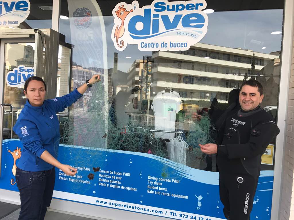
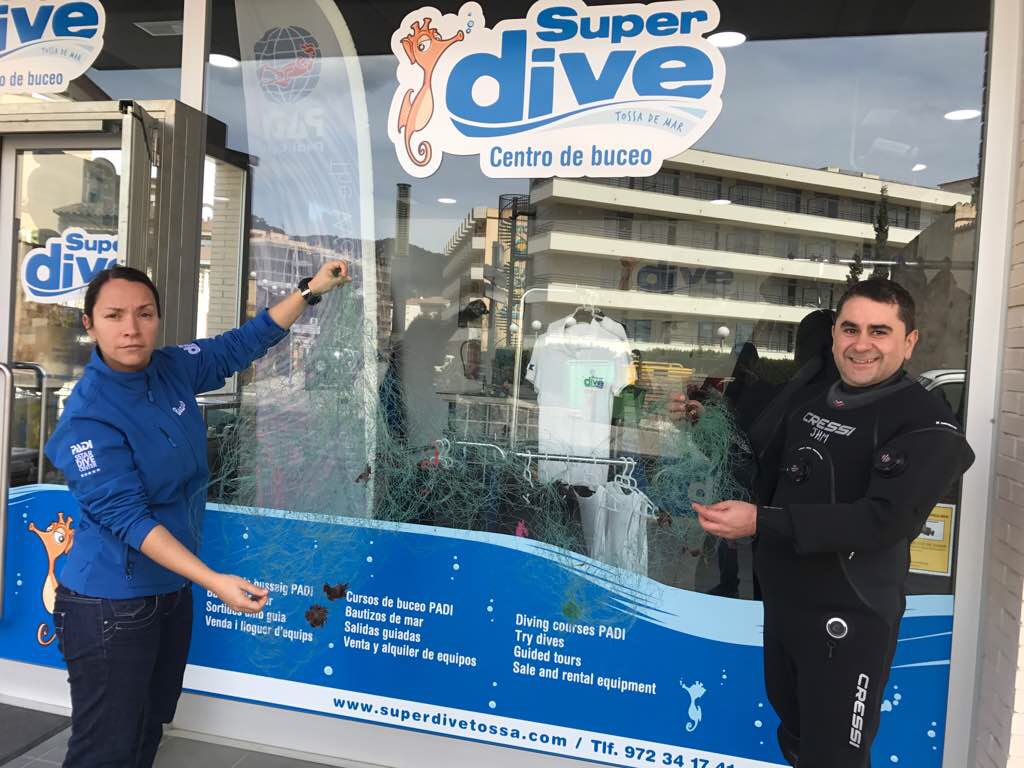
SuperDive Tossa de Mar
Chiqui Bustos
0
0
0
0
0
0
0
0
0
0
0
0
0
0
0
0
0
0
0
3
0
0
0
0
0
0
0
0
0
0
0
0
0
0
1.00
55
18.00
6.00
0
estimated
0
0
477436.00
0
0
0
0
0
0
On
kilograms
0
I have debris data to report
0
0
0
Smooth (wavelets) for waves 0.1 - 0.5 meter high
0
0
0
0
0
0
0
m2
0
0
meters
other
0
0
0
0
0
0
0
0
0
0
0
0
0
0
0
0
0
0
0
0
0
0
0
0
0
0
0
0
Spain
State\Province
Girona
City
Tossa de Mar
Map Help


Dive Location

If you know your survey site coordinates, enter them manually in decimal degrees using WGS84 Map Datum. Use the minus sign for latitudes south of the equator and longitudes west of the Prime Meridian to 180 degrees.

If you do not know your survey site coordinates, click the “Map Location” tab to use the map to zoom into your survey site and drop the pin on the map to fall within your survey dive site in the water (not on land or the beach). Ensure you zoom in as much as possible to ensure data accuracy.

Entangled Help


Use the vertical tabs below to record any entangled animals you found of each type.

ADS375 - Mar Menuda

0
0
1

41.721823209708, 2.9388595392716

0
0
0
rock
0
0
0
0
0
Ok
0
0
0
0
0
0
0
0
0
0
0
0
0
0
0
0
0
0
0
0
SuperDive Tossa de Mar
Chiqui Bustos
0
0
0
0
0
0
0
0
0
0
0
0
0
0
0
0
0
0
0
3
0
0
0
0
0
0
0
0
0
0
0
0
0
0
0.00
58
18.00
6.00
0
estimated
0
0
12.00
0
0
0
0
0
0
On
kilograms
0
I have debris data to report
0
0
0
Slight for waves 0.5 -1.25 meter high
0
0
0
0
0
0
0
m2
0
0
meters
other
0
0
0
0
0
0
0
0
0
0
0
0
0
0
0
0
0
0
0
0
0
0
0
0
0
0
0
0
Spain
State\Province
Girona
City
Tossa de Mar
Map Help


Dive Location

If you know your survey site coordinates, enter them manually in decimal degrees using WGS84 Map Datum. Use the minus sign for latitudes south of the equator and longitudes west of the Prime Meridian to 180 degrees.

If you do not know your survey site coordinates, click the “Map Location” tab to use the map to zoom into your survey site and drop the pin on the map to fall within your survey dive site in the water (not on land or the beach). Ensure you zoom in as much as possible to ensure data accuracy.

Entangled Help


Use the vertical tabs below to record any entangled animals you found of each type.

ADS296 - St. Petersburg Bay Reef

27.7887, 82.590633

silt
4
Fishermen and boaters catch anchors and leave them behind.
3
1
Anchor
Anchor Chain
Tikkun HaYam
Shayna Cohen
3
30.00
50
35.00
15.00
estimated
60.00
On
pounds
I have debris data to report
1
Calm (glassy to rippled) for waves 0 – 0.1 meter high ft2
6
feet
other
United States
State\Province
Florida
City
St. Petersburg
Map Help


Dive Location

If you know your survey site coordinates, enter them manually in decimal degrees using WGS84 Map Datum. Use the minus sign for latitudes south of the equator and longitudes west of the Prime Meridian to 180 degrees.

If you do not know your survey site coordinates, click the “Map Location” tab to use the map to zoom into your survey site and drop the pin on the map to fall within your survey dive site in the water (not on land or the beach). Ensure you zoom in as much as possible to ensure data accuracy.

Entangled Help


Use the vertical tabs below to record any entangled animals you found of each type.

Ecosystem Other
Artificial Reef
Subscribe to