Menu

ADS352 - Meno Slope

6
4
5
0

-8.35026, 116.0511

0
0
0
coral
0
0
0
0
0
Windy
1
2
1
Beauty product
Shampoo
Laundry wrapper
Gili Shark Conservation
Obed And Addie
1
0
0
0
0
0
0
0
1
0
0
0
0
0
1
0
0
0
2
8
0
0
0
0
1
0
5
0
0
0
0
0
0
0
0
0
2.00
42
25.00
12.00
0
estimated
0
0
0
0
62974.00
0
0
0
0
0
0
On
kilograms
0
I have debris data to report
0
0
0
Slight for waves 0.5 -1.25 meter high
6
0
0
0
0
0
0
m2
0
0
meters
coral reef
0
0
0
0
0
0
0
0
0
0
0
0
0
0
0
0
0
0
0
0
0
0
0
0
0
0
0
0
0
Indonesia
State\Province
West Nusa Tenggara
City
Gili Air
Map Help


Dive Location

If you know your survey site coordinates, enter them manually in decimal degrees using WGS84 Map Datum. Use the minus sign for latitudes south of the equator and longitudes west of the Prime Meridian to 180 degrees.

If you do not know your survey site coordinates, click the “Map Location” tab to use the map to zoom into your survey site and drop the pin on the map to fall within your survey dive site in the water (not on land or the beach). Ensure you zoom in as much as possible to ensure data accuracy.

Entangled Help


Use the vertical tabs below to record any entangled animals you found of each type.

El Barqo

0
0
0

12.53678, -81.737580890371

0
0
0
sand
0
0
0
0
0
No
Spray cans
Windy and wavy
0
0
0
0
0
0
0
0
0
0
0
0
0
0
0
0
0
0
0
0
Float N’ Flag
Brad Snyder
0
0
0
0
0
0
0
0
0
0
0
0
0
0
0
0
0
0
0
8
0
0
0
0
0
0
0
0
0
0
0
0
0
0
20.00
52
50.00
40.00
0
estimated
0
2
18831.00
0
0
0
0
0
Beverage containers
Batteries
Shoe soles
0
On
pounds
0
I have debris data to report
3
0
0
Slight for waves 0.5 -1.25 meter high
0
0
10
0
0
0
0
ft2
0
0
feet
coral reef
0
0
0
0
0
0
0
0
1
0
0
0
3
0
0
0
2
0
0
0
0
3
0
2
0
1
1
0
Colombia
City
San Andreas
Map Help


Dive Location

If you know your survey site coordinates, enter them manually in decimal degrees using WGS84 Map Datum. Use the minus sign for latitudes south of the equator and longitudes west of the Prime Meridian to 180 degrees.

If you do not know your survey site coordinates, click the “Map Location” tab to use the map to zoom into your survey site and drop the pin on the map to fall within your survey dive site in the water (not on land or the beach). Ensure you zoom in as much as possible to ensure data accuracy.

Entangled Help


Use the vertical tabs below to record any entangled animals you found of each type.

Runway SW

0
0
0
0

24.53211, -80.33237

1
0
0
coral
0
0
0
9
0
Fishing
Fishing pole
Light afternoon thunderstorms
1
1
Anchor
Spear pole
Key Dives/FKNMS
Cortney Benson
0
0
0
0
0
0
0
0
0
0
0
0
0
0
0
0
0
0
0
18
0
0
0
0
0
0
0
0
0
0
0
0
0
0
0
0
27.00
45
45.00
40.00
0
measured
0
0
0
0
150.00
0
0
0
0
0
Fishing line
Fish hooks
Lobster trap lines
0
On
pounds
0
I have debris data to report
0
0
0
Smooth (wavelets) for waves 0.1 - 0.5 meter high
0
0
0
1
0
0
0
ft2
7
0
feet
coral reef
0
0
0
0
1
0
0
0
0
0
0
0
0
0
0
0
0
0
0
0
0
0
0
0
0
0
0
0
0
United States
State\Province
Florida
City
Islamorada
Map Help


Dive Location

If you know your survey site coordinates, enter them manually in decimal degrees using WGS84 Map Datum. Use the minus sign for latitudes south of the equator and longitudes west of the Prime Meridian to 180 degrees.

If you do not know your survey site coordinates, click the “Map Location” tab to use the map to zoom into your survey site and drop the pin on the map to fall within your survey dive site in the water (not on land or the beach). Ensure you zoom in as much as possible to ensure data accuracy.

Entangled Help


Use the vertical tabs below to record any entangled animals you found of each type.

ADS303 - Kastelia Bay

35.470134, 27.193667

rock
Karpathos Diving Center
Dino Protopapas
3
2.00
35
20.00
5.00
estimated
25.00
On
kilograms
I have debris data to report
Calm (glassy to rippled) for waves 0 – 0.1 meter high m2
meters
rocky reef
1
1
Greece
City
Pigadia, Karpathos
Map Help


Dive Location

If you know your survey site coordinates, enter them manually in decimal degrees using WGS84 Map Datum. Use the minus sign for latitudes south of the equator and longitudes west of the Prime Meridian to 180 degrees.

If you do not know your survey site coordinates, click the “Map Location” tab to use the map to zoom into your survey site and drop the pin on the map to fall within your survey dive site in the water (not on land or the beach). Ensure you zoom in as much as possible to ensure data accuracy.

Entangled Help


Use the vertical tabs below to record any entangled animals you found of each type.

Strome ferry

gravel

57.358180781615, -5.5534030156875

very good, calm winds, no rain
Highland diving
Bart Lafere
2
1.25
43
14.00
1.00
estimated
100.00
On
kilograms
I have debris data to report
4
Calm (glassy to rippled) for waves 0 – 0.1 meter high m2
meters
rocky reef
United Kingdom
State\Province
Ross shire
City
Muir of Ord
Map Help


Dive Location

If you know your survey site coordinates, enter them manually in decimal degrees using WGS84 Map Datum. Use the minus sign for latitudes south of the equator and longitudes west of the Prime Meridian to 180 degrees.

If you do not know your survey site coordinates, click the “Map Location” tab to use the map to zoom into your survey site and drop the pin on the map to fall within your survey dive site in the water (not on land or the beach). Ensure you zoom in as much as possible to ensure data accuracy.
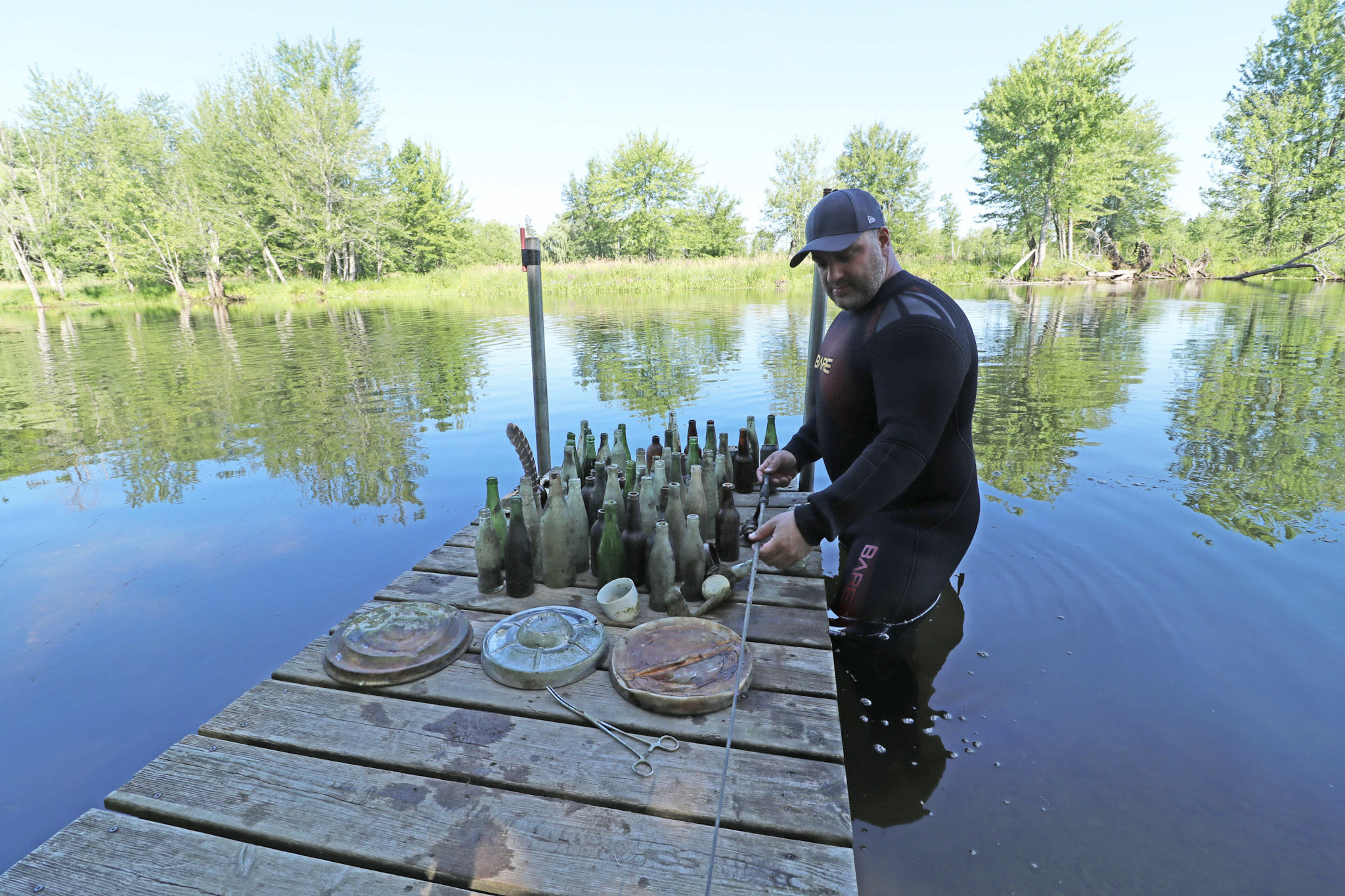
Entangled Help


Use the vertical tabs below to record any entangled animals you found of each type.

Perth River

7

44.895659027157, -76.282909100261

gravel
1

44.895659027157, -76.282909100261

No
Large egg.
Andre Constantineau
1
1
20.00
60
15.00
5.00
estimated
200.00
On
pounds
I have debris data to report
50
Calm (glassy to rippled) for waves 0 – 0.1 meter high ft2
feet
other
1
1
1
Canada
State\Province
Ontario
City
Perth
Map Help


Dive Location

If you know your survey site coordinates, enter them manually in decimal degrees using WGS84 Map Datum. Use the minus sign for latitudes south of the equator and longitudes west of the Prime Meridian to 180 degrees.

If you do not know your survey site coordinates, click the “Map Location” tab to use the map to zoom into your survey site and drop the pin on the map to fall within your survey dive site in the water (not on land or the beach). Ensure you zoom in as much as possible to ensure data accuracy.

Entangled Help


Use the vertical tabs below to record any entangled animals you found of each type.

Ecosystem Other
River

ADS354 - Site X

-4.61765, 55.396383

1
coral
5
Rainy
GVI Cap Ternay
Andy Ezeta
7
6.50
32
8.00
3.00
measured
11
3750.00
Glass Bottles
On
kilograms
I have debris data to report
2
Smooth (wavelets) for waves 0.1 - 0.5 meter high
1
m2
1
meters
coral reef
1
1
Seychelles
State\Province
Mahe
City
Victoria
Map Help


Dive Location

If you know your survey site coordinates, enter them manually in decimal degrees using WGS84 Map Datum. Use the minus sign for latitudes south of the equator and longitudes west of the Prime Meridian to 180 degrees.

If you do not know your survey site coordinates, click the “Map Location” tab to use the map to zoom into your survey site and drop the pin on the map to fall within your survey dive site in the water (not on land or the beach). Ensure you zoom in as much as possible to ensure data accuracy.

Entangled Help


Use the vertical tabs below to record any entangled animals you found of each type.

ADS120 - Praia Vermelha Red Beach

3
22
1
1

-22.955263618689, -43.164148628712

7
2
rock
7
9
Sunny with some thunder storms
6
Spark Plug
Projeto Verde Mar
Caio Salles
3
3
12
1
3
1
7
8.00
50
10.00
3.00
estimated
31
800.00
On
kilograms
I have debris data to report
Calm (glassy to rippled) for waves 0 – 0.1 meter high
3
m2
1
meters
rocky reef
2
1
2
Brazil
State\Province
RJ
City
Rio de Janeiro
Map Help


Dive Location

If you know your survey site coordinates, enter them manually in decimal degrees using WGS84 Map Datum. Use the minus sign for latitudes south of the equator and longitudes west of the Prime Meridian to 180 degrees.

If you do not know your survey site coordinates, click the “Map Location” tab to use the map to zoom into your survey site and drop the pin on the map to fall within your survey dive site in the water (not on land or the beach). Ensure you zoom in as much as possible to ensure data accuracy.

Entangled Help


Use the vertical tabs below to record any entangled animals you found of each type.

ADS333 - Corsaire

2

-4.616933, 55.40745

coral
Brand new scuba mask
Rainy
GVI Cap Ternay
Andy Ezeta
1
10
3.00
35
7.00
6.30
measured
3750.00
Glass Bottles
On
kilograms
I have debris data to report
2
Smooth (wavelets) for waves 0.1 - 0.5 meter high m2
1
meters
coral reef
1
2
Seychelles
State\Province
Mahe
City
Victoria
Map Help


Dive Location

If you know your survey site coordinates, enter them manually in decimal degrees using WGS84 Map Datum. Use the minus sign for latitudes south of the equator and longitudes west of the Prime Meridian to 180 degrees.

If you do not know your survey site coordinates, click the “Map Location” tab to use the map to zoom into your survey site and drop the pin on the map to fall within your survey dive site in the water (not on land or the beach). Ensure you zoom in as much as possible to ensure data accuracy.

Entangled Help


Use the vertical tabs below to record any entangled animals you found of each type.

Ras Katy

1
3
coral
5

27.848261637902, 34.30080577965

Thank you to everyone that took part and helped us raise awareness of the underwater world in PADI Women's Dive Day 2018
Camel Dive Club
Beth Sanders
1
4
25
1
3
2
2.50
60
20.00
1.00
measured
100.00
On
kilograms
I have debris data to report
Calm (glassy to rippled) for waves 0 – 0.1 meter high
1
2
m2
meters
coral reef
1
Egypt
State\Province
Sinai
City
Sharm el Sheikh
Map Help


Dive Location

If you know your survey site coordinates, enter them manually in decimal degrees using WGS84 Map Datum. Use the minus sign for latitudes south of the equator and longitudes west of the Prime Meridian to 180 degrees.

If you do not know your survey site coordinates, click the “Map Location” tab to use the map to zoom into your survey site and drop the pin on the map to fall within your survey dive site in the water (not on land or the beach). Ensure you zoom in as much as possible to ensure data accuracy.

Entangled Help


Use the vertical tabs below to record any entangled animals you found of each type.

Subscribe to