Arrecife artificial Las Llantas/Tumaco Nariño
2
sand
3
1.8771130802284, -78.764260590305
Hoy queda oficialmente adoptado este lugar. Con el compromiso de mantenerlo libre de escombros marinos y procurar.mejorar las condiciones de habitad para las especies viven allí.
Agradecimientos especiales para todos los buzos voluntarios que se sumaron a esta gran iniciativa!!!
"Un tumaco mas limpio y sano es posible"
"Un tumaco mas limpio y sano es posible"
Almohada
Normales
CIOHP DIMAR / CENTRO BUCEO TUMACO DIVERS/ SEAWORLD
Jaime Santamaría Ayala
1
1
10
13
32
19
90.00
33
55.00
50.00
estimated
50.00
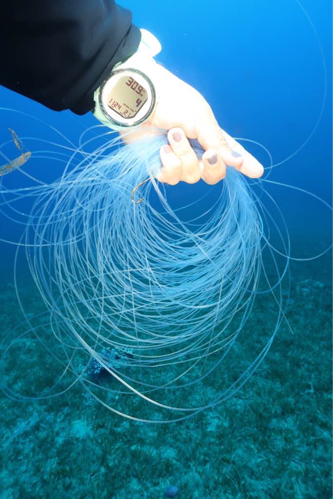
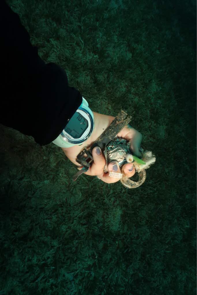
Bolsas plasticas
Botellas plasticas
Pañales
On
kilograms
I have debris data to report
6
Slight for waves 0.5 -1.25 meter high
m2


6
feet
other
3
State\Province
Narino
City
Tumaco
Map Help
Dive Location
If you know your survey site coordinates, enter them manually in decimal degrees using WGS84 Map Datum. Use the minus sign for latitudes south of the equator and longitudes west of the Prime Meridian to 180 degrees.
If you do not know your survey site coordinates, click the “Map Location” tab to use the map to zoom into your survey site and drop the pin on the map to fall within your survey dive site in the water (not on land or the beach). Ensure you zoom in as much as possible to ensure data accuracy.
Entangled Help
Use the vertical tabs below to record any entangled animals you found of each type.
Ecosystem Other
Arrecife artificial de llantas