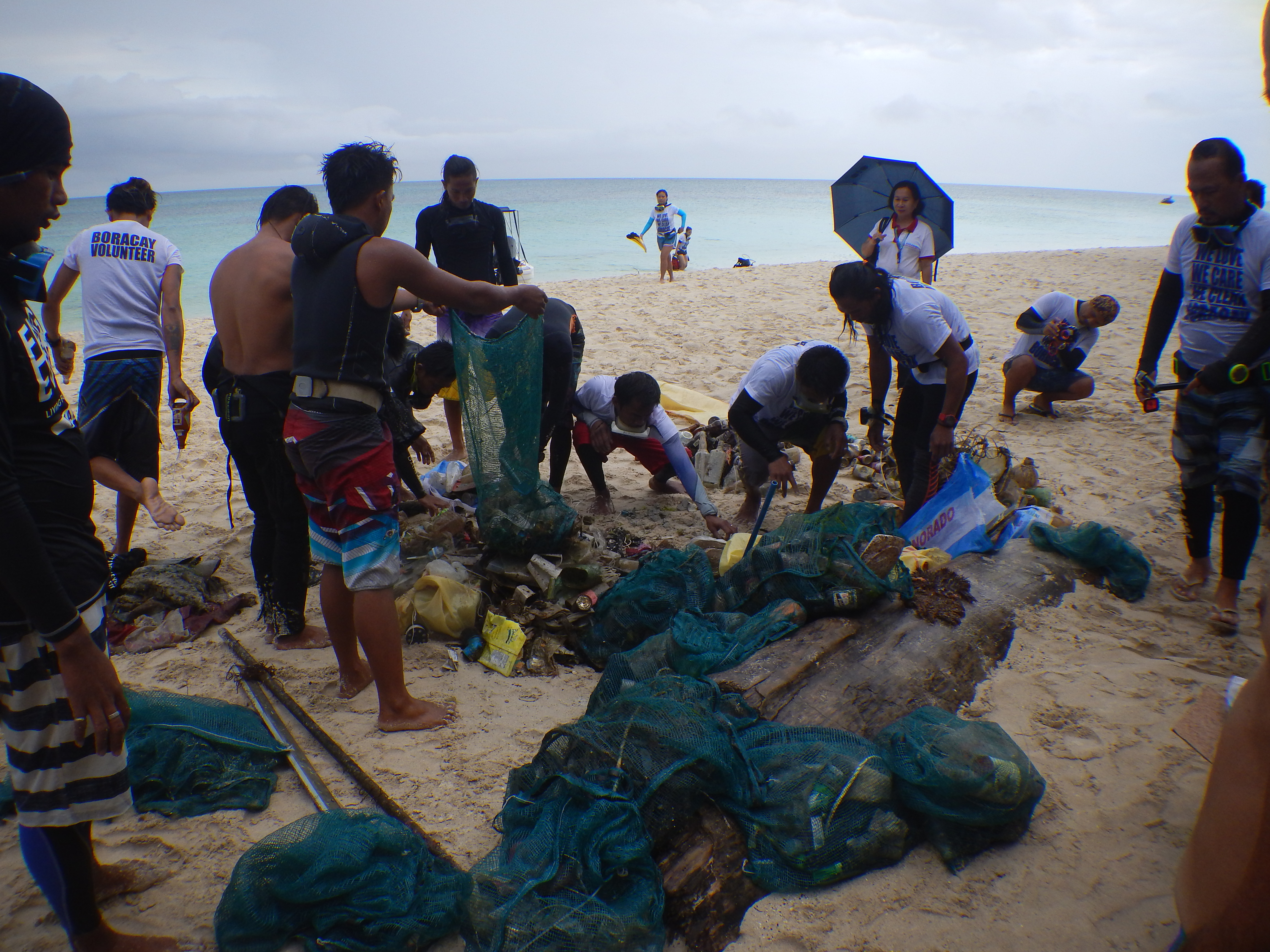
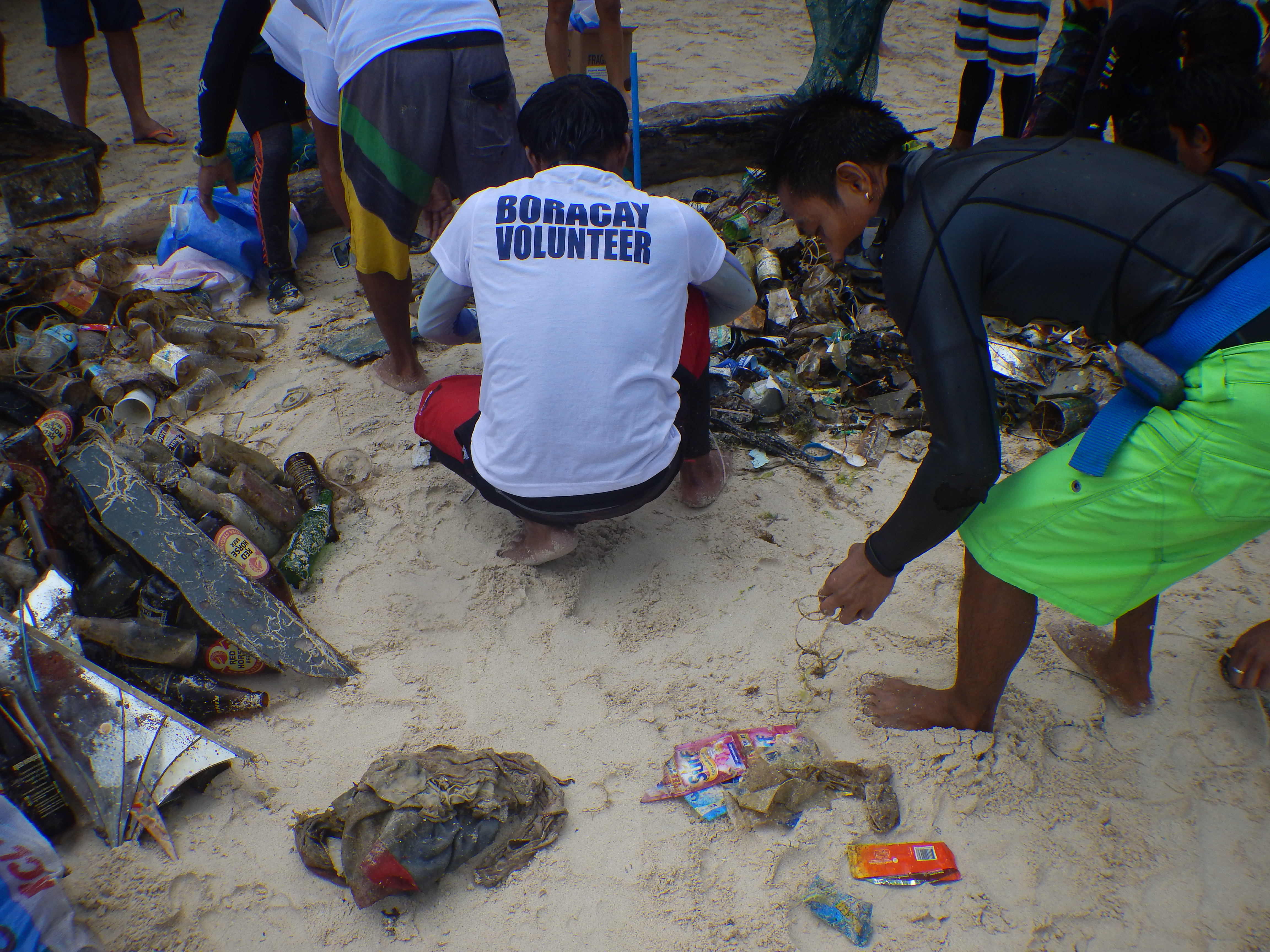
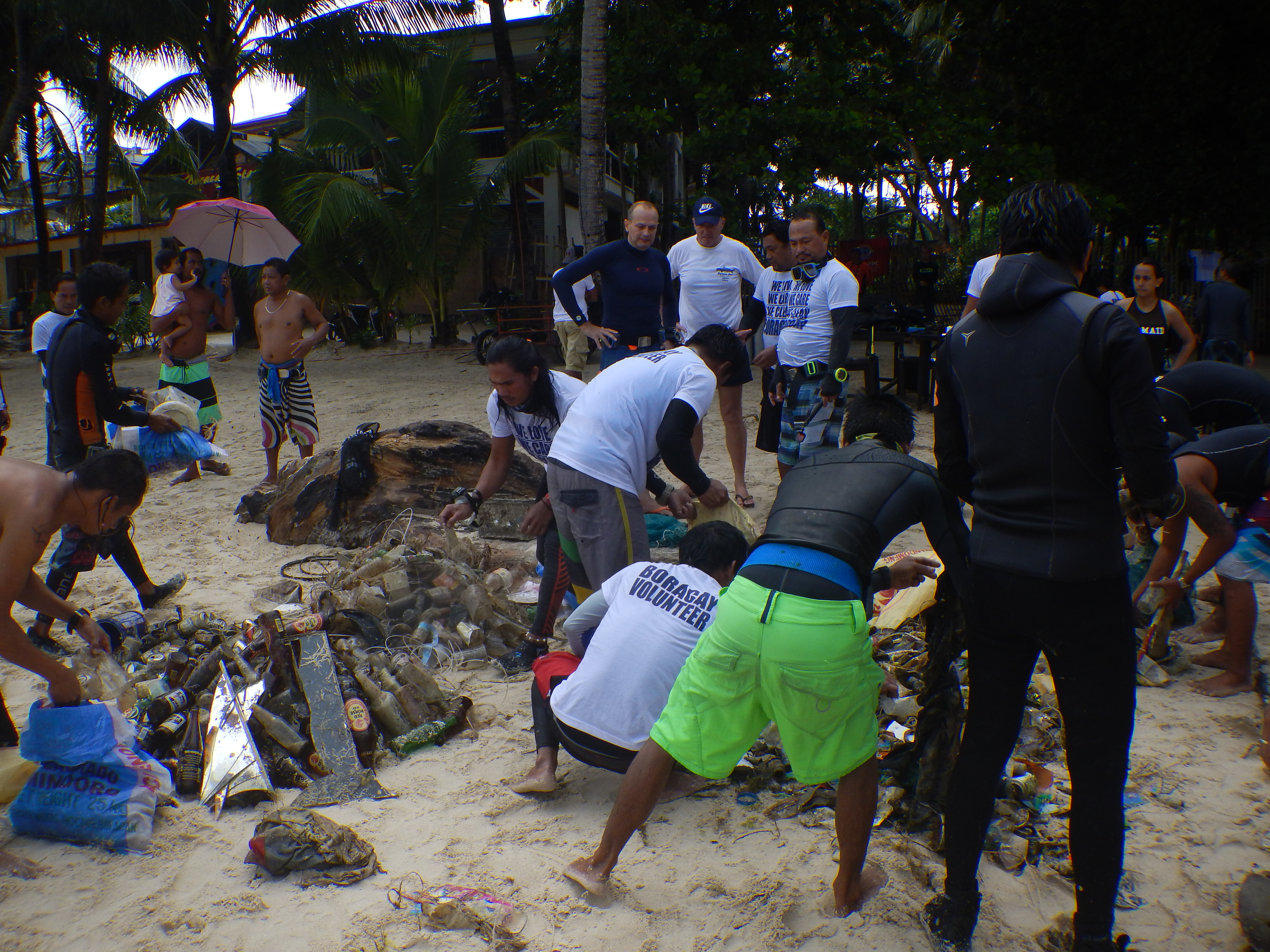
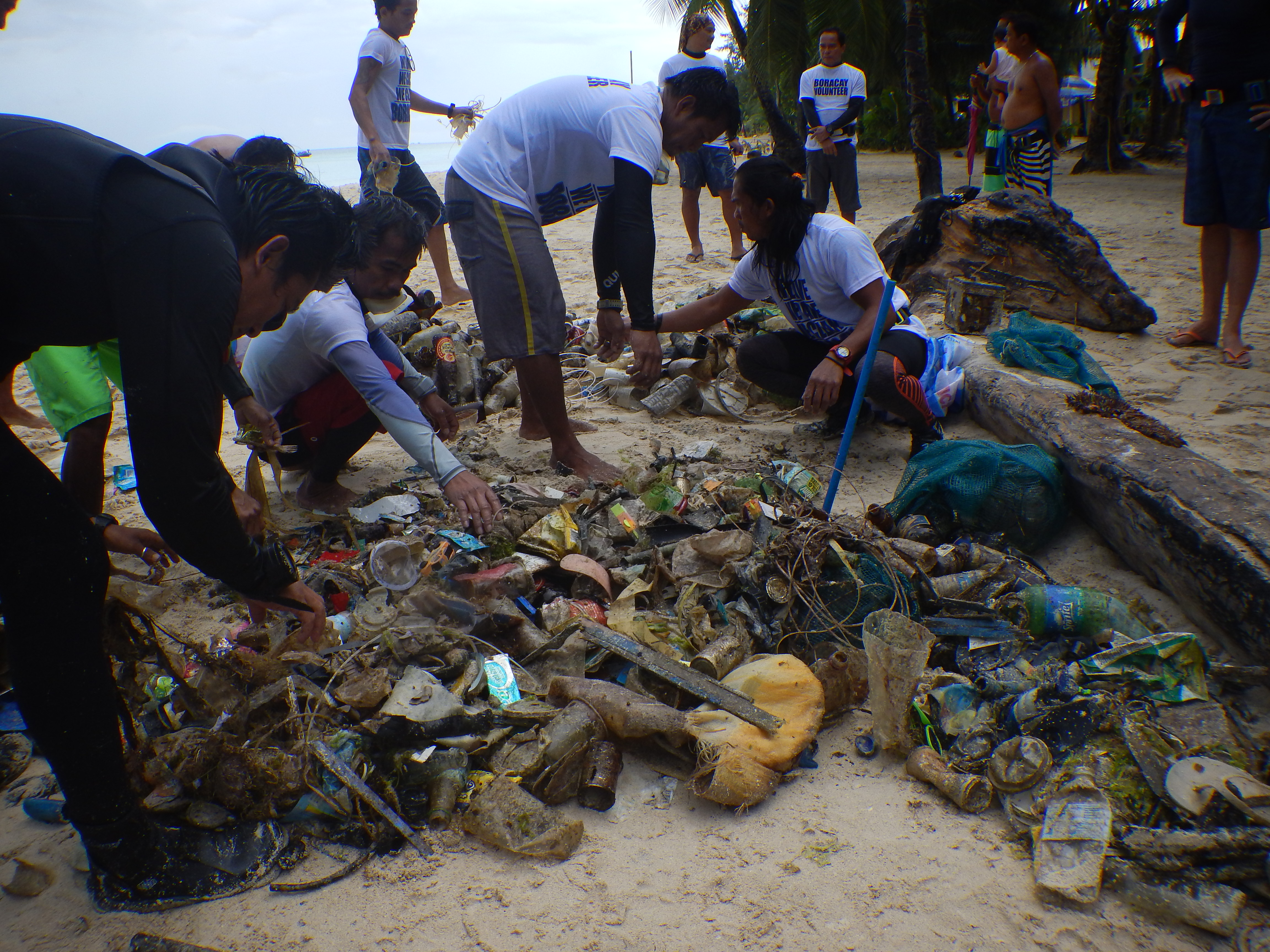
Menu

Loutraki Beach

11
1
1
sand
5

37.966188674747, 22.971092108145

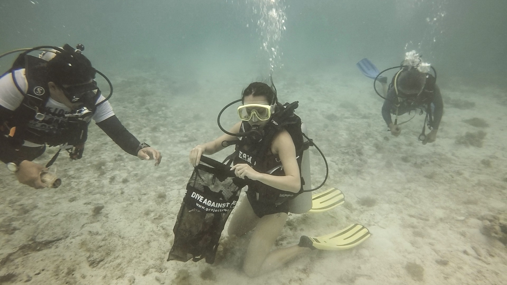
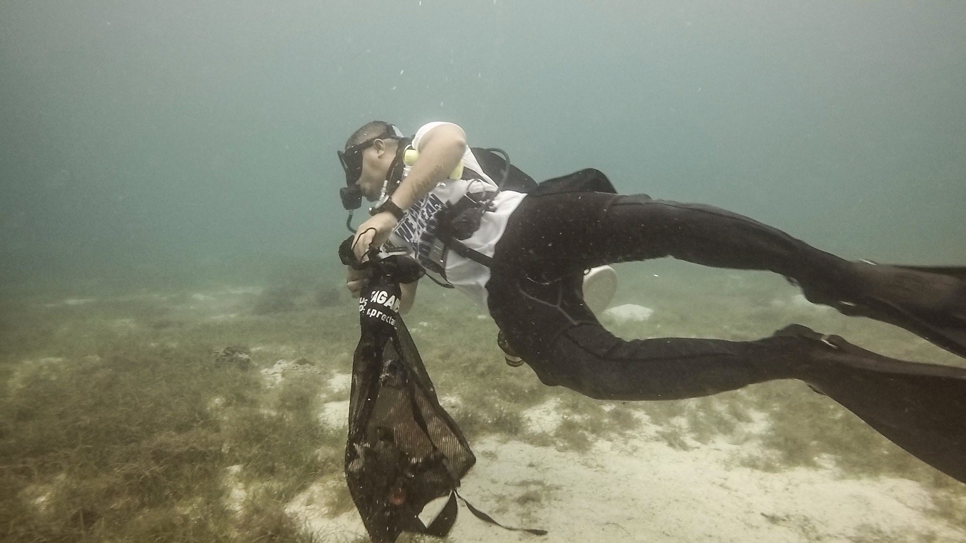
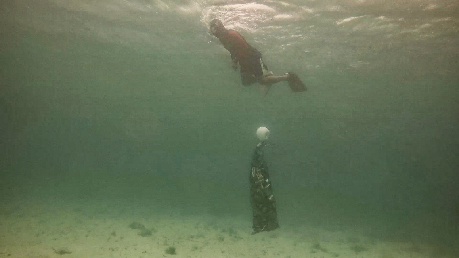
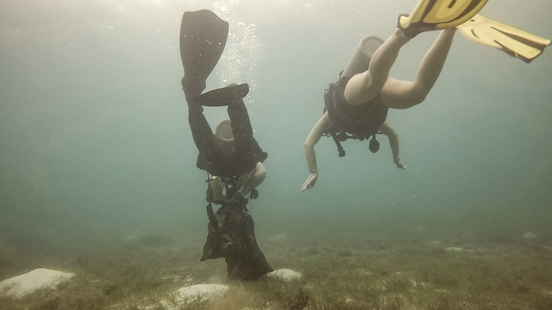
At thiw event we were 5 divers and 3 land support
very good
1
1
1
1
1
1
1
1
2
pen
plastic tile
plastic sack
aluminium pipe
umbrella web
card plastic
anchor
chain
polyester piece
Loutraki Dive Club
Nikos_Ba
5
1
5
1
131.00
39
14.30
3.00
7
measured
6
2080.00
1
On
kilograms
I have debris data to report
Calm (glassy to rippled) for waves 0 – 0.1 meter high m2
meters
seagrass
5
1
1
Greece
State\Province
Corinthia
City
Loutraki
Map Help


Dive Location

If you know your survey site coordinates, enter them manually in decimal degrees using WGS84 Map Datum. Use the minus sign for latitudes south of the equator and longitudes west of the Prime Meridian to 180 degrees.

If you do not know your survey site coordinates, click the “Map Location” tab to use the map to zoom into your survey site and drop the pin on the map to fall within your survey dive site in the water (not on land or the beach). Ensure you zoom in as much as possible to ensure data accuracy.

Entangled Help


Use the vertical tabs below to record any entangled animals you found of each type.

Agioi Theodoroi

6
3
2
12
sand
5
12

37.931202758408, 23.147160769227

Loutraki dive club Agioi Theodoroi Loutraki Greece 17/5/2018
At this event we were 6 divers and 1 land support from our club. At first we visited the Primary school of Agioi Theodoroi and showed to the children videos about marine debris and pollution, given them advise for environmental protection. After that all together we went to the beach , the children done a beach clean up and we dive against debris. The Agioi Theodoroi Port Authorities were supporting the whole action and at school they showed clips and photos about sea risks and how to avoit them....
very good
2
1
1
3
1
1
1
1
1
1
1
hair clamp
plastic foam
rubber watch strap
tenis ball
metal spring
aluminum utensil
plexiglas roof
plastic sack
polyester piece
fire extinguisher
plastic packaging
Loutraki Dive Club
Nikos_Ba
3
1
49
2
6
1
19
1
97.00
43
18.00
1.50
13
measured
2332.00
2
1
On
kilograms
I have debris data to report
5
Calm (glassy to rippled) for waves 0 – 0.1 meter high
3
7
m2
2
tire - plastic piece
1 small octopus , 1 starfish
Released Unharmed
meters
seagrass
4
4
1
1
11
2
Greece
State\Province
Corinthia
City
Agioi Theodoroi
Map Help


Dive Location

If you know your survey site coordinates, enter them manually in decimal degrees using WGS84 Map Datum. Use the minus sign for latitudes south of the equator and longitudes west of the Prime Meridian to 180 degrees.

If you do not know your survey site coordinates, click the “Map Location” tab to use the map to zoom into your survey site and drop the pin on the map to fall within your survey dive site in the water (not on land or the beach). Ensure you zoom in as much as possible to ensure data accuracy.

Entangled Help


Use the vertical tabs below to record any entangled animals you found of each type.

ADS137 - Vouliagmeni Lake Loutraki

60
4
sand
25
4

38.032156155259, 22.873632814258

ADS137 - Vouliagmeni Lake Loutraki 5/5/2018
At this event we were 4 divers and 3 land support
The number is estimated ...
some of the fishes died in the procces
very good
1
1
2
1
1
1
pils tablet
Thermal Bottle cup
Aluminium food packaging
fender from motorbike (plastic)
a portion of milk
concrete mooring
Loutraki Dive Club
Nikos_Ba
10
25
4
4
1
5
91
2
58.00
45
17.40
1.00
5
measured
1710.00
On
kilograms
I have debris data to report
14
Calm (glassy to rippled) for waves 0 – 0.1 meter high
4
cans , plastic bottles
Injured
various small fish
CRABs + crayfish
Released Unharmed
35
15
cans , plastic bottles
4
m2
meters
seagrass
1
161
4
6
6
Greece
State\Province
Corinthia
City
Loutraki
Map Help


Dive Location

If you know your survey site coordinates, enter them manually in decimal degrees using WGS84 Map Datum. Use the minus sign for latitudes south of the equator and longitudes west of the Prime Meridian to 180 degrees.

If you do not know your survey site coordinates, click the “Map Location” tab to use the map to zoom into your survey site and drop the pin on the map to fall within your survey dive site in the water (not on land or the beach). Ensure you zoom in as much as possible to ensure data accuracy.

Entangled Help


Use the vertical tabs below to record any entangled animals you found of each type.

ADS116 - Tunnelen

67.234674, 14.604692

1
rock
2
Saltstraumen DykkeCamp
Fredric Ihrsen
1
0.30
36
28.00
5.00
measured
3
3000.00
On
kilograms
I have debris data to report
Smooth (wavelets) for waves 0.1 - 0.5 meter high m2
meters
kelp
Norway
Map Help


Dive Location

If you know your survey site coordinates, enter them manually in decimal degrees using WGS84 Map Datum. Use the minus sign for latitudes south of the equator and longitudes west of the Prime Meridian to 180 degrees.

If you do not know your survey site coordinates, click the “Map Location” tab to use the map to zoom into your survey site and drop the pin on the map to fall within your survey dive site in the water (not on land or the beach). Ensure you zoom in as much as possible to ensure data accuracy.

Entangled Help


Use the vertical tabs below to record any entangled animals you found of each type.

ADS10 - Ørneset

67.225682, 14.616451

2
rock
2
Saltstraumen DykkeCamp
Fredric Ihrsen
1
0.40
41
27.00
1.00
measured
5
3000.00
On
kilograms
I have debris data to report
Smooth (wavelets) for waves 0.1 - 0.5 meter high m2
meters
kelp
Norway
Map Help


Dive Location

If you know your survey site coordinates, enter them manually in decimal degrees using WGS84 Map Datum. Use the minus sign for latitudes south of the equator and longitudes west of the Prime Meridian to 180 degrees.

If you do not know your survey site coordinates, click the “Map Location” tab to use the map to zoom into your survey site and drop the pin on the map to fall within your survey dive site in the water (not on land or the beach). Ensure you zoom in as much as possible to ensure data accuracy.

Entangled Help


Use the vertical tabs below to record any entangled animals you found of each type.

Boracay island, Station 3 anchorage area

10
10
22
10

11.952291824801, 121.9278278979

sand
127
33

11.952291824801, 121.9278278979

This was an anchorage area of passenger and tour boats. People probably just dispose of the rubbish there
engine battery
SUNNY WITH SCATTERED SHOWERS
BORACAY BUSINESS ADMINISTRATION OF SCUBA SHOPS
Therese Garcia
10
47
10
33
8
15
39
2
294
180
12
103
2
1
300.00
60
25.00
15.00
75
estimated
10000.00
2
2
14
plastic bags
beverage bottles
4
On
kilograms
I have debris data to report
269
Smooth (wavelets) for waves 0.1 - 0.5 meter high
11
18
ft2
35
feet
other
2
80
25
2
27
109
40
10
85
8
5
40
Philippines
City
AKLAN
Map Help


Dive Location

If you know your survey site coordinates, enter them manually in decimal degrees using WGS84 Map Datum. Use the minus sign for latitudes south of the equator and longitudes west of the Prime Meridian to 180 degrees.

If you do not know your survey site coordinates, click the “Map Location” tab to use the map to zoom into your survey site and drop the pin on the map to fall within your survey dive site in the water (not on land or the beach). Ensure you zoom in as much as possible to ensure data accuracy.

Entangled Help


Use the vertical tabs below to record any entangled animals you found of each type.

Ecosystem Other
SAND AND REEF

ADS163 - Vietnamese Bay

0
5
0
0

10.6257, 103.310757

0
0
0
coral
0
40
0
2
0
Mainland Sihanoukville is teeming with insane amounts of single use plastic waste, as the wind sometimes come directly from mainland it transports the plastic in the direction of the island only for it to end up at most of our dive sites and along the beaches of both sides of the island, also people seem to be unaware of the dangers of not deposing of plastic properly so they just drop it in to the ocean
Single use plastic bags
Extended thunder showers
The Dive Shop Cambodia
Emmanuel Rautenbach
0
0
0
0
0
0
0
0
0
0
0
0
0
0
0
0
0
0
0
2
0
0
0
0
1
0
1
0
0
0
0
0
0
0
0
0
2.00
50
7.00
3.00
2
estimated
0
0
0
0
3032.31
0
0
0
0
0
Plastic grocery bags
Instant noodles packaging
Fishing line
0
On
kilograms
0
I have debris data to report
0
0
0
Slight for waves 0.5 -1.25 meter high
0
0
0
Jax
1
Not provided
0
0
0
0
m2
1
0
meters
coral reef
0
0
0
0
0
0
0
0
0
0
0
0
0
0
0
0
0
0
0
0
0
0
0
0
0
0
0
0
0
Cambodia
State\Province
Sihanoukville Province
City
Sihanoukville
Map Help


Dive Location

If you know your survey site coordinates, enter them manually in decimal degrees using WGS84 Map Datum. Use the minus sign for latitudes south of the equator and longitudes west of the Prime Meridian to 180 degrees.

If you do not know your survey site coordinates, click the “Map Location” tab to use the map to zoom into your survey site and drop the pin on the map to fall within your survey dive site in the water (not on land or the beach). Ensure you zoom in as much as possible to ensure data accuracy.

Entangled Help


Use the vertical tabs below to record any entangled animals you found of each type.

From Liscannor Pier

0
0
0
0

52.941827, -9.476877

0
0
0
rock
0
0
0
0
0
Dive Academy
Niall McKee
0
0
0
0
0
0
0
0
0
0
0
0
0
0
0
0
0
0
0
4
0
0
0
0
0
0
0
0
0
0
0
0
0
0
0
0
0.00
45
18.00
8.00
0
estimated
0
0
0
0
1666.32
0
0
0
0
0
0
On
kilograms
0
Our Survey Site was free of debris
0
0
0
Smooth (wavelets) for waves 0.1 - 0.5 meter high
0
0
0
0
0
0
0
m2
0
0
meters
rocky reef
0
0
0
0
0
0
0
0
0
0
0
0
0
0
0
0
0
0
0
0
0
0
0
0
0
0
0
0
0
Ireland
Map Help


Dive Location

If you know your survey site coordinates, enter them manually in decimal degrees using WGS84 Map Datum. Use the minus sign for latitudes south of the equator and longitudes west of the Prime Meridian to 180 degrees.

If you do not know your survey site coordinates, click the “Map Location” tab to use the map to zoom into your survey site and drop the pin on the map to fall within your survey dive site in the water (not on land or the beach). Ensure you zoom in as much as possible to ensure data accuracy.

Entangled Help


Use the vertical tabs below to record any entangled animals you found of each type.

From Liscannor Pier

0
0
0
0

52.90848, -9.432644

0
0
0
rock
0
0
0
0
0
Dive Academy
Niall McKee
0
0
0
0
0
0
0
0
0
0
0
0
0
0
0
0
0
0
0
6
0
0
0
0
0
0
0
0
0
0
0
0
0
0
0
0
0.00
45
25.00
12.00
0
estimated
0
0
0
0
849.41
0
0
0
0
0
0
On
kilograms
0
Our Survey Site was free of debris
0
0
0
Smooth (wavelets) for waves 0.1 - 0.5 meter high
0
0
0
0
0
0
0
m2
0
0
meters
rocky reef
0
0
0
0
0
0
0
0
0
0
0
0
0
0
0
0
0
0
0
0
0
0
0
0
0
0
0
0
0
Ireland
Map Help


Dive Location

If you know your survey site coordinates, enter them manually in decimal degrees using WGS84 Map Datum. Use the minus sign for latitudes south of the equator and longitudes west of the Prime Meridian to 180 degrees.

If you do not know your survey site coordinates, click the “Map Location” tab to use the map to zoom into your survey site and drop the pin on the map to fall within your survey dive site in the water (not on land or the beach). Ensure you zoom in as much as possible to ensure data accuracy.

Entangled Help


Use the vertical tabs below to record any entangled animals you found of each type.

Koh Haa

coral

7.4333918296729, 98.897443402528

8
0.00
60
30.00
2.00
measured
300.00
On
kilograms
Our Survey Site was free of debris
Calm (glassy to rippled) for waves 0 – 0.1 meter high m2
meters
coral reef
Thailand
Map Help


Dive Location

If you know your survey site coordinates, enter them manually in decimal degrees using WGS84 Map Datum. Use the minus sign for latitudes south of the equator and longitudes west of the Prime Meridian to 180 degrees.

If you do not know your survey site coordinates, click the “Map Location” tab to use the map to zoom into your survey site and drop the pin on the map to fall within your survey dive site in the water (not on land or the beach). Ensure you zoom in as much as possible to ensure data accuracy.

Entangled Help


Use the vertical tabs below to record any entangled animals you found of each type.

Subscribe to