Menu

Molinere

0
0
0

12.082803126824, -61.762728722462

0
0
0
coral
0
0
0
1
0
Sunny, windy, ocean surge
0
0
0
0
0
0
0
0
0
0
0
0
0
0
0
0
0
0
0
0
Michelle
0
0
0
0
0
0
0
0
0
0
0
0
0
0
0
0
0
0
0
1
0
0
0
0
0
0
0
0
0
0
0
0
0
0
0.10
52
11.30
4.20
0
estimated
0
2
10695.10
0
0
0
0
0
0
On
kilograms
0
I have debris data to report
0
0
0
Smooth (wavelets) for waves 0.1 - 0.5 meter high
0
0
0
0
0
0
0
m2
0
0
meters
coral reef
0
0
0
0
0
0
0
0
0
0
0
0
0
0
0
0
0
0
0
0
0
0
0
0
0
0
0
0
Grenada
City
St. George’s
Map Help


Dive Location

If you know your survey site coordinates, enter them manually in decimal degrees using WGS84 Map Datum. Use the minus sign for latitudes south of the equator and longitudes west of the Prime Meridian to 180 degrees.

If you do not know your survey site coordinates, click the “Map Location” tab to use the map to zoom into your survey site and drop the pin on the map to fall within your survey dive site in the water (not on land or the beach). Ensure you zoom in as much as possible to ensure data accuracy.

Entangled Help


Use the vertical tabs below to record any entangled animals you found of each type.

Grand Anse

1
3
0

12.026942804873, -61.764570743818

0
0
0
sand
0
0
0
1
0
Sunny, windy, ocean surge
0
0
0
0
0
0
0
0
0
0
0
0
0
0
0
0
0
0
0
0
Michelle
0
0
0
1
0
0
0
0
0
0
0
0
0
0
0
0
0
0
0
1
0
0
0
0
0
0
0
0
0
0
0
0
0
0
0.75
37
4.20
0.90
0
measured
0
0
2067.12
0
0
0
0
0
0
On
kilograms
0
I have debris data to report
2
0
0
Smooth (wavelets) for waves 0.1 - 0.5 meter high
0
0
0
0
0
0
0
m2
0
1
meters
other
0
0
0
0
0
0
0
0
0
0
0
0
0
0
0
0
2
0
0
0
0
0
0
0
0
0
0
0
Grenada
City
St. George’s
Map Help


Dive Location

If you know your survey site coordinates, enter them manually in decimal degrees using WGS84 Map Datum. Use the minus sign for latitudes south of the equator and longitudes west of the Prime Meridian to 180 degrees.

If you do not know your survey site coordinates, click the “Map Location” tab to use the map to zoom into your survey site and drop the pin on the map to fall within your survey dive site in the water (not on land or the beach). Ensure you zoom in as much as possible to ensure data accuracy.
Entangled Help


Use the vertical tabs below to record any entangled animals you found of each type.

ADS175 - Blue Bay

0
0
0

35.031984, 34.042372

0
0
0
sand
0
6
0
0
0
0
0
0
0
0
0
0
0
0
0
0
0
0
0
0
0
0
0
0
0
Taba Diving Centre
Manuel Vollmer
0
0
0
0
0
0
0
0
0
0
0
0
0
0
0
0
0
0
0
3
0
0
0
0
0
0
0
0
0
0
0
0
0
0
3.00
45
6.00
1.00
0
estimated
0
0
200.00
0
0
0
0
0
0
On
kilograms
0
I have debris data to report
1
0
0
Smooth (wavelets) for waves 0.1 - 0.5 meter high
0
0
0
0
0
0
0
m2
0
0
meters
rocky reef
0
0
0
0
0
0
0
0
0
0
0
0
0
0
0
0
5
0
0
0
0
0
0
0
0
0
0
0
Cyprus
City
Protaras
Map Help


Dive Location

If you know your survey site coordinates, enter them manually in decimal degrees using WGS84 Map Datum. Use the minus sign for latitudes south of the equator and longitudes west of the Prime Meridian to 180 degrees.

If you do not know your survey site coordinates, click the “Map Location” tab to use the map to zoom into your survey site and drop the pin on the map to fall within your survey dive site in the water (not on land or the beach). Ensure you zoom in as much as possible to ensure data accuracy.
Entangled Help


Use the vertical tabs below to record any entangled animals you found of each type.

ADS175 - Blue Bay

0
11
0

35.031984, 34.042372

0
0
0
sand
0
5
0
0
0
0
0
0
0
0
0
0
0
0
0
0
0
0
0
0
0
0
0
0
0
Taba Diving Centre
Manuel Vollmer
0
0
0
1
0
0
0
0
0
0
0
0
0
0
0
0
1
5
0
3
0
0
0
0
0
0
0
0
0
0
0
0
0
0
7.00
45
6.00
1.00
0
estimated
0
0
200.00
0
0
0
3
0
0
On
kilograms
0
I have debris data to report
2
0
0
Smooth (wavelets) for waves 0.1 - 0.5 meter high
0
0
0
0
0
0
0
m2
2
1
meters
rocky reef
6
0
0
0
0
0
0
0
0
0
0
0
0
0
0
0
13
0
0
0
0
0
0
0
0
0
0
0
Cyprus
City
Protaras
Map Help


Dive Location

If you know your survey site coordinates, enter them manually in decimal degrees using WGS84 Map Datum. Use the minus sign for latitudes south of the equator and longitudes west of the Prime Meridian to 180 degrees.

If you do not know your survey site coordinates, click the “Map Location” tab to use the map to zoom into your survey site and drop the pin on the map to fall within your survey dive site in the water (not on land or the beach). Ensure you zoom in as much as possible to ensure data accuracy.
Entangled Help


Use the vertical tabs below to record any entangled animals you found of each type.

ADS238 - Chabahr Bay

coral
2

25.319334528619, 60.620244364439

1
Concrete masonry
Amir Ghazilou
2
3.00
30
6.00
1.50
estimated
150.00
On
kilograms
I have debris data to report
Calm (glassy to rippled) for waves 0 – 0.1 meter high m2
meters
coral reef
1
Iran
Map Help


Dive Location

If you know your survey site coordinates, enter them manually in decimal degrees using WGS84 Map Datum. Use the minus sign for latitudes south of the equator and longitudes west of the Prime Meridian to 180 degrees.

If you do not know your survey site coordinates, click the “Map Location” tab to use the map to zoom into your survey site and drop the pin on the map to fall within your survey dive site in the water (not on land or the beach). Ensure you zoom in as much as possible to ensure data accuracy.
Entangled Help


Use the vertical tabs below to record any entangled animals you found of each type.

St Georges Island

34.906555555556, 32.321347222222

rock

35.04092, 32.393906

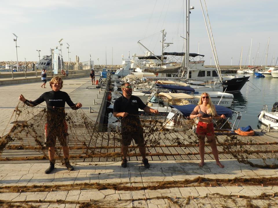
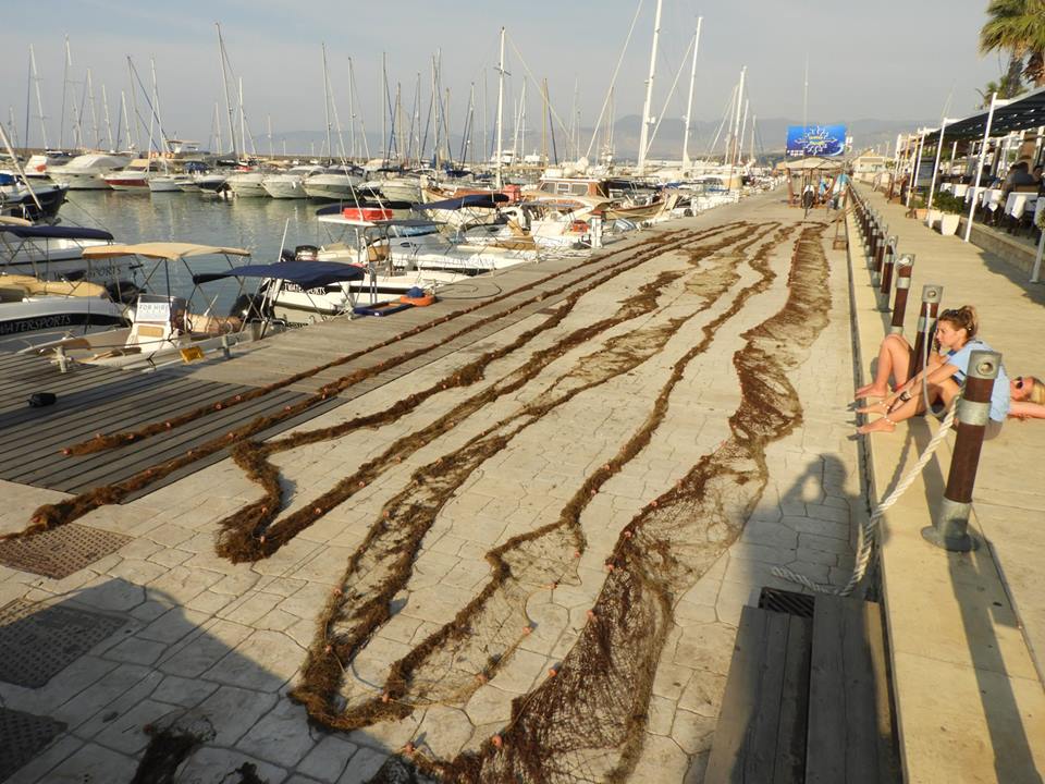
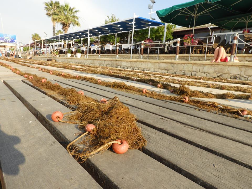
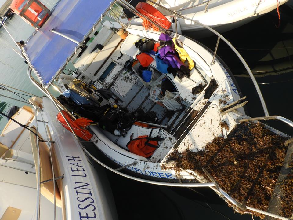
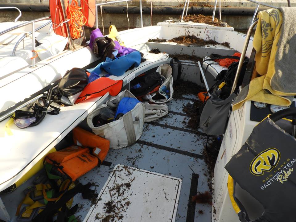
Large 700ft fishing net. Lead weighted rope + small buoys.
1
Lead Weighted Fishing net
Latchi Dive Centre
Johnny H
3
495.00
62
40.00
19.00
estimated
320.00
On
kilograms
I have debris data to report
Smooth (wavelets) for waves 0.1 - 0.5 meter high
Fishing net
Slipper Lobster
Released Unharmed
14
m2
8
Fishing Net
Common Crab
Injured
meters
seagrass
Cyprus
City
Latchi
Map Help


Dive Location

If you know your survey site coordinates, enter them manually in decimal degrees using WGS84 Map Datum. Use the minus sign for latitudes south of the equator and longitudes west of the Prime Meridian to 180 degrees.

If you do not know your survey site coordinates, click the “Map Location” tab to use the map to zoom into your survey site and drop the pin on the map to fall within your survey dive site in the water (not on land or the beach). Ensure you zoom in as much as possible to ensure data accuracy.
Entangled Help


Use the vertical tabs below to record any entangled animals you found of each type.

Biorocks

4

-8.356745, 116.042474

1
sand
1
1
calm
Gili Eco Trust
Sian Williams
4
5
2
1
1
4.00
65
19.00
3.00
measured
1
400.00
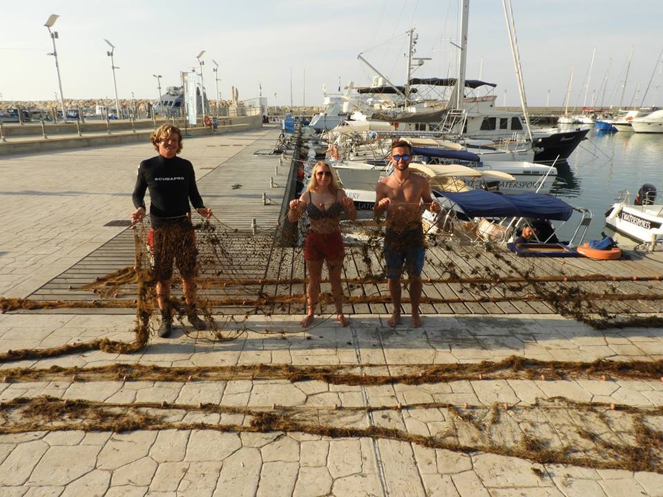
Plasticbottles
Fishing Lines
Glass Bottles
On
kilograms
I have debris data to report
1
Smooth (wavelets) for waves 0.1 - 0.5 meter high m2
meters
other
Indonesia
City
Gili Trawangan
Map Help


Dive Location

If you know your survey site coordinates, enter them manually in decimal degrees using WGS84 Map Datum. Use the minus sign for latitudes south of the equator and longitudes west of the Prime Meridian to 180 degrees.

If you do not know your survey site coordinates, click the “Map Location” tab to use the map to zoom into your survey site and drop the pin on the map to fall within your survey dive site in the water (not on land or the beach). Ensure you zoom in as much as possible to ensure data accuracy.
Entangled Help


Use the vertical tabs below to record any entangled animals you found of each type.

Ecosystem Other
Biorock-Reefs

Black rock

0
4
0

20.92822196449, -156.69621747753

2
0
0
rock
0
0
0
18
0
No
Overcast with light rain
1
0
0
0
0
0
0
0
0
0
0
0
0
0
0
0
0
0
0
0
Extended Horizons
Crystal Grenade
0
0
0
1
0
0
0
0
1
0
0
0
0
0
0
0
0
0
2
3
0
0
0
0
0
0
0
0
0
0
0
0
0
0
1.50
58
33.00
5.00
1
measured
0
17
2490.66
0
0
0
0
0
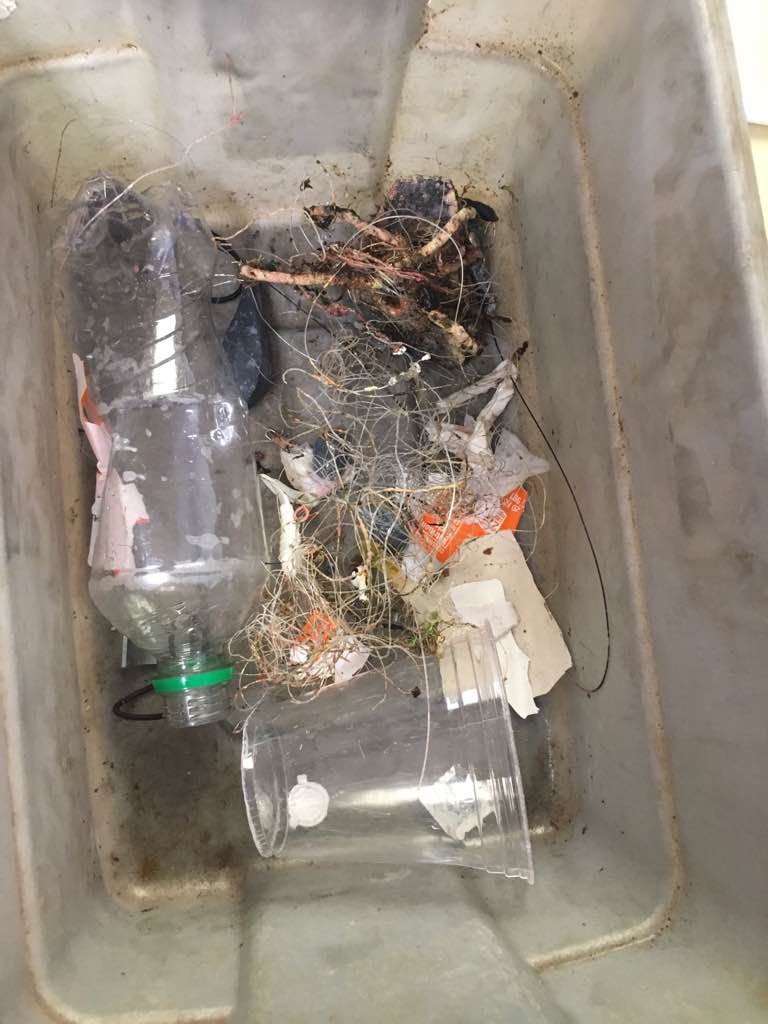
Monofilament
Metal sinkers
Lures
0
On
pounds
0
I have debris data to report
0
0
0
Smooth (wavelets) for waves 0.1 - 0.5 meter high
0
0
0
0
3
0
0
m2
0
0
feet
rocky reef
1
0
0
0
0
0
0
0
0
0
0
0
0
0
0
0
0
0
0
0
0
String
Injured
Green Sea Turtles
0
0
0
0
0
0
0
0
United States
State\Province
Hawaii
City
Lahaina
Map Help


Dive Location

If you know your survey site coordinates, enter them manually in decimal degrees using WGS84 Map Datum. Use the minus sign for latitudes south of the equator and longitudes west of the Prime Meridian to 180 degrees.

If you do not know your survey site coordinates, click the “Map Location” tab to use the map to zoom into your survey site and drop the pin on the map to fall within your survey dive site in the water (not on land or the beach). Ensure you zoom in as much as possible to ensure data accuracy.
Entangled Help


Use the vertical tabs below to record any entangled animals you found of each type.

Cozumel Marine World

0
0
0
0

20.483241, -86.971984

0
0
0
sand
0
0
0
0
0
No
Broken bottle
Good
1
Duct tape
Scuba Center
Rick F
0
0
0
0
0
0
0
0
1
0
0
0
0
0
0
0
0
0
0
1
0
0
0
0
0
0
0
0
0
0
0
0
0
0
0
0
0.50
30
35.00
10.00
0
estimated
0
0
0
0
4565.86
0
0
0
0
0
Glass
Tape
Snorkel parts
0
On
pounds
0
I have debris data to report
0
0
0
Calm (glassy to rippled) for waves 0 – 0.1 meter high
0
0
0
0
0
0
0
ft2
0
0
feet
rocky reef
0
0
0
0
0
0
0
0
0
0
0
0
0
0
0
0
0
0
0
0
0
0
1
0
0
0
0
0
0
Mexico
State\Province
Q Roo
City
San Miguel
Map Help


Dive Location

If you know your survey site coordinates, enter them manually in decimal degrees using WGS84 Map Datum. Use the minus sign for latitudes south of the equator and longitudes west of the Prime Meridian to 180 degrees.

If you do not know your survey site coordinates, click the “Map Location” tab to use the map to zoom into your survey site and drop the pin on the map to fall within your survey dive site in the water (not on land or the beach). Ensure you zoom in as much as possible to ensure data accuracy.

Entangled Help


Use the vertical tabs below to record any entangled animals you found of each type.

Cozumel Marine World Pier

1

20.498093, -86.954506

sand

20.483173483154, -86.971994983941

fair
Scuba Center
Fae Mellichamp
4
1
0.25
40
25.00
10.00
estimated
25.00
1
On
pounds
I have debris data to report
1
Calm (glassy to rippled) for waves 0 – 0.1 meter high m2
1
feet
coral reef
United States
State\Province
MN
City
Eagan
Map Help


Dive Location

If you know your survey site coordinates, enter them manually in decimal degrees using WGS84 Map Datum. Use the minus sign for latitudes south of the equator and longitudes west of the Prime Meridian to 180 degrees.

If you do not know your survey site coordinates, click the “Map Location” tab to use the map to zoom into your survey site and drop the pin on the map to fall within your survey dive site in the water (not on land or the beach). Ensure you zoom in as much as possible to ensure data accuracy.

Entangled Help


Use the vertical tabs below to record any entangled animals you found of each type.

Subscribe to