Menu

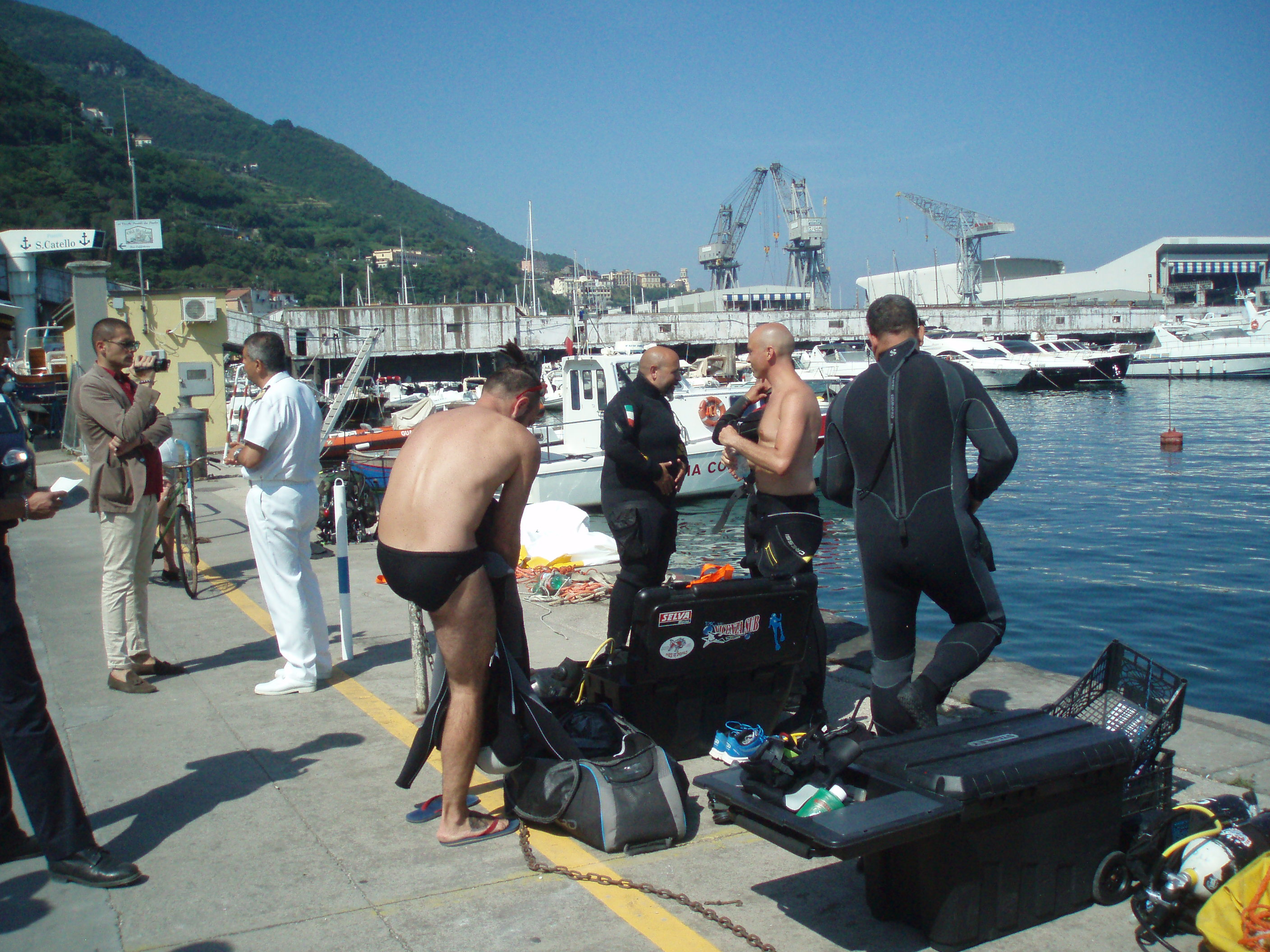
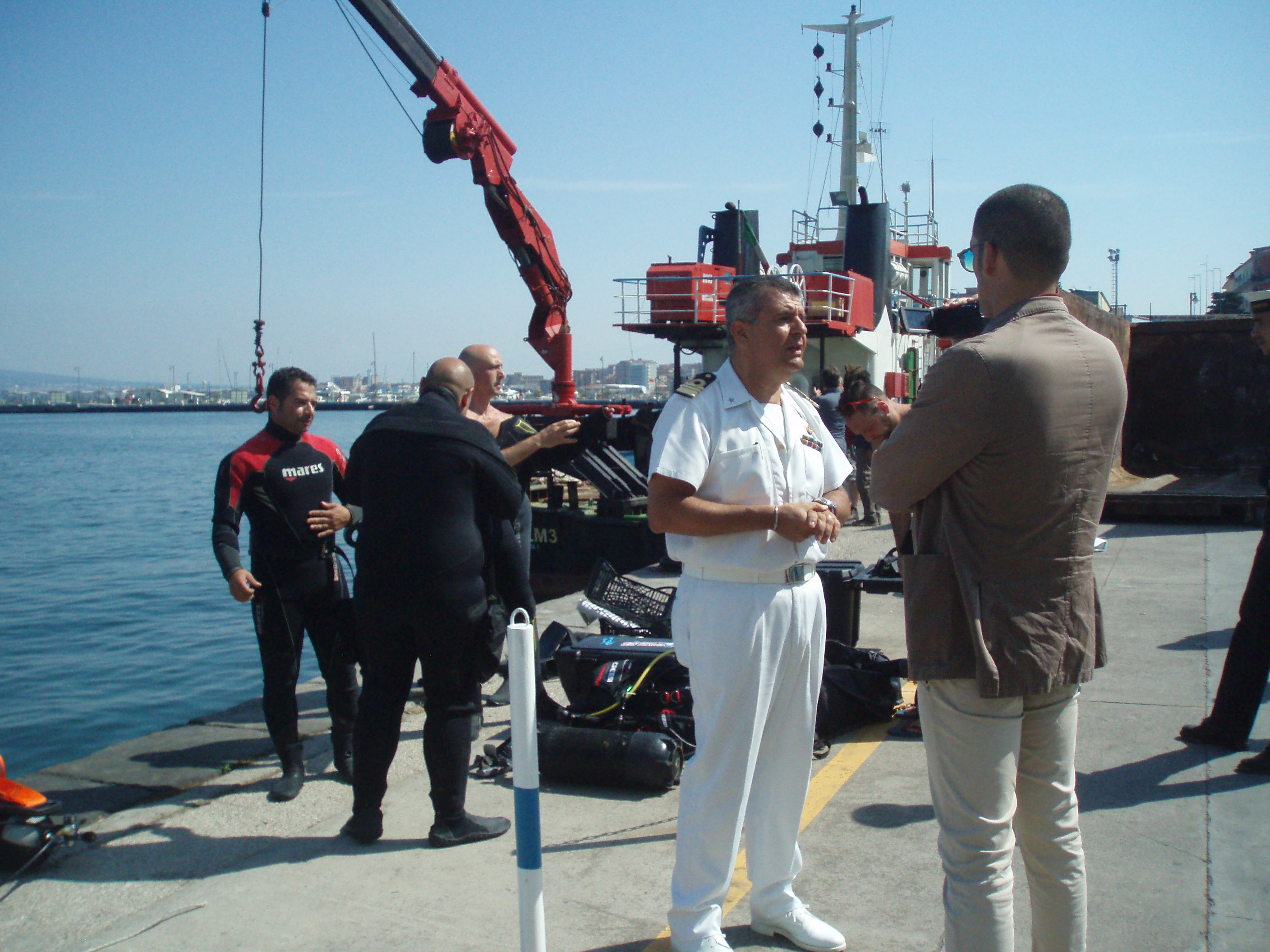
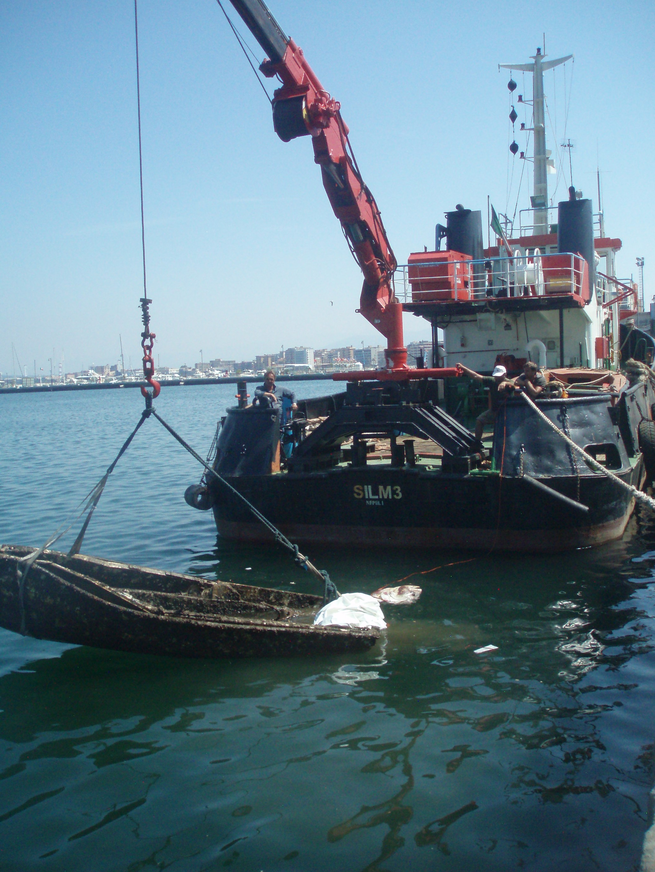
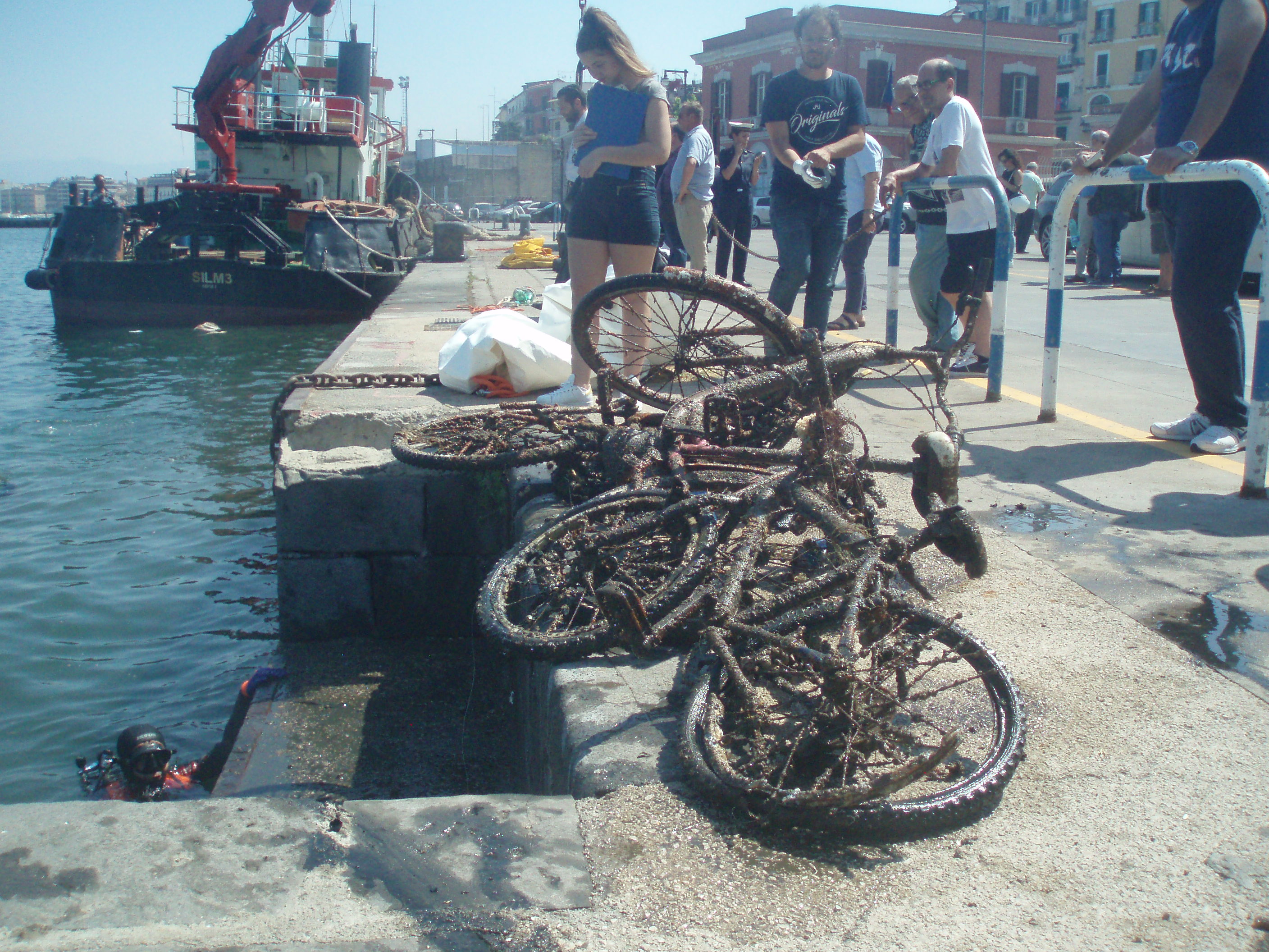
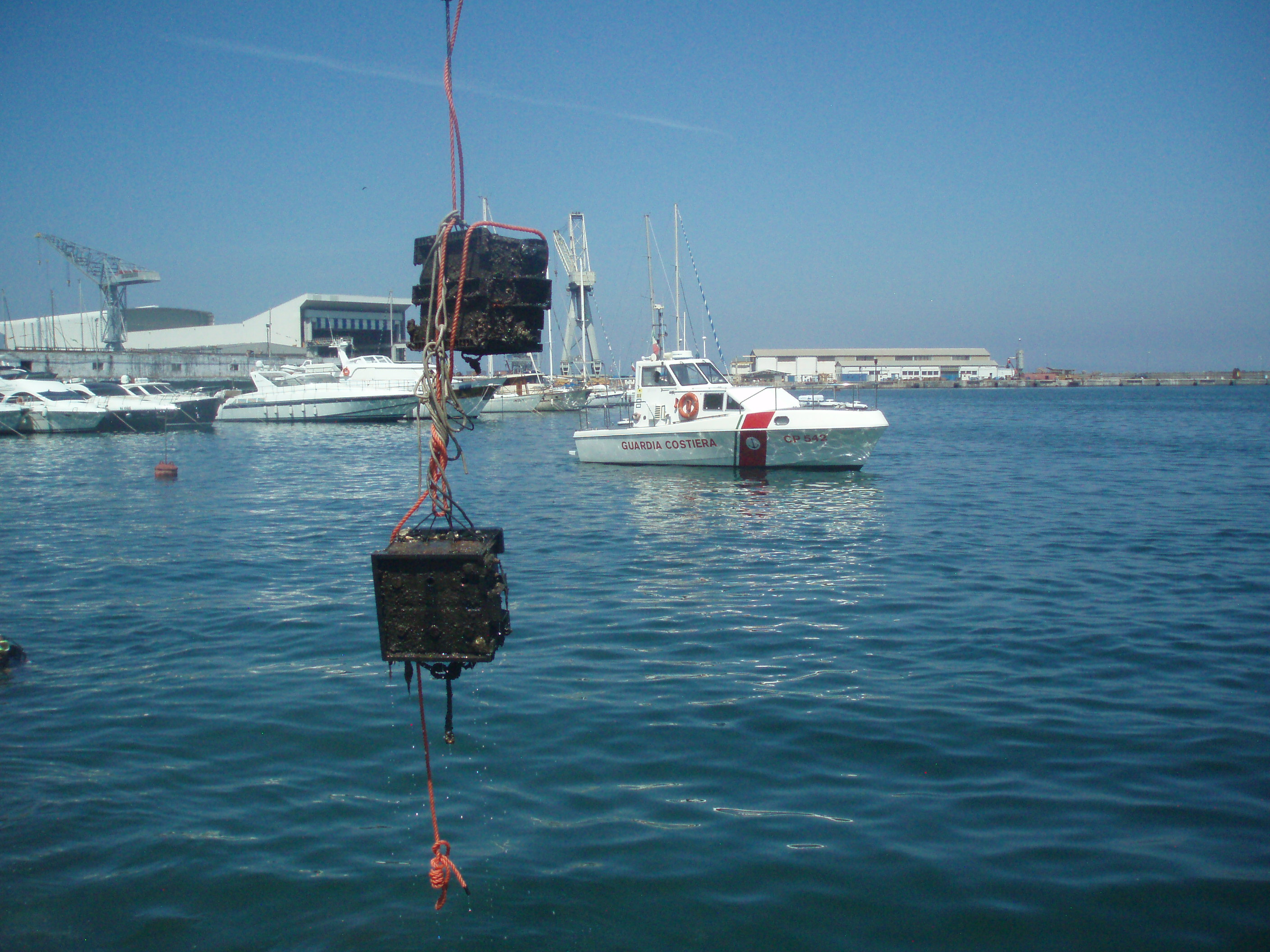
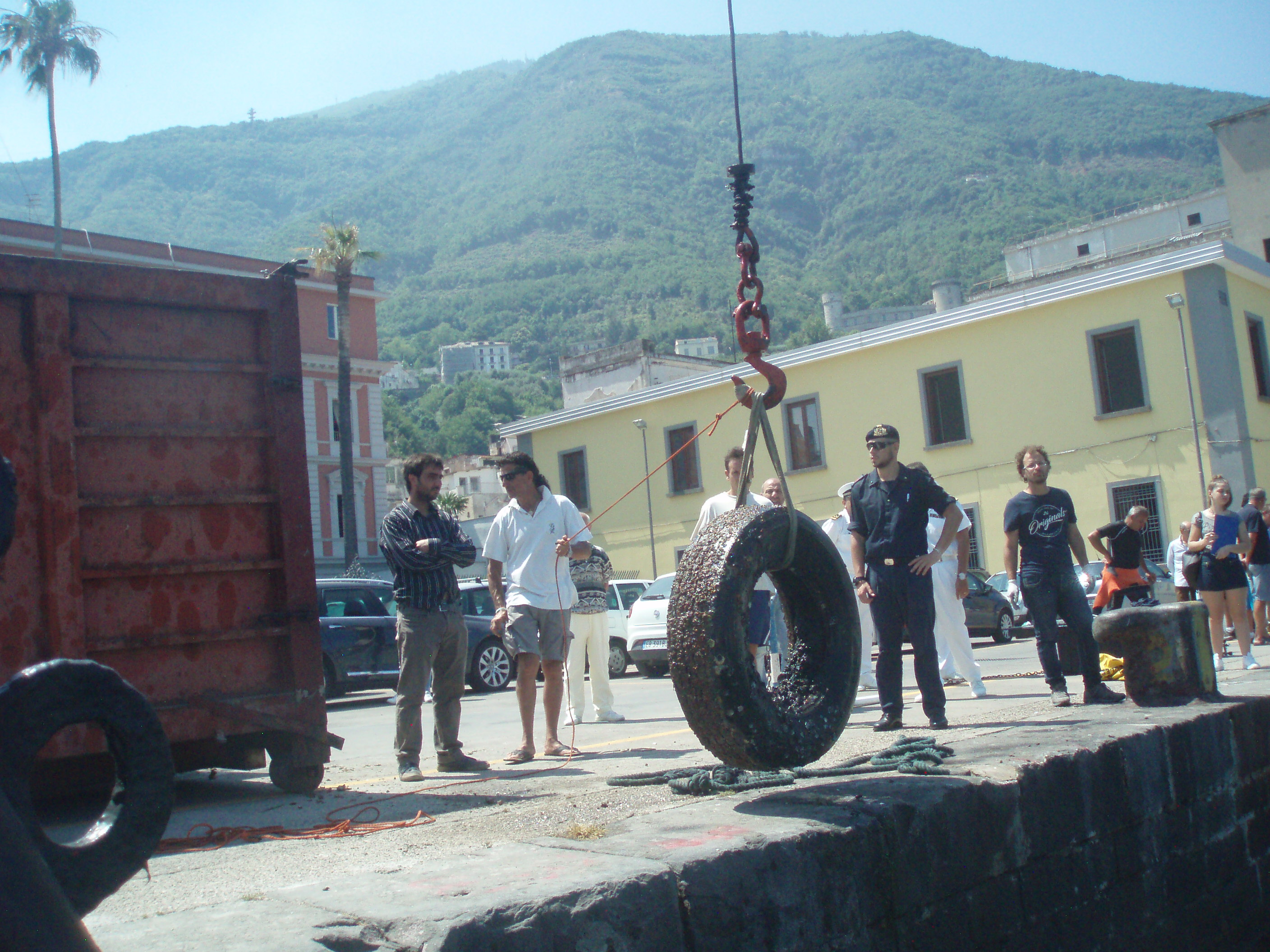
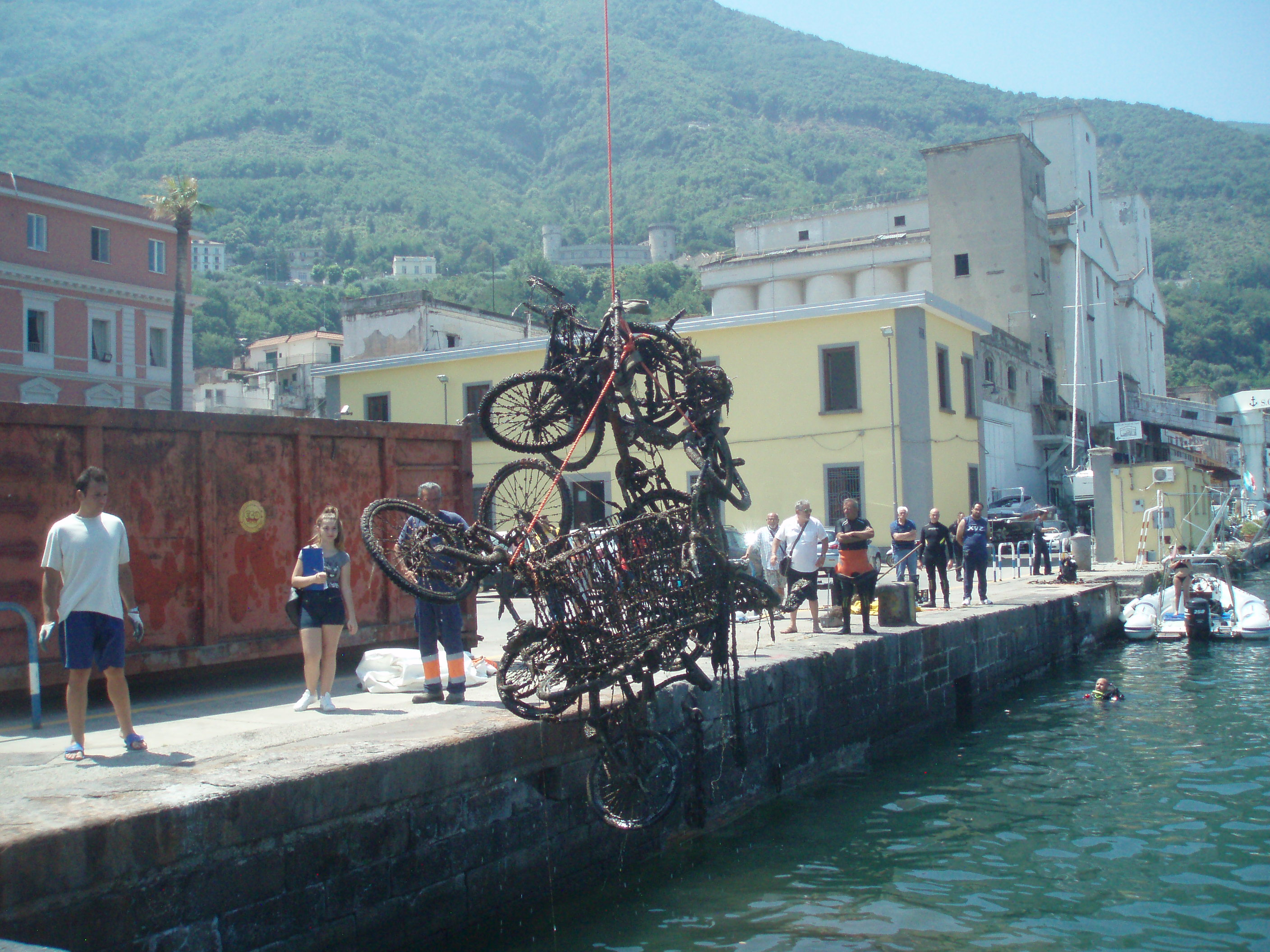
Pulizia fondali Porto Castellammare di Stabia

46
1
1
2
sand

40.69466333083, 14.476860254872

Great commitment of the Authorities, local association, diving and people, let hope for our environment.
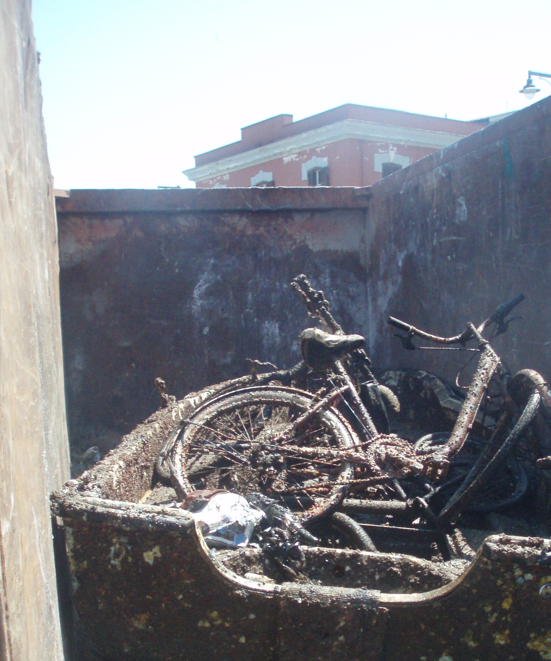
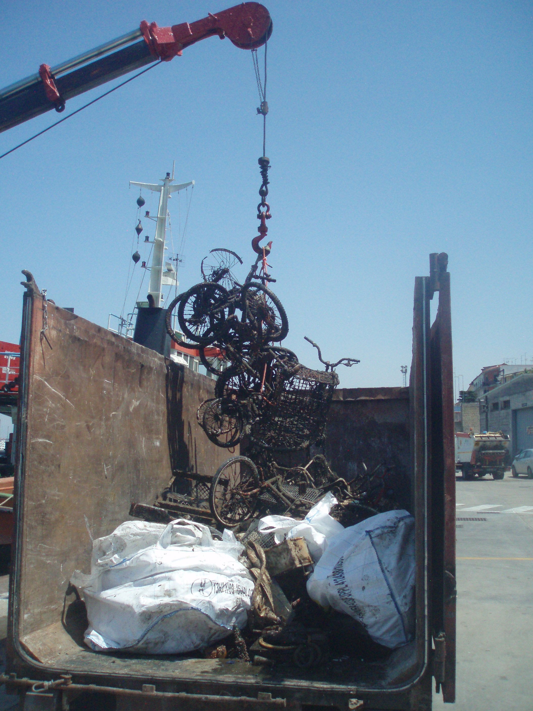
So many bicycles.
18
1
1
1
2
1
2
Bicycles
Boat
Anchor
Baby Stroller
Boat fenders
Iron stair
CD
Guardia Costiera Castellammare di Stabia, Comune di Castellammare di Stabia, diving e associazioni locali
Francesco Palomba
2
1
3
12
10
1
9
5
4
650.00
65
7.00
2.00
estimated
5
3
500.00
3
Plastic fragments , biological cycle alteration
Batteries car or boat , release toxic substances
Electronic devices , release toxic substances
On
kilograms
I have debris data to report
18
Calm (glassy to rippled) for waves 0 – 0.1 meter high
1
metal and plastic fragments
Crabs (Carcinus aestuarii) , bolinus brandaris
Released Unharmed
35
15
m2
1
meters
other
40
1
2
11
2
3
1
1
56
Italy
State\Province
Napoli
City
Castellammare di Stabia
Map Help


Dive Location

If you know your survey site coordinates, enter them manually in decimal degrees using WGS84 Map Datum. Use the minus sign for latitudes south of the equator and longitudes west of the Prime Meridian to 180 degrees.

If you do not know your survey site coordinates, click the “Map Location” tab to use the map to zoom into your survey site and drop the pin on the map to fall within your survey dive site in the water (not on land or the beach). Ensure you zoom in as much as possible to ensure data accuracy.

Entangled Help


Use the vertical tabs below to record any entangled animals you found of each type.

Ecosystem Other
Benthos

The Next Wave Submission 1497894901

User Name
Edwina Tucker
User Email
User Country
US
Top Issue
empower
Ocean Lover Type
all of the above

The Next Wave Submission 1497894418

User Name
Mark Hudson
User Email
User Country
US
Top Issue
leadership
Ocean Lover Type
all of the above

The Next Wave Submission 1497891509

User Name
Maria Ianc
User Email
User Country
ES
Top Issue
leadership
Ocean Lover Type
none of the above

The Next Wave Submission 1497890239

User Name
Martin Kelly
User Email
User Country
US
Top Issue
cleanocean
Ocean Lover Type
diver

The Next Wave Submission 1497888786

User Name
mahmoud ahmed
User Email
User Country
EG
Top Issue
sharksrays
Ocean Lover Type
diver

The Next Wave Submission 1497888445

User Name
Mahmoud Ahmed
User Email
User Country
EG
Top Issue
empower
Ocean Lover Type
diver

The Next Wave Submission 1497888211

User Name
Dora Stanculescu
User Email
User Country
RO
Top Issue
sharksrays
Ocean Lover Type
none of the above

ADS221 - Pointe Des Cascades

3

45.33125, -73.968028

silt
1
To Project Aware Team: thank you for this program. It makes our teaching even more interesting.
Very proud of the team. They did this survey during their Advanced Open Water Course.
Fortunately the visibility (5-10m) was much better than last time, so we could spot small pieces of glass and metal more easily. We saw less plastic, as we collected most of it in May.
I encourage instructors to include the DAD dive into the AOW course. My students made significant progress in mastering their buoyancy and they were very proud of what they did. They now think as Project Aware Divers :-)
Sunny, no wind.
Didier Duprat
1
2
4
1
34.00
45
6.00
1.00
1
measured
1
300.00
plastic
metal
glass
On
pounds
I have debris data to report
4
Calm (glassy to rippled) for waves 0 – 0.1 meter high m2
meters
other
24
1
0
2
147
Canada
State\Province
Quebec
City
Montreal
Map Help


Dive Location

If you know your survey site coordinates, enter them manually in decimal degrees using WGS84 Map Datum. Use the minus sign for latitudes south of the equator and longitudes west of the Prime Meridian to 180 degrees.

If you do not know your survey site coordinates, click the “Map Location” tab to use the map to zoom into your survey site and drop the pin on the map to fall within your survey dive site in the water (not on land or the beach). Ensure you zoom in as much as possible to ensure data accuracy.

Entangled Help


Use the vertical tabs below to record any entangled animals you found of each type.

Ecosystem Other
Canal

play ground

coral
40

26.7153424, -80.0533746

deep six/ease
Madison Heffernan
12
2
1.00
30
55.00
45.00
estimated
800.00
ballons/ plastic bags
On
pounds
I have debris data to report
Smooth (wavelets) for waves 0.1 - 0.5 meter high
Released Unharmed
Grunts
3
fishing line
ft2
feet
other
United States
State\Province
fl
City
vero beach
Map Help


Dive Location

If you know your survey site coordinates, enter them manually in decimal degrees using WGS84 Map Datum. Use the minus sign for latitudes south of the equator and longitudes west of the Prime Meridian to 180 degrees.

If you do not know your survey site coordinates, click the “Map Location” tab to use the map to zoom into your survey site and drop the pin on the map to fall within your survey dive site in the water (not on land or the beach). Ensure you zoom in as much as possible to ensure data accuracy.

Entangled Help


Use the vertical tabs below to record any entangled animals you found of each type.

Ecosystem Other
artifical reer
Subscribe to