If you know your survey site coordinates, enter them manually in decimal degrees using WGS84 Map Datum. Use the minus sign for latitudes south of the equator and longitudes west of the Prime Meridian to 180 degrees.
If you do not know your survey site coordinates, click the “Map Location” tab to use the map to zoom into your survey site and drop the pin on the map to fall within your survey dive site in the water (not on land or the beach). Ensure you zoom in as much as possible to ensure data accuracy.
Entangled Help
Use the vertical tabs below to record any entangled animals you found of each type.
I saw a large metal and wood sign partially buried in the sand under the reef. I plan to return and collect on a later dive. I will need a lift bag.
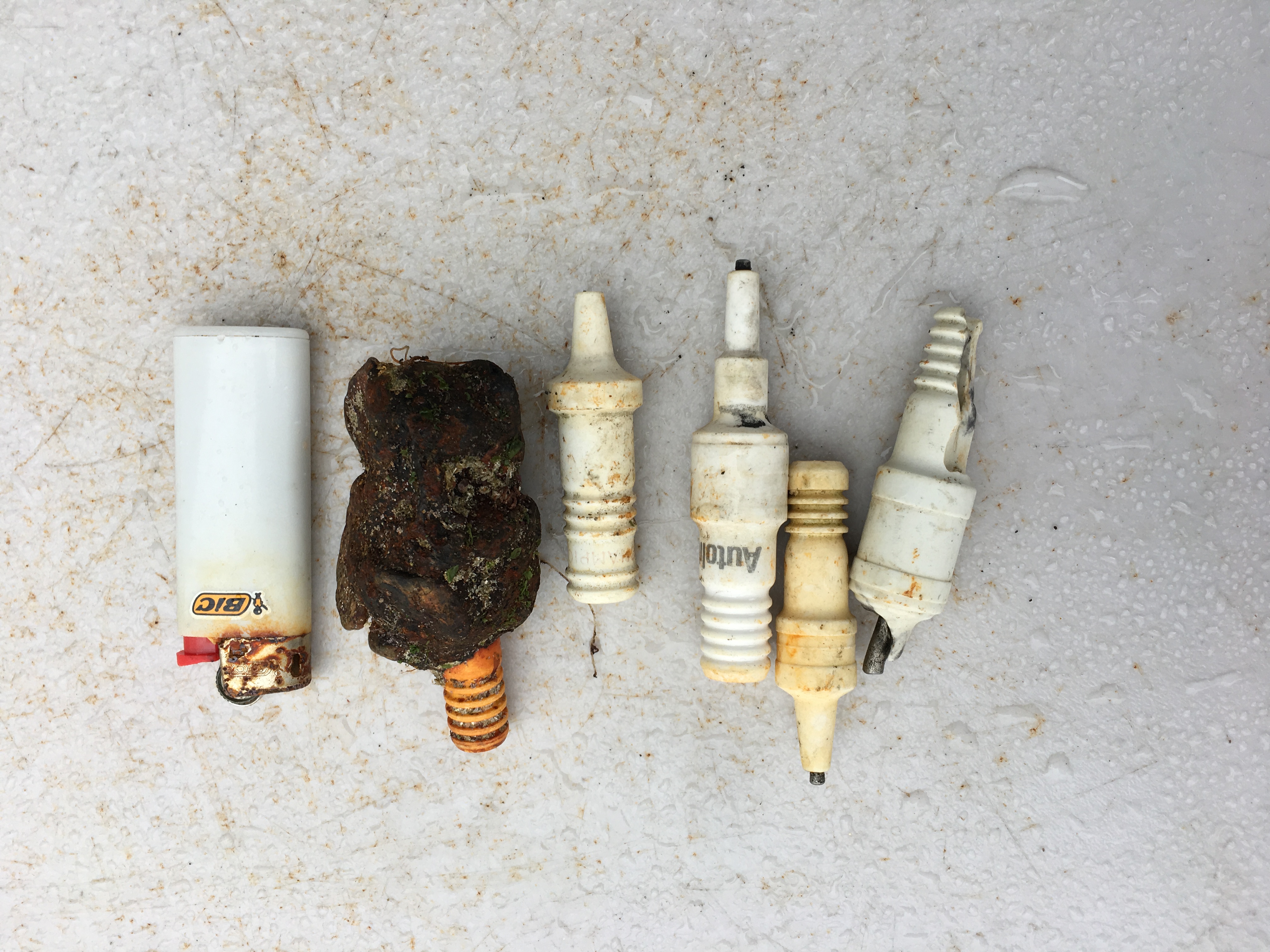
Fishermen using old spark plugs as weights
Spark plug encrusted with corrosion and rocks
Clear skies. Big waves.
5
spark plug
Beach Cities Scuba
Paul Dumais
1
0.50
66
36.00
8.00
estimated
56368.00
Spark plugs
disposable lighter
On
pounds
I have debris data to report
Slight for waves 0.5 -1.25 meter high
ft2
feet
rocky reef
United States
State\Province
CA
City
Laguna Beach
Map Help
Dive Location
If you know your survey site coordinates, enter them manually in decimal degrees using WGS84 Map Datum. Use the minus sign for latitudes south of the equator and longitudes west of the Prime Meridian to 180 degrees.
If you do not know your survey site coordinates, click the “Map Location” tab to use the map to zoom into your survey site and drop the pin on the map to fall within your survey dive site in the water (not on land or the beach). Ensure you zoom in as much as possible to ensure data accuracy.
Entangled Help
Use the vertical tabs below to record any entangled animals you found of each type.
Calm (glassy to rippled) for waves 0 – 0.1 meter high
2
m2
meters
coral reef
1
1
4
1
Dominican Republic
State\Province
La Romana
City
Bayahibe
Map Help
Dive Location
If you know your survey site coordinates, enter them manually in decimal degrees using WGS84 Map Datum. Use the minus sign for latitudes south of the equator and longitudes west of the Prime Meridian to 180 degrees.
If you do not know your survey site coordinates, click the “Map Location” tab to use the map to zoom into your survey site and drop the pin on the map to fall within your survey dive site in the water (not on land or the beach). Ensure you zoom in as much as possible to ensure data accuracy.
Entangled Help
Use the vertical tabs below to record any entangled animals you found of each type.
car trailer wire entangled in to the branches of the tree on the bottom
fishing lines - long and entangled
On
kilograms
I have debris data to report
3
Calm (glassy to rippled) for waves 0 – 0.1 meter high
m2
meters
other
4
2
2
5
4
Switzerland
State\Province
Geneva
City
Vernier
Map Help
Dive Location
If you know your survey site coordinates, enter them manually in decimal degrees using WGS84 Map Datum. Use the minus sign for latitudes south of the equator and longitudes west of the Prime Meridian to 180 degrees.
If you do not know your survey site coordinates, click the “Map Location” tab to use the map to zoom into your survey site and drop the pin on the map to fall within your survey dive site in the water (not on land or the beach). Ensure you zoom in as much as possible to ensure data accuracy.
Entangled Help
Use the vertical tabs below to record any entangled animals you found of each type.
Ecosystem Other
Silt + rock lake bottom with some logs and branches
Loutraki Dive Club / Isthmia Loutraki Greece 20/5/2017
At this event we were 4 divers and 3 land support
Very Good
1
1
1
1
3
1
1
1
1
1
1
1
1
1
1
1
1
1
17
5
gasoline filter
Packaging of condoms
line reel
Plastic profile
boat trailer reel
Plastic box
cd
hanger
Navigation lamp cover
Security belt mechanism
screwdriver
Storm lamp cover
chain
packaging tetrapak
Butterfly Hair Clips
Shift Boot (Rubber)
Fishing bell
Beach Umbrella shaft
shell casings from BULLETS
BULLETS
Loutraki Dive Club
Nikos_Ba
1
6
1
49
1
6
4
8
37
66.00
48
14.60
1.50
4
measured
7
971.00
2
On
kilograms
I have debris data to report
45
Calm (glassy to rippled) for waves 0 – 0.1 meter high
2
cans & bottles
CRABs
Released Unharmed
6
2
m2
meters
rocky reef
1
1
4
31
26
5
Greece
State\Province
Corinthia
City
Isthmia
Map Help
Dive Location
If you know your survey site coordinates, enter them manually in decimal degrees using WGS84 Map Datum. Use the minus sign for latitudes south of the equator and longitudes west of the Prime Meridian to 180 degrees.
If you do not know your survey site coordinates, click the “Map Location” tab to use the map to zoom into your survey site and drop the pin on the map to fall within your survey dive site in the water (not on land or the beach). Ensure you zoom in as much as possible to ensure data accuracy.
Entangled Help
Use the vertical tabs below to record any entangled animals you found of each type.