There needs to be more awareness on Nissi beach, maybe more workers doing beach clean ups during the day?
Can you send information on how to protect parts of Cyprus from fishing?? we have seen a decline in marine life because of overfishing and was wondering what we can do to help..
A blow up lilo
warm and a little windy.
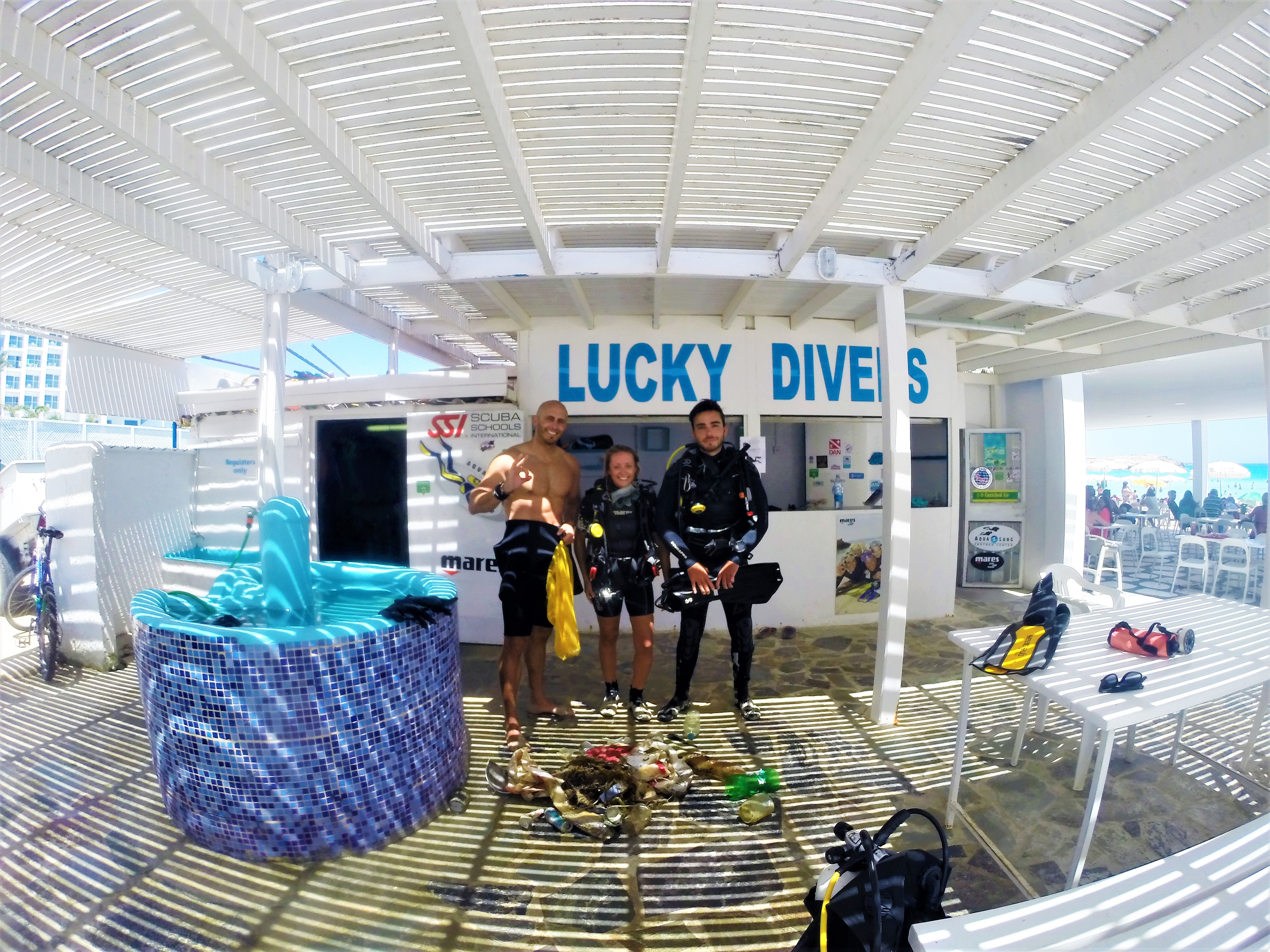
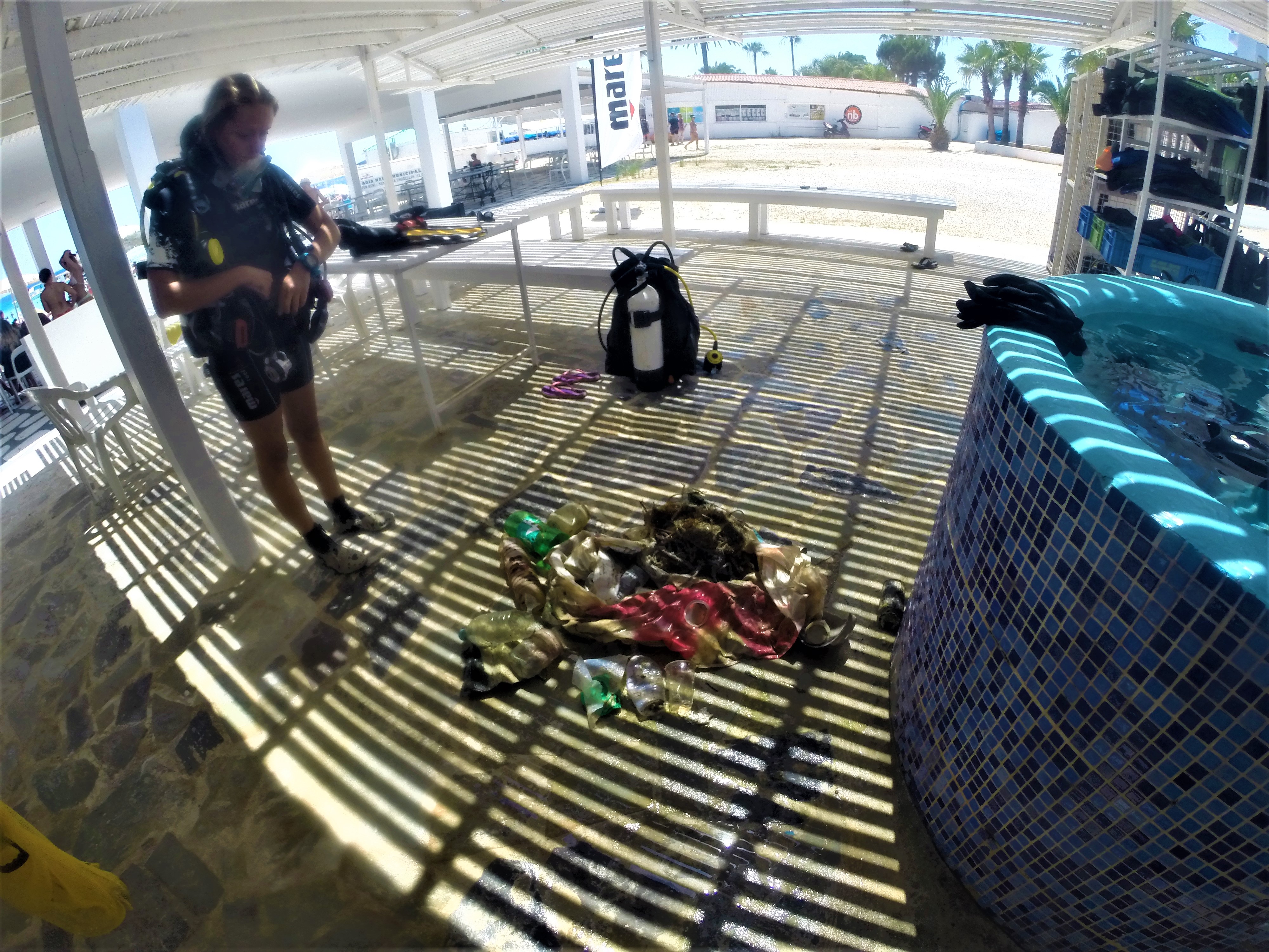
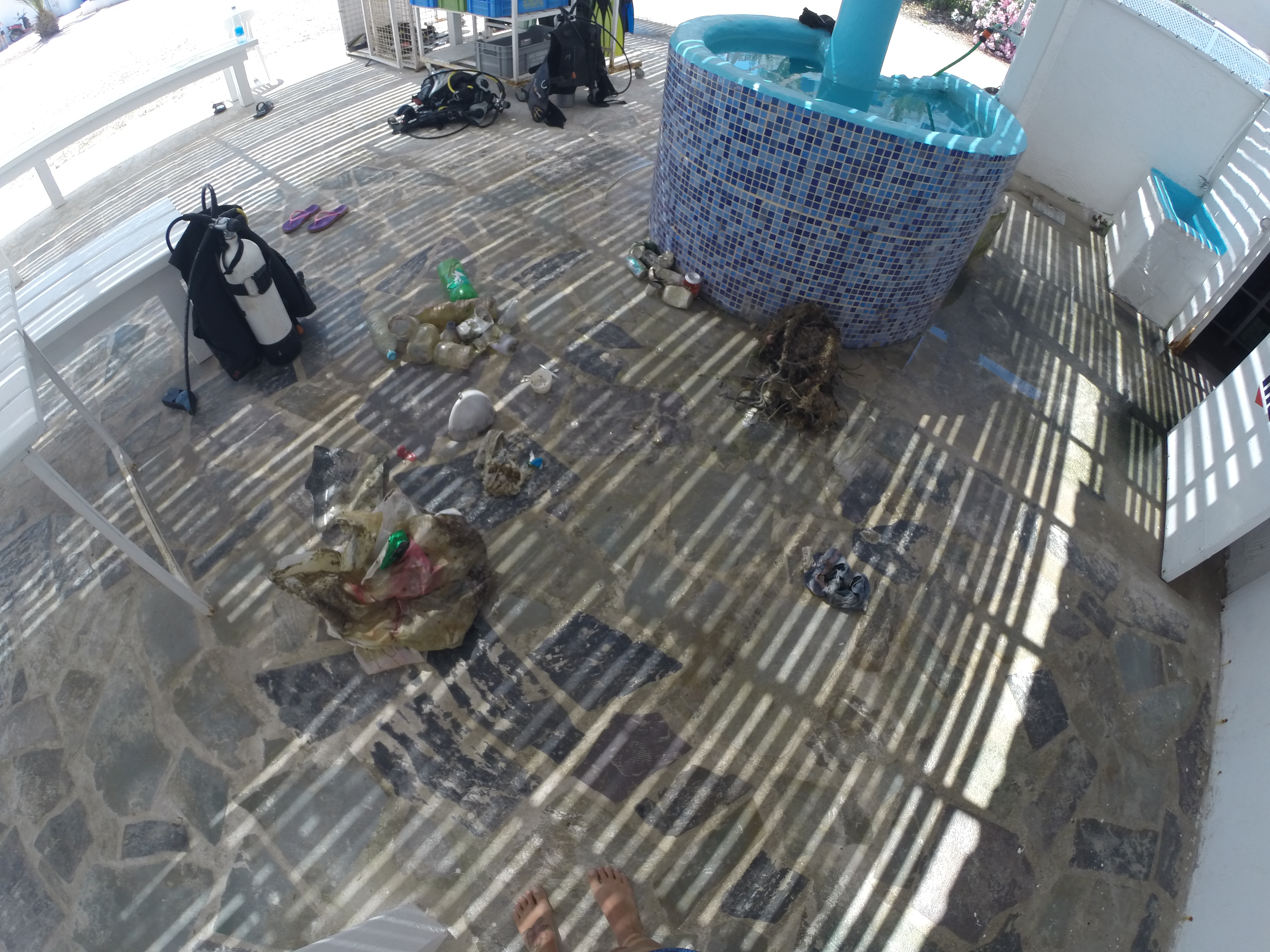
Lucky Divers Nissi Beach
Louise Floyd/Matt Godfrey
9
2
3
8
5
1
3
20.00
20
3.00
1.00
1
estimated
15.00
fishing nets, as they can trap sea life
plastic bottles, they never dissintegrate
drinks cans, they can harm life
On
kilograms
I have debris data to report
2
Calm (glassy to rippled) for waves 0 – 0.1 meter high
2
m2
meters
rocky reef
2
8
Cyprus
City
Ayia Napa
Map Help
Dive Location
If you know your survey site coordinates, enter them manually in decimal degrees using WGS84 Map Datum. Use the minus sign for latitudes south of the equator and longitudes west of the Prime Meridian to 180 degrees.
If you do not know your survey site coordinates, click the “Map Location” tab to use the map to zoom into your survey site and drop the pin on the map to fall within your survey dive site in the water (not on land or the beach). Ensure you zoom in as much as possible to ensure data accuracy.
Entangled Help
Use the vertical tabs below to record any entangled animals you found of each type.
Garbage is thrown by fishermen and tourists resting on the beach
A bottle of vodka, apparently lost
Rain, wind, cold
Panorama Divers
Anna Schmitt
2
6
2
2
3
4
6.00
35
1.00
2.00
estimated
100.00
glass bottles
plastic bottles
Aluminum cans
On
kilograms
I have debris data to report
8
Smooth (wavelets) for waves 0.1 - 0.5 meter high
m2
meters
other
11
1
1
Language
English
Russia
State\Province
Russia
City
Moscow
Map Help
Dive Location
If you know your survey site coordinates, enter them manually in decimal degrees using WGS84 Map Datum. Use the minus sign for latitudes south of the equator and longitudes west of the Prime Meridian to 180 degrees.
If you do not know your survey site coordinates, click the “Map Location” tab to use the map to zoom into your survey site and drop the pin on the map to fall within your survey dive site in the water (not on land or the beach). Ensure you zoom in as much as possible to ensure data accuracy.
Entangled Help
Use the vertical tabs below to record any entangled animals you found of each type.
Smooth (wavelets) for waves 0.1 - 0.5 meter high
ft2
feet
coral reef
Language
English
United States
State\Province
HI
City
Kailua-Kona
Map Help
Dive Location
If you know your survey site coordinates, enter them manually in decimal degrees using WGS84 Map Datum. Use the minus sign for latitudes south of the equator and longitudes west of the Prime Meridian to 180 degrees.
If you do not know your survey site coordinates, click the “Map Location” tab to use the map to zoom into your survey site and drop the pin on the map to fall within your survey dive site in the water (not on land or the beach). Ensure you zoom in as much as possible to ensure data accuracy.
Entangled Help
Use the vertical tabs below to record any entangled animals you found of each type.
We had a small—but efficient—group gather at Ftelia Beach in Mykonos, Greece to clean the sandy shore and shallow waters from plastic in order to crease a permanent paradise!
Thank you to our volunteers, who ranged from 2 to 60 in age, the aquatic life and sunbathers will get to enjoy the beauty of Ftelia beach without all the plastic, that is not only unpleasant to look at but also a danger to our planet!
Katerina Zouganeli, Thodoros Hatziapostolidis, Anastasia Assimomiti, Stacey Harris-Papaioannou and Zoe Stefanopoulos... THANK YOU for your support! Also a special thanks to Mr. Alexos Koukas, who sent a Mykonos municipality truck to our site to collect the trash we gathered.
www.AllForBlue.org
Katerina Topouzoglou
10
8
23
4
12
80.00
65
8.00
1.00
estimated
44865.30
On
kilograms
I have debris data to report
15
Smooth (wavelets) for waves 0.1 - 0.5 meter high
m2
6
meters
seagrass
4
5
23
Language
English
Greece
State\Province
Mykonos
Map Help
Dive Location
If you know your survey site coordinates, enter them manually in decimal degrees using WGS84 Map Datum. Use the minus sign for latitudes south of the equator and longitudes west of the Prime Meridian to 180 degrees.
If you do not know your survey site coordinates, click the “Map Location” tab to use the map to zoom into your survey site and drop the pin on the map to fall within your survey dive site in the water (not on land or the beach). Ensure you zoom in as much as possible to ensure data accuracy.
Entangled Help
Use the vertical tabs below to record any entangled animals you found of each type.