If you know your survey site coordinates, enter them manually in decimal degrees using WGS84 Map Datum. Use the minus sign for latitudes south of the equator and longitudes west of the Prime Meridian to 180 degrees.
If you do not know your survey site coordinates, click the “Map Location” tab to use the map to zoom into your survey site and drop the pin on the map to fall within your survey dive site in the water (not on land or the beach). Ensure you zoom in as much as possible to ensure data accuracy.
Entangled Help
Use the vertical tabs below to record any entangled animals you found of each type.
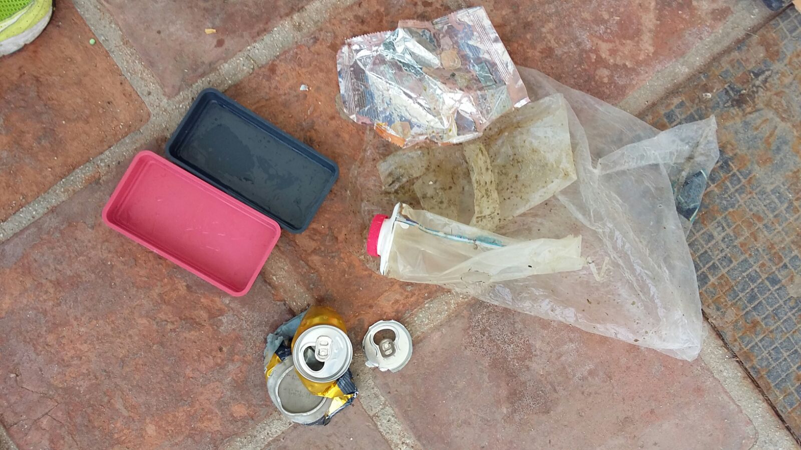
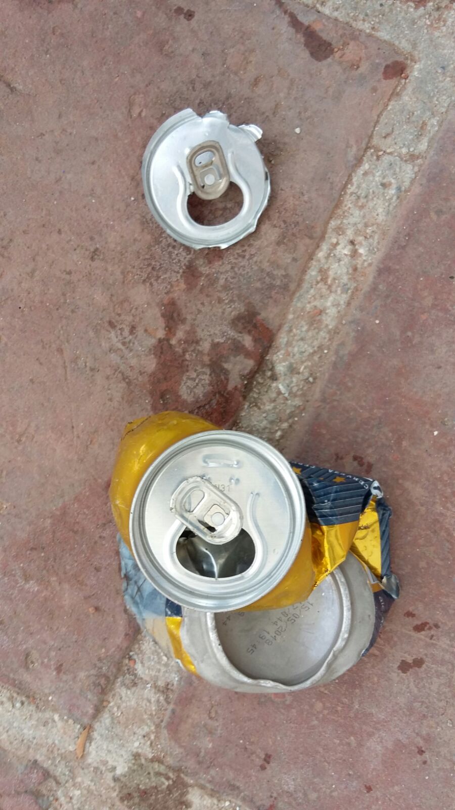
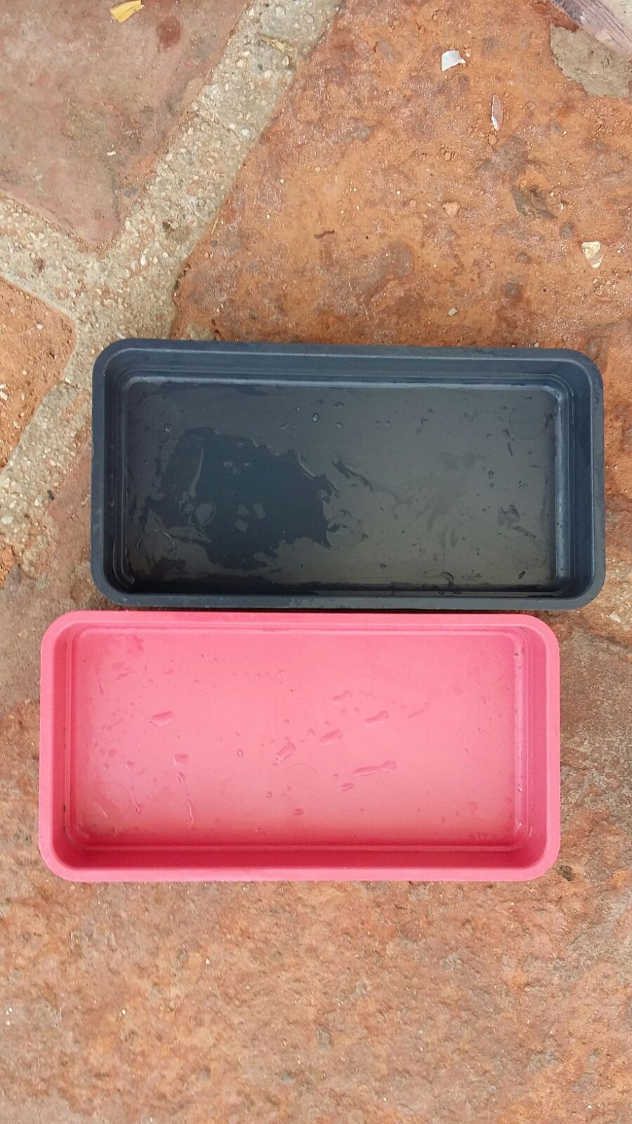
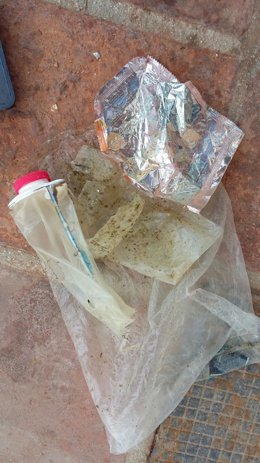
We have not underwater camera so we took these pictures of the marine debris out of the water, once in the Dive Center...
East Wind
Waves between 1 and 2 meters of height
Nerja Dive Resort S.L.
Erika González Sánchez
1
3
2
2
1.00
40
12.00
2.00
estimated
2500.00
Plastic: there is a lot of them, on the surface and underwater, everywhere, specially in summer because we receive a lot of tourists...
Beverage cans: people from the boats throw the beverage cans into the water and it is easy to find them at the bottom...
Fishing weights and lines
On
kilograms
I have debris data to report
Moderate to rough for waves greater than 1.25 meters
m2
meters
rocky reef
2
Spain
State\Province
Granada
City
Almuñécar
Map Help
Dive Location
If you know your survey site coordinates, enter them manually in decimal degrees using WGS84 Map Datum. Use the minus sign for latitudes south of the equator and longitudes west of the Prime Meridian to 180 degrees.
If you do not know your survey site coordinates, click the “Map Location” tab to use the map to zoom into your survey site and drop the pin on the map to fall within your survey dive site in the water (not on land or the beach). Ensure you zoom in as much as possible to ensure data accuracy.
Entangled Help
Use the vertical tabs below to record any entangled animals you found of each type.
Smooth (wavelets) for waves 0.1 - 0.5 meter high
m2
meters
rocky reef
Brazil
Map Help
Dive Location
If you know your survey site coordinates, enter them manually in decimal degrees using WGS84 Map Datum. Use the minus sign for latitudes south of the equator and longitudes west of the Prime Meridian to 180 degrees.
If you do not know your survey site coordinates, click the “Map Location” tab to use the map to zoom into your survey site and drop the pin on the map to fall within your survey dive site in the water (not on land or the beach). Ensure you zoom in as much as possible to ensure data accuracy.
Entangled Help
Use the vertical tabs below to record any entangled animals you found of each type.
plastic is the most common debris in this part of the beach, also on the beach close to the dive point.
Good
Michelle Mayumi Tizuka
2
1
0.10
45
2.00
2.00
estimated
40.00
plastic retail
On
kilograms
I have debris data to report
Calm (glassy to rippled) for waves 0 – 0.1 meter high
m2
meters
rocky reef
Brazil
Map Help
Dive Location
If you know your survey site coordinates, enter them manually in decimal degrees using WGS84 Map Datum. Use the minus sign for latitudes south of the equator and longitudes west of the Prime Meridian to 180 degrees.
If you do not know your survey site coordinates, click the “Map Location” tab to use the map to zoom into your survey site and drop the pin on the map to fall within your survey dive site in the water (not on land or the beach). Ensure you zoom in as much as possible to ensure data accuracy.
Entangled Help
Use the vertical tabs below to record any entangled animals you found of each type.
Overcast, bad visibility underwater, medium currents
Best Dives Vittaveli
Emily
4
1
1
3
9
2
5
1
2
8
2
15.00
38
15.00
3.00
estimated
100.00
On
kilograms
I have debris data to report
Slight for waves 0.5 -1.25 meter high
7
1
6
18
m2
11
1
meters
coral reef
1
6
2
1
Maldives
City
Bolifushi
Map Help
Dive Location
If you know your survey site coordinates, enter them manually in decimal degrees using WGS84 Map Datum. Use the minus sign for latitudes south of the equator and longitudes west of the Prime Meridian to 180 degrees.
If you do not know your survey site coordinates, click the “Map Location” tab to use the map to zoom into your survey site and drop the pin on the map to fall within your survey dive site in the water (not on land or the beach). Ensure you zoom in as much as possible to ensure data accuracy.
Entangled Help
Use the vertical tabs below to record any entangled animals you found of each type.