Menu

Saxon Reef, Twin Peaks

0
0
0
0

-16.460596, 145.985048

0
0
0
coral
0
0
0
0
0
no
windy, rainy
Diversden
Lukas Elster
0
0
0
0
0
0
0
0
0
0
0
0
0
0
0
0
0
0
0
4
0
0
0
0
0
0
0
0
0
0
0
0
0
0
0
0
0.00
63
13.60
1.00
0
estimated
0
0
0
0
779.00
0
0
0
0
0
dive equipment
dive boat related
fishing line
0
On
pounds
0
Our Survey Site was free of debris
0
0
0
Moderate to rough for waves greater than 1.25 meters
0
0
0
0
0
0
0
m2
0
0
meters
coral reef
0
0
0
0
0
0
0
0
0
0
0
0
0
0
0
0
0
0
0
0
0
0
0
0
0
0
0
0
0
Australia
State\Province
Queensland
City
Cairns
Map Help


Dive Location

If you know your survey site coordinates, enter them manually in decimal degrees using WGS84 Map Datum. Use the minus sign for latitudes south of the equator and longitudes west of the Prime Meridian to 180 degrees.

If you do not know your survey site coordinates, click the “Map Location” tab to use the map to zoom into your survey site and drop the pin on the map to fall within your survey dive site in the water (not on land or the beach). Ensure you zoom in as much as possible to ensure data accuracy.

Entangled Help


Use the vertical tabs below to record any entangled animals you found of each type.

Saxon Reef, Twin Peaks

0
0
0
0

-16.46053, 145.985371

0
0
0
coral
0
0
0
0
0
No
Nothing
Windy, Choppy, Rainy.
Diversden
Antonella
0
0
0
0
0
0
0
0
0
0
0
0
0
0
0
0
0
0
0
3
0
0
0
0
0
0
0
0
0
0
0
0
0
0
0
0
0.00
63
13.70
3.00
0
estimated
0
0
0
0
16.06
0
0
0
0
0
Dive gear
Towels
Fishing lines
0
On
pounds
0
Our Survey Site was free of debris
0
0
0
Moderate to rough for waves greater than 1.25 meters
0
0
0
0
0
0
0
m2
0
0
meters
coral reef
0
0
0
0
0
0
0
0
0
0
0
0
0
0
0
0
0
0
0
0
0
0
0
0
0
0
0
0
0
Australia
State\Province
Qld
City
Cairns
Map Help


Dive Location

If you know your survey site coordinates, enter them manually in decimal degrees using WGS84 Map Datum. Use the minus sign for latitudes south of the equator and longitudes west of the Prime Meridian to 180 degrees.

If you do not know your survey site coordinates, click the “Map Location” tab to use the map to zoom into your survey site and drop the pin on the map to fall within your survey dive site in the water (not on land or the beach). Ensure you zoom in as much as possible to ensure data accuracy.

Entangled Help


Use the vertical tabs below to record any entangled animals you found of each type.

Ohio River, Pittsburgh Pa USA

0
0
0
0

40.4485437916, -80.023544695565

0
0
0
silt
0
0
0
0
0
No
Only addressed vehicles
Clear
Pittsburgh River Rescue and Splash Water Sports
Eric Capets
0
0
0
0
0
0
0
0
0
0
0
0
0
0
0
0
0
0
0
30
0
0
0
0
0
0
0
0
0
0
0
0
0
0
7
0
30000.00
20
25.00
5.00
0
estimated
0
0
96834.70
0
0
0
0
0
Vehicles
Car Batteries
0
On
pounds
0
I have debris data to report
0
0
0
Calm (glassy to rippled) for waves 0 – 0.1 meter high
0
0
0
0
0
0
0
ft2
0
0
feet
other
0
0
0
0
0
0
20
0
0
0
0
0
0
0
0
0
0
0
0
0
0
0
0
0
0
0
0
0
0
United States
State\Province
Pa
City
Pittsburgh
Map Help


Dive Location

If you know your survey site coordinates, enter them manually in decimal degrees using WGS84 Map Datum. Use the minus sign for latitudes south of the equator and longitudes west of the Prime Meridian to 180 degrees.

If you do not know your survey site coordinates, click the “Map Location” tab to use the map to zoom into your survey site and drop the pin on the map to fall within your survey dive site in the water (not on land or the beach). Ensure you zoom in as much as possible to ensure data accuracy.

Entangled Help


Use the vertical tabs below to record any entangled animals you found of each type.

Ecosystem Other
River

North Beach

0
0
0
2

21.456986155937, -157.74035507375

0
0
0
rock
0
0
0
2
0
No
Dive knife sheaf
Sun
James Delecki
0
0
0
0
0
0
0
0
0
0
0
0
0
0
0
0
0
0
0
1
0
0
0
0
0
0
0
0
0
0
0
0
3
0
0
0
4.00
45
35.00
15.00
0
measured
0
4
9473.77
0
0
0
0
0
Fishing gear
Golf balls
0
On
pounds
0
I have debris data to report
0
0
0
Smooth (wavelets) for waves 0.1 - 0.5 meter high
0
0
0
0
0
1
0
m2
0
0
feet
rocky reef
0
0
0
0
0
0
0
0
0
0
0
0
0
0
0
0
0
1
0
0
0
0
0
0
0
0
0
0
0
United States
State\Province
Hawaii
City
Kailua
Map Help


Dive Location

If you know your survey site coordinates, enter them manually in decimal degrees using WGS84 Map Datum. Use the minus sign for latitudes south of the equator and longitudes west of the Prime Meridian to 180 degrees.

If you do not know your survey site coordinates, click the “Map Location” tab to use the map to zoom into your survey site and drop the pin on the map to fall within your survey dive site in the water (not on land or the beach). Ensure you zoom in as much as possible to ensure data accuracy.

Entangled Help


Use the vertical tabs below to record any entangled animals you found of each type.

North Beach

0
0
0
0

21.456986155937, -157.74035507375

0
0
0
rock
0
0
0
5
0
No
Tire
Sun
James Delecki
0
0
0
0
0
0
0
0
2
0
0
0
0
0
0
0
0
0
0
2
0
0
0
0
0
0
0
0
0
0
0
0
6
0
0
0
66.00
90
35.00
15.00
2
measured
0
12
9473.77
0
1
0
0
0
Fishing gear
Golf balls
Surf gear
0
On
pounds
0
I have debris data to report
0
0
0
Smooth (wavelets) for waves 0.1 - 0.5 meter high
0
0
0
0
0
0
0
m2
0
1
feet
rocky reef
0
0
0
0
0
0
0
0
0
0
0
0
0
0
0
0
0
2
0
0
0
0
0
0
0
0
0
0
0
United States
State\Province
Hawaii
City
Kailua
Map Help


Dive Location

If you know your survey site coordinates, enter them manually in decimal degrees using WGS84 Map Datum. Use the minus sign for latitudes south of the equator and longitudes west of the Prime Meridian to 180 degrees.

If you do not know your survey site coordinates, click the “Map Location” tab to use the map to zoom into your survey site and drop the pin on the map to fall within your survey dive site in the water (not on land or the beach). Ensure you zoom in as much as possible to ensure data accuracy.

Entangled Help


Use the vertical tabs below to record any entangled animals you found of each type.

Karacaoren Bay

0
1
0
0

36.543747885304, 29.055632737414

0
0
0
sand
0
0
2
0
0
Lost or dropped from tourist boats
2 Apple watched
Fine
1
2
Bone
Apple Watch
Seahorse dive centre
Adem Türkoğlu
0
0
0
0
0
0
0
0
8
0
0
0
0
0
0
0
0
0
2
2
0
0
0
0
0
0
3
0
0
0
0
0
0
0
0
0
8.70
47
23.00
8.00
0
measured
0
0
2753.83
0
0
0
0
0
Glass
1
On
kilograms
0
I have debris data to report
6
0
0
Calm (glassy to rippled) for waves 0 – 0.1 meter high
0
0
1
Clothing
Crab
Released Unharmed
1
0
0
0
0
m2
0
2
meters
rocky reef
1
0
0
0
0
0
0
0
0
2
0
0
0
0
0
0
0
0
0
1
9
0
5
0
0
0
0
0
0
Turkey
State\Province
Muğla
City
Ölüdeniz
Map Help


Dive Location

If you know your survey site coordinates, enter them manually in decimal degrees using WGS84 Map Datum. Use the minus sign for latitudes south of the equator and longitudes west of the Prime Meridian to 180 degrees.

If you do not know your survey site coordinates, click the “Map Location” tab to use the map to zoom into your survey site and drop the pin on the map to fall within your survey dive site in the water (not on land or the beach). Ensure you zoom in as much as possible to ensure data accuracy.

Entangled Help


Use the vertical tabs below to record any entangled animals you found of each type.

Aziz Ağa

0
0
0
1

36.599078420589, 29.02941991821

0
0
0
rock
0
0
0
0
0
Lost by fishermen
Fine
Seahorse dive centre
Mark Taylor
0
0
0
0
0
0
0
0
0
0
0
0
0
0
0
0
0
0
0
6
0
0
0
0
0
0
0
0
0
0
0
0
0
0
0
0
2.20
43
20.00
5.00
0
measured
0
70
4098.83
0
0
0
0
0
0
On
kilograms
0
I have debris data to report
0
0
0
Smooth (wavelets) for waves 0.1 - 0.5 meter high
0
0
0
0
0
0
0
m2
0
0
meters
rocky reef
0
0
0
0
0
0
0
0
0
0
0
0
0
0
0
0
0
0
0
0
0
0
0
0
0
0
0
0
0
Turkey
State\Province
Muğla
City
Fethiye
Map Help


Dive Location

If you know your survey site coordinates, enter them manually in decimal degrees using WGS84 Map Datum. Use the minus sign for latitudes south of the equator and longitudes west of the Prime Meridian to 180 degrees.

If you do not know your survey site coordinates, click the “Map Location” tab to use the map to zoom into your survey site and drop the pin on the map to fall within your survey dive site in the water (not on land or the beach). Ensure you zoom in as much as possible to ensure data accuracy.

Entangled Help


Use the vertical tabs below to record any entangled animals you found of each type.

Shark Bay

3
5
gravel
10
1

-41.30054150432, 174.81720172375

Strong wind blowing directly into the bay the week before could have added to the assembly of rubbish
Speaker
Southerly wind 15-35 knots, torrential rain.
Dive HQ Wellington
Cam Preston
4
1
1
9.00
48
12.60
1.00
estimated
5
31285.00
On
kilograms
I have debris data to report
4
Slight for waves 0.5 -1.25 meter high m2
meters
rocky reef
3
1
2
15
New Zealand
State\Province
Wellington
City
Wellington
Map Help


Dive Location

If you know your survey site coordinates, enter them manually in decimal degrees using WGS84 Map Datum. Use the minus sign for latitudes south of the equator and longitudes west of the Prime Meridian to 180 degrees.

If you do not know your survey site coordinates, click the “Map Location” tab to use the map to zoom into your survey site and drop the pin on the map to fall within your survey dive site in the water (not on land or the beach). Ensure you zoom in as much as possible to ensure data accuracy.

Entangled Help


Use the vertical tabs below to record any entangled animals you found of each type.

Carlisle bay

1
1
0
0

13.085939981297, -59.612015465513

0
0
0
sand
0
1
0
0
0
Most of the glass bottles are very old between the 60s - 17th century
Hurricane Beryl
Sardine can
Mostly calm
West Side Scuba
Thea
0
0
0
2
0
0
0
0
0
0
0
0
2
0
0
0
0
0
0
2
0
0
0
0
0
0
1
0
0
0
0
0
0
0
0
0
5.00
50
52.00
10.00
3
estimated
0
0
4504.75
0
0
0
0
0
Plastic cups
Plastic rope
Plastic packaging
0
On
pounds
0
I have debris data to report
3
0
0
Calm (glassy to rippled) for waves 0 – 0.1 meter high
0
0
0
0
0
0
0
m2
0
0
feet
coral reef
0
0
0
0
0
0
0
0
0
0
0
0
0
0
0
0
1
0
0
0
0
0
0
0
0
0
0
0
0
Barbados
City
Bridgetown
Map Help


Dive Location

If you know your survey site coordinates, enter them manually in decimal degrees using WGS84 Map Datum. Use the minus sign for latitudes south of the equator and longitudes west of the Prime Meridian to 180 degrees.

If you do not know your survey site coordinates, click the “Map Location” tab to use the map to zoom into your survey site and drop the pin on the map to fall within your survey dive site in the water (not on land or the beach). Ensure you zoom in as much as possible to ensure data accuracy.
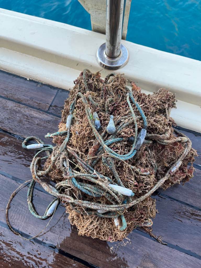
Entangled Help


Use the vertical tabs below to record any entangled animals you found of each type.

Pieces of 8

0
0
0
0

13.072737922573, -59.594186635121

0
0
0
coral
0
0
0
0
0
Mostly calm and sunny
West Side Scuba
Thea
0
0
0
0
0
0
0
0
0
0
0
0
0
0
0
0
0
0
0
2
0
0
0
0
0
0
0
0
0
0
0
0
0
0
0
0
0.00
30
60.00
40.00
0
measured
0
0
1490.40
0
0
0
0
0
0
On
kilograms
0
Our Survey Site was free of debris
0
0
0
Slight for waves 0.5 -1.25 meter high
0
0
0
0
0
0
0
m2
0
0
feet
coral reef
0
0
0
0
0
0
0
0
0
0
0
0
0
0
0
0
0
0
0
0
0
0
0
0
0
0
0
0
0
Barbados
City
Bridgetown
Map Help


Dive Location

If you know your survey site coordinates, enter them manually in decimal degrees using WGS84 Map Datum. Use the minus sign for latitudes south of the equator and longitudes west of the Prime Meridian to 180 degrees.

If you do not know your survey site coordinates, click the “Map Location” tab to use the map to zoom into your survey site and drop the pin on the map to fall within your survey dive site in the water (not on land or the beach). Ensure you zoom in as much as possible to ensure data accuracy.
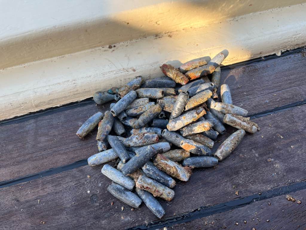
Entangled Help


Use the vertical tabs below to record any entangled animals you found of each type.

Subscribe to