Gasus Soraya
34
1
26.555, 34.03766
27
coral
9
26.555134094132, 34.037661552429
Windy
1
1
2
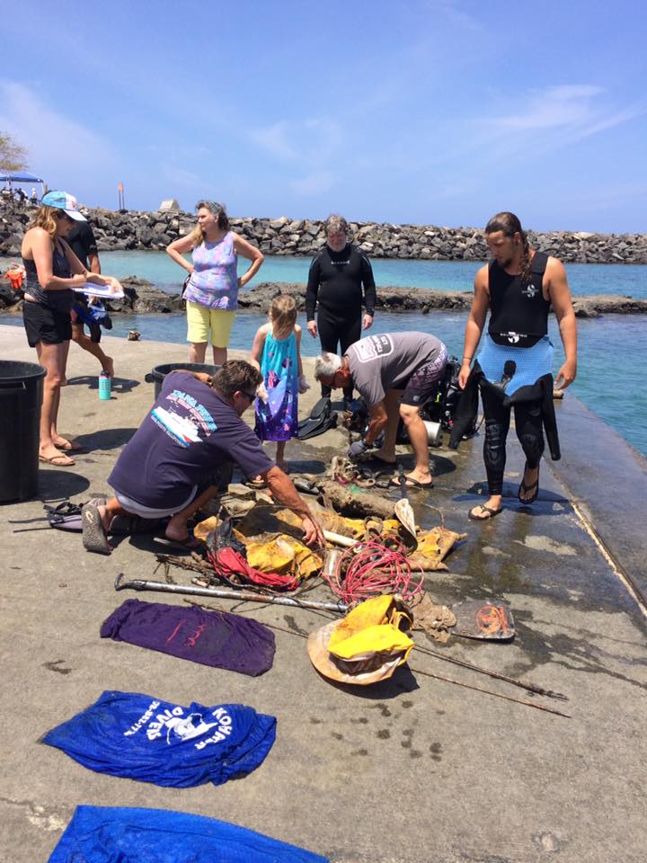
plastic hanger
Plastic childrens spade
Plastic childrens toys
Pharaoh Dive Club
Allan Prommik
11
1
1
17
1
123
7
9
2
1
2
4.67
50
22.00
1.00
2
measured
9400.00
1
fishing line as we have alot of local fisherman using lines to catch reef fish which gets caught in the coral and they cut it free leaving most of it including hooks tangled in the reef
Food wrappers from picnics etc gets blown into the sea and caught in corals etc.
plastic bottles. we have no recycling facilities here so lots of plastic bottles end up getting blown into the sea
On
kilograms
I have debris data to report
Smooth (wavelets) for waves 0.1 - 0.5 meter high
5
m2
meters
coral reef
State\Province
Red Sea
City
el quseir
Map Help
Dive Location
If you know your survey site coordinates, enter them manually in decimal degrees using WGS84 Map Datum. Use the minus sign for latitudes south of the equator and longitudes west of the Prime Meridian to 180 degrees.
If you do not know your survey site coordinates, click the “Map Location” tab to use the map to zoom into your survey site and drop the pin on the map to fall within your survey dive site in the water (not on land or the beach). Ensure you zoom in as much as possible to ensure data accuracy.
Entangled Help