Patrol 31 (P31) boat
2
36.009, 14.3231
no other debris was found during this dive.
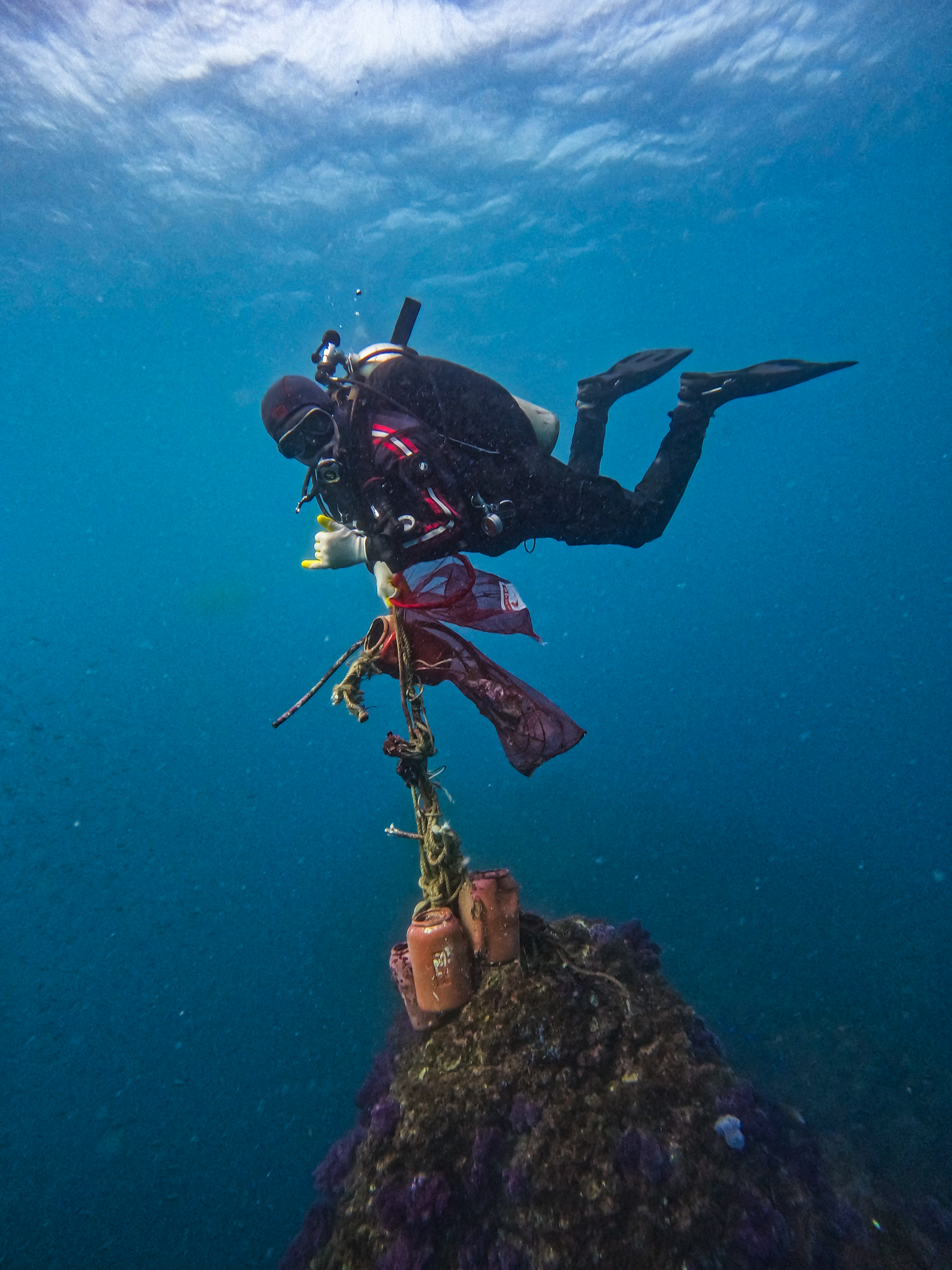
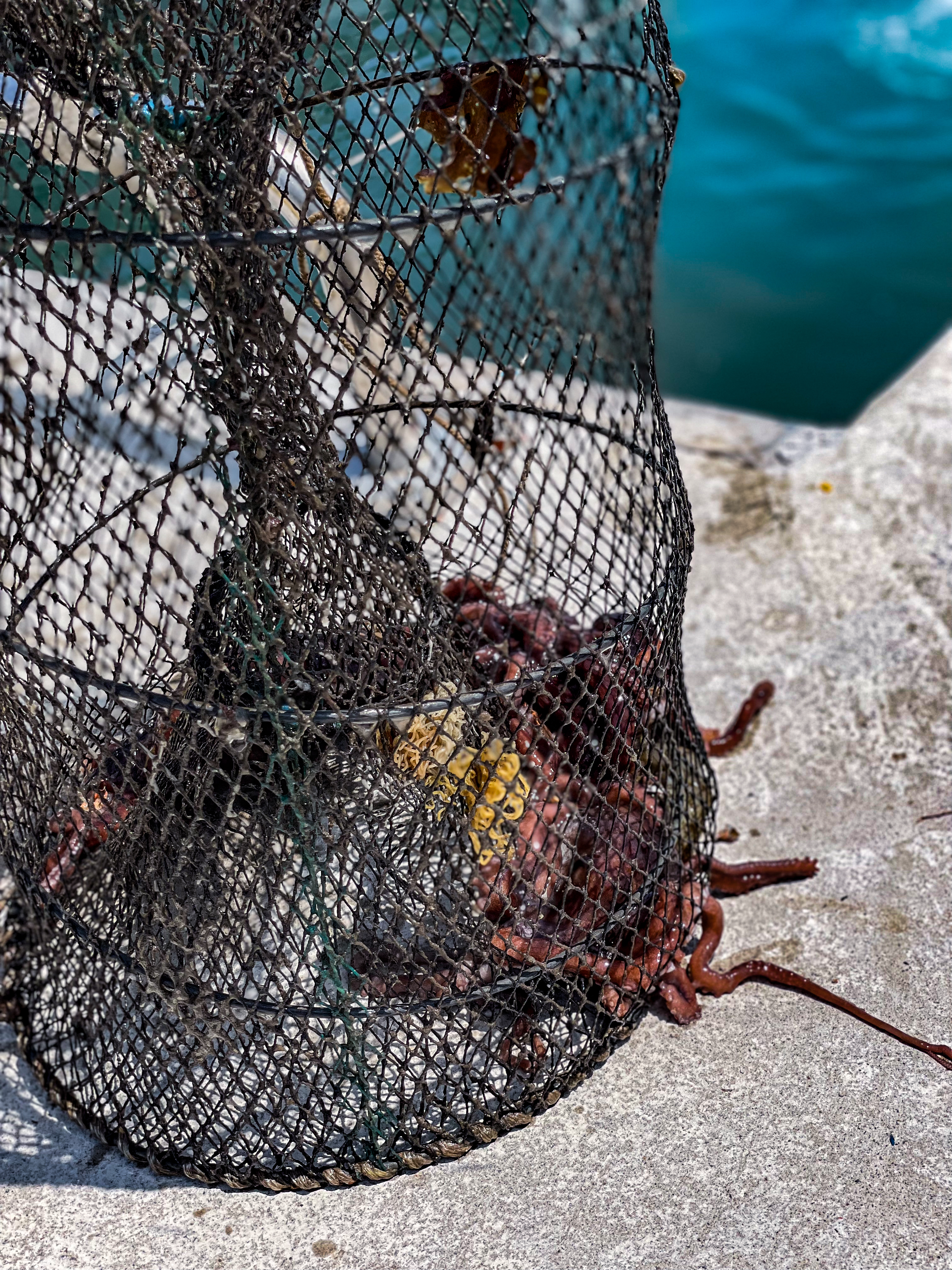
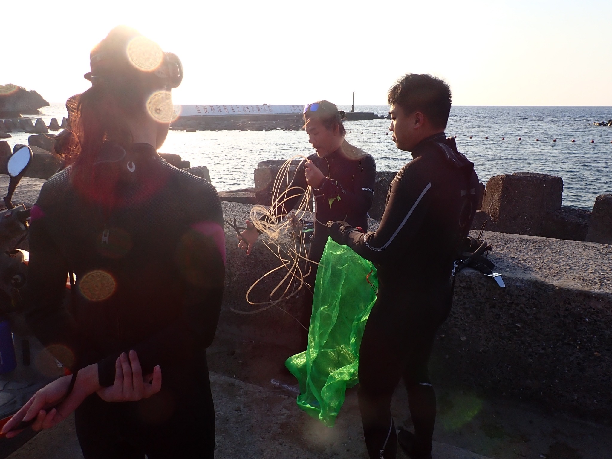
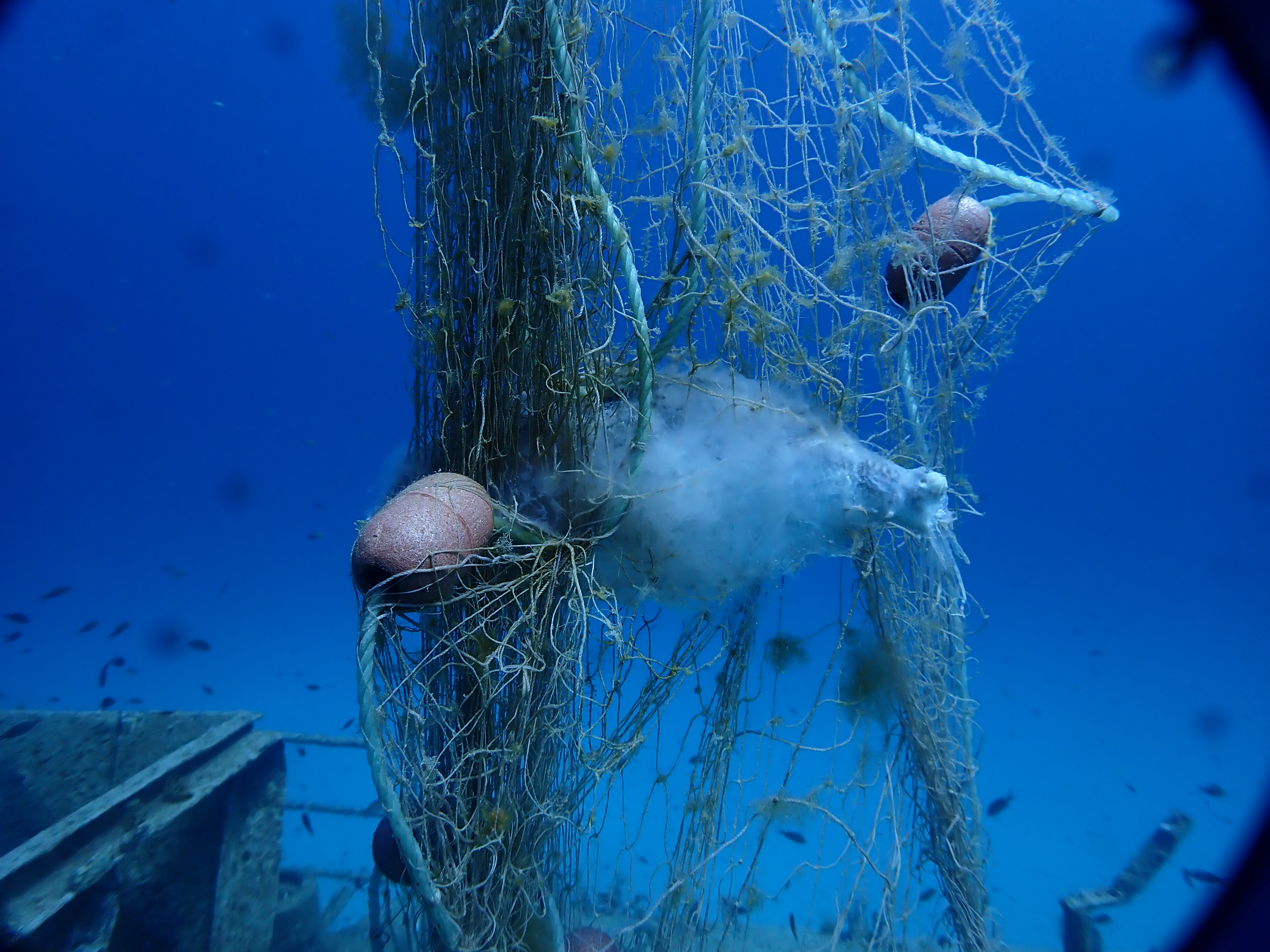
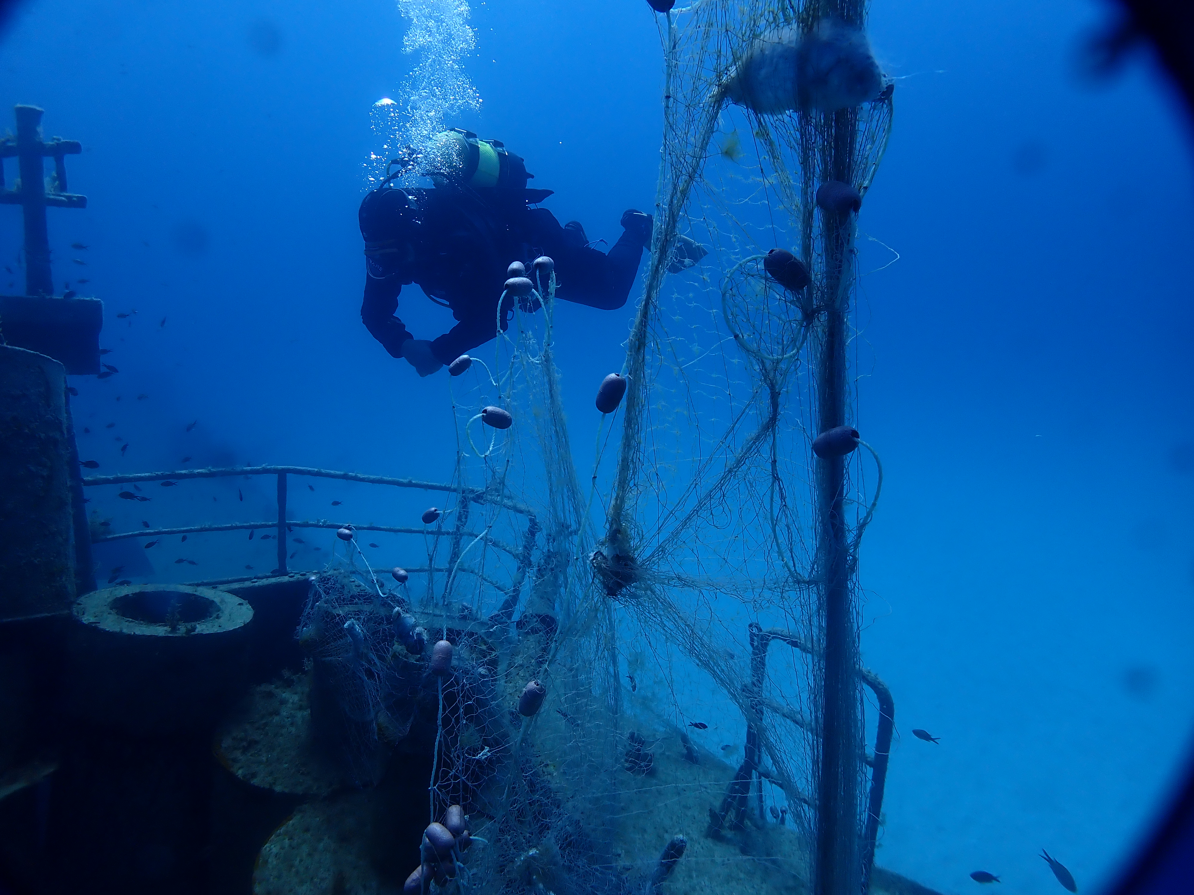
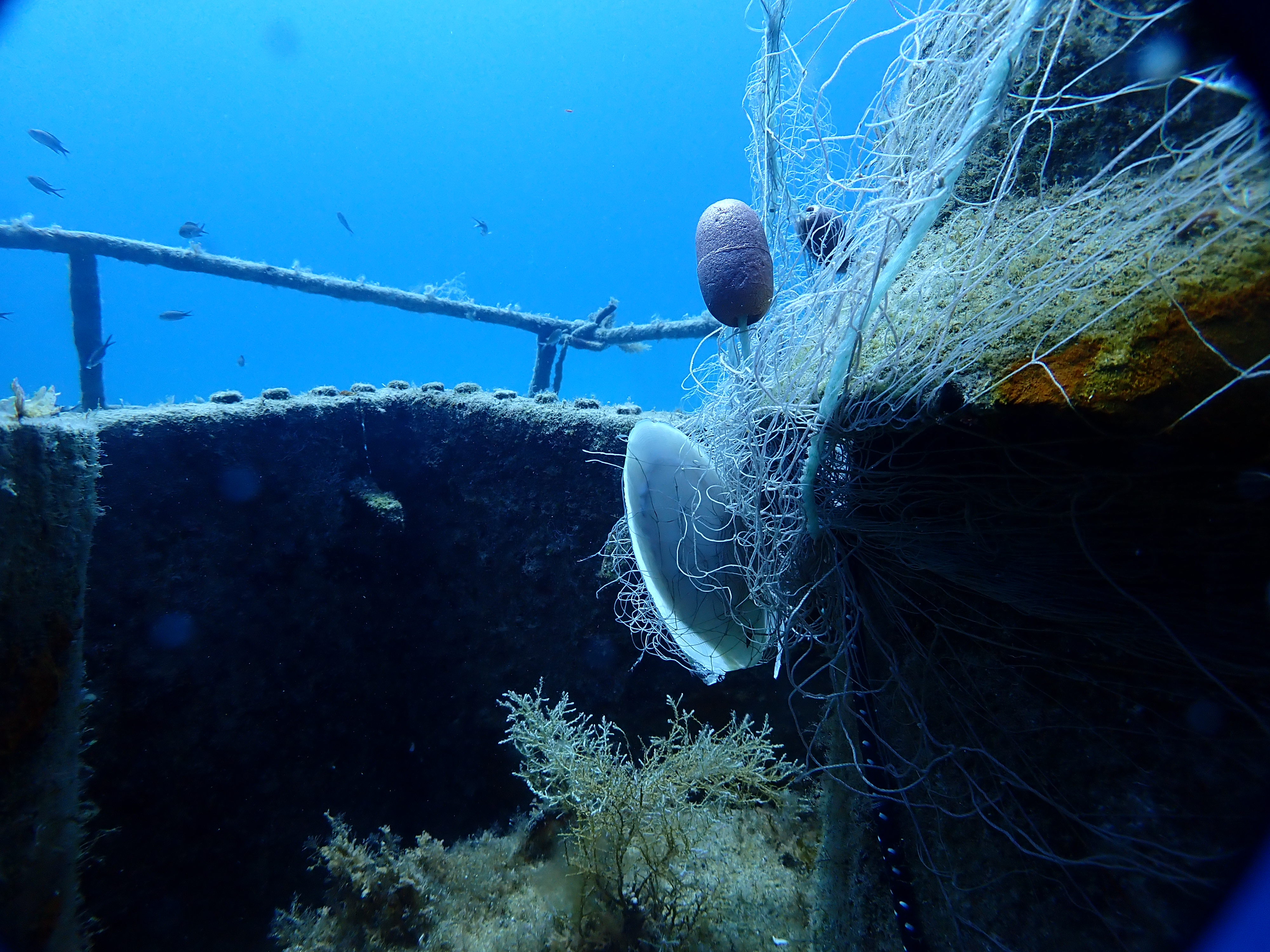
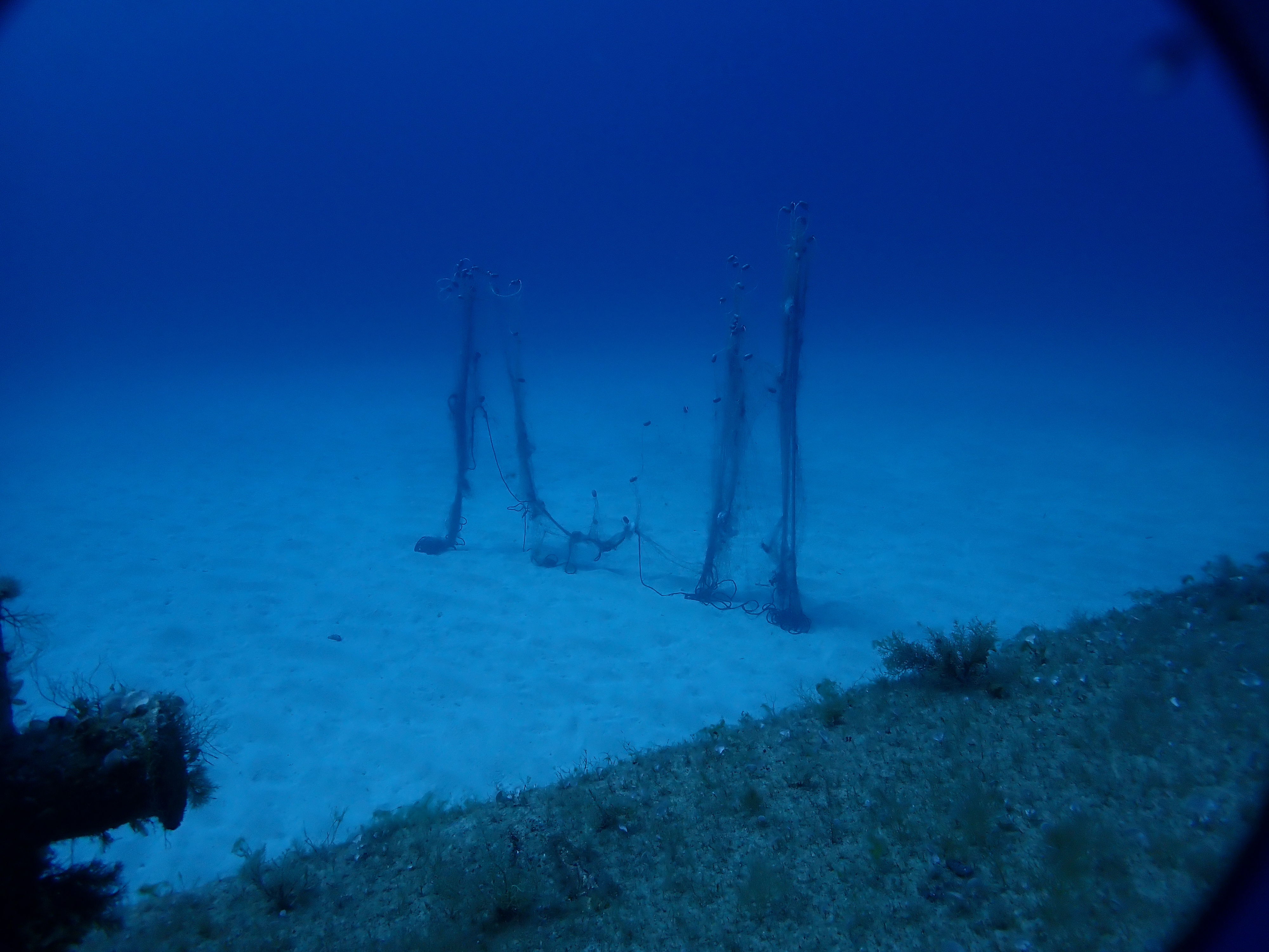
Either illegal fishing or a drifting ghost net. very large fishing net
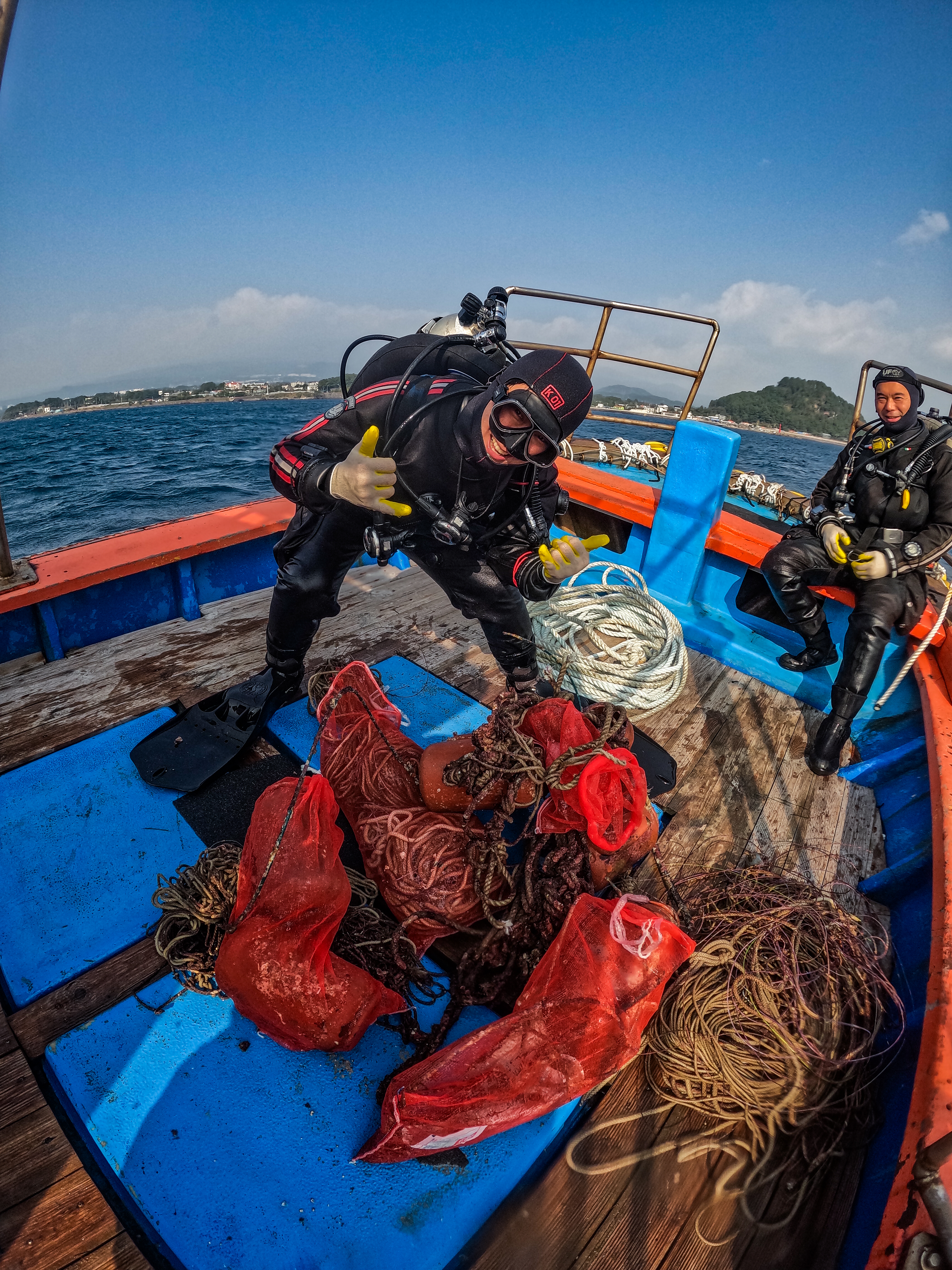
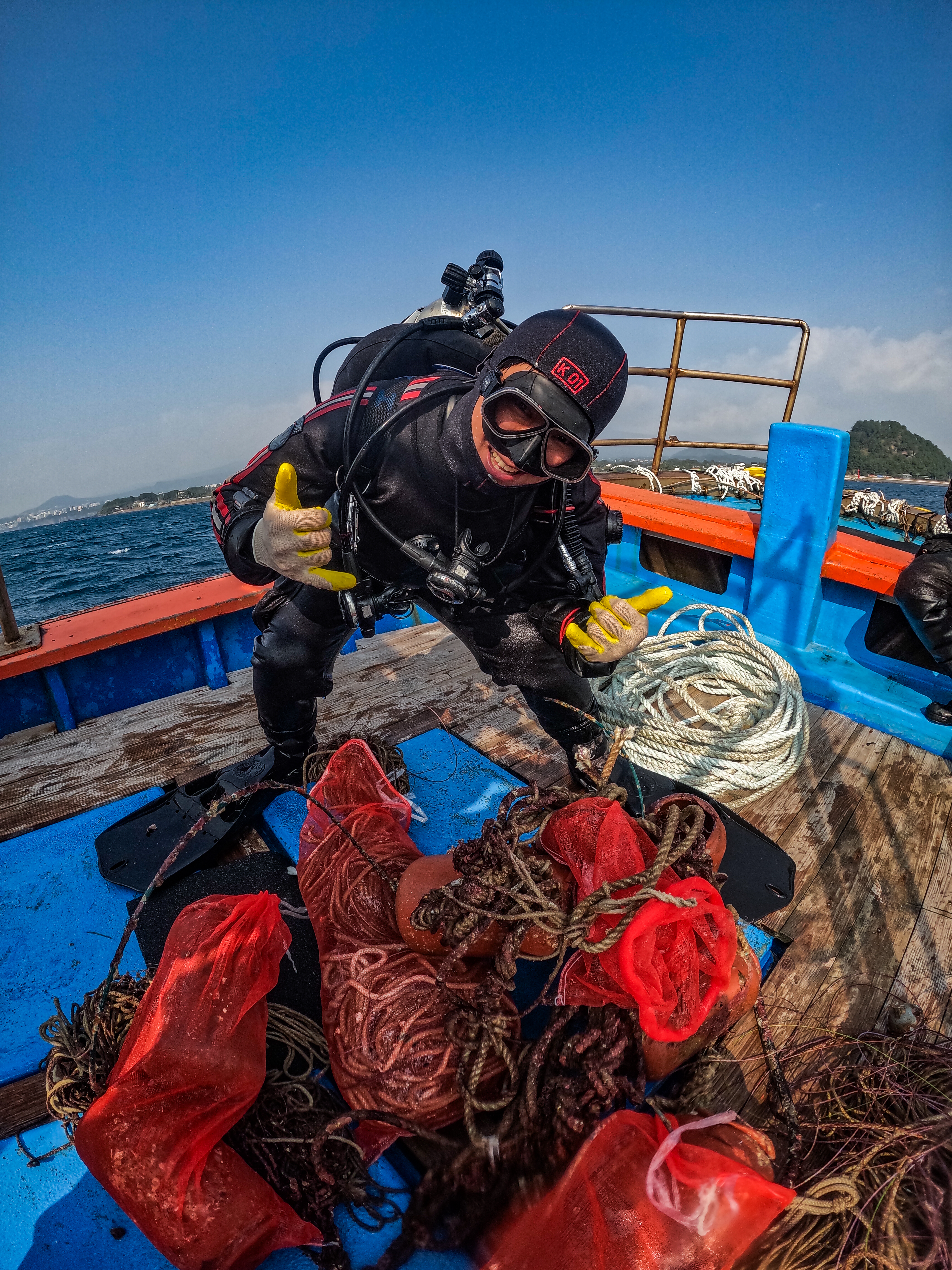
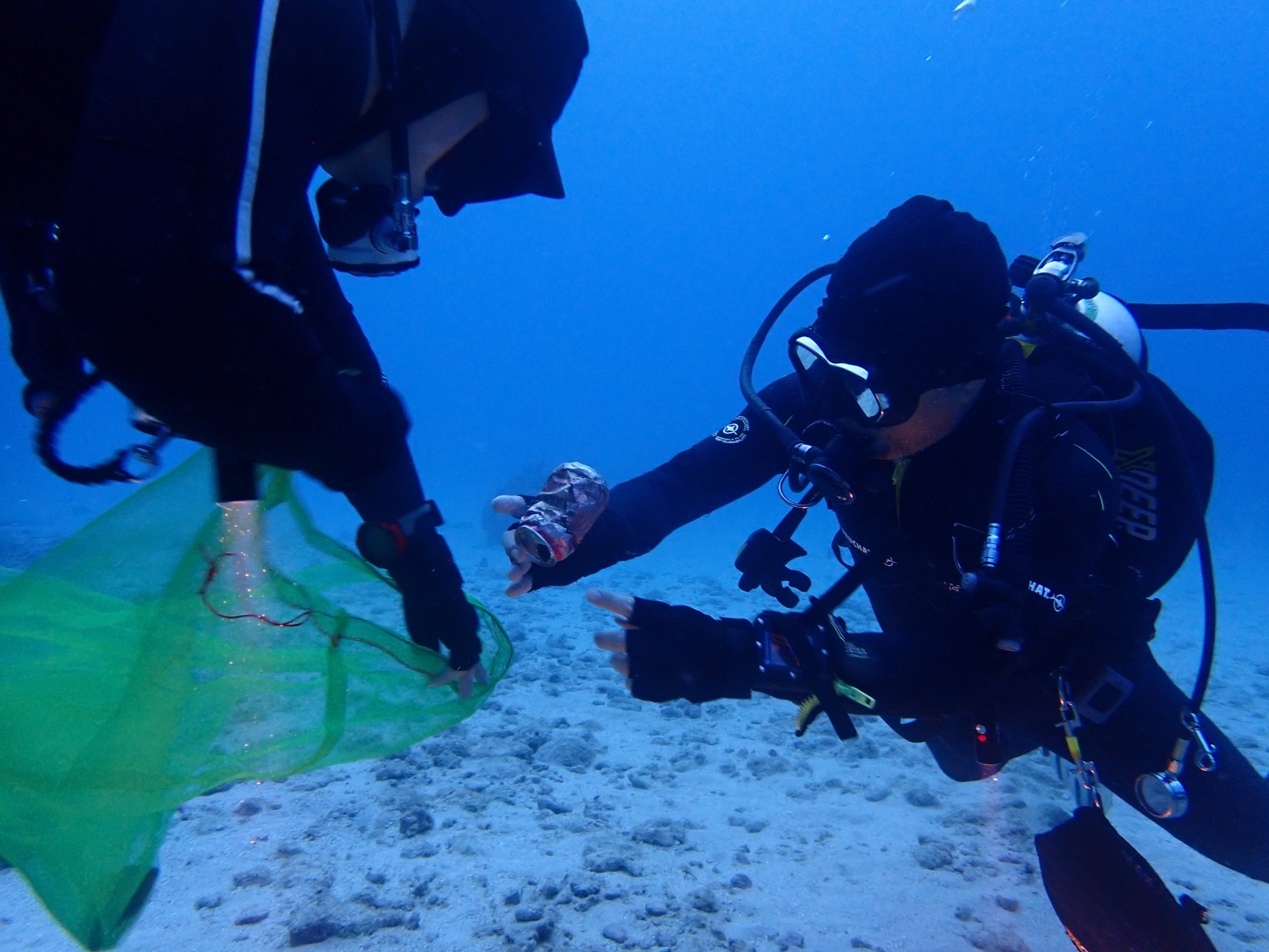
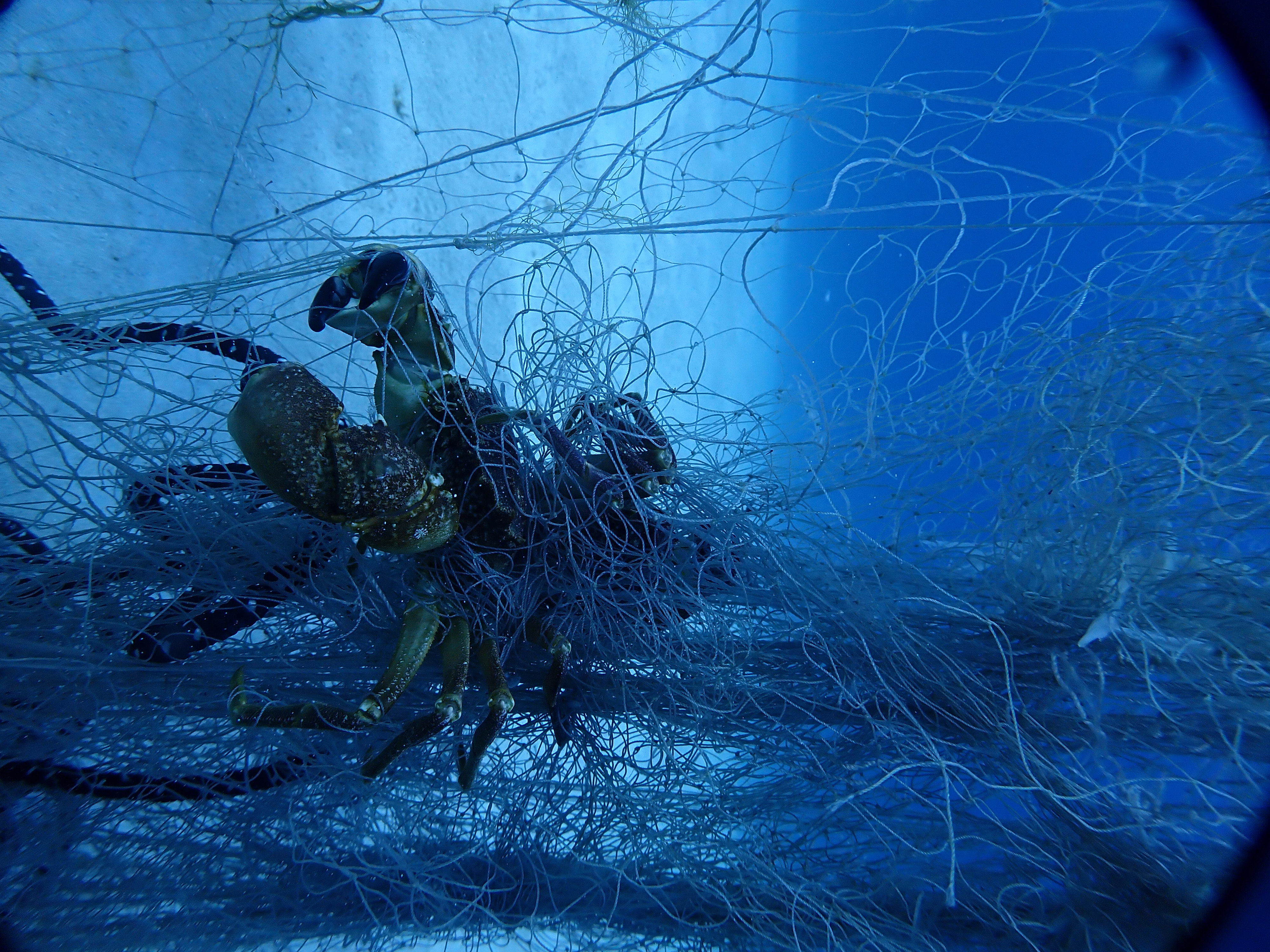
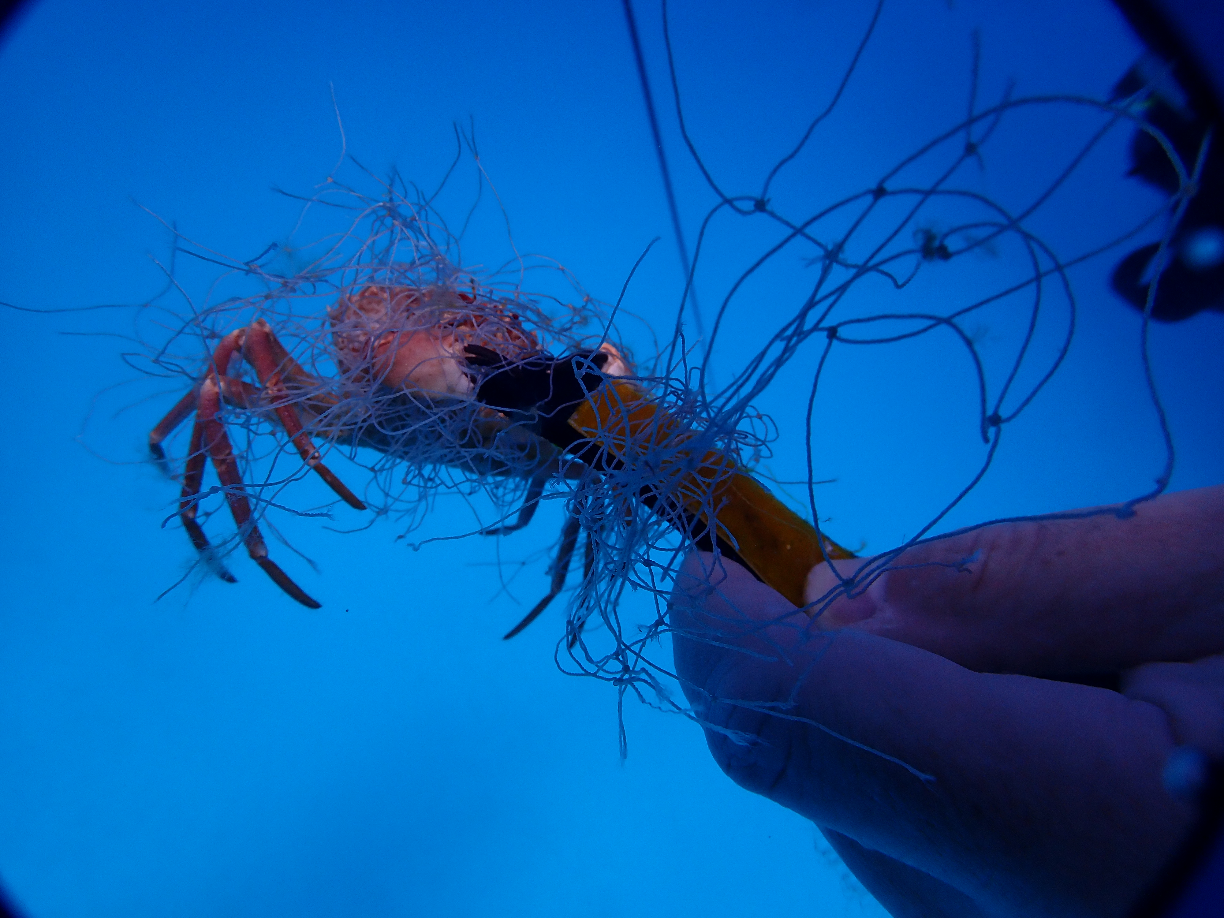
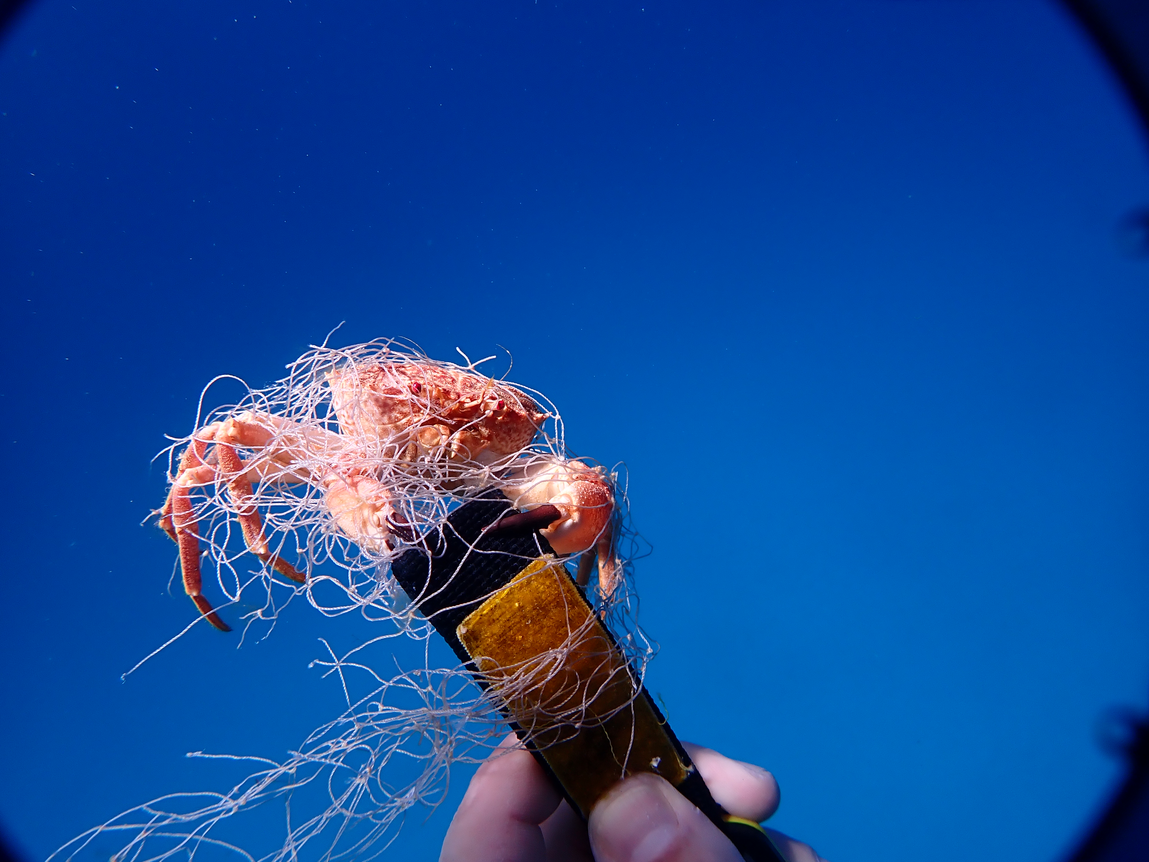
while bring the net to the surface with lift bags we noticed 2 alive crabs. we cut them free and let them go.
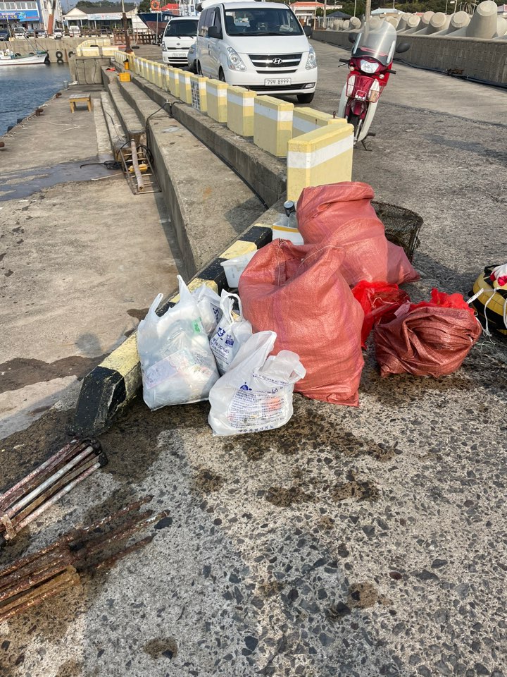
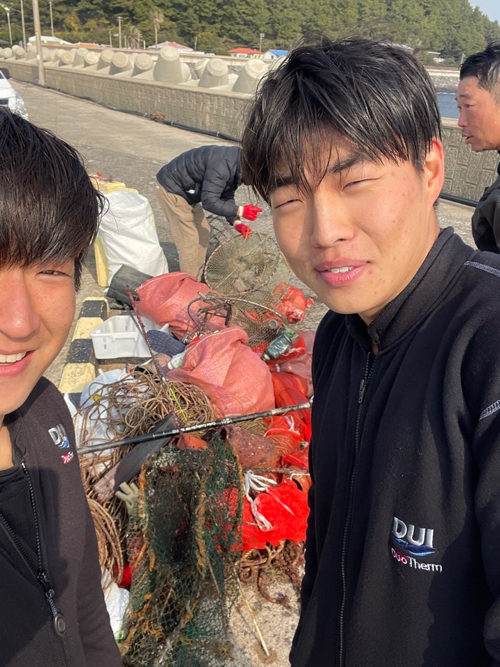
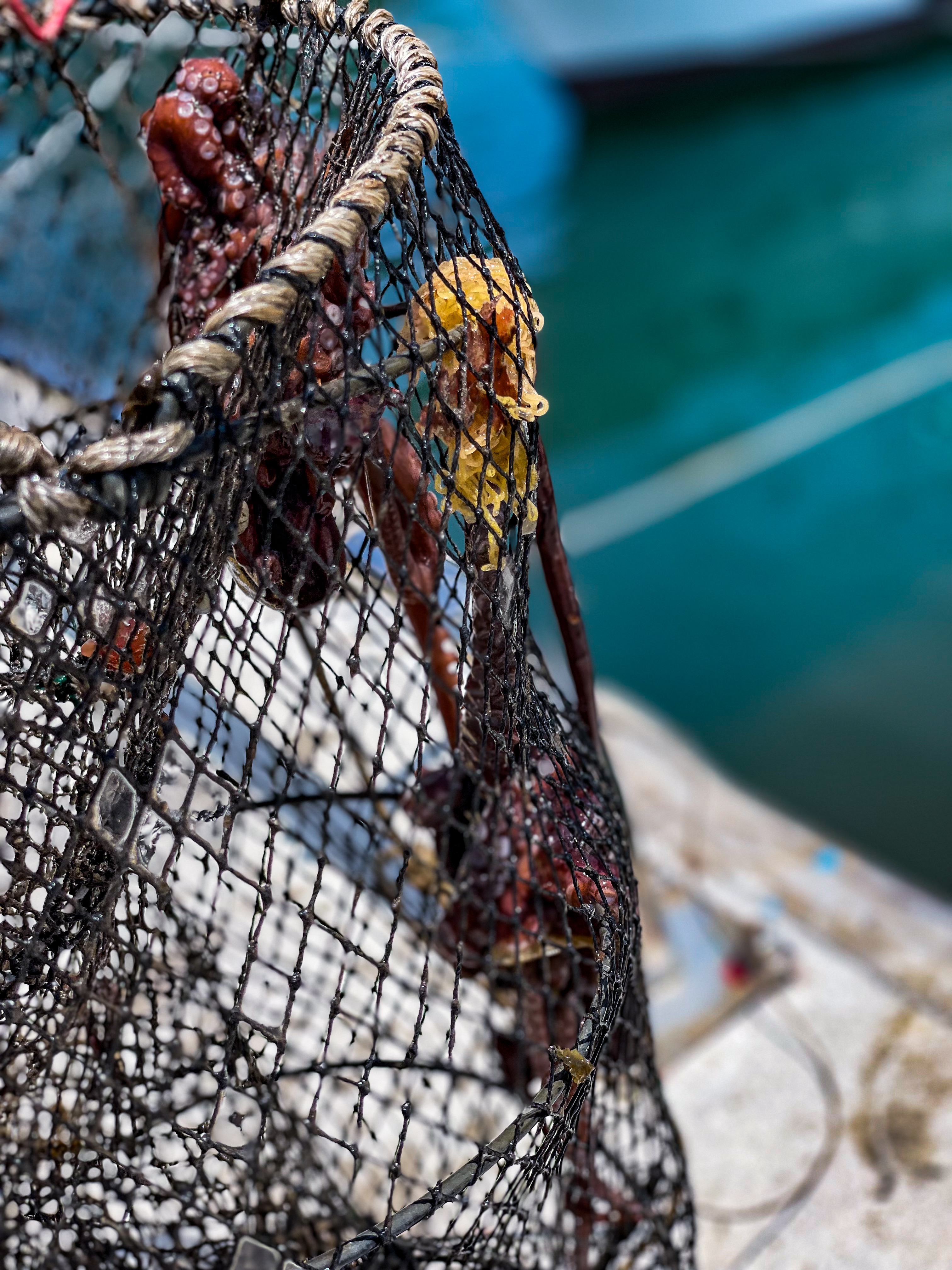
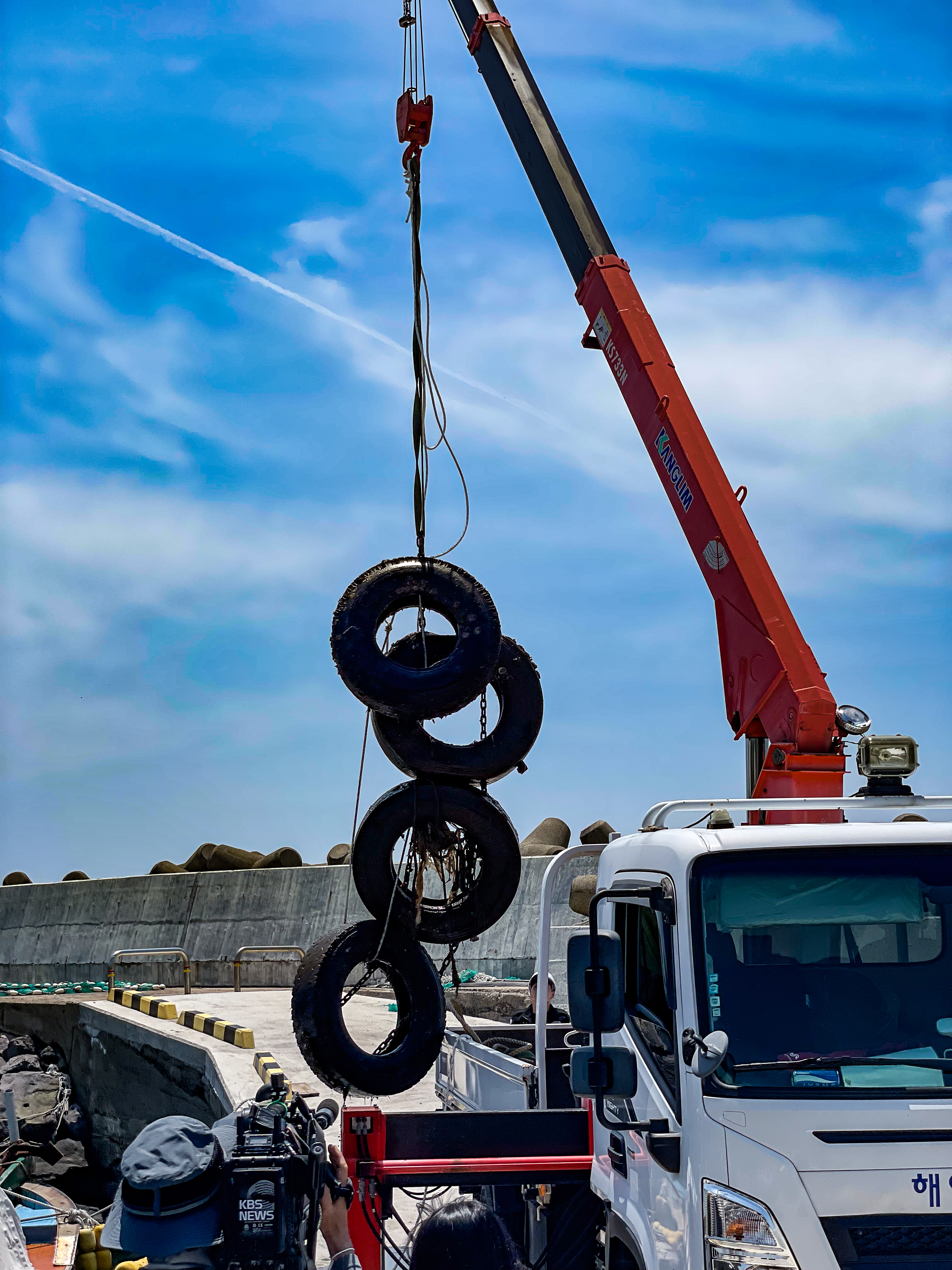
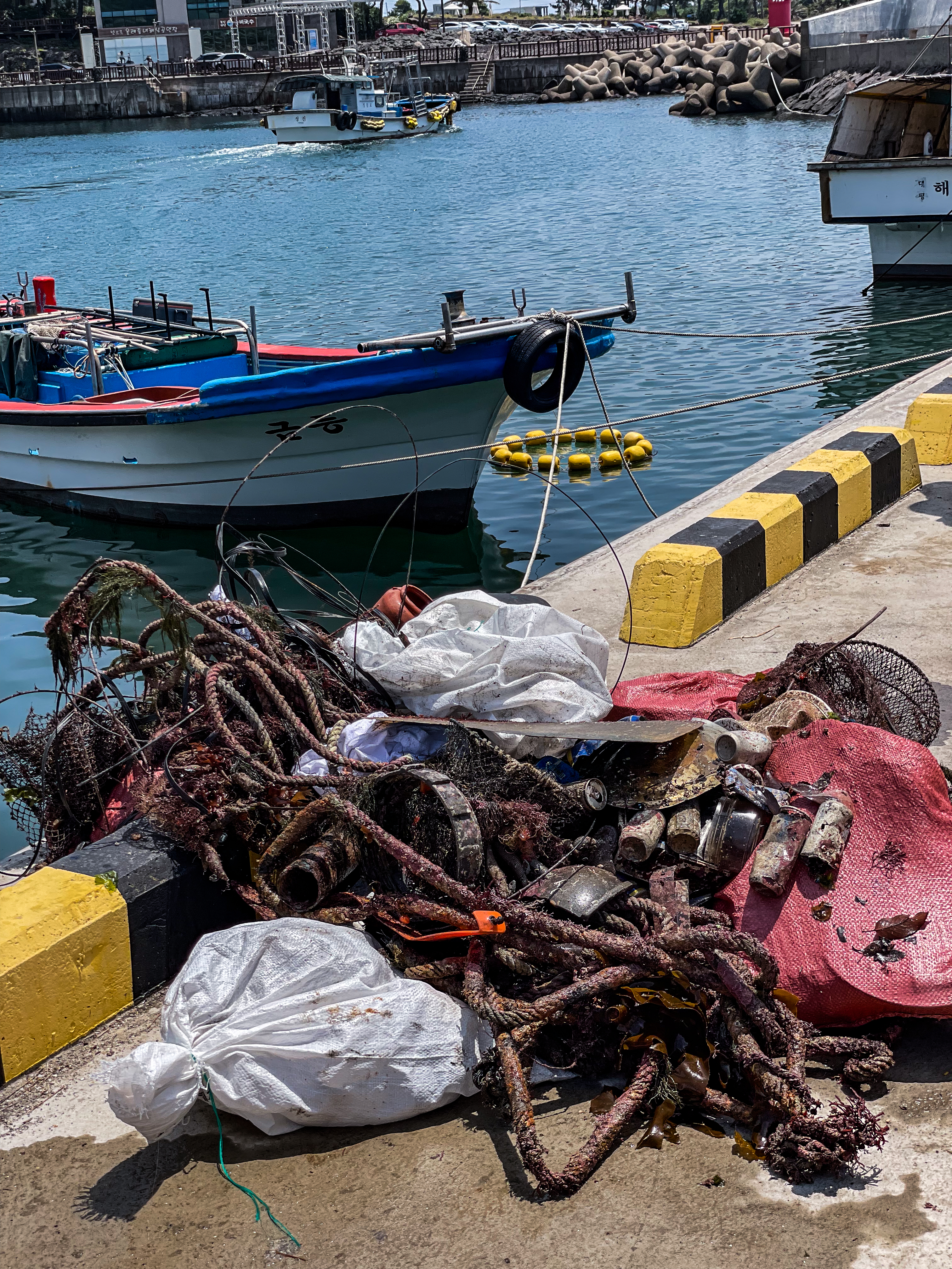
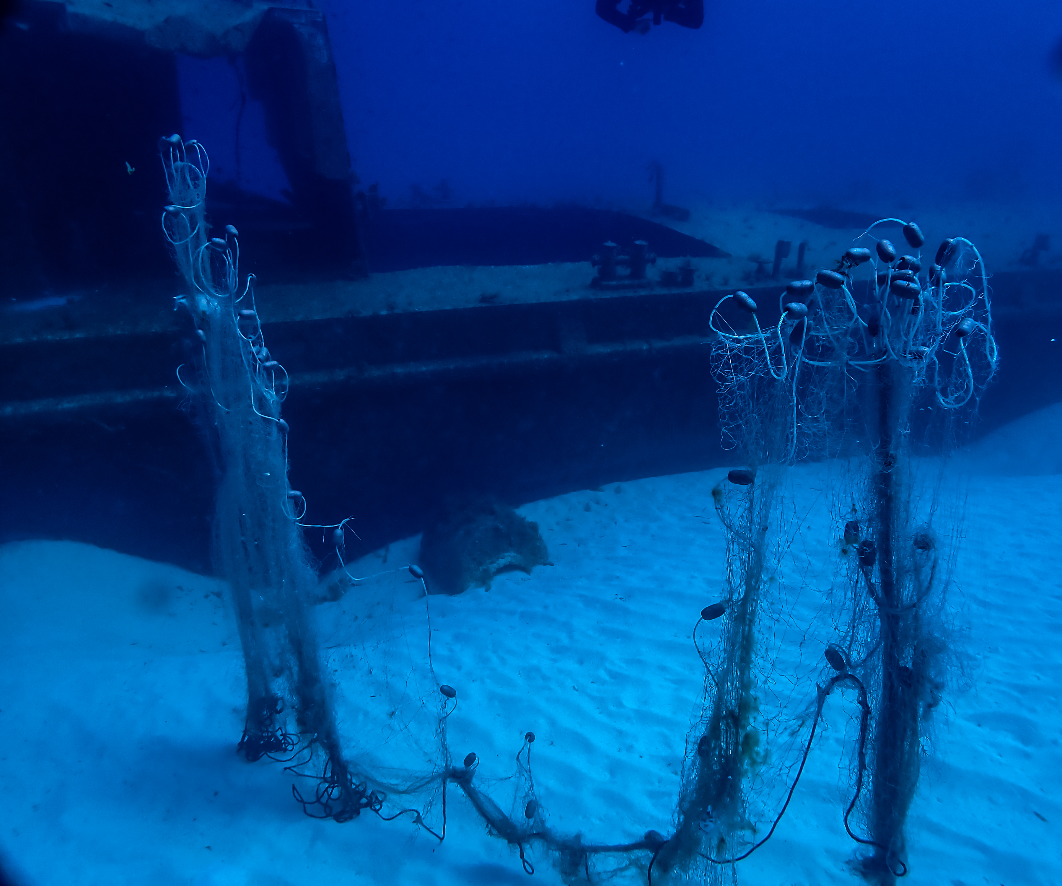
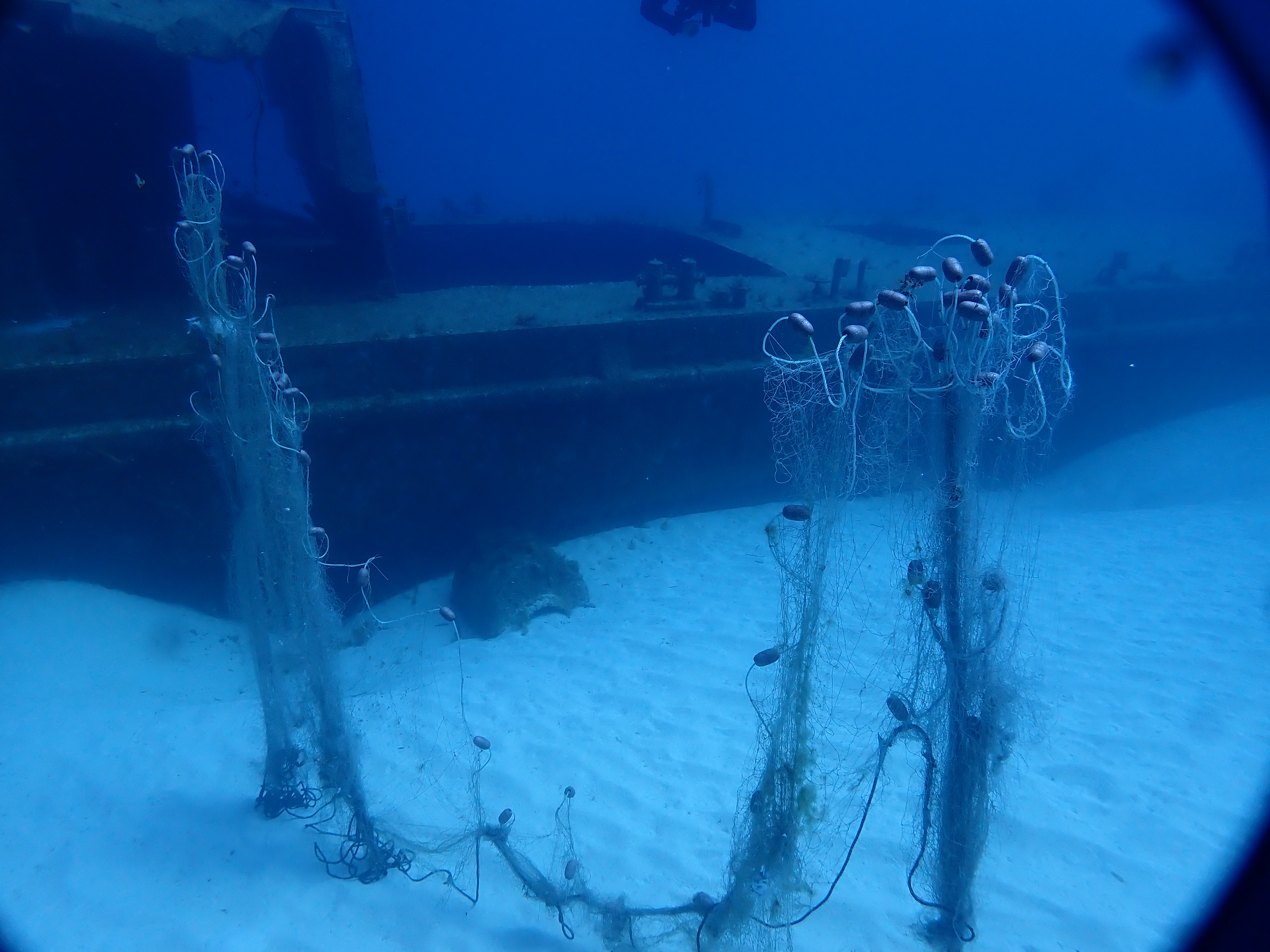
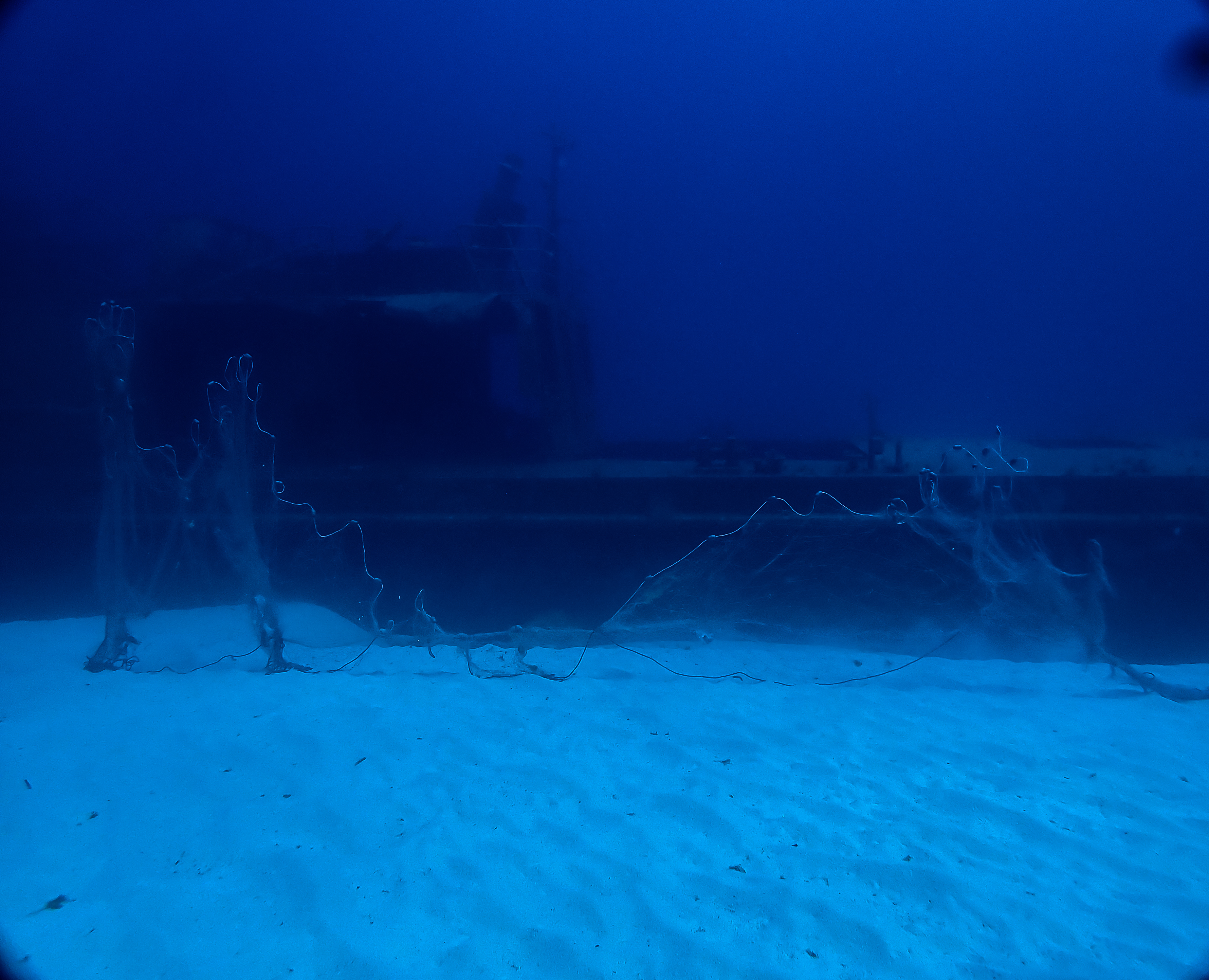
Fishing net
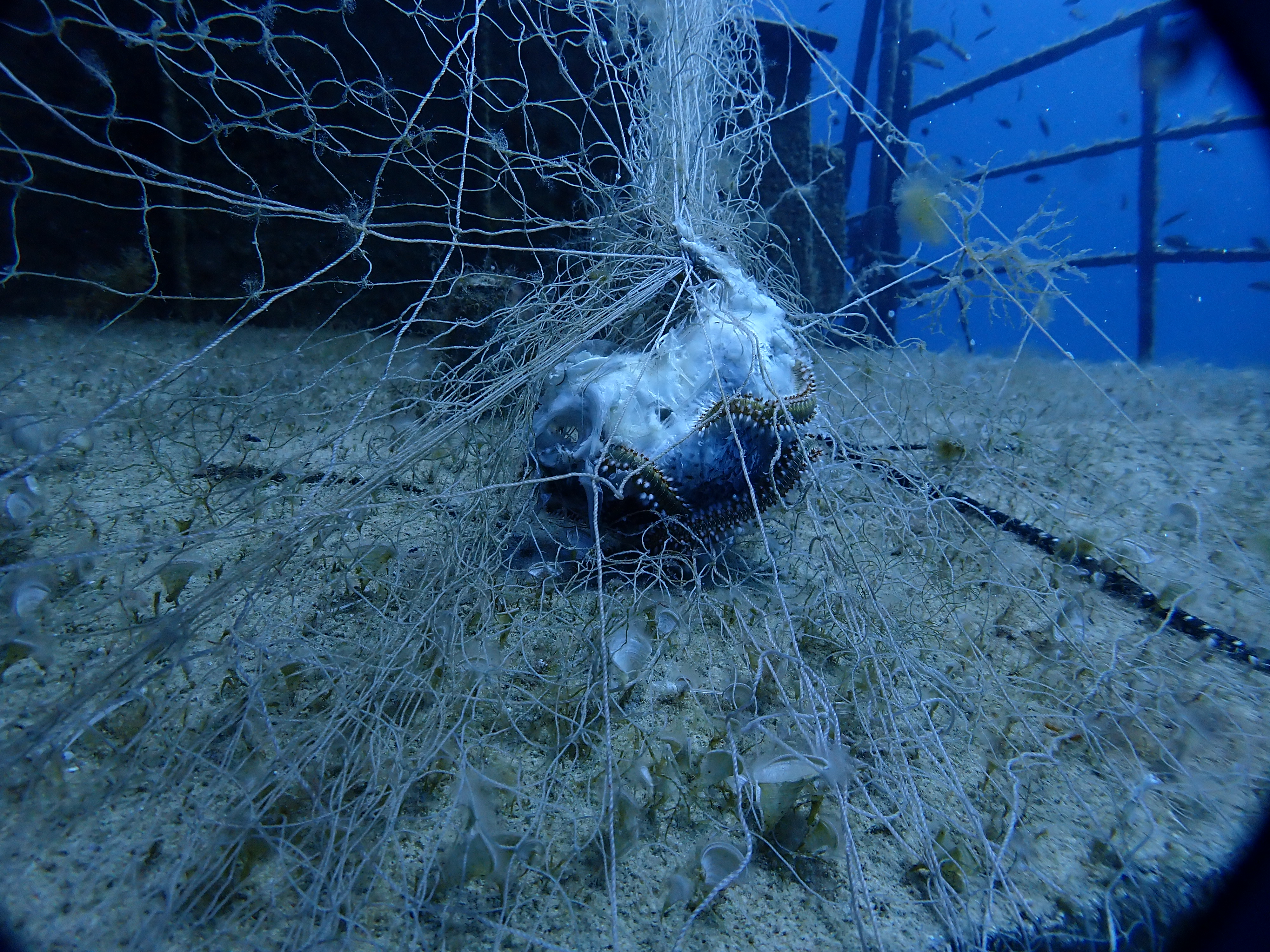
We found many fish entangled and dead within the ghost fishing net.
It was the very beginning of the diving season and I do believe no one would have dived this site for a long time prior due to it only being accessible by boat and the season hadn't really begun yet. it seemed like the net must have drifted through the water and got entangled on the wreck or illegal fishing was taking place on the wreck site in the off season leading it to get entangled and the abandoned.
It was the very beginning of the diving season and I do believe no one would have dived this site for a long time prior due to it only being accessible by boat and the season hadn't really begun yet. it seemed like the net must have drifted through the water and got entangled on the wreck or illegal fishing was taking place on the wreck site in the off season leading it to get entangled and the abandoned.
calm seas
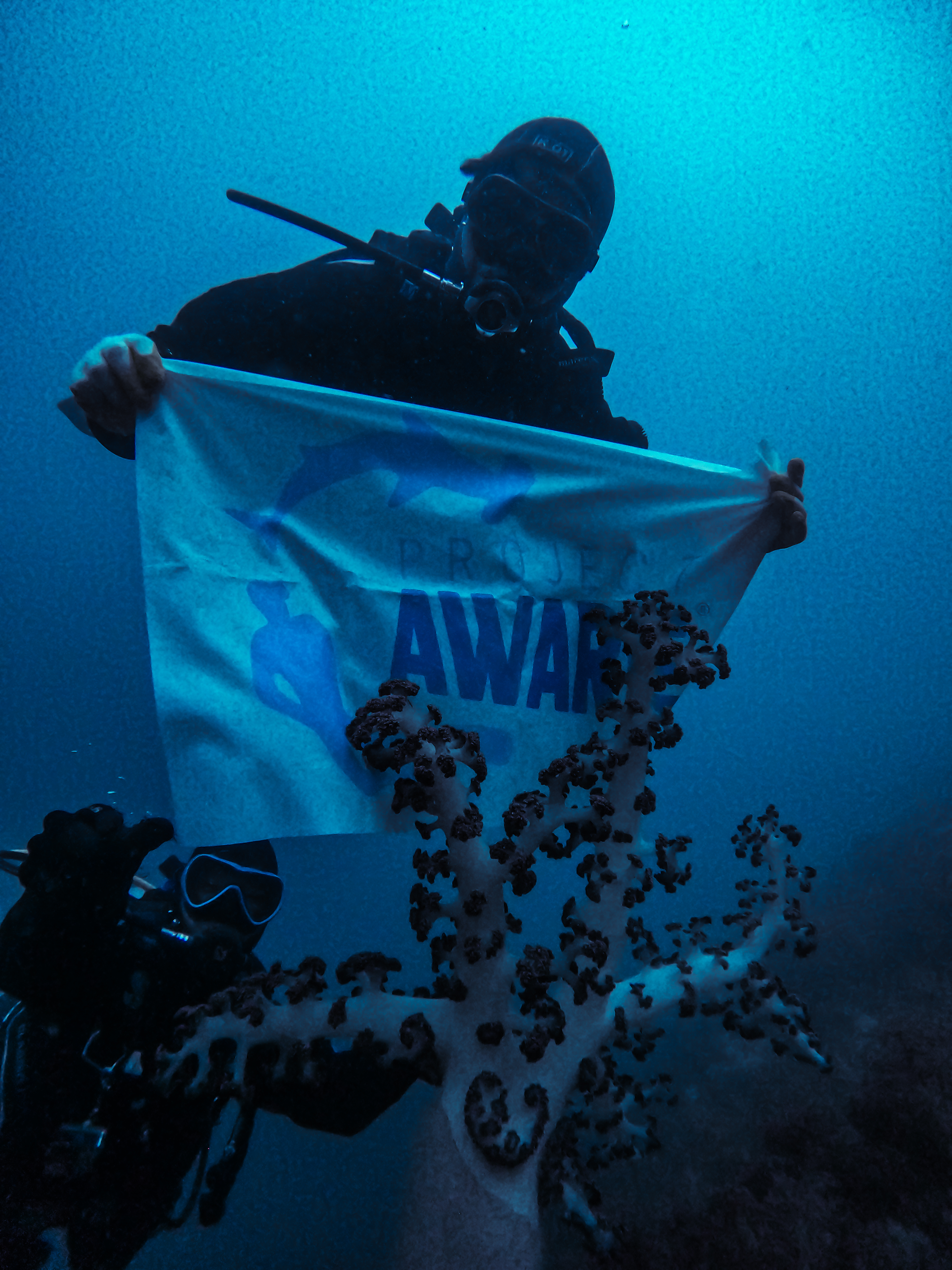
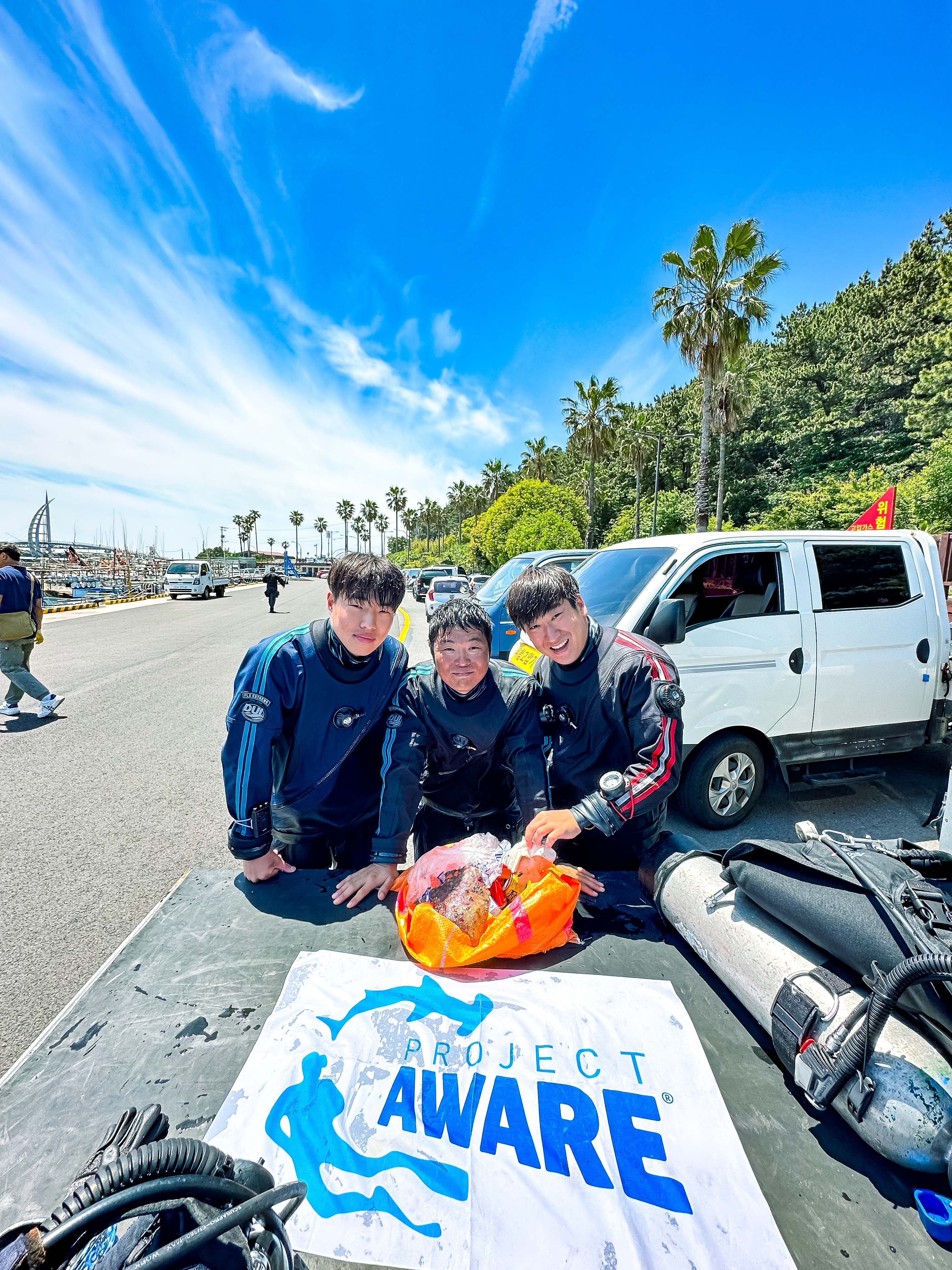
Dive club
Constantinos antoniou
2
1
87.00
60
18.00
12.00
measured
22
600.00
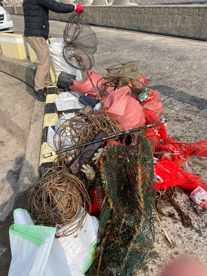
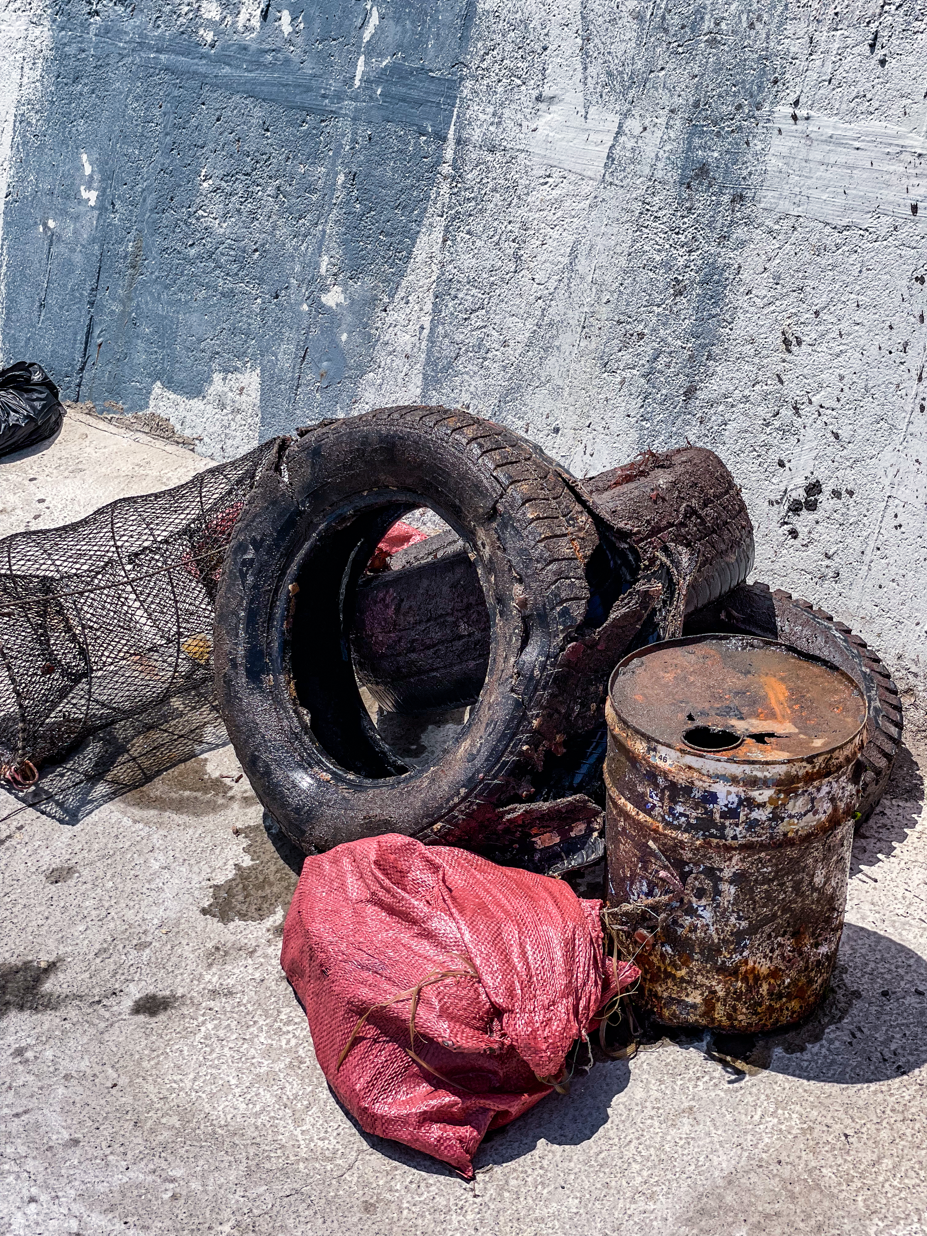
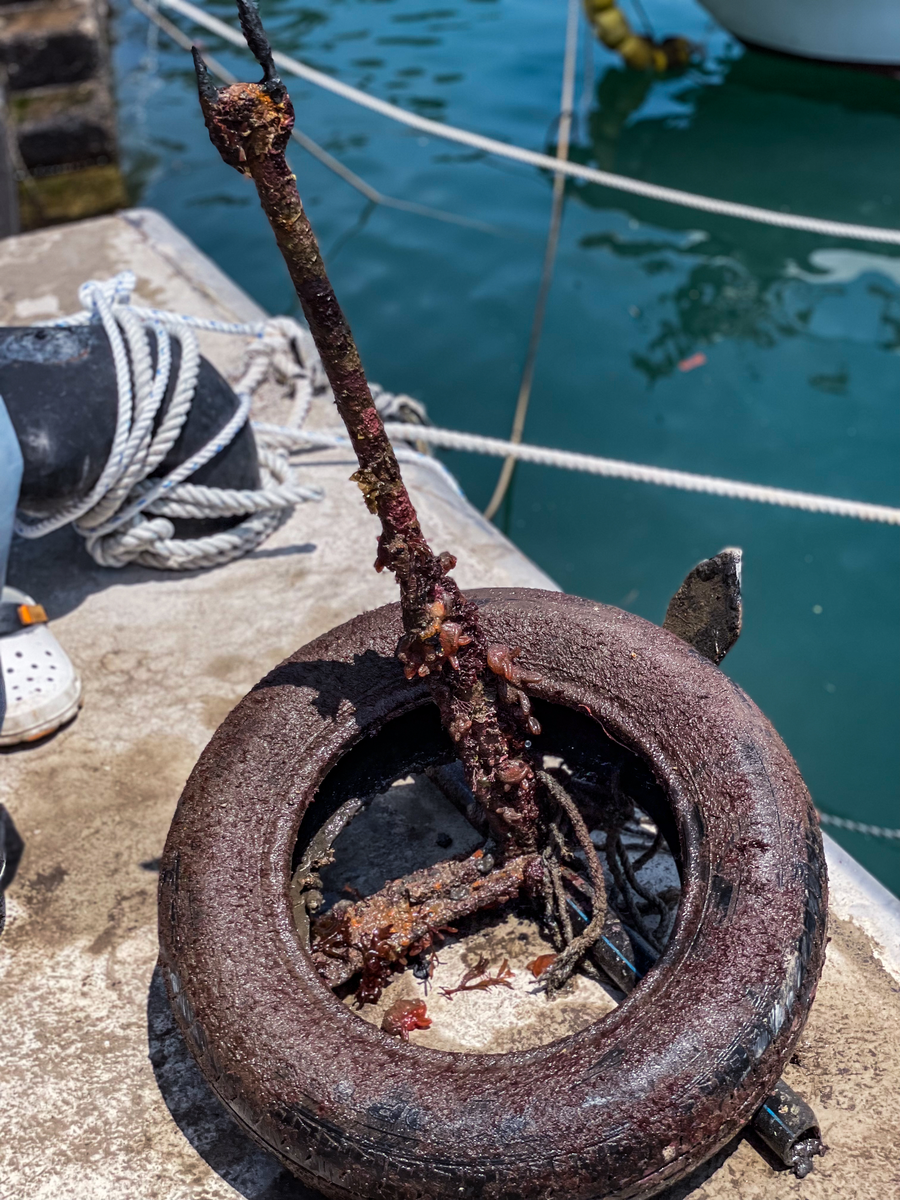
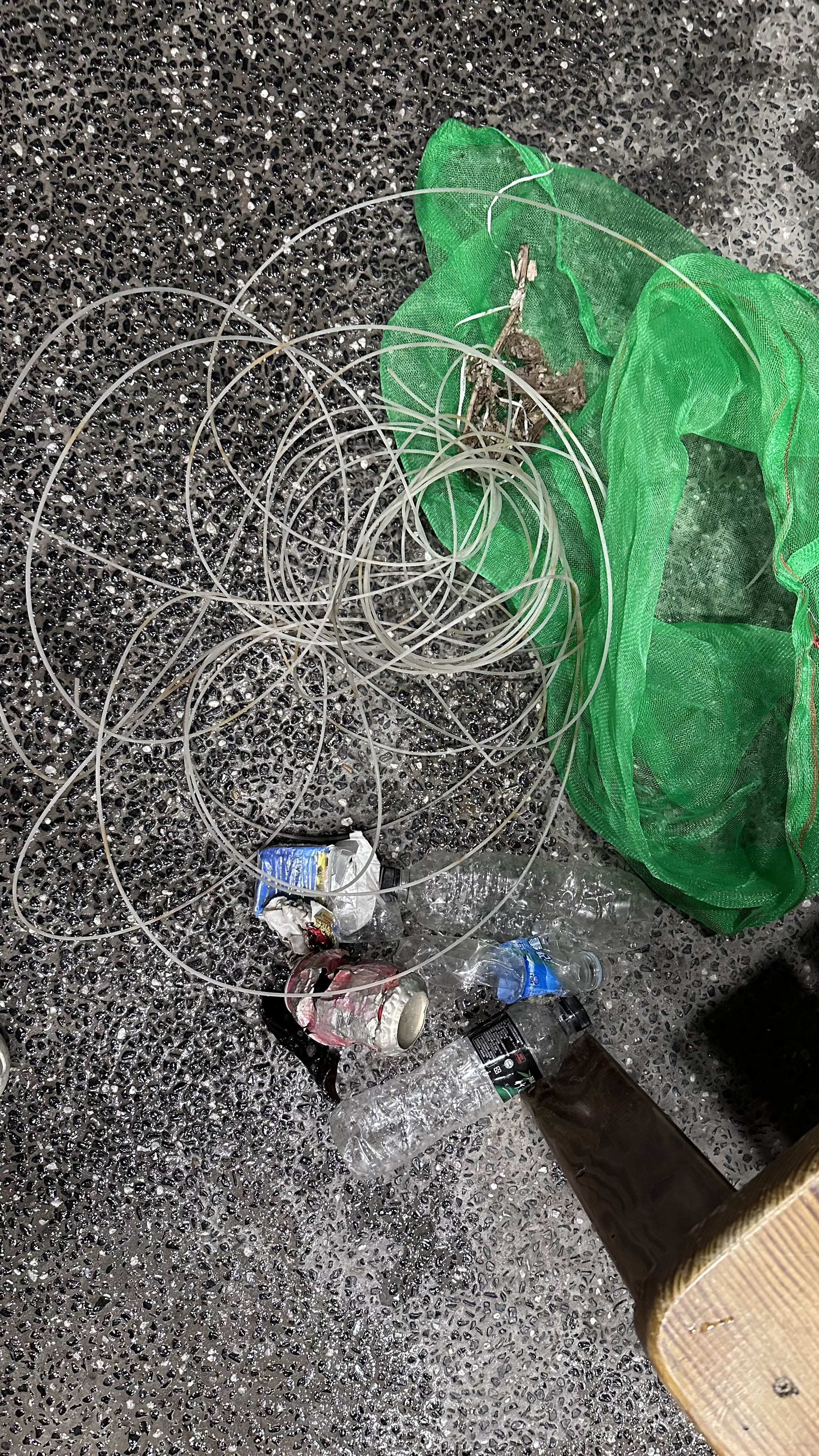
plastic small and large
fishing lines and weights
fishing nets
On
kilograms
I have debris data to report
Smooth (wavelets) for waves 0.1 - 0.5 meter high
fishing net
Dead
cow bream, common bream, parrot fish, jack fish
Crab
Released Unharmed
2
9
fishing net
m2


meters
other
City
comino island
Map Help
Dive Location
If you know your survey site coordinates, enter them manually in decimal degrees using WGS84 Map Datum. Use the minus sign for latitudes south of the equator and longitudes west of the Prime Meridian to 180 degrees.
If you do not know your survey site coordinates, click the “Map Location” tab to use the map to zoom into your survey site and drop the pin on the map to fall within your survey dive site in the water (not on land or the beach). Ensure you zoom in as much as possible to ensure data accuracy.
Entangled Help
Use the vertical tabs below to record any entangled animals you found of each type.
Ecosystem Other
artificial reef, ship wreck
Dominant Substrate Other
wreck on sand