Menu

Murramurang beach

0
0
0
0

-35.665642678259, 150.30286630638

0
0
0
gravel
0
0
0
0
0
Medium swell 1.2-1.8m and variable winds
Drawn2Water
Mick
0
0
0
0
0
0
0
0
0
0
0
0
0
0
0
0
0
0
0
6
0
0
0
0
0
0
0
0
0
0
0
0
0
0
0
0
0.00
20
3.00
1.00
0
measured
0
0
6297.11
0
0
0
0
0
0
On
kilograms
0
Our Survey Site was free of debris
0
0
0
Smooth (wavelets) for waves 0.1 - 0.5 meter high
0
0
0
0
0
0
0
m2
0
0
meters
rocky reef
0
0
0
0
0
0
0
0
0
0
0
0
0
0
0
0
0
0
0
0
0
0
0
0
0
0
0
0
0
Australia
State\Province
Nsw
City
South Durras
Map Help


Dive Location

If you know your survey site coordinates, enter them manually in decimal degrees using WGS84 Map Datum. Use the minus sign for latitudes south of the equator and longitudes west of the Prime Meridian to 180 degrees.

If you do not know your survey site coordinates, click the “Map Location” tab to use the map to zoom into your survey site and drop the pin on the map to fall within your survey dive site in the water (not on land or the beach). Ensure you zoom in as much as possible to ensure data accuracy.

Entangled Help


Use the vertical tabs below to record any entangled animals you found of each type.

Caleta de chon

0
0
0
2

17.632367531307, -101.56122071206

0
0
0
rock
0
2
0
3
0
No
Nothing unusual
Good
Dive Zihua
Simeon
0
0
0
3
0
0
0
0
0
0
0
0
0
0
0
0
0
0
0
2
0
0
0
0
2
0
0
0
0
0
0
0
0
0
0
0
0.50
50
18.00
1.00
0
estimated
0
0
16755.50
0
0
0
0
0
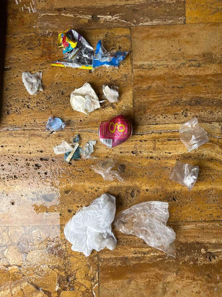
Fishing net
Plastic cups
Straws
0
On
pounds
0
I have debris data to report
0
0
0
Smooth (wavelets) for waves 0.1 - 0.5 meter high
0
0
0
0
0
0
0
ft2
0
0
meters
rocky reef
0
0
0
0
0
0
0
0
0
0
0
0
0
0
0
0
0
0
0
0
0
0
0
0
0
0
0
0
0
Mexico
State\Province
Guerrero
City
Zihuatanejo
Map Help


Dive Location

If you know your survey site coordinates, enter them manually in decimal degrees using WGS84 Map Datum. Use the minus sign for latitudes south of the equator and longitudes west of the Prime Meridian to 180 degrees.

If you do not know your survey site coordinates, click the “Map Location” tab to use the map to zoom into your survey site and drop the pin on the map to fall within your survey dive site in the water (not on land or the beach). Ensure you zoom in as much as possible to ensure data accuracy.
Entangled Help


Use the vertical tabs below to record any entangled animals you found of each type.

Bahader resort

3

21.756390808586, 39.05259847641

11
coral
8
20

21.756390808586, 39.05259847641

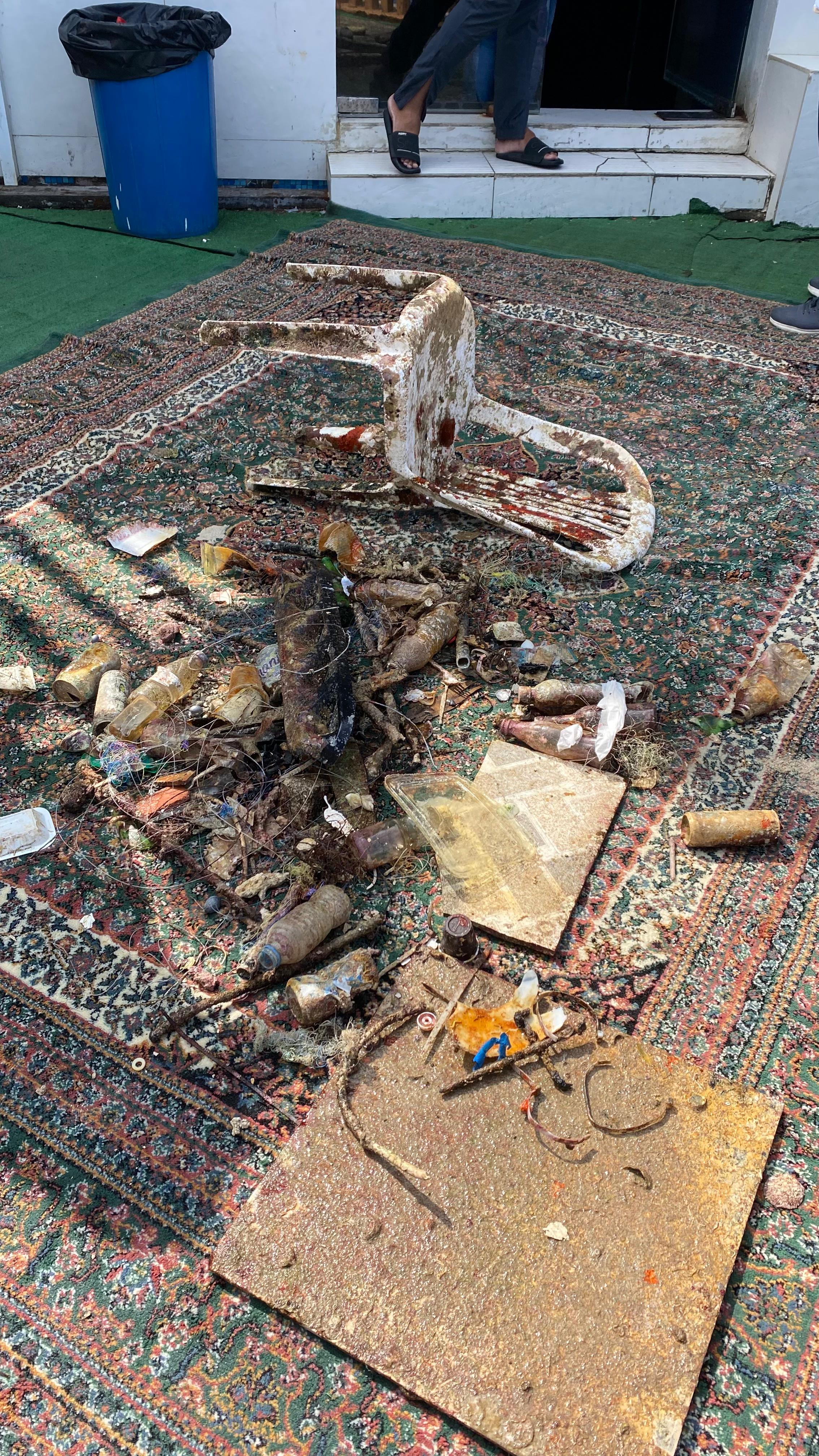
Plastic chair
Rainy/sunny
1
Plastic chair
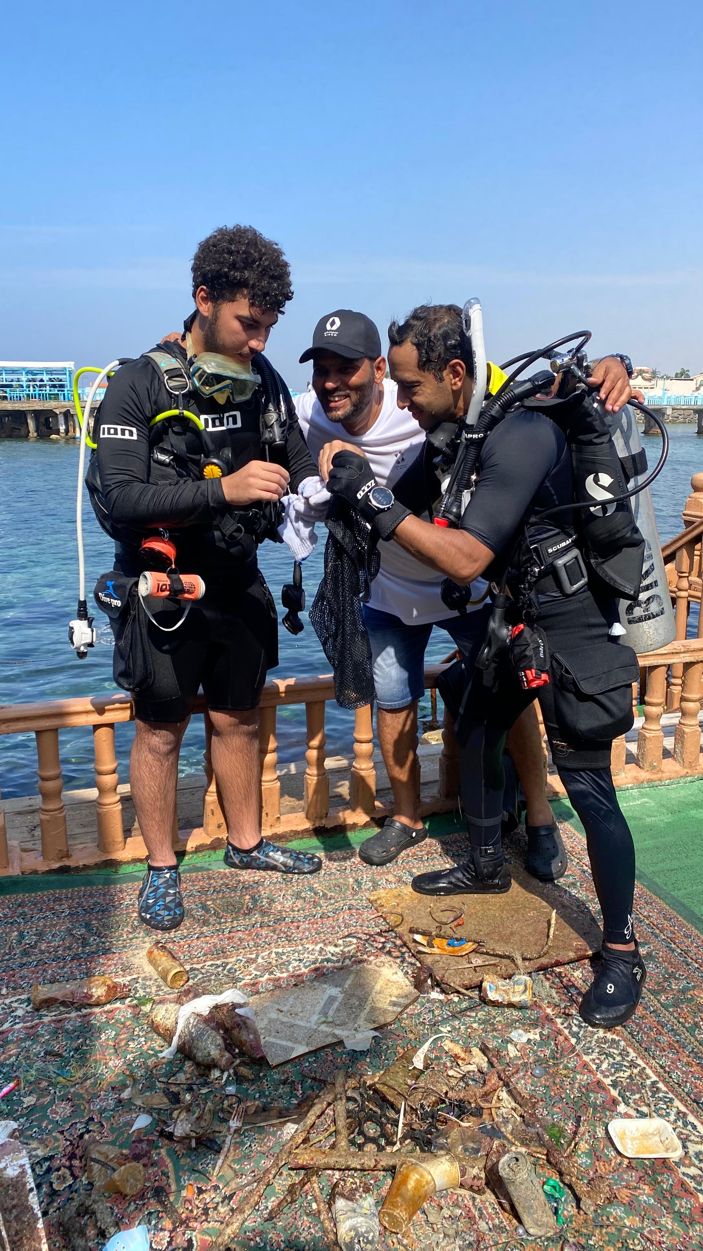
Blue reef diver
Mohammed Baghdadi
5
20
11
45.00
60
23.00
5.00
2
estimated
15
1000.00
Fishing lines
Fishing hooks
Plastic bottles
On
kilograms
I have debris data to report
7
Smooth (wavelets) for waves 0.1 - 0.5 meter high m2
meters
coral reef
5
2
5
Saudi Arabia
State\Province
Makkah
City
Jeddah
Map Help


Dive Location

If you know your survey site coordinates, enter them manually in decimal degrees using WGS84 Map Datum. Use the minus sign for latitudes south of the equator and longitudes west of the Prime Meridian to 180 degrees.

If you do not know your survey site coordinates, click the “Map Location” tab to use the map to zoom into your survey site and drop the pin on the map to fall within your survey dive site in the water (not on land or the beach). Ensure you zoom in as much as possible to ensure data accuracy.
Entangled Help


Use the vertical tabs below to record any entangled animals you found of each type.

Enoura

0
0
0
0

35.693234151004, 139.76967577358

0
0
0
rock
0
0
1
0
0
Sunny
Coconuts Tokyo
Kyohei Horimoto
0
0
0
0
0
0
0
0
0
0
0
0
0
0
0
0
0
0
0
2
0
0
0
0
0
0
2
0
0
0
0
0
0
0
0
0
0.50
40
14.00
5.00
0
estimated
0
0
8279.79
0
0
0
0
0
0
On
kilograms
0
I have debris data to report
0
0
0
Calm (glassy to rippled) for waves 0 – 0.1 meter high
0
0
0
0
0
0
0
m2
0
0
meters
rocky reef
0
0
0
0
0
0
0
0
0
0
0
0
0
0
0
0
0
0
0
0
0
0
0
0
0
0
0
0
0
Japan
State\Province
Kanagawa
City
Enoura
Map Help


Dive Location

If you know your survey site coordinates, enter them manually in decimal degrees using WGS84 Map Datum. Use the minus sign for latitudes south of the equator and longitudes west of the Prime Meridian to 180 degrees.

If you do not know your survey site coordinates, click the “Map Location” tab to use the map to zoom into your survey site and drop the pin on the map to fall within your survey dive site in the water (not on land or the beach). Ensure you zoom in as much as possible to ensure data accuracy.
Entangled Help


Use the vertical tabs below to record any entangled animals you found of each type.

Doljo

coral
3

9.5915867654093, 123.73471467401

Windy,rainning at night around 11pm to 2am
Blue Gravity dive resort
LIU SHUAI
2
3
1
1
1.00
46
14.00
5.00
estimated
1.00
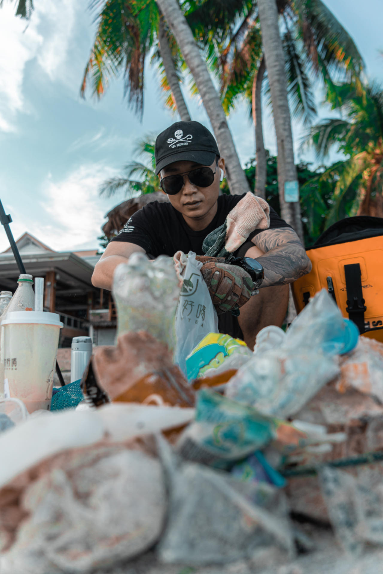
plastic bag
On
kilograms
I have debris data to report
Calm (glassy to rippled) for waves 0 – 0.1 meter high m2
meters
coral reef
Philippines
State\Province
bohol
City
panglao
Map Help


Dive Location

If you know your survey site coordinates, enter them manually in decimal degrees using WGS84 Map Datum. Use the minus sign for latitudes south of the equator and longitudes west of the Prime Meridian to 180 degrees.

If you do not know your survey site coordinates, click the “Map Location” tab to use the map to zoom into your survey site and drop the pin on the map to fall within your survey dive site in the water (not on land or the beach). Ensure you zoom in as much as possible to ensure data accuracy.

Entangled Help


Use the vertical tabs below to record any entangled animals you found of each type.

ADS211 - Anse Chastanet Reef

1
0
0
0

13.864875, -61.0777964

0
0
0
coral
0
2
0
0
0
No
Rainy
Scuba Saint Lucia
Carmen Toanchina
0
0
0
0
0
0
0
0
0
0
0
0
0
0
0
0
0
1
0
2
0
0
0
0
0
0
0
0
0
0
0
0
0
0
0
0
0.20
75
10.00
3.00
1
estimated
0
0
6894.56
0
0
0
0
0
Plastic caps
Plastic bags
0
On
pounds
0
I have debris data to report
0
0
0
Smooth (wavelets) for waves 0.1 - 0.5 meter high
0
0
0
0
0
0
0
m2
0
0
meters
coral reef
0
0
0
0
0
0
0
0
0
0
0
0
0
0
0
0
0
0
0
0
0
0
0
0
0
0
0
0
0
Saint Lucia
State\Province
Soufriere
City
Soufriere
Map Help


Dive Location

If you know your survey site coordinates, enter them manually in decimal degrees using WGS84 Map Datum. Use the minus sign for latitudes south of the equator and longitudes west of the Prime Meridian to 180 degrees.

If you do not know your survey site coordinates, click the “Map Location” tab to use the map to zoom into your survey site and drop the pin on the map to fall within your survey dive site in the water (not on land or the beach). Ensure you zoom in as much as possible to ensure data accuracy.

Entangled Help


Use the vertical tabs below to record any entangled animals you found of each type.

Daymaniyat

0
0
0
2

23.854511, 58.0917

0
0
0
coral
0
0
0
2
0
Omanta
Behnaz Banirad
0
0
0
0
0
0
0
0
0
0
0
0
0
0
0
0
0
0
0
3
0
0
0
0
0
0
0
0
0
0
0
0
0
0
0
0
3.00
60
10.00
5.00
2
estimated
0
0
0
6
11574.00
0
0
0
0
0
0
On
pounds
0
I have debris data to report
0
0
0
Calm (glassy to rippled) for waves 0 – 0.1 meter high
0
0
0
0
0
0
0
m2
0
0
meters
coral reef
0
0
0
0
0
0
0
0
0
0
0
0
0
0
0
0
0
0
0
0
0
0
0
0
0
0
0
0
0
Oman
State\Province
Muscat
City
Muscat
Map Help


Dive Location

If you know your survey site coordinates, enter them manually in decimal degrees using WGS84 Map Datum. Use the minus sign for latitudes south of the equator and longitudes west of the Prime Meridian to 180 degrees.

If you do not know your survey site coordinates, click the “Map Location” tab to use the map to zoom into your survey site and drop the pin on the map to fall within your survey dive site in the water (not on land or the beach). Ensure you zoom in as much as possible to ensure data accuracy.

Entangled Help


Use the vertical tabs below to record any entangled animals you found of each type.

ADS409 - St. George's Bay

14
3
1
2
sand
1

35.926566024127, 14.489876356753

Car mat
Sunny. Windy.
1
Car mat
Cresta Dive Centre
Sara & Lea
12
1
2
3
2
3
5.00
40
5.00
1.50
estimated
1500.00
Plastic
Metal
Glass
On
kilograms
I have debris data to report
2
Calm (glassy to rippled) for waves 0 – 0.1 meter high
3
1
m2
1
meters
seagrass
5
1
15
1
1
Malta
City
St. Julian's
Map Help


Dive Location

If you know your survey site coordinates, enter them manually in decimal degrees using WGS84 Map Datum. Use the minus sign for latitudes south of the equator and longitudes west of the Prime Meridian to 180 degrees.

If you do not know your survey site coordinates, click the “Map Location” tab to use the map to zoom into your survey site and drop the pin on the map to fall within your survey dive site in the water (not on land or the beach). Ensure you zoom in as much as possible to ensure data accuracy.

Entangled Help


Use the vertical tabs below to record any entangled animals you found of each type.

Osezaki, Shizuoka, Japan

2
3

35.02720799529, 138.78910744875

sand

35.024500963485, 138.78654956818

rain, sunny
Marin House Lei Aloha
Taro Yamaguchi
2
1
2
1.00
58
14.00
1.00
estimated
5637.00
2
2
On
kilograms
I have debris data to report
Calm (glassy to rippled) for waves 0 – 0.1 meter high
1
m2
meters
rocky reef
1
2
0
Japan
State\Province
Shizuoka
City
Mishima
Map Help


Dive Location

If you know your survey site coordinates, enter them manually in decimal degrees using WGS84 Map Datum. Use the minus sign for latitudes south of the equator and longitudes west of the Prime Meridian to 180 degrees.

If you do not know your survey site coordinates, click the “Map Location” tab to use the map to zoom into your survey site and drop the pin on the map to fall within your survey dive site in the water (not on land or the beach). Ensure you zoom in as much as possible to ensure data accuracy.

Entangled Help


Use the vertical tabs below to record any entangled animals you found of each type.

Tala Bay

2
7
0
0

29.43426, 34.972391

0
0
0
sand
0
2
0
0
0
Windy
1
2
Handiwipe
Paper cups with plastic linings
Deep Blue Dive Center
Catherine Hoelzer
0
0
0
2
0
0
0
0
0
0
0
0
0
0
0
0
0
0
0
2
0
0
0
0
0
0
0
0
0
0
0
0
0
0
0
0
0.25
50
20.00
5.00
0
estimated
0
0
2738.51
0
0
0
0
0
0
On
kilograms
0
I have debris data to report
0
0
0
Smooth (wavelets) for waves 0.1 - 0.5 meter high
0
0
0
0
0
0
0
m2
0
0
meters
seagrass
0
0
0
0
0
0
0
0
0
0
0
0
0
0
0
0
0
1
0
0
0
0
0
0
0
0
0
0
0
Jordan
State\Province
Aqaba
City
Aqaba
Map Help


Dive Location

If you know your survey site coordinates, enter them manually in decimal degrees using WGS84 Map Datum. Use the minus sign for latitudes south of the equator and longitudes west of the Prime Meridian to 180 degrees.

If you do not know your survey site coordinates, click the “Map Location” tab to use the map to zoom into your survey site and drop the pin on the map to fall within your survey dive site in the water (not on land or the beach). Ensure you zoom in as much as possible to ensure data accuracy.

Entangled Help


Use the vertical tabs below to record any entangled animals you found of each type.

Subscribe to