Menu

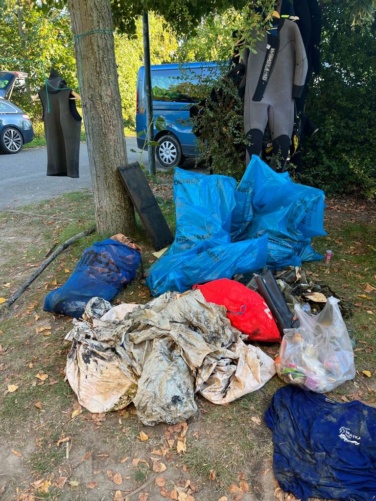
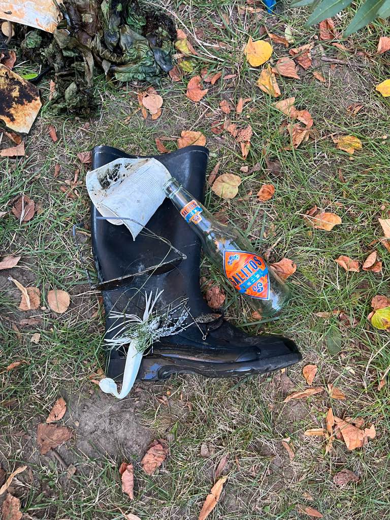
Kulkwitzer See

2
4
2
0

51.306898194238, 12.25143698171

1
0
0
silt
0
10
0
2
0
No
Welly’s
Calm and sunny
Just Leave Bubbles
Bine
0
0
0
0
0
0
0
0
0
0
0
0
0
0
0
0
0
0
0
17
0
0
0
0
2
3
2
0
0
0
0
0
0
0
0
0
67.00
50
4.30
1.20
0
measured
0
1
8247.96
0
0
0
0
0
Fishing hook
Broken glas
3
On
kilograms
0
I have debris data to report
7
2
0
Calm (glassy to rippled) for waves 0 – 0.1 meter high
0
0
1
0
4
0
0
m2
0
0
meters
other
6
0
2
0
0
2
0
0
0
0
0
0
0
0
0
0
0
3
0
0
0
0
0
0
0
0
0
0
0
Germany
State\Province
Saxony
City
Leipzig
Map Help


Dive Location

If you know your survey site coordinates, enter them manually in decimal degrees using WGS84 Map Datum. Use the minus sign for latitudes south of the equator and longitudes west of the Prime Meridian to 180 degrees.

If you do not know your survey site coordinates, click the “Map Location” tab to use the map to zoom into your survey site and drop the pin on the map to fall within your survey dive site in the water (not on land or the beach). Ensure you zoom in as much as possible to ensure data accuracy.

Entangled Help


Use the vertical tabs below to record any entangled animals you found of each type.

Ecosystem Other
Lake

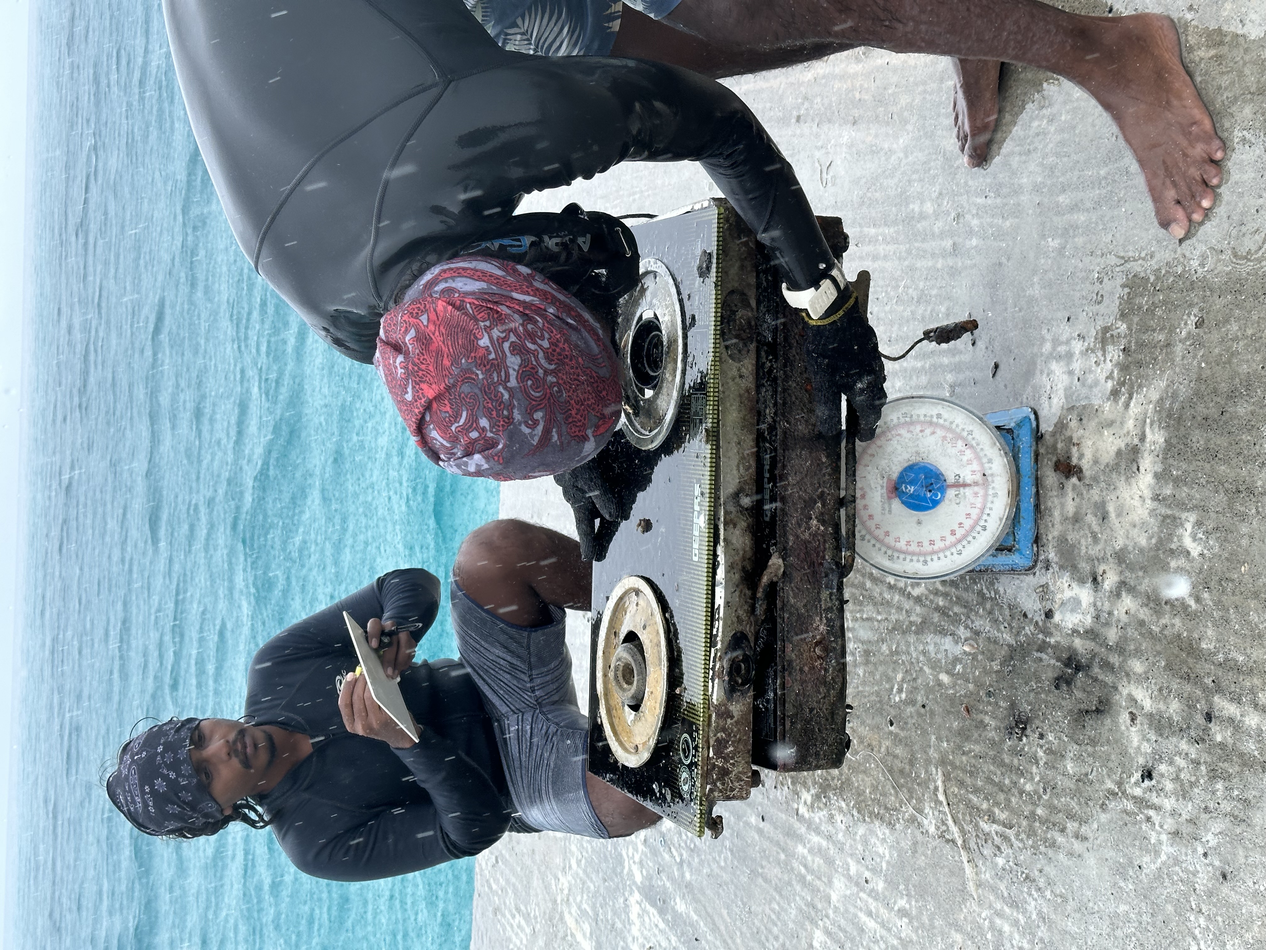
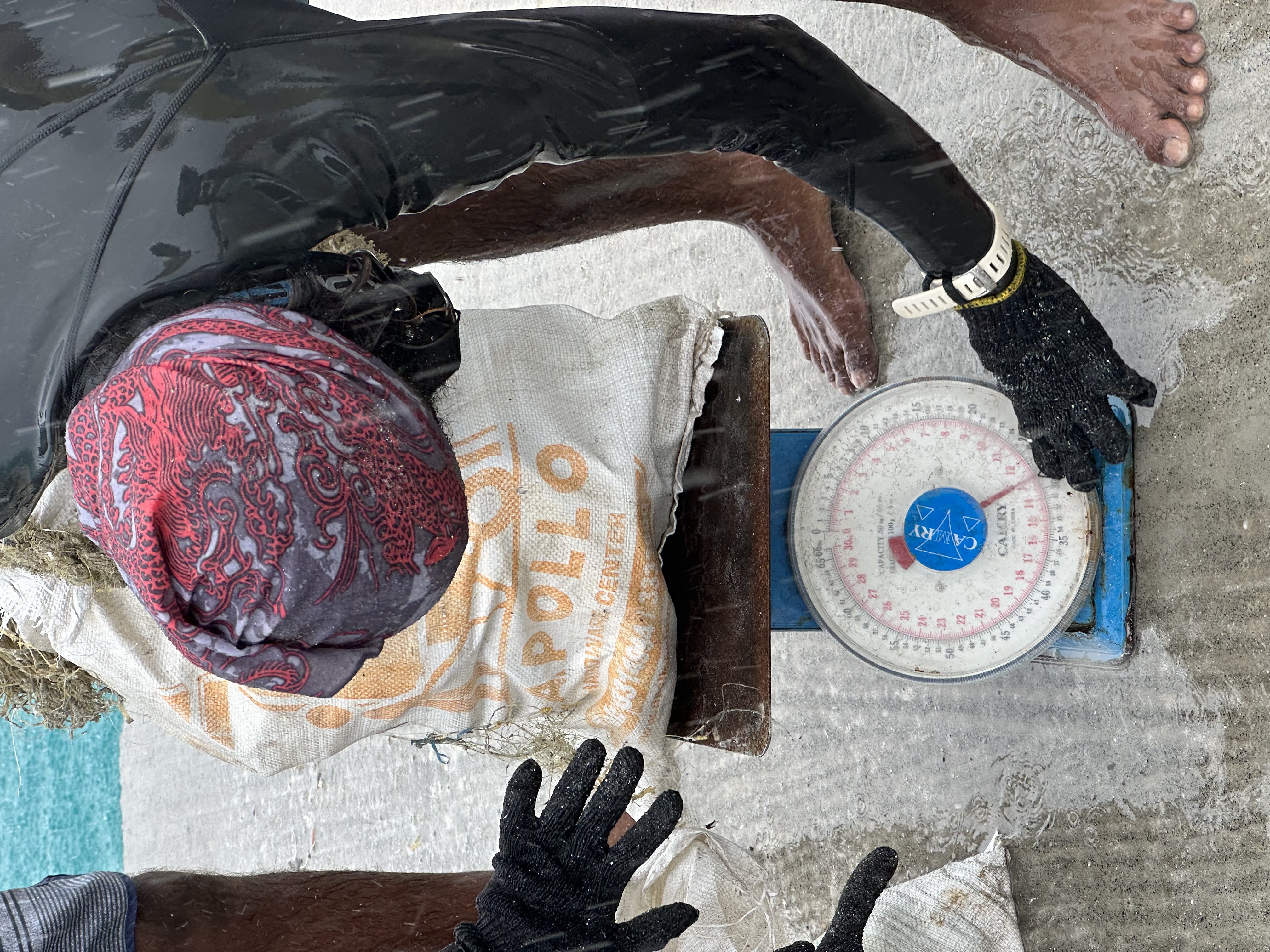
Fulidhoo Lagoon

0
0
0
0

3.6790301, 73.4160851

0
0
0
sand
0
1
0
0
0
Moderate, cloudy
Fulidhoo Dive and watersports
Mizaan
0
0
0
0
0
0
0
0
0
0
0
0
0
0
0
0
0
0
0
12
0
0
0
0
2
0
2
0
0
1
0
0
0
0
0
0
193.00
120
8.00
1.00
1
measured
0
0
3128.14
0
2
0
0
0
Plastic
Metals
Ropes
0
On
kilograms
1
I have debris data to report
1
2
0
Slight for waves 0.5 -1.25 meter high
1
0
0
0
1
0
0
m2
2
0
meters
other
1
0
0
0
0
0
0
0
0
1
0
0
0
0
0
1
0
1
0
0
0
0
1
0
0
1
0
0
0
Maldives
State\Province
Vaavu atoll
City
Fulidhoo
Map Help


Dive Location

If you know your survey site coordinates, enter them manually in decimal degrees using WGS84 Map Datum. Use the minus sign for latitudes south of the equator and longitudes west of the Prime Meridian to 180 degrees.

If you do not know your survey site coordinates, click the “Map Location” tab to use the map to zoom into your survey site and drop the pin on the map to fall within your survey dive site in the water (not on land or the beach). Ensure you zoom in as much as possible to ensure data accuracy.

Entangled Help


Use the vertical tabs below to record any entangled animals you found of each type.

Ecosystem Other
Other

Fulidhoo lagoon

2

3, 73.416388888889

sand
1

3.6804936, 73.4161794

Moderate,Cloudy
Fulidhoo Dive and Watersports
Mizaan
15
2
3
1
425.00
120
8.00
1.00
measured
4000.00
2
Plastic
Metals
Ropes
On
pounds
I have debris data to report
1
3
Slight for waves 0.5 -1.25 meter high
2
ft2
2
meters
other
2
1
1
2
1
Maldives
State\Province
Vaavu Atoll
City
Fulidhoo
Map Help


Dive Location

If you know your survey site coordinates, enter them manually in decimal degrees using WGS84 Map Datum. Use the minus sign for latitudes south of the equator and longitudes west of the Prime Meridian to 180 degrees.

If you do not know your survey site coordinates, click the “Map Location” tab to use the map to zoom into your survey site and drop the pin on the map to fall within your survey dive site in the water (not on land or the beach). Ensure you zoom in as much as possible to ensure data accuracy.

Entangled Help


Use the vertical tabs below to record any entangled animals you found of each type.

Hin Fai

0
1
1
0

10.113007, 99.81911

0
0
0
sand
0
4
0
4
0
No
Plastic fragments
Sunny
1
2
1
1
Electric wire
Fishing weights
Mask strap
Plastic fork
Jennifer Dowling
0
0
0
0
0
0
0
0
0
0
0
0
0
0
0
0
0
0
0
3
0
0
0
0
0
0
4
0
0
0
0
0
0
0
0
0
1.50
50
11.50
8.00
4
estimated
0
0
0
0
1000.00
0
0
1
0
0
1
On
kilograms
0
I have debris data to report
0
0
0
Calm (glassy to rippled) for waves 0 – 0.1 meter high
0
0
0
0
0
0
0
m2
0
0
meters
coral reef
0
0
0
0
0
0
0
0
0
0
0
0
0
0
0
1
0
0
0
0
0
0
0
0
0
0
0
0
0
Thailand
State\Province
Sarut Thani
City
Koh Tao
Map Help


Dive Location

If you know your survey site coordinates, enter them manually in decimal degrees using WGS84 Map Datum. Use the minus sign for latitudes south of the equator and longitudes west of the Prime Meridian to 180 degrees.

If you do not know your survey site coordinates, click the “Map Location” tab to use the map to zoom into your survey site and drop the pin on the map to fall within your survey dive site in the water (not on land or the beach). Ensure you zoom in as much as possible to ensure data accuracy.

Entangled Help


Use the vertical tabs below to record any entangled animals you found of each type.

Iruka-beach,Kawana,Ito,Shizuoka

0
14
0
0

35.023293814344, 138.89746911395

41
1
3
sand
0
12
3
4
0
sunny day
team PADI
reiko akiyama
0
1
0
0
2
0
0
0
3
0
2
0
0
0
0
0
0
2
0
39
0
0
0
0
0
3
10
1
0
0
0
0
0
1
0
0
44.16
34
5.00
3.00
1
measured
0
22
9201.40
0
0
0
1
0
fishing gear
beverrage cans
beverrage bottle
0
On
kilograms
0
I have debris data to report
21
0
0
Calm (glassy to rippled) for waves 0 – 0.1 meter high
3
0
0
0
0
4
0
m2
13
0
meters
rocky reef
13
0
5
0
0
0
0
0
0
0
0
0
0
0
1
1
3
9
0
0
0
0
32
0
5
0
0
2
0
Japan
State\Province
Shizuoka
City
Ito
Map Help


Dive Location

If you know your survey site coordinates, enter them manually in decimal degrees using WGS84 Map Datum. Use the minus sign for latitudes south of the equator and longitudes west of the Prime Meridian to 180 degrees.

If you do not know your survey site coordinates, click the “Map Location” tab to use the map to zoom into your survey site and drop the pin on the map to fall within your survey dive site in the water (not on land or the beach). Ensure you zoom in as much as possible to ensure data accuracy.

Entangled Help


Use the vertical tabs below to record any entangled animals you found of each type.

Magallanes Reef

15
coral
4
80

18.355321170148, -68.840120919403

Except few plastic trashes, all the debris collected were fishing lines, we can't really count how many but about 43kg of the debris collected were fishing lines.
2
Fishing Traps & Pots
DANA & IVAN CERNY FOUNDATION
Chloe von Kaenel
3
7
10
6
15.00
80
8.00
4.00
estimated
99.00
On
kilograms
I have debris data to report
Calm (glassy to rippled) for waves 0 – 0.1 meter high m2
meters
coral reef
Dominican Republic
City
BAYAHIBE
Map Help


Dive Location

If you know your survey site coordinates, enter them manually in decimal degrees using WGS84 Map Datum. Use the minus sign for latitudes south of the equator and longitudes west of the Prime Meridian to 180 degrees.

If you do not know your survey site coordinates, click the “Map Location” tab to use the map to zoom into your survey site and drop the pin on the map to fall within your survey dive site in the water (not on land or the beach). Ensure you zoom in as much as possible to ensure data accuracy.

Entangled Help


Use the vertical tabs below to record any entangled animals you found of each type.

Magallanes Beach

15
60
10
5
coral
11
20

18.363788208479, -68.842514927721

This dive clean-up was part of a bigger beach cleaning event. There was a team in the water (data reported here) and a team on the beach (data not reported here), in total we collected 202 kg of trash. This report contains only the underwater clean up.
DANA & IVAN CERNY FOUNDATION
Chloe von Kaenel
2
21
20
50
30
10
20
86.30
50
6.00
2.00
measured
80.00
15
On
kilograms
I have debris data to report
15
Calm (glassy to rippled) for waves 0 – 0.1 meter high
12
m2
meters
coral reef
3
20
Dominican Republic
City
BAYAHIBE
Map Help


Dive Location

If you know your survey site coordinates, enter them manually in decimal degrees using WGS84 Map Datum. Use the minus sign for latitudes south of the equator and longitudes west of the Prime Meridian to 180 degrees.

If you do not know your survey site coordinates, click the “Map Location” tab to use the map to zoom into your survey site and drop the pin on the map to fall within your survey dive site in the water (not on land or the beach). Ensure you zoom in as much as possible to ensure data accuracy.

Entangled Help


Use the vertical tabs below to record any entangled animals you found of each type.

LA JOLLA COVE

0
5
0
0

32.850658, -117.272494

2
0
0
sand
0
0
0
0
0
2
Sunglasses
Michael Gantt
0
0
0
0
0
0
0
0
0
0
0
0
0
0
0
0
0
0
0
2
0
0
0
0
0
0
0
0
0
0
0
0
0
0
0
0
5.00
60
50.00
10.00
0
measured
0
0
0
0
3828.00
0
0
0
0
0
0
On
pounds
0
I have debris data to report
0
0
0
Smooth (wavelets) for waves 0.1 - 0.5 meter high
0
0
0
0
0
0
0
m2
0
0
feet
kelp
0
0
0
0
0
0
0
0
0
0
0
0
0
0
0
0
0
0
0
0
0
0
0
0
0
0
0
0
0
United States
Map Help


Dive Location

If you know your survey site coordinates, enter them manually in decimal degrees using WGS84 Map Datum. Use the minus sign for latitudes south of the equator and longitudes west of the Prime Meridian to 180 degrees.

If you do not know your survey site coordinates, click the “Map Location” tab to use the map to zoom into your survey site and drop the pin on the map to fall within your survey dive site in the water (not on land or the beach). Ensure you zoom in as much as possible to ensure data accuracy.
Entangled Help


Use the vertical tabs below to record any entangled animals you found of each type.

ADS592 - Lady Hole

0
0
0
0

55.553019, -1.6245

0
0
0
rock
0
0
0
0
0
The Fifth Point
Sean Hamilton
0
0
0
0
0
0
0
0
0
0
0
0
0
0
0
0
0
0
0
9
0
0
0
0
0
0
0
0
0
0
0
0
0
0
0
0
0.00
49
7.60
2.00
0
estimated
0
0
0
0
3691.27
0
0
0
0
0
0
On
pounds
0
Our Survey Site was free of debris
0
0
0
Smooth (wavelets) for waves 0.1 - 0.5 meter high
0
0
0
0
0
0
0
m2
0
0
meters
rocky reef
0
0
0
0
0
0
0
0
0
0
0
0
0
0
0
0
0
0
0
0
0
0
0
0
0
0
0
0
0
United Kingdom
State\Province
Northumberland
City
Beadnell
Map Help


Dive Location

If you know your survey site coordinates, enter them manually in decimal degrees using WGS84 Map Datum. Use the minus sign for latitudes south of the equator and longitudes west of the Prime Meridian to 180 degrees.

If you do not know your survey site coordinates, click the “Map Location” tab to use the map to zoom into your survey site and drop the pin on the map to fall within your survey dive site in the water (not on land or the beach). Ensure you zoom in as much as possible to ensure data accuracy.
Entangled Help


Use the vertical tabs below to record any entangled animals you found of each type.

ADS592 - Lady Hole

0
0
0
0

55.553019, -1.6245

0
0
0
rock
0
0
0
0
0
The Fifth Point
James Learwood
0
0
0
0
0
0
0
0
0
0
0
0
0
0
0
0
0
0
0
17
0
0
0
0
0
0
0
0
0
0
0
0
3
0
0
0
1.00
31
8.80
2.00
0
estimated
0
0
0
1
4800.16
0
0
0
0
0
0
On
kilograms
0
I have debris data to report
0
0
0
Calm (glassy to rippled) for waves 0 – 0.1 meter high
0
0
0
0
0
0
0
m2
0
0
meters
rocky reef
0
0
0
0
0
0
0
0
0
0
0
0
0
0
0
0
0
1
0
0
0
0
0
0
0
0
0
0
0
United Kingdom
State\Province
Northumberland
City
Beadnell
Map Help


Dive Location

If you know your survey site coordinates, enter them manually in decimal degrees using WGS84 Map Datum. Use the minus sign for latitudes south of the equator and longitudes west of the Prime Meridian to 180 degrees.

If you do not know your survey site coordinates, click the “Map Location” tab to use the map to zoom into your survey site and drop the pin on the map to fall within your survey dive site in the water (not on land or the beach). Ensure you zoom in as much as possible to ensure data accuracy.
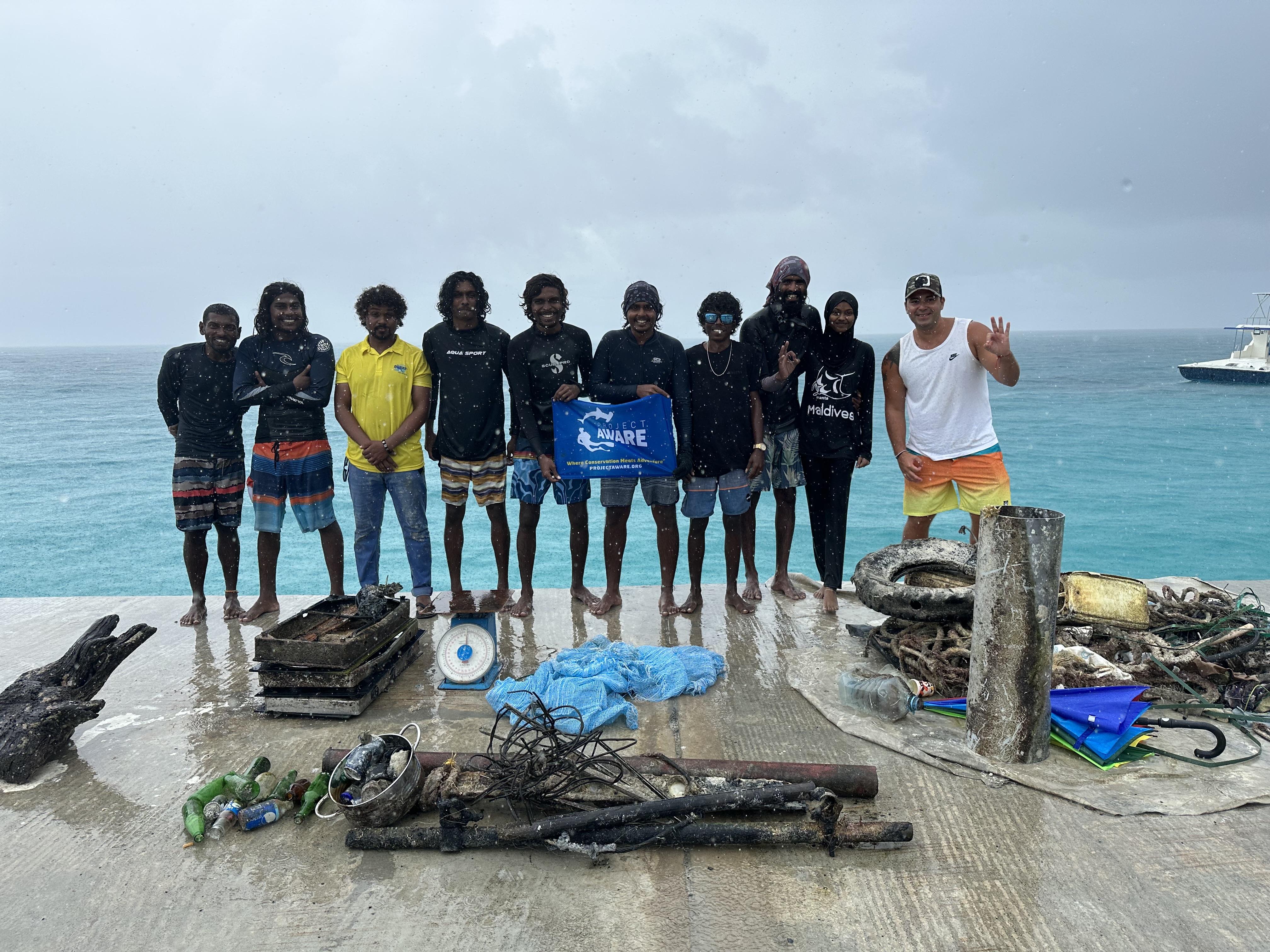
Entangled Help


Use the vertical tabs below to record any entangled animals you found of each type.

Subscribe to