Menu

Karacaören Island East Wall

0
0
0
0

36.5412463745, 29.061264505732

0
0
0
rock
0
0
0
15
0
Fishermen and rental boats
Boot
Calm
Seahorse Diving Centre
Mark Taylor
0
0
0
0
0
0
0
0
0
0
0
0
0
0
0
0
0
0
0
6
0
0
0
0
0
0
0
0
0
0
0
0
0
0
0
0
1.00
39
30.00
9.00
0
estimated
0
1
1673.55
0
0
0
0
0
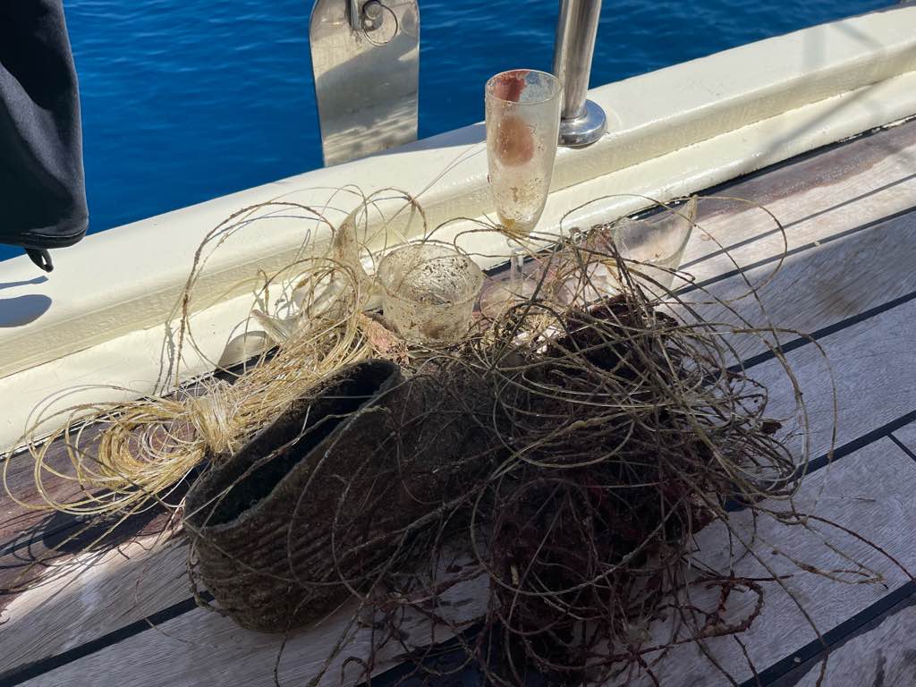
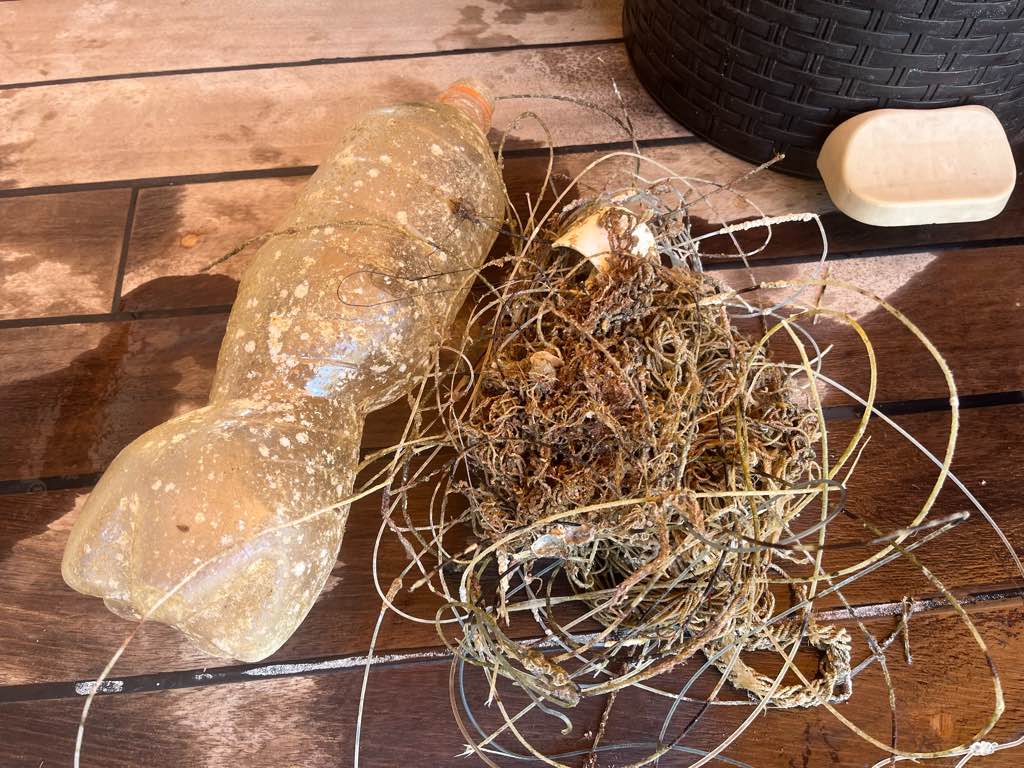
Fishing lines
0
On
kilograms
0
I have debris data to report
0
0
0
Calm (glassy to rippled) for waves 0 – 0.1 meter high
0
0
1
0
0
0
0
m2
0
0
meters
rocky reef
0
0
0
0
0
0
0
0
0
0
0
0
0
0
0
0
0
0
0
0
3
0
1
0
0
0
0
0
0
Turkey
State\Province
Muğla
City
Ölüdeniz
Map Help


Dive Location

If you know your survey site coordinates, enter them manually in decimal degrees using WGS84 Map Datum. Use the minus sign for latitudes south of the equator and longitudes west of the Prime Meridian to 180 degrees.

If you do not know your survey site coordinates, click the “Map Location” tab to use the map to zoom into your survey site and drop the pin on the map to fall within your survey dive site in the water (not on land or the beach). Ensure you zoom in as much as possible to ensure data accuracy.

Entangled Help


Use the vertical tabs below to record any entangled animals you found of each type.

Sancaklı Koyu

0
1
0
0

36.427053467829, 29.129919618289

0
0
0
seagrass
0
0
0
5
0
Fishermen
Calm
Seahorse dive centre
Mark Taylor
0
0
0
0
0
0
0
0
0
0
0
0
0
0
0
0
0
0
0
7
0
0
0
0
0
0
1
0
0
0
0
0
0
0
0
0
0.01
50
18.00
8.00
0
estimated
0
0
2659.21
0
0
0
0
0
0
On
kilograms
0
I have debris data to report
0
0
0
Calm (glassy to rippled) for waves 0 – 0.1 meter high
0
0
0
0
0
0
0
m2
0
0
meters
seagrass
0
0
0
0
0
0
0
0
0
0
0
0
0
0
0
0
0
0
0
0
0
0
0
0
0
0
0
0
0
Turkey
State\Province
Muğla
City
Ölüdeniz
Map Help


Dive Location

If you know your survey site coordinates, enter them manually in decimal degrees using WGS84 Map Datum. Use the minus sign for latitudes south of the equator and longitudes west of the Prime Meridian to 180 degrees.

If you do not know your survey site coordinates, click the “Map Location” tab to use the map to zoom into your survey site and drop the pin on the map to fall within your survey dive site in the water (not on land or the beach). Ensure you zoom in as much as possible to ensure data accuracy.
Entangled Help


Use the vertical tabs below to record any entangled animals you found of each type.

XVII Limpieza de Fondos Marinos (Underwater cleaup)

0
153
0
1

36.81348, -2.560815

2
0
0
seagrass
0
36
27
0
Part of a radio- A woman pocket mirrow
1
1 little mirrow
Aquatours Almería
Fernando Orri-
0
7
-1
1
0
-1
0
1
0
0
0
0
0
0
0
0
55
30
0
2
46
206
0
0
1
-1
0
0
0
0
0
148.00
45
9.00
3.00
7
measured
2
0
4
300.00
1
0
Plastic
Fishing gear
On
kilograms
I have debris data to report
38
Smooth (wavelets) for waves 0.1 - 0.5 meter high
5
0
1
4
m2
1
1
meters
seagrass
2
-1
0
0
0
0
3
1
0
1
0
0
70
0
0
1
0
1
1
1
0
0
0
Spain
State\Province
Almería
City
Aguadulce-Roquetas de Mar
Map Help


Dive Location

If you know your survey site coordinates, enter them manually in decimal degrees using WGS84 Map Datum. Use the minus sign for latitudes south of the equator and longitudes west of the Prime Meridian to 180 degrees.

If you do not know your survey site coordinates, click the “Map Location” tab to use the map to zoom into your survey site and drop the pin on the map to fall within your survey dive site in the water (not on land or the beach). Ensure you zoom in as much as possible to ensure data accuracy.

Entangled Help


Use the vertical tabs below to record any entangled animals you found of each type.

Blue Lagoon - Padang Bai

6
sand
13

-8.5297361783245, 115.51451034737

AWARE Week, Underwater Clean-up by AquaMarine Diving - Bali
Sunny,
Cloudy
AquaMarine Diving - Bali
Aramita Livia Ardis
9
1
1
1.77
41
16.80
5.00
3
measured
12
999.00
Fishing Line
Plastic Fragments
Fishing Lures, Sinkers, Hooks
On
kilograms
I have debris data to report
Smooth (wavelets) for waves 0.1 - 0.5 meter high
1
m2
meters
coral reef
Indonesia
State\Province
Bali
City
Badung
Map Help


Dive Location

If you know your survey site coordinates, enter them manually in decimal degrees using WGS84 Map Datum. Use the minus sign for latitudes south of the equator and longitudes west of the Prime Meridian to 180 degrees.

If you do not know your survey site coordinates, click the “Map Location” tab to use the map to zoom into your survey site and drop the pin on the map to fall within your survey dive site in the water (not on land or the beach). Ensure you zoom in as much as possible to ensure data accuracy.

Entangled Help


Use the vertical tabs below to record any entangled animals you found of each type.

ADS525 - Padang Bai Jetty

6
77
10
2
sand
2

-8.5144595997186, 115.51108414467

AWARE Week, Underwater Clean-up by AquaMarine Diving - Bali
Sunny, Cloudy
AquaMarine Diving - Bali
Aramita Livia Ardis
2
2
1
1
2
9
2
1
15.67
45
14.60
5.00
5
measured
999.00
1
Plastic Fragments
Cloth Fragments
Fishing Nets
On
kilograms
I have debris data to report
Calm (glassy to rippled) for waves 0 – 0.1 meter high
1
35
1
m2
meters
coral reef
1
3
1
1
1
1
Indonesia
State\Province
Bali
City
Badung
Map Help


Dive Location

If you know your survey site coordinates, enter them manually in decimal degrees using WGS84 Map Datum. Use the minus sign for latitudes south of the equator and longitudes west of the Prime Meridian to 180 degrees.

If you do not know your survey site coordinates, click the “Map Location” tab to use the map to zoom into your survey site and drop the pin on the map to fall within your survey dive site in the water (not on land or the beach). Ensure you zoom in as much as possible to ensure data accuracy.

Entangled Help


Use the vertical tabs below to record any entangled animals you found of each type.

Port Vila Seafront

41
3
0
0

-17.737198564103, 168.31207400072

0
0
0
sand
0
2
0
4
0
2x cat 4 tropical cyclones in March this year
Traffic cone
Windy
1
3
1
1
Umbrella
Sunglasses plastic
Traffic cone
Aluminium plate -boat part
Big Blue Vanuatu
Christina Shaw
0
0
0
0
0
0
0
0
1
0
0
0
0
0
0
0
0
0
0
16
0
0
1
0
0
0
14
0
0
0
0
0
0
0
0
0
123.00
48
20.00
3.00
0
measured
0
0
12144.60
0
0
0
3
0
Drink bottles
Food wrappers
Clothes and shoes
0
On
kilograms
0
I have debris data to report
89
0
0
Smooth (wavelets) for waves 0.1 - 0.5 meter high
0
0
14
0
0
0
0
m2
0
0
meters
coral reef
2
0
1
0
0
3
1
0
0
20
8
0
19
0
0
2
4
86
0
0
1
1
33
0
1
0
0
0
0
Vanuatu
State\Province
Shefa
City
Port Vila
Map Help


Dive Location

If you know your survey site coordinates, enter them manually in decimal degrees using WGS84 Map Datum. Use the minus sign for latitudes south of the equator and longitudes west of the Prime Meridian to 180 degrees.

If you do not know your survey site coordinates, click the “Map Location” tab to use the map to zoom into your survey site and drop the pin on the map to fall within your survey dive site in the water (not on land or the beach). Ensure you zoom in as much as possible to ensure data accuracy.

Entangled Help


Use the vertical tabs below to record any entangled animals you found of each type.

Elbow Reef

0
0
0
0

25.14556, -80.26083

0
0
0
coral
0
0
0
0
0
Silent World Dive Center
Killian
0
0
0
0
0
0
0
0
0
0
0
0
0
0
0
0
0
0
0
2
0
0
0
0
0
0
0
0
0
0
0
0
0
0
0
0
0.00
45
25.00
10.00
0
measured
0
0
10000.00
0
0
0
0
0
0
On
kilograms
0
Our Survey Site was free of debris
0
0
0
Smooth (wavelets) for waves 0.1 - 0.5 meter high
0
0
0
0
0
0
0
ft2
0
0
feet
coral reef
0
0
0
0
0
0
0
0
0
0
0
0
0
0
0
0
0
0
0
0
0
0
0
0
0
0
0
0
0
United States
Map Help


Dive Location

If you know your survey site coordinates, enter them manually in decimal degrees using WGS84 Map Datum. Use the minus sign for latitudes south of the equator and longitudes west of the Prime Meridian to 180 degrees.

If you do not know your survey site coordinates, click the “Map Location” tab to use the map to zoom into your survey site and drop the pin on the map to fall within your survey dive site in the water (not on land or the beach). Ensure you zoom in as much as possible to ensure data accuracy.

Entangled Help


Use the vertical tabs below to record any entangled animals you found of each type.

Carysfort Reef S2061

0
0
0
0

25.2219, -80.2113

0
0
0
coral
0
0
0
0
0
Silent World Dive Center
Brianna
0
0
0
0
0
0
0
0
0
0
0
0
0
0
0
0
0
0
0
2
0
0
0
0
0
0
0
0
0
0
0
0
0
0
0
0
0.00
45
25.00
10.00
0
measured
0
0
10000.00
0
0
0
0
0
0
On
kilograms
0
Our Survey Site was free of debris
0
0
0
Calm (glassy to rippled) for waves 0 – 0.1 meter high
0
0
0
0
0
0
0
ft2
0
0
feet
coral reef
0
0
0
0
0
0
0
0
0
0
0
0
0
0
0
0
0
0
0
0
0
0
0
0
0
0
0
0
0
United States
Map Help


Dive Location

If you know your survey site coordinates, enter them manually in decimal degrees using WGS84 Map Datum. Use the minus sign for latitudes south of the equator and longitudes west of the Prime Meridian to 180 degrees.

If you do not know your survey site coordinates, click the “Map Location” tab to use the map to zoom into your survey site and drop the pin on the map to fall within your survey dive site in the water (not on land or the beach). Ensure you zoom in as much as possible to ensure data accuracy.

Entangled Help


Use the vertical tabs below to record any entangled animals you found of each type.

Key Largo Dry Rocks: Christ of the Abyss S2061

0
0
0
0

25.12, -80.3

0
0
0
coral
0
0
0
0
0
Silent World Dive Center
Ashlyn
0
0
0
0
0
0
0
0
0
0
0
0
0
0
0
0
0
0
0
2
0
0
0
0
0
0
0
0
0
0
0
0
0
0
0
0
0.00
45
25.00
10.00
0
measured
0
0
12000.00
0
0
0
0
0
0
On
kilograms
0
Our Survey Site was free of debris
0
0
0
Calm (glassy to rippled) for waves 0 – 0.1 meter high
0
0
0
0
0
0
0
ft2
0
0
feet
coral reef
0
0
0
0
0
0
0
0
0
0
0
0
0
0
0
0
0
0
0
0
0
0
0
0
0
0
0
0
0
United States
Map Help


Dive Location

If you know your survey site coordinates, enter them manually in decimal degrees using WGS84 Map Datum. Use the minus sign for latitudes south of the equator and longitudes west of the Prime Meridian to 180 degrees.

If you do not know your survey site coordinates, click the “Map Location” tab to use the map to zoom into your survey site and drop the pin on the map to fall within your survey dive site in the water (not on land or the beach). Ensure you zoom in as much as possible to ensure data accuracy.

Entangled Help


Use the vertical tabs below to record any entangled animals you found of each type.

Key Largo Dry Rocks: Christ of the Abyss S2061

0
0
0
0

25.12, -80.3

0
0
0
coral
0
0
0
0
0
Silent World Dive Center
Alex
0
0
0
0
0
0
0
0
0
0
0
0
0
0
0
0
0
0
0
2
0
0
0
0
0
0
0
0
0
0
0
0
0
0
0
0
0.00
45
25.00
10.00
0
measured
0
0
12000.00
0
0
0
0
0
0
On
kilograms
0
Our Survey Site was free of debris
0
0
0
Smooth (wavelets) for waves 0.1 - 0.5 meter high
0
0
0
0
0
0
0
ft2
0
0
feet
coral reef
0
0
0
0
0
0
0
0
0
0
0
0
0
0
0
0
0
0
0
0
0
0
0
0
0
0
0
0
0
United States
Map Help


Dive Location

If you know your survey site coordinates, enter them manually in decimal degrees using WGS84 Map Datum. Use the minus sign for latitudes south of the equator and longitudes west of the Prime Meridian to 180 degrees.

If you do not know your survey site coordinates, click the “Map Location” tab to use the map to zoom into your survey site and drop the pin on the map to fall within your survey dive site in the water (not on land or the beach). Ensure you zoom in as much as possible to ensure data accuracy.

Entangled Help


Use the vertical tabs below to record any entangled animals you found of each type.

Subscribe to