Menu

Vobster Quay

0
6
0
0

51.246232, -2.423519

0
0
0
silt
0
0
0
0
0
No
Yes is a diving site
No
Tyre
Dry and Cloudy
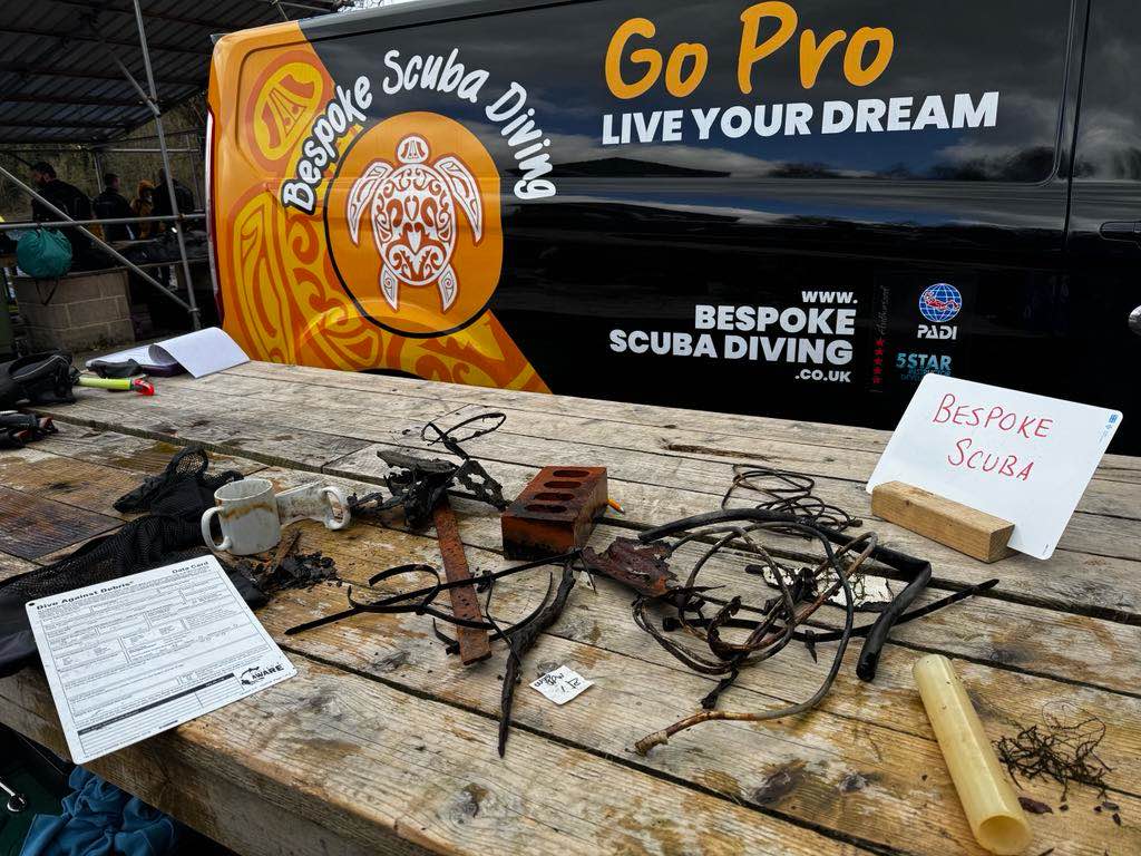
Bespoke 26187
Paul French
0
2
0
0
0
0
0
0
0
0
0
0
0
0
0
0
0
0
2
3
0
0
0
0
0
0
0
0
0
0
0
0
0
0
0
0
5.00
26
24.00
10.00
0
estimated
0
0
40.00
0
0
0
1
0
Metal tin
0
On
kilograms
0
I have debris data to report
0
0
0
Smooth (wavelets) for waves 0.1 - 0.5 meter high
4
0
0
0
0
0
0
m2
1
0
meters
other
40
0
1
0
0
0
0
0
0
0
0
0
1
0
0
1
1
0
0
0
2
0
0
0
0
0
0
0
0
United Kingdom
State\Province
Somerset
City
Bath
Map Help


Dive Location

If you know your survey site coordinates, enter them manually in decimal degrees using WGS84 Map Datum. Use the minus sign for latitudes south of the equator and longitudes west of the Prime Meridian to 180 degrees.

If you do not know your survey site coordinates, click the “Map Location” tab to use the map to zoom into your survey site and drop the pin on the map to fall within your survey dive site in the water (not on land or the beach). Ensure you zoom in as much as possible to ensure data accuracy.

Entangled Help


Use the vertical tabs below to record any entangled animals you found of each type.

Ecosystem Other
fresh

Magallanes

coral
1

18.363407121492, -68.841381759849

Slow Dive Casa Chihuahua
Julie
7
2
1
0.60
44
8.00
3.00
estimated
3600.00
On
kilograms
I have debris data to report
Calm (glassy to rippled) for waves 0 – 0.1 meter high m2
meters
coral reef
1
Dominican Republic
State\Province
La Altagracia
City
Bayahibe
Map Help


Dive Location

If you know your survey site coordinates, enter them manually in decimal degrees using WGS84 Map Datum. Use the minus sign for latitudes south of the equator and longitudes west of the Prime Meridian to 180 degrees.

If you do not know your survey site coordinates, click the “Map Location” tab to use the map to zoom into your survey site and drop the pin on the map to fall within your survey dive site in the water (not on land or the beach). Ensure you zoom in as much as possible to ensure data accuracy.
Entangled Help


Use the vertical tabs below to record any entangled animals you found of each type.

Lazarus Island

silt
1

1.2279860139376, 103.84936431918

Partly cloudy, periodic rain
The Submersibles
May-Ann
3
0.20
50
11.00
5.00
estimated
200.00
On
kilograms
I have debris data to report
Slight for waves 0.5 -1.25 meter high m2
meters
coral reef
Singapore
State\Province
Singapore
City
Singapore
Map Help


Dive Location

If you know your survey site coordinates, enter them manually in decimal degrees using WGS84 Map Datum. Use the minus sign for latitudes south of the equator and longitudes west of the Prime Meridian to 180 degrees.

If you do not know your survey site coordinates, click the “Map Location” tab to use the map to zoom into your survey site and drop the pin on the map to fall within your survey dive site in the water (not on land or the beach). Ensure you zoom in as much as possible to ensure data accuracy.

Entangled Help


Use the vertical tabs below to record any entangled animals you found of each type.

Lazadus North

0
4
0
0

1.229799, 103.848462

2
0
0
silt
0
0
0
4
0
No
Cooking pot
Calm
The Submersible
Felix Wang
0
0
0
0
0
0
0
0
0
0
0
0
0
0
0
0
0
0
0
6
0
0
0
0
0
0
0
0
0
0
0
0
0
0
0
0
1.80
60
11.00
5.00
0
measured
0
0
0
0
647.00
0
0
0
0
0
Fishing line
0
On
kilograms
0
I have debris data to report
0
0
0
Smooth (wavelets) for waves 0.1 - 0.5 meter high
0
0
0
0
0
0
0
m2
0
0
meters
rocky reef
1
0
0
0
0
0
0
0
0
0
0
0
0
0
1
0
0
0
0
0
0
0
0
0
0
0
0
0
0
Singapore
State\Province
Singapore
City
Singapore
Map Help


Dive Location

If you know your survey site coordinates, enter them manually in decimal degrees using WGS84 Map Datum. Use the minus sign for latitudes south of the equator and longitudes west of the Prime Meridian to 180 degrees.

If you do not know your survey site coordinates, click the “Map Location” tab to use the map to zoom into your survey site and drop the pin on the map to fall within your survey dive site in the water (not on land or the beach). Ensure you zoom in as much as possible to ensure data accuracy.

Entangled Help


Use the vertical tabs below to record any entangled animals you found of each type.

Garden Eel Cove. Makako Bay, Hawai’i

0
0
0
0

19.683574103751, -156.05831718401

0
0
0
coral
0
0
0
0
0
Hair scrunchy.
Clear
Jacks Diving Locker
Keller Laros
0
0
0
0
0
0
0
0
0
0
0
0
0
0
0
0
0
0
0
12
0
0
0
0
0
0
0
0
0
0
0
0
0
0
0
0
0.01
60
60.00
1.00
0
estimated
0
0
100.00
0
0
0
0
0
0
On
pounds
0
I have debris data to report
0
0
0
Smooth (wavelets) for waves 0.1 - 0.5 meter high
0
0
0
0
1
0
0
m2
0
0
feet
coral reef
0
0
0
0
0
0
0
0
0
0
0
0
0
0
0
0
0
0
0
0
0
0
0
0
0
0
0
0
0
United States
State\Province
Hawaii
City
Kailua-Kona
Map Help


Dive Location

If you know your survey site coordinates, enter them manually in decimal degrees using WGS84 Map Datum. Use the minus sign for latitudes south of the equator and longitudes west of the Prime Meridian to 180 degrees.

If you do not know your survey site coordinates, click the “Map Location” tab to use the map to zoom into your survey site and drop the pin on the map to fall within your survey dive site in the water (not on land or the beach). Ensure you zoom in as much as possible to ensure data accuracy.

Entangled Help


Use the vertical tabs below to record any entangled animals you found of each type.

Katada,Mie

23
10
1
1

34.267437031344, 136.84713932321

0
0
1
silt
0
0
0
0
0
household goods
Hammer
cloudy
1
hammer
SEA POINT Mie
Nezu
0
5
5
0
0
0
0
0
0
0
0
0
0
0
0
0
0
2
0
10
0
0
0
0
0
0
0
0
0
0
0
0
0
0
0
1
25.00
40
8.00
2.00
0
estimated
0
0
1402.50
1
0
0
2
0
plastics
Part of metallic materials
clothes
0
On
kilograms
0
I have debris data to report
4
0
0
Calm (glassy to rippled) for waves 0 – 0.1 meter high
5
0
0
0
4
0
0
m2
7
1
meters
kelp
36
0
0
0
0
0
1
0
0
0
0
0
0
0
2
0
3
3
0
0
0
0
4
0
0
0
0
0
0
Japan
State\Province
Mie
City
Shima
Map Help


Dive Location

If you know your survey site coordinates, enter them manually in decimal degrees using WGS84 Map Datum. Use the minus sign for latitudes south of the equator and longitudes west of the Prime Meridian to 180 degrees.

If you do not know your survey site coordinates, click the “Map Location” tab to use the map to zoom into your survey site and drop the pin on the map to fall within your survey dive site in the water (not on land or the beach). Ensure you zoom in as much as possible to ensure data accuracy.

Entangled Help


Use the vertical tabs below to record any entangled animals you found of each type.

Kawaihae surf park

0
1
0
0

20.039010498923, -155.83008549322

150
0
0
sand
0
0
0
0
0
Spring break
Dog bed
Wind and swell
Kohala divers
Chantel Morris
0
0
0
0
0
0
0
0
0
0
0
0
0
0
0
0
0
0
0
3
0
0
0
0
0
0
0
0
2
0
0
0
0
0
0
0
5.00
45
11.00
10.00
0
estimated
0
17
83.40
0
0
0
1
0
Fishing line
Aluminum cans
Lead weights
0
On
pounds
0
I have debris data to report
0
0
0
Calm (glassy to rippled) for waves 0 – 0.1 meter high
0
0
0
0
0
0
0
m2
0
0
feet
rocky reef
28
0
0
0
0
0
0
0
0
0
0
0
0
0
0
0
4
0
0
0
0
0
7
0
1
0
0
0
0
United States
State\Province
Hawaii
City
Kawaihae
Map Help


Dive Location

If you know your survey site coordinates, enter them manually in decimal degrees using WGS84 Map Datum. Use the minus sign for latitudes south of the equator and longitudes west of the Prime Meridian to 180 degrees.

If you do not know your survey site coordinates, click the “Map Location” tab to use the map to zoom into your survey site and drop the pin on the map to fall within your survey dive site in the water (not on land or the beach). Ensure you zoom in as much as possible to ensure data accuracy.

Entangled Help


Use the vertical tabs below to record any entangled animals you found of each type.

Kawaihae Surf Park

0
0
0
0

20.0391504, -155.8301909

0
0
0
sand
0
0
1
100
0
Spring Break
Lighter
Windy and Swell
Kohala Divers
Damien
0
0
0
0
0
0
0
0
0
0
0
0
0
0
0
0
0
0
0
3
0
0
0
0
0
0
0
0
0
0
0
0
1
0
0
0
5.00
50
11.00
1.00
0
estimated
0
0
0
18
3294.26
0
0
0
0
0
Fishing lines
Lead weights
Cans
0
On
pounds
0
I have debris data to report
4
0
0
Calm (glassy to rippled) for waves 0 – 0.1 meter high
0
0
0
0
1
0
0
m2
0
0
feet
rocky reef
1
0
0
0
0
18
0
0
0
0
0
0
0
0
0
0
2
0
0
0
0
0
0
0
0
0
0
0
0
United States
State\Province
Hawaii
City
Kawaihae
Map Help


Dive Location

If you know your survey site coordinates, enter them manually in decimal degrees using WGS84 Map Datum. Use the minus sign for latitudes south of the equator and longitudes west of the Prime Meridian to 180 degrees.

If you do not know your survey site coordinates, click the “Map Location” tab to use the map to zoom into your survey site and drop the pin on the map to fall within your survey dive site in the water (not on land or the beach). Ensure you zoom in as much as possible to ensure data accuracy.

Entangled Help


Use the vertical tabs below to record any entangled animals you found of each type.

Kawaihae Surf Park

0
0
0
0

20.0390311, -155.8302034

0
0
0
sand
0
0
0
100
0
No
Spring Break
No
Lighter
Wind + Swell
1
Handheld Lighter
Kohala Divers
0
0
0
0
0
0
0
0
0
0
0
0
0
0
0
0
0
0
0
3
0
0
0
0
0
0
0
0
0
0
0
0
1
0
0
0
5.00
25
11.00
4.00
0
estimated
0
0
0
18
5449.66
0
0
0
0
0
Fishing line
Leadweights & Aluminum cans
0
On
pounds
0
I have debris data to report
4
0
0
Calm (glassy to rippled) for waves 0 – 0.1 meter high
0
0
0
0
0
0
0
ft2
0
0
feet
rocky reef
1
0
0
0
0
17
0
0
0
0
0
0
0
0
0
0
0
2
0
0
0
0
0
0
0
0
0
0
0
United States
State\Province
Hawaii
City
Kawaihae
Map Help


Dive Location

If you know your survey site coordinates, enter them manually in decimal degrees using WGS84 Map Datum. Use the minus sign for latitudes south of the equator and longitudes west of the Prime Meridian to 180 degrees.

If you do not know your survey site coordinates, click the “Map Location” tab to use the map to zoom into your survey site and drop the pin on the map to fall within your survey dive site in the water (not on land or the beach). Ensure you zoom in as much as possible to ensure data accuracy.

Entangled Help


Use the vertical tabs below to record any entangled animals you found of each type.

Mango Bay

5
9
1
sand
4

10.1222425163, 99.834371885003

sunny
The Coral Tribe
Jenny Dowling
1
7
3
1
2.44
48
16.00
10.00
measured
150.00
On
kilograms
I have debris data to report
Calm (glassy to rippled) for waves 0 – 0.1 meter high
1
m2
3
1
meters
coral reef
2
Thailand
State\Province
Surat Thani
City
Koh Tao
Map Help


Dive Location

If you know your survey site coordinates, enter them manually in decimal degrees using WGS84 Map Datum. Use the minus sign for latitudes south of the equator and longitudes west of the Prime Meridian to 180 degrees.

If you do not know your survey site coordinates, click the “Map Location” tab to use the map to zoom into your survey site and drop the pin on the map to fall within your survey dive site in the water (not on land or the beach). Ensure you zoom in as much as possible to ensure data accuracy.

Entangled Help


Use the vertical tabs below to record any entangled animals you found of each type.

Subscribe to