Menu

Blue Planet House Reef

1
coral
2

-5.6094704857626, 120.44893303179

Windy, wavy, cloudy
IOP / Blue Planet
Kavita Sayers
1
4
0.20
56
16.00
6.00
measured
450.00
fishing net
fishing line
fishing line
On
kilograms
I have debris data to report
Smooth (wavelets) for waves 0.1 - 0.5 meter high m2
3
meters
coral reef
Indonesia
State\Province
South Sulawesi
City
Bira
Map Help


Dive Location

If you know your survey site coordinates, enter them manually in decimal degrees using WGS84 Map Datum. Use the minus sign for latitudes south of the equator and longitudes west of the Prime Meridian to 180 degrees.

If you do not know your survey site coordinates, click the “Map Location” tab to use the map to zoom into your survey site and drop the pin on the map to fall within your survey dive site in the water (not on land or the beach). Ensure you zoom in as much as possible to ensure data accuracy.

Entangled Help


Use the vertical tabs below to record any entangled animals you found of each type.

Crystal Bay

17
2

-8.715681, 115.457371

1
coral
1
2 batteries
Rain
Indo Ocean Project
Arya
3
1
2
2
5
3.16
39
7.00
5.00
1
measured
700.00
On
kilograms
I have debris data to report
2
Slight for waves 0.5 -1.25 meter high m2
meters
coral reef
2
2
Indonesia
State\Province
Bali
City
Klungkung
Map Help


Dive Location

If you know your survey site coordinates, enter them manually in decimal degrees using WGS84 Map Datum. Use the minus sign for latitudes south of the equator and longitudes west of the Prime Meridian to 180 degrees.

If you do not know your survey site coordinates, click the “Map Location” tab to use the map to zoom into your survey site and drop the pin on the map to fall within your survey dive site in the water (not on land or the beach). Ensure you zoom in as much as possible to ensure data accuracy.

Entangled Help


Use the vertical tabs below to record any entangled animals you found of each type.

Inca Inca

0
0
0
0

11.210582, -74.236879

0
0
0
sand
1
22
0
0
0
Sunny, no waves
2
Sun glases
Atlantida SantaMarta
Juan
0
0
0
5
0
0
0
0
1
0
0
0
0
0
0
90
0
0
0
3
0
0
0
0
0
0
16
0
0
0
0
0
0
0
0
0
11.00
45
10.00
5.00
0
measured
0
0
0
0
467.41
0
0
0
0
0
0
On
kilograms
0
I have debris data to report
0
0
0
Calm (glassy to rippled) for waves 0 – 0.1 meter high
0
0
0
0
20
0
1
m2
2
0
meters
coral reef
0
0
0
0
0
0
0
0
0
0
0
0
0
0
0
0
0
0
0
0
0
0
0
0
0
0
0
0
0
Colombia
State\Province
Magdalena
City
Santa Marta
Map Help


Dive Location

If you know your survey site coordinates, enter them manually in decimal degrees using WGS84 Map Datum. Use the minus sign for latitudes south of the equator and longitudes west of the Prime Meridian to 180 degrees.

If you do not know your survey site coordinates, click the “Map Location” tab to use the map to zoom into your survey site and drop the pin on the map to fall within your survey dive site in the water (not on land or the beach). Ensure you zoom in as much as possible to ensure data accuracy.

Entangled Help


Use the vertical tabs below to record any entangled animals you found of each type.

Ban’s reef

0
3
0
0

10.093381, 99.827291

0
0
0
silt
0
1
0
1
0
.
There are few bars and Longtail
.
.
Clam
Ban’s diving resort
Maria Boadella
0
8
0
24
0
0
0
0
0
1
2
0
0
0
0
0
0
0
0
8
0
0
0
0
5
0
7
0
0
0
0
0
0
0
0
0
7.00
40
2.00
1.00
0
measured
0
0
2195.09
0
0
0
0
0
Plastic cup
Beverage cans
Plastic bottles
0
On
kilograms
0
I have debris data to report
2
0
0
Calm (glassy to rippled) for waves 0 – 0.1 meter high
0
0
0
0
3
0
0
m2
0
1
meters
coral reef
0
0
0
1
0
0
0
0
0
0
0
0
0
6
0
0
0
22
0
0
0
0
0
0
0
0
0
0
0
Thailand
State\Province
Surat Thani
City
Koh tao
Map Help


Dive Location

If you know your survey site coordinates, enter them manually in decimal degrees using WGS84 Map Datum. Use the minus sign for latitudes south of the equator and longitudes west of the Prime Meridian to 180 degrees.

If you do not know your survey site coordinates, click the “Map Location” tab to use the map to zoom into your survey site and drop the pin on the map to fall within your survey dive site in the water (not on land or the beach). Ensure you zoom in as much as possible to ensure data accuracy.

Entangled Help


Use the vertical tabs below to record any entangled animals you found of each type.

Mari Mari house reef

0
8
5
2

6.0282597897254, 116.07364590191

0
0
0
coral
0
13
0
0
0
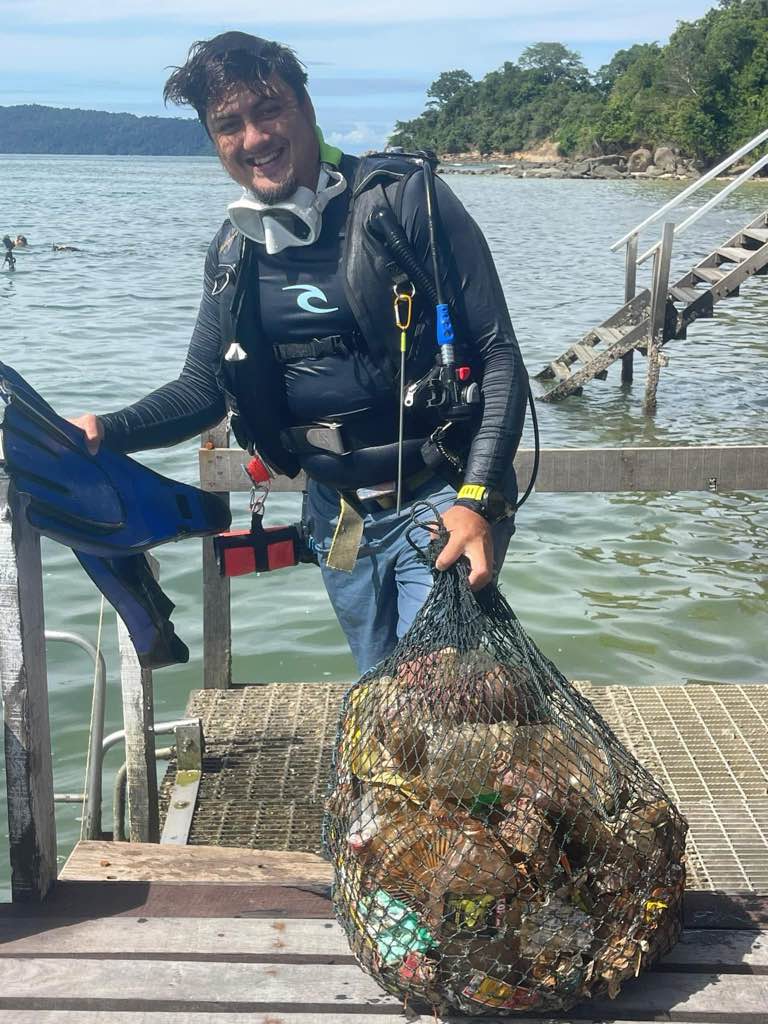
Bottles and instant coffee packets
Cloudy
New KK Holiday
Jamal Amir
0
0
0
16
0
0
0
0
0
7
0
0
0
0
14
0
0
11
0
4
0
0
0
0
20
16
32
0
12
0
0
0
0
0
0
0
50.00
27
16.00
5.00
0
estimated
0
0
1843.29
0
0
0
0
0
Plastic bottles
0
On
kilograms
0
I have debris data to report
0
0
0
Slight for waves 0.5 -1.25 meter high
0
0
0
0
0
0
0
m2
0
0
meters
coral reef
0
0
0
0
0
0
0
0
0
0
0
0
0
0
0
0
0
0
0
0
0
0
0
0
0
0
0
0
0
Malaysia
State\Province
Sabah
City
Kota Kinabalu
Map Help


Dive Location

If you know your survey site coordinates, enter them manually in decimal degrees using WGS84 Map Datum. Use the minus sign for latitudes south of the equator and longitudes west of the Prime Meridian to 180 degrees.

If you do not know your survey site coordinates, click the “Map Location” tab to use the map to zoom into your survey site and drop the pin on the map to fall within your survey dive site in the water (not on land or the beach). Ensure you zoom in as much as possible to ensure data accuracy.

Entangled Help


Use the vertical tabs below to record any entangled animals you found of each type.

獅子浜ダイビングセンター

1
0
0
0

35.047604, 138.885961

0
0
0
sand
0
3
0
0
2
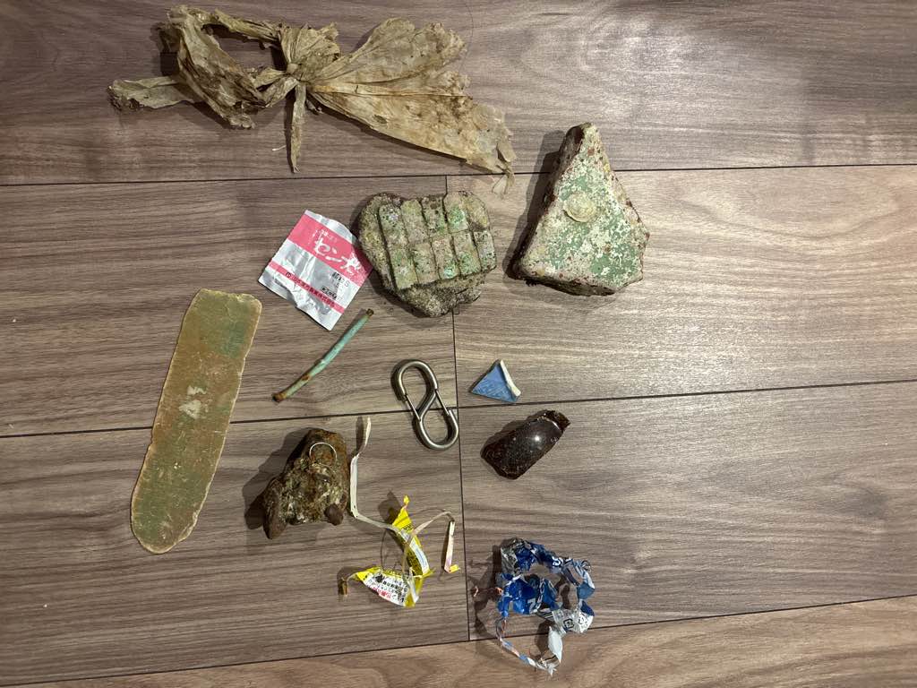
西風が強い日が続き、ビーチの桟橋が波で破壊されていた
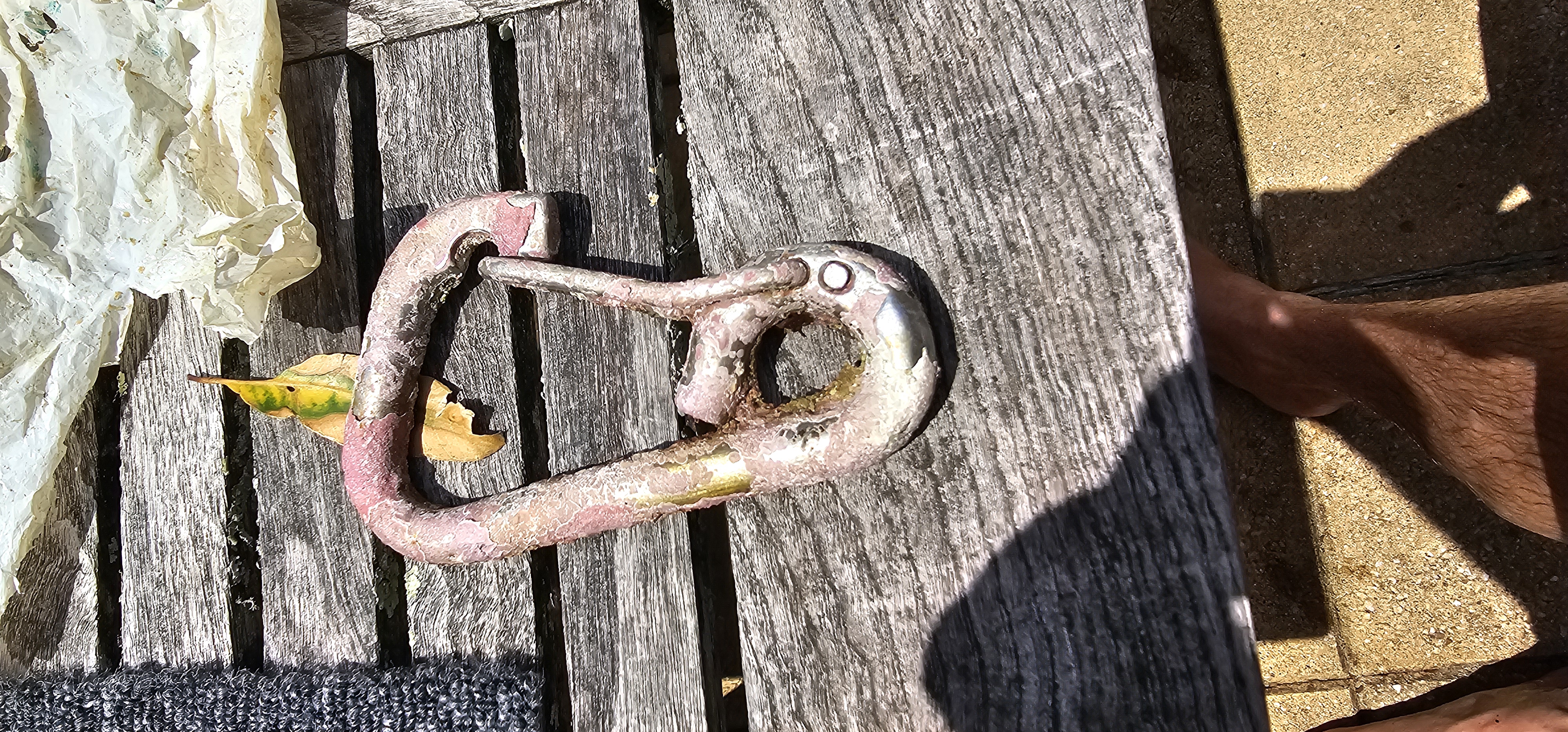
ダイバーが落としたカラビナ
sunny
獅子浜ダイビングセンター
UTAKO OKAI
0
0
0
0
0
0
0
0
0
0
0
0
1
0
0
0
0
0
0
2
0
0
0
0
0
0
0
0
0
0
0
0
0
0
0
0
0.58
61
33.00
5.00
0
measured
0
1
11111.50
0
0
0
0
0
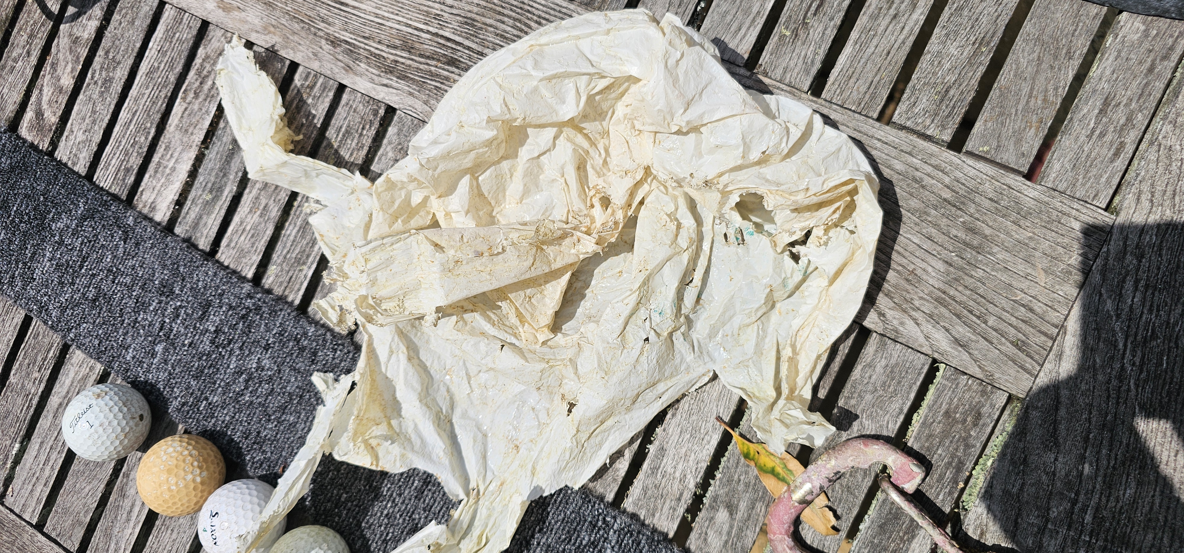
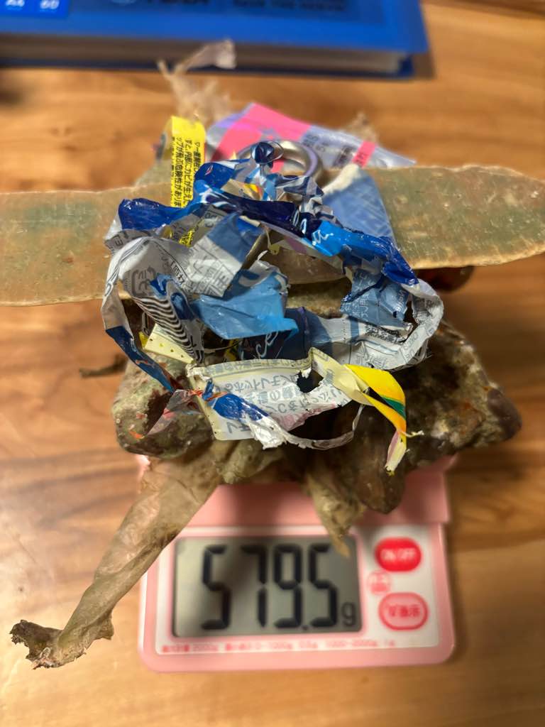
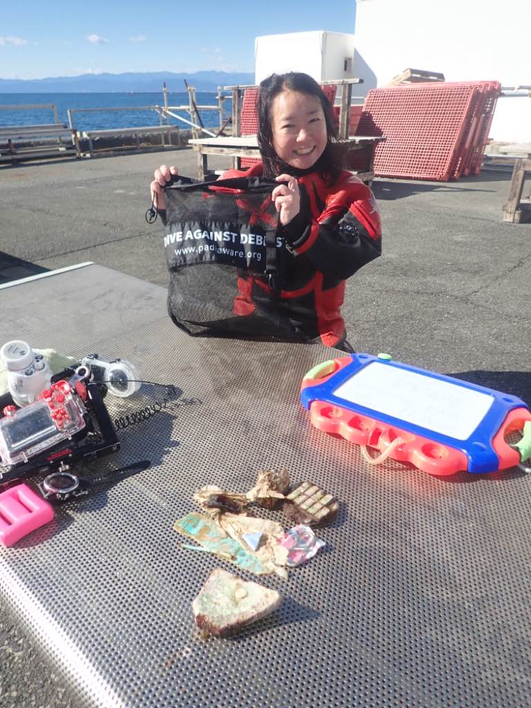
ダイバーが落とした器材の一部
漁船から落ちたとみられる、甲板の一部
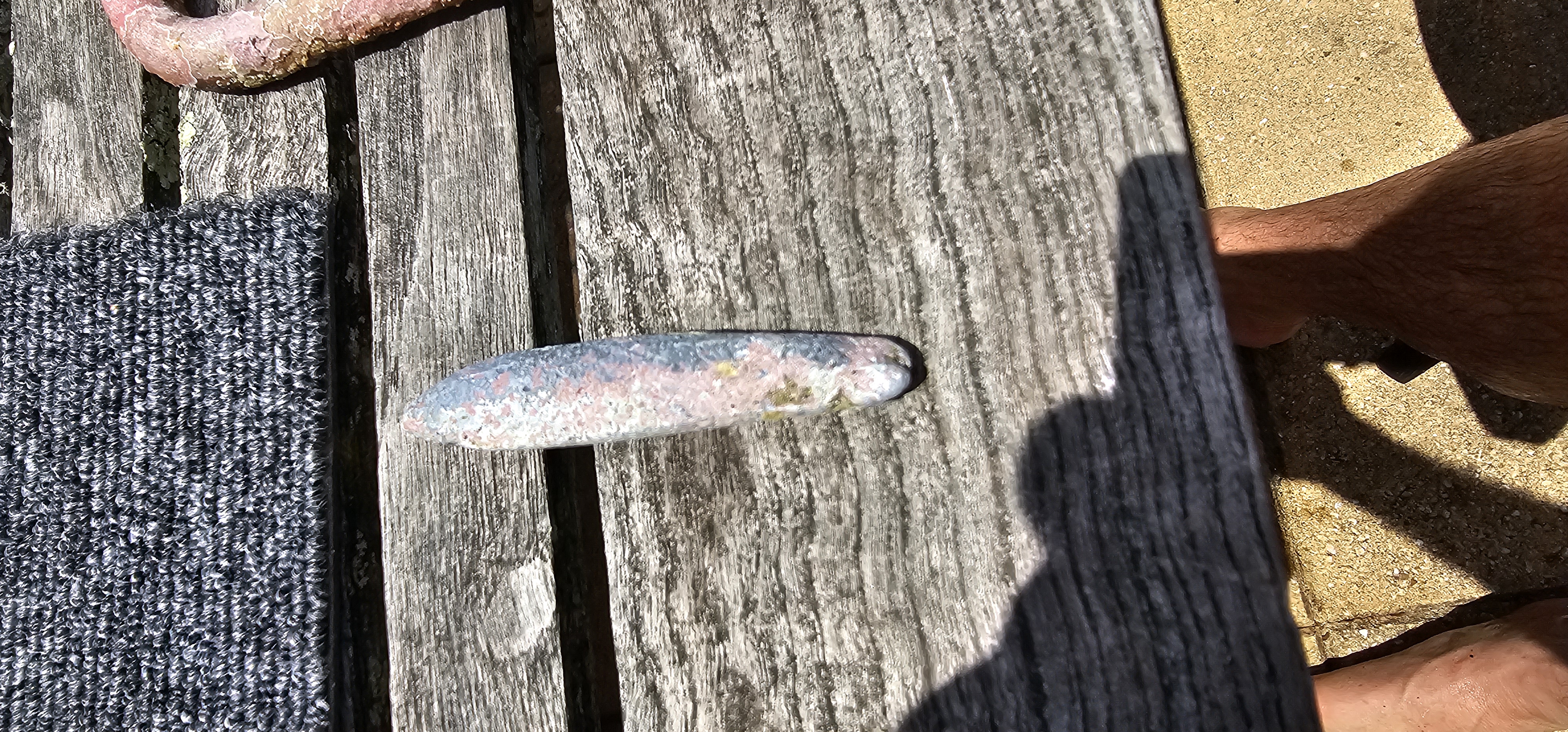
破壊された桟橋をつないでいたとみられる金具のついた石
0
On
kilograms
0
I have debris data to report
0
0
0
Smooth (wavelets) for waves 0.1 - 0.5 meter high
0
0
0
0
0
0
0
m2
0
0
meters
rocky reef
0
0
0
0
0
0
0
0
0
0
0
0
1
0
0
0
0
0
0
0
0
0
3
0
0
0
0
0
0
Japan
State\Province
Shizuoka
City
Numazu
Map Help


Dive Location

If you know your survey site coordinates, enter them manually in decimal degrees using WGS84 Map Datum. Use the minus sign for latitudes south of the equator and longitudes west of the Prime Meridian to 180 degrees.

If you do not know your survey site coordinates, click the “Map Location” tab to use the map to zoom into your survey site and drop the pin on the map to fall within your survey dive site in the water (not on land or the beach). Ensure you zoom in as much as possible to ensure data accuracy.
Entangled Help


Use the vertical tabs below to record any entangled animals you found of each type.

Pali Nisyros

18
7
3
2
sand
48
1
5

36.619267515436, 27.170832949312

Calm
Dive In Action - Volcano Bubbles
Dimitris Kampanos - Michael Pachos
2
6
5
1
1
1
2
5
7
2
97
1
5
1
88.65
120
7.00
4.00
6
measured
400.00
2
On
kilograms
I have debris data to report
Calm (glassy to rippled) for waves 0 – 0.1 meter high m2
meters
seagrass
1
19
4
4
19
2
1
Greece
State\Province
South Aegean
City
Nisyros
Map Help


Dive Location

If you know your survey site coordinates, enter them manually in decimal degrees using WGS84 Map Datum. Use the minus sign for latitudes south of the equator and longitudes west of the Prime Meridian to 180 degrees.

If you do not know your survey site coordinates, click the “Map Location” tab to use the map to zoom into your survey site and drop the pin on the map to fall within your survey dive site in the water (not on land or the beach). Ensure you zoom in as much as possible to ensure data accuracy.
Entangled Help


Use the vertical tabs below to record any entangled animals you found of each type.

Mandraki Port

3
4
13
2
sand
11

36.614311482896, 27.139964469398

soda can from1987
Calm
Dive in Action & Volcano Bubbles
Dimitris Kampanos - Michael Pachos
3
6
2
3
5
6
5
15
2
164.00
120
20.00
5.00
6
measured
2
294.00
3
Plastic
On
kilograms
I have debris data to report
2
Calm (glassy to rippled) for waves 0 – 0.1 meter high
7
4
m2
3
meters
seagrass
1
1
14
1
30
Greece
State\Province
South Aegean
City
Nisyros
Map Help


Dive Location

If you know your survey site coordinates, enter them manually in decimal degrees using WGS84 Map Datum. Use the minus sign for latitudes south of the equator and longitudes west of the Prime Meridian to 180 degrees.

If you do not know your survey site coordinates, click the “Map Location” tab to use the map to zoom into your survey site and drop the pin on the map to fall within your survey dive site in the water (not on land or the beach). Ensure you zoom in as much as possible to ensure data accuracy.
Entangled Help


Use the vertical tabs below to record any entangled animals you found of each type.

Cruwee Cove

rock
1

-33.999230880327, 151.24739033084

Very clean area.. no line litter ..
Dan
5
4
2.00
55
16.00
1.00
estimated
1
7700.00
On
kilograms
I have debris data to report
Calm (glassy to rippled) for waves 0 – 0.1 meter high m2
meters
rocky reef
Australia
Map Help


Dive Location

If you know your survey site coordinates, enter them manually in decimal degrees using WGS84 Map Datum. Use the minus sign for latitudes south of the equator and longitudes west of the Prime Meridian to 180 degrees.

If you do not know your survey site coordinates, click the “Map Location” tab to use the map to zoom into your survey site and drop the pin on the map to fall within your survey dive site in the water (not on land or the beach). Ensure you zoom in as much as possible to ensure data accuracy.
Entangled Help


Use the vertical tabs below to record any entangled animals you found of each type.

Scuba Republic House Reef

sand

-0.44323061892752, 130.75339928269

Indo Ocean Project
Maxs
5
0.10
60
20.00
10.00
measured
2000.00
On
kilograms
I have debris data to report
Calm (glassy to rippled) for waves 0 – 0.1 meter high m2
meters
coral reef
Indonesia
State\Province
Southwest Papua
City
Raja Ampat
Map Help


Dive Location

If you know your survey site coordinates, enter them manually in decimal degrees using WGS84 Map Datum. Use the minus sign for latitudes south of the equator and longitudes west of the Prime Meridian to 180 degrees.

If you do not know your survey site coordinates, click the “Map Location” tab to use the map to zoom into your survey site and drop the pin on the map to fall within your survey dive site in the water (not on land or the beach). Ensure you zoom in as much as possible to ensure data accuracy.
Entangled Help


Use the vertical tabs below to record any entangled animals you found of each type.

Subscribe to