Menu

Caletita / Playa cosmica

13
1

20.494896563635, -86.964082479526

seagrass
4

20.494562057539, -86.964340209961

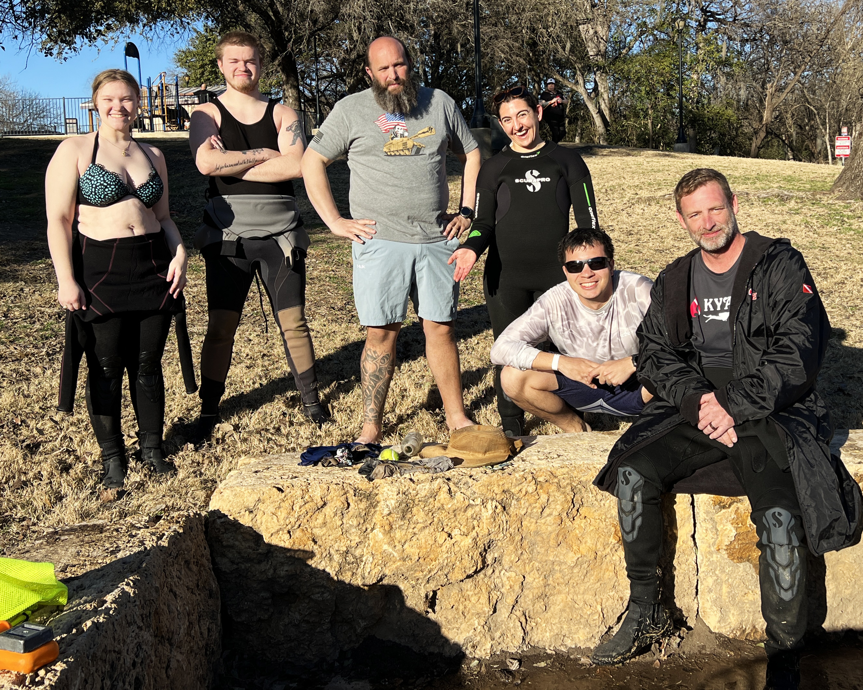
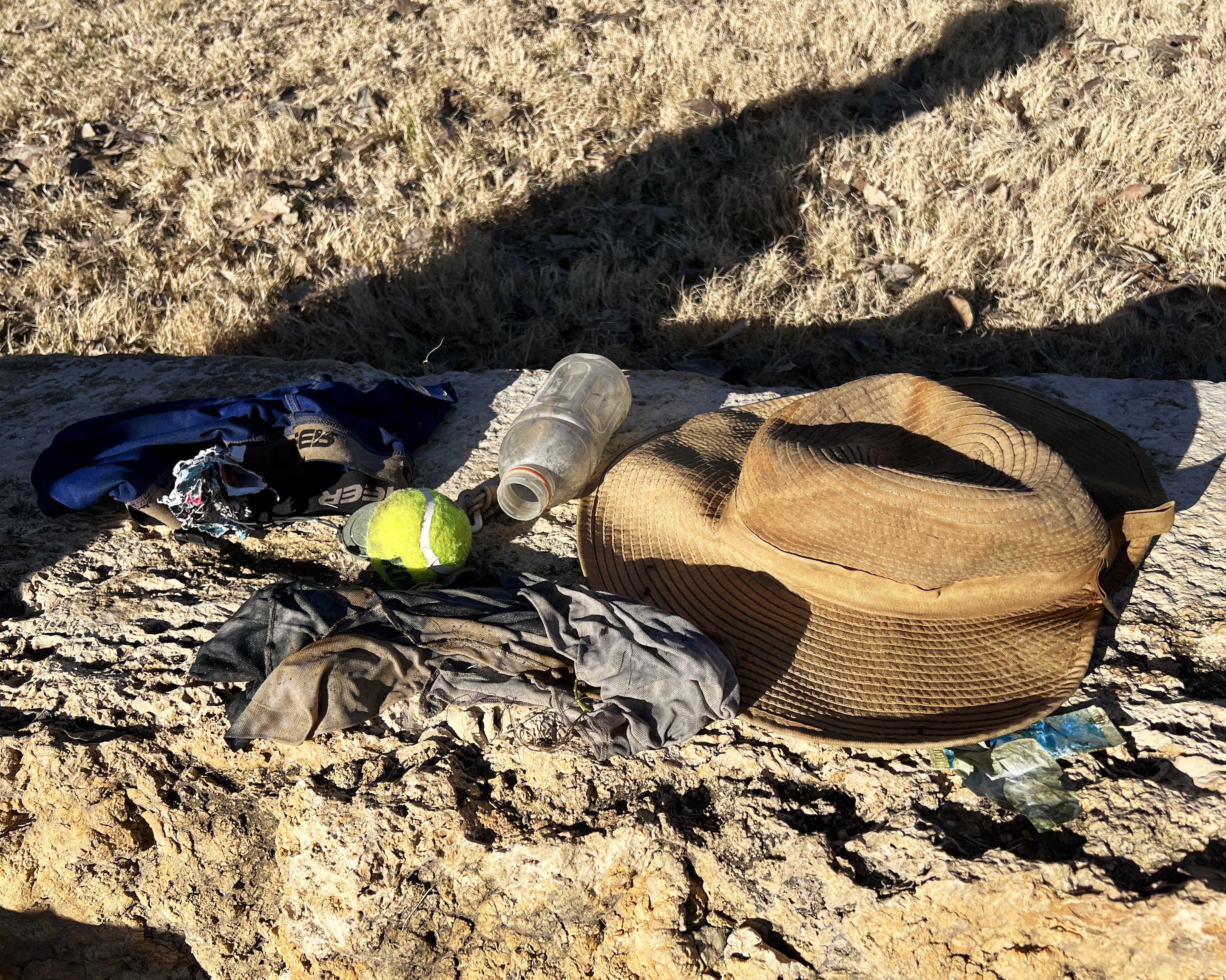
The port was close for four days, normally we expect to have trash in the area for the waves thatthe strong wind ocassioned.
Maple Leaf Scuba
Lore, MJ, Diana
2
1
1
3
11
21
2
10.80
48
7.50
3.00
2
measured
1
1861.00
1
5
On
kilograms
I have debris data to report
13
Calm (glassy to rippled) for waves 0 – 0.1 meter high
2
1
m2
meters
seagrass
7
6
7
3
1
1
58
Mexico
State\Province
Quintana Roo
City
Cozumel
Map Help


Dive Location

If you know your survey site coordinates, enter them manually in decimal degrees using WGS84 Map Datum. Use the minus sign for latitudes south of the equator and longitudes west of the Prime Meridian to 180 degrees.

If you do not know your survey site coordinates, click the “Map Location” tab to use the map to zoom into your survey site and drop the pin on the map to fall within your survey dive site in the water (not on land or the beach). Ensure you zoom in as much as possible to ensure data accuracy.

Entangled Help


Use the vertical tabs below to record any entangled animals you found of each type.

Mayday - Bocas Dive Center

83
20
7
sand
1
9

9.3350359600157, -82.241193707912

Bocas Dive Center
Leandro
14
19
6
24
3
10
143
14
1
120.00
45
10.00
5.00
estimated
7000.00
5
On
pounds
I have debris data to report
37
Calm (glassy to rippled) for waves 0 – 0.1 meter high
3
3
m2
2
meters
coral reef
2
2
9
18
2
Panama
State\Province
Bocas del Toro
City
Isla Colón
Map Help


Dive Location

If you know your survey site coordinates, enter them manually in decimal degrees using WGS84 Map Datum. Use the minus sign for latitudes south of the equator and longitudes west of the Prime Meridian to 180 degrees.

If you do not know your survey site coordinates, click the “Map Location” tab to use the map to zoom into your survey site and drop the pin on the map to fall within your survey dive site in the water (not on land or the beach). Ensure you zoom in as much as possible to ensure data accuracy.

Entangled Help


Use the vertical tabs below to record any entangled animals you found of each type.

Padang Bai - Blue Lagoon

19

-8.5144912530887, 115.51099506096

sand
9
Rainy
Cloudy
1
Fiberglass Fragment
AquMarine Diving - Bali
Hafid
5
0.40
41
22.00
5.00
1
measured
6
1100.00
On
kilograms
I have debris data to report
Calm (glassy to rippled) for waves 0 – 0.1 meter high m2
meters
coral reef
Indonesia
State\Province
Bali
City
Denpasar
Map Help


Dive Location

If you know your survey site coordinates, enter them manually in decimal degrees using WGS84 Map Datum. Use the minus sign for latitudes south of the equator and longitudes west of the Prime Meridian to 180 degrees.

If you do not know your survey site coordinates, click the “Map Location” tab to use the map to zoom into your survey site and drop the pin on the map to fall within your survey dive site in the water (not on land or the beach). Ensure you zoom in as much as possible to ensure data accuracy.

Entangled Help


Use the vertical tabs below to record any entangled animals you found of each type.

Bio rock Pemuteran

0
0
0
0

-8.131599, 114.65823

0
0
0
sand
0
0
1
0
0
Yes
There isn’t any
Little bit windy and a bit wave
Abyss Ocean World
Kadek
3
0
0
20
0
0
0
0
0
0
0
0
0
0
2
0
0
5
0
2
0
0
0
0
0
0
7
5
0
0
0
0
0
0
0
0
2.00
45
40.00
16.00
0
estimated
0
0
5455.90
0
0
0
0
0
To much plastic food
0
On
kilograms
0
I have debris data to report
0
0
0
Calm (glassy to rippled) for waves 0 – 0.1 meter high
0
0
0
0
0
0
0
m2
0
0
meters
coral reef
0
0
0
0
0
0
0
0
0
0
0
0
0
0
0
0
0
0
0
0
0
0
0
0
0
0
0
0
0
Indonesia
State\Province
Bali
City
Pemuteran
Map Help


Dive Location

If you know your survey site coordinates, enter them manually in decimal degrees using WGS84 Map Datum. Use the minus sign for latitudes south of the equator and longitudes west of the Prime Meridian to 180 degrees.

If you do not know your survey site coordinates, click the “Map Location” tab to use the map to zoom into your survey site and drop the pin on the map to fall within your survey dive site in the water (not on land or the beach). Ensure you zoom in as much as possible to ensure data accuracy.

Entangled Help


Use the vertical tabs below to record any entangled animals you found of each type.

Comal River / Hinman Island Park

29.708134, -98.123983

silt

29.708153812645, -98.12398191785

Hinman Island Park is a public park along the Comal River. During warmer months it is heavily used by tubers, swimmers and scuba divers. The park is open year round.
underwear
Lows in the 50s warming to mid 70s with periods of light rain
Texas Dive Center
Sean Cowher
1
1
6
1
1
2
1
6.00
37
10.00
4.00
measured
82590.00
Plastic water and soda bottles. High use area.
Beverage caps. High use area.
Clothing. High use area.
On
pounds
I have debris data to report
Calm (glassy to rippled) for waves 0 – 0.1 meter high
3
ft2
1
feet
seagrass
2
United States
State\Province
TX
City
New Braunfels
Map Help


Dive Location

If you know your survey site coordinates, enter them manually in decimal degrees using WGS84 Map Datum. Use the minus sign for latitudes south of the equator and longitudes west of the Prime Meridian to 180 degrees.

If you do not know your survey site coordinates, click the “Map Location” tab to use the map to zoom into your survey site and drop the pin on the map to fall within your survey dive site in the water (not on land or the beach). Ensure you zoom in as much as possible to ensure data accuracy.

Entangled Help


Use the vertical tabs below to record any entangled animals you found of each type.

Crystal Bay

17
2

-8.715681, 115.457371

coral
1
1
Plastic Roof
Rainy
1
1
Cap / clothing item
Plastic roof
Indo ocean project
Arya
1
4
1
1
7
1
4
21
4.32
50
11.60
5.00
measured
700.00
Diapers
Plastic fragments
bags trash plastic
On
kilograms
I have debris data to report
2
Slight for waves 0.5 -1.25 meter high
1
2
m2
meters
coral reef
Indonesia
State\Province
Bali
City
Nusa Penida
Map Help


Dive Location

If you know your survey site coordinates, enter them manually in decimal degrees using WGS84 Map Datum. Use the minus sign for latitudes south of the equator and longitudes west of the Prime Meridian to 180 degrees.

If you do not know your survey site coordinates, click the “Map Location” tab to use the map to zoom into your survey site and drop the pin on the map to fall within your survey dive site in the water (not on land or the beach). Ensure you zoom in as much as possible to ensure data accuracy.

Entangled Help


Use the vertical tabs below to record any entangled animals you found of each type.

Bio rock

0
0
0
0

-8.131599, 114.65823

0
0
0
sand
0
0
0
5
0
Yes
Yes
A bit big wave and little rain
Abyss Ocean World
Kadek
1
0
0
0
0
0
0
0
0
0
2
0
0
0
0
0
0
13
0
2
0
0
0
0
0
0
0
1
0
0
0
0
0
0
0
0
2.00
35
14.00
5.00
0
estimated
0
0
4169.95
0
0
0
0
0
To much plastic
0
On
kilograms
0
I have debris data to report
0
0
0
Calm (glassy to rippled) for waves 0 – 0.1 meter high
0
0
0
0
0
0
0
m2
0
0
meters
seagrass
0
0
0
0
0
0
0
0
0
0
0
0
0
0
0
0
0
0
0
0
0
0
0
0
0
0
0
0
0
Indonesia
State\Province
Bali
City
Pemuteran
Map Help


Dive Location

If you know your survey site coordinates, enter them manually in decimal degrees using WGS84 Map Datum. Use the minus sign for latitudes south of the equator and longitudes west of the Prime Meridian to 180 degrees.

If you do not know your survey site coordinates, click the “Map Location” tab to use the map to zoom into your survey site and drop the pin on the map to fall within your survey dive site in the water (not on land or the beach). Ensure you zoom in as much as possible to ensure data accuracy.

Entangled Help


Use the vertical tabs below to record any entangled animals you found of each type.

Mangrove Bay

14
6
7
2

25.868065, 34.416601

0
0
0
rock
0
1
0
18
0
No
Even though Mangrove Bay is a popular dive site, no one cleans it. There is a lot of fishing line that needs to be removed from the reef.
Shower hose
Windy and sunny
1
1
1
1
Rubber mat
Fan belt
Shower hose
Broom fragment
Open Ocean Project
Emma Wilkinson
3
1
0
4
0
0
0
0
1
0
0
0
0
1
0
0
0
1
12
5
2
0
0
0
2
0
31
0
0
46
3
0
0
0
0
1
52.10
63
14.10
5.50
15
measured
0
0
0
7
40.00
0
0
0
1
0
Water bottles 2 litre +
Water bottles 1 litre
Fishing line
0
On
kilograms
0
I have debris data to report
3
0
0
Calm (glassy to rippled) for waves 0 – 0.1 meter high
0
0
1
0
3
0
0
m2
0
1
meters
coral reef
1
0
0
0
0
2
0
0
0
1
0
0
0
0
0
0
6
0
0
0
0
0
0
0
0
0
1
1
0
Egypt
State\Province
Red Sea
City
El Quesir
Map Help


Dive Location

If you know your survey site coordinates, enter them manually in decimal degrees using WGS84 Map Datum. Use the minus sign for latitudes south of the equator and longitudes west of the Prime Meridian to 180 degrees.

If you do not know your survey site coordinates, click the “Map Location” tab to use the map to zoom into your survey site and drop the pin on the map to fall within your survey dive site in the water (not on land or the beach). Ensure you zoom in as much as possible to ensure data accuracy.

Entangled Help


Use the vertical tabs below to record any entangled animals you found of each type.

Sweet Dreams

coral
1

12.033953303502, -68.261195273029

Windy. Some rain
1
Scuba mouthpiece
VIP Diving
Martijn Klijnstra
1
2
0.50
73
17.00
5.00
estimated
2000.00
On
kilograms
I have debris data to report
Smooth (wavelets) for waves 0.1 - 0.5 meter high m2
meters
coral reef
1
Netherlands Antilles
State\Province
Bonaire
City
Kralendijk
Map Help


Dive Location

If you know your survey site coordinates, enter them manually in decimal degrees using WGS84 Map Datum. Use the minus sign for latitudes south of the equator and longitudes west of the Prime Meridian to 180 degrees.

If you do not know your survey site coordinates, click the “Map Location” tab to use the map to zoom into your survey site and drop the pin on the map to fall within your survey dive site in the water (not on land or the beach). Ensure you zoom in as much as possible to ensure data accuracy.

Entangled Help


Use the vertical tabs below to record any entangled animals you found of each type.

Lighthouse / Bannerfish Bay

4
126
5
0

28.498747, 34.51991

0
0
0
sand
0
2
0
7
0
Public holidays
Tampon
Windy. Dry.
1
1
1
0
8
Fibreglass
Face mask
False nail
Tampo
Chewing gum
Red Sea Tribe
Rachel Shelley
0
0
0
52
273
0
0
0
0
2
2
0
0
0
0
0
1
3
57
4
0
0
0
0
0
3
7
0
0
0
0
0
0
0
0
0
5.00
31
29.00
1.00
0
estimated
0
0
0
0
2327.00
0
0
3
0
0
Cigarette butts
Plastic pieces
Clothing fragments
2
On
kilograms
0
I have debris data to report
1
0
0
Smooth (wavelets) for waves 0.1 - 0.5 meter high
8
1
0
0
0
0
0
m2
0
0
meters
coral reef
1
0
0
0
0
11
0
0
0
158
0
0
0
27
0
0
5
0
0
0
0
0
6
0
0
0
0
0
0
Egypt
State\Province
South Sinai
City
Dahab
Map Help


Dive Location

If you know your survey site coordinates, enter them manually in decimal degrees using WGS84 Map Datum. Use the minus sign for latitudes south of the equator and longitudes west of the Prime Meridian to 180 degrees.

If you do not know your survey site coordinates, click the “Map Location” tab to use the map to zoom into your survey site and drop the pin on the map to fall within your survey dive site in the water (not on land or the beach). Ensure you zoom in as much as possible to ensure data accuracy.

Entangled Help


Use the vertical tabs below to record any entangled animals you found of each type.

Subscribe to