
Dive Against Debris Data Submission
Chesil Beach
12 July, 2020
- Team Leader
- Steve Cook
- Number of Participants
- 4
- Total Debris Collected
- 2 kgs (estimated)
50.556081744013, -2.454543199817
Survey Information
- Location Name
- Chesil Beach
- Organization/Dive Centre
- Andark diving and Watersports
- City
- Portland
- Country
- United Kingdom
- Date
- 12 July, 2020
- Survey Duration
- 42 Minutes
- GPS Coordinates
- Latitude: 50.556081744013
Longitude: -2.454543199817
- Weather Conditions
-
Flat calm
- Survey Depth Range
- 3–10 meters
- Area Surveyed
- 100 m2
- Dominant Substrate
- rock
- Ecosystem
- rocky reef
- Wave Conditions
- Calm (glassy to rippled) for waves 0 – 0.1 meter high
Survey Photos
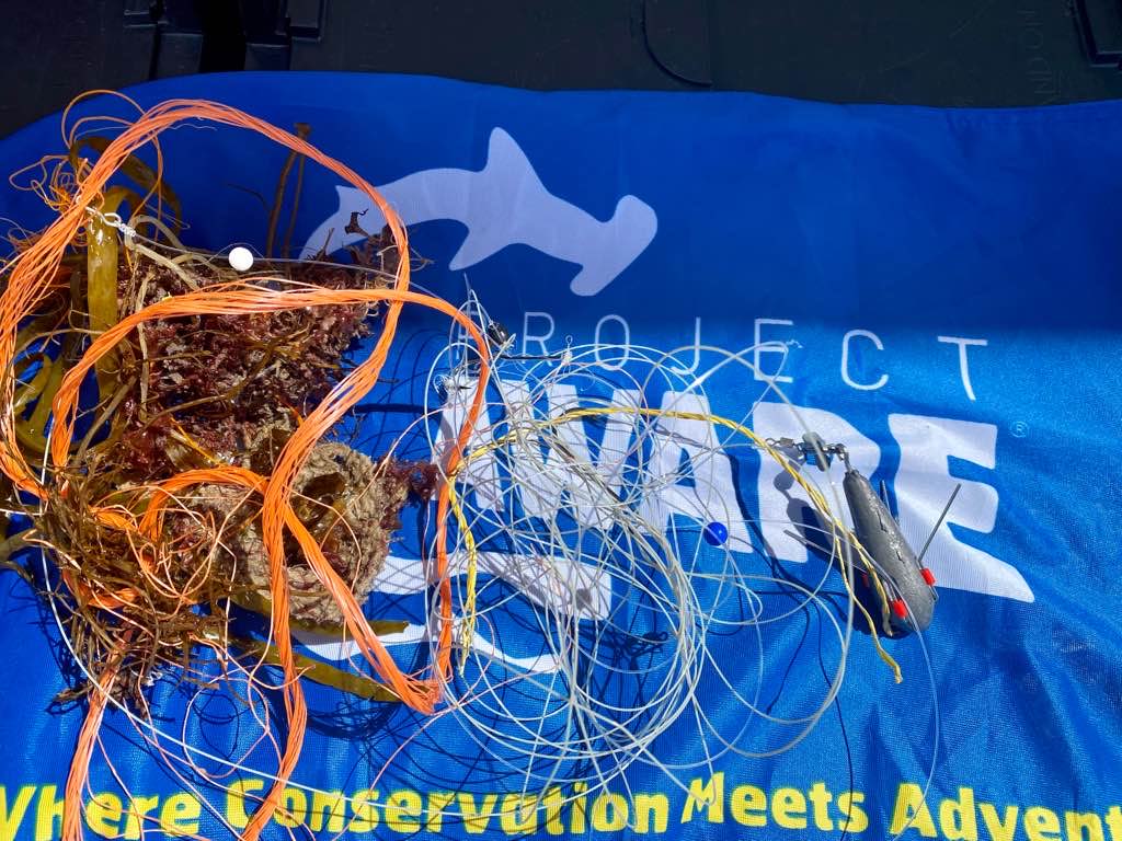
Debris Items Collected
| metal materials collected | |
|---|---|
| Fishing: Sinkers, Lures, Hooks | 6 |
Additional Information
No
Very large fishing hooks and weight/lure
Fishing hooks
Weight
Lure
Comments and Feedback
Spoke to locals? Possible shark fishing hooks
Difficult entry and exit to dive site


