
Dive Against Debris Data Submission
HMS Maori
1 March, 2020
- Team Leader
- Faisal Al Jumaie
- Number of Participants
- 3
- Total Debris Collected
- 1.5 kgs (estimated)
35.90246165094, 14.515469302393
Survey Information
- Location Name
- HMS Maori
- Organization/Dive Centre
- DiveWise
- City
- Valletta
- Country
- Malta
- Date
- 1 March, 2020
- Survey Duration
- 30 Minutes
- GPS Coordinates
- Latitude: 35.90246165094
Longitude: 14.515469302393
- Weather Conditions
- Survey Depth Range
- 1–20 meters
- Area Surveyed
- 4873.01 m2
- Dominant Substrate
- sand
- Ecosystem
- rocky reef
- Wave Conditions
- Smooth (wavelets) for waves 0.1 - 0.5 meter high
Survey Photos
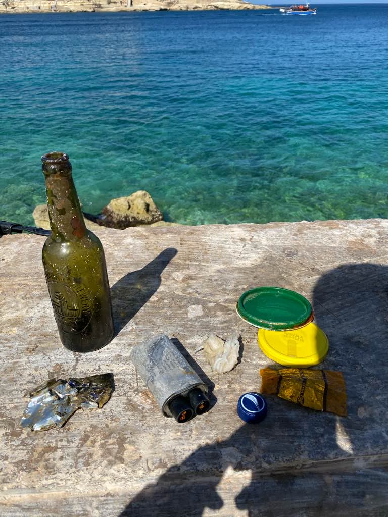
Debris Items Collected
| plastic materials collected | |
|---|---|
| Bags-grocery/retail (plastic) | 1 |
| Caps & Lids (plastic) | 1 |
| Diapers/nappies | 1 |
| glass materials collected | |
|---|---|
| Beverage Bottles (glass) | 1 |
| metal materials collected | |
|---|---|
| Cans: Food/juice, Other (tin) | 1 |
| Caps & Lids (metal) | 2 |


