
Dive Against Debris Data Submission
Neptune’s Finger
30 May, 2020
- Team Leader
- Jay Clue
- Number of Participants
- 5
- Total Debris Collected
- 1 kgs (estimated)
22.877562999984, -109.8948465
Survey Information
- Location Name
- Neptune’s Finger
- Organization/Dive Centre
- Saving Los Cabos & Dive Ninja Expeditions
- City
- Cabo San Lucas
- Country
- Mexico
- Date
- 30 May, 2020
- Survey Duration
- 35 Minutes
- GPS Coordinates
- Latitude: 22.877562999984
Longitude: -109.8948465
- Weather Conditions
-
Sunny with strong gusts
- Survey Depth Range
- 5–20 meters
- Area Surveyed
- 855 m2
- Dominant Substrate
- rock
- Ecosystem
- rocky reef
- Wave Conditions
- Smooth (wavelets) for waves 0.1 - 0.5 meter high
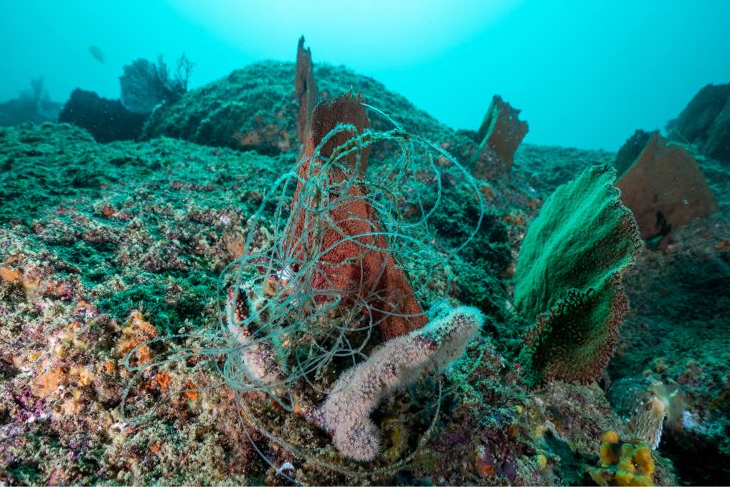
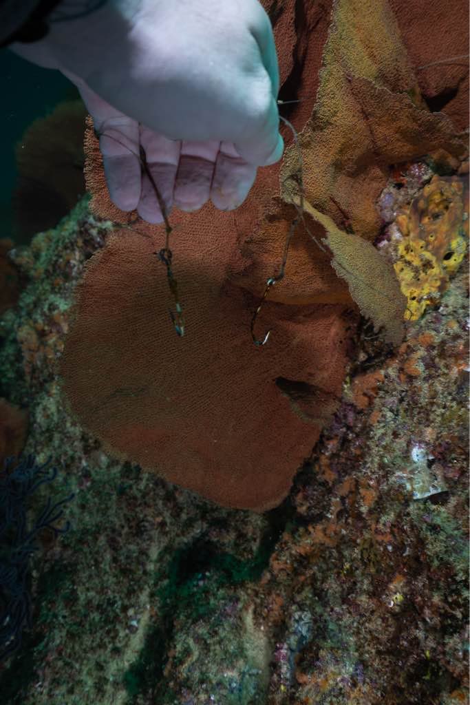
Survey Photos
Debris Items Collected
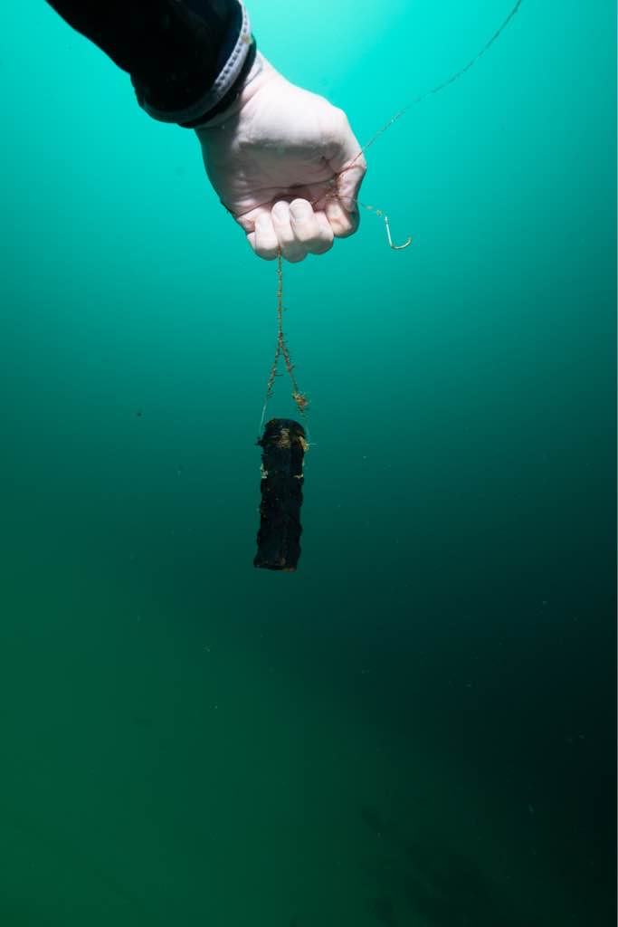
| plastic materials collected | |
|---|---|
| Fishing: Line | 12 |
| metal materials collected | |
|---|---|
| Pipes & Rebar | 1 |
| Fishing: Sinkers, Lures, Hooks | 12 |
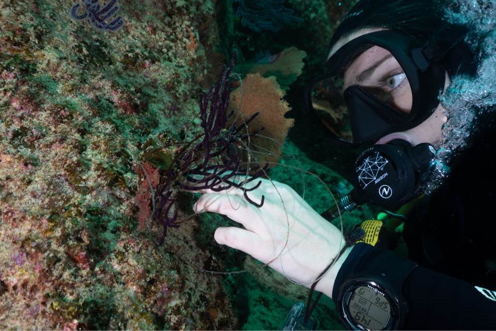
| Entangled Animals | |
|---|---|
| Other Animals | |
| Species or Common Name | Starfish |
| Number Entangled | 1 |
| Status | released unharmed |
| Type of Debris | Fishing Line |
| Comments | Starfish was completely wrapped in fishing line and needed to be unwrapped and cut free. |
Additional Information
The COVID 19 quarantine has left the dive sites unprotected from illegal fishing within the MPA
Rebar
Fishing line
Fishing Hooks
Fishing Weights
Comments and Feedback
Is it possible to add satellite maps to the dive against debris app?


