Menu

El Ñuro

18
4

-4.216743, -81.181664

sand
2
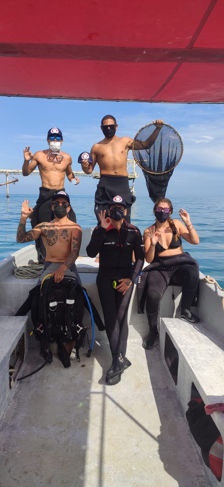
Chelonia Dive Center
Adriana Zavala
7
7.00
35
7.00
4.00
estimated
300.00
On
kilograms
I have debris data to report
Calm (glassy to rippled) for waves 0 – 0.1 meter high m2
meters
rocky reef
Peru
State\Province
Talara
City
Los Organos
Map Help


Dive Location

If you know your survey site coordinates, enter them manually in decimal degrees using WGS84 Map Datum. Use the minus sign for latitudes south of the equator and longitudes west of the Prime Meridian to 180 degrees.

If you do not know your survey site coordinates, click the “Map Location” tab to use the map to zoom into your survey site and drop the pin on the map to fall within your survey dive site in the water (not on land or the beach). Ensure you zoom in as much as possible to ensure data accuracy.

Entangled Help


Use the vertical tabs below to record any entangled animals you found of each type.

Cabo Blanco

5

-4.229243, -81.222664

rock
Chelonia Dive Center
Diego García
5
5.00
25
21.00
16.00
estimated
100.00
Fishing nets
On
kilograms
I have debris data to report
Smooth (wavelets) for waves 0.1 - 0.5 meter high m2
meters
rocky reef
Peru
State\Province
Talara
City
El Alto
Map Help


Dive Location

If you know your survey site coordinates, enter them manually in decimal degrees using WGS84 Map Datum. Use the minus sign for latitudes south of the equator and longitudes west of the Prime Meridian to 180 degrees.

If you do not know your survey site coordinates, click the “Map Location” tab to use the map to zoom into your survey site and drop the pin on the map to fall within your survey dive site in the water (not on land or the beach). Ensure you zoom in as much as possible to ensure data accuracy.
Entangled Help


Use the vertical tabs below to record any entangled animals you found of each type.

Cabo Blanco

14

-4.223795, -81.212363

coral

-4.1757624, -81.1274263

Chelonia Dive Center
Diego García
5
1
1
10.00
45
9.00
5.00
estimated
1
200.00
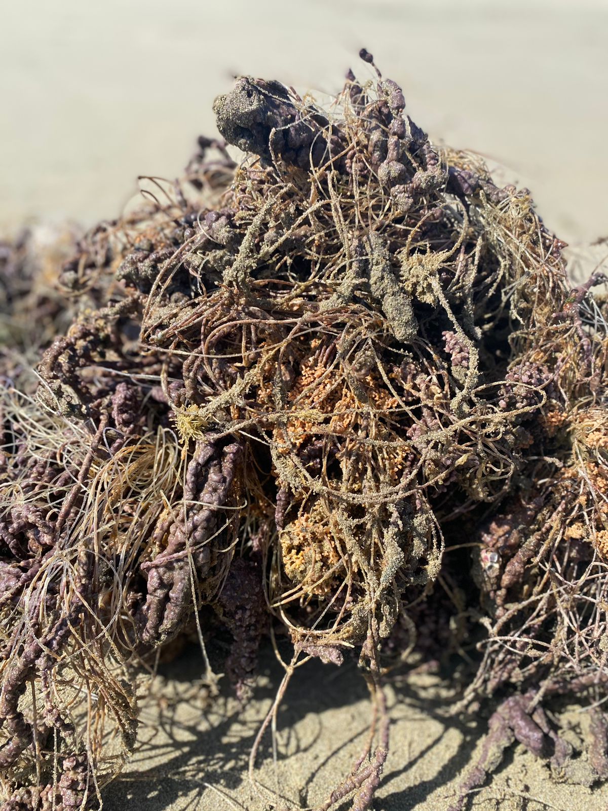
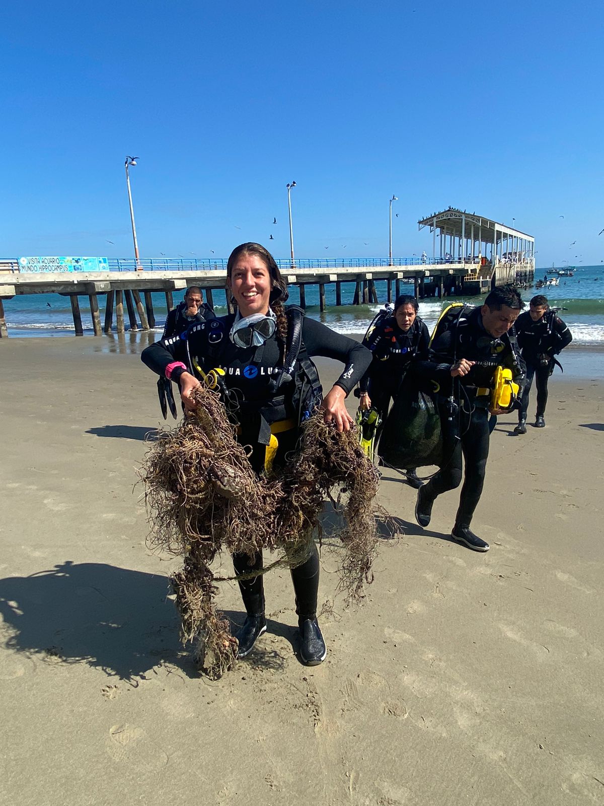
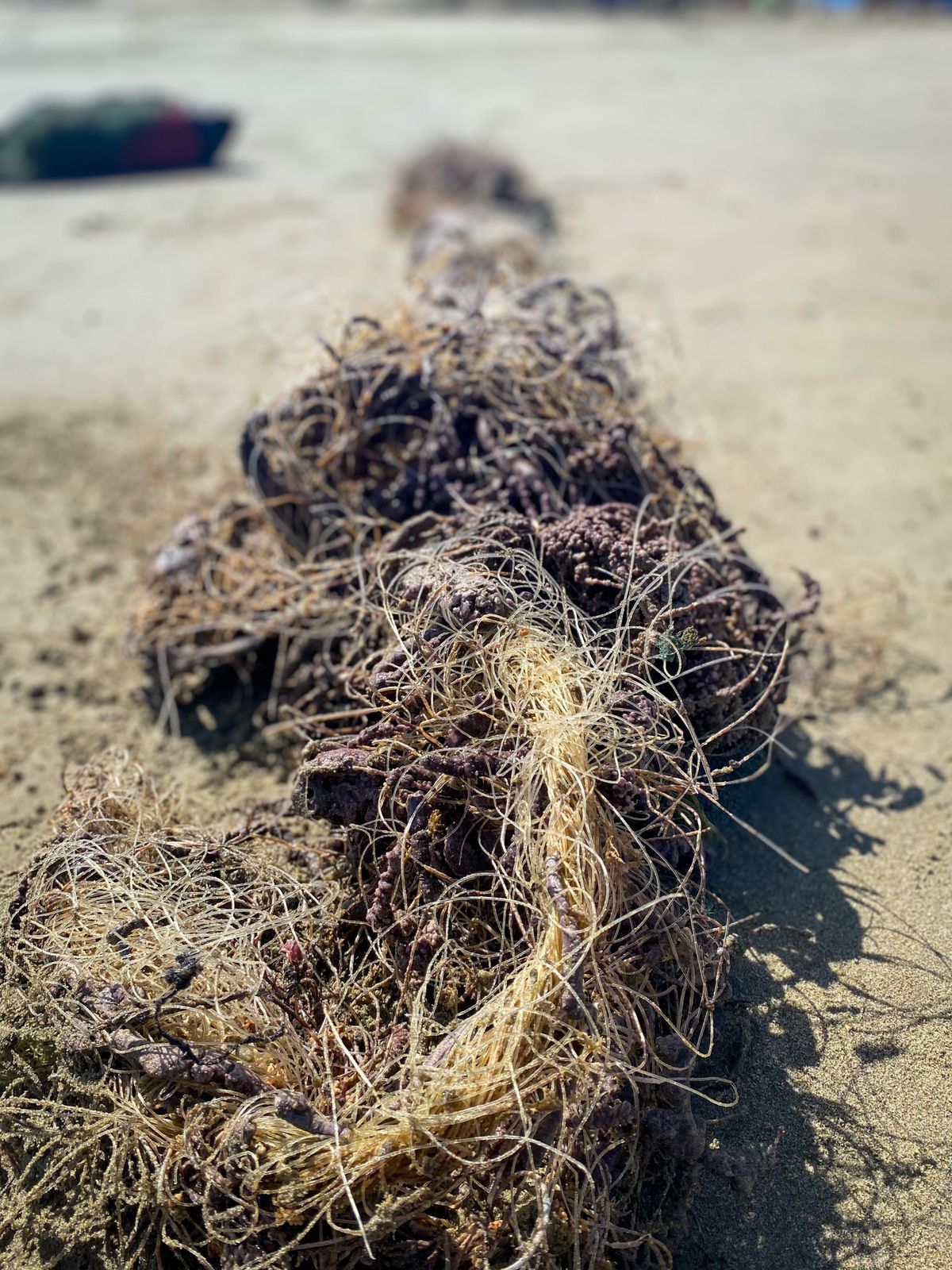
Taking the fishing gear out withouth harming marine life like corals.
On
kilograms
I have debris data to report
Smooth (wavelets) for waves 0.1 - 0.5 meter high
Fishing net
Crab
Released Unharmed
1
m2
meters
rocky reef
Peru
State\Province
Talara
City
El Alto
Map Help


Dive Location

If you know your survey site coordinates, enter them manually in decimal degrees using WGS84 Map Datum. Use the minus sign for latitudes south of the equator and longitudes west of the Prime Meridian to 180 degrees.

If you do not know your survey site coordinates, click the “Map Location” tab to use the map to zoom into your survey site and drop the pin on the map to fall within your survey dive site in the water (not on land or the beach). Ensure you zoom in as much as possible to ensure data accuracy.

Entangled Help


Use the vertical tabs below to record any entangled animals you found of each type.

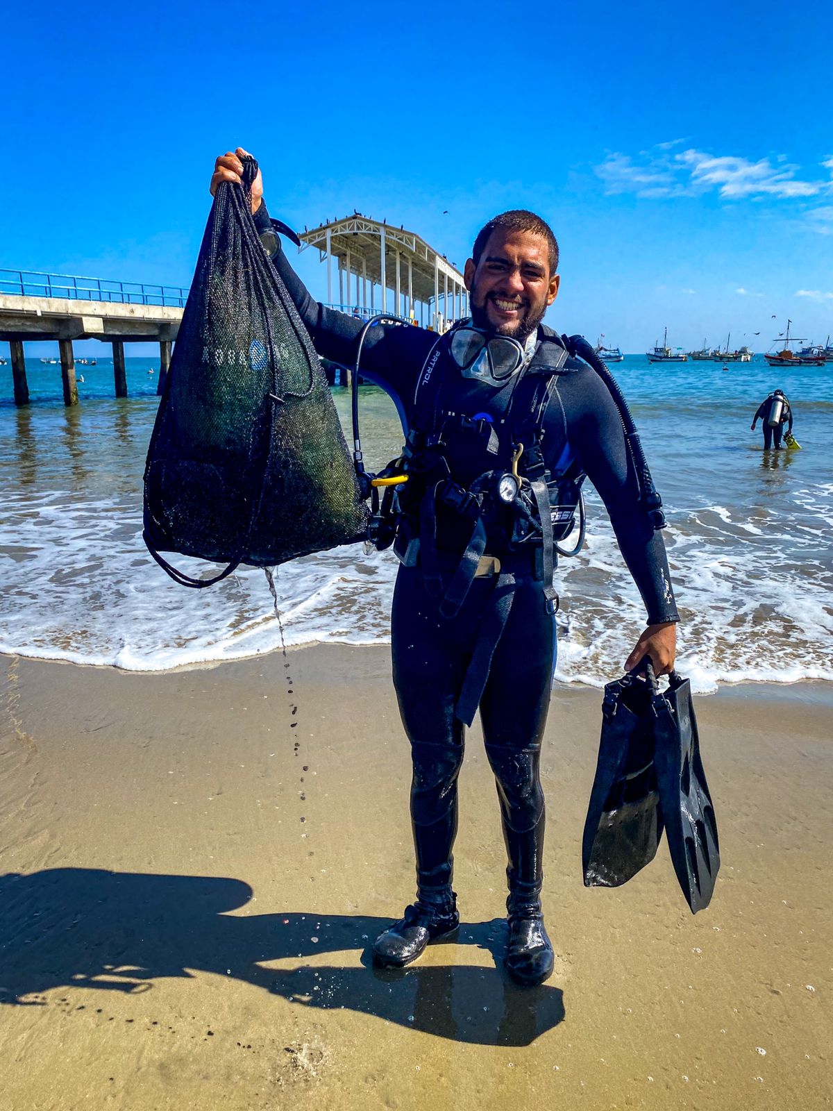
Muelle de Los Órganos

3

-4.177861, -81.134063

sand
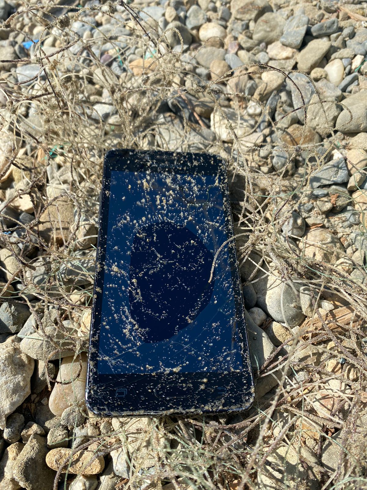
Cellphone
Chelonia Dive Center
Adriana Zavala
1
7
1
11.00
40
8.00
2.00
estimated
300.00
Fishing gear
On
kilograms
I have debris data to report
Smooth (wavelets) for waves 0.1 - 0.5 meter high m2
meters
rocky reef
1
Peru
State\Province
Talara
City
Los Organos
Map Help


Dive Location

If you know your survey site coordinates, enter them manually in decimal degrees using WGS84 Map Datum. Use the minus sign for latitudes south of the equator and longitudes west of the Prime Meridian to 180 degrees.

If you do not know your survey site coordinates, click the “Map Location” tab to use the map to zoom into your survey site and drop the pin on the map to fall within your survey dive site in the water (not on land or the beach). Ensure you zoom in as much as possible to ensure data accuracy.
Entangled Help


Use the vertical tabs below to record any entangled animals you found of each type.

North Wall

32.86215, -117.261966

sand
John Evans
3
10.00
60
120.00
30.00
estimated
1500.00
On
pounds
I have debris data to report
Smooth (wavelets) for waves 0.1 - 0.5 meter high ft2
feet
other
United States
Map Help


Dive Location

If you know your survey site coordinates, enter them manually in decimal degrees using WGS84 Map Datum. Use the minus sign for latitudes south of the equator and longitudes west of the Prime Meridian to 180 degrees.

If you do not know your survey site coordinates, click the “Map Location” tab to use the map to zoom into your survey site and drop the pin on the map to fall within your survey dive site in the water (not on land or the beach). Ensure you zoom in as much as possible to ensure data accuracy.
Entangled Help


Use the vertical tabs below to record any entangled animals you found of each type.

Ecosystem Other
Sand

La Jolla Cove

32.852004, -117.272904

sand
John Evans
5
5.00
85
40.00
5.00
estimated
5600.00
On
pounds
I have debris data to report
Slight for waves 0.5 -1.25 meter high ft2
feet
kelp
United States
Map Help


Dive Location

If you know your survey site coordinates, enter them manually in decimal degrees using WGS84 Map Datum. Use the minus sign for latitudes south of the equator and longitudes west of the Prime Meridian to 180 degrees.

If you do not know your survey site coordinates, click the “Map Location” tab to use the map to zoom into your survey site and drop the pin on the map to fall within your survey dive site in the water (not on land or the beach). Ensure you zoom in as much as possible to ensure data accuracy.
Entangled Help


Use the vertical tabs below to record any entangled animals you found of each type.

Marine Room

32.854867, -117.264578

sand
John Evans
5
15.00
80
50.00
10.00
estimated
6500.00
On
pounds
I have debris data to report
Slight for waves 0.5 -1.25 meter high ft2
feet
seagrass
United States
Map Help


Dive Location

If you know your survey site coordinates, enter them manually in decimal degrees using WGS84 Map Datum. Use the minus sign for latitudes south of the equator and longitudes west of the Prime Meridian to 180 degrees.

If you do not know your survey site coordinates, click the “Map Location” tab to use the map to zoom into your survey site and drop the pin on the map to fall within your survey dive site in the water (not on land or the beach). Ensure you zoom in as much as possible to ensure data accuracy.
Entangled Help


Use the vertical tabs below to record any entangled animals you found of each type.

North wall

1
1

32.861118, -117.26485

sand
John Evans
2
5
1
3
1
1
10.00
61
80.00
10.00
estimated
9600.00
On
pounds
I have debris data to report
Slight for waves 0.5 -1.25 meter high ft2
feet
other
1
United States
Map Help


Dive Location

If you know your survey site coordinates, enter them manually in decimal degrees using WGS84 Map Datum. Use the minus sign for latitudes south of the equator and longitudes west of the Prime Meridian to 180 degrees.

If you do not know your survey site coordinates, click the “Map Location” tab to use the map to zoom into your survey site and drop the pin on the map to fall within your survey dive site in the water (not on land or the beach). Ensure you zoom in as much as possible to ensure data accuracy.
Entangled Help


Use the vertical tabs below to record any entangled animals you found of each type.

Ecosystem Other
Sand/mud

Marine room

32.853919, -117.264841

sand
John Evans
1
5
4
5
1
30.00
80
70.00
10.00
estimated
7000.00
On
pounds
I have debris data to report
Calm (glassy to rippled) for waves 0 – 0.1 meter high ft2
feet
seagrass
6
1
1
5
2
United States
Map Help


Dive Location

If you know your survey site coordinates, enter them manually in decimal degrees using WGS84 Map Datum. Use the minus sign for latitudes south of the equator and longitudes west of the Prime Meridian to 180 degrees.

If you do not know your survey site coordinates, click the “Map Location” tab to use the map to zoom into your survey site and drop the pin on the map to fall within your survey dive site in the water (not on land or the beach). Ensure you zoom in as much as possible to ensure data accuracy.

Entangled Help


Use the vertical tabs below to record any entangled animals you found of each type.

Scripps Canyon

32.871802, -117.26182

rock
1
1
1
John Evans
5
1
3
4
1
1
2
10.00
75
120.00
10.00
estimated
6500.00
2
On
pounds
I have debris data to report
1
Smooth (wavelets) for waves 0.1 - 0.5 meter high ft2
feet
rocky reef
1
United States
Map Help


Dive Location

If you know your survey site coordinates, enter them manually in decimal degrees using WGS84 Map Datum. Use the minus sign for latitudes south of the equator and longitudes west of the Prime Meridian to 180 degrees.

If you do not know your survey site coordinates, click the “Map Location” tab to use the map to zoom into your survey site and drop the pin on the map to fall within your survey dive site in the water (not on land or the beach). Ensure you zoom in as much as possible to ensure data accuracy.

Entangled Help


Use the vertical tabs below to record any entangled animals you found of each type.

Subscribe to