Menu

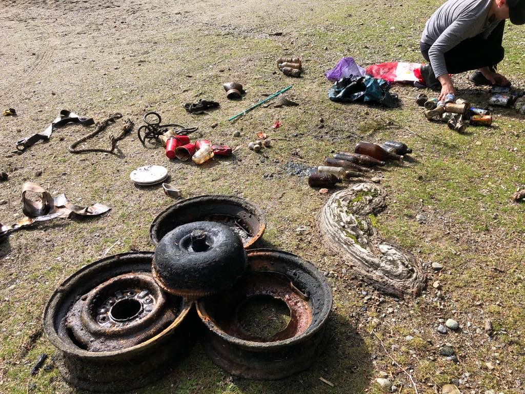
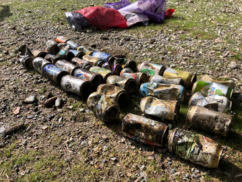
Cultus Lake

0
0
0

49.063325800969, -121.96714360155

0
0
0
silt
0
0
0
0
0
No
No
No
Knee brace
Mixed
1
1
4
0
0
0
0
0
0
0
0
0
0
0
0
0
0
0
0
0
Knee brace
Sunglasses
Boat paddles
Divers for Cleaner Lakes and Oceans
Henry Wang
0
0
0
7
0
0
0
0
1
0
0
0
0
0
0
0
0
0
0
2
0
0
0
0
1
0
0
0
0
0
0
0
0
0
152.30
40
44.00
3.00
0
measured
0
0
5761.99
0
0
0
0
0
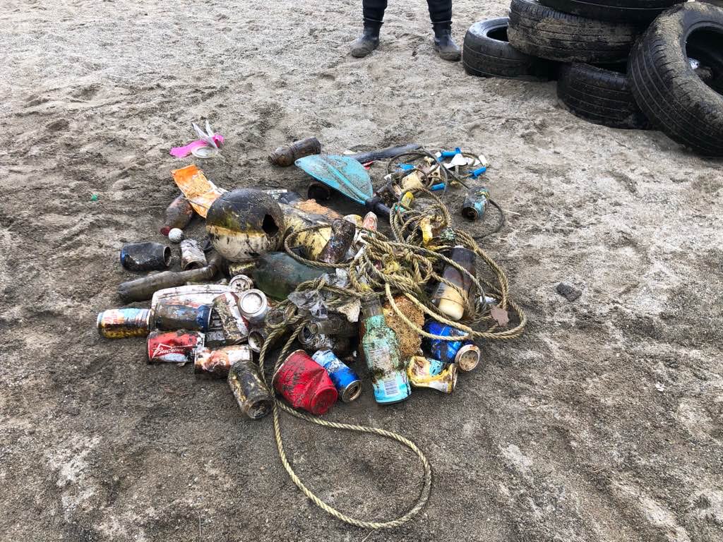
Beer cans
0
On
pounds
0
I have debris data to report
8
0
0
Calm (glassy to rippled) for waves 0 – 0.1 meter high
0
0
2
0
0
0
0
m2
4
0
feet
other
4
0
0
0
0
0
4
0
0
1
0
0
0
0
0
0
37
0
0
3
0
0
0
0
0
0
0
0
Canada
State\Province
British Columbia
City
Chilliwack
Map Help


Dive Location

If you know your survey site coordinates, enter them manually in decimal degrees using WGS84 Map Datum. Use the minus sign for latitudes south of the equator and longitudes west of the Prime Meridian to 180 degrees.

If you do not know your survey site coordinates, click the “Map Location” tab to use the map to zoom into your survey site and drop the pin on the map to fall within your survey dive site in the water (not on land or the beach). Ensure you zoom in as much as possible to ensure data accuracy.

Entangled Help


Use the vertical tabs below to record any entangled animals you found of each type.

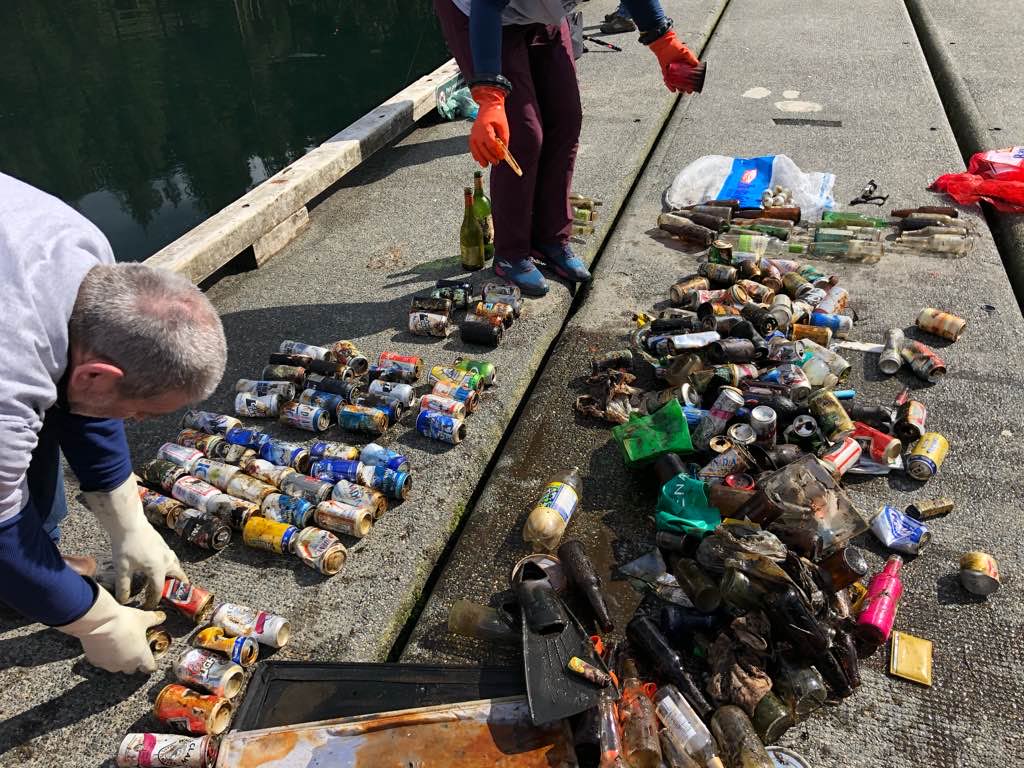
Sasamat Lake

19
9
0

49.316523092643, -122.88783156799

4
0
0
silt
0
3
14
3
0
No
Rain
1
5
0
0
0
0
0
0
0
0
0
0
0
0
0
0
0
0
0
0
Wallet
Sunglasses
Divers for Cleaner Lakes and Oceans
Henry Wang
0
0
0
7
0
0
0
0
4
0
0
0
0
0
0
0
0
6
0
3
0
0
1
0
0
0
0
0
0
0
11
0
0
0
97.80
32
47.00
47.00
0
measured
0
0
8645.72
0
0
0
0
0
Beer can
Beer bottle
0
On
pounds
0
I have debris data to report
58
0
0
Calm (glassy to rippled) for waves 0 – 0.1 meter high
0
0
0
0
4
0
0
ft2
0
0
feet
other
13
0
0
0
0
0
0
0
0
9
0
0
0
0
0
0
134
0
0
0
0
9
0
0
0
0
0
0
Canada
State\Province
British Columbia
City
Port Moody
Map Help


Dive Location

If you know your survey site coordinates, enter them manually in decimal degrees using WGS84 Map Datum. Use the minus sign for latitudes south of the equator and longitudes west of the Prime Meridian to 180 degrees.

If you do not know your survey site coordinates, click the “Map Location” tab to use the map to zoom into your survey site and drop the pin on the map to fall within your survey dive site in the water (not on land or the beach). Ensure you zoom in as much as possible to ensure data accuracy.
Entangled Help


Use the vertical tabs below to record any entangled animals you found of each type.

Albert Dyck

0
11
0

49.025722700675, -122.34484077088

0
0
0
other
0
0
0
0
0
No
Wakeboard ramp
Mixed
2
0
0
0
0
0
0
0
0
0
0
0
0
0
0
0
0
0
0
0
Paddle
Divers for Cleaner Lakes and Oceans
Henry Wang
0
0
0
5
0
0
0
0
0
0
0
0
0
0
0
0
0
1
1
4
8
0
0
0
0
0
3
1
0
0
5
0
0
0
535.50
32
47.00
3.00
3
measured
0
0
20328.00
0
16
0
0
0
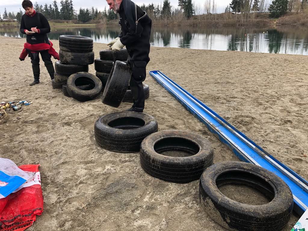
Tires
0
On
pounds
0
I have debris data to report
5
0
0
Calm (glassy to rippled) for waves 0 – 0.1 meter high
0
0
0
0
0
0
0
ft2
0
0
feet
other
0
0
0
0
0
0
0
0
0
0
0
0
0
0
0
0
36
0
0
0
0
0
0
0
0
0
0
0
Canada
State\Province
British Columbia
City
Abbotsford
Map Help


Dive Location

If you know your survey site coordinates, enter them manually in decimal degrees using WGS84 Map Datum. Use the minus sign for latitudes south of the equator and longitudes west of the Prime Meridian to 180 degrees.

If you do not know your survey site coordinates, click the “Map Location” tab to use the map to zoom into your survey site and drop the pin on the map to fall within your survey dive site in the water (not on land or the beach). Ensure you zoom in as much as possible to ensure data accuracy.
Entangled Help


Use the vertical tabs below to record any entangled animals you found of each type.

May Day

66

9.335086, -82.241135

sand
7
7

9.3351194073558, -82.241312076658

doll
Sunny
Bocas Dive Center
Marta
2
18
6
19
60
5
30.00
50
13.00
3.00
estimated
3000.00
plastic items
aluminum cans
On
kilograms
I have debris data to report
23
Calm (glassy to rippled) for waves 0 – 0.1 meter high
2
m2
meters
coral reef
4
11
69
Panama
State\Province
Bocas del toro
City
Isla Colon
Map Help


Dive Location

If you know your survey site coordinates, enter them manually in decimal degrees using WGS84 Map Datum. Use the minus sign for latitudes south of the equator and longitudes west of the Prime Meridian to 180 degrees.

If you do not know your survey site coordinates, click the “Map Location” tab to use the map to zoom into your survey site and drop the pin on the map to fall within your survey dive site in the water (not on land or the beach). Ensure you zoom in as much as possible to ensure data accuracy.
Entangled Help


Use the vertical tabs below to record any entangled animals you found of each type.

ADS314 - Shark Island

0
0
0
0

25.353533, 56.376133

0
0
0
coral
0
0
0
0
0
N/A
Hassan NK Khayal
0
0
0
0
0
0
0
0
0
0
0
0
0
0
0
0
0
0
0
2
0
0
0
0
0
0
0
0
0
0
0
0
0
0
0
0
0.00
60
8.00
3.00
0
estimated
0
0
0
0
50.00
0
0
0
0
0
0
On
kilograms
0
Our Survey Site was free of debris
0
0
0
Calm (glassy to rippled) for waves 0 – 0.1 meter high
0
0
0
0
0
0
0
m2
0
0
meters
coral reef
0
0
0
0
0
0
0
0
0
0
0
0
0
0
0
0
0
0
0
0
0
0
0
0
0
0
0
0
0
United Arab Emirates
Map Help


Dive Location

If you know your survey site coordinates, enter them manually in decimal degrees using WGS84 Map Datum. Use the minus sign for latitudes south of the equator and longitudes west of the Prime Meridian to 180 degrees.

If you do not know your survey site coordinates, click the “Map Location” tab to use the map to zoom into your survey site and drop the pin on the map to fall within your survey dive site in the water (not on land or the beach). Ensure you zoom in as much as possible to ensure data accuracy.
Entangled Help


Use the vertical tabs below to record any entangled animals you found of each type.

ADS268 - Dibba Rock

0
0
0
0

25.6025977, 56.351134

0
0
0
coral
0
0
0
0
0
N/A
Hassan NK Khayal
0
0
0
0
0
0
0
0
0
0
0
0
0
0
0
0
0
0
0
2
0
0
0
0
0
0
0
0
0
0
0
0
0
0
0
0
0.00
60
14.00
4.00
0
estimated
0
0
0
0
50.00
0
0
0
0
0
0
On
kilograms
0
Our Survey Site was free of debris
0
0
0
Calm (glassy to rippled) for waves 0 – 0.1 meter high
0
0
0
0
0
0
0
m2
0
0
meters
coral reef
0
0
0
0
0
0
0
0
0
0
0
0
0
0
0
0
0
0
0
0
0
0
0
0
0
0
0
0
0
United Arab Emirates
Map Help


Dive Location

If you know your survey site coordinates, enter them manually in decimal degrees using WGS84 Map Datum. Use the minus sign for latitudes south of the equator and longitudes west of the Prime Meridian to 180 degrees.

If you do not know your survey site coordinates, click the “Map Location” tab to use the map to zoom into your survey site and drop the pin on the map to fall within your survey dive site in the water (not on land or the beach). Ensure you zoom in as much as possible to ensure data accuracy.
Entangled Help


Use the vertical tabs below to record any entangled animals you found of each type.

Edmonds fishing pier

22

47.811263408688, -122.38912990426

3
sand
1
100
Fishing pier
Some way to rotate the photos would be nice.

A unit of measure for the rope and fishing line would also be good.
Sunny up until last night - rain last night and today
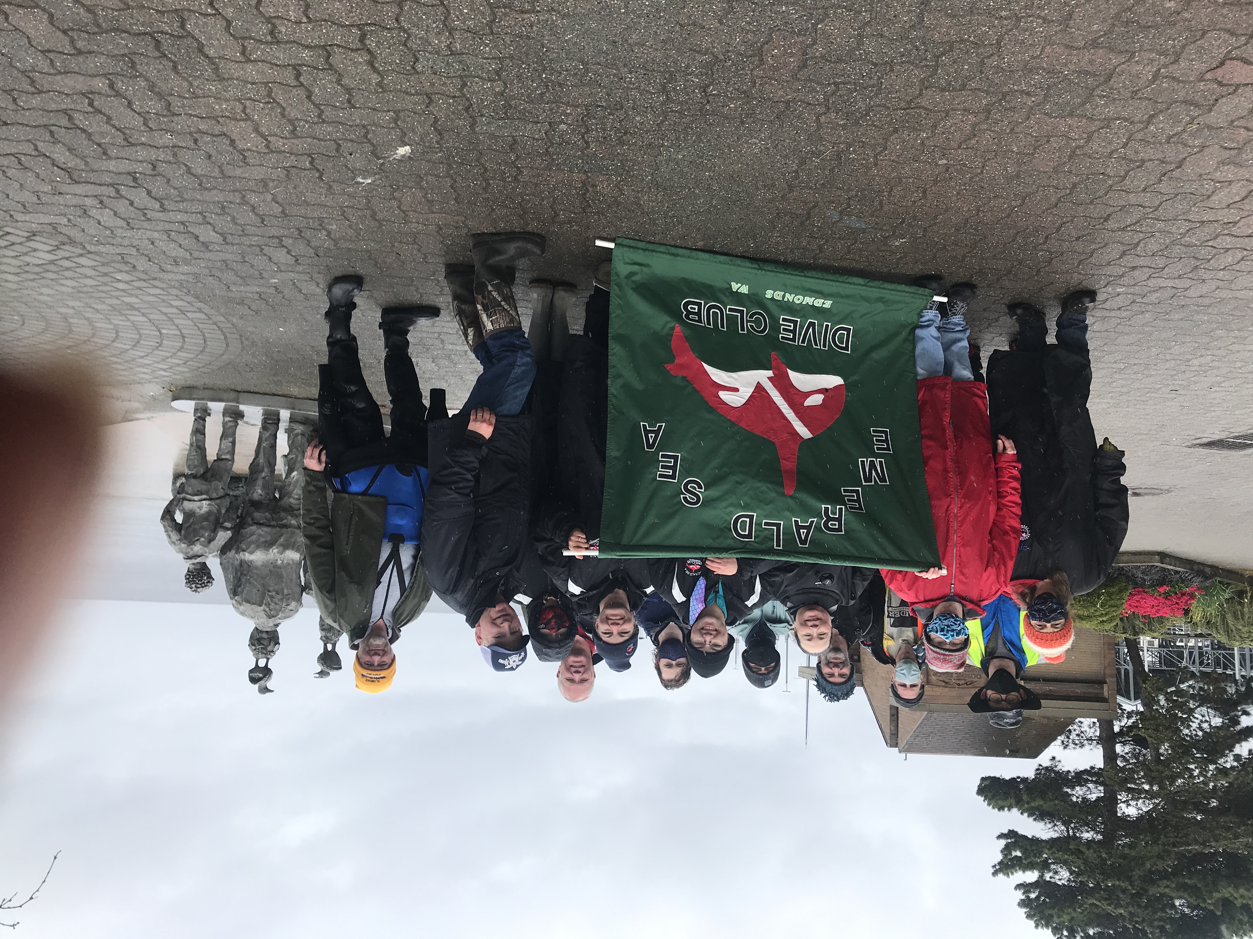
Emerald Sea Dive Club
Bill Berger
19
8
1
1
3
51.00
60
50.00
30.00
3
measured
175
5500.00
9
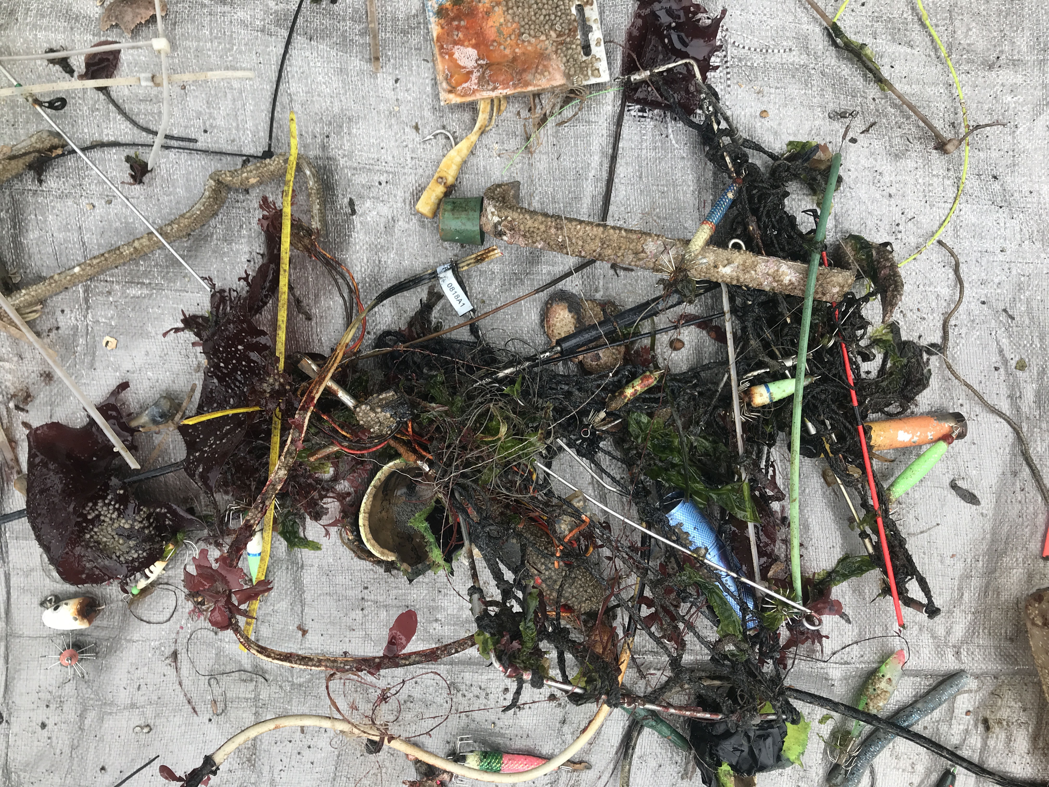
squid jigs and weights
12
On
pounds
I have debris data to report
1
Calm (glassy to rippled) for waves 0 – 0.1 meter high ft2
feet
other
15
1
4
9
2
1
United States
State\Province
WA
City
Edmonds
Map Help


Dive Location

If you know your survey site coordinates, enter them manually in decimal degrees using WGS84 Map Datum. Use the minus sign for latitudes south of the equator and longitudes west of the Prime Meridian to 180 degrees.

If you do not know your survey site coordinates, click the “Map Location” tab to use the map to zoom into your survey site and drop the pin on the map to fall within your survey dive site in the water (not on land or the beach). Ensure you zoom in as much as possible to ensure data accuracy.
Entangled Help


Use the vertical tabs below to record any entangled animals you found of each type.

Ecosystem Other
man made

Edmonds fishing pier

47.810204042774, -122.39089743434

1
sand
3
100
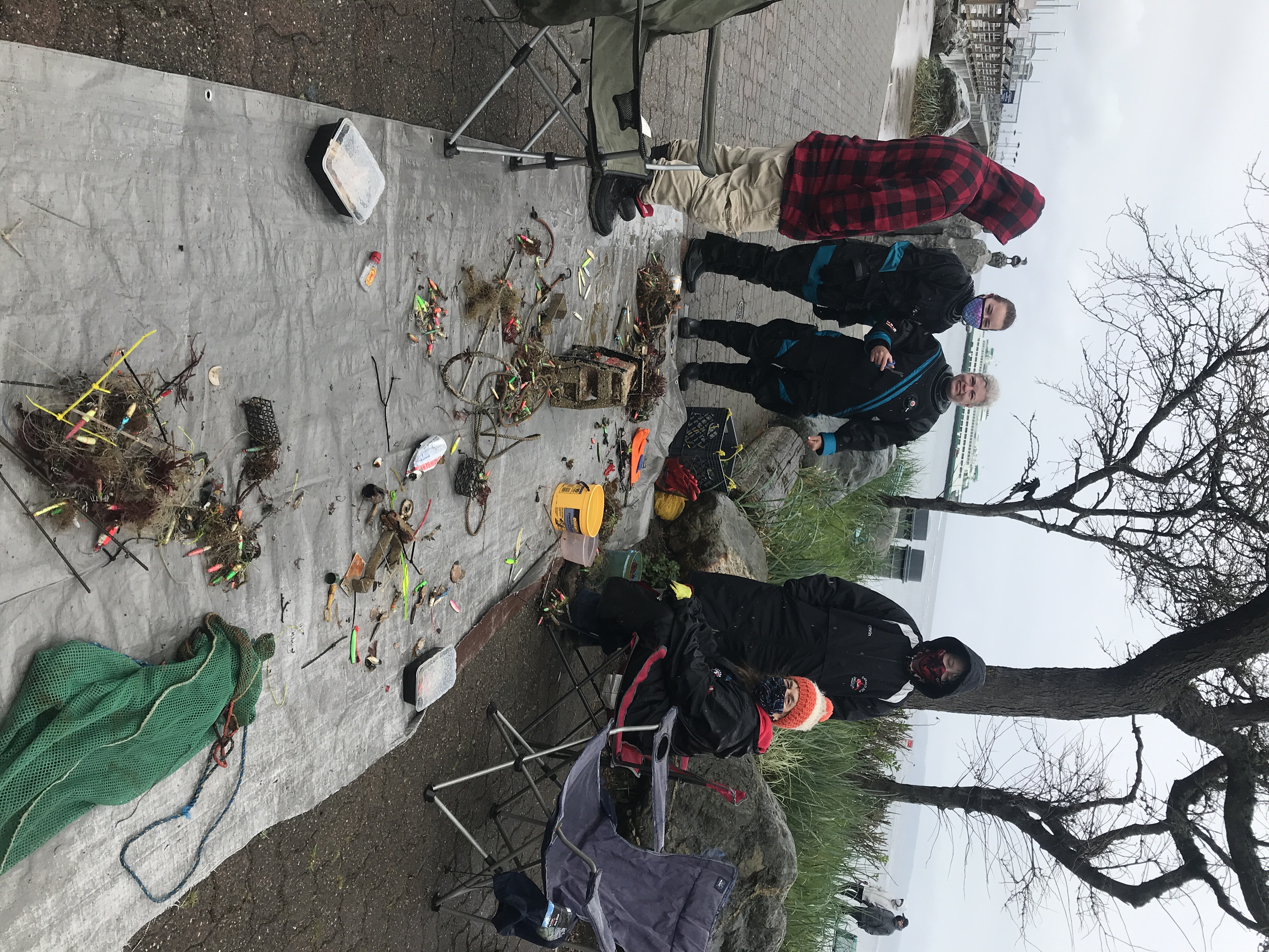
Couldn't have done it w/o our amazing shore support team!
Inverter / light combo
Sunny and warm for most the week with heavy rain Friday night and today
Emerald Sea Dive Club
Bill Berger
1
3
20
11
3
2
65.00
55
65.00
45.00
4
measured
3
220
8681.00
2
Fishing lures and lead weights
8
On
pounds
I have debris data to report
Calm (glassy to rippled) for waves 0 – 0.1 meter high
1
ft2
feet
other
22
3
3
2
3
United States
State\Province
WA
City
Edmonds
Map Help


Dive Location

If you know your survey site coordinates, enter them manually in decimal degrees using WGS84 Map Datum. Use the minus sign for latitudes south of the equator and longitudes west of the Prime Meridian to 180 degrees.

If you do not know your survey site coordinates, click the “Map Location” tab to use the map to zoom into your survey site and drop the pin on the map to fall within your survey dive site in the water (not on land or the beach). Ensure you zoom in as much as possible to ensure data accuracy.

Entangled Help


Use the vertical tabs below to record any entangled animals you found of each type.

Ecosystem Other
man made

Boca’s Hidden Ledge

0
3
0

26.332341018661, -80.061425797223

1
0
0
coral
0
1
0
0
0
No
Old beer can
Not eventful - couple rainy afternoons
0
0
0
0
0
0
0
0
0
0
0
0
0
0
0
0
0
0
0
0
Dixie Divers
WolfPod
0
0
0
1
0
0
0
0
1
0
0
0
0
0
0
0
0
0
0
2
0
0
0
0
0
0
0
0
0
0
0
0
0
0
20.00
40
65.00
40.00
0
estimated
0
0
53970.00
0
0
0
0
0
Plastic
Fishing line
Cans
0
On
pounds
0
I have debris data to report
0
0
0
Slight for waves 0.5 -1.25 meter high
0
0
0
0
0
0
0
ft2
0
1
feet
coral reef
0
0
0
0
0
0
0
0
0
0
0
0
0
0
0
0
3
0
0
0
0
0
0
0
0
0
0
0
United States
State\Province
Florida
City
Boca Raton
Map Help


Dive Location

If you know your survey site coordinates, enter them manually in decimal degrees using WGS84 Map Datum. Use the minus sign for latitudes south of the equator and longitudes west of the Prime Meridian to 180 degrees.

If you do not know your survey site coordinates, click the “Map Location” tab to use the map to zoom into your survey site and drop the pin on the map to fall within your survey dive site in the water (not on land or the beach). Ensure you zoom in as much as possible to ensure data accuracy.

Entangled Help


Use the vertical tabs below to record any entangled animals you found of each type.

Malom-tó

0
0
0
0

47.518222, 19.036045

0
0
0
gravel
0
0
0
0
0
MJLake
Bence Balazs Kalinovits
0
0
0
0
0
0
0
0
0
0
0
0
0
0
0
0
0
0
0
4
0
0
0
0
0
0
0
0
0
0
0
0
0
0
0
0
0.20
20
3.00
1.00
0
estimated
0
0
0
0
53.01
0
0
0
0
0
Glass fragments
1
On
kilograms
0
I have debris data to report
0
0
0
Calm (glassy to rippled) for waves 0 – 0.1 meter high
0
0
0
0
0
0
0
m2
0
0
meters
other
0
0
0
0
0
0
0
0
0
0
0
0
0
0
0
0
0
0
0
0
0
0
5
0
0
0
0
0
0
Hungary
City
Budapest
Map Help


Dive Location

If you know your survey site coordinates, enter them manually in decimal degrees using WGS84 Map Datum. Use the minus sign for latitudes south of the equator and longitudes west of the Prime Meridian to 180 degrees.

If you do not know your survey site coordinates, click the “Map Location” tab to use the map to zoom into your survey site and drop the pin on the map to fall within your survey dive site in the water (not on land or the beach). Ensure you zoom in as much as possible to ensure data accuracy.

Entangled Help


Use the vertical tabs below to record any entangled animals you found of each type.

Subscribe to