Menu

ADS476 - Delfins Beach Resort

12.115297981043, -68.2946926062

coral
Calm
Daniel
2
0.00
55
21.00
2.00
measured
200.00
On
kilograms
Our Survey Site was free of debris
Smooth (wavelets) for waves 0.1 - 0.5 meter high m2
meters
coral reef
Netherlands Antilles
City
Kralendijk
Map Help


Dive Location

If you know your survey site coordinates, enter them manually in decimal degrees using WGS84 Map Datum. Use the minus sign for latitudes south of the equator and longitudes west of the Prime Meridian to 180 degrees.

If you do not know your survey site coordinates, click the “Map Location” tab to use the map to zoom into your survey site and drop the pin on the map to fall within your survey dive site in the water (not on land or the beach). Ensure you zoom in as much as possible to ensure data accuracy.

Entangled Help


Use the vertical tabs below to record any entangled animals you found of each type.

Florence Khamsin Beach in Hurghada

0
20
0

27.244235, 33.850164

0
0
0
sand
0
13
1
1
0
Hot and windy
0
0
0
0
0
0
0
0
0
0
0
0
0
0
0
0
0
0
0
0
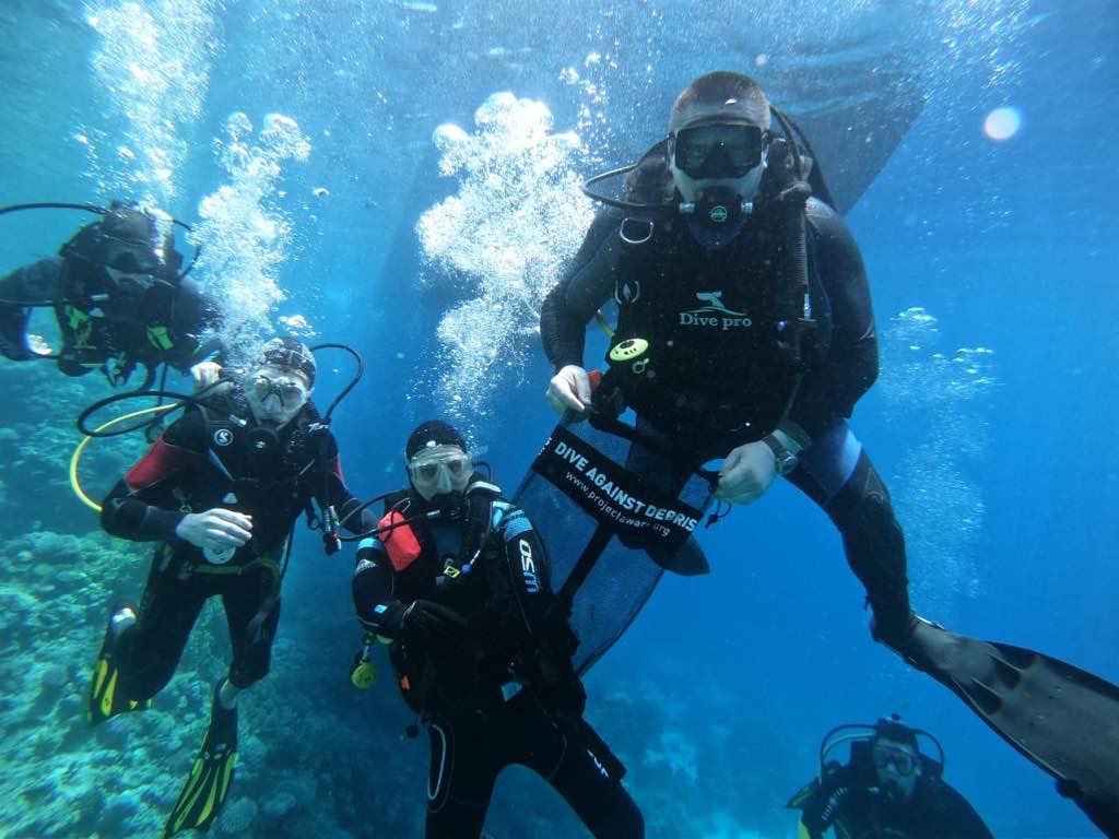
Ural-ALPHA-Diving
Vladimir Akimov
0
0
0
15
0
0
0
0
0
0
0
0
0
6
0
3
0
0
9
10
1
4
0
0
0
0
0
0
1
1
0
0
0
0
8.00
48
8.00
1.00
0
measured
0
0
2713.79
0
0
0
0
0
0
On
kilograms
0
I have debris data to report
4
0
0
Smooth (wavelets) for waves 0.1 - 0.5 meter high
0
0
0
0
1
1
0
m2
1
0
meters
coral reef
0
0
0
0
0
0
0
0
0
0
0
0
0
0
0
0
0
0
0
0
0
0
0
0
0
0
1
0
Egypt
State\Province
El-Bahr
City
Hurghada
Map Help


Dive Location

If you know your survey site coordinates, enter them manually in decimal degrees using WGS84 Map Datum. Use the minus sign for latitudes south of the equator and longitudes west of the Prime Meridian to 180 degrees.

If you do not know your survey site coordinates, click the “Map Location” tab to use the map to zoom into your survey site and drop the pin on the map to fall within your survey dive site in the water (not on land or the beach). Ensure you zoom in as much as possible to ensure data accuracy.

Entangled Help


Use the vertical tabs below to record any entangled animals you found of each type.

Las lajas

0
0
5

36.432464254311, -5.1087482844694

5
0
0
sand
0
0
0
0
0
Fishing
Phone
Rascasio with fishing line. Cut most of the line but still injured
Storms
0
0
0
0
0
0
0
0
0
0
0
0
0
0
0
0
0
0
0
0
Estepona Dive Center
Kegan Reina Bixler
0
0
0
0
0
0
0
0
0
0
0
0
0
0
0
0
0
0
0
2
0
0
0
0
0
0
1
0
0
0
0
0
0
0
10.00
75
0.00
0.00
2
estimated
0
0
9156.54
0
0
0
0
0
Fishing nets
Fishing lines
Fish traps
0
On
kilograms
0
I have debris data to report
0
0
0
Smooth (wavelets) for waves 0.1 - 0.5 meter high
0
0
0
Injured
Rascasio Stone Fish
1
Fishing line
0
0
0
0
m2
0
0
meters
seagrass
0
0
0
0
0
0
0
0
0
0
0
0
0
0
0
0
0
0
0
0
0
0
0
0
0
0
0
0
Spain
State\Province
Malaga
City
Estepona
Map Help


Dive Location

If you know your survey site coordinates, enter them manually in decimal degrees using WGS84 Map Datum. Use the minus sign for latitudes south of the equator and longitudes west of the Prime Meridian to 180 degrees.

If you do not know your survey site coordinates, click the “Map Location” tab to use the map to zoom into your survey site and drop the pin on the map to fall within your survey dive site in the water (not on land or the beach). Ensure you zoom in as much as possible to ensure data accuracy.
Entangled Help


Use the vertical tabs below to record any entangled animals you found of each type.

Confetti Bay 2

-19.9335119, 57.616741111111

coral
Sunny and Calm
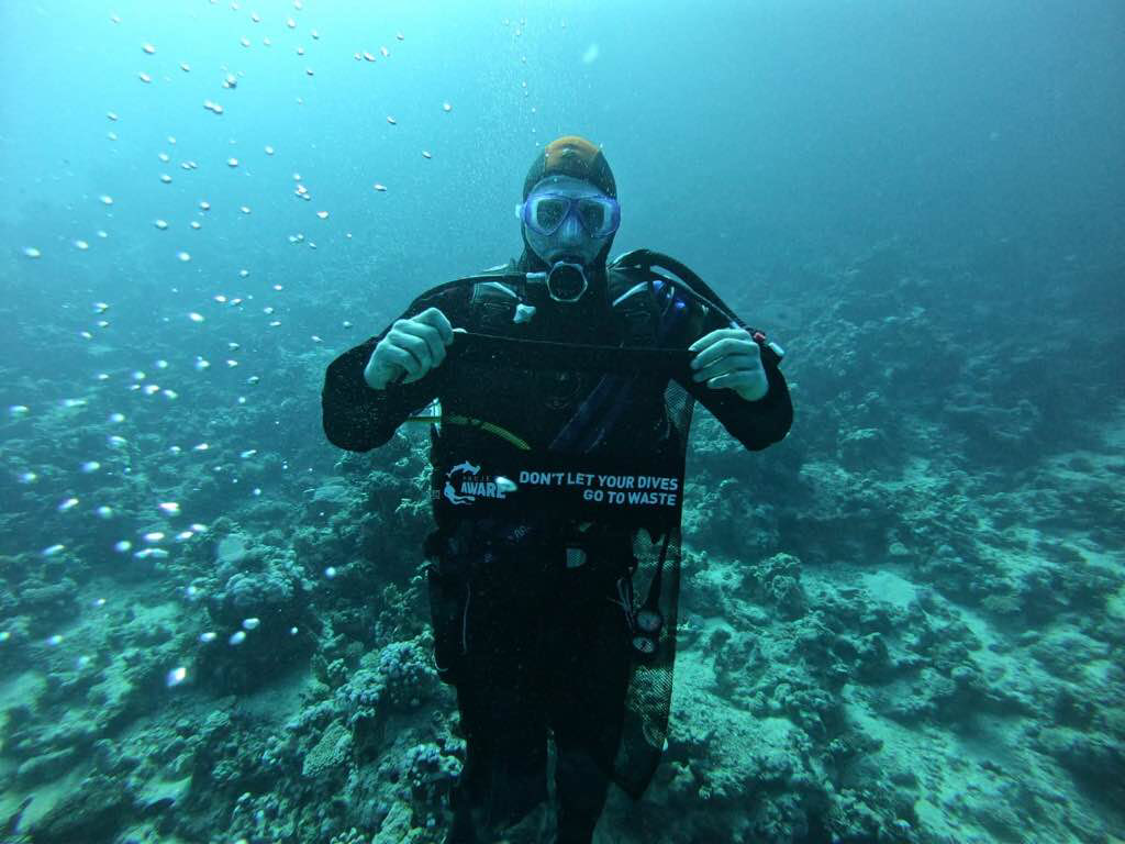
Crystal Divers Mauritius
Emma Andrews
2
0.00
36
18.00
12.00
measured
315.00
On
kilograms
Our Survey Site was free of debris
Smooth (wavelets) for waves 0.1 - 0.5 meter high m2
meters
coral reef
Mauritius
City
Bain Boeuf
Map Help


Dive Location

If you know your survey site coordinates, enter them manually in decimal degrees using WGS84 Map Datum. Use the minus sign for latitudes south of the equator and longitudes west of the Prime Meridian to 180 degrees.

If you do not know your survey site coordinates, click the “Map Location” tab to use the map to zoom into your survey site and drop the pin on the map to fall within your survey dive site in the water (not on land or the beach). Ensure you zoom in as much as possible to ensure data accuracy.
Entangled Help


Use the vertical tabs below to record any entangled animals you found of each type.

Confetti Bay 1

57.621174, -19.944307

coral
Wavy and Sunny
Crystal Divers Mauritius
Emma Andrews
4
0.00
43
18.00
12.00
measured
243.18
On
kilograms
Our Survey Site was free of debris
Slight for waves 0.5 -1.25 meter high m2
meters
coral reef
Mauritius
City
Bain Boeuf
Map Help


Dive Location

If you know your survey site coordinates, enter them manually in decimal degrees using WGS84 Map Datum. Use the minus sign for latitudes south of the equator and longitudes west of the Prime Meridian to 180 degrees.

If you do not know your survey site coordinates, click the “Map Location” tab to use the map to zoom into your survey site and drop the pin on the map to fall within your survey dive site in the water (not on land or the beach). Ensure you zoom in as much as possible to ensure data accuracy.
Entangled Help


Use the vertical tabs below to record any entangled animals you found of each type.

Confetti Bay 1

57.621174, -19.944307

coral
Wavy and Sunny
Crystal Divers Mauritius
Emma Andrews
4
0.00
43
18.00
12.00
measured
243.18
On
kilograms
Our Survey Site was free of debris
Slight for waves 0.5 -1.25 meter high m2
meters
coral reef
Mauritius
City
Bain Boeuf
Map Help


Dive Location

If you know your survey site coordinates, enter them manually in decimal degrees using WGS84 Map Datum. Use the minus sign for latitudes south of the equator and longitudes west of the Prime Meridian to 180 degrees.

If you do not know your survey site coordinates, click the “Map Location” tab to use the map to zoom into your survey site and drop the pin on the map to fall within your survey dive site in the water (not on land or the beach). Ensure you zoom in as much as possible to ensure data accuracy.
Entangled Help


Use the vertical tabs below to record any entangled animals you found of each type.

Mid Reef

1
1
1
1
coral
1
1

26.309044905771, -79.916589458148

Plastic gun cover.
Dixie Divers
WolfPod
4
4
1
10.00
112
64.00
49.00
2
estimated
2151.00
Plastic
Cans
Fishing line
On
pounds
I have debris data to report
Slight for waves 0.5 -1.25 meter high ft2
feet
coral reef
United States
State\Province
FL
City
Deerfield Beach
Map Help


Dive Location

If you know your survey site coordinates, enter them manually in decimal degrees using WGS84 Map Datum. Use the minus sign for latitudes south of the equator and longitudes west of the Prime Meridian to 180 degrees.

If you do not know your survey site coordinates, click the “Map Location” tab to use the map to zoom into your survey site and drop the pin on the map to fall within your survey dive site in the water (not on land or the beach). Ensure you zoom in as much as possible to ensure data accuracy.
Entangled Help


Use the vertical tabs below to record any entangled animals you found of each type.

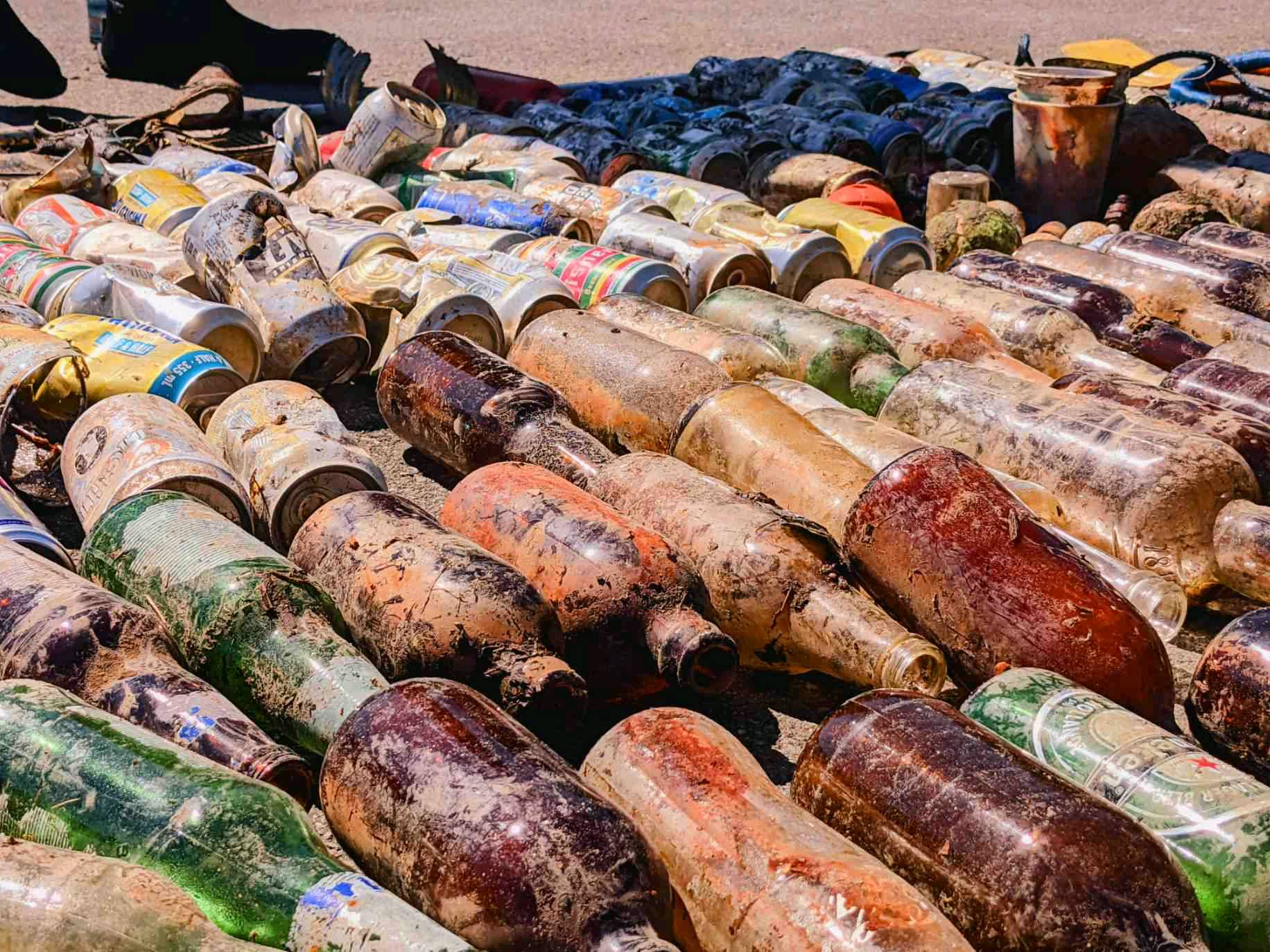
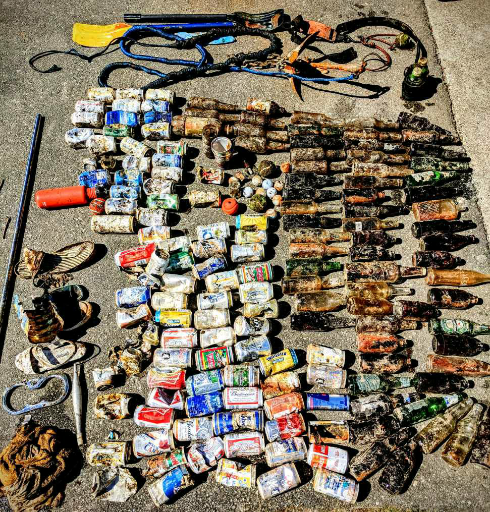
ADS663 - Alouette Lake

0
9
1
0

49.28986283855, -122.48905166599

4
0
0
silt
0
0
5
1
0
Boating season
Huge rubber mat
1
1
2
1
1
5
1
1
1
1
Rubber mat
Metal pole
Bungee
Spark plug
Leather belt
Cinch with strap
Can opener
Anchor
Boat oar
1 liter tin can
Ocean Pro Divers
Tori
0
0
0
4
0
0
0
0
0
0
0
0
0
0
0
0
0
2
0
7
0
0
0
0
0
0
0
0
0
0
0
0
16
0
0
0
222.00
60
60.00
5.00
1
measured
0
0
0
0
25281.00
0
1
0
0
0
0
On
pounds
0
I have debris data to report
79
0
0
Calm (glassy to rippled) for waves 0 – 0.1 meter high
0
0
0
0
0
0
0
ft2
0
0
feet
other
14
0
0
0
1
0
0
0
0
5
0
0
0
0
0
0
150
0
0
0
0
0
1
0
1
0
0
0
0
Canada
State\Province
BC
City
Maple Ridge
Map Help


Dive Location

If you know your survey site coordinates, enter them manually in decimal degrees using WGS84 Map Datum. Use the minus sign for latitudes south of the equator and longitudes west of the Prime Meridian to 180 degrees.

If you do not know your survey site coordinates, click the “Map Location” tab to use the map to zoom into your survey site and drop the pin on the map to fall within your survey dive site in the water (not on land or the beach). Ensure you zoom in as much as possible to ensure data accuracy.
Entangled Help


Use the vertical tabs below to record any entangled animals you found of each type.

Jerry's Joint

24.880447, -80.561854

rock
anchor was definitely cut because they got it stuck. Must of been from a 17'-24' boat
ongoing commercial and recreational fishing and boating
some storms overnight and evenings, 2-5ft waves
1
1
anchor
chain
Key Dives/FKNMS
Alyssa
6
25.00
45
48.00
36.00
measured
30.00
small fluke anchors
On
pounds
I have debris data to report
Slight for waves 0.5 -1.25 meter high
1
m2
feet
coral reef
United States
State\Province
FL
City
Islamorada
Map Help


Dive Location

If you know your survey site coordinates, enter them manually in decimal degrees using WGS84 Map Datum. Use the minus sign for latitudes south of the equator and longitudes west of the Prime Meridian to 180 degrees.

If you do not know your survey site coordinates, click the “Map Location” tab to use the map to zoom into your survey site and drop the pin on the map to fall within your survey dive site in the water (not on land or the beach). Ensure you zoom in as much as possible to ensure data accuracy.

Entangled Help


Use the vertical tabs below to record any entangled animals you found of each type.

ADS501 - The Maze

24.889633, -80.566477

rock
commercial fishing
less than 15 knot winds, less than 2-3 foot waves
Key Dives/FKNMS
Cortney
1
100.00
45
25.00
20.00
measured
1
30.00
derelict lobster pot
On
pounds
I have debris data to report
Smooth (wavelets) for waves 0.1 - 0.5 meter high m2
feet
rocky reef
United States
State\Province
FL
City
Islamorada
Map Help


Dive Location

If you know your survey site coordinates, enter them manually in decimal degrees using WGS84 Map Datum. Use the minus sign for latitudes south of the equator and longitudes west of the Prime Meridian to 180 degrees.

If you do not know your survey site coordinates, click the “Map Location” tab to use the map to zoom into your survey site and drop the pin on the map to fall within your survey dive site in the water (not on land or the beach). Ensure you zoom in as much as possible to ensure data accuracy.

Entangled Help


Use the vertical tabs below to record any entangled animals you found of each type.

Subscribe to