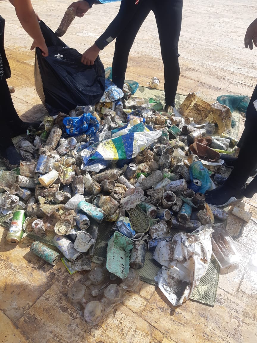
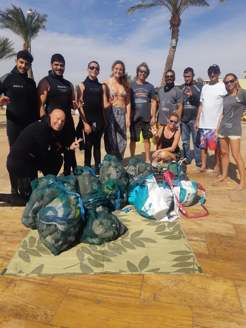
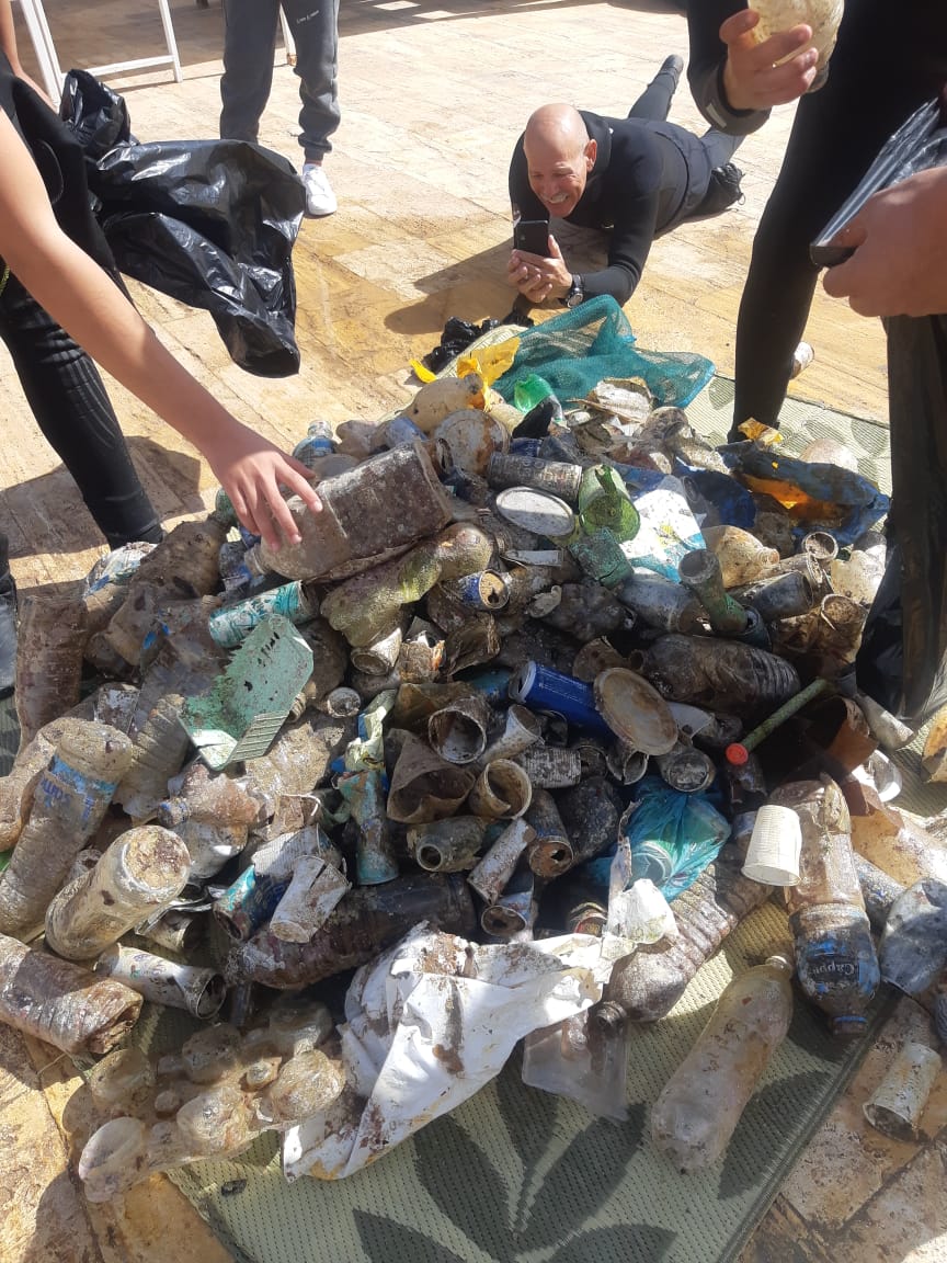
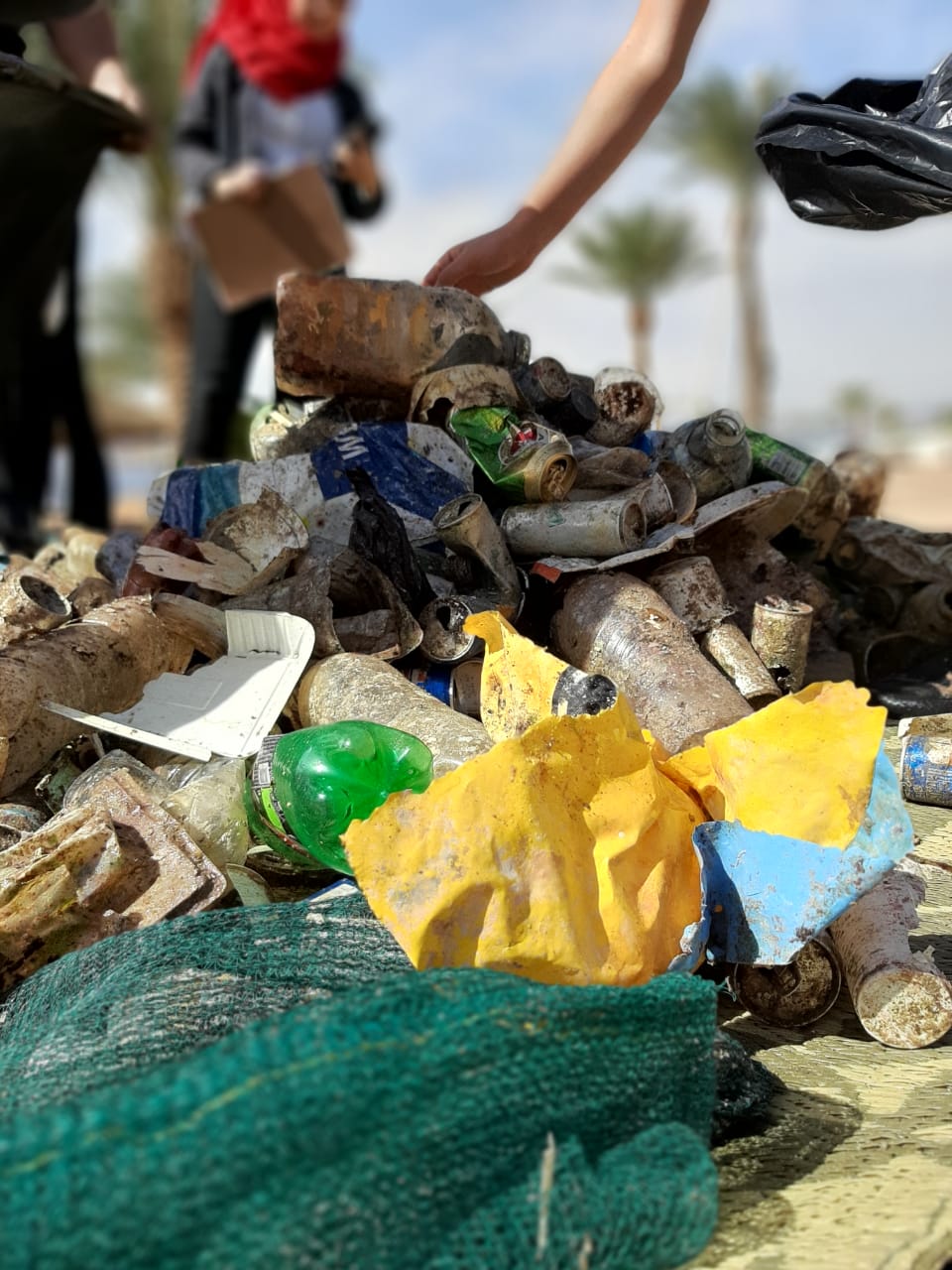
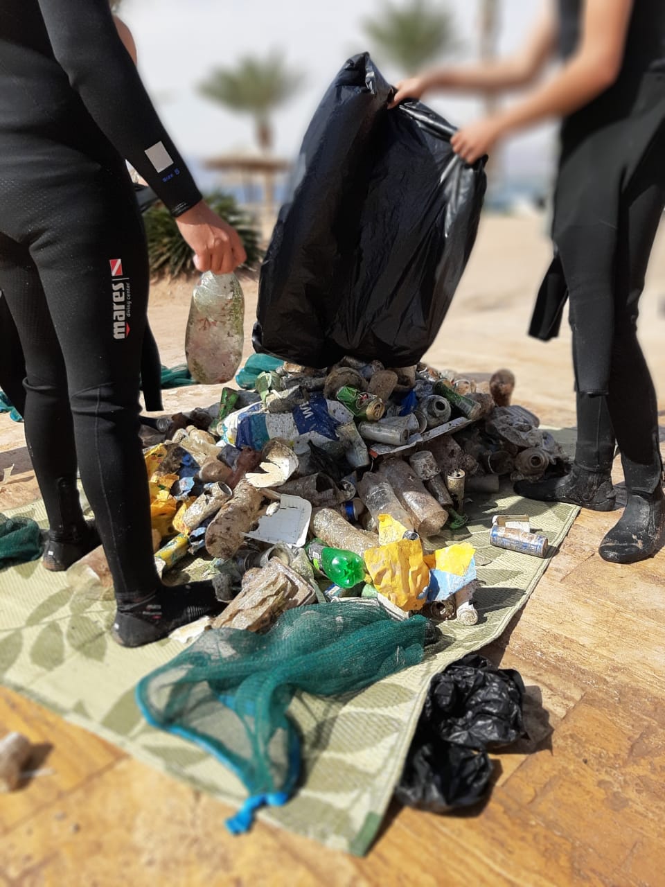
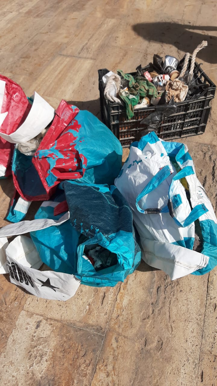
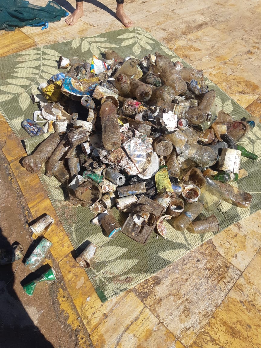
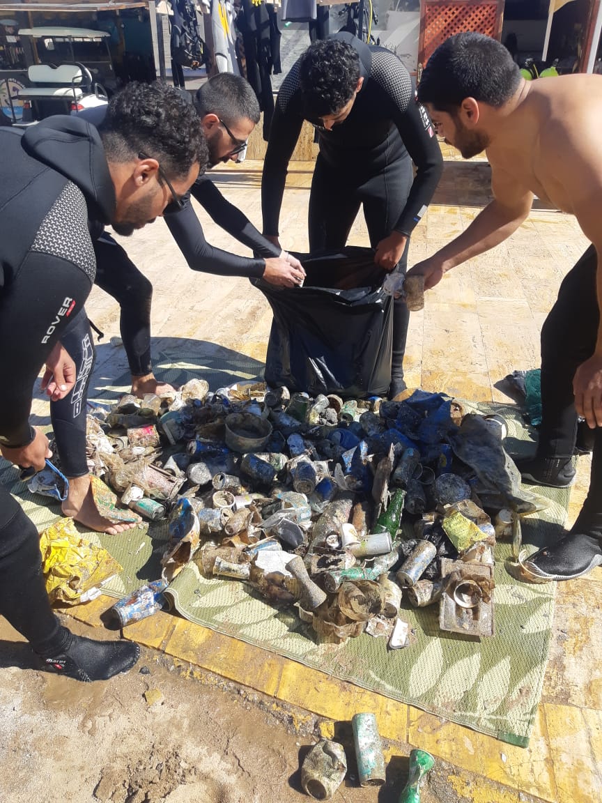
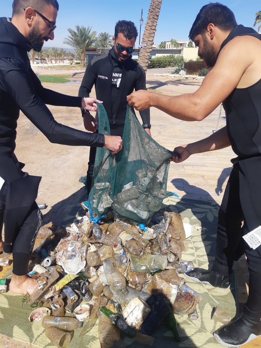
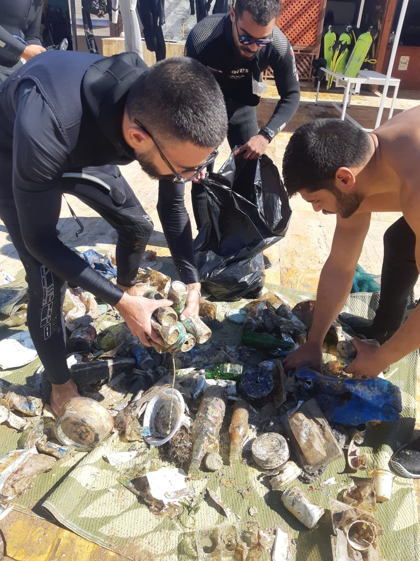
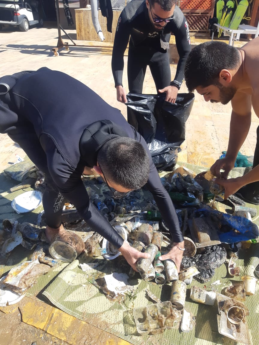
On the beach there are lots of fishermen so most of the debris is from them. Like the fishing lines and food cans.
Sunny and very windy.
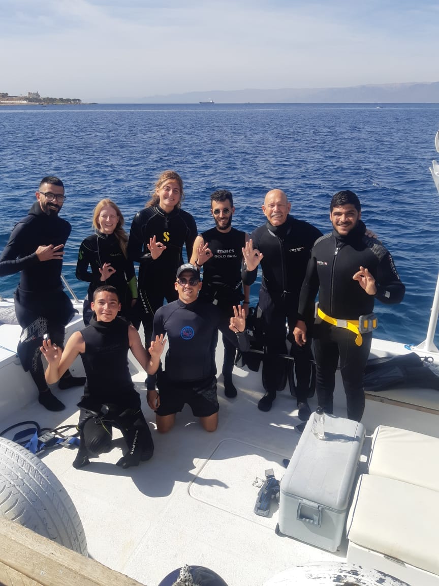
The Dive Bus
Whitney Jones
1
3
1
1.00
110
17.00
5.00
estimated
2000.00
fishing lines
On
kilograms
I have debris data to report
Smooth (wavelets) for waves 0.1 - 0.5 meter high
m2
meters
coral reef
3
Netherlands Antilles
City
Willemstad
Map Help
Dive Location
If you know your survey site coordinates, enter them manually in decimal degrees using WGS84 Map Datum. Use the minus sign for latitudes south of the equator and longitudes west of the Prime Meridian to 180 degrees.
If you do not know your survey site coordinates, click the “Map Location” tab to use the map to zoom into your survey site and drop the pin on the map to fall within your survey dive site in the water (not on land or the beach). Ensure you zoom in as much as possible to ensure data accuracy.
Entangled Help
Use the vertical tabs below to record any entangled animals you found of each type.
Nothing special except a little bit of wind the west.
Huatulco Dive Center
David-Alexandre Gassin
4
1.00
62
11.00
5.00
estimated
388.84
On
pounds
I have debris data to report
Smooth (wavelets) for waves 0.1 - 0.5 meter high
m2
meters
coral reef
1
Language
English
Mexico
State\Province
Oaxaca
City
Huatulco
Map Help
Dive Location
If you know your survey site coordinates, enter them manually in decimal degrees using WGS84 Map Datum. Use the minus sign for latitudes south of the equator and longitudes west of the Prime Meridian to 180 degrees.
If you do not know your survey site coordinates, click the “Map Location” tab to use the map to zoom into your survey site and drop the pin on the map to fall within your survey dive site in the water (not on land or the beach). Ensure you zoom in as much as possible to ensure data accuracy.
Entangled Help
Use the vertical tabs below to record any entangled animals you found of each type.
Our partner, H&S Watersports, also did a beach cleanup and was able to gather a lot of plastic bags and cigarette butts from the shoreline.
People are eating and drinking on a beach where there are no waste bins. They leave it on the beach and the debris blows into the water.
Windy
Deep Blue Dive Center
Mohammed Leddawi
13
8
1
134
1
46.10
35
22.00
6.00
measured
40.00
plastic water bottles
aluminum soda cans
food containers
On
kilograms
I have debris data to report
6
Calm (glassy to rippled) for waves 0 – 0.1 meter high
1
1
m2
meters
coral reef
165
Language
English
Jordan
City
Aqaba
Map Help
Dive Location
If you know your survey site coordinates, enter them manually in decimal degrees using WGS84 Map Datum. Use the minus sign for latitudes south of the equator and longitudes west of the Prime Meridian to 180 degrees.
If you do not know your survey site coordinates, click the “Map Location” tab to use the map to zoom into your survey site and drop the pin on the map to fall within your survey dive site in the water (not on land or the beach). Ensure you zoom in as much as possible to ensure data accuracy.
Entangled Help
Use the vertical tabs below to record any entangled animals you found of each type.
Calm (glassy to rippled) for waves 0 – 0.1 meter high
2
2
m2
meters
coral reef
1
110
Language
English
Jordan
City
Aqaba
Map Help
Dive Location
If you know your survey site coordinates, enter them manually in decimal degrees using WGS84 Map Datum. Use the minus sign for latitudes south of the equator and longitudes west of the Prime Meridian to 180 degrees.
If you do not know your survey site coordinates, click the “Map Location” tab to use the map to zoom into your survey site and drop the pin on the map to fall within your survey dive site in the water (not on land or the beach). Ensure you zoom in as much as possible to ensure data accuracy.
Entangled Help
Use the vertical tabs below to record any entangled animals you found of each type.
Calm (glassy to rippled) for waves 0 – 0.1 meter high
1
1
2
3
m2
1
meters
coral reef
1
1
1
15
Language
English
Jordan
City
Aqaba
Map Help
Dive Location
If you know your survey site coordinates, enter them manually in decimal degrees using WGS84 Map Datum. Use the minus sign for latitudes south of the equator and longitudes west of the Prime Meridian to 180 degrees.
If you do not know your survey site coordinates, click the “Map Location” tab to use the map to zoom into your survey site and drop the pin on the map to fall within your survey dive site in the water (not on land or the beach). Ensure you zoom in as much as possible to ensure data accuracy.
Entangled Help
Use the vertical tabs below to record any entangled animals you found of each type.
Baby barracuda released unharmed. Rabbit fish had superficial injuries, also vertebrae of unidentified fish
Sunny, windy, high waves, strong current
Temple Adventures
Siddharth Jha
0
0
0
0
0
0
0
0
0
0
0
0
0
0
0
0
0
0
0
4
0
0
0
0
0
0
2
0
7
1
0
0
0
0
0
0
4.00
45
18.00
16.00
8
measured
0
0
0
17
150.00
0
0
0
0
0
Fishing nets
Fishing hooks
Fishing ropes
0
On
kilograms
0
I have debris data to report
0
0
0
Smooth (wavelets) for waves 0.1 - 0.5 meter high
0
0
0
Net
Released Unharmed
Baby Barracuda, Rabbitfish
Crab
Injured
1
3
Net
0
0
0
0
m2
0
0
7
Net
1 Cowry, 2 Murex, 4 Clams
Dead
meters
rocky reef
0
0
0
0
0
0
0
0
0
0
0
0
0
0
0
1
0
0
0
0
0
0
0
0
0
0
0
0
0
Language
English
India
State\Province
Pondicherry
City
Pondicherry
Map Help
Dive Location
If you know your survey site coordinates, enter them manually in decimal degrees using WGS84 Map Datum. Use the minus sign for latitudes south of the equator and longitudes west of the Prime Meridian to 180 degrees.
If you do not know your survey site coordinates, click the “Map Location” tab to use the map to zoom into your survey site and drop the pin on the map to fall within your survey dive site in the water (not on land or the beach). Ensure you zoom in as much as possible to ensure data accuracy.
Entangled Help
Use the vertical tabs below to record any entangled animals you found of each type.
Video of the complete dive can be found here: https://youtu.be/dI7eivBBqVA
Quite a lot of shredded plastic.
scuba weight belt with 10kg of weight
Clear, but rough seas mostly
1
scuba weight belt
Dive Against Debris Korea (Daegu)
William Henderson
1
2
1
1
2
2
15.00
53
5.00
1.00
2
estimated
9
110.00
1
plastic strips
discarded clothing
On
kilograms
I have debris data to report
Smooth (wavelets) for waves 0.1 - 0.5 meter high
1
1
m2
7
2
meters
rocky reef
4
2
2
5
1
1
3
3
1
Language
English
South Korea
State\Province
Gyeongbuk-do
City
Pohang
Map Help
Dive Location
If you know your survey site coordinates, enter them manually in decimal degrees using WGS84 Map Datum. Use the minus sign for latitudes south of the equator and longitudes west of the Prime Meridian to 180 degrees.
If you do not know your survey site coordinates, click the “Map Location” tab to use the map to zoom into your survey site and drop the pin on the map to fall within your survey dive site in the water (not on land or the beach). Ensure you zoom in as much as possible to ensure data accuracy.
Entangled Help
Use the vertical tabs below to record any entangled animals you found of each type.
Warm weather would of brought out a lot of fishermen
Hot
0
0
0
0
0
0
0
0
0
0
0
0
0
0
0
0
0
0
0
0
Melbourne Mermaids
Jourdane
0
0
0
0
0
0
0
0
0
0
0
0
0
0
0
0
0
0
0
2
0
0
0
0
0
0
0
0
0
0
0
0
0
0
0.50
60
4.00
1.00
0
estimated
0
15
479.00
0
0
0
0
0
100m of fishing line was found not 100 pieces of it
0
On
kilograms
0
I have debris data to report
0
0
0
Calm (glassy to rippled) for waves 0 – 0.1 meter high
0
0
0
0
0
0
0
m2
0
0
meters
coral reef
0
0
0
0
0
0
0
0
0
0
0
0
0
0
0
0
0
0
0
0
0
0
0
0
0
0
0
0
Language
English
Australia
State\Province
Victoria
City
Blairgowrie
Map Help
Dive Location
If you know your survey site coordinates, enter them manually in decimal degrees using WGS84 Map Datum. Use the minus sign for latitudes south of the equator and longitudes west of the Prime Meridian to 180 degrees.
If you do not know your survey site coordinates, click the “Map Location” tab to use the map to zoom into your survey site and drop the pin on the map to fall within your survey dive site in the water (not on land or the beach). Ensure you zoom in as much as possible to ensure data accuracy.
Entangled Help
Use the vertical tabs below to record any entangled animals you found of each type.